5 Utah National Parks Road Trip: The Mighty 5 Loop

5 Utah National Parks Road Trip: The Mighty 5 Loop

Distance
~400 mi
between the parks
Time needed
5 to 7 days
7 is ideal
Parks
5
national parks
Best season
Spring / Fall
Apr to May, Sep to Oct
Start / End
SLC or LAS
loop or one way
Difficulty
Easy drive
paved throughout
The itinerary

The day-by-day

We map it from Salt Lake City, Arches first, ending at Zion within striking distance of Las Vegas. Each leg gets the drive, the stops that earn the detour, and where we would eat and sleep that night.

The five parks in driving order, Arches to Zion. Zoom in for the base towns between them. Map: OpenTopoMap / MTJP
Delicate Arch standing against red rock in Arches National Park Days 1 to 2
Leg 1 · Salt Lake City to Moab

Arches National Park

~3h 45m from SLC ~230 mi 2 nights in Moab

Fly into Salt Lake City, pick up the car and point it south. Base in Moab and give Arches a full day plus a sunset. The park holds more than 2,000 natural stone arches, and the famous ones sit close to the road.

Top stops

  • Delicate Arch, hike it for the late light
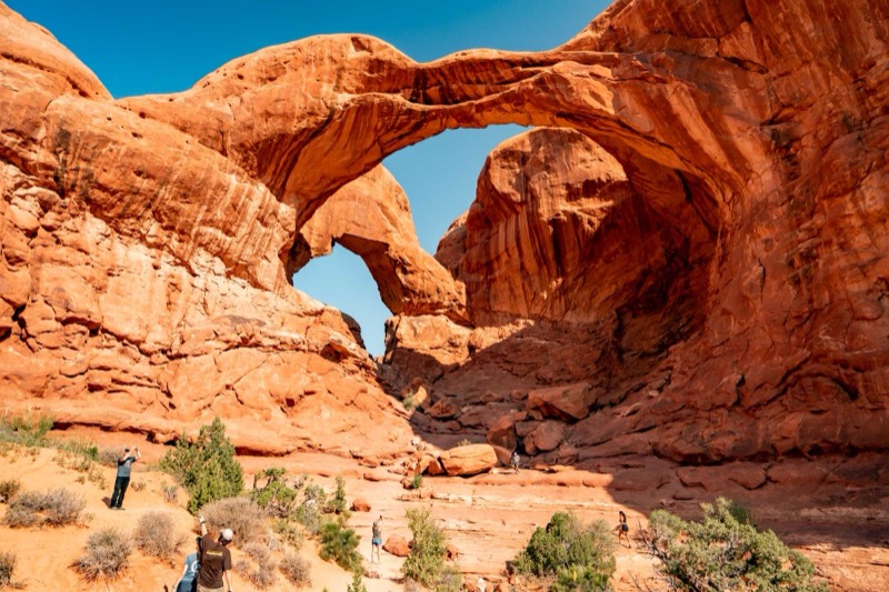
  • The Windows and Double Arch, short walks, big payoff
  • Devils Garden Trail out to Landscape Arch
  • Balanced Rock, a five minute roadside stop

Where to eat

  • Moab Diner, the classic breakfast stop
  • Antica Forma for wood-fired pizza after the trail
Time it right: Arches dropped its timed-entry reservation for 2026, so nobody needs an entry slot this year. The park still suggests arriving before 8am or after 3pm to skip the entrance line, and that early light is the good light anyway. Fiery Furnace hikes and Devils Garden Campground do still require reservations.
Where to stay: Moab, the base for Arches and Canyonlands · two nights here covers both parks without a hotel move
Find Moab hotels
Layered canyons stretching below the Island in the Sky mesa in Canyonlands Day 3
Leg 2 · Canyonlands from Moab

Canyonlands, Island in the Sky

~40m from Moab ~32 mi day trip

Thirty-two miles from Moab, the Island in the Sky mesa ends in overlooks that drop a thousand feet to the canyons below. It is the easy-access district of a park that otherwise swallows whole expeditions.

Top stops

  • Mesa Arch at sunrise, the glowing underside shot
  • Grand View Point, rangers give geology talks spring through fall
  • Green River Overlook
  • Dead Horse Point State Park on the drive back

Where to eat

  • Pack lunch, and fill bottles at the visitor center, water runs year-round
  • Quesadilla Mobilla back in Moab, the food-truck reward
Time it right: Mesa Arch faces east and the underside catches fire at first light. Set the alarm, it is over fast. Then work the overlooks while the canyons still hold shadow.
Striped cliffs of the Waterpocket Fold in Capitol Reef National Park Day 4
Leg 3 · Moab to Torrey

Capitol Reef National Park

~2h 30m ~150 mi 1 night

The quietest of the five protects the Waterpocket Fold, a wrinkle in the earth that runs almost 100 miles. The old orchards of Fruita sit green against the red rock, and when the U-Pick signs are up you can pick fruit right off the trees.

Top stops

  • Hickman Bridge Trail, the short hike to a natural bridge
  • The Scenic Drive into Capitol Gorge
  • The historic Fruita orchards, harvests vary by year
  • Gifford House for pie, open mid-March through October

Where to eat

  • Gifford House pies and baked goods, made with orchard fruit
  • Slackers Burger Joint in Torrey, open seasonally
Time it right: The Gifford House opens at 9am and the pies routinely sell out by late morning. Go before the trail, not after.
Where to stay: Torrey, a few miles from the visitor center · tiny town, big sky, book early in peak season
Find Torrey hotels
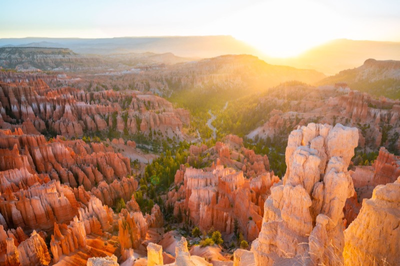
Orange hoodoo spires filling the Bryce Canyon amphitheater Day 5
Leg 4 · Torrey to Bryce over Scenic Byway 12

Bryce Canyon National Park

~2h 30m ~115 mi 1 night

The drive over Scenic Byway 12 is the best road of the trip, so leave Torrey with daylight to spare. Bryce is an amphitheater of hoodoos with a rim that sits between 8,000 and 9,000 feet. Pack a warm layer, even in summer.

Top stops

  • Sunrise Point to Sunset Point along the rim
  • Queens Garden down, Navajo Loop up, the combo to hike
  • Inspiration Point for the full amphitheater
  • Stay out after dark, Bryce is a certified International Dark Sky Park

Where to eat

  • The Lodge at Bryce Canyon dining room, in the park, first come first served
  • Stock a cooler in Tropic for trail lunches
Time it right: Hoodoos glow in low light. Walk down among them in late afternoon, catch sunset from the rim, then get sunrise at Sunrise or Inspiration Point before the drive to Zion.
Where to stay: Bryce Canyon City or Tropic · Tropic is cheaper and a short drive from the rim
Find Bryce hotels
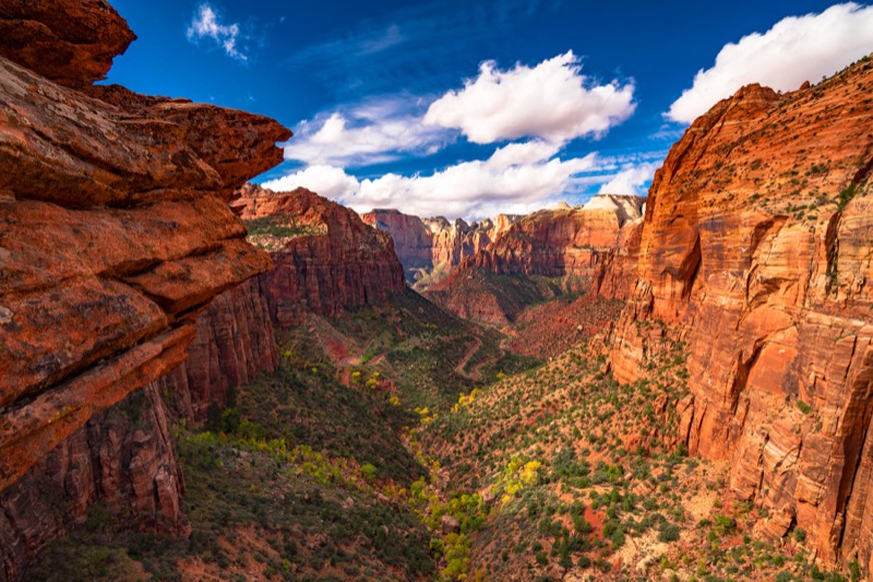
Towering sandstone walls above the Virgin River in Zion Canyon Days 6 to 7
Leg 5 · Bryce to Springdale

Zion National Park

~1h 45m ~85 mi 2 nights

The finale walks you along the canyon floor looking up. From March through November the park shuttle is the only way up Zion Canyon Scenic Drive, so park once in Springdale and ride. Zion earns both days.

Top stops

  • The Narrows, wading up the Virgin River from the Riverside Walk
  • Angels Landing, permit required past Scout Lookout
  • Canyon Overlook Trail, a big view for little effort
  • The Emerald Pools for the easy day

Where to eat

  • Oscar's Cafe, the Springdale standby
  • Zion Canyon Brew Pub, right at the park gate
  • Deep Creek Coffee before the first shuttle

Getting home

  • Springdale to Las Vegas, ~2h 45m (~165 mi)
  • Springdale to Salt Lake City, ~4h 30m (~310 mi)
  • A one-way rental skips the backtrack
Time it right: Angels Landing permits come from a lottery on Recreation.gov, seasonal rounds plus a day-before drawing that closes at 3pm Mountain. No permit still gets you to Scout Lookout. The first shuttle leaves at 7am in peak season, and the Narrows is the reason to be on it.
Where to stay: Springdale, right at the park gate · walk to the shuttle and skip the parking scramble
Find Springdale hotels
Will and Jim Pattiz
Who's behind this

Will and Jim Pattiz

We are the brothers behind More Than Just Parks. We have filmed all five Utah national parks and driven this loop ourselves, and our films have been featured by the National Park Service and the Department of the Interior. Everything here is from the road, not a press release.

The full plan, day by day Everything above, unpacked stop by stop below.
Last verified June 21, 2026
· Originally published September 11, 2024

Utah’s Mighty 5 is the best national park road trip in America, and we do not say that lightly. In one loop you string together five wildly different national parks, Arches, Canyonlands, Capitol Reef, Bryce Canyon, and Zion, separated by some of the most cinematic driving in the country. We have filmed all five, run this route more than once, and watched first-timers go quiet at every overlook. This is the trip we send people on when they want to understand the American Southwest.

This guide lays out the full loop in driving order, with the distances between parks, what to do in each one, how many days to give it, and the best time of year to go. Plan on at least seven days; eight is better. Less than that and you are driving past the things you came to see.

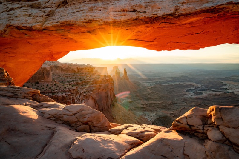
Sunrise glowing through Mesa Arch in Canyonlands National Park, Utah
Mesa Arch, Canyonlands National Park

The Mighty 5 Route at a Glance

Stop Park Drive From Previous Suggested Days Fee
1 Arches 3.5 hrs from Salt Lake City 1-2 $30
2 Canyonlands 30 min from Arches 1-2 $30
3 Capitol Reef 3 hrs from Canyonlands 1 $20
4 Bryce Canyon 2 hrs from Capitol Reef 1 $35
5 Zion 1.5 hrs from Bryce Canyon 1-2 $35

The full loop runs about 20 hours of driving end to end. Most people fly into Salt Lake City and drive the parks west to south, ending near Zion within a couple of hours of Las Vegas, which makes a one-way rental and a fly-out from Vegas a smart option. Fees shown are the standard 7-day vehicle rate; confirm current rates, and note that Zion has fee and permit changes worth checking before you go. See our best road trips in the USA ranking for where this one lands.

Stop 1: Arches National Park

Delicate Arch glowing at sunset in Arches National Park
Delicate Arch, Arches National Park

Three and a half hours south of Salt Lake City, Arches kicks off the loop with the highest concentration of natural stone arches on Earth, more than 2,000 of them. The hike to Delicate Arch, the one on the Utah license plate, is the signature, best done in the soft light of late afternoon. Turret Arch, the Windows, and Landscape Arch are all short walks from the road. In peak season (typically spring through fall) Arches runs a timed-entry reservation system, so check before you arrive. Plan with our things to do in Arches.

117 public lands destinations are under threat. Get the free briefing that 27,000+ people use to stay informed and take action.

Turret Arch framed against blue sky in Arches National Park
Turret Arch, Arches

Stop 2: Canyonlands National Park

The vast canyon expanse from Green River Overlook in Canyonlands
Green River Overlook, Canyonlands

Just 30 minutes from Arches, Canyonlands is its opposite: enormous, raw, and far emptier. The Island in the Sky district, the most accessible section, is a high mesa with overlooks that drop a thousand feet to the rivers below. Mesa Arch at sunrise, when the underside of the arch glows orange, is one of the most photographed scenes in the Southwest, and worth the early alarm. Grand View Point and the Green River Overlook deliver the scale. Our things to do in Canyonlands covers the districts.

Stop 3: Capitol Reef National Park

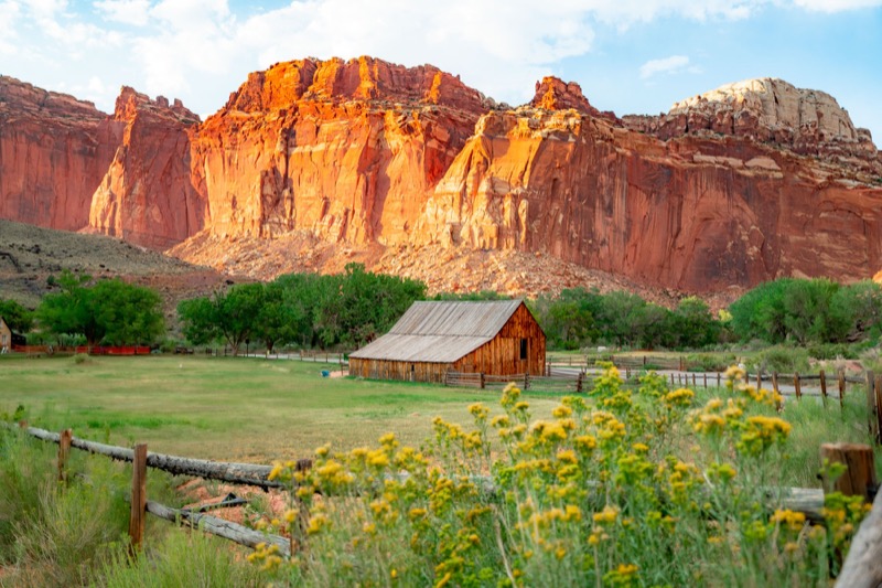
Red cliffs and rock formations in Capitol Reef National Park
Capitol Reef National Park

Three hours west sits the most underrated of the five. Capitol Reef protects the Waterpocket Fold, a hundred-mile wrinkle in the Earth’s crust, plus the green orchards and historic buildings of the old Mormon settlement of Fruita, where you can still pick fruit in season. The Hickman Bridge trail is the must-walk, and the Scenic Drive packs a lot of canyon into a short distance. It is the quietest of the Mighty 5, and a relief after Arches. See our things to do in Capitol Reef.

The Hickman Bridge natural arch in Capitol Reef National Park
Hickman Bridge, Capitol Reef

Stop 4: Bryce Canyon National Park

Sunrise over the hoodoo amphitheater at Inspiration Point, Bryce Canyon
Inspiration Point at sunrise, Bryce Canyon

The two-hour drive from Capitol Reef to Bryce, along Scenic Byway 12 through Escalante, is one of the great drives in the country in its own right. Bryce itself is unlike anything else: a vast amphitheater of orange-pink hoodoos, the spindly rock spires carved by ice and water. At 8,000 to 9,000 feet, it is the coolest of the five and the most likely to hold snow. Watch sunrise from Inspiration Point, then walk down among the hoodoos on the Navajo Loop and Wall Street. Our Navajo Loop trail guide and the Natural Bridge overlook are good starting points; see all our things to do in Bryce Canyon.

Switchbacks descending into the Wall Street slot in Bryce Canyon
Wall Street, Bryce Canyon

Stop 5: Zion National Park

The deep red walls of Zion Canyon from the Canyon Overlook
Canyon Overlook, Zion National Park

The finale, 90 minutes from Bryce, is the most visited of the five and one of the most visited parks in the country. Zion is a soaring sandstone canyon you walk through from the bottom up, the opposite of looking down into a gorge. The Narrows wades up the Virgin River between thousand-foot walls; Angels Landing climbs an exposed spine to a heart-stopping view (and now requires a permit). The Canyon Overlook trail offers a big payoff for little effort. Plan with our best things to do in Zion, plus our guides to Lava Point and Kolob Canyon for escaping the crowds.

Sunset light over the high country at Lava Point in Zion National Park
Lava Point sunset, Zion

Worthwhile Detours

The Grand Canyon at sunset, a possible detour from the Mighty 5 route
Grand Canyon North Rim

If you have extra days, the route opens onto more. The Grand Canyon’s North Rim is about two hours from Las Vegas or four from Salt Lake City. Death Valley National Park adds roughly four hours from Vegas. From Bryce, the Fishlake and Manti-La Sal National Forests are 30 to 60 minutes away and glorious in fall, when the aspens turn. These are National Forests rather than National Park units, but they slot right into the loop.

Eroded badlands in Death Valley National Park
Death Valley National Park

When to Go and How to Plan

Best seasons. Spring (April-May) and fall (September-October) are the sweet spots: warm rather than scorching, lower crowds than midsummer, and gold cottonwoods in autumn. Summer brings brutal desert heat at the lower parks and the heaviest crowds. Winter is quiet and beautiful, especially the snow-dusted hoodoos at Bryce, but expect cold and some limited access.

Reservations. Arches uses timed entry in peak season and Zion has shuttle and permit systems, so build those into your plan rather than showing up and hoping. Our road trip planning tools help map the logistics.

Pace yourself. The temptation is to cram all five into five days. Resist it. Each park deserves at least a full day, and the drives between them, especially Byway 12, are part of the experience, not just transit.
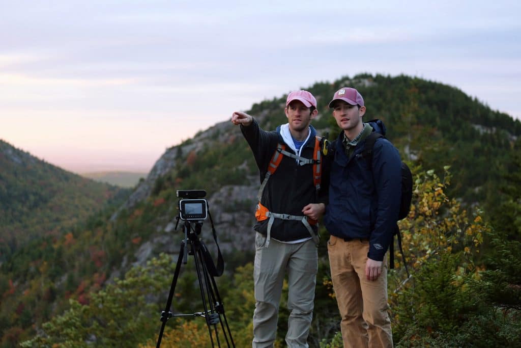
Will and Jim Pattiz, founders of More Than Just Parks
Will and Jim Pattiz, More Than Just Parks

We are Will and Jim Pattiz, the filmmakers behind More Than Just Parks. We have filmed all five Utah national parks and driven this loop ourselves, and our work has been featured by the National Park Service, the Department of the Interior, and outlets across the country. Of every road trip we have done, the Mighty 5 is the one we recommend first.

Worth protecting

These places stay wild because people insist on it

Protection is a choice Americans keep making, and it can be unmade. We keep watch so it holds.

Pin Share