


Capitol Reef is the Utah park most people drive past on their way to somewhere else, and that is exactly why I keep going back. It has the slot canyons and slickrock of its more famous neighbors without the crowds, plus a 100-mile wrinkle in the earth called the Waterpocket Fold and an honest-to-goodness fruit orchard you can pick from in season. I have shot here in spring light and late fall cold, and the park rewards anyone willing to slow down.
Below are 25 things to do in Capitol Reef, ranked by what I would actually send a friend to do first, grouped so you can build a one-day blitz or a three-day deep dive. Each one comes with the trailhead, distance, difficulty, and the time of day I think it works best. For the full park overview, maps, and seasonal notes, start at our Capitol Reef National Park hub.
Here is our 8K film shot across the park if you want to see what you are signing up for.
At a Glance
| Activity | Type | Distance / Time | Difficulty |
|---|---|---|---|
| Cassidy Arch Trail | Hike | 3.4 mi RT, 2 to 3 hrs | Moderate |
| Hickman Bridge | Hike | 1.8 mi RT, 1 to 1.5 hrs | Easy to moderate |
| Cathedral Valley Loop | 4WD drive | 57.6 mi loop, half to full day | High clearance, river ford |
| Grand Wash | Hike | 4.4 mi RT, 2 to 3 hrs | Easy |
| Scenic Drive | Drive | 16 mi RT, 1.5 hrs | Paved, fee required |
| Cohab Canyon | Hike | 3.4 mi RT, 2 hrs | Moderate |
| Petroglyphs | Roadside walk | 0.2 mi, 15 min | Easy, accessible boardwalk |
| Goosenecks Overlook | Viewpoint | 0.2 mi, 15 min | Easy |
| Stargazing | Night sky | Any clear night | Easy |
The Best Hikes in Capitol Reef
1. Hike the Cassidy Arch Trail
Trailhead: Grand Wash, off the Scenic Drive. Distance: 3.4 miles round trip. Elevation gain: about 845 feet. Difficulty: Moderate. Best time: Early morning before the slickrock bakes.
Love Capitol Reef? It's one of 117 threatened public lands destinations we're tracking. Get the free briefing.
Start here. The trail climbs out of Grand Wash on switchbacks, then runs across open slickrock until you are standing on top of the arch looking down into the canyon. Most arches you photograph from below. This one you walk right out onto, which makes it the rare hike that gets better the closer you get. Wear shoes with grip, because the last stretch is bare rock.
2. Hike to Hickman Bridge

Trailhead: Highway 24, two miles east of the visitor center. Distance: 1.8 miles round trip. Elevation gain: about 416 feet. Difficulty: Easy to moderate. Best time: Morning, before the parking lot fills.
If you only have an hour and a half, do this one. The trail gains a little elevation up front, then levels into a wash before delivering you under a 133-foot natural bridge. It is the busiest trail in the park for good reason. Go early and you might get the span to yourself for a few minutes.
3. Hike Through the Grand Wash

Trailhead: End of Grand Wash Road, or from Highway 24. Distance: 4.4 miles round trip. Difficulty: Easy, flat. Best time: Midday when the high walls give shade, but never during a thunderstorm.
Flat, sandy, and walled in by cliffs that pinch down to 16 feet apart at the Narrows. It is the easy hike that does not feel easy because the scenery does all the work. Check the forecast first. This is a wash, and flash floods are real here.
4. Hike the Cohab Canyon Trail

Trailhead: Across from Fruita Campground on Highway 24. Distance: 3.4 miles round trip to the overlooks. Difficulty: Moderate. Best time: Late afternoon for the overlook light.
The switchbacks up front are the price of admission. After that the trail enters a hidden canyon full of honeycombed rock and side slots worth poking into. Push to the overlook spurs and you get a top-down view of the orchards and the campground laid out along the Fremont River.
5. Explore Upper Muley Twist Canyon

Trailhead: End of Upper Muley Twist Road off the Burr Trail. Distance: Up to 9 miles for the full loop. Difficulty: Strenuous, route-finding required. Best time: Spring or fall, full day.
This is the back-of-the-park reward for people who came prepared. The canyon is packed with arches and dramatic folds in the rock, and the rim route gives you a long look down the Waterpocket Fold. You need a high-clearance vehicle to reach the trailhead and solid navigation once you are out there.
6. Hike to Pectols Pyramid

Trailhead: Off Highway 24 near the east end. Distance: About 4 miles round trip. Difficulty: Strenuous, steep and unmaintained. Best time: Cool morning.
An off-the-radar scramble up toward a distinct pyramid-shaped peak. There is no maintained trail, so this is for hikers comfortable picking their own line up loose terrain. The payoff is a quiet summit view that almost nobody else bothers to earn.
Scenic Drives and Backcountry Roads
7. Drive the Scenic Drive
Route: From the visitor center south, paved. Distance: 16 miles round trip. Time: 1.5 hours with stops. Note: Fee required, covered by your park pass.
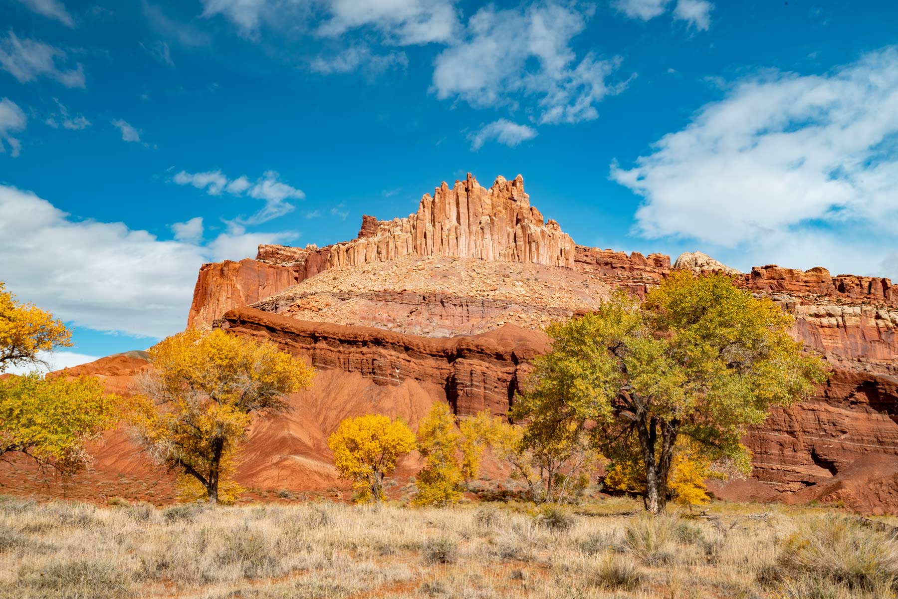
The paved spine of the park. It runs past the orchards and the historic Fruita district, then deeper into the cliffs toward the Capitol Gorge and Grand Wash spurs. Pull-offs are frequent, and the light on these walls late in the day is the reason I keep a camera on the passenger seat the whole drive.
8. Experience Lower Cathedral Valley
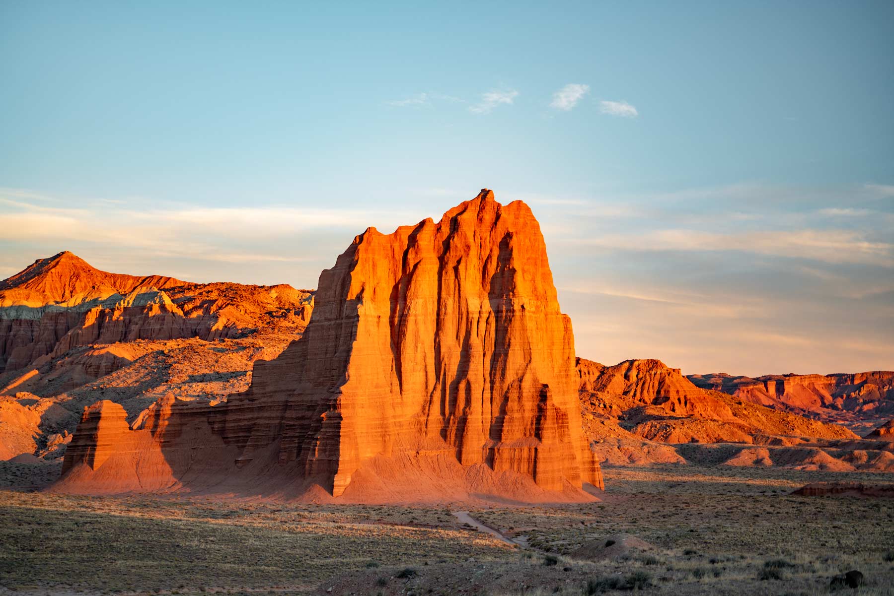
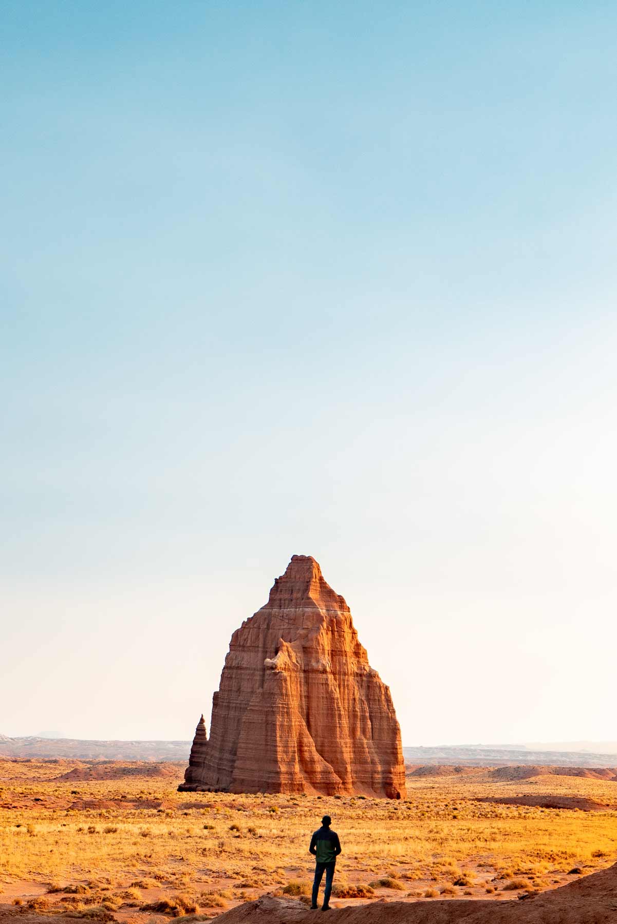
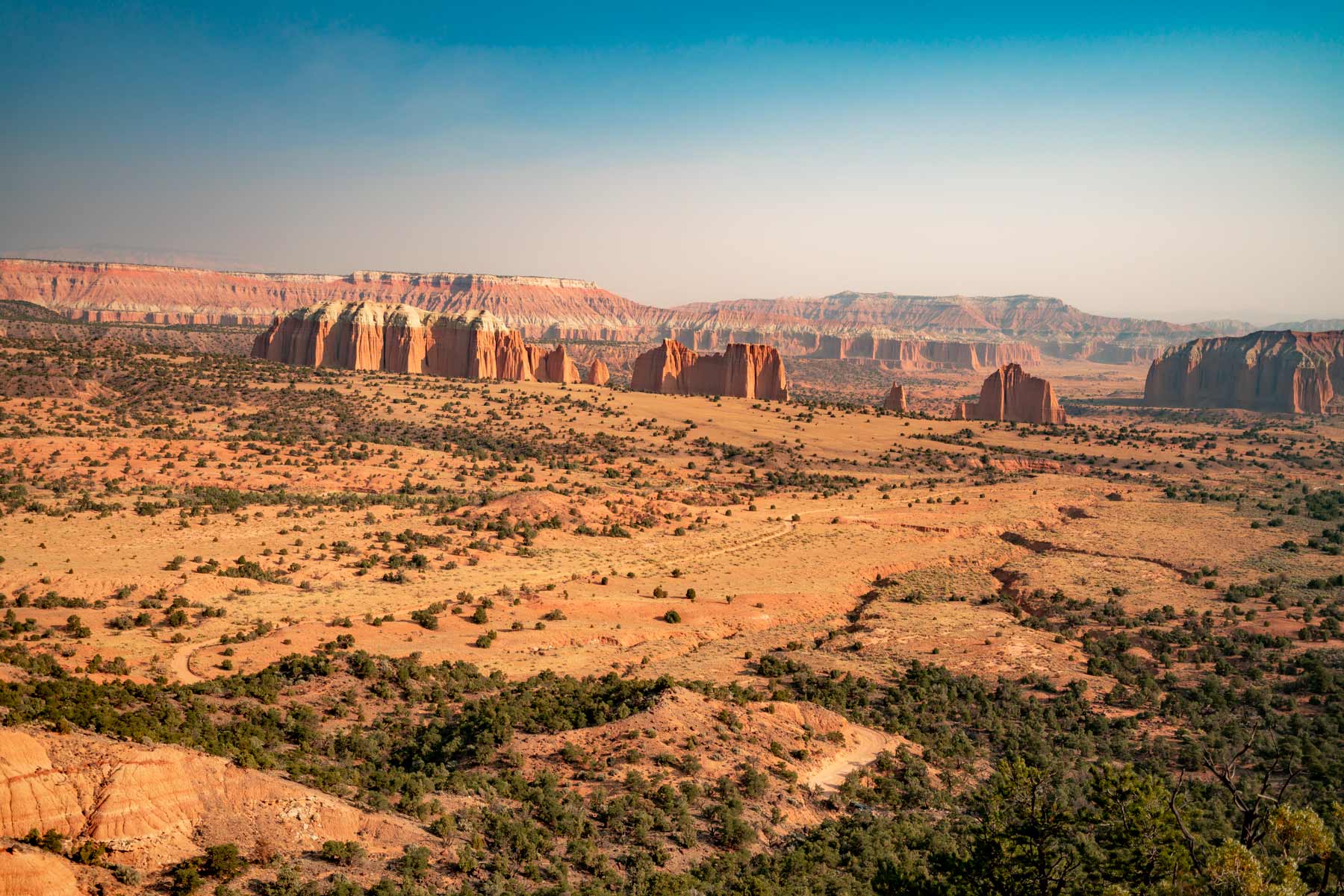
Route: Cathedral Valley Loop, 57.6 miles. Difficulty: High-clearance 4WD, includes a Fremont River ford. Time: Half to full day. Best time: Sunrise on the temples.
The remote north end of the park, and my favorite corner of it. Standalone monoliths like the Temple of the Sun and Temple of the Moon rise straight out of the desert floor with nothing around them. The loop starts with a river crossing, so check depth at the visitor center before you commit, and carry a spare and water.
9. Drive the Notom Bullfrog Road

Route: Notom Road south along the Waterpocket Fold. Difficulty: Graded dirt, high clearance recommended when wet. Time: Half day.
This road runs the eastern length of the Waterpocket Fold and shows you the scale of the thing from the side. It connects to the Burr Trail and several canyon trailheads, so it doubles as the access route for the southern hikes. Skip it after heavy rain when the clay turns to grease.
10. Brave the Burr Trail Switchbacks
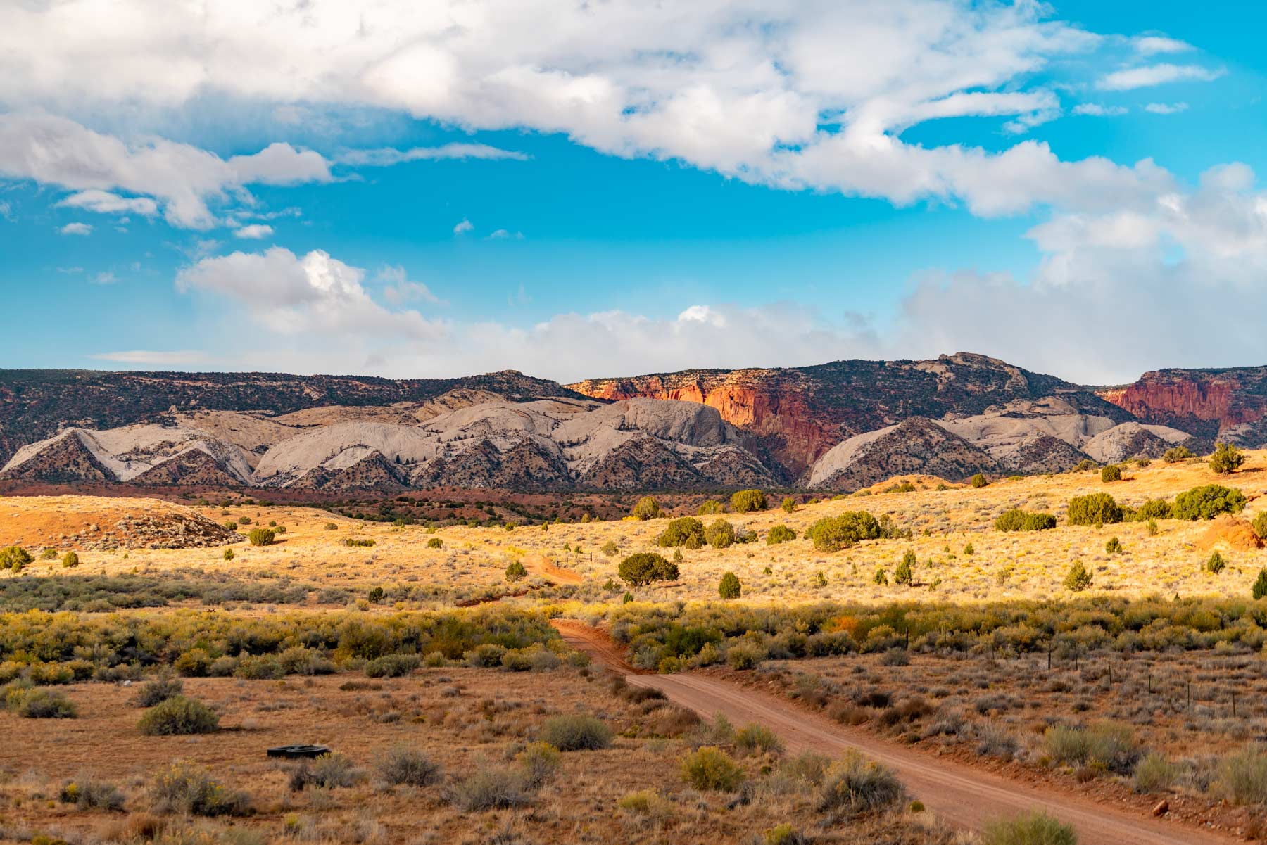
Route: Burr Trail switchbacks, off Notom Road. Difficulty: Steep gravel, high clearance, no trailers. Time: Plan around it as part of a loop.
One of the great drives in southern Utah. The road climbs straight up the face of the Waterpocket Fold on tight gravel switchbacks, gaining 800 feet fast. The view back down once you top out is worth the white knuckles. Drive it dry and sober, and yield to anyone coming up.
Viewpoints and Overlooks
11. See the Twisted Overlook at the Goosenecks

Trailhead: Goosenecks spur off Highway 24. Distance: 0.2 miles. Difficulty: Easy. Best time: Any time, quick stop.
A short walk to a railing above a deep set of entrenched meanders carved by Sulphur Creek. It is one of the fastest payoffs in the park, and it pairs naturally with Sunset Point right next door.
12. Catch a Sunset at Sunset Point
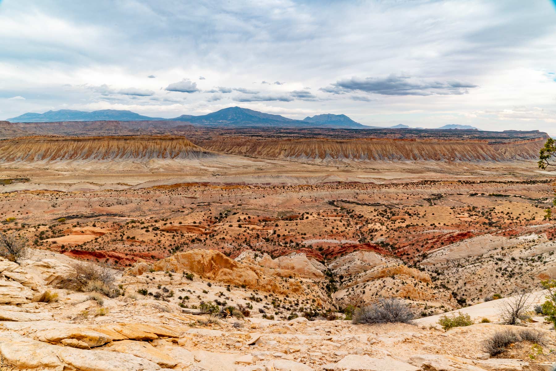
Trailhead: Same lot as the Goosenecks. Distance: 0.8 miles round trip. Difficulty: Easy. Best time: The hour before sunset.
A flat, easy walk to a wide view west across the cliffs. When the sun drops, the whole rock face goes orange. Bring a headlamp for the short walk back to the car.
13. Soak in the Views at Panorama Point

Trailhead: Pullout off Highway 24. Distance: Roadside. Difficulty: Easy. Best time: Sunset, or after dark for stars.
A drive-up overlook with one of the widest views in the park. It also doubles as a great dark-sky spot once the sun is down, since you can take in the whole sky without leaving the parking area.
14. Admire the Views at Strike Valley Overlook

Trailhead: End of Upper Muley Twist Road. Distance: 0.9 miles round trip from the lot. Difficulty: Moderate, high-clearance access. Best time: Late afternoon.
If you want the single best look at the Waterpocket Fold, this is it. The short walk ends at a view straight down the tilted layers of rock that define the whole park. Getting to the trailhead requires a rough road, so it earns its quiet.
15. See the Great Slickrock Divide

Trailhead: Pullout on the Scenic Drive. Distance: Roadside. Difficulty: Easy. Best time: Midday for the texture.
A marked stop on the Scenic Drive where the road crosses a broad expanse of bare domes. It is a good place to understand why they call this rock slickrock, and a fun spot to let kids scramble a little under supervision.
16. See the Upper Cathedral Valley Overlook
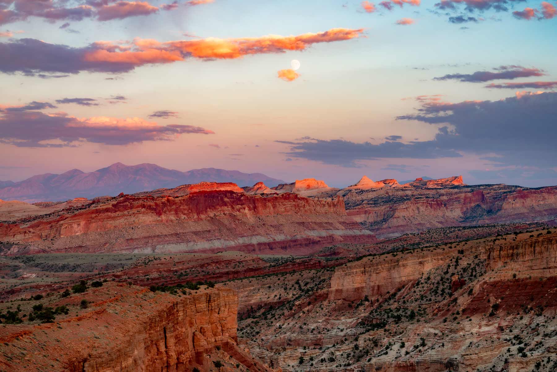
Trailhead: Cathedral Valley Loop, north section. Distance: Short walk from the road. Difficulty: Easy once you reach it by 4WD. Best time: Morning.
The high view over the cathedral formations on the back loop. You have already done the hard driving to get here, so the walk to the rail is the easy part. Stand here in morning light and the whole valley glows.
History, Culture, and the Orchards
17. See the Petroglyphs

Trailhead: Petroglyph boardwalk off Highway 24. Distance: 0.2 miles. Difficulty: Easy, accessible boardwalk. Best time: Morning, when the panels are not in glare.
The Fremont people carved these figures into the cliff face roughly a thousand years ago. A flat boardwalk runs along the base of the wall, and a spotting scope or a zoom lens helps you pick out the higher panels. Look but do not touch.
18. View the Pioneer Register

Trailhead: Capitol Gorge, end of the Scenic Drive. Distance: 2 miles round trip. Difficulty: Easy. Best time: Morning.
A flat walk into Capitol Gorge where early travelers scratched their names and dates into the rock. It is a living timeline of who came through this canyon before the road existed. Some of the inscriptions date to the 1800s.
19. See the Fruita Schoolhouse
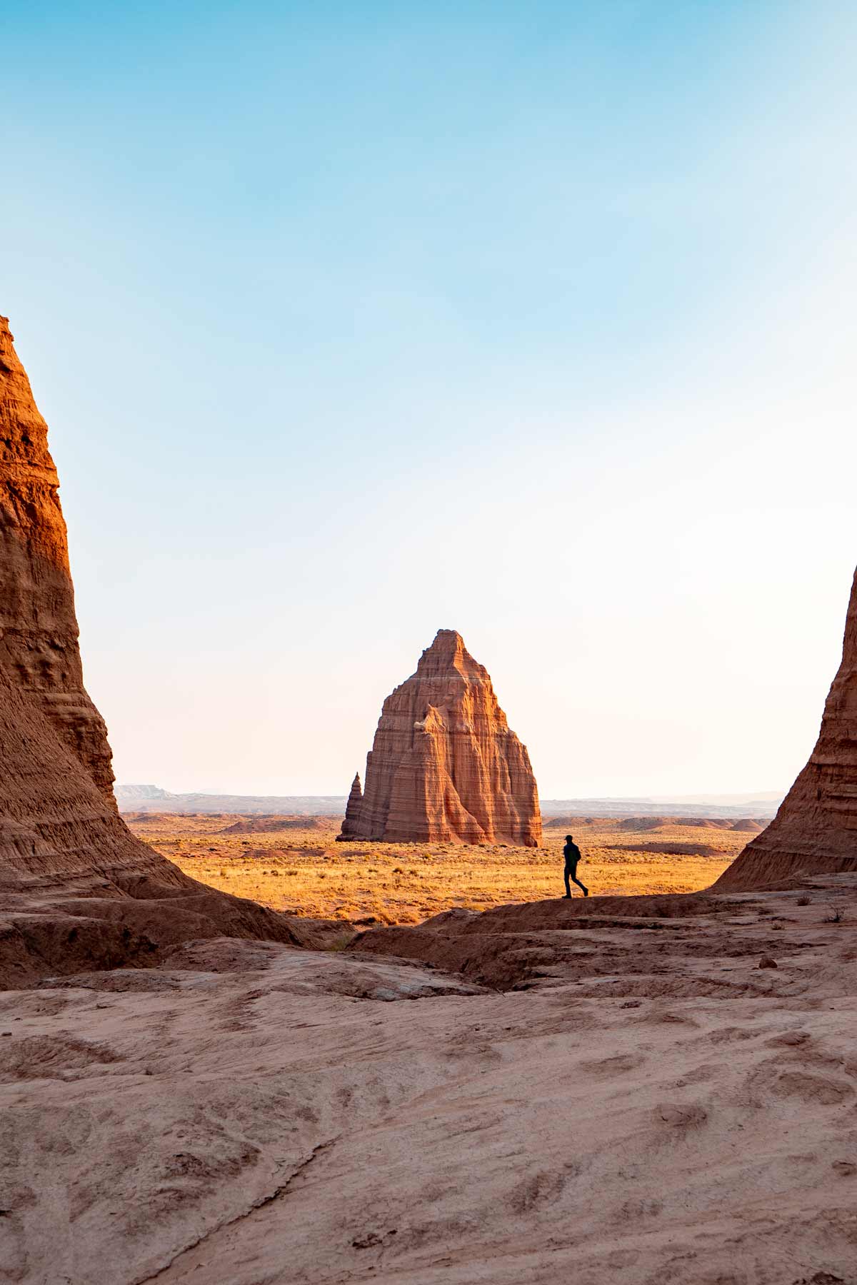
Location: Highway 24, Fruita district. Difficulty: Roadside stop. Best time: Any time.
A restored one-room schoolhouse from the Mormon settlement of Fruita, which farmed this valley until the park took over. You view it through the windows, and the setting against the cliffs tells the story of how hard and how beautiful life out here would have been.
20. Find the Lesley Morrell Line Cabin
Location: Cathedral Valley Loop. Difficulty: 4WD access, short walk. Best time: Part of the loop drive.
A weathered cattle-camp cabin on the remote back loop, restored and left as it was. It is a reminder that people ranched this hard country well into the last century. Stop here if you are already running the Cathedral Valley loop.
21. Explore Behunin Cabin

Location: Highway 24, east of the visitor center. Difficulty: Roadside stop. Best time: Any time.
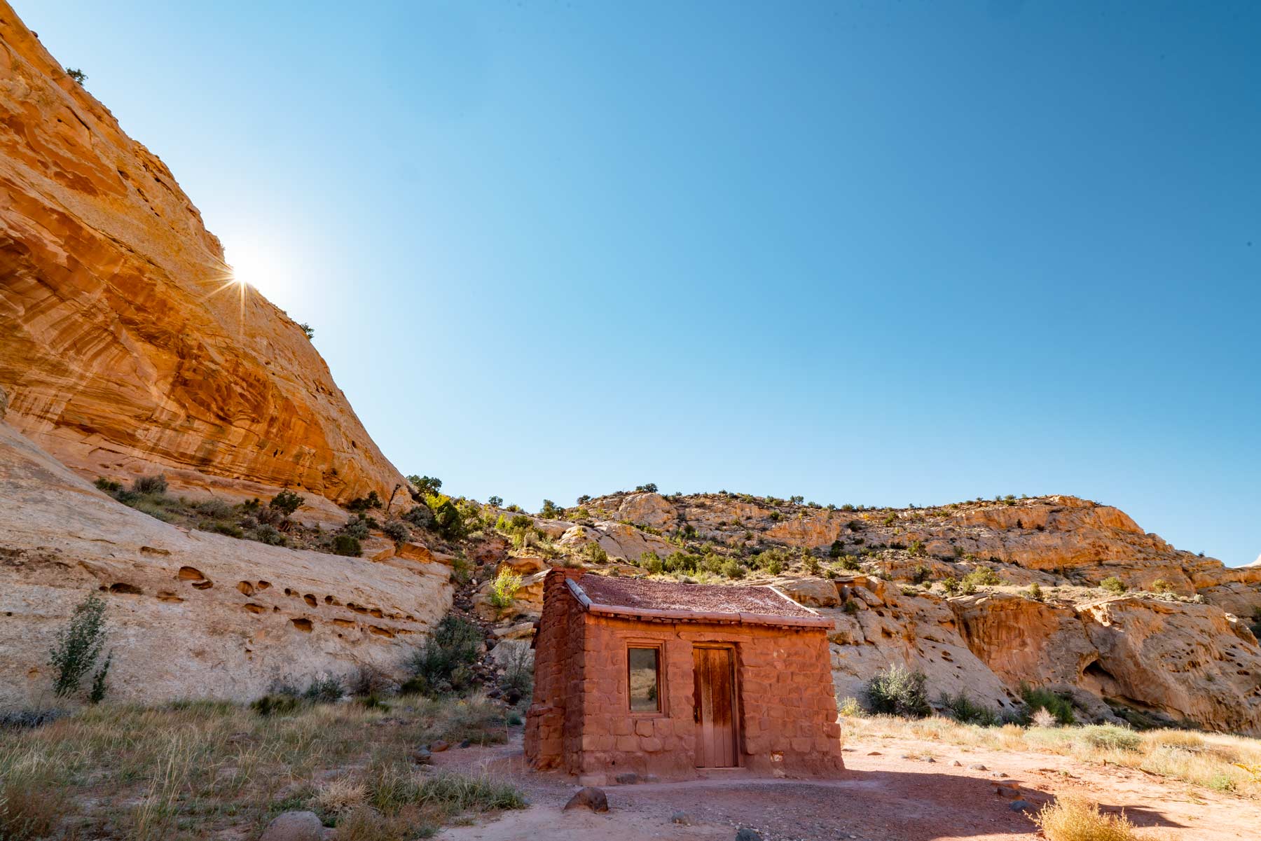
A tiny sandstone cabin where the Behunin family lived in the 1880s. You will wonder how a family fit inside once you see it. It is a 30-second stop that puts the rest of the pioneer story in perspective.
22. Pick Fruit in the Fruita Orchards
Location: Fruita district. Difficulty: Easy. Best time: Harvest season, roughly June through October by crop.
The park still maintains the historic orchards the settlers planted, and during harvest you can walk in and pick cherries, apricots, peaches, and apples for a small per-pound fee. Eating ripe fruit in the shade of a cliff is one of the most unexpected things you can do in any national park. Check the harvest schedule at the visitor center.
Sunsets, Stars, and Slow Mornings
23. Watch the Sunset at the Fruita Barn

Location: Fruita district. Difficulty: Easy. Best time: Golden hour.
The old Fruita barn with the cliffs behind it is one of the most photographed scenes in the park, and for once the popular spot earns it. Come at golden hour when the light rakes across the wood and the rock goes warm. Deer often graze the field at dusk.
24. Go Stargazing

Location: Panorama Point, the Scenic Drive, or anywhere away from lights. Difficulty: Easy. Best time: New moon, after astronomical twilight.
Capitol Reef is a certified International Dark Sky Park, and on a moonless night the Milky Way is bright enough to throw a faint shadow. Let your eyes adjust for 20 minutes, keep your phone on red light, and look up. The park runs ranger astronomy programs in the warmer months.
25. Try Horseback Riding

Location: Permitted areas, via local outfitters near the park. Difficulty: Easy to moderate. Best time: Cooler months.
If you want to cover desert ground the old way, outfitters in the Torrey area run guided rides on terrain near the park. It is a relaxed way to see the country, and it is a good option for groups with mixed hiking ability. Book ahead in peak season.
Planning Your Capitol Reef Visit
Fees and Reservations
Capitol Reef does not require any timed-entry or reservation system. Highway 24 runs through the park for free, but the Scenic Drive past the orchards charges an entrance fee of $20 per private vehicle, $15 per motorcycle, or $10 per person, good for seven days. An America the Beautiful annual pass covers it. Pay at the self-serve station near the visitor center.
How Many Days You Need
One full day gets you the Scenic Drive, Hickman Bridge, and Cassidy Arch, plus the orchards and a sunset. Two days lets you add Grand Wash, Cohab Canyon, and the overlooks at an unhurried pace. Three days opens the door to the 4WD country in Cathedral Valley and the southern canyons off the Burr Trail, which is where the park really separates from its neighbors.
Where to Stay

Inside the park, the Fruita Campground sits among the orchards along the Fremont River and books up fast in spring and fall, so reserve through Recreation.gov as early as you can. Just outside the west entrance, the town of Torrey has lodges, cabins, and a few good restaurants, and it makes the easiest base for most visitors. There are also free dispersed and primitive camping options on the surrounding public lands destinations managed by the BLM and Forest Service.
When to Go
Spring and fall are the sweet spots, with mild days and cool nights. Summer afternoons get hot and bring monsoon storms that can flash-flood the washes, so hike canyons early and watch the sky. Winter is quiet and often clear, with snow dusting the red rock for a few magic days. The orchards are at their best from early summer into fall.
Frequently Asked Questions
Is Capitol Reef worth visiting?
Yes, and it is one of the most underrated parks in Utah. You get slot canyons, slickrock, arches, dark skies, and pioneer history with a fraction of the crowds at Zion or Arches. If you like quiet and you do not mind a little driving, it is hard to beat.
How long should I spend in Capitol Reef?
One full day covers the highlights along the Scenic Drive and Highway 24. Two to three days lets you reach the backcountry roads and canyons that most visitors never see.
Do I need a 4WD vehicle?
Not for the main park. The Scenic Drive and Highway 24 are paved and reach most of the top hikes. You only need high clearance and four-wheel drive for Cathedral Valley, the Notom Bullfrog Road, and the Burr Trail.
Can you really pick fruit in the orchards?
Yes. During harvest season the park lets visitors pick cherries, apricots, peaches, and apples for a small per-pound fee. Check current harvest dates at the visitor center, since they shift year to year with the weather.
Planning a wider Utah road trip? Pair Capitol Reef with our guide to things to do in Bryce Canyon, and dig into the region with our roundup of historic sites in Utah.
What to Bring to Capitol Reef
Gear we recommend for Capitol Reef. Affiliate links support our work at no cost to you.
More Than Just Parks may earn a small commission from purchases made through these links, at no extra cost to you. We only recommend gear we would actually use.
Affiliate disclosure: Some links on this page earn us a small commission at no extra cost to you. We only recommend gear we actually use.
More Than Just Parks Film Watch our 8K film of Capitol Reef We spent weeks in Capitol Reef, one of our favorite public lands destinations, capturing it the way it deserves. Take a few minutes and see it for yourself.


