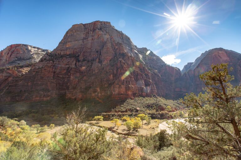
I’ve spent years filming and hiking in Zion National Park. In 2015 I was part of a small crew that shot a film here and my job was to find every beautiful corner of the park. I’ve hiked nearly every trail in Zion since then, and this is my definitive list of the best hikes, from the popular favorites in the main canyon to incredible trails you’ve probably never heard of.
Zion National Park Map
8 trails mapped — click a pin to learn more
Zion National Park at a Glance
5 alerts1. The Narrows Hike
The Narrows
Permit Required- Distance: 16 miles (but most only hike the first few miles which are incredible)
- Elevation: Minimal
- Time: Depends (typically a 2-4 hours)
- Difficulty: Easy (depending on how far you go)
The Narrows is one of the absolute coolest hikes in Zion National Park and the entire national park system for that matter.
Hiking the Narrows
Hikers hike, walk, and wade through a narrow canyon of massive red rock canyon walls where the Virgin River has been at work for millions of years.
The total hike is 16 miles long but most folks only do the first few which are incredible. You’ll need some good water shoes for this hike and a hiking pole is recommended although most folks go without (water shoes can be rented in Springdale at a number of places).
The deepest the water gets is about 3-4ft but most of the hike is in ankle deep water.
2. Angels Landing Hike
Angels Landing
Permit Required- Distance: 5 miles
- Elevation: 1500 feet
- Time: 3-4 hours
- Difficulty: Moderate
Hiking Angels Landing
Angel’s Landing is the most popular, well-known hike in Zion National Park leading to one of the most iconic views in all the National Park system.
The Angel’s Landing trail is a steep 5 miles with about 1,500ft of elevation gain. Starting back in 2022, everyone who hikes Angels Landing must have a permit from the NPS to do so.
This hike is not for acraphobics or the faint of heart as one section of the trail involves holding onto a chain bolted onto a cliff side with sheer drop offs.
I recommend starting this hike as early in the morning as possible to avoid the (massive) crowds that flock in by mid-morning.
It’s no fun waiting on the cliff face holding onto the chain link guide. Read more about the Angels Landing hike if you’re interested.

3. Canyon Overlook Hike
Canyon Overlook Trail
- Distance: 1 mile
- Elevation: Minimal
- Time: 1-2 hours
- Difficulty: Easy
Hiking Canyon Overlook
Canyon Overlook is one of the most spectacular and relatively easy to access overlooks in all of Zion National Park.
Located on the Zion Mt. Carmel (East) side of the park, the Canyon Overlook Trail is a popular one.
The trail itself is about a mile round trip with little elevation gain. Hikers will be rewarded with sweeping views of Zion National Park.
Canyon Overlook is also a decent place to see sunrise but not so much sunset as the shadows fill the canyon long before the sun actually sets.

4. Timber Creek Overlook Trail
Timber Creek Overlook Trail
- Distance: 1 mile
- Elevation: 100 feet
- Time: 30 minutes – 1 hour
- Difficulty: Easy
Hiking Timber Creek Overlook Trail
The Timber Creek Overlook Trail is perhaps the most overlooked (pun intended) trail in all of Zion National Park.
The sweeping panoramic views of Kolob Canyon are absolutely and with a tiny fraction of the visitors of most of the other hikes in the park.
Located in the Kolob Canyon section of the park (separate entrance from Springdale located off I-15 to the north) Timber Creek Overlook Trail is located at the end of the East Kolob Canyon Road.
The hike itself is easy and offers incredible views of Kolob Canyon at 1 mile round trip with just 100 feet of elevation gain.


Interested in visiting all the Utah Mighty 5 National Parks? Read our Utah National Parks article!
5. Observation Point (via East Mesa Trail)
Observation Point via East Mesa Trail
- Distance: 7 miles (or 9 without using the treacherous road)
- Elevation: 700 feet
- Time: 4-6 hours
- Difficulty: Moderate
- Status: One route open
Hiking to Observation Point
Observation Point is one of the best hikes in all of Zion National Park offering what some argue are the most epic views in the entire park.
The best views are available from the top of the hike and look down the main Zion Canyon revealing a true “land before time” landscape.
There are three trail options for getting to Observation Point itself, only one of which is currently open to hikers due to a major rock fall.
- (OPEN) Observation Point via East Mesa Trail
- (CLOSED) Observation Point via East Rim Trail
- (CLOSED) Observation Point via Weeping Rock Trail
Currently the only way to access the trail to Observation Point is through the Eastern side of Zion through Zion Ponderosa Ranch Resort (privately owned) and BLM land.
I HIGHLY recommend parking at Zion Ranch (only $5) and taking the shuttle to the trailhead rather than driving your own vehicle. The road is extremely treacherous, even for tricked out 4WD jeeps.
The trail is actually lovely with gentle elevation gain over several miles. There is also plenty of shade on this trail (surprisingly) but be sure to pack enough water, especially in Summer months when heat exhaustion is all too common.
At the end you’ll reach Observation Point with relatively minimal effort, one of the best views in Zion National Park.

This is currently the only way to get to Observation Point due to a major rock fall in the the park.
6. La Verkin Creek Trail
La Verkin Creek Trail to Kolob Arch
- Distance: 14 miles
- Elevation: 1000 feet
- Time: 8-10 hours
- Difficulty: Difficult
Hiking La Verkin Creek
If you’re looking for an uncrowded hike in Zion National Park, La Verkin Creek Trail is a great choice.
This hike sees far fewer hikers each year than most trails in Zion National Park entering into the primitive Zion Wilderness area.
The highlight of the La Verkin Creek Trail is Kolob Arch (one of the world’s largest natural arches) which can be viewed up close off a spur trail about 7 miles into the hike.
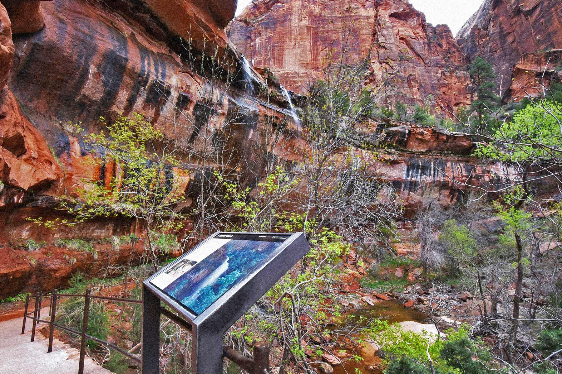
7. Weeping Rock
Weeping Rock Trail
- Distance: .4 miles
- Elevation: 100 feet
- Time: 30 minutes
- Difficulty: Easy
- Status: CLOSED
Hiking Weeping Rock
The Weeping Rock Trail is a favorite hike in Zion National Park for many offering beautiful views of the famous Weeping Rock.
Weeping Rock is a small rock alcove with water dripping from an overhang.
The trail is short but steep at points but overall relatively easy for all age groups.
Note: This trail is currently closed due to a major rock fall.
8. Lower Emerald Pool Trail
Lower Emerald Pool Trail
- Distance: 1.2 miles
- Elevation: Minimal
- Time: 1 hour
- Difficulty: Easy
Hiking Lower Emerald Pool Zion
Lower Emerald Pool Trail is one of the most recently paved trails in Zion National Park offering greatly improved accessibility for hikers.
The trail was re-opened in 2017 after damage was sustained from a large rock fall.
Hiking to Lower Emerald Pool is relatively easy at 1.2 miles round trip with minimal elevation gain. The pool itself features some nice little waterfalls and beautiful canyon scenery.
9. Hop Valley Trail
Hop Valley Trail
- Distance: 6.6 miles (point to point) or 13.2 round trip
- Elevation: 1000 feet
- Time: 3 hours (each way)
- Difficulty: Moderate – Difficult
Hiking Zion’s Hop Valley Trail
The Hop Valley Trail is one of Zion’s finest starting in the Kolob Terrace region of the park and taking hikers into the spectacular Kolob Canyon.
Along the way you’ll see beautiful valley scenery with fields and meados transform into red rock canyons.
This hike should not be attempted without adequate preparation.
The round trip hike back to the Hop Valley Trailhead is over 13 miles so make sure you have a plan for someone to pick you up if you’re doing the point to point hike!

10. Taylor Creek Trail
Taylor Creek Trail
- Distance: 5 miles
- Elevation: 500 feet
- Time: 3-4 hours
- Difficulty: Moderate
Hiking Taylor Creek in Zion
Taylor Creek is a wonderful hike in the Kolob Canyon region of Zion National Park leading hikers into a narrow, beautiful canyon toward Double Arch Alcove.
There are two historic cabins located on this hike which are worth checking out. Both were built in the 1930s with fir logs, the Larson cabin and the Fife cabin.
The hike follows Taylor Creek and offers hikers plenty of shade and areas to rest. At 5 miles round trip and 500 feet elevation gain the hike is rated as moderate. Double Arch Alcove marks the end of the hike.
Plan for at least 3 hours for this hike.

11. Lava Point Overlook
Lava Point Overlook
- Distance: .3 miles
- Elevation: Minimal
- Time: 20-30 minutes
- Difficulty: Easy
Hiking to Lava Point Overlook
Lava Point Overlook isn’t as much of a hike as it is a short walk from the Lava Point Parking Lot to the overlook.
The hike is one of the shortest n Zion National Park and one of the most beautiful.
Lava Point is a spectacular overlook located in the Kolob Terrace region of Zion National Park. Here you’ll find less crowds, more solace, and just as much beauty albeit of a different variety than what you’ll see in the canyons.
I highly recommend Lava Point at sunset as I believe it’s the best place in all of Zion to watch the sun fade away.


12. Hidden Canyon (via Weeping Rock Trail)
Hidden Canyon
- Distance: 3 miles
- Elevation: 850 feet
- Time: 3-4 hours
- Difficulty: Strenuous
Hiking Hidden Canyon
Hidden Canyon is a very popular hike located in the main canyon of Zion National Park.
Hikers ascend nearly 1000ft up the side of the canyon wall to get into a smaller “hidden” canyon with sandy paths.
There are two ways to access Hidden Canyon, both are currently closed due to a rock fall.
- Hidden Canyon via Weeping Rock Trail (CLOSED)
- Hidden Canyon via East Rim Trail (CLOSED)

Note: This trail is currently closed due to a major rock fall.
13. The Subway (Left Fork, Bottom Up)
The Subway (Left Fork)
Permit Required- Distance: 9 miles
- Elevation: 1300 feet
- Time: 6-10 hours
- Difficulty: Strenuous
Hiking to The Subway in Zion
Hiking the left fork of the Subway in Zion National Park is one of the most coveted, bucket list hikes in America offering spectacular, up-close viewing of one of the most beautiful slot canyons in the world.
NOTE: Hiking to the Subway always requires a permit via a lottery system. The cost is $5. The lucky few who win permits must also check in at the Wilderness Desk of the Zion National Park Visitor Center to obtain the actual permit.
The “trail” to the Subway follows the left fork of North Creek and frequently is in the creek itself meaning be prepared to get wet in this water (it’s cold).
Be sure to have waterproof shoes and/or a game plan for having wet feet. The hike starts at the left fork trailhead in the Kolob Terrace part of the park. First up, a 400 foot descent or so meaning you’ll have a nice steep ascent on the way back “up”.
The trail eventually hits the creek bed where I highly recommend bringing something bright and visible to tie onto a tree so you’ll remember where the way out is.
From here, “simply” follow the creek up to the subway. This will involve scrambling over rocks, climbing around beautiful cascading waterfalls, and passing by ancient dinosaur tracks.
The Subway itself is quite small but with endless photo opportunities. Be respectful of the other folks there and try to stay as quiet as possible in the Subway to preserve the grandeur of this special place.
Add this to your list of best hikes in Zion National Park if you’re looking for a full day of adventure.

14. West Rim Trail (via Lava Point)
West Rim Trail
- Distance: 19 miles (or however long you want to go)
- Elevation: 1500 feet
- Time: 9-11 hours
- Difficulty: Difficult
Hiking the West Rim Trail
The West Rim Trail offers hikers in Zion National Park the rare opportunity of solace in a place so crowded with eager visitors.
The trail is long but can be used as a shorter out & back hike for a great afternoon hike (which is what I usually do).
The scenery on the West Rim Trail is dramatically different than what you see in the photos of Zion offering visitors a unique, unexpected, and uncrowded experience.
Add this to your list of best hikes in Zion National Park if you’re looking to escape the crowds and enjoy the high desert scenery.

15. Pa’rus Trail
Pa'rus Trail
- Distance: 3.5 miles
- Elevation: Minimal
- Time: 1-2 hours
- Difficulty: Easy
Hiking the Pa’rus Trail
The Pa’rus Trail is considered to be one of the easiest and most pleasant hikes in Zion National Park offering great views for minimal effort.
The trail is paved and handicap accessible following the Zion River.
At 3.5 miles long with minimal elevation the Pa’rus Trail is great for kids and families of all ages. One of the most famous views in Zion National Park of the Watchman can be achieved from this hike.

16. Pine Creek Gorge Slot Canyon
The Pine Creek Gorge Slot Canyon is one of the most popular technical canyoneering spots in Zion National Park.
If you’re not up for technical rappelling then no problem!
Drive toward the east entrance a bit and find another part of the Pine Creek Gorge to hike around. The creek bed is long and provides lots of great entry points for hikers.
I love this hike as a lesser-traveled and beautiful look into the east side of Zion National Park.


Best Time to Visit Zion
The best time to visit Zion National Park is September and October when visitation drops, temperatures cool off, and the cottonwood trees along the Virgin River turn a brilliant yellow. Spring is a strong second choice with bright canyon greens and smaller crowds. Summer is brutally hot in the canyon, and winter brings surprisingly cold temperatures.

Getting Around Zion
No private vehicles are allowed in the main canyon unless you have reservations at the Zion Lodge. The Zion Shuttle runs daily and stops at all the major trailheads. Visitors need $1 tickets in advance. Outside the main canyon, you can drive the Zion-Mt. Carmel Highway, Kolob Terrace Road, and Kolob Canyon on your own.

Where to Stay in Zion
Most visitors base themselves in Springdale, the small town right outside the main canyon entrance. It’s a 2.5-hour drive from Las Vegas and 4.5 hours from Salt Lake City. Check out our guide on visiting Zion National Park for detailed lodging tips, or browse hotels near Zion here.

Zion National Park is unlike anywhere else on the planet. Looking up at those impossibly big canyon walls for the first time is a feeling you don’t ever forget. I hope this guide helps you find the perfect trail.
Related Guides
- 18 Things to Do in Zion National Park
- Zion Rockfall: What Trails Are Closed
- 12 Best Hikes in Arches National Park
- 20 Things to Do in Canyonlands National Park
- 20 Things to Do in Bryce Canyon National Park
- 15 Things to Do in Capitol Reef National Park
- All 63 National Parks Ranked by Experts
Frequently Asked Questions About Zion National Park
When is the best time to visit Zion?
The best time to visit Zion National Park is April through October. Conditions vary significantly by season, so plan accordingly and check current conditions before your trip.
How much does it cost to enter Zion National Park?
The entrance fee for Zion National Park is $35 per vehicle (valid for 7 days). An America the Beautiful Annual Pass ($80) covers entrance to all 63 national parks and 2,000+ federal recreation sites.
What is Zion known for?
Zion National Park is known for Angels Landing, The Narrows, Emerald Pools, and Canyon Overlook Trail. The park spans 147,243 acres and was established in 1919.
What are the best things to do at Zion National Park?
The top activities at Zion include Hiking, Canyoneering, Rock climbing, Scenic drives, and Stargazing. Check our Zion guide for detailed recommendations.
Where is Zion National Park located?
Zion National Park is located in Utah. Visit our complete Zion guide for directions, nearby airports, and getting-there tips.
What to Bring to Zion
Gear we recommend for Zion. Affiliate links support our work at no cost to you.
Affiliate disclosure: Some links on this page earn us a small commission at no extra cost to you. We only recommend gear we actually use.