
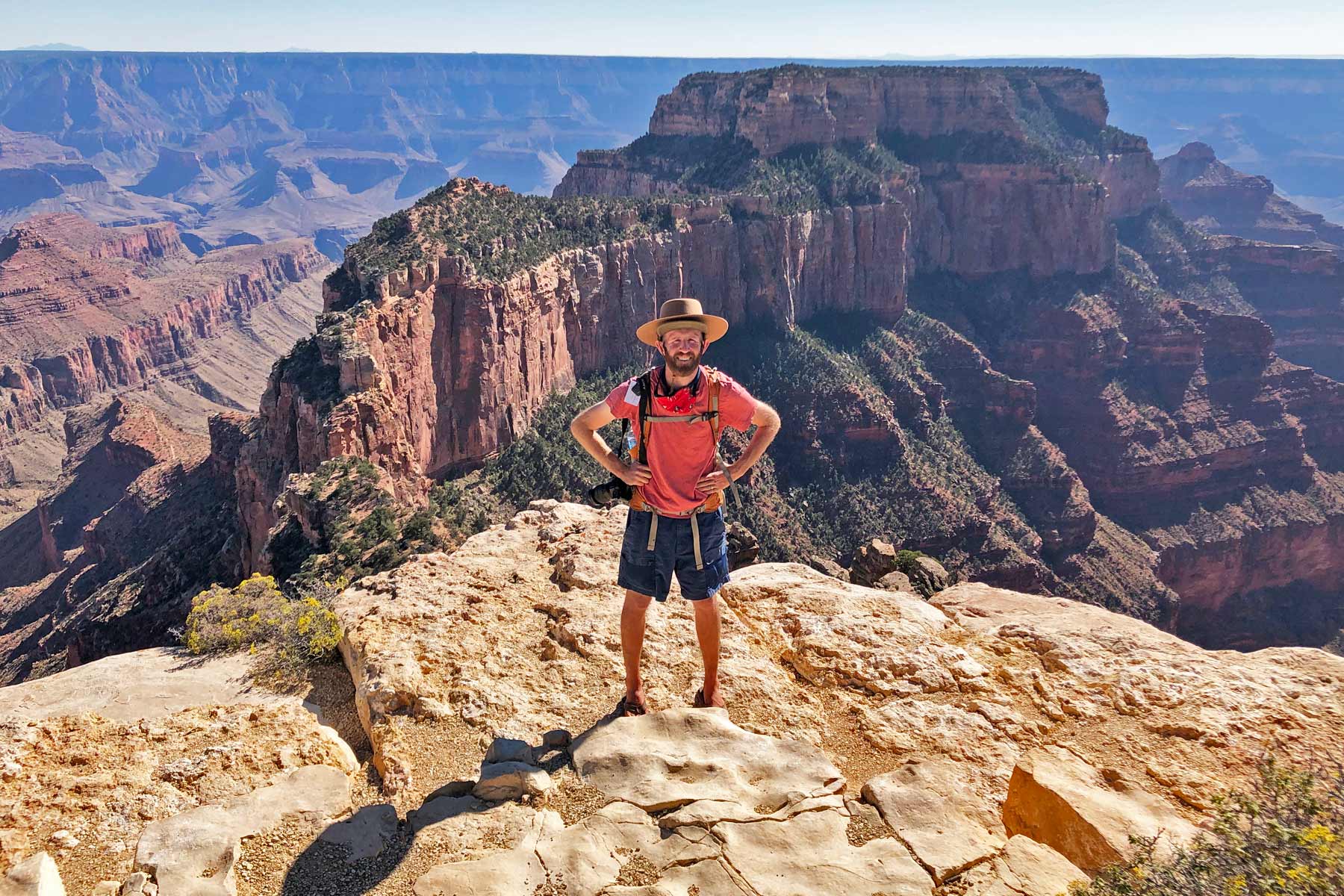


The Grand Canyon is one of those places that flattens a photograph. A mile deep, up to 18 miles across, and 277 river miles long, it does not fit in a frame and it does not fit in your head until you are standing on the edge of it. The first road trip I took to this canyon is the reason More Than Just Parks exists, so I have a soft spot for it that no amount of crowds at Mather Point can dent.
Below are 20 things to do in the Grand Canyon, ranked and grouped so you can plan a solid day on the South Rim or stretch it into a multi-day trip. Almost everything here is on the South Rim, which is open year-round and where 90 percent of visitors go. I have flagged the North Rim items with their 2026 reality, since the rim is reopening with limited services after the Dragon Bravo Fire. For the full overview and current conditions, start at our Grand Canyon National Park hub.
Some links below are affiliate links. If you book a stay or buy a recommended map or guidebook through them, we may earn a small commission at no extra cost to you. It helps keep our park coverage free.
Where to stay near Grand Canyon National Park: Most visitors base themselves in Tusayan, Arizona, the closest gateway with a real range of options. You can compare hotels and lodges near Grand Canyon National Park to find dates that still have availability, since the best places book out months ahead in peak season.
Love Grand Canyon? It's one of 117 threatened public lands destinations we're tracking. Get the free briefing.
It is also worth carrying a paper map and a good guidebook, because cell service is spotty across most of the park. We use the National Geographic Trails Illustrated map for Grand Canyon National Park for trail planning, paired with a detailed Grand Canyon National Park guidebook for trip ideas and logistics.
At a Glance
| Activity | Type | Distance / Time | Difficulty |
|---|---|---|---|
| South Kaibab to Ooh Aah Point | Hike | 1.8 mi RT, 1 to 2 hrs | Moderate |
| Bright Angel to 1.5-Mile Resthouse | Hike | 3 mi RT, 2 to 4 hrs | Moderate to strenuous |
| Hermit Road | Scenic drive / shuttle | 7 mi, 9 viewpoints | Easy |
| Desert View Drive | Scenic drive | 25 mi one way | Easy |
| Desert View Watchtower | Landmark | 30 min | Easy |
| Mather Point and Rim Trail | Viewpoint / walk | Varies | Easy |
| Trail of Time | Interpretive walk | 1.3 mi one way | Easy |
| Yavapai Geology Museum | Indoor / view | 30 to 45 min | Easy |
The Best Hikes Below the Rim
1. Hike the South Kaibab Trail to Ooh Aah Point

Trailhead: South Kaibab, shuttle access only via the Kaibab/Rim route. Distance: 1.8 miles round trip. Elevation change: about 760 feet. Difficulty: Moderate. Best time: Sunrise, before the heat.
If you do one hike below the rim, make it this one. The South Kaibab follows an open ridgeline, so unlike the Bright Angel you get massive views the entire way down, not just at the bottom. Ooh Aah Point delivers a panorama that earns its name in under a mile. Remember that going down is the easy half. Turn around with energy to spare, and carry water.
2. Hike the Bright Angel Trail

Trailhead: Bright Angel, near the Bright Angel Lodge in the village. Distance: 3 miles round trip to the 1.5-Mile Resthouse, 4.6 miles to the 3-Mile Resthouse. Elevation change: about 1,120 feet to the first resthouse. Difficulty: Moderate to strenuous. Best time: Early morning.
The most famous trail in the canyon, with shade in spots, water stations seasonally, and resthouses that give you natural turnaround points. The 1.5-Mile Resthouse is a realistic goal for most fit day hikers. Do not try to reach the river and return in a day. People attempt it every summer and rangers spend the day pulling them back out.
3. See Ooh Aah Point at Sunrise

Trailhead: South Kaibab. Distance: 1.8 miles round trip. Difficulty: Moderate. Best time: Catch the first shuttle to hit it at dawn.
Worth calling out on its own because timing changes everything here. Hike down in the dark with a headlamp and a layer, and watch the first light pour across the buttes from a perch most day visitors never reach. It is the best sunrise on the South Rim that involves actual hiking, and the early shuttle makes it doable.
Scenic Drives and the Rim
4. Drive or Shuttle Hermit Road

Route: Hermit Road, west from the village. Distance: 7 miles, 9 viewpoints. Difficulty: Easy. Note: Closed to private cars roughly March through November, shuttle only.
The classic western drive, lined with overlooks like Hopi Point and Mohave Point that face straight into sunset. For most of the year private cars are not allowed, so you ride the free red-route shuttle and hop off at the stops you like. Hopi Point is the sunset favorite, so get there early to claim a spot.
5. Cruise the Desert View Drive
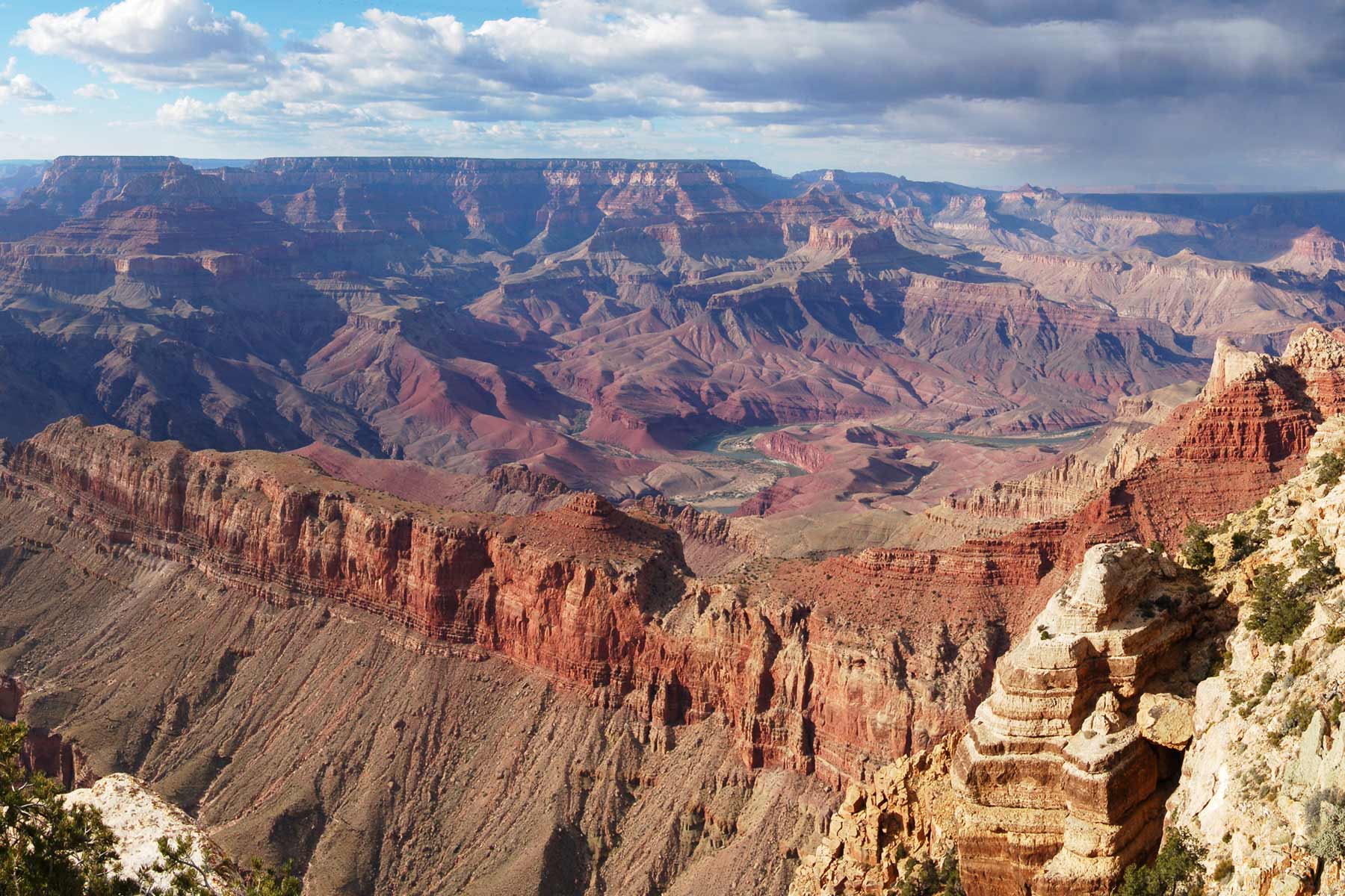
Route: Highway 64 east from the village to Desert View. Distance: 25 miles one way. Difficulty: Easy, private cars allowed. Best time: Afternoon heading east.
The eastern scenic drive, and the one you can do in your own car. It strings together Grandview Point, Moran Point, Lipan Point, and finally Desert View, where the Colorado River makes a long visible bend below. Lipan Point is one of the few overlooks where you see a big stretch of the river itself.
6. Soak in the Views at Mather Point and the Rim Trail
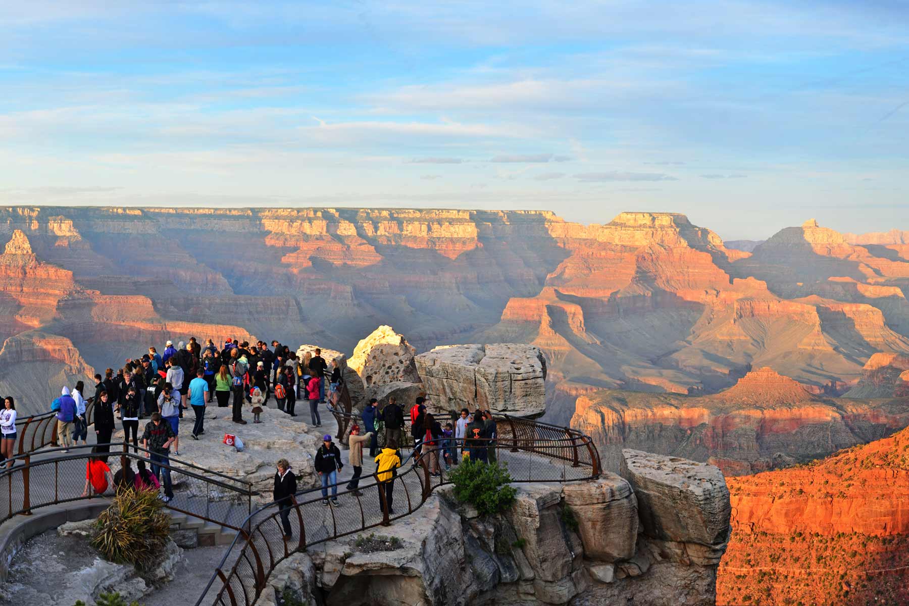
Location: Near the main visitor center. Difficulty: Easy, paved and accessible. Best time: Sunrise to dodge the worst crowds.
Mather Point is the first canyon view most people get, and for good reason. It is right by the visitor center and the railing frames the whole eastern canyon. From here the paved Rim Trail runs for miles in both directions, mostly flat, so you can walk to quieter overlooks and leave the crowd behind in five minutes.
7. Watch the Sunset from Yaki and Grandview Points

Location: Yaki Point (shuttle), Grandview Point (Desert View Drive). Difficulty: Easy. Best time: Last hour of light.
Everyone piles into Hopi and Mather for sunset, so I send people to Yaki or Grandview instead. Yaki sits on the Kaibab shuttle route and faces a dramatic stretch of buttes. Grandview, off the eastern drive, is higher and less mobbed. Bring a layer, because the rim cools off fast once the sun drops.
8. Catch a Sunrise at Hopi Point

Location: Hermit Road shuttle. Difficulty: Easy. Best time: First shuttle of the morning.
Hopi Point juts far enough into the canyon that you get light on both sides, which makes it a rare spot that works for both sunrise and sunset. Mornings are far quieter than evenings here. Catch the first shuttle, find a perch, and watch the canyon fill with light from the bottom up.
History, Culture, and Learning
9. Visit the Desert View Watchtower

Location: Desert View, east end of the drive. Difficulty: Easy. Best time: Late afternoon.
Mary Colter designed this 70-foot stone tower in 1932, modeled on Ancestral Puebloan structures, and it is the standout piece of architecture in the park. Climb the inside to see murals by Hopi artist Fred Kabotie, then step out for the long river view. It anchors the eastern end of any South Rim trip.
10. Step Inside the Watchtower Kiva Room

Location: Base of the Watchtower. Difficulty: Easy. Best time: Any time it is open.
The ground-floor Kiva Room is worth slowing down for. Its picture windows frame the canyon like paintings, and the space now serves as a hub for the Intertribal Cultural Heritage Site, with demonstrations by Native artists on many days. Check the schedule at Desert View for what is happening when you visit.
11. Discover the Tusayan Ruin and Museum

Location: Desert View Drive, near the east end. Difficulty: Easy, short paved loop. Best time: Morning.
An 800-year-old Ancestral Puebloan village with a small free museum next door. A short self-guided loop walks you through the foundations of the rooms and plazas. It is a quiet, often-skipped stop that adds real human depth to a place most people experience purely as scenery.
12. Walk the Trail of Time

Location: Rim Trail between Yavapai and the village. Distance: 1.3 miles one way. Difficulty: Easy, paved. Best time: Any time.
A brilliant interpretive walk where each meter you stroll equals a million years of the canyon’s geologic history, with rock samples set along the path. It turns the dizzying timescale into something you can pace out with your feet. Do it alongside a visit to the Yavapai museum for the full picture.
13. Visit the Yavapai Geology Museum

Location: Yavapai Point, Rim Trail. Difficulty: Easy. Best time: Midday heat or bad weather.
The best place to understand what you are looking at. Floor-to-ceiling windows frame the canyon while exhibits explain the rock layers and the river that cut them. It is also one of the best indoor viewpoints in the park, which makes it a smart move when the sun is high or a storm rolls in.
14. Take a Guided Ranger Tour

Location: Various, check the visitor center schedule. Difficulty: Easy. Best time: Whenever a talk fits your day.
Free ranger programs run daily on the South Rim, from geology talks to condor watches to evening programs. They are the fastest way to go from looking at a big hole to understanding it. Grab the day’s schedule at the visitor center or the park app when you arrive.
The Colorado River and Inner Canyon
15. Take a Mule Ride

Location: South Rim mule barn, book through the park concessioner. Difficulty: Easy riding, but long. Best time: Book months ahead.
The mules have carried visitors into this canyon for over a century. The rim ride is a relaxed couple of hours along the edge, while the overnight trip to Phantom Ranch at the bottom is a genuine adventure. Both book out far in advance through the park concessioner, so plan early.
16. Stay or Day-Dream at Phantom Ranch

Location: Canyon floor, near the Colorado River. Access: Hike, mule, or raft only. Best time: Reserve via lottery 15 months out.
The only lodging below the rim, tucked along Bright Angel Creek near the river. Beds and meals here are won through a lottery more than a year in advance, and getting there means a serious hike or a mule ride. Even if you never sleep here, knowing it exists changes how you see the canyon from the top.
17. Watch for California Condors

Where: Rim overlooks, often near the village and Desert View. Difficulty: Easy. Best time: Late morning when thermals build.
The Grand Canyon is one of the best places on earth to see California condors, a species that was down to 22 birds in the 1980s. They have a 9.5-foot wingspan and numbered tags on their wings. Scan the thermals off the rim midday, and ask a ranger where they have been hanging out lately.
The North Rim in 2026
18. Catch a Sunrise at Point Imperial

Location: North Rim. Difficulty: Easy. Best time: Sunrise. 2026 note: Limited services, check status before you go.
At 8,803 feet, Point Imperial is the highest overlook in the park, facing the painted cliffs of the eastern canyon. The North Rim is reopening in phases for 2026 after the Dragon Bravo Fire, with viewpoints accessible but no in-park lodging, fuel, or water during the initial phase. If you make the long drive up here, come fully self-sufficient and verify the rim is open first.
19. Drive to Cape Royal

Location: North Rim, end of the Cape Royal Road. Difficulty: Easy, short walks from the lot. 2026 note: Limited services, stock use suspended for the season.
The Cape Royal Road strings together overlooks like Roosevelt Point and the Angels Window arch, ending at a sweeping view of the inner canyon and a slice of the Colorado. It is the must-do North Rim drive in a normal year. For 2026, treat the North Rim as a self-supported day trip given the post-fire service limits.
20. Understand the Dragon Bravo Fire Recovery

Location: North Rim. Difficulty: Easy. Best time: N/A.
The 2025 Dragon Bravo Fire burned about 145,000 acres on the North Rim and destroyed the historic Grand Canyon Lodge. The rim is reopening for 2026 with limited access, no overnight lodging in the park, and stock use suspended for the whole season. Visiting now means seeing both the resilience of the landscape and the scale of what fire can take. Check the park’s North Rim status page before any trip up here.
Planning Your Grand Canyon Visit
Fees and Reservations
The entrance fee is $35 per private vehicle, $30 per motorcycle, or $20 per person, good for seven days and covering both rims. There is no timed-entry or reservation system to enter the park. Note that the park is cashless, so bring a card. An America the Beautiful annual pass covers entry.
Getting Around the South Rim
The South Rim runs a free shuttle system, and during the busy season Hermit Road and the South Kaibab trailhead are reachable by shuttle only. Park once near the visitor center and use the buses. The orange Kaibab route reaches the South Kaibab trailhead and Yaki Point, and the red route covers Hermit Road. Read our full Grand Canyon shuttle guide before you go.
Where to Stay

On the South Rim, the historic El Tovar and Bright Angel Lodge sit right on the edge and book up far ahead through the park concessioner. Mather Campground is the main reservable campground, bookable on Recreation.gov. Just outside the south entrance, the town of Tusayan has hotels and restaurants. For 2026, the North Rim has no in-park lodging, so plan to stay outside the park if you head up there.
How Many Days You Need
One full day on the South Rim covers Mather Point, a stretch of the Rim Trail, a below-rim hike to Ooh Aah Point, and a sunset at Hopi or Yaki. Two days lets you add the full Desert View Drive and the Watchtower without rushing. Three or more days opens the door to a mule ride, a longer descent, or the long haul to the North Rim.
When to Go
The South Rim is open year-round. Spring and fall bring the most comfortable temperatures and thinner crowds than summer. Summer is hot below the rim and busy on top, so hike early and ride the shuttle. Winter is quiet and often snowy on the rim, which makes for striking photos of red rock under white. The North Rim is seasonal and, for 2026, opening with limits.
Frequently Asked Questions
Which rim of the Grand Canyon is better?
For a first visit, the South Rim. It is open year-round, has the most viewpoints, lodging, and services, and is far easier to reach. The North Rim is higher, cooler, and quieter, but it is seasonal and, in 2026, reopening with limited services after the Dragon Bravo Fire.
Is the North Rim open in 2026?
It is reopening in phases for 2026 after the 2025 fire, with viewpoints accessible but no in-park lodging, fuel, or water during the initial phase, and stock use suspended for the season. The historic Grand Canyon Lodge was destroyed and will not reopen soon. Check the park’s North Rim status page before planning a trip up there.
Can you hike to the bottom and back in one day?
No, and the park strongly warns against it. The round trip to the river is far harder than it looks, especially in summer heat, and rangers rescue people attempting it every year. Pick a resthouse turnaround instead, like the 1.5-Mile Resthouse on the Bright Angel.
Do I need a reservation to enter the Grand Canyon?
No. There is no timed-entry or reservation system to enter the park. You pay the standard entrance fee, and the park is cashless, so bring a card. You only need reservations for lodging, campgrounds, mule rides, and Phantom Ranch.
Building a wider Arizona trip? Pair the Grand Canyon with our guide to national parks near Phoenix for the rest of the Southwest.
What to Bring to Grand Canyon
Gear we recommend for Grand Canyon. Affiliate links support our work at no cost to you.
More Than Just Parks may earn a small commission from purchases made through these links, at no extra cost to you. We only recommend gear we would actually use.
Affiliate disclosure: Some links on this page earn us a small commission at no extra cost to you. We only recommend gear we actually use.


