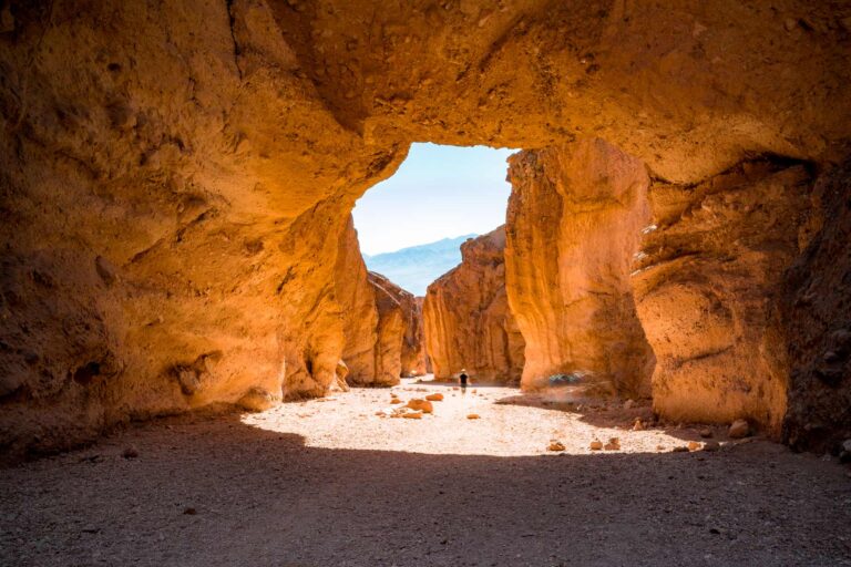
We’ve spent years filming in Yosemite, and we’ll say this plainly. Clouds Rest is the best summit hike in the park. It stands 1,070 feet higher than Half Dome, the view is wider, you don’t need to win a lottery to hike it, and you won’t spend an hour waiting in line at a cable section. This guide covers the whole route from Tenaya Lake, what the trail actually does to your legs, and how Clouds Rest stacks up against its famous neighbor.
5 Quick Things to Know About the Clouds Rest Hike
- Yosemite costs $35 per vehicle. The America the Beautiful Pass runs $80 and covers more than 2,000 federal sites for a year. If you’re hitting Sequoia or any other park on this trip, the pass pays for itself.
- There is no mobile service on most of this hike. Carry a paper map. This Yosemite map and this guidebook both earn their pack weight.
- The first three miles belong to the mosquitoes, especially in early summer. Bring bug spray and sunscreen. At this altitude you burn faster than you think.
- Rush Creek Lodge sits near the Big Oak Flat Entrance and has a hot tub. A hot tub matters a great deal more after this hike than before it.
- This is a high-altitude hike, starting around 8,150 feet and topping out at 9,926 feet. Altitude sickness is the most underrated safety concern on the trail.
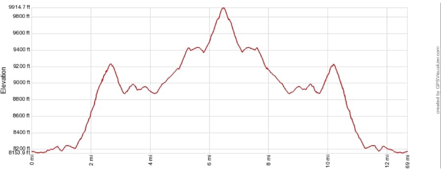
Clouds Rest Hike Elevation Profile
Clouds Rest Hike Step by Step
Length: 12.4 miles out and back
Yosemite National Park Map
2 trails mapped — click a pin to learn more
Yosemite National Park at a Glance
Time: 6 to 8 hours
Love Yosemite? It's one of 109 threatened public lands destinations we're tracking. Get the free weekly briefing.
Difficulty: Strenuous
Altitude: 8,150 feet at the trailhead, 9,926 feet at the summit. Net gain is about 1,775 feet, but the ups and downs push total climbing closer to 3,000 feet.
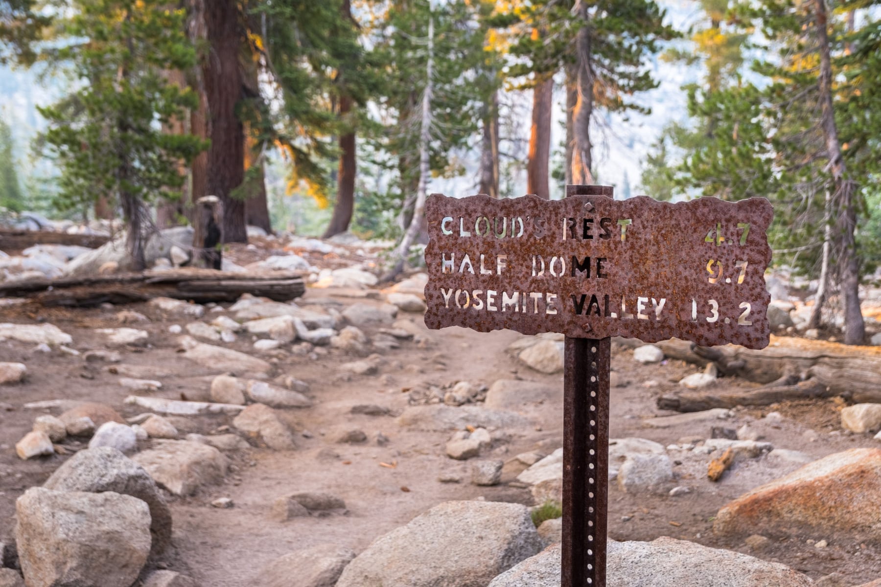
The standard route runs from Tenaya Lake, and it’s the one we recommend. Two parking lots sit near the trailhead. Use the one farthest from the lake. Both fill early in summer, so arrive by 8 am or plan on parking along Tioga Road and adding distance to an already long day.
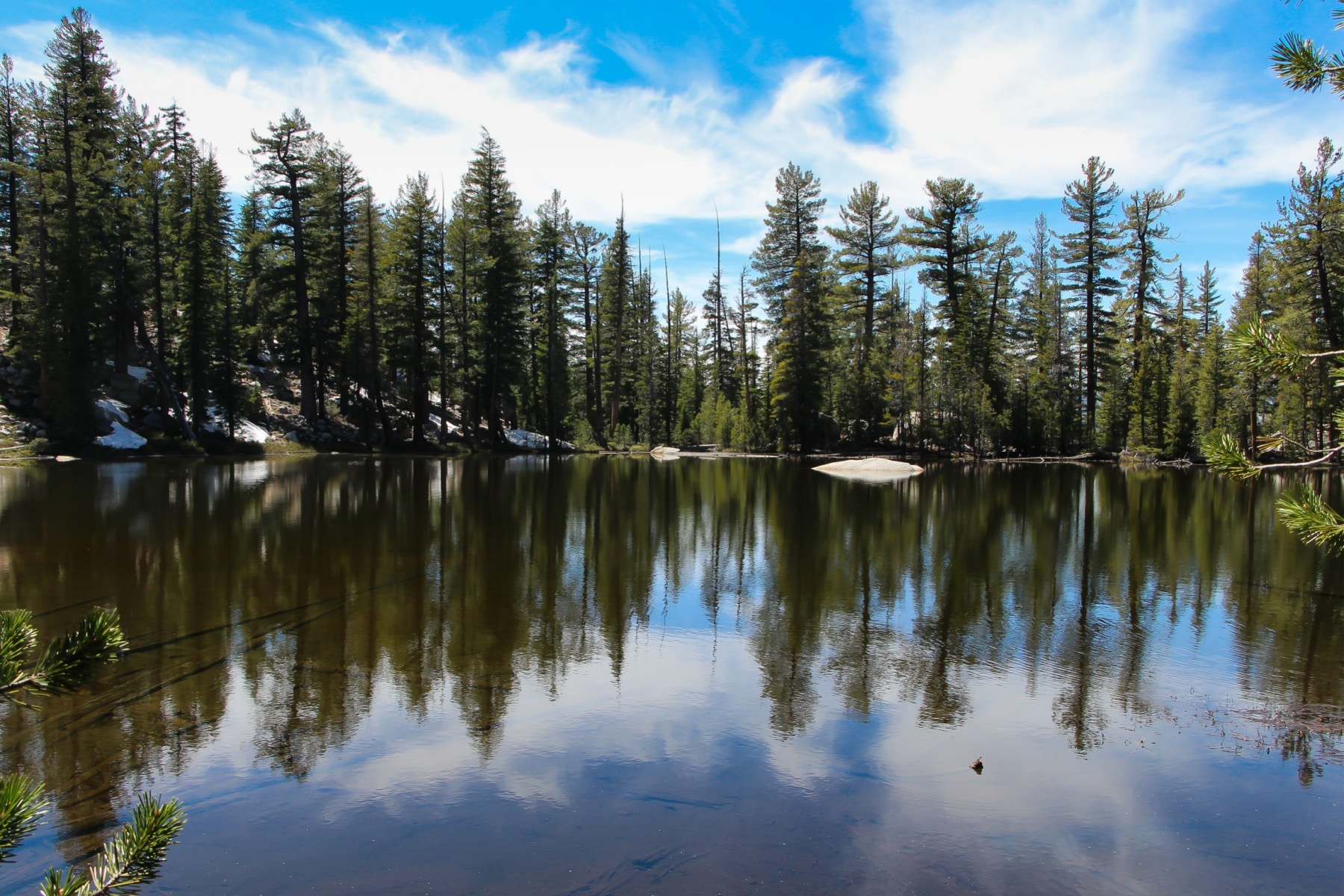
The first mile is easy and often wet. You start on the Sunrise Lakes Trailhead, and the signs count down the miles to Clouds Rest the whole way. The biggest water crossing comes in the first tenth of a mile at Tenaya Creek.
In early season the creek runs high. Bring water shoes. Past the crossing, the rest of the first mile is flat. Enjoy it. It ends.
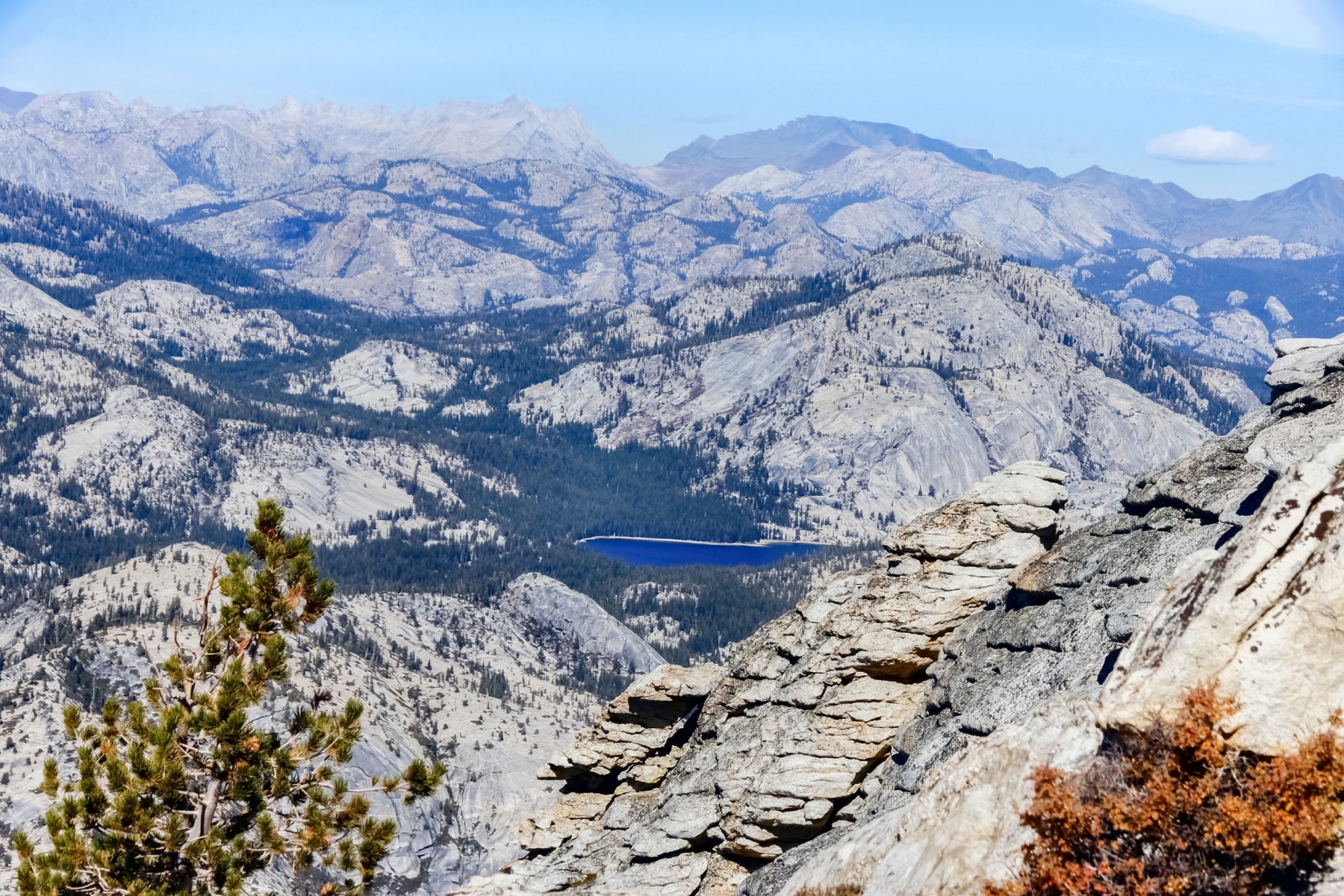
Glacial lines. Check your elevation as you climb. Below 8,900 feet you’re walking ground a glacier once carved. Above 8,900 feet you’re standing higher than the ice that shaped the valleys on either side of you.
The First Climb
About a mile in, the trail tilts up and stays up. Over the next mile and a half you gain roughly 1,000 feet through forest, switchbacking dirt, and stone staircases that seem designed by someone with longer legs than yours.
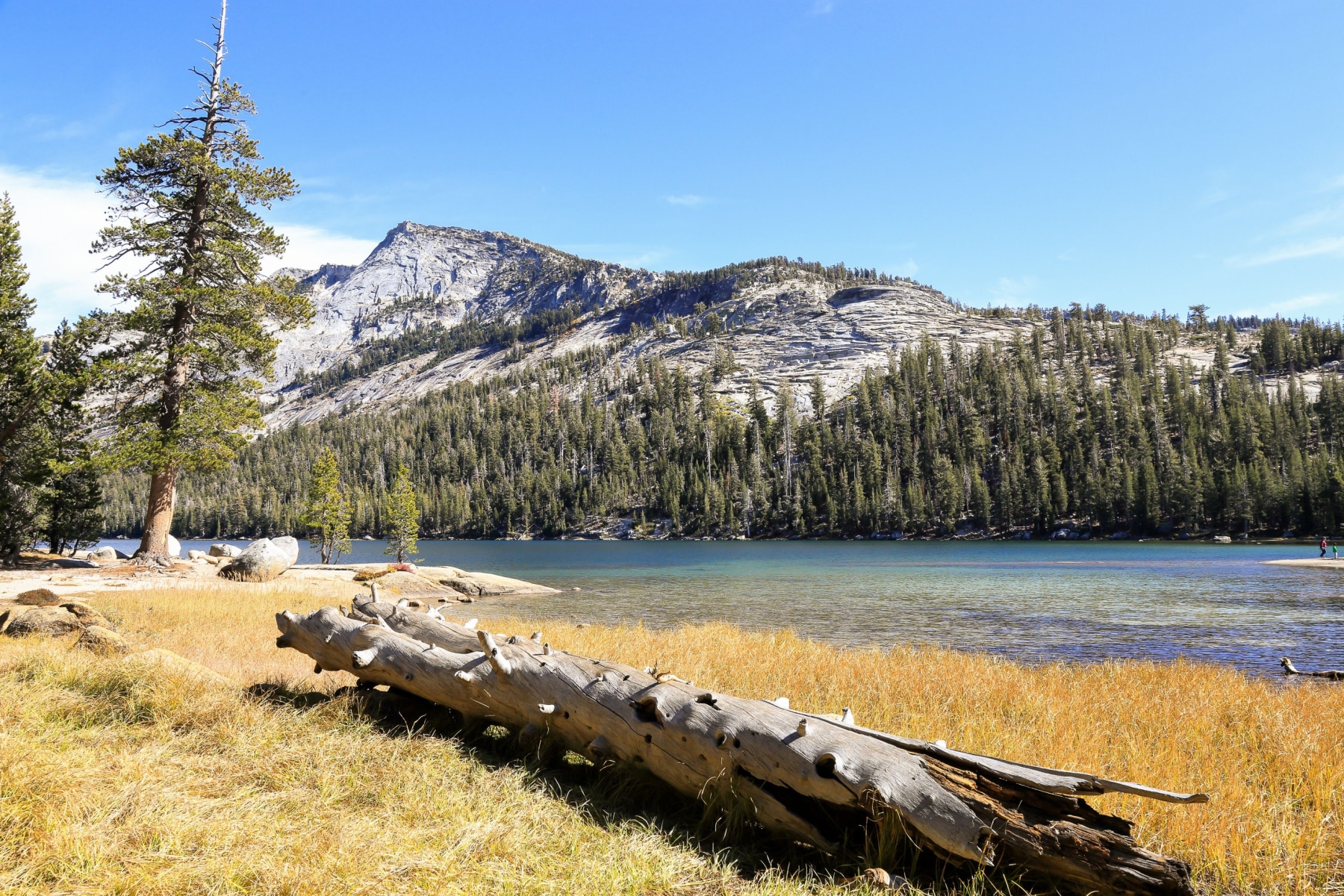
At the top of the climb you reach a clearing where a spur trail peels off toward the actual Sunrise Lakes. Keep following the signs to Clouds Rest. From this junction, the summit is another 4.7 miles.
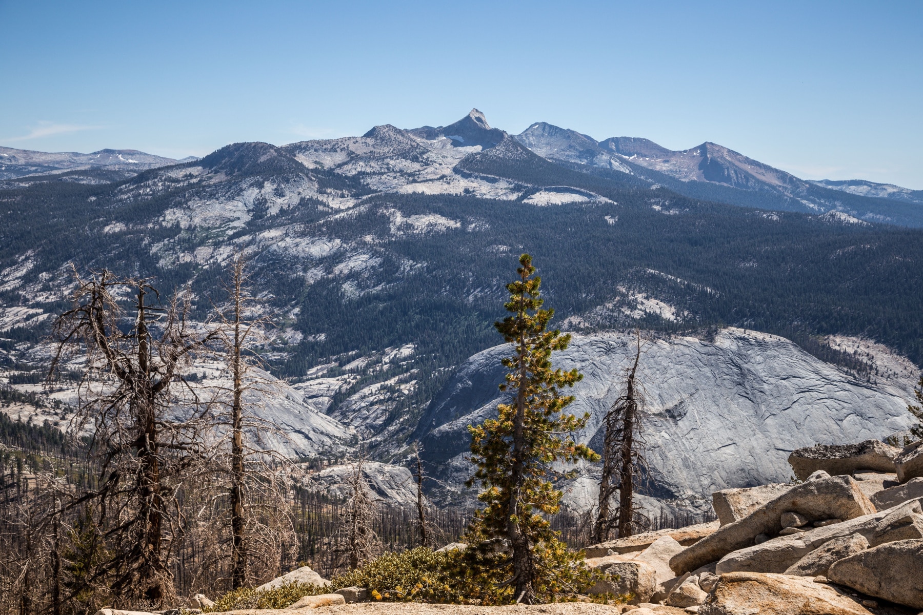
The Middle Miles
The trail then rolls downhill and flat for a stretch, which feels generous until you remember every foot you give back has to be climbed again. The mile markers out here don’t always agree with a GPS watch. Trust the signs more than the watch.
The unnamed pond along this flatter stretch marks the halfway point to the summit. Farther on, you hit a fork with the Pack Trail at a clearing. The sign claims 2.5 miles to Clouds Rest. It’s closer to 1.5, though they’re a demanding 1.5.
The Final Ascent
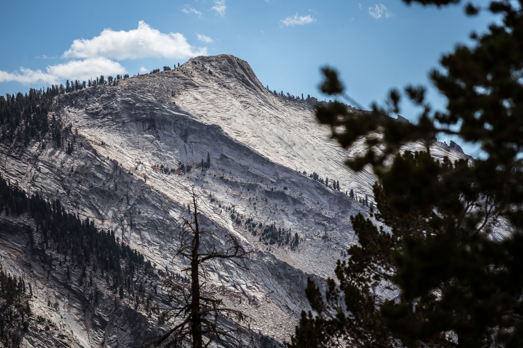
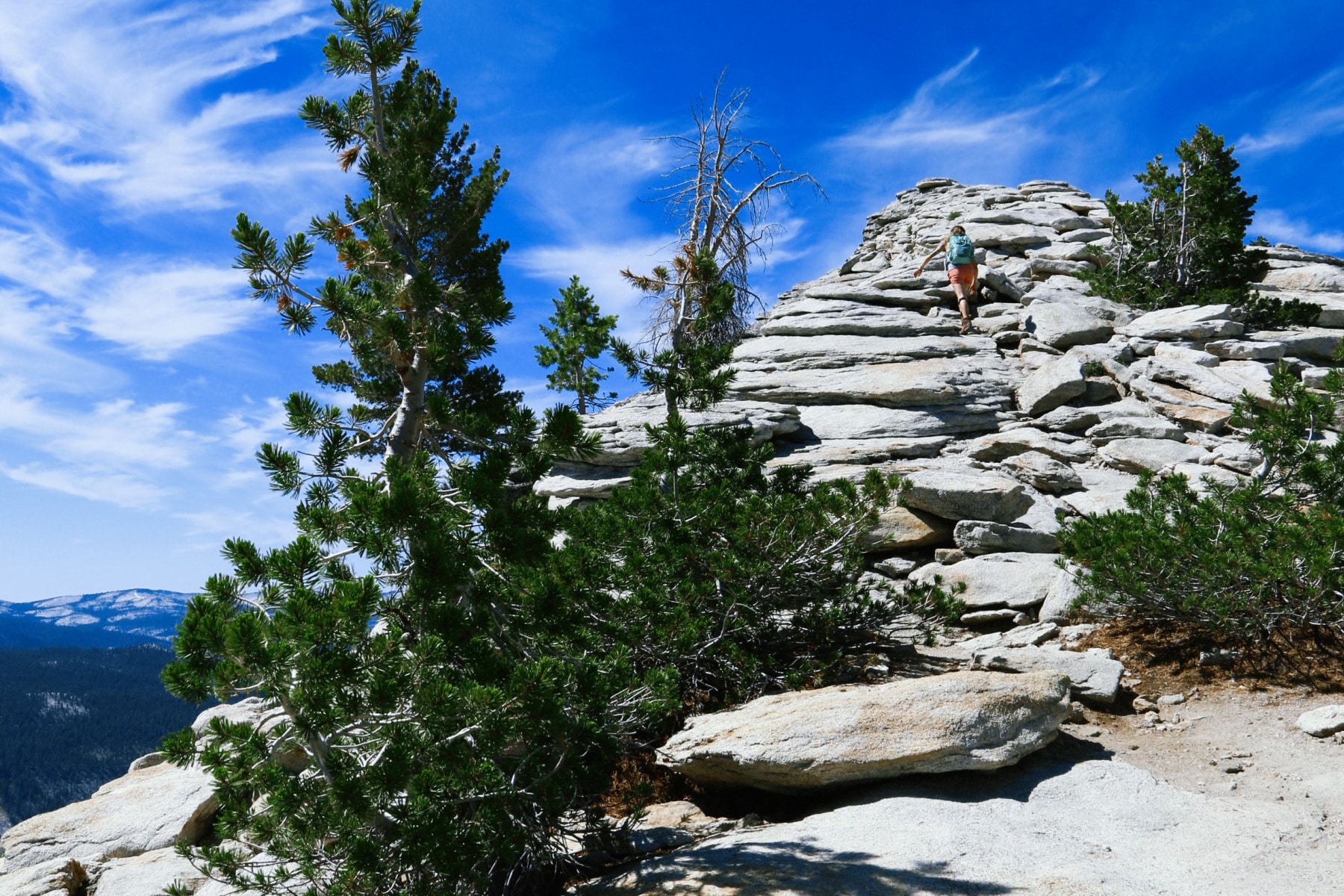
The forest opens, and the bare granite spine rises straight ahead of you. This section is steep and exposed. Don’t attempt it on snow or wet rock. The granite up here doesn’t offer second chances.
Pick your line before you start up. The ridge looks more intimidating from a distance than it feels underfoot, but some sections narrow to a few feet wide with a drop of several thousand feet into Tenaya Canyon. If heights bother you, bear left going up the spine and you’ll stay on gentler ground.
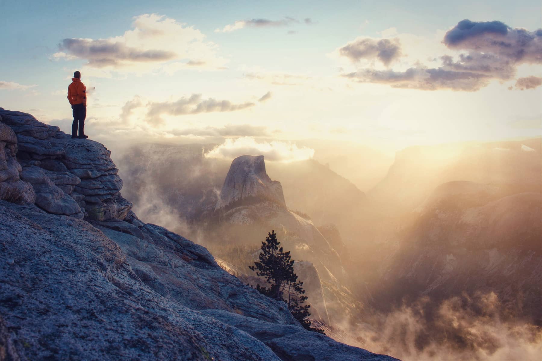
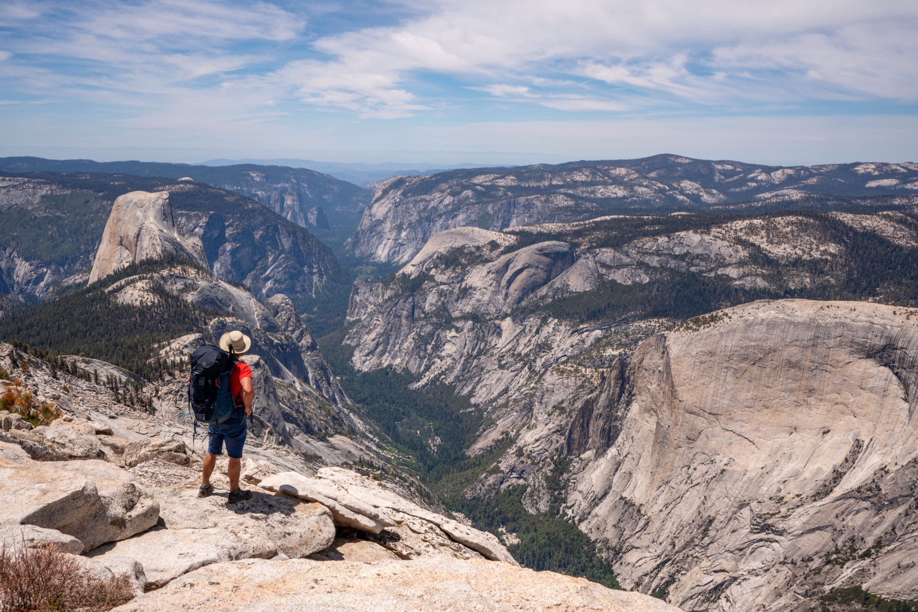
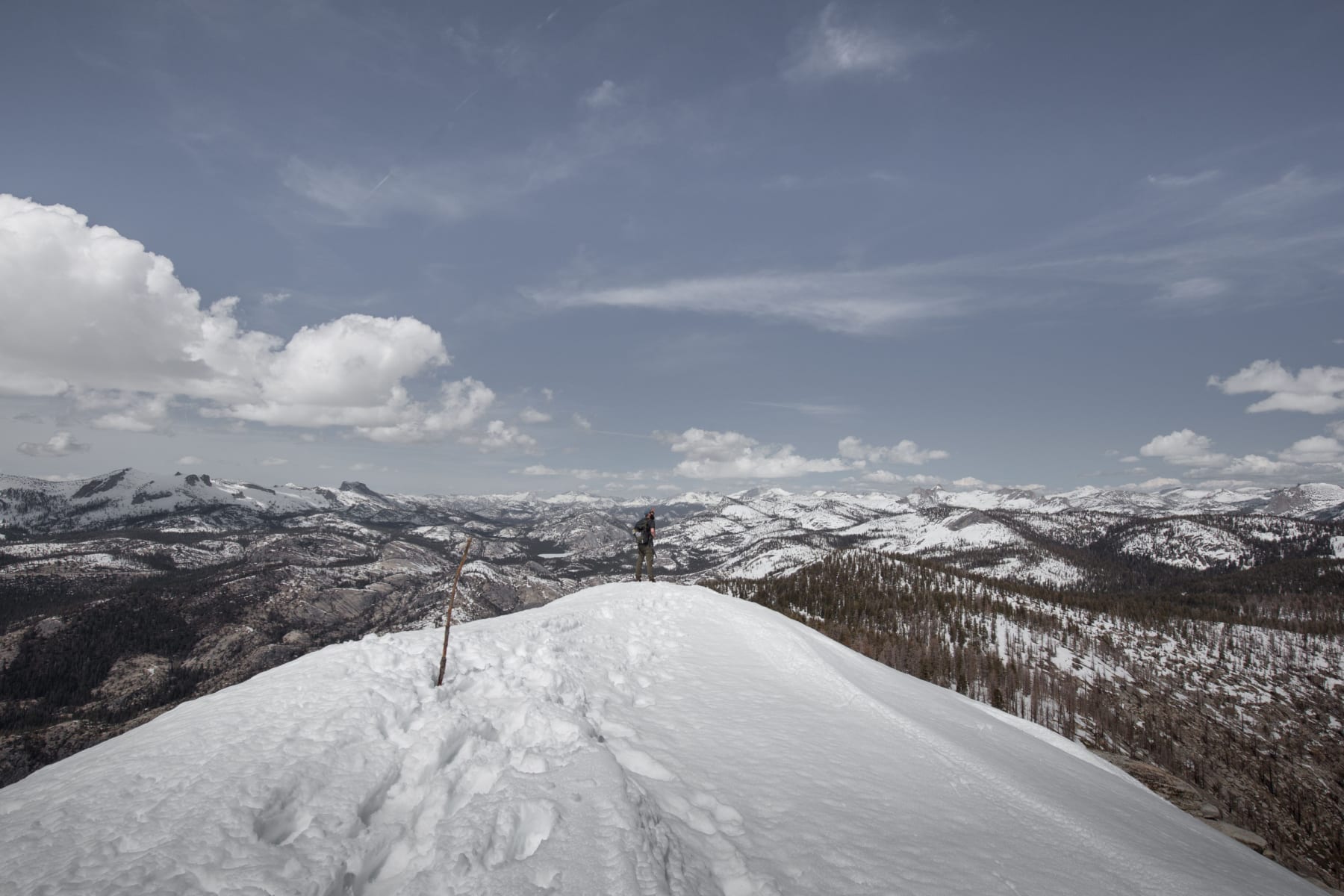
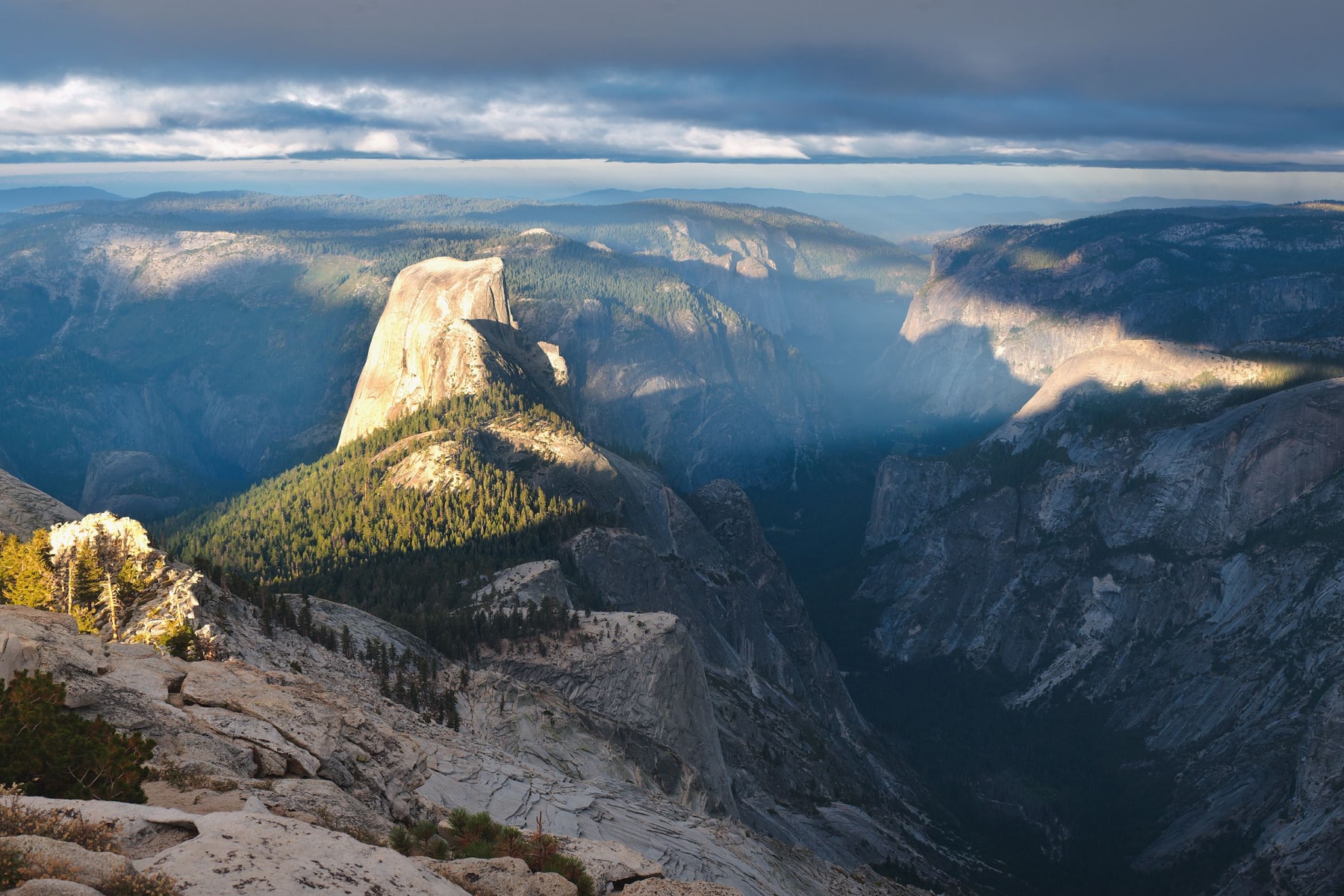
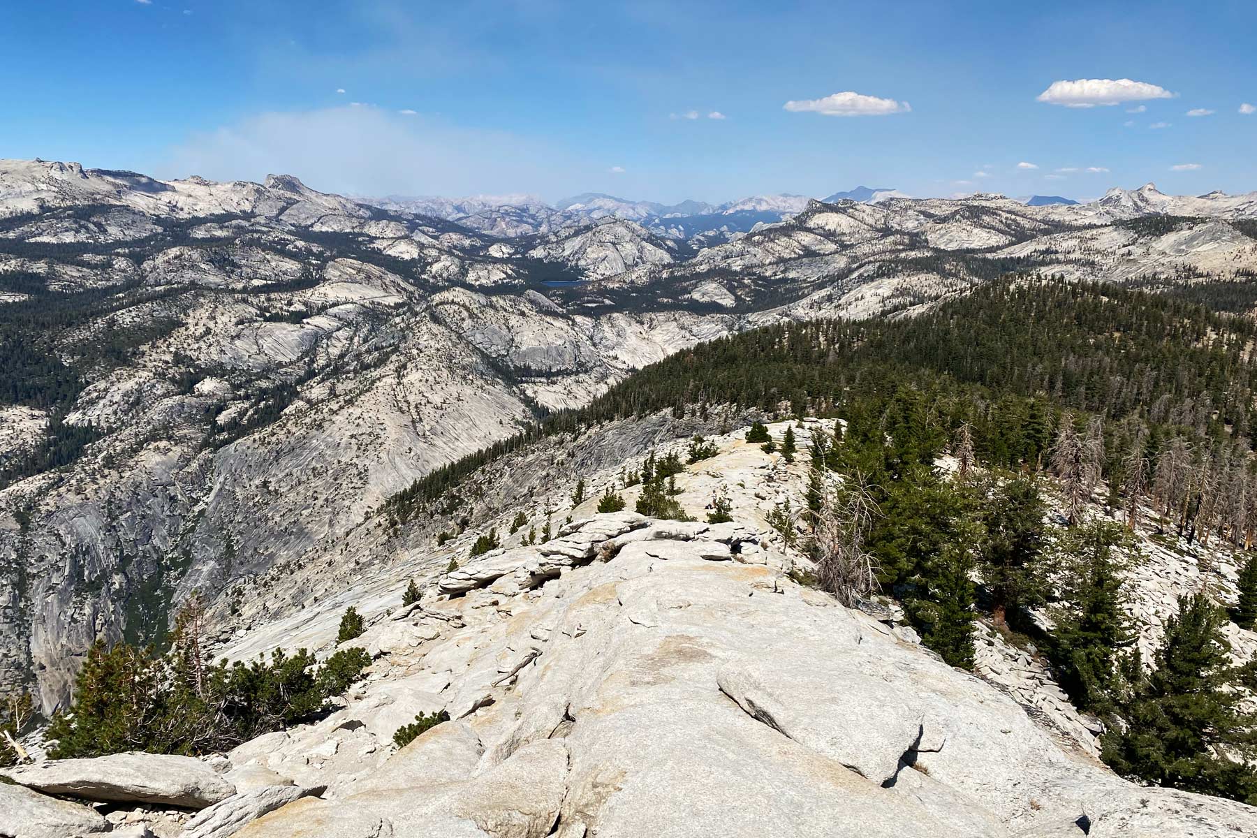
The Summit
At the top of the spine, Yosemite unrolls in every direction. The Valley, Tenaya Canyon, the high country, the Clark Range.
Look northwest and you’ll spot what appear to be ants crawling up a big gray rock in the distance. Those are the people on the Half Dome cables. From up here, you’re looking down on all of them.
No photo or film does this panorama justice. We make films for a living, and we’ll admit it freely.
Three Ways to Reach Clouds Rest
Yosemite’s own website is strangely quiet about Clouds Rest. The information exists, scattered across a half dozen pages. We’ve pulled it together here.
Clouds Rest is a destination, not a single named trail. Several routes get you there, and the signage along each is clear.
| Route | Base Elevation | Round Trip | Time | Level |
|---|---|---|---|---|
| Via Sunrise Lakes (Tenaya Lake) | 8,150 feet | 12.4 miles | 6 to 8 hours | Strenuous |
| Via Yosemite Valley | 4,040 feet | About 21 miles | 12 hours or overnight | Extremely strenuous |
| Via Pywiack Cascade | 8,150 feet | 6 miles to the climbing area | Varies | Rock climbers only |
You can also go point to point. Start at Tenaya Lake, summit Clouds Rest, and descend to Yosemite Valley for a roughly 19-mile day. That order can be reversed if you enjoy suffering.
Want Clouds Rest and Half Dome in one day? That’s a 23-mile push. Expert hikers only, and you’d still need a Half Dome permit.
Any overnight backpacking in Yosemite requires a Wilderness Permit, which can be hard to get for popular trailheads. Camping along these routes is allowed within the wilderness regulations.
This color-coded map helps with planning a campsite location.
Getting to the Clouds Rest Trailhead
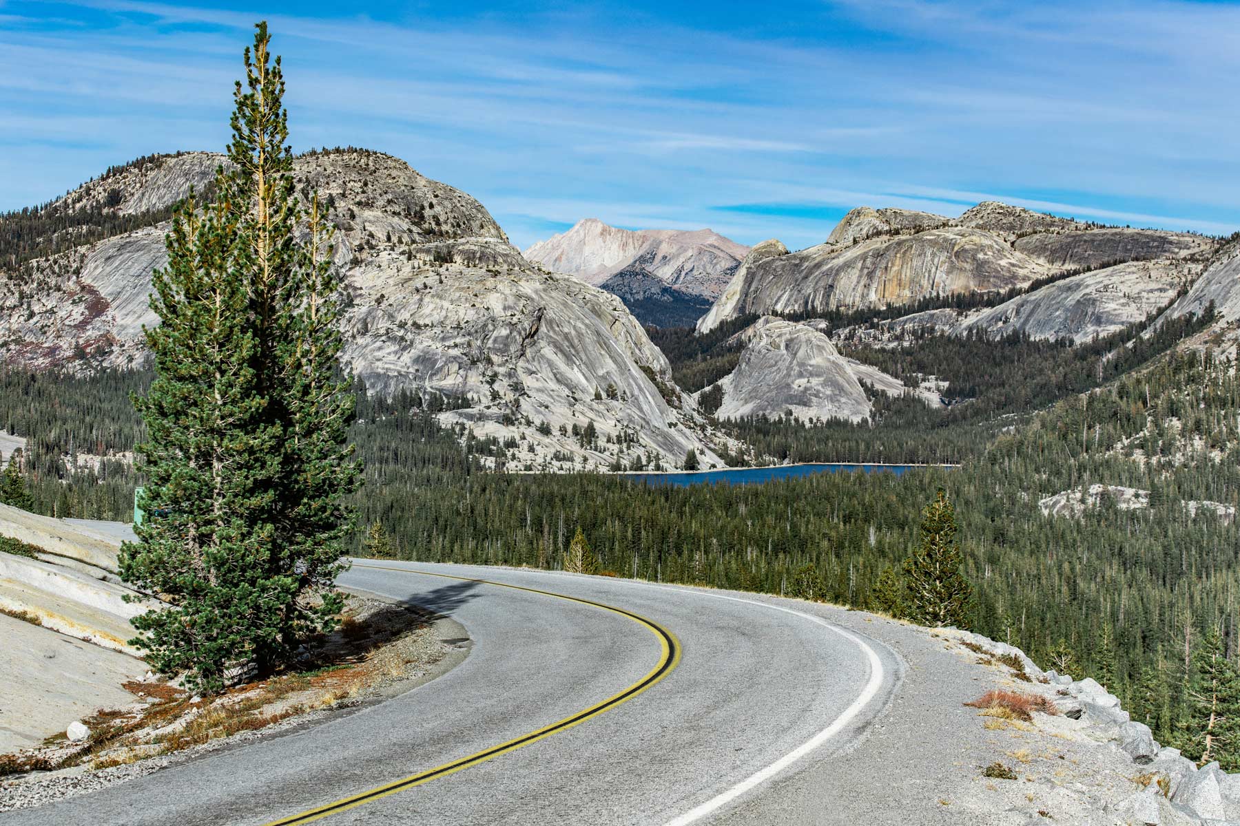
Everything about planning this hike starts with the status of Tioga Road. The Tenaya Lake trailhead is unreachable by car for roughly half the year. Tioga Road closes in November and reopens whenever the snowpack allows, anywhere from early May to July. In 2026 it opened May 15, the earliest opening in 11 years. Don’t count on a repeat.
Hiking from Yosemite Valley? Use Shuttle Stop 16. For the Tenaya Lake route you need your own vehicle since the Valley shuttle doesn’t run that far. One smart move for dodging summer congestion is entering through the Tioga Pass Entrance on the east side, just 15 miles from Tenaya Lake.
One more piece of good news. Yosemite dropped its reservation system for 2026, so no timed-entry booking is required to drive in. Expect bigger crowds in the Valley because of it. The Clouds Rest trail will still feel empty by comparison.
Clouds Rest vs Half Dome
Here’s the case in plain numbers. Half Dome requires a permit every day the cables are up, late May through mid-October. The park issues a maximum of 300 per day through a lottery, with a $10 application fee and $10 per person if you win. Clouds Rest requires nothing for a day hike. Show up and walk.
Half Dome tops out at 8,839 feet. Clouds Rest reaches 9,926. The view from Clouds Rest includes Half Dome. The view from Half Dome does not.
We’ve made our position on the cables clear in our honest guide to the Half Dome hike. If you only have one big summit day in Yosemite, spend it here.
Watch the Clouds Rest Trail Hike
Clouds Rest Hike FAQ
A permit is not needed for the Clouds Rest hike in Yosemite if you are doing it as a day hike. If you are camping overnight, you’ll need a Wilderness Permit.
The elevation gain from Tenaya Lake to Clouds Rest is 1,781 feet, but don’t let that seem like an easy hike. The high altitude of the starting point at 8,150 can impact your health on the trail.
Clouds Rest and Half Dome both provide strenuous hikes with scenic views. Half Dome is more popular as it’s an icon of the park. Hikers want to climb those famed cables. Clouds Rest stands nearly 1,100 feet taller than Half Dome, but it’s not quite as long. Clouds Rest hike in Yosemite and Half Dome both provide challenges for those with a fear of heights, but Clouds Rest isn’t quite as intimidating at the top.
Altitude Sickness on Clouds Rest
Altitude affects everyone differently, and 8,000 feet is the rough line where Acute Mountain Sickness starts showing up. This entire hike sits above that line. Know your own threshold before you commit to a 12-mile day up high.
The nasty part is the timing. Altitude sickness usually takes 6 to 12 hours to set in, which means you can be deep into the hike before your body files its complaint. Once symptoms start, the only real fix is descending.
Watch for trouble breathing, appetite loss, nausea, and vomiting. Confusion, loss of coordination, and extreme fatigue are the serious warning signs. Take those seriously.
Limiting Altitude Sickness
You can reduce the risk by taking the proper steps.
- Acetazolamide. Talk with your doctor about this prescription, which helps the body acclimate faster. It matters most for high-altitude campers with obstructive sleep apnea.
- Acclimate. Give your body a day or two at moderate elevation before attempting Clouds Rest. Coming straight from sea level to a 9,926-foot summit is asking for a headache or worse.
- Hydrate. Long exposed stretches dry you out fast in summer. Dehydration and altitude sickness stack on each other.
- Carb up. Carbohydrate-heavy meals provide steadier energy and help offset altitude effects.
Wildfire and Lightning on Clouds Rest
The high country around Clouds Rest is wildfire territory, and fires close trails. Fire restrictions go into effect when conditions turn dangerous. Check the fire news section of Yosemite’s website before you go.
“Fire season is officially enacted when fire danger rating indices for the park show Moderate for 3 consecutive days.”
Yosemite park staff
Fires move with the wind, and they move fast. This video shows how quickly a wildfire can spread. It’s from the 2014 Meadow Fire, which closed Clouds Rest.
Lightning is the other summer hazard up here. Start at dawn so you’re off the exposed summit before the afternoon thunderstorms build, which they do with frustrating regularity in July and August.
More reading. A backpacker’s guide to surviving storms.
Why Is Clouds Rest Shaped Like That?
Clouds Rest isn’t a peak. It’s an arête, a knife-edge ridge left behind when two glaciers grind along either side of a mountain. The glaciers that carved Tenaya Canyon and Little Yosemite Valley shaved, shoved, and snagged rock off both flanks as they moved.
Download the map below to see how the ice moved to form Clouds Rest, Half Dome, and El Capitan.
When three or more glaciers work on one mountain, they carve a pyramidal peak instead. The Matterhorn is the textbook example.
Pin Clouds Rest Hike in Yosemite
More Helpful Related Articles
Half Dome Hike: Why We Don’t Recommend the Half Dome Hike (Honest Guide)
Yosemite Trip Planning: Visiting Yosemite, the 1 to 5 Day Yosemite Itinerary
Yosemite Facts: 16 Yosemite National Park Facts Worth Knowing
Beyond Half Dome and Clouds Rest: 20 Best Hikes in Yosemite National Park
The Park Next Door: Things to Do in Sequoia National Park
What to Bring to Yosemite
Gear we recommend for Yosemite. Affiliate links support our work at no cost to you.
Affiliate disclosure: Some links on this page earn us a small commission at no extra cost to you. We only recommend gear we actually use.