


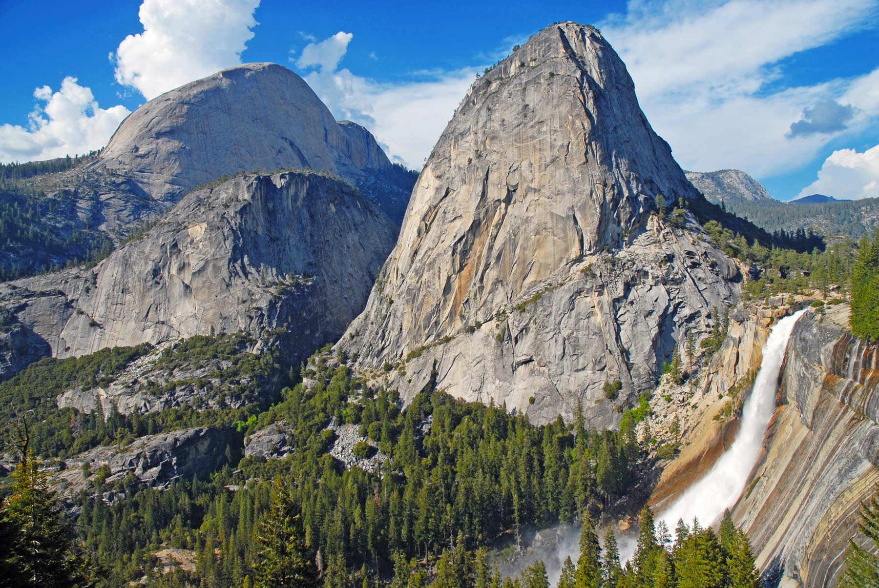
If You Only Do One Hike: The Mist Trail to Vernal and Nevada Falls. Two world-class waterfalls on one trail, and in spring the spray off Vernal Fall soaks you to the bone. This is Yosemite distilled into a single hike.
| Trail | Distance | Elevation | Difficulty | Time |
|---|---|---|---|---|
| Lower Yosemite Fall | 1.0 mi loop | 50 ft | Easy | 30 min |
| Four Mile Trail | 9.6 mi RT | 3,200 ft | Hard | 6-8 hrs |
| Cathedral Lakes | 7.0 mi RT | 1,000 ft | Moderate | 4-6 hrs |
| Half Dome | 14-16 mi RT | 4,800 ft | Very Hard | 10-14 hrs |
| North Dome | 9.0 mi RT | 1,500 ft | Moderate-Hard | 5-7 hrs |
| Clouds Rest | 12.2 mi RT | 2,300 ft | Hard | 7-10 hrs |
| Wapama Falls | 5.0 mi RT | 500 ft | Moderate | 2-3 hrs |
| Tuolumne Grove | 2.5 mi RT | 500 ft | Moderate | 1-2 hrs |
| Mariposa Grove (Wawona Point) | 7.0 mi RT | 1,200 ft | Hard | 4-6 hrs |
| Nevada Fall (Mist Trail) | 5.4 mi RT | 2,000 ft | Hard | 5-6 hrs |
| Vernal Fall (Mist Trail) | 2.4 mi RT | 1,000 ft | Moderate | 3-4 hrs |
| Panorama Trail | 8.5 mi one-way | 3,200 ft descent | Moderate-Hard | 5-7 hrs |
| Taft Point | 2.2 mi RT | 250 ft | Easy-Moderate | 1-2 hrs |
| Cook’s Meadow Loop | 1.0 mi loop | Minimal | Easy | 30 min |
| Columbia Rock | 2.2 mi RT | 1,000 ft | Moderate | 2 hrs |
| Wawona Meadow Loop | 3.5 mi loop | Minimal | Easy | 2 hrs |
| Grizzly Giant Loop | 2.0 mi loop | 300 ft | Moderate | 1.5-2 hrs |
| Mirror Lake | 2.0 mi RT | 100 ft | Easy | 1-2 hrs |
| Bridalveil Fall | 1.0 mi RT | 80 ft | Easy | 30 min |
| Lukens Lake | 4.6 mi RT | 400 ft | Moderate | 2-3 hrs |
Yosemite is the park people picture when they picture a national park: a glacier-carved valley walled by granite, with waterfalls pouring off the rim and giant sequoias at the southern end. It has been drawing hikers since before it was a park, and the trail network reflects that, ranging from paved half-mile loops to the cable-assisted slog up Half Dome.
This is my ranked list of the best hikes in Yosemite National Park, built from years of returning in every season. I have weighted it toward trails that show you something the road cannot, and I have been honest about which ones are harder than they look. For broader trip planning, see our full Yosemite National Park guide.
Things to Know Before You Hike Yosemite
Entrance Fees and Reservations
The standard entrance fee is $35 per private vehicle, valid for seven days. An America the Beautiful annual pass covers entry to Yosemite and every other federal recreation site. In recent summers Yosemite has used a peak-hours reservation system to manage crowds, so check the park’s current-conditions page before you go to see whether a day-use reservation is required for your dates.
Love Yosemite? It's one of 117 threatened public lands destinations we're tracking. Get the free briefing.
International visitors ages 16 and up pay a $100 per person non-resident surcharge on top of the entrance fee (effective 2026). The surcharge is waived if you hold an Annual or America the Beautiful pass, so for most foreign visitors the annual pass is the cheaper choice.
Seasonal Roads
Two of the park’s best hiking areas sit on roads that close in winter. Tioga Road (the high country, including Cathedral Lakes, Clouds Rest, and Lukens Lake) and Glacier Point Road (Taft Point, Sentinel Dome, and the Panorama and Four Mile trails) typically open in late spring and close with the first heavy snow, usually by November. Both are open in summer. Always confirm current status before planning a high-country hike.
Half Dome Permits
A permit is required to climb the Half Dome cables, in place every day the cables are up (roughly the Friday before Memorial Day through mid-October). Permits come through a preseason lottery in March and a daily lottery two days before your hike date. Plan this one well in advance; see the Half Dome section below for the full breakdown.
Sun, Bugs, and a Map
The exposed granite trails get a lot of sun, so carry reef-safe sunscreen and more water than you think you need. For bugs, especially near meadows and lakes in early summer, we like this eco-friendly repellent or this DEET option. Our preferred guide book is this one and we carry this map for trail navigation.
Planning a trip to Yosemite but haven’t decided where to stay? Here’s our favorite place to stay when visiting Yosemite.

20. Lukens Lake
Distance 4.6 mi RT Elevation Gain 400 ft Difficulty Moderate Time 2-3 hrs Trailhead Tioga Road (White Wolf)
Lukens Lake is a meadow-ringed lake in the White Wolf area, off Tioga Road. It is a quiet, family-friendly hike that most valley visitors never make it to, which is exactly the appeal. Because it sits high in the park, the trailhead is among the last to open each year, often not until late spring, and one of the first to close in fall.
You can reach the lake on the shorter route from Tioga Road or the slightly longer, more scenic approach from White Wolf, an out-and-back through forest and along the Middle Fork of the Tuolumne River. Expect wildflowers in the meadow in early summer and a few muddy stretches after snowmelt.
19. Bridalveil Fall
Distance 1.0 mi RT Elevation Gain 80 ft Difficulty Easy Time 30 min Trailhead Bridalveil Fall Parking
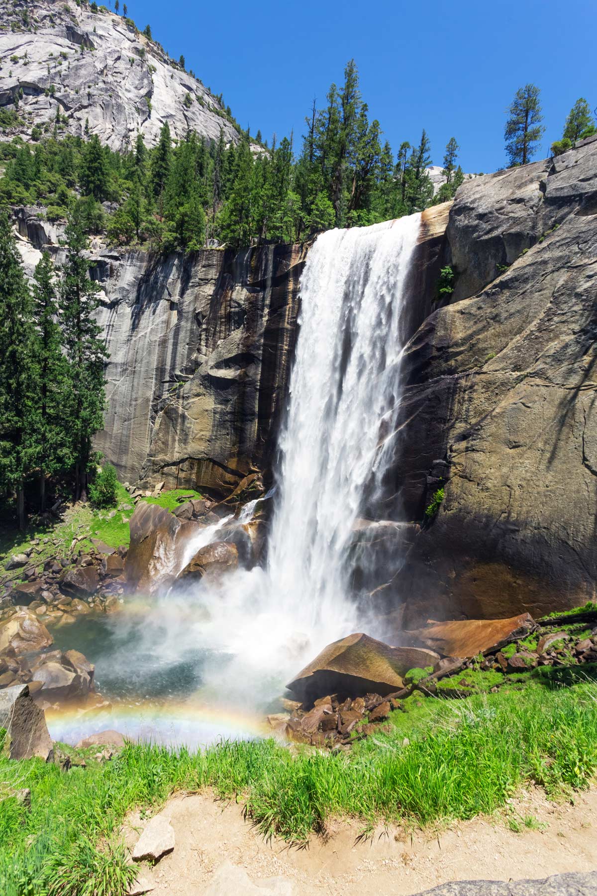
Bridalveil is one of the most recognizable waterfalls in the park, and for many people it is their first close-up view of the valley after the drive in through Tunnel View. A short, mostly paved path leads from the parking area to the base, where a 620-foot single drop sends spray drifting across the trail in spring.
Snowmelt makes it thunderous from April into June; by late summer the flow thins to a wispy ribbon, which is how it got its name. The trail was rebuilt and reopened in recent years, so footing and accessibility are much improved over the old approach.

18. Mirror Lake Trail
Distance 2.0 mi RT (5.0 mi full loop) Elevation Gain 100 ft Difficulty Easy Time 1-2 hrs Trailhead Mirror Lake / Shuttle Stop 17
Mirror Lake is a gentle warm-up at the foot of Half Dome and Mount Watkins. The paved first mile leads straight to the lake; from there you can turn around or continue on a longer loop around Tenaya Canyon and the meadow. In spring the still water mirrors the cliffs above, which is the whole point.
By late summer the “lake” is often more meadow than water, since it is a seasonal pool fed by Tenaya Creek. Check for high-water or mud warnings in spring and icy patches in winter.

17. Grizzly Giant Loop
Distance 2.0 mi loop Elevation Gain 300 ft Difficulty Moderate Time 1.5-2 hrs Trailhead Mariposa Grove Welcome Plaza
Despite the name, the Grizzly Giant is a gentle giant: a roughly 3,000-year-old sequoia and the headline tree of Mariposa Grove. This short loop from the Welcome Plaza area is the most popular way to see the grove’s celebrity trees, including the California Tunnel Tree, without committing to a long day.
Mariposa Grove sits at the park’s southern end and holds its largest concentration of giant sequoias, several hundred mature trees. The grove was restored between 2015 and 2018, so the trail surface and signage are relatively new. Note there is no running water at the arrival area, so fill up at the Welcome Plaza first.

16. Wawona Meadow Loop
Distance 3.5 mi loop Elevation Gain Minimal Difficulty Easy Time 2 hrs Trailhead Wawona Hotel
For a flat, dog-friendly walk with real scenery, the Wawona Meadow Loop is one of the best easy options in the park. The level path circles a broad meadow along an old fire road, and leashed pets are welcome, which is rare in Yosemite.
The draw is the wildflowers, which carpet the meadow in spring and early summer. It can get busy with joggers at peak hours, so go early for a quiet lap. Start near the Wawona Hotel and follow the loop in either direction.
15. Columbia Rock
Distance 2.2 mi RT Elevation Gain 1,000 ft Difficulty Moderate Time 2 hrs Trailhead Yosemite Falls Trailhead
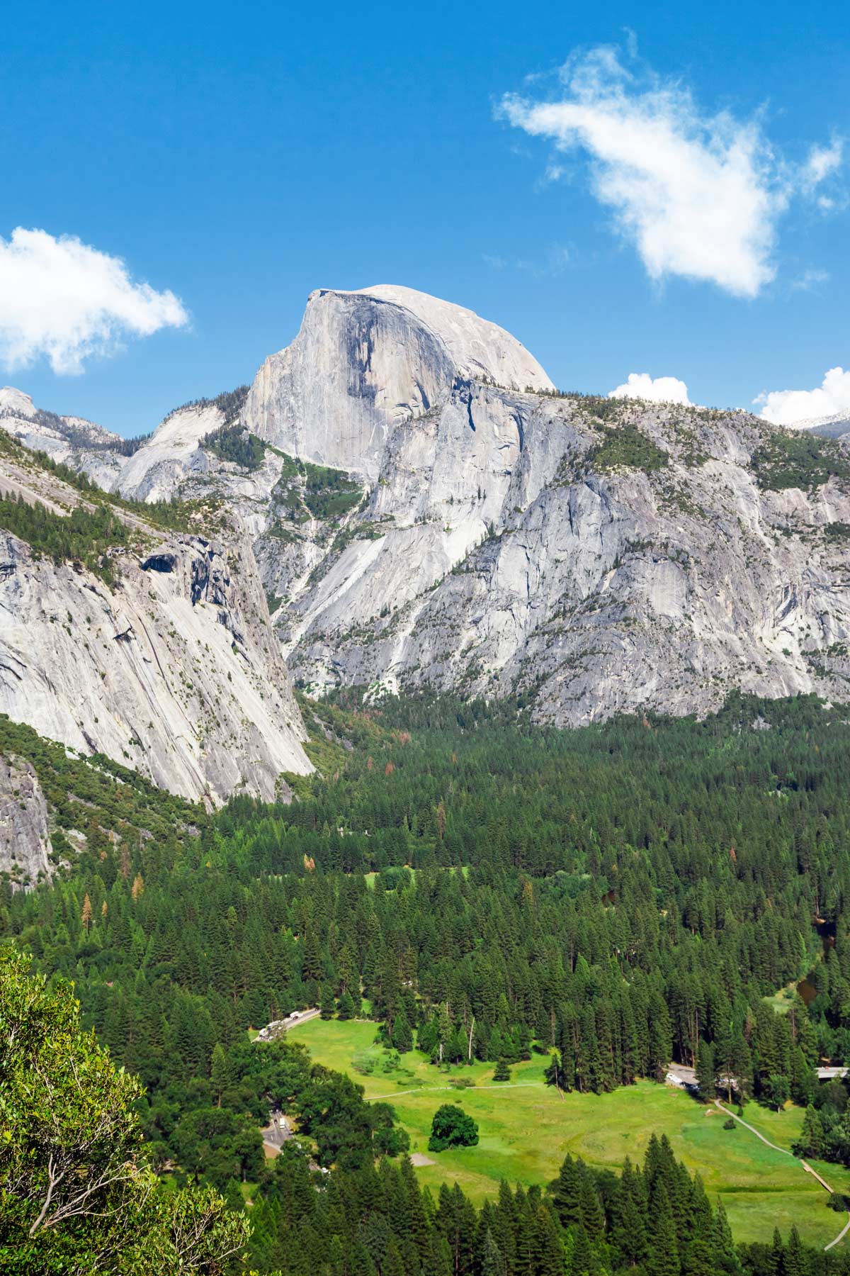
Columbia Rock is the first big payoff on the Yosemite Falls Trail, and a great option if the full climb to the top of Upper Yosemite Fall is more than you want. A series of steady switchbacks gains 1,000 feet to a railed overlook with a head-on view of the valley, Half Dome, and Sentinel Rock.
Push a little farther and you get a glimpse of Upper Yosemite Fall before the trail steepens toward the rim. This is a popular trail, so start early. The descent is hard on the knees, so trekking poles help.
14. Cook’s Meadow Loop
Distance 1.0 mi loop Elevation Gain Minimal Difficulty Easy Time 30 min Trailhead Yosemite Valley Visitor Center
Cook’s Meadow is the easiest way to stand in the middle of the valley and see all of it at once. A flat boardwalk loop from the visitor center delivers open views of Half Dome, El Capitan, Sentinel Rock, and Yosemite Falls, with wildflowers in the meadow in spring.
Sentinel Bridge, on the loop, is one of the classic spots to photograph Half Dome reflected in the Merced River at sunset. Stay on the boardwalk to protect the meadow, and note there are no restrooms or water on the loop itself.

13. Taft Point
Distance 2.2 mi RT Elevation Gain 250 ft Difficulty Easy-Moderate Time 1-2 hrs Trailhead Sentinel Dome / Taft Point (Glacier Point Road)
Taft Point packs an enormous payoff into a short, mostly easy walk. The trail rolls through red fir forest before opening onto a cliff edge that drops some 3,000 feet straight to the valley floor, with a wide-open view of El Capitan across the way.
The signature feature is the fissures, deep slots cut into the cliff edge that you can peer straight down. There is a railing at the point itself but not at the fissures, and the exposure is serious, so keep a firm hold on children. It is a popular sunset spot for good reason.
12. Panorama Trail
Distance 8.5 mi one-way Elevation 3,200 ft descent Difficulty Moderate-Hard Time 5-7 hrs Trailhead Glacier Point

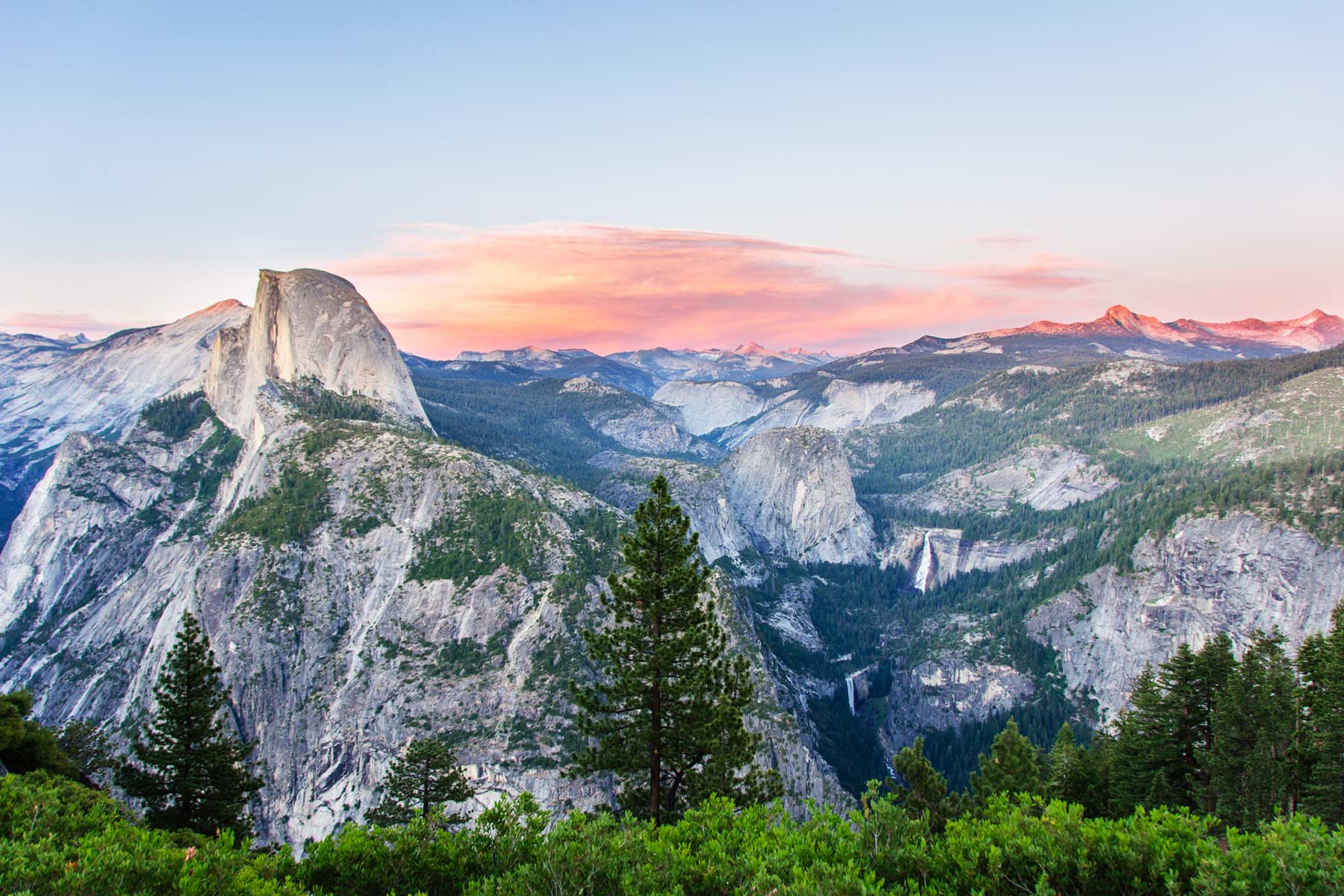
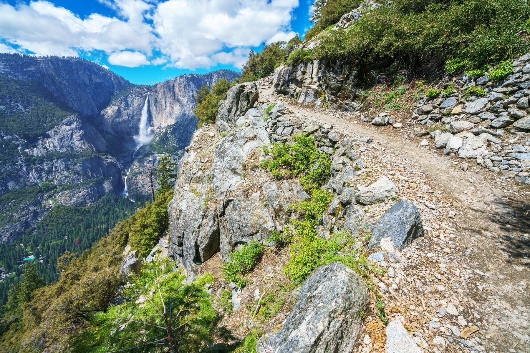
The Panorama Trail earns its name. It starts high at Glacier Point and descends to the valley, so you walk downhill into one of the great viewsheds in the park, with Half Dome, Vernal Fall, and Nevada Fall in front of you for much of the way. Along the route you pass Illilouette Fall, a quieter cascade most valley visitors never see.
Because it ends far from where it starts, this is a one-way hike: most people use a shuttle or a car spot at the bottom rather than climb 3,200 feet back to Glacier Point. The final descent joins the Mist Trail past Nevada and Vernal Falls, or you can take the gentler John Muir Trail. Start early and carry plenty of water; the exposed sections get hot.
11. Vernal Fall (Mist Trail)
Distance 2.4 mi RT to top of Vernal Fall Elevation Gain 1,000 ft Difficulty Moderate Time 3-4 hrs Trailhead Happy Isles
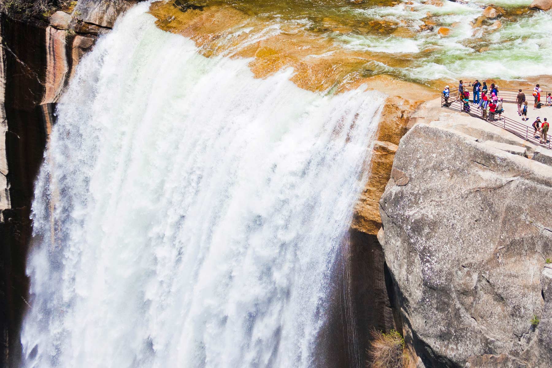
The Mist Trail is the most famous day hike in Yosemite, and the climb to the top of Vernal Fall is the first half of it. From Happy Isles you climb a steep granite staircase right alongside the cascade, where in spring the spray soaks everyone on the trail and rainbows hang in the gorge.
The footbridge below the fall is a fine turnaround if you want a shorter day; the stairs above it are steep, wet, and slippery, so wear grippy shoes. The stair section closes in winter for ice. If a soaking sounds miserable in cold weather, bring a rain shell or take the drier John Muir Trail.

10. Nevada Fall (Mist Trail)
Distance 5.4 mi RT Elevation Gain 2,000 ft Difficulty Hard Time 5-6 hrs Trailhead Happy Isles
Push past the top of Vernal Fall and you are halfway to Nevada Fall, the bigger of the two cascades and the natural turnaround for a full Mist Trail day. The trail passes the Silver Apron and Emerald Pool before a long set of switchbacks climbs to the brink of a 594-foot drop into the Merced River.
The classic loop climbs the Mist Trail and descends the John Muir Trail (or the reverse), which spreads the steep parts out and gives you new scenery on the way down. Expect spray, slick rock, and, in winter, closures from ice fall. Spare socks are not a bad idea.
9. Mariposa Grove (Wawona Point)
Distance ~7 mi RT Elevation Gain 1,200 ft Difficulty Hard Time 4-6 hrs Trailhead Mariposa Grove Welcome Plaza
If the short Grizzly Giant loop leaves you wanting more, the full grove hike continues uphill past the Grizzly Giant toward Wawona Point, taking in the upper grove and a wide overlook of the surrounding country. It turns a quick tree walk into a real half-day with serious elevation.
This is one of the older trail systems in Yosemite, restored within the last decade. In winter the grove is popular for snowshoeing and cross-country skiing, and there are backcountry camping options nearby with a valid wilderness permit. A shuttle from the Welcome Plaza gets you near the lower trailhead.

8. Tuolumne Grove
Distance 2.5 mi RT Elevation Gain 500 ft Difficulty Moderate Time 1-2 hrs Trailhead Tuolumne Grove Parking (Crane Flat)
Tuolumne Grove is the quieter sequoia experience, a smaller stand of giants near Crane Flat that sees a fraction of Mariposa’s crowds. The catch is the return: the trail drops about 500 feet to the trees, which means you climb that same 500 feet back out at the end.
The highlight is a walk-through tunnel tree, a fallen giant carved with a passage you can step inside. In winter the area draws snowshoers and skiers, and shaded stretches hold packed snow and ice well into spring.
7. Wapama Falls
Distance 5.0 mi RT Elevation Gain 500 ft Difficulty Moderate Time 2-3 hrs Trailhead O’Shaughnessy Dam (Hetch Hetchy)
Hetch Hetchy is the part of Yosemite most visitors skip, a glacial valley much like Yosemite Valley that was dammed and flooded a century ago to create a reservoir for San Francisco. The Wapama Falls hike traces the reservoir’s north shore from O’Shaughnessy Dam to a thundering waterfall best seen in spring, passing the wispy Tueeulala Fall on the way.
The trail starts with a walk through a lighted tunnel and stays relatively gentle along the shoreline. Strong hikers can continue all the way to Rancheria Falls for a long day; most turn around at Wapama. Note that the footbridges below Wapama can flood and close at peak runoff.

6. Clouds Rest
Distance 12.2 mi RT Elevation Gain 2,300 ft Difficulty Hard Time 7-10 hrs Trailhead Sunrise Lakes (Tioga Road)
Clouds Rest is the hike I send people to when they want a summit but cannot get a Half Dome permit, or do not want the cables. At 9,926 feet it actually stands higher than Half Dome and looks down on it, and the final ridge walk to the top is one of the great views in the Sierra.
It is a long day from the Sunrise Lakes trailhead on Tioga Road, climbing through forest and switchbacks before the exposed summit ridge. That last stretch is narrow with big drops on both sides, so it is not for anyone shaky with heights. Many hikers cool off at Tenaya Lake or the Sunrise Lakes on the way out. Start early. We make the full case in our guide to hiking Clouds Rest instead of Half Dome.
5. North Dome
Distance 9.0 mi RT Elevation Gain 1,500 ft Difficulty Moderate-Hard Time 5-7 hrs Trailhead Porcupine Creek (Tioga Road)
North Dome gives you the one view you cannot get from Half Dome: Half Dome itself, seen straight on from across the valley. The hike from Porcupine Creek on Tioga Road is long but never brutally steep, winding through forest and granite before opening onto the dome.
About two-thirds of the way the trees fall away and Half Dome fills the view. The summit is a flat, open slab that makes an ideal lunch spot. An optional short spur leads to Indian Rock, the only natural arch in the park.
4. Half Dome
Distance 14-16 mi RT Elevation Gain 4,800 ft Difficulty Very Hard Time 10-14 hrs Permit Required for cables Trailhead Happy Isles
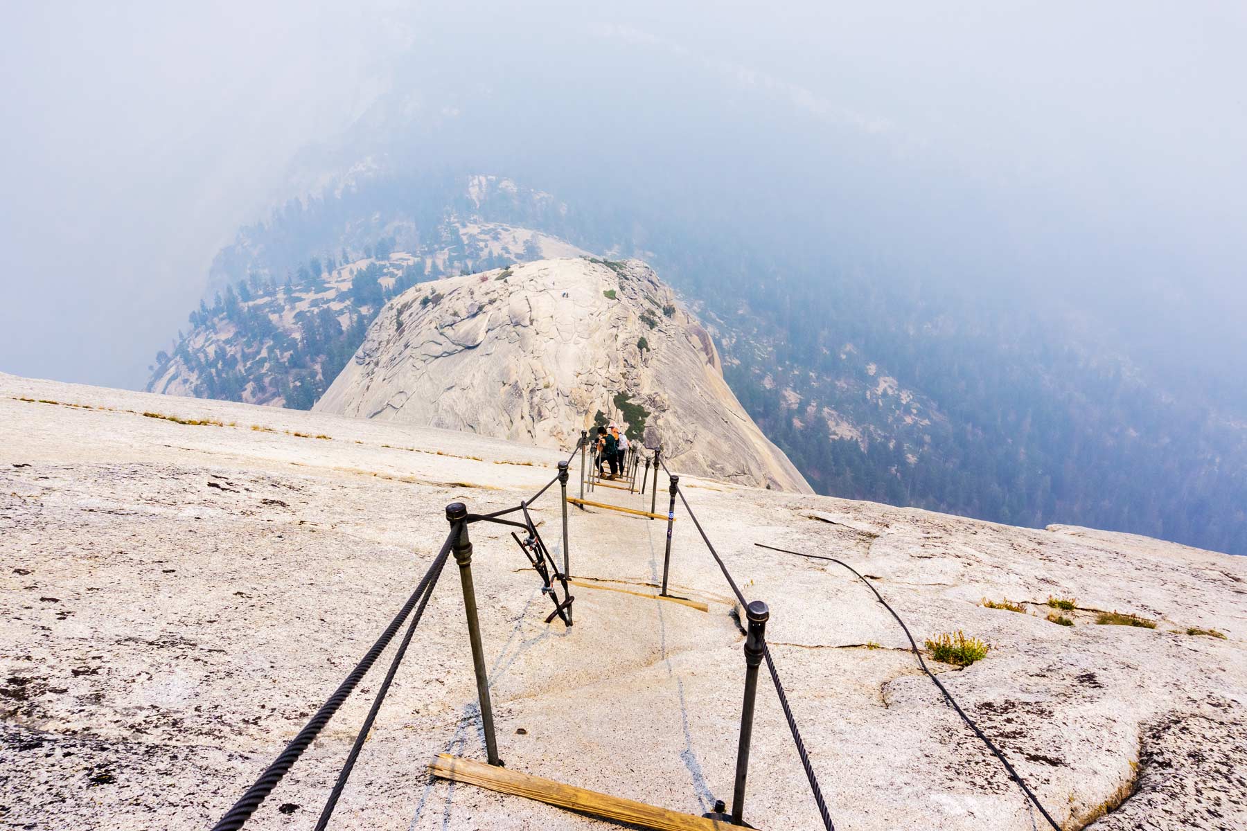
Half Dome is the most demanding day hike in the park and one of the hardest in the national park system. The Half Dome hike runs 14 to 16 miles round trip with about 4,800 feet of gain, and the final 400 feet ascend the bare dome on a pair of steel cables. Plan on 10 to 14 hours and start before sunrise.
You cannot climb the cables without a permit. The cables are up roughly from the Friday before Memorial Day through the day after the second Monday in October, and a permit is required every day during that window. Permits come from a preseason lottery (apply March 1 to 31, results in mid-April) and a daily lottery that opens two days before your hike date. Bring gloves for the cables, and do not attempt them if a storm is anywhere in the forecast; the granite and the steel are deadly when wet.
The route climbs the Mist Trail past Vernal and Nevada Falls, eases through Little Yosemite Valley, then grinds up the subdome before the cables. The sense of accomplishment at the top is real, but so are the risks. If the permit lottery does not go your way, Clouds Rest (number 6 above) is a superb alternative with no cables.
3. Cathedral Lakes
Distance 7.0 mi RT Elevation Gain 1,000 ft Difficulty Moderate Time 4-6 hrs Trailhead Cathedral Lakes (Tioga Road)
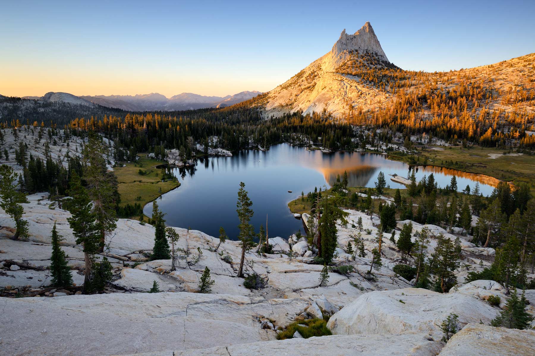
If you have seen the valley from every angle and want the high country instead, Cathedral Lakes is the best introduction to it. The trail climbs from Tioga Road through the Tuolumne Meadows area to two alpine lakes beneath the spire of Cathedral Peak, one of the most striking summits in the park.
Upper Cathedral Lake, with the peak reflected in it, is the showstopper, though Lower Cathedral Lake is worth the short side trail too. Because this is high country, it is only reachable in summer and early fall when Tioga Road is open. The trail is popular but the crowds thin out at the lakes.
2. Four Mile Trail
Distance 9.6 mi RT (4.8 mi one-way) Elevation Gain 3,200 ft Difficulty Hard Time 6-8 hrs Trailhead Four Mile Trailhead (Southside Drive)
The Four Mile Trail climbs from the valley floor to Glacier Point, trading 3,200 feet of switchbacks for the single best overlook of Yosemite Valley. It is one of the oldest trails in the park, so well established that it once charged a toll. Despite the name, it is closer to 4.8 miles one way.
Most hikers go up the Four Mile Trail and either return the same way or arrange a ride down from Glacier Point. There is a snack bar and restrooms at the top in summer. The trail passes beneath Sentinel Rock and has little shade, so carry water and an early start. Glacier Point Road is open in summer, which makes a one-way descent option feasible by shuttle or car spot.
1. Lower Yosemite Fall
Distance 1.0 mi loop Elevation Gain 50 ft Difficulty Easy Time 30 min Trailhead Lower Yosemite Fall Trailhead
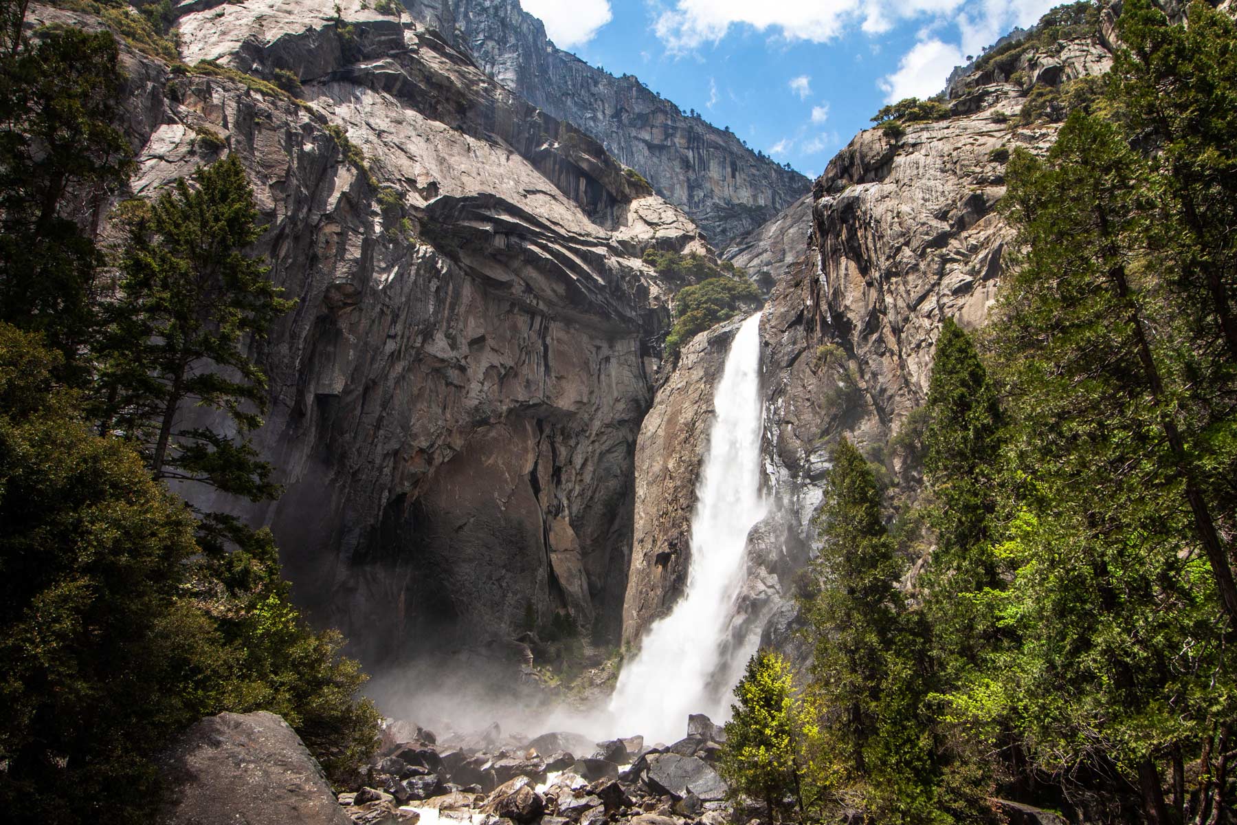
The top spot goes to the easiest hike on the list, because nothing else delivers this much for this little effort. Yosemite Falls, at 2,425 feet, is the tallest waterfall in North America, and this flat one-mile loop puts you right at the base of the lower drop, close enough to feel the spray when the falls are running hard.
The paved loop from near the visitor center has interpretive signs and several viewpoints, and works in either direction. The falls peak with the spring snowmelt and often run dry by late summer, so come in May or June for the full roar. It is fully accessible, which makes it the rare Yosemite highlight nearly everyone can reach.
The 20 Best Hikes in Yosemite, Ranked
- Lower Yosemite Fall
- Four Mile Trail
- Cathedral Lakes
- Half Dome
- North Dome
- Clouds Rest
- Wapama Falls
- Tuolumne Grove
- Mariposa Grove (Wawona Point)
- Nevada Fall (Mist Trail)
- Vernal Fall (Mist Trail)
- Panorama Trail
- Taft Point
- Cook’s Meadow Loop
- Columbia Rock
- Wawona Meadow Loop
- Grizzly Giant Loop
- Mirror Lake Trail
- Bridalveil Fall
- Lukens Lake
Hike Yosemite Safely
Yosemite is a wild place, and people die here every year, most often on water and on exposed granite. Stay on the trails, check the weather before any long or high hike, turn around if a storm is building, and never climb the Half Dome cables or the Mist Trail stairs when the rock is wet. Carry more water than you expect to need, and start early so you are off the exposed sections before afternoon heat and thunderstorms.
Yosemite Hiking FAQ
Lower Yosemite Fall is the most popular hike in Yosemite National Park, a flat one-mile loop to the base of the tallest waterfall in North America.
For the best views in Yosemite National Park, the Four Mile Trail to Glacier Point and Clouds Rest are hard to beat.
Half Dome is the hardest day hike in Yosemite, with 4,800 feet of gain and a cable climb that requires a permit.
Helpful Related Links
Yosemite National Park Guide: Our full guide to planning a trip to Yosemite.
Clouds Rest: Why we hike Clouds Rest instead of Half Dome.
Half Dome Hike: What to know before you attempt the cables.
Yosemite Facts: 10 things you might not know about Yosemite.
West Coast National Parks: The best West Coast national parks, ranked.
What to Bring to Yosemite
Gear we recommend for Yosemite. Affiliate links support our work at no cost to you.
More Than Just Parks may earn a small commission from purchases made through these links, at no extra cost to you. We only recommend gear we would actually use.
Affiliate disclosure: Some links on this page earn us a small commission at no extra cost to you. We only recommend gear we actually use.


