FOR NEWSROOMS, EDITORS AND ORGANIZATIONS
The figures, quotes, graphics, video and embeds on this page are free to quote, lift and embed with a credit to More Than Just Parks and a link. The photographs are licensed. Every figure below names the document it came from.
More Than Just Parks, a reader-funded public lands advocacy organization, has published an interactive investigation of the Ambler Road, a proposed 211-mile private industrial road across the southern Brooks Range in Alaska, from the Dalton Highway west to the Ambler Mining District, including 26 miles through Gates of the Arctic National Preserve. The road would be built and owned by AIDEA, a public corporation of the State of Alaska, closed to the public by staffed gates (the federal review says it "eventually may be opened"), and used to haul ore concentrate from four deposits where no mine is yet permitted. The investigation runs fifteen chapters, an eighteen-scene visual story, a mile-by-mile flight along the route, and an interactive atlas of every one of the road's 2,932 water crossings, with every figure cited to the federal record, AIDEA's financial statements, the applicant's own engineering files or filings with the SEC, and our own counts labeled as ours. It reports, from the executed agreements filed with the SEC, that the Department of War closed a $35.6 million stake in Trilogy Metals, the company behind the mines, on September 11, 2026, with the right to buy 12,323,356 more shares at one cent: 6,161,678 warrants that unlock on the earliest of Phase 1 of the road, ten ore-concentrate trucks in ten days, or a change of control, and a 6,161,678-share South32 option that Trilogy says unlocks on Phase 1 or a change of control. It was reported from the corridor in August 2026 and is illustrated with original photographs.
Link: morethanjustparks.com/ambler-road. Three ways in: the story, mile by mile, the map. Updated October 5, 2026.
Each figure below is printed on the site with the same citation. The chapter linked in the third column carries the page reference and the caveats.
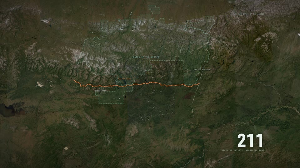
| 211 | miles of private industrial road, Dalton Highway to the Ambler Mining District, on AIDEA's Alternative A centerline (211.18 miles). Closed to the public: "Access would be controlled, with no access by the general public, including area residents." The 2024 Final SEIS adds that the road "eventually may be opened to the public." | BLM EIS GIS record · 2020 Final EIS Vol. 1, pp. 40 and 45 · 2024 Final SEIS Vol. 1, p. 375 · The Road |
| 26 | miles inside Gates of the Arctic National Preserve, 332 acres of footprint on Park Service land. The 1980 law that made the park directs the Interior Secretary to permit surface access across the preserve, through a process it sets out. | 2024 Record of Decision, pp. 9 and 12 · ANILCA §201(4)(b) · The Road |
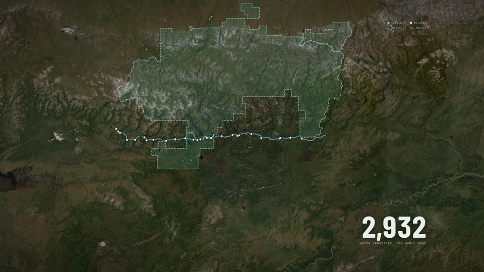
| 2,932 | water crossings, counted by us on the applicant's own engineering file: twelve on rivers, 35 on creeks, two on other named water and 2,883 on unnamed drainages; 544 inside the preserve. The 2020 Joint Record of Decision gives the same total (“approximately 2,932 streams”). The 2024 decision counts 49 bridges, the applicant's file 29. | AIDEA crossing inventory · 2020 Joint ROD, p. 20 · 2024 ROD structure table · The Water |
| 4,524 | acres of total footprint: 41 gravel mines over 1,863 acres, 137 acres of access roads, three airstrips, five camps, four maintenance stations, twelve towers. The road itself is 2,318 acres of it, about half. | 2024 Record of Decision, p. 12 · AIDEA engineering GIS · A Road Is Not a Line |
| 5,122 | active state mining claims on 649,057 acres along the corridor; 3,431 of them, two thirds, located after AIDEA applied for the road on November 24, 2015; 504 in the five weeks after the President's decision of October 6, 2025. | Alaska DNR claims file, counted by us · The Mines |
| 0 | mines permitted. "No mines have been developed, and no plans of development are pending before the federal government." That was 2024. Ambler Metals applied for the Arctic mine's Clean Water Act permit in 2026 (April 20 by the company's account, a complete application on May 19 by the Corps' notice). The Corps published its notice of intent to prepare an environmental impact statement on September 18, 2026, and targets a Record of Decision by September 15, 2028 and a permit decision by September 22, 2028. Scoping comments are due November 2. | 2024 Record of Decision, p. 24 · Corps special public notice POA-2019-00081, Sept. 18, 2026 · Trilogy Metals 8-K, Sept. 21, 2026 · The Mines |
| 20.9 | decibels, the natural ambient sound level the Park Service measured at South Walker Lake inside the project area. The government's model puts 788 square miles within earshot of the finished road, for one mine at six trucks an hour (the 2024 review's forecast for full operation with four mines in production runs 4.3 to 7 an hour on average), and calls Alternative A "a noise incursion into Gates of the Arctic National Park." | 2020 Final EIS, p. 101 and Appendix D, Attachment A · 2024 Final SEIS Vol. 1, pp. 206 and 208 · The Sound |
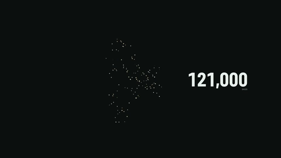
| 121,000 | caribou in the Western Arctic Herd at the 2025 census, down from more than 490,000 in 2003. Management level, set by the herd's working group in December 2025: "Critical, Declining." At the Red Dog road, Alaska's one comparable mining road, 8 of 28 collared caribou were delayed and took an average of 33 days to cross; the other 71 percent did not appear to be delayed. | WACH Working Group, Dec. 2025 · 2020 Final EIS Vol. 1, p. 155 · 2024 Final SEIS Vol. 1, p. 209 · The Caribou |
| $2.2B | to build, finance, maintain and remove the road over 50 years, by our calculation. The 2024 Record of Decision puts construction at $672.4 million, up about a third from the $501.9 million in the 2020 errata; in 2026 prices that's about $763 million, and the 30-year bonds AIDEA plans to sell would add about $726 million in interest at the 5 percent in AIDEA's own example. As of June 30, 2025, AIDEA's auditors record that the parties have not entered into a road use agreement; the company's reserves assume a toll of $8.04 a tonne. Our calculation, method on The Money: $763 million construction, $726 million interest, about $88 million closure, about $595 million maintenance. | 2024 ROD, p. 23 · 2020 Joint ROD errata · 2024 Final SEIS, p. C-3 and p. 3-206 · FHWA National Highway Construction Cost Index, 2026 Q1 · AIDEA FY2025 audited statements, p. 57 · Trilogy 10-K FY2025, p. 66 · The Money |
| $28M | a year in road tolls and maintenance the Arctic mine assumes it would pay, by its own 2022 study ($8.04 a tonne), about $367 million over its 13-year life. No road use agreement exists. The state's review projects about $1.1 billion in revenue over the lives of all four mines, two of which have no economic study and one of which "would not be economically viable" without inferred resources. The company's three studies of the mine raised the build cost 51 percent from 2018 to 2022, from $779.6 million to $1,176.8 million, and cut the after-tax value from $1,412.7 million to $1,108.1 million. Nobody has a number that pays for the road. | Arctic S-K 1300 Technical Report Summary, pp. 221, 378, 382 / Trilogy 8-Ks Feb. 21, 2018 and Aug. 20, 2020 / Form 10-K FY2025 / 2024 Final SEIS Vol. 1, p. 269 / The Money |
| $102M | lined up through AIDEA, a public corporation of the State of Alaska, at most: $17 million appropriated by the Legislature, up to $35 million committed under 2020 funding agreements with Ambler Metals by board action rather than appropriation, $50 million authorized by AIDEA's board in October 2025. | AIDEA resolutions and audited statements FY2022 to FY2025 · The Money |
| $35.6M | the Department of War's investment for about 10 percent of Trilogy Metals, announced October 6, 2025, closed September 11, 2026. It also carries the right to 12,323,356 more shares at one cent, in two pieces. The 6,161,678 warrants become exercisable on the earliest of three events: Phase 1 of the road complete (as determined by the Engineering Firm or AIDEA), ten trucks carrying ore concentrate on the road in any ten-day period, or a change of control of the company. The 6,161,678-share South32 option is described by Trilogy as exercisable on Phase 1 or a change of control; its text is not public. Trilogy's stock rose 211 percent in the next session ($2.09 on October 6, 2025 to $6.50 on October 7). | Trilogy Metals 8-K, Sept. 14, 2026, Exhibits 10.1 and 10.5 · 8-K, Aug. 31, 2026 · 10-Q filed Oct. 2, 2026 · The Deal |
| Gov. | what else the government got: the right to name one independent director to Trilogy's board until October 6, 2028; a non-voting board observer while it holds at least 8,000,000 shares; an observer inside the Ambler Metals joint venture; written approval, “not to be unreasonably withheld,” for Trilogy borrowing above $1 billion until the earlier of January 1, 2029 or a change of control; and a commitment to “work in good faith to help facilitate financing required for construction of the Ambler Access Project in coordination with the State of Alaska.” Veto rights through a special representative apply only if “Restricted Entities” reach 10 percent of Trilogy or South32, for national security reasons. | Investment Agreement, sections 5.1 to 5.3 · Cooperation Agreement · Trilogy Metals 8-K, Sept. 14, 2026 · The Deal |
| 30 | communities whose subsistence the government found the road may significantly restrict. In June 2024 the BLM denied the road because it could not find that restriction "necessary." The President reversed the denial on October 6, 2025, using a separate ANILCA appeal provision, section 1106(a), after making his own public-interest findings. | 2024 Record of Decision, pp. 18 and 28 · Decision of the President, Oct. 6, 2025 · The People |
| 3 / 89 | Three Tribes in the region passed resolutions supporting it: Allakaket and Hughes only with access limited to the mining companies, local communities and residents, and Ruby with no condition. High Country News counted some 89 northern Tribes and First Nations, across a far wider region, that passed or supported resolutions against it, and Audubon Alaska counted 88 Indigenous governments supporting the No Action Alternative. The site prints the supporters' documents in full. | Resolutions hosted by AIDEA at ambleraccess.org · High Country News, Mar. 28, 2025 · Audubon Alaska, April 19, 2024 · The Case for the Road |
Comment on the Arctic mine: the Army Corps is taking public comment on the mine's environmental review (reference POA-2019-00081) until November 2, 2026, 11:59 pm Alaska time. Write a comment with the sources built in.
Download the fact sheet as textAttributable to Will Pattiz, co-founder of More Than Just Parks. For a fresh quote or an interview, write to the address at the bottom of this page.
“We're against this road and we say so on the front page. That's exactly why every figure on the site is cited to a document you can open, and why there's a page that lists what we got wrong.”
Will Pattiz, More Than Just Parks“Fights over public land are won and lost on whether people can picture what's at stake. Very little imagery existed of the country this road would cross, so we went and made some.”
Will Pattiz, More Than Just Parks“This is a private industrial road across public land, with staffed gates at both ends and no access for the general public. Every part of that sentence is in the government's own record.”
Will Pattiz, More Than Just Parks“The money is the part worth reading closely. The federal government now holds about ten percent of Trilogy Metals, the company that owns half the ore this road would serve, and it has the right to buy 12.3 million more shares for a penny each. The warrants unlock when the road's first phase is built, when ten ore-concentrate trucks use it in a ten-day period, or when control of the company changes. South32's option unlocks when the first phase is built or control of the company changes. We read the executed agreements Trilogy filed with the SEC and quoted them.”
Will Pattiz, More Than Just Parks“We counted every water crossing on the applicant's own centerline and got 2,932, the same total the federal record gives. That's about fourteen crossings for every mile of road.”
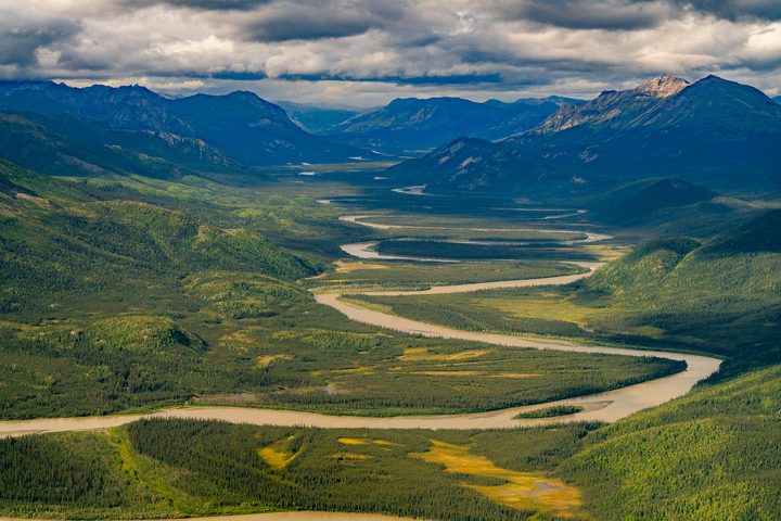
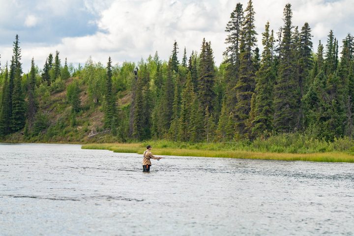
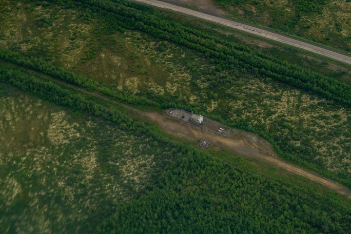
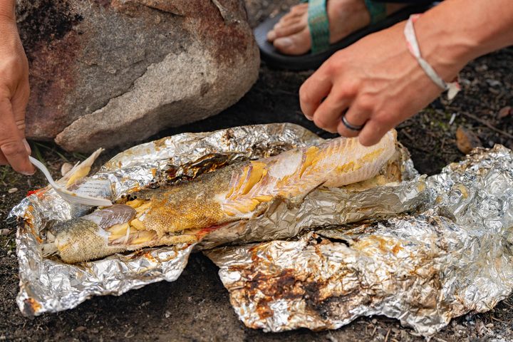
Will Pattiz, More Than Just Parks60 original frames from the August 2026 trip, every one downloadable at full size with its caption: The country from the air (12) · Rivers, lakes and the range (12) · The road that already exists (14) · Fishing, camp and getting there (12) · On the ground (10). Every use needs a license: rates and requests on our licensing page. Licensed use carries the visible credit More Than Just Parks. No resale, no AI training.
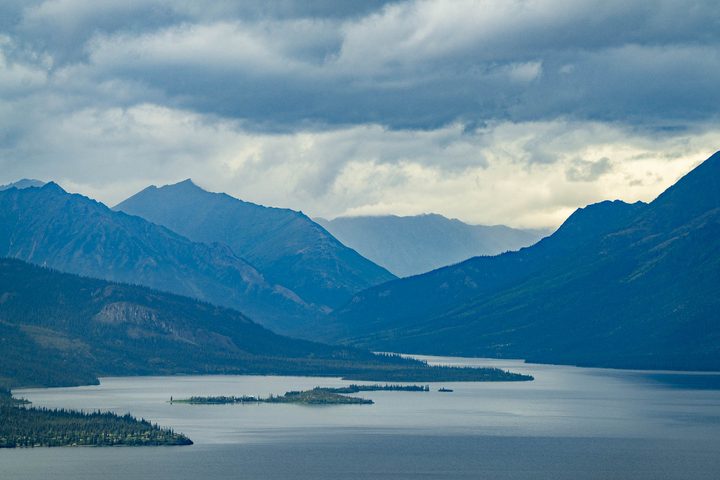
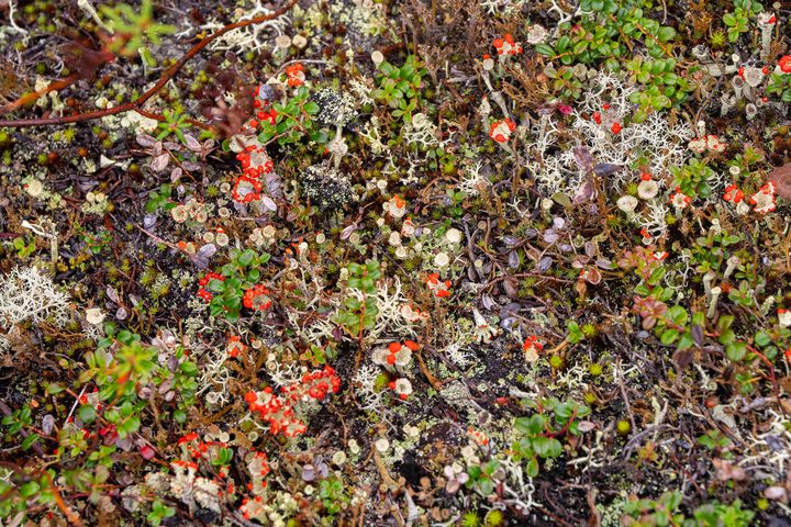
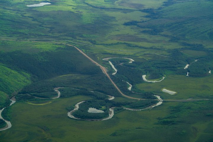
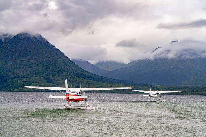
Send the library link itself to a reporter or a partner: morethanjustparks.com/ambler-road/press/photos/
A route map, the key figures one to a card, and three charts, built from the same record as the site. Each carries its source line and comes at 1920 × 1080, 1080 × 1080 and 1080 × 1350, with a vector PDF at each size; the map and charts also come as SVG. Free for editorial use; the credit is More Than Just Parks. Figures that are our own count or calculation say so on the graphic.


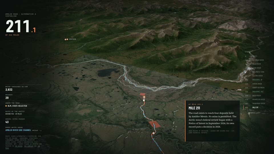
9 HD clips of the animated maps, 16:9 and 9:16 at 30 fps, with clean plates for your own type: the route drawing in, 2,932 water crossings, the atlas, the terrain flight down the centerline, the footprint, the claims, the preserve and the caribou herd. Free for editorial and advocacy use with the on-screen credit Maps and animation: More Than Just Parks. Imagery: Esri, Maxar, Earthstar Geographics.
Send the clips link itself to a producer or a partner: morethanjustparks.com/ambler-road/press/video/
The map and the mile-by-mile flight can be embedded directly. The story is built to be read at full screen and is best linked, not framed.
The interactive map · every crossing, every claim
<iframe src="https://morethanjustparks.com/ambler-road/map/" width="100%" height="640" style="border:0;max-width:100%" loading="lazy" title="The Ambler Road map by More Than Just Parks" allowfullscreen></iframe>
<p>Map: <a href="https://morethanjustparks.com/ambler-road/map/">More Than Just Parks</a></p>
Mile by mile · fly all 211 miles
<iframe src="https://morethanjustparks.com/ambler-road/mile-by-mile/" width="100%" height="720" style="border:0;max-width:100%" loading="lazy" title="The Ambler Road, mile by mile, by More Than Just Parks" allowfullscreen></iframe>
<p><a href="https://morethanjustparks.com/ambler-road/mile-by-mile/">More Than Just Parks</a></p>
A deep link to any mile
https://morethanjustparks.com/ambler-road/mile-by-mile/#m122   (the Kobuk River bridge, inside the preserve)
https://morethanjustparks.com/ambler-road/mile-by-mile/#m110   (the road enters Gates of the Arctic)
Share cards, 1200 × 630
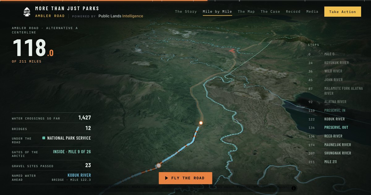
We reported this from the corridor in August 2026 alongside a small group of writers. Their work from the same trip, credited to them and linked at the source:
Field & Stream · Article · October 1, 2026
“Feds Announce Plans for Open-Pit Mine Tied to Ambler Road in Alaska”
Travis Hall on the Army Corps review of the Arctic mine, the first mine the road is meant to reach, with a longtime Brooks Range hunter on what the road would cost the people who hunt and fish there. Travis Hall was with us in the Brooks Range.
Read it on Field & StreamAmerican Hunters & Anglers · Reel · September 29, 2026
“While everyone's looking at the latest insane public land headline, the Ambler Road fight is unfolding in Alaska.”
A short reel from American Hunters & Anglers that lays out the fight in plain words and asks hunters and anglers to weigh in before the November 2 deadline. Land Tawney, the group's co-chair, was with us in the Brooks Range.
Watch it on InstagramOutdoor Life · Film · September 25, 2026
“This place could disappear forever - fishing at ground zero for Ambler Road”
Roy Holdford's sixteen-minute film for Outdoor Life, fly fishing for grayling in the country the Ambler Road would cross. Roy Holdford was with us in the Brooks Range.
Watch it on YouTubeOutdoor News · Article · August 26, 2026
“An unforgettable fishing trip reveals the risks of the Ambler Road project in Alaska”
Rob Drieslein on a morning alone with a fly rod at the foot of the Brooks Range, where lake trout were chasing grayling in three feet of fast water, and on what the federal review says the road would put a few miles south of it. Rob Drieslein was with us in the Brooks Range.
Read it on Outdoor News→ The latest, as it lands: the Ambler Wire
Release
The launch release: what the investigation is, what it found, who made it, and where to link. Paste-ready.
release.txtFact sheet
The table above as plain text, one figure per line with its document and page, for a producer's notes or a fact-check desk.
fact-sheet.txtBriefing
Seven pages on the federal stake, from the SEC filings: the penny shares, the right to name an independent director, the triggers, the approval right over borrowing.
MTJP-Ambler-Money-Trail-Briefing.pdfThe record
106 documents, searchable, every answer cited to a page. The same engine we used.
Open the RecordMore Than Just Parks is a public lands advocacy organization. Its mission is to protect America's public lands, the forests, deserts, canyons and coastlines that belong to every American in common, and it does that with evidence: reporting from the ground, a public record anyone can check, and tools that put a federal decision in front of the people who care about the place while there is still time to act. PLAN, the Public Lands Action Network, reads the Federal Register the day a decision is published and helps the public write the comment; the Public Lands Scorecard holds every member of Congress to their votes on public land. It was founded by Will and Jim Pattiz, is funded by its readers, and takes no money from the industries it covers. The Ambler Road investigation was reported from the corridor in August 2026 and built from a record of 106 documents; its methods and corrections are in How We Know.
Interviews, fresh quotes, higher-resolution frames, custom crops, data exports from the atlas, or a walk-through of the record: write and say what you're working on and your deadline.