 MORE THAN JUST PARKS
PART I · WHAT IS PROPOSED CHAPTER 2 The inventory
The Ambler Road is drawn as a thin stroke across a map. What's actually proposed is 41 gravel mines, 137 acres of spur roads, three airstrips, five camps, four maintenance stations, twelve communications towers and 2,932 water crossings. The road itself is only about half of the ground it takes.
What this chapter finds
This is the Bureau of Land Management's own component table for the chosen route, set against what AIDEA's engineering GIS actually draws. Nothing here's our estimate. The left column is the decision document, the right is the applicant's file, and where they differ the difference is the story.
| Component | Record of Decision, Alternative A | AIDEA's engineering file |
|---|---|---|
| Material sites, the gravel mines | 41, over 1,863 acres | 44 polygons, 32 carrying its own asbestos rating; one inside the preserve, where the signed park permit allows none |
| Support access and spur roads | 137 acres of footprint | 137 drawn segments: 53 permanent, 84 temporary |
| Airstrips, 150 feet by 3,000 feet | 3, over 153 acres | 3 permanent, plus 3 construction airstrips |
| Maintenance stations, 12 acres each | 4, over 48 acres | 5 |
| Construction camps | Camps every 40 to 45 miles, about 5 acres each (2024 Final SEIS, p. 49) | 5 |
| Vehicle turnouts | 20, one every 10 to 11 miles | 21 |
| Communications towers | 12: three at maintenance stations, nine at material sites | 12, at landing strips, camps and material sites |
| Culverts | 2,864 minor, 7 moderate, 12 major | Drawn individually |
| Bridges | 22 small, 16 medium, 11 large | 32 bridge footprints |
| Total water crossings | 2,932 | 2,932, counted off the centerline ourselves |
| Total project footprint | 4,524 acres | |
| Footprint inside Gates of the Arctic | 332 acres | |
| Gravel to build | 15 million cubic yards | |
| Gravel to maintain, every year | 220,000 cubic yards |
2024 Record of Decision, page 12, component comparison table, sourced there to DOWL 2016, the US Army Corps of Engineers 2020, and BLM analysis. Engineering file counts are from AIDEA's published GIS, recounted against the files on September 11, 2026.
Two different 137s, and they aren't the same number
The Record of Decision reports 137 acres of support access road footprint. AIDEA's GIS draws 137 access-road segments, 53 permanent and 84 temporary, a few of them only slivers. It's a coincidence. One is an area and one is a count, they aren't convertible into each other, and no sentence on this site may imply they're.
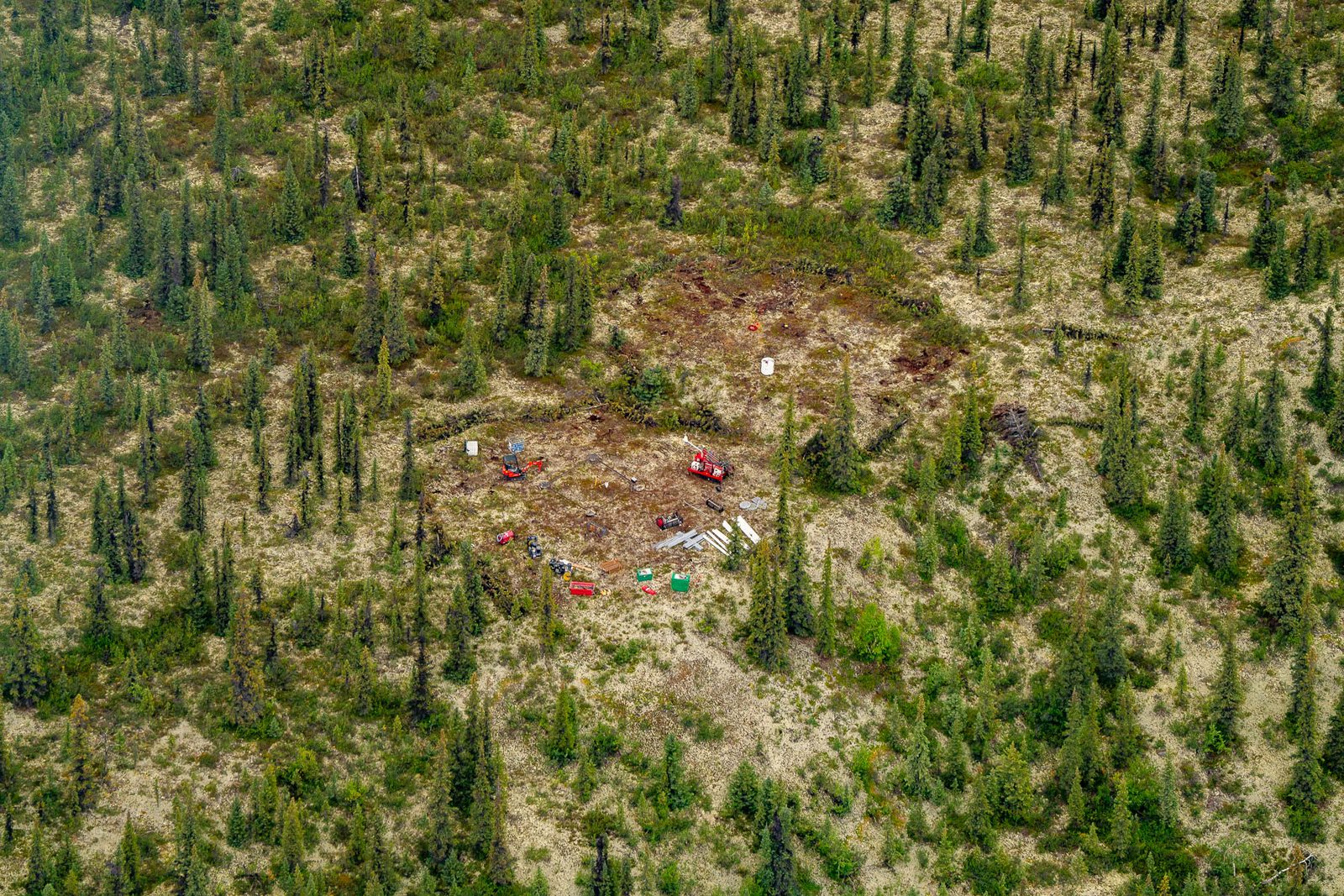
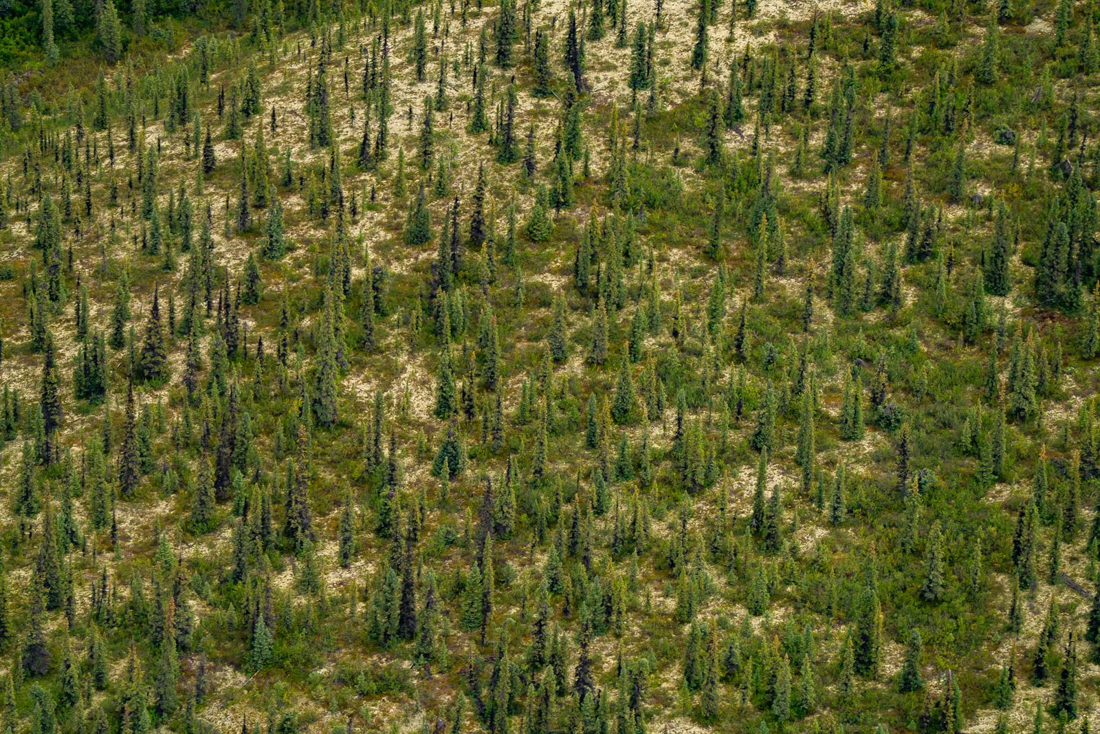
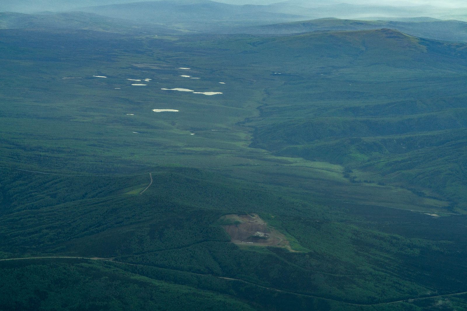
Numbers in a table are easy to skim past. Here's a clearing in this country, photographed from the air in August, and the same forest a few frames later on the same flight, with nothing in it.
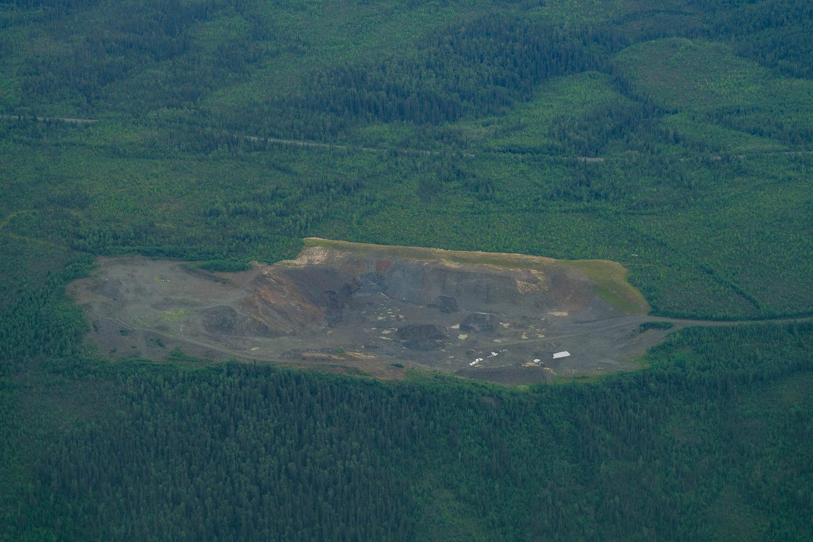
The project proposes 41 gravel mines over 1,863 acres. That is a clearing roughly every five miles for 211 miles, each one a separate excavation with its own access road running off the corridor to reach it. In the 2020 Army Corps permit action, AIDEA's own design changes cut the material sites it requested from 41 to 15 and took every one of them out of the park unit, with any more to be requested in a separate permit. AIDEA's engineering file still draws one inside the preserve, GANPP Outwash, 47 acres. The right-of-way permit the Park Service signed on October 21, 2025 allows none: it “does not include authorization for any material sites, construction camps, maintenance facilities or airstrips; any such facilities are prohibited.”
National Park Service right-of-way permit RW GAAR-25-001, page 4, executed October 21, 2025; its Exhibit B-2 maps draw no material site inside the preserve. Read October 15, 2026. The site's location and acreage: AIDEA engineering GIS, material sites layer, against the National Park Service boundary.
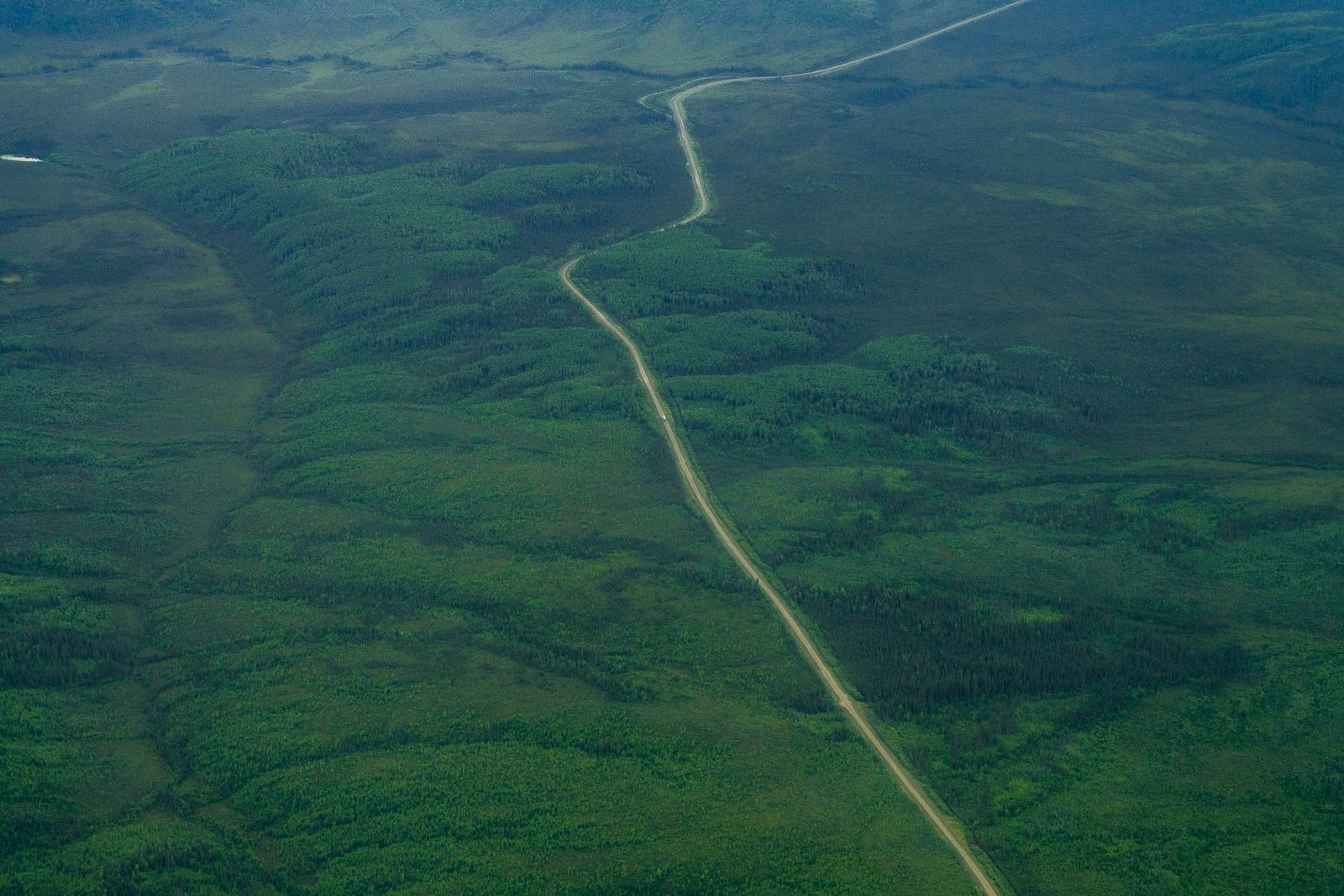
A gravel road on thawing ground isn't a thing you build once. The decision document states both numbers plainly: 15 million cubic yards to construct, and 220,000 cubic yards every year to maintain.
Multiplying those two figures together is our arithmetic and not the government's, so we label it and let the reader do what they like with it: at 220,000 cubic yards a year across the 50-year term of the grant, maintenance alone calls for about 11 million more cubic yards, on top of the 15 million it takes to build. That gravel comes out of the same pits, in the same country, for the life of the road.
And it's worth being precise about why the embankment is so hungry. It's 3 to 8 feet thick because the ground underneath is frozen, and where the ground is worst it gets thicker still. The ground chapter follows that chain all the way down.
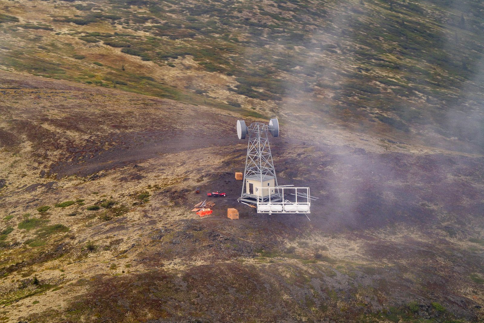
The components that get least attention are the ones that turn a road into a system. Twelve communications facilities. Three airstrips at 150 feet by 3,000 feet, plus three more for construction. Five camps. Four maintenance stations at twelve acres each, permanent, staffed, kept for the life of the road.
None of this is hidden. All of it's in the application, the environmental review and the decision. It's simply never the thing that gets drawn on a map, and a single line across an empty map is a misleading picture of what's being decided.
The largest number in the inventory is the one nobody quotes: 2,932 water crossings. 2,864 minor culverts, 7 moderate and 12 major, plus 22 small bridges, 16 medium and 11 large.
We didn't take that number from a press release. We counted every crossing off AIDEA's own engineering centerline, and each one is on the atlas with its structure class, its landowner, its watershed and its corridor mile. The water chapter takes them apart; the atlas lets you check our count against the government's.
Structure counts: 2024 Record of Decision, page 12. Crossing geometry and attributes: AIDEA engineering GIS, counted by More Than Just Parks. Our 2,932 matches the federal total: the 2020 Joint Record of Decision says "approximately 2,932 streams would be crossed," and the 2024 table's crossing rows sum to it.
What this chapter doesn't say
It doesn't say the applicant hid any of this. Every component here comes from documents AIDEA filed or the government published. The public conversation has been about a line on a map, and the decision was about an industrial complex.
It doesn't treat the two counts as an accusation. Where the ROD counts 41 pits and the file draws 44, or 4 maintenance stations against 5, the likeliest explanations are mundane: multipart geometry, features belonging to another alternative, or shared facilities at the Dalton end. We print both numbers and don't resolve what we can't.
It doesn't claim the photographs show Ambler infrastructure. No part of the Ambler Road exists. The clearing and the tower on this page are in this country, photographed in August 2026, and they show what this kind of facility looks like here. Nothing more is claimed for them.
Beyond the 211-mile road itself: 41 gravel mines, 137 acres of spur roads, three airstrips, five camps, four maintenance stations, twelve communications towers and 2,932 water crossings. All of it is permanent infrastructure in country that has none.
2024 Record of Decision; AIDEA engineering GIS. Both counts are printed on this page.The full footprint is 4,524 acres, and 332 of those acres are inside a national park unit. The road itself is 2,318 of those acres, about half. The rest is gravel mines, spur roads, airstrips, camps and stations.
2024 Record of Decision; AIDEA engineering GIS. Both counts are printed on this page.Fifteen million cubic yards to build, and 220,000 more every year to maintain, which is why the project needs 41 gravel mines of its own along the route. The Ground covers what the applicant's own file says is in some of those pits.
2024 Record of Decision; AIDEA engineering GIS. Both counts are printed on this page.Everything on this page is mapped, and the map is open. If you want to see where the pits are, which ones AIDEA rated for asbestos, where the towers and camps and turnouts sit, and which of the 2,932 crossings fall on National Park Service land, the atlas answers all of it and it's free.
If you write about this project, the single most useful correction you can make is to stop calling it a road. It's a road plus 41 gravel mines plus 137 acres of spur roads plus the rest of this table.