 MORE THAN JUST PARKS
PART I · WHAT IS PROPOSED CHAPTER 1 The line
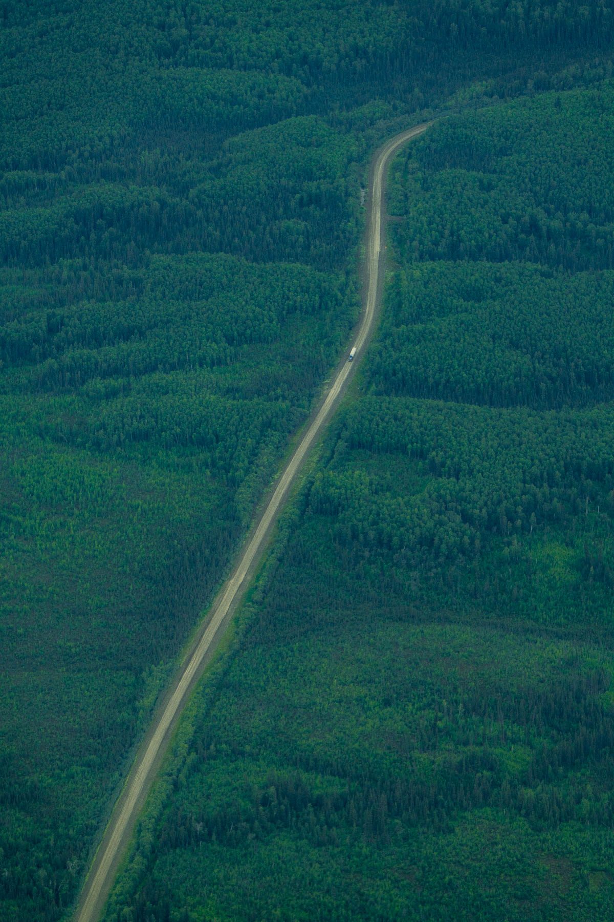
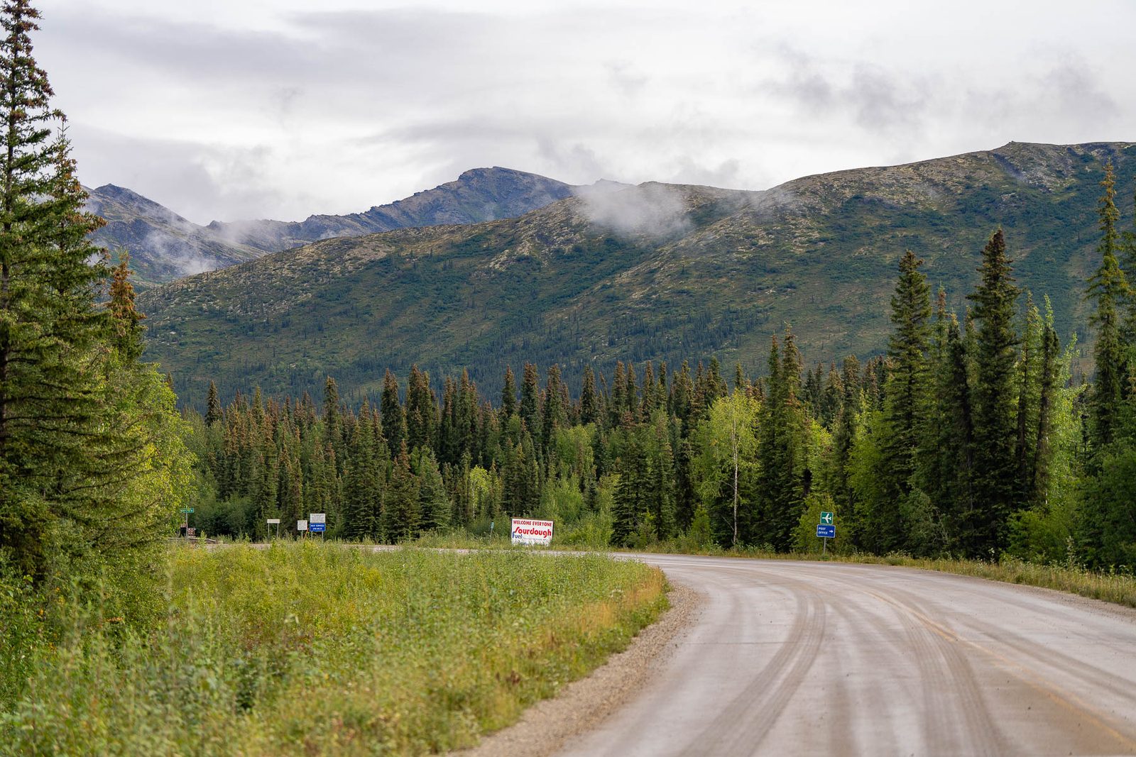
Two hundred and eleven miles of gravel, built in three phases on a 250-foot corridor, closed to the public by staffed gates at both ends, permitted for fifty years, through a national preserve whose founding law directs the Interior Secretary to permit surface access across it. The record says what it is. It also says it may not stay closed.
What this chapter finds
The whole argument about this road fits in eight words, and every one of them can be proved from the record. Public land, public money, private road, public excluded.
| Clause | Where the record proves it |
|---|---|
| 211 miles | A 211-mile industrial access road from the Dalton Highway west to the Ambler Mining District, Alternative A, the alignment carried forward |
| Private road | "A controlled, private industrial access road" (FY2025) and "the controlled industrial private access road" (FY2024), in the unaudited project schedule of AIDEA's financial statements |
| Closed to the public | "Access would be controlled, with no access by the general public, including area residents." Staffed gatehouses at each end, round-the-clock security, regular patrols |
| Public money | AIDEA is a public corporation of the State of Alaska. It would build, own and toll the road and finance it with revenue bonds sold to private investors, which the federal review says would not become a liability of the State |
| On public land | A 4,524-acre footprint across Bureau of Land Management, National Park Service, State of Alaska and Native corporation land |
| Through a national park unit | 26 to 27 miles inside Gates of the Arctic National Preserve, and 332 acres of the footprint on Park Service land |
| A 250-foot corridor | The application is for a 250-foot-wide right-of-way, widening to 400 feet at water crossings and on steep ground |
| Fifty years | AIDEA projects a road life of about 50 years, the period over which it expects the district's mining to run |
AIDEA financial statements, Schedule 2, development project information (unaudited), FY2025 p. 74 and FY2024 p. 80. 2020 Final EIS, Vol. 1, p. 40 and p. 45 (gatehouses, access). 2024 Record of Decision, p. 8 (phases, 50-year life), p. 9 and p. 12 (footprint, land, Park Service acres), p. 23 (250-foot corridor). 2020 Final EIS, p. 227 (400 feet at crossings and steep terrain). Presidential decision, October 2025, p. 6 (the SF-299 application of November 24, 2015 for a 250-foot right-of-way).
The record of decision describes the road as three roads built in sequence on the same line:
"AIDEA proposes building this road in phases, starting with a seasonal, single-lane, gravel pioneer road (Phase 1). The road would be expanded in Phase 2 to a wider all-season, single-lane gravel road and later further expanded to a two-lane gravel road in Phase 3." 2024 Record of Decision, p. 8
Phase 1 is the one that matters for the money. The federal government's penny-priced warrants in Trilogy Metals unlock on completion of Phase 1, once ten trucks carrying ore concentrate have used the road in any ten-day period, or on a change of control of the company, whichever comes first. The South32 option, as Trilogy describes it, unlocks on Phase 1 or a change of control. A seasonal single lane of gravel is the payout trigger. That chapter is here.
The ground has already changed the sequence once. The Army Corps of Engineers' Clean Water Act permit, special condition 13, requires the full Phase 2 embankment depth from the start rather than a pioneer road first, because "approximately 60 percent of the Alternative A alignment is estimated to be in in [sic] areas with thaw-sensitive permafrost soils or emergent wetlands." The Bureau of Land Management developed the same idea as an option in the supplemental review, eliminating Phase 1 "to address impacts on permafrost, water quality, and fish."
2024 Final SEIS, Vol. 1, Corps special condition 13. 2024 Record of Decision, p. 11, the road-without-Phase-1 option. 2020 Final EIS, p. 41, "Road without Phasing."
The embankment is proposed at three to eight feet thick, and the record is explicit about why: the gravel "provides additional insulation to underlying soils with the potential to reduce the active layer thickness." The road is thick because the ground under it's frozen, and building it takes 15 million cubic yards of gravel, with 220,000 cubic yards more every year to keep it up. Every acre of the footprint is on mapped permafrost; 78 percent of it's continuous permafrost in mountain terrain.
The record doesn't claim that works. Its own words: "Changes to the natural thermal regime cannot be avoided; however, impacts would be minimized by using appropriate fill material and embankment designs and construction approaches." The mitigation menu is "embankment insulation, air convention [sic] embankment, thermosyphons, sunsheds, snowsheds, or air ducts," judged "likely to be mostly, but not completely, successful where implemented and maintained. Some permafrost may melt regardless." And the consequence, in the record of decision: "the potential for the road to accelerate the predicted rate of climate-driven permafrost degradation, which would further degrade downstream water quality, potentially inhibit fish movement, and may alter species distribution and abundance and influence fish populations."
What comes out of thawing ground, and what's in the gravel that goes on top of it, is the ground chapter.
2024 Record of Decision, p. 12 (gravel volumes), p. 13 (embankment thickness and insulation), p. 14 (the permafrost sentence). 2024 Final SEIS, Vol. 1 (thermal regime, mitigation menu) and Appendix D, Table 2 (footprint by permafrost class).
There are two answers in the record and they're far apart. The applicant's own application, cited in the 2020 statement, puts production traffic at up to 80 trucks a day. The federal analysis of the same road predicts 104 to 168 trucks a day in Phase 3, counting other mines in production, "or 5 to 7 trucks per hour on average" (the 2024 supplemental review puts it at 4.3 to 7), and its mining scenario peaks at about 170 one-way heavy truck trips a day, roughly 60,000 a year. The noise model that produced the sound chapter's map assumed six an hour.
Up to 80 trucks a day, 40 round trips, during production. AIDEA's application, as the 2020 statement records it.
The federal analysis of the road in its final phase, with other mines in production. On the public Dalton Highway, where the Ambler traffic would join, 160 to 238 more trucks a day, a rise of 74 to 110 percent over current total traffic, on 161 miles of state highway.
2020 Final EIS, p. 44 (the application figure, citing DOWL 2016a), p. 162 (Phase 3 prediction), p. 108 (mining scenario), p. 303 (noise model assumption). 2024 Final SEIS, Vol. 1, p. 3-153 (Dalton traffic). What the Dalton already costs to carry the traffic it has is the precedents chapter.
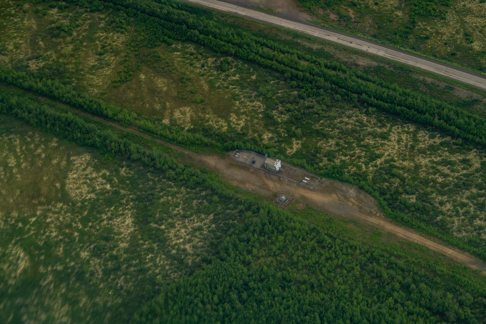
Everything about this road is designed around exclusion. The 2020 statement, describing operations: "Access would be controlled, with no access by the general public, including area residents." Staffed gatehouses at each end, with the east-end guardhouse laid out down to its kitchen and emergency bunks. As permitted, this isn't a road you or the people who live along it would be allowed to drive.
Then the supplemental review, four years later, in its own analysis of subsistence:
"Additionally, based on experience with the Dalton Highway and DMTS where public access was granted to a previously closed road, the Ambler Road eventually may be opened to the public for hunting, fishing and other uses." 2024 Final SEIS, Volume 1, p. 375
Both are true. The road is closed as designed and as permitted, and the government's own record says the two closest precedents didn't stay closed. A private road across public land, or a public road nobody planned for across a national preserve: the record leaves it open which one this is, and the honest sentence carries both.
2020 Final EIS, Vol. 1, p. 40 and p. 45. 2024 Final SEIS, Vol. 1, p. 375.
Gates of the Arctic was created by the Alaska National Interest Lands Conservation Act in 1980, and the same law made room for a road across the preserve. Section 201(4) directs the Interior Secretary to permit surface access across the preserve from the Ambler Mining District, and sets the procedure: an application, a joint route analysis by the Interior and Transportation secretaries, and a route and terms they agree on. AIDEA's consolidated application of November 24, 2015, for a 250-foot right-of-way, triggered that procedure. The presidential decision of October 2025 recites that history, but its legal basis is the appeal provision, section 1106(a). The fight over this road was written into the park's birth certificate, which is why the 2024 denial came from BLM, over the road's effects across its own lands, and not from the Park Service over the preserve crossing.
The Native regional corporation that owns the land at the road's western end, NANA, withdrew its participation from the project in 2024 and remains an intervenor in court to protect its own 201(4)(d) access right, a distinction its own statements make carefully. In December 2025 NANA and Doyon signed a non-binding memorandum with AIDEA that, in NANA's words, "does not constitute a final determination" about the road. Where the line actually runs at its western end is therefore not settled, and the official engineering geometry we map is the permitted alignment.
ANILCA, Pub. L. 96-487, section 201(4)(d). Presidential decision, October 2025, p. 6. AIDEA audited statements FY2025, p. 74 (application date). AIDEA FY2024 statements, p. 23 (the section cited in litigation). NANA statements and FAQ, 2024, and the December 2025 memorandum as reported by Northern Journal; both in our record.
The reissued right-of-way grant runs 50 years. The Clean Water Act section 404 permit that authorises the fill runs 15. AIDEA projects the road's life at about 50 years and "calls for removal of the road and reclamation and restoration" when the district's mining ends. The current federal estimate for building it is $672.4 million, plus $11.9 million a year to maintain. In 2026 prices that's about $763 million, and with the interest on the 30-year bonds AIDEA plans to sell, plus upkeep and removal, about $2.2 billion over its life, by our calculation. The Bureau of Land Management's own record of decision states the dependency plainly: "the economic feasibility of the Ambler Road... is ultimately based on the economic feasibility of the mines proposed in the District."
Alaska has built one public road to a mine before, to Red Dog. Thirty-six years on, nobody can say who removes it. That chapter is here.
2024 Record of Decision, p. 8 (life, removal), cost estimate for the preferred alternative and annual maintenance. The 2026 figures are our calculation, method and sources in the money chapter. Term of the grant and the permit as recorded in our ledger from the joint record and the Corps permit.
What this chapter doesn't say
It doesn't say the road is federally funded. AIDEA, a state corporation, would finance it with revenue bonds sold to private investors and repay them with tolls. What's federal is the permit, the stake in the mining company, and the written commitment to help arrange financing, which is the deal chapter.
It doesn't say the road will open to the public. It says the record says it may, and that the two precedents the record cites did.
It doesn't say where the western end runs. The engineering geometry on our map is the permitted Alternative A. AIDEA has said it would move the line north onto state land after NANA withdrew, and no revised geometry has been published.
It doesn't say the mines will be built. Neither does the Bureau of Land Management, whose record ties the road's feasibility to mines that don't yet exist. The first mine's own permit application entered federal review in April 2026.
Two hundred and eleven miles, from the Dalton Highway west to the Ambler Mining District, on a 250-foot right-of-way corridor. It's proposed in three phases: a seasonal single-lane pioneer road, then an all-season single lane, then two lanes.
The Army Corps' water permit requires the full second-phase embankment from the start wherever the ground is thaw-unstable permafrost or emergent wetland, which the 2024 review puts at about 60 percent of the route.
2024 Record of Decision, p. 8 and p. 13; 2024 Final SEIS, Appendix D. Full citations under How we know on this page.Not as permitted. AIDEA's own financial reports call it "a controlled, private industrial access road," and the federal record describes staffed gates at each end and "no access by the general public, including area residents."
The same federal record also says the road "eventually may be opened to the public." Both sentences are quoted on this page.
AIDEA financial statements FY2025, unaudited project schedule, p. 74; 2020 Final EIS, p. 40; 2024 Final SEIS, p. 375.The proponent's application says up to 80 trucks a day. The federal review's 104 to 168 a day is a Phase 3 figure that includes other mines in production, 4.3 to 7 trucks an hour on average in the final supplemental review, and it adds 160 to 238 trucks a day to the public Dalton Highway, a rise of 74 to 110 percent over current total traffic.
2020 Final EIS, p. 44; 2024 Final SEIS, p. 3-153.The right-of-way runs 50 years. The Clean Water Act permit that lets it be built runs 15. The proposal calls for the road to be removed at the end of its life, and the record can't say who would pay for that. The Precedents follows the same question on Alaska's mining road to Red Dog and on the Dalton Highway the Ambler Road would start from.
2024 Record of Decision, p. 8; 2024 Final SEIS, Appendix D.Every figure on this page is from a federal decision document, the presidential decision that revived the permits, or the applicant's own financial statements, all of which are in our document record and searchable by passage. Where the applicant and the government disagree, as they do on traffic, both numbers are printed with their sources.
The record permits a private road for fifty years, a water permit for fifteen, and says in the same breath that the road may end up public. Those are three questions with a named agency each: ask the Bureau of Land Management what happens to a 50-year grant when its 15-year water permit lapses; ask the Army Corps whether the Phase 1 pioneer road is off the table or merely optional; and ask AIDEA whether it will commit in writing that the road never opens to public traffic. None has been answered in print.
If you're a reporter, the 80-versus-168 gap is the applicant's own production figure against the government's analysis extended to other mines, and it has never been put to AIDEA directly.