
The road draws itself in
Maps and animation: More Than Just Parks. Imagery: Esri, Maxar, Earthstar Geographics.
PRESS KIT · VIDEO
The investigation's animated maps as HD clips you can cut with: the road drawing in, every water crossing, the atlas, the flight down the centerline, the claims, the preserve and the herd. Wide and tall, with clean plates for your own type. Free with credit.
Terms, in one paragraph
Every clip here was recorded from the live Ambler Road investigation at morethanjustparks.com/ambler-road, at 30 frames a second, wide and tall. Free for editorial and advocacy use with the credit on screen while the clip plays and, online, a link to morethanjustparks.com/ambler-road. The satellite imagery under the maps belongs to Esri and its providers, so its credit stays on screen wherever a map does. No commercial licensing, no resale, no AI training. Every figure in a clip is the page's own, sourced on the page and in the README.
The credit line
Maps and animation: More Than Just Parks. Imagery: Esri, Maxar, Earthstar Geographics.The mile by mile clips add “Terrain: Mapzen.” The caribou herd has no imagery, so its credit is “Animation: More Than Just Parks.”
Five of the animations as looping GIFs for posts, slides and threads, 600 pixels wide at twice the speed. Each one downloads on its own, or all 5 in one zip (43 MB).
Maps and animation: More Than Just Parks. Imagery: Esri, Maxar, Earthstar Geographics.
Maps and animation: More Than Just Parks. Imagery: Esri, Maxar, Earthstar Geographics.
Maps and animation: More Than Just Parks. Imagery: Esri, Maxar, Earthstar Geographics. Terrain: Mapzen.
Maps and animation: More Than Just Parks. Imagery: Esri, Maxar, Earthstar Geographics.
The route drawing in, every water crossing landing in order, the atlas filling in by landowner, and the terrain flight down the centerline.
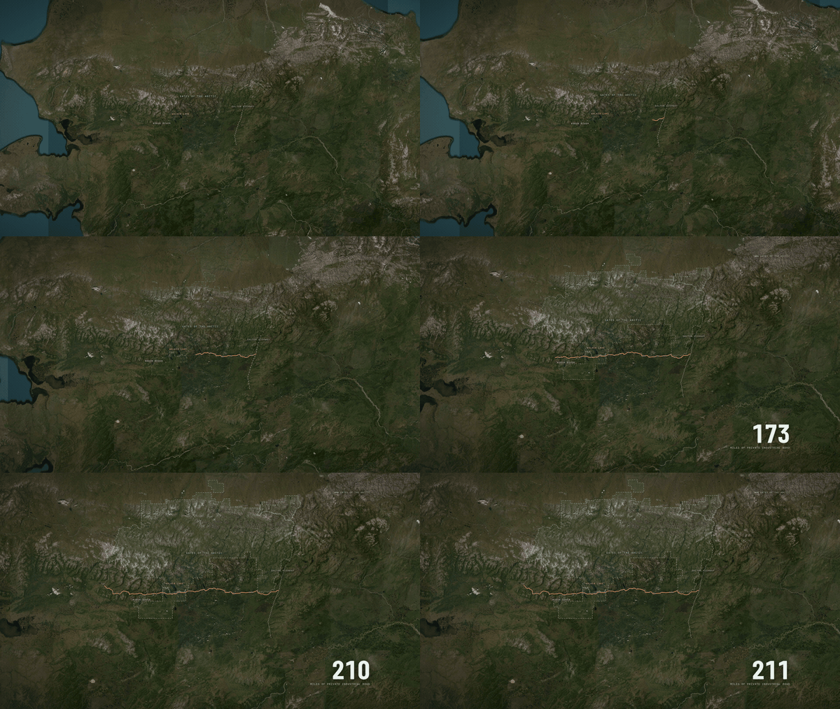
The 211-mile route draws west from the Dalton Highway to the Ambler Mining District, with a mile counter.
Route: AIDEA Alternative A centerline, BLM EIS GIS record, 211.18 miles. Preserve boundary: National Park Service.
Maps and animation: More Than Just Parks. Imagery: Esri, Maxar, Earthstar Geographics. See it live
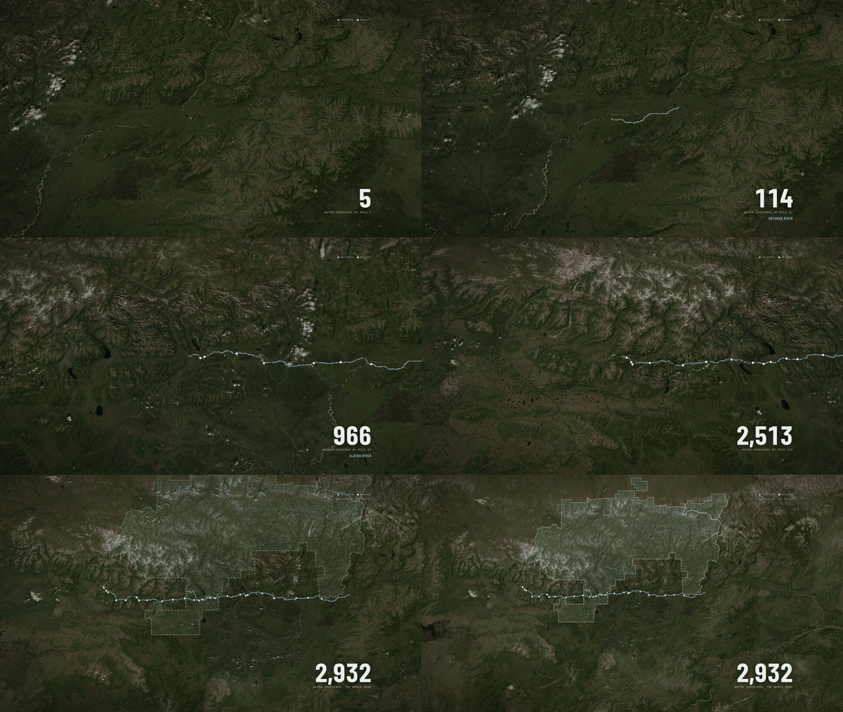
The camera follows the road west and every bridge and culvert lands as the road reaches it. The named rivers flash on the way, and it ends on the national preserve.
AIDEA Alternative A engineering file, crossing inventory, counted by More Than Just Parks; the Record of Decision's structure table totals the same.
Maps and animation: More Than Just Parks. Imagery: Esri, Maxar, Earthstar Geographics. See it live
The interactive map with every layer on: right-of-way, gravel sites, access roads, airstrips, camps, claims, streams and land status. The crossings fill in from mile 0 to 211, colored by who owns the land under each one.
AIDEA Alt. A GIS, USGS National Hydrography Dataset, ADF&G Anadromous Waters Catalog, Alaska DNR, National Park Service.
Maps and animation: More Than Just Parks. Imagery: Esri, Maxar, Earthstar Geographics. See it live
A terrain flight down the centerline from mile 0 to mile 211. A tape on the left counts crossings, bridges, landowner and gravel sites as it goes.
Route, crossings, landowner: AIDEA Alt. A, BLM EIS GIS record. Gravel sites: AIDEA's engineering file. Preserve: NPS.
Maps and animation: More Than Just Parks. Imagery: Esri, Maxar, Earthstar Geographics. Terrain: Mapzen. See it live
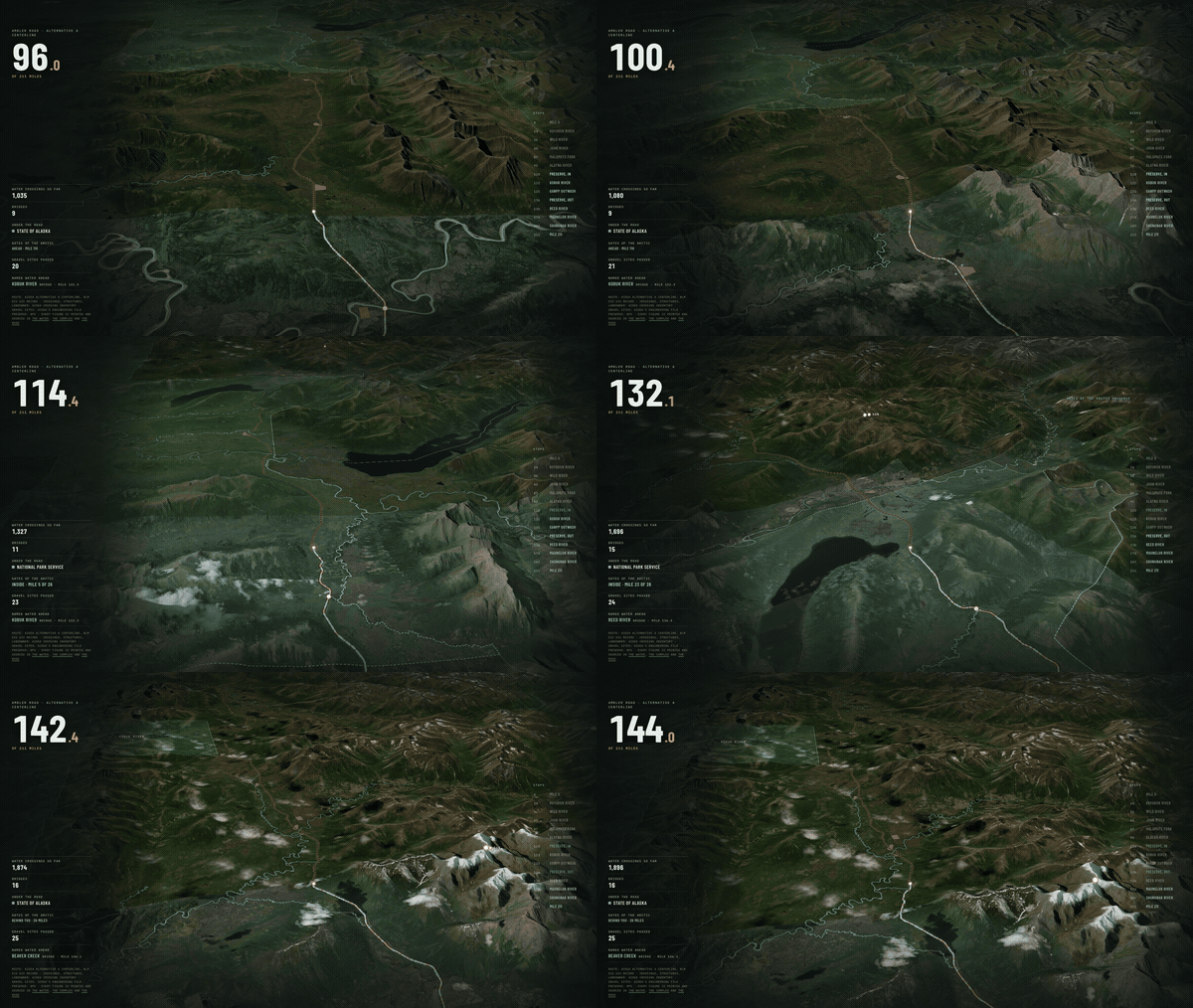
The same flight from mile 96 to mile 144, the stretch through Gates of the Arctic National Preserve.
Route, crossings, landowner: AIDEA Alt. A, BLM EIS GIS record. Preserve: NPS.
Maps and animation: More Than Just Parks. Imagery: Esri, Maxar, Earthstar Geographics. Terrain: Mapzen. See it live
Four more scenes from the scrolling story, each carrying the figure it's about.
Down close to the 250-foot corridor, then out as the rest of the build appears: 137 access-road segments, the gravel mines, airstrips, camps, maintenance stations and towers, to 4,524 acres in all.
AIDEA engineering GIS, BLM EIS record. 2024 Record of Decision, p. 12, component table.
Maps and animation: More Than Just Parks. Imagery: Esri, Maxar, Earthstar Geographics. See it live
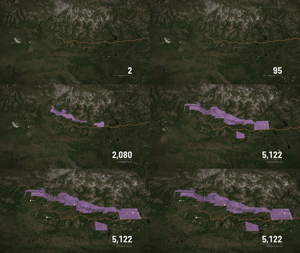
Active state mining claims appear in the order they were staked, from 2 to 5,122, ending on the deposits the road exists to reach.
Alaska DNR state mining claims, date located, counted by More Than Just Parks.
Maps and animation: More Than Just Parks. Imagery: Esri, Maxar, Earthstar Geographics. See it live
Gates of the Arctic, then down into the stretch where the road crosses the preserve: 26 to 27 miles inside the preserve.
Park boundary: National Park Service. 2024 Record of Decision, pp. 9 and 12.
Maps and animation: More Than Just Parks. Imagery: Esri, Maxar, Earthstar Geographics. See it live
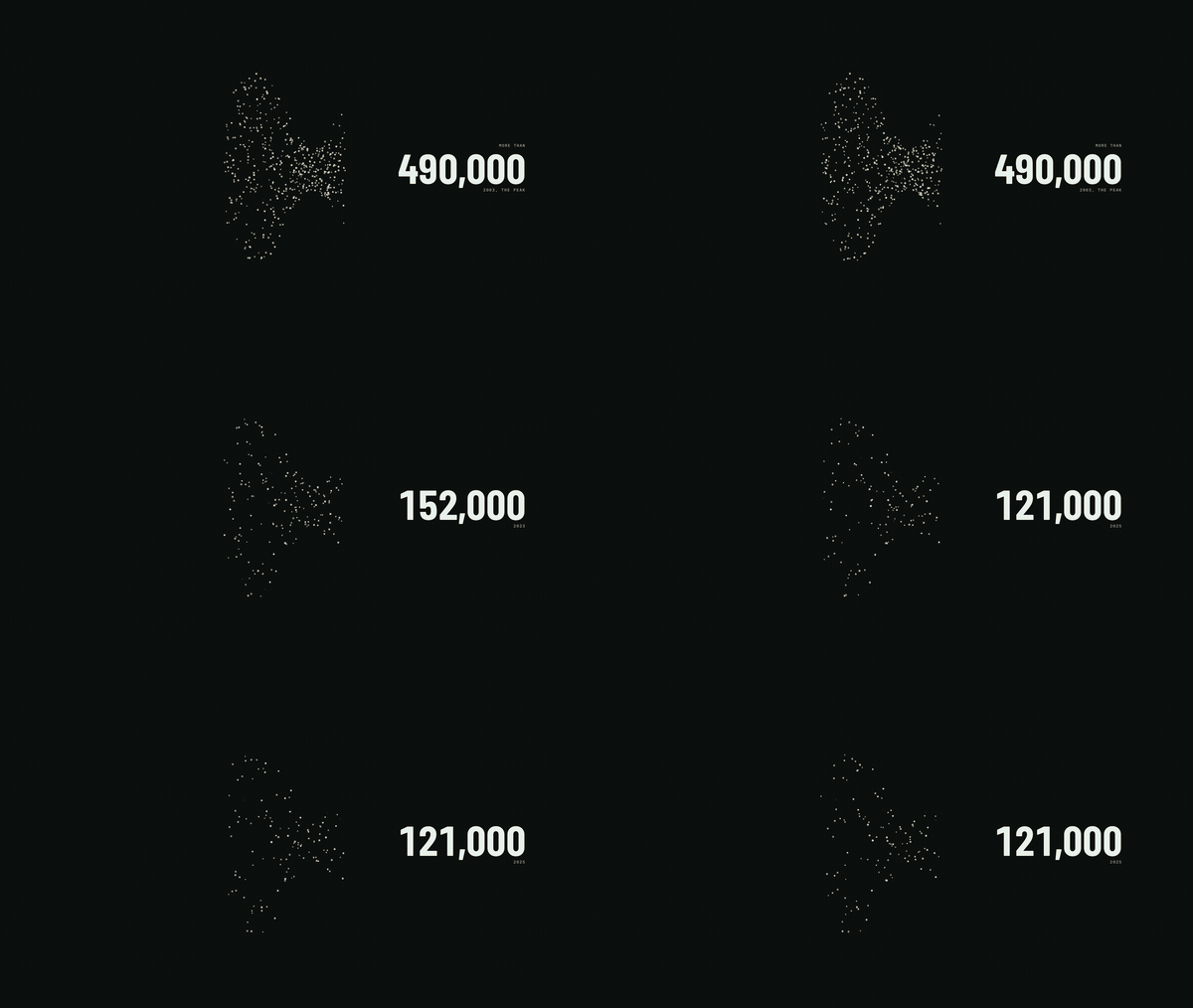
One dot for a thousand caribou: more than 490,000 at the 2003 peak, 152,000 in 2023, 121,000 in 2025.
2020 Final EIS, Vol. 1, p. 155 (Dau 2015). Western Arctic Caribou Herd Working Group, December 2025 meeting record, pp. 2 and 5.
Animation: More Than Just Parks. See it live
Need a different stretch of road, another length, a frame rate for your timeline or a 4K master? Write ask@morethanjustparks.com with what you're cutting and your deadline. The full press kit, with figures, quotes, photographs and charts, is at morethanjustparks.com/ambler-road/press/.