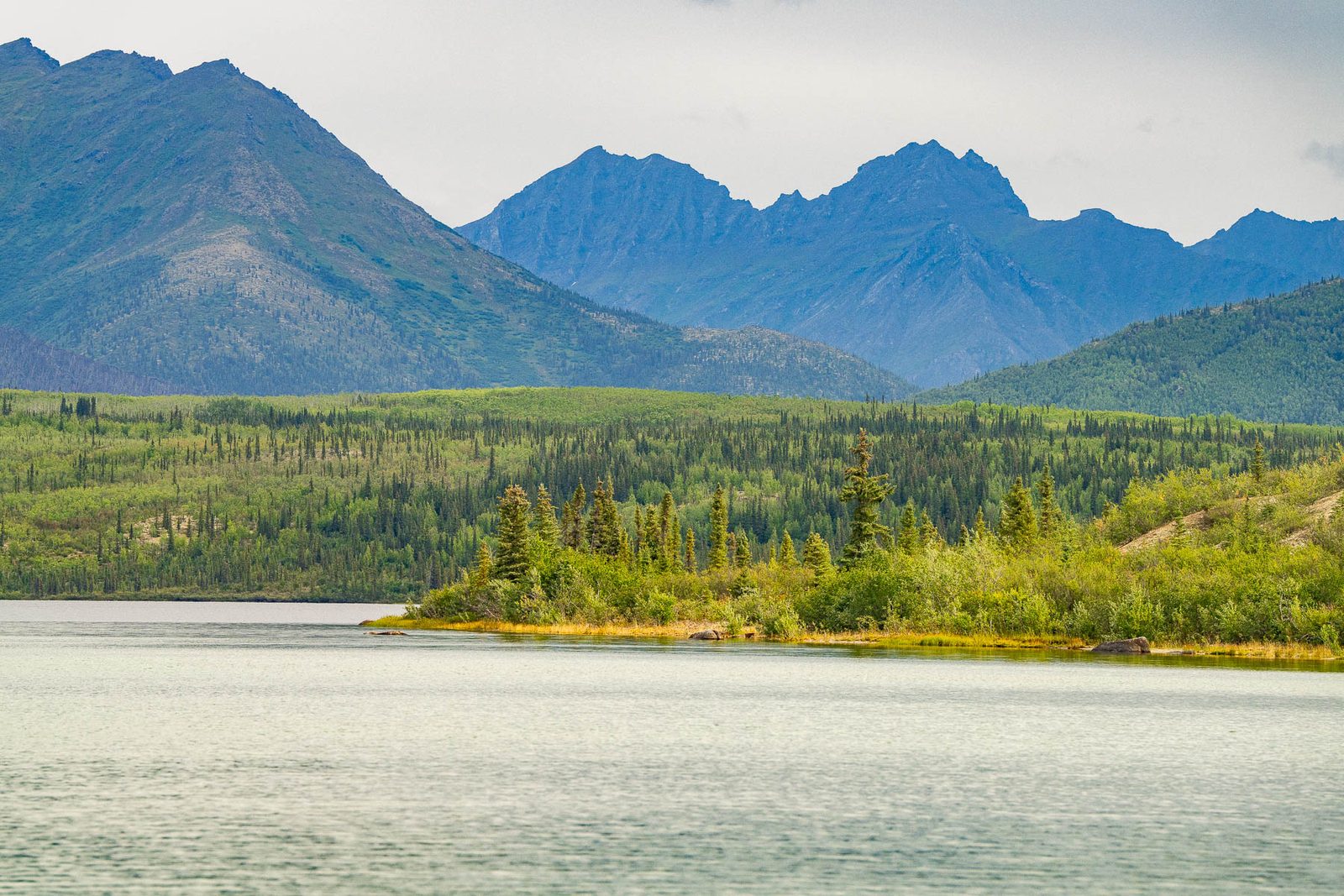
 MORE THAN JUST PARKS
PART III · WHAT IT WOULD COST CHAPTER 1 Measured
The Park Service left a microphone running inside the project area and measured 20.9 decibels. The government's own model of the finished road puts 788 square miles of that country within earshot, and warns in its own words that it will run low if lighter vehicles use the road or trucks drive faster than 45 miles an hour.
What this chapter finds
Before any of this, the National Park Service left a microphone running at a study site on South Walker Lake, inside the area the road would cross. The Final Environmental Impact Statement reports what it found, in one line, quoting the Park Service's own acoustic inventory: the site "had a time-averaged natural ambient sound pressure level... of 20.9 dBA."
That sentence is worth more than any adjective, because it's a measurement. It was taken in a specific place, with an instrument, by the agency that manages the park.
What we aren't saying
You will read that Gates of the Arctic is one of the quietest places in America. We can't source that and we don't print it. The Park Service's own published reference values put remote Grand Canyon trails near 20 dBA and the Haleakala crater near 10. And we haven't found any published decibel figure for Gates of the Arctic as a whole. What's verified is narrower and better: this place, measured, at 20.9 dBA.
20.9 dBA: 2020 Final EIS, page 101, quoting Betchkal 2019. 40 dBA: Shannon et al. 2016, Biological Reviews. Crickets at five meters: National Park Service, Understanding Sound.
The Park Service built a noise model for the road at the Bureau of Land Management's request, and extended it over the full length of every alternative. It's printed as Attachment A to Appendix D of the Final Environmental Impact Statement, and this is its result.
| Alternative | Area affected by noise | Area per mile of road |
|---|---|---|
| A, the chosen route | 788 mi2 | 3.7 mi2 per mile |
| B | 841 mi2 | 3.7 mi2 per mile |
| C | 1,681 mi2 | 5.1 mi2 per mile |
2020 Final EIS, Appendix D, Attachment A, "Predictive Noise Modeling of the Ambler Road", Table 1. The tables in this appendix are not in the text layer most readers get; they were read from the source document.
"Area affected per unit road length" is the agency's own metric, and it's stated in square miles per mile. Square miles per mile is simply miles of average width, so the audible corridor of the chosen route averages 3.7 miles across, for 211 miles. That restatement is ours. The 3.7 is theirs.
Audible corridor: 2020 Final EIS, Appendix D, Attachment A, Table 1. Footprint: 4,524 acres over 211 miles, Record of Decision page 12. Converting the footprint to an average width is our arithmetic, from the agency's two figures.
Exhibit · Figure 22020 Final EIS, Appendix D, Attachment A
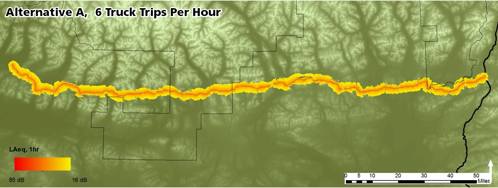
This is the government's own figure, reproduced exactly as it appears in the record and not recolored to suit this page. It's the modeled one-hour equivalent sound level for Alternative A at six truck trips per hour. The band is continuous for 211 miles. Public domain, Bureau of Land Management and National Park Service.
The most useful paragraphs in the appendix are the ones where the modellers describe their own limits. They're worth quoting exactly, because they are the model's own words.
"Under the current development scenario that includes a single mine, the estimated volume of vehicles on the road is 6 heavy truck trips per hour." 2020 Final EIS, Appendix D, Attachment A
One mine. The federal analysis's own scenario for the district assumes four. Six trips an hour is 144 a day, above AIDEA's application figure of 80 and inside the four-mine forecast of 104 to 168, so the model sits below the forecast's peak, not far under it.
"if additional small vehicles are expected to use the road, these models will underestimate the impact of road development. If any vehicles travel faster than 45 miles per hour, these models will also underestimate impacts." 2020 Final EIS, Appendix D, Attachment A
Heavy trucks only, at 45 miles per hour. Every pickup, every fuel tanker, every bus of workers, every vehicle moving faster than 45, all of it sits outside the model, and the agency says so in advance.
There's one more number hiding in that first quotation. Six heavy truck trips an hour is 144 trips a day. AIDEA's application says up to 80 trucks a day. The federal analysis predicts 104 to 168 during Phase 3. The noise model wasn't run on the applicant's number.
Traffic figures: 2020 Final EIS page 44 for AIDEA's 80 per day, page 162 for the 104 to 168 range in Phase 3, page 108 for roughly 170 per day and 60,000 trips a year in the full mining scenario.
Noise is one of the ways a road becomes a wall. Animals cross in the gaps, and the appendix analyses those gaps directly, calling them noise-free intervals.
The appendix is careful and we'll be too. The figure is an average, it's written as an upper bound, and it assumes no knowledge of how the trucks would be spaced: "Without knowledge of vehicle spacing, the anticipated average noise free interval is 9.9 minutes or less." That is the arithmetic of a road that never really stops.
The same section notes something a reader can do nothing with and a regulator could: a lower speed limit lengthens the typical gap between trucks, which means a slower road is a more crossable road.
2020 Final EIS, Appendix D, Attachment A, Temporal Noise Impacts. The appendix cites Barber et al. 2010, Vistnes and Nellemann 2008 and McClure et al. 2013 for noise as a barrier to wildlife movement.
Decibels are logarithmic, which makes them easy to underestimate. The thing that matters to an animal is the listening area: the size of the circle within which it can still hear a rival, a mate, a calf, or something moving toward it.
We stop the arithmetic here on purpose
Running that scaling from a 20.9 dBA baseline up to road levels produces a loss past 99 percent. We don't publish that number. It would be our extrapolation wearing someone else's citation. The three anchors above are what the literature actually measured, and they're enough.
The cleanest evidence that sound alone does this comes from an experiment with no road in it. Researchers put speakers on a ridge in Idaho along a migratory stopover and played traffic noise. No pavement, no traffic, no headlights. Just the sound.
The dose matters at every level tested, which is why 40 dBA is a place where effects start rather than a line below which things are fine.
The acoustic-predator literature is bats and owls. That's the whole list. There's no published study of wolves, foxes or any canid hunting by ear under human noise. Both taxa anyone has tested show steep, dose-dependent losses, and nobody has tested the acoustic hunters that actually live in the Brooks Range. That absence is a gap. It's evidence of neither safety nor harm, and it's worth one honest sentence.
American protected areas are already losing this, and the cause has a name. From Buxton et al. 2017, in Science:
"anthropogenic noise doubled background sound levels in 63% of U.S. protected area units and caused a 10-fold or greater increase in 21%... Elevated noise was also found in critical habitats of endangered species." Buxton et al. 2017, Science
And, from the same paper: "noise pollution in protected areas is closely linked with transportation, development, and extractive land use." The Ambler Road is all three at once.
The appendix says what this particular road would be, without hedging:
"Alternative A represents a noise incursion into Gates of the Arctic National Park, and is predicted to impact federally-designated wilderness and a national natural landmark." 2020 Final EIS, Appendix D, Attachment A
The threshold the modellers chose, they note, follows National Park Service Management Policy 8.2.3: the natural ambient sound level is the baseline against which the impacts of a proposed action are measured. By that standard, the baseline here was measured, and it's 20.9.
The noise chapter is usually filed under wildlife. The federal record doesn't file it there. The same analysis says plainly what construction sound does to the people who use this country for food:
"subsistence users may choose not to access nearby subsistence use areas any longer because construction-related sites, smells, lights, noises, and activities could disturb resources, reduce the potential for a successful harvest, and impact the harvester's experience." 2020 Final EIS, page 214. The same finding appears in the 2024 Supplemental EIS, volume 1 page 304 and volume 2 page 405
A restriction on subsistence doesn't require a fence or a regulation. The agency's own language is that people may simply stop going. That's what an audible corridor 3.7 miles wide and 211 miles long means for a household that has hunted or fished inside it.
What this chapter doesn't say
It doesn't give a decibel figure for the road. The appendix models areas and maps, not a single headline level, and no projected dBA for the Ambler Road goes on this page until one comes out of a source we hold.
40 dBA isn't a safe threshold and not a regulatory limit. It's where documented responses begin in a review of the literature. Roughly a fifth of the papers in that review found impacts below 50 dBA, and that's a share of papers, not a share of species.
20.9 dBA is one study site, not the whole park. It's the number the federal record reports for a place inside the project area, and that's all we claim for it.
The community audibility finding belongs to a different route. The appendix predicts noise audible in several rural Alaskan communities under Alternative C, which isn't the alternative that was chosen. We don't attach it to Alternative A.
The modeling floor isn't the ambient. The models are clipped at an LAeq of 16 dB, which is a tenth-percentile summer level, a different metric from the 20.9 dBA time-averaged ambient. The two aren't interchangeable.
A National Park Service study site at South Walker Lake, inside the project area, recorded a time-averaged natural ambient of 20.9 dBA. That's a measurement, not an adjective.
2020 Final EIS, Chapter 3, Affected Environment.The government's own model puts 788 square miles within earshot of the chosen route, an audible corridor averaging 3.7 square miles for every mile of road.
The model assumes heavy trucks only, at 45 miles per hour, and its appendix says it will underestimate the impact if smaller vehicles use the road or any vehicle drives faster.
2020 Final EIS, Appendix D, Attachment A, "Predictive Noise Modeling of the Ambler Road."Measurable wildlife responses begin around 40 dBA, roughly the loudness of crickets at five meters. The cost of noise is a collapse in how far an animal can hear. The Caribou follows what the record says about the herd that migrates through this country.
The effects literature cited under How we know on this page.Every federal figure on this page comes from the 2020 Final Environmental Impact Statement and its appendices, which are in our document record and searchable by passage. The noise appendix is the one document in this project that nearly didn't get read. Its tables don't survive the text extraction that most readers and most search tools rely on, which is why its numbers have circulated as approximations for years. We read them out of the source document on September 11, 2026.
Every published study is cited where it's used, by author, year and journal, so the claim and the paper can be checked against each other rather than against us.
The soundscape of a national park unit isn't an abstraction in federal law. Park Service policy makes natural ambient sound the baseline against which a proposed action is judged, and the agency's own appendix calls this road a noise incursion into Gates of the Arctic.
Call the Capitol switchboard at (202) 224-3121, ask for your senators and representative, and ask a question specific enough that a staffer has to write it down: the government's own noise model says this road puts 788 square miles within earshot, on the assumption of a single mine and no traffic but heavy trucks. What's the federal position on a private industrial road whose modeled noise footprint is a hundred times wider than its physical one?
If you want to read the appendix yourself, it's in the record, and so is everything else cited here.