
From our experience filming and traveling across the country, we’ve driven just about every major scenic route in the national park system. What follows is a road trip guide built from the ground up on real knowledge of these roads.
We’re also going to talk about why you shouldn’t bring a banana or apple across the state lines on multi-state California road trips. Seriously.
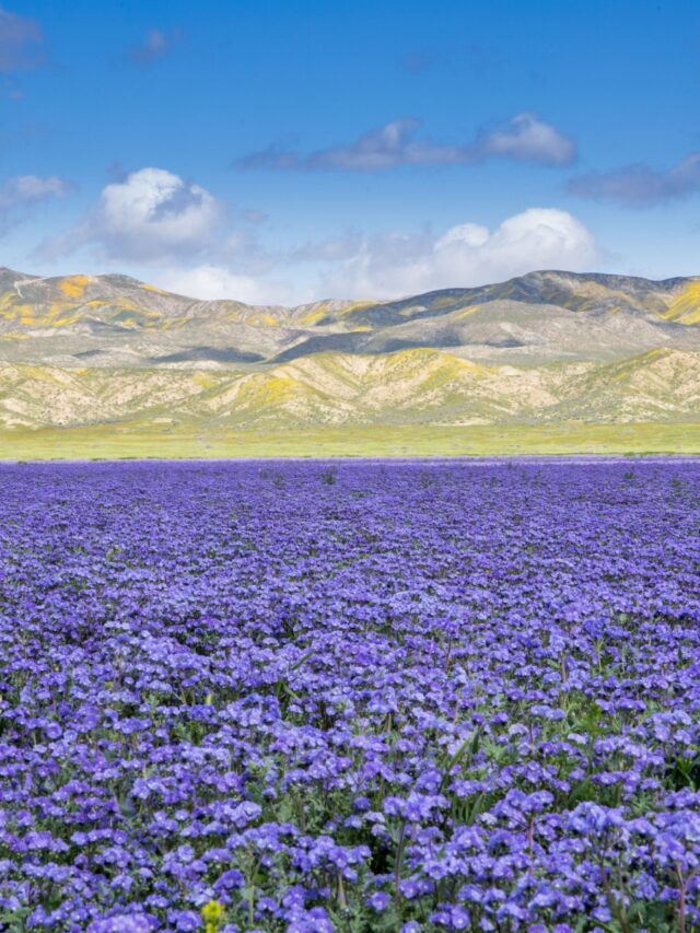
POP QUIZ: One of the best California road trips takes you to the largest lake in California! Can you name that lake? The answer is coming up!
Best Coastal California Scenic Drives
The Pacific Coast Highway (PCH), also known as Route 1, takes on different scenic byway titles throughout its 650 miles along the California coast. You can extend California road trips to drive the entire nearly 1700-mile path to Washington.
117 public lands destinations are under threat. Get the free briefing that 27,000+ people use to stay informed and take action.
However, if you have to choose certain sections for various California road trips, you won’t be disappointed with any of them.
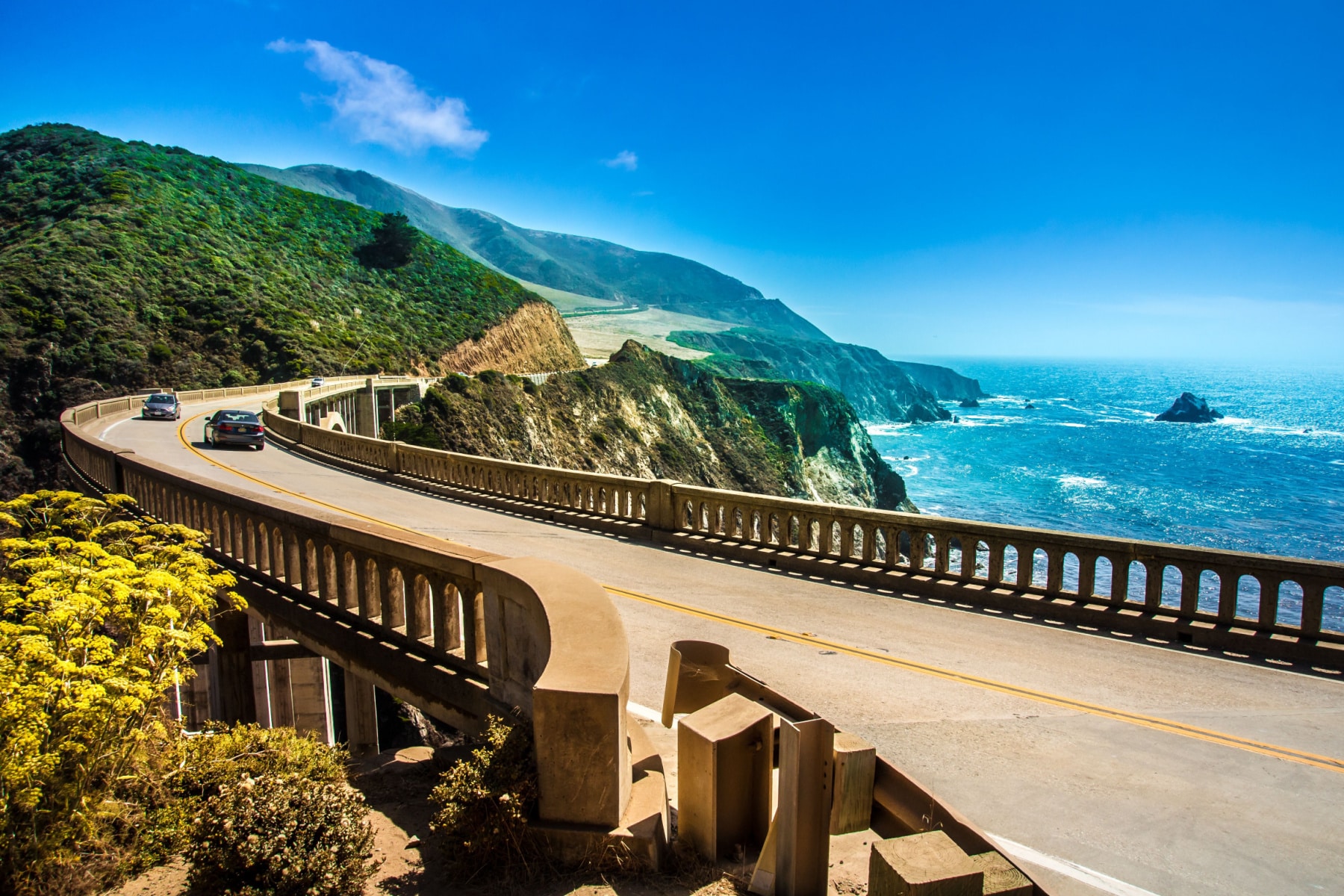
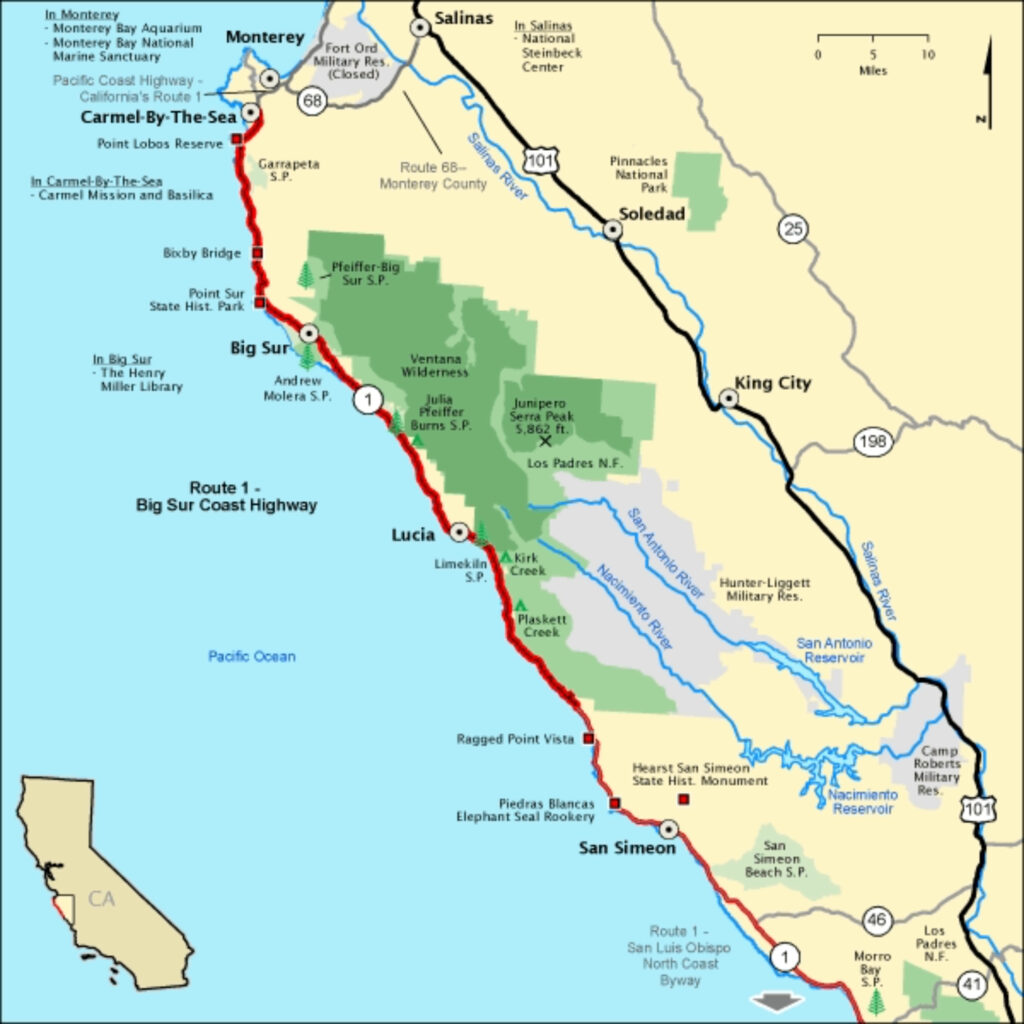
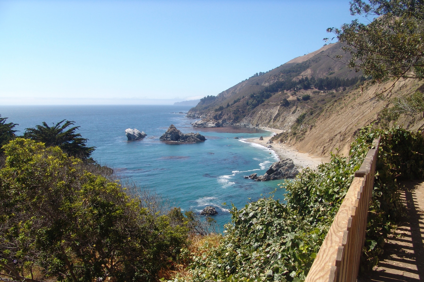
Big Sur Coast Highway Route 1
Length: 72 Miles
Duration: 1.5 hours without stopping, but plan for a 5-8 hour day.
Seasonal Risks?: Open year-round. Mudslides and wildfires could lead to road closures.
Katy Perry said it best, “You could travel the world, but nothing comes close to the Golden Coast” in her hit song California Girls.
The famous California road trip on the Pacific Coast Highway takes you from San Luis Obispo to Carmel-by-the-Sea on this stretch of road. It ranks as one of our Top 5 Road Trips USA. It’s likely the most popular of all the California road trips, but that also means you should expect traffic.
You’ll drive at sea level before rising on the ridge of cliffs and pass redwoods that give you a taste of what’s to come on California road trips in the northern part of the state. And if you don’t know much about California, it’s helpful to know the vibes are totally different. There’s a reason they keep trying to split the state in two.
This is one of the California road trips that should be on your list.
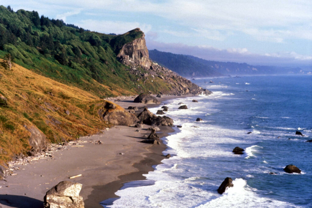
Redwood Highway
The most important tool you can have for California Road Trips is CalTrans. Use the Quick Map option to check road conditions by region. In the mountains, California road trips can be detoured or stopped due to snowfall, high winds, or other extreme weather, like wildfires.
Length: Up to 200 miles
Duration: 3-4 hours, but you’ll stop so many times you should plan for 8-12.
Seasonal Risks?: Open year-round. Mudslides, wildfires, and winter weather could impact roads.
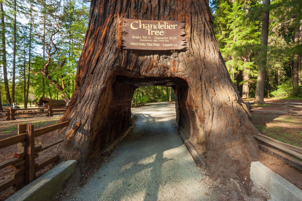
Big Sur offers a lot for California road trips, but on the northern California stretch of the PCH, you get something you can’t do anywhere else: drive through a tree. The Redwood Highway weaves on and around the coastline on Highway 101 (Route 1 turns into 101).
You’ll pass through Redwood National Park and the associated state parks, where the tallest trees on earth stand at attention near this and other California road trips.
At the same time, you’ll have shoreline views to look forward to, and I’ve got a secret California road trip for you. Take one of these rugged routes in Redwood National Park to get the best coastal views.
Take the Avenue of the Giants to drive 31 miles through three redwood trees carved for car access in Humbolt Redwoods State Park. It’s one of the most popular Northern California road trips of all the great options.
After Klamath, the road veers back toward the coastline with those rugged coastlines and crashing waves for the next choice of your California road trips.
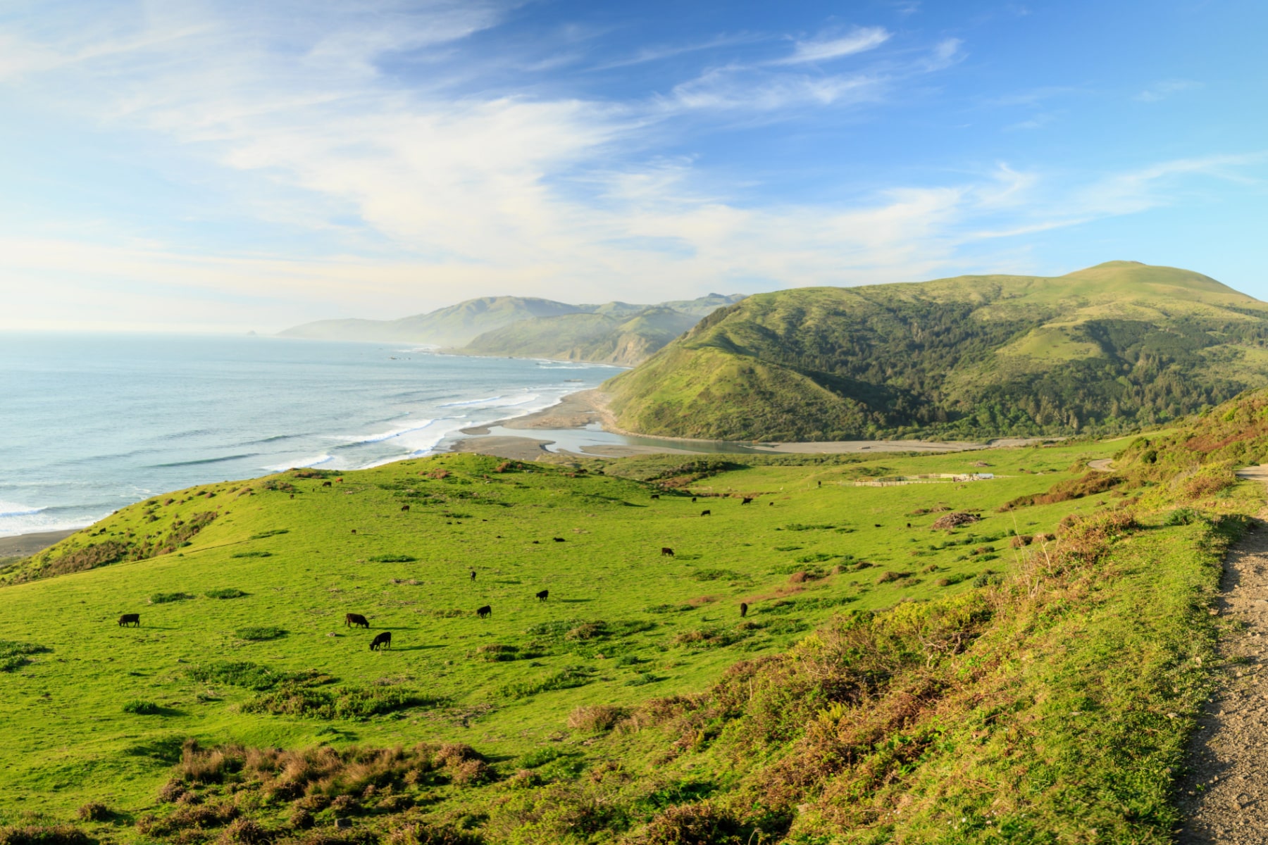
The Lost Coast Scenic Byway
Length: 100 Miles
Duration: 4 Hours
Seasonal Risks?: Possibly, check road conditions.
Many California road trips take you down the well-beaten path of the coastline. Somehow, The Lost Coast of Northern California stays somewhat lost, yet stays easy enough to find. It’s an unmatched option among great California road trips.
Accordingly, this paved road takes you through a mix of everything that makes California road trips great: rolling hills, dense forests, coastal views, and small towns brimming with unique charm.
This trip veers off the PCH to Matteole Road near Ferndale. We highly recommend you take this California road trip counterclockwise so you can meander down the road with coastal views that rival Big Sur.
The only difference on The Lost Coast is that you won’t find beachfront developments or roadside attractions outside of the towns along this California road trip. It’s the true California coastal wilderness. Those with high-clearance 4WD vehicles will find additional ways to extend California road trips.
TRAVEL TIP: Want to stretch your legs? Park at Matteole River Beach and hike to the Punta Gorda lighthouse, which was rehabilitated in 2022. Take this trek at low tide or risk impassable trail sections or getting trapped at high tide. It’s one of the best detours of all California road trips.
Map of Coastal California Road Trips
Best Mountain California Road Trips
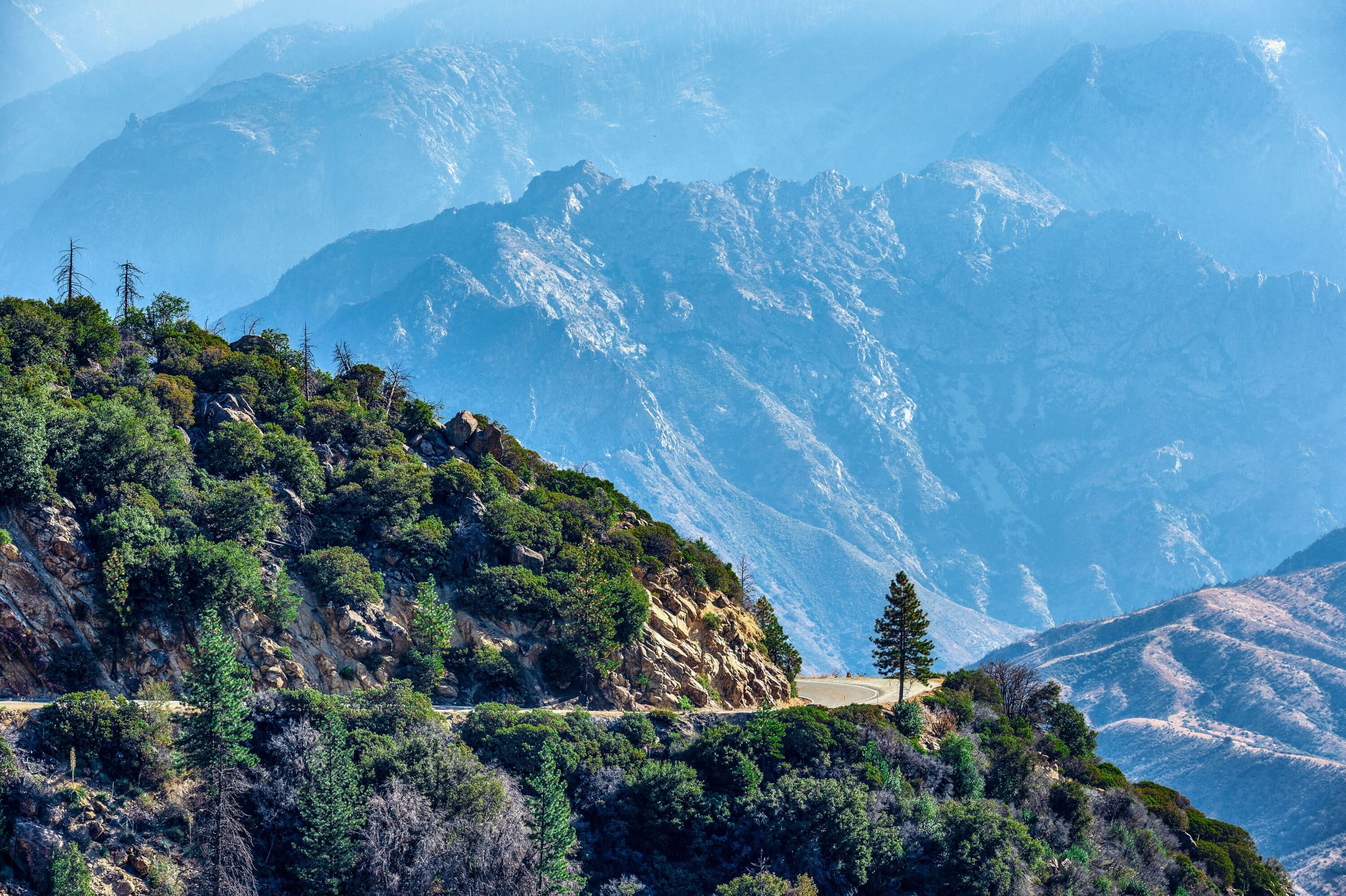
Kings Canyon Scenic Byway
Length: 50 Miles
Duration: 2-3 Hours
Seasonal Risks?: Closed in winter, generally November through May. Check road conditions.
First of all, if a place is so divine that John Muir, Father of National Parks, says a place rivals Yosemite, can you really afford to miss the comparison on your California road trip?
“Thus it appears that this new Yosemite is longer and deeper, and lies embedded in grander mountains, than the well-known Yosemite of the Merced.”
John Muir, “A Rival of the Yosemite”, Father of National Parks
The 50 glorious miles rank among the best California road trips. Look at it this way, you get to drive deeper than the Grand Canyon, see sights that “rival” Yosemite, explore caves, and see waterfalls along the way. Did we mention the sequoias? The second-largest one in the world, General Grant, is right off the route.
In addition, taking this California road trip requires a pass to Kings Canyon National Park. However, Sequoia National Park is under the same management. That’s why you’ll formally see them referred to as Sequoia & Kings Canyon National Parks. Tack on another 50 miles or so on your California road trip to add the Generals Highway through Sequoia National Park.
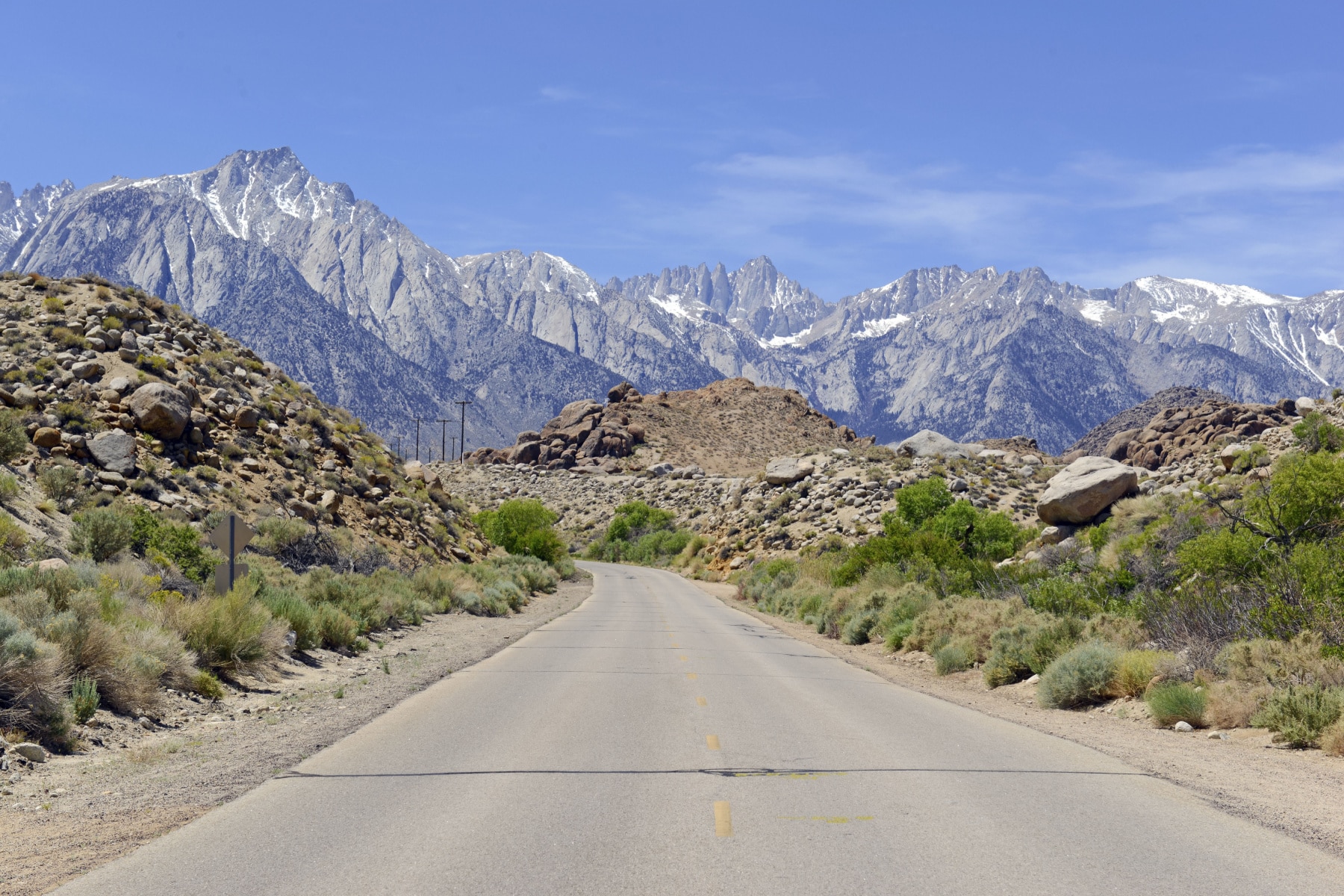
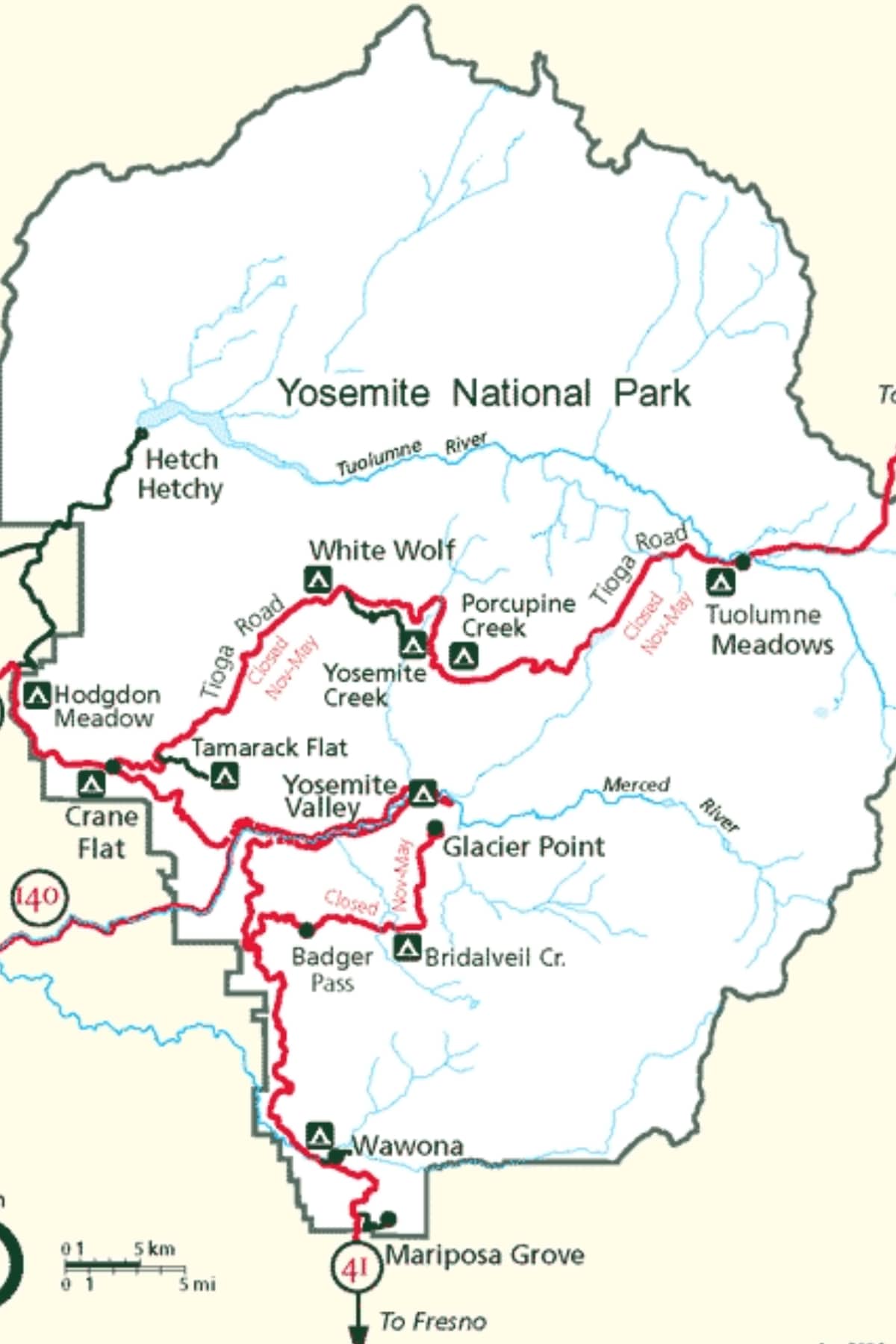
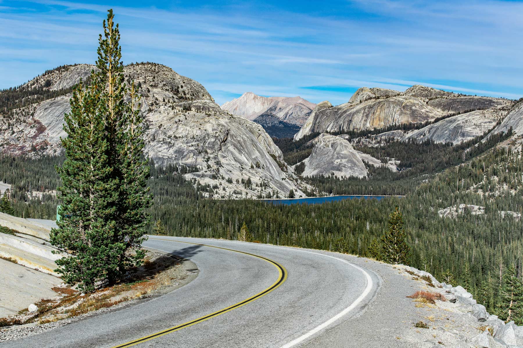
Tioga Pass
Length: 64 Miles
Duration: 1-2 hours without stopping, but you’ll want to stop, most likely.
Seasonal Risks?: Closes from November through late May, but check road conditions any time of year for storm damage or early/late winter weather.
First of all, this is the highest mountain pass road in California. Tioga Pass Byway is a route through the Sierra Nevada Mountains in California, offering a sensory feast compared to all California road trips.
This winding road, which reaches elevations over 9,000 feet, is a gateway to Yosemite National Park. Additionally, you’ll see Yosemite favorites like Half Dome, El Capitan, and the Tuolumne Meadows while exploring this California road trip.
Those taking California road trips with pets will enjoy dog-friendly trails like the Nunatak Tioga Tarns, which is just past the start of Inyo National Forest.
TRAVEL TIP: Plan for traffic during the high season of summer on a California road trip, and add at least 1-2 hours to the time it will take to complete this trip. Arrive before 8:00am for the lowest traffic volume.
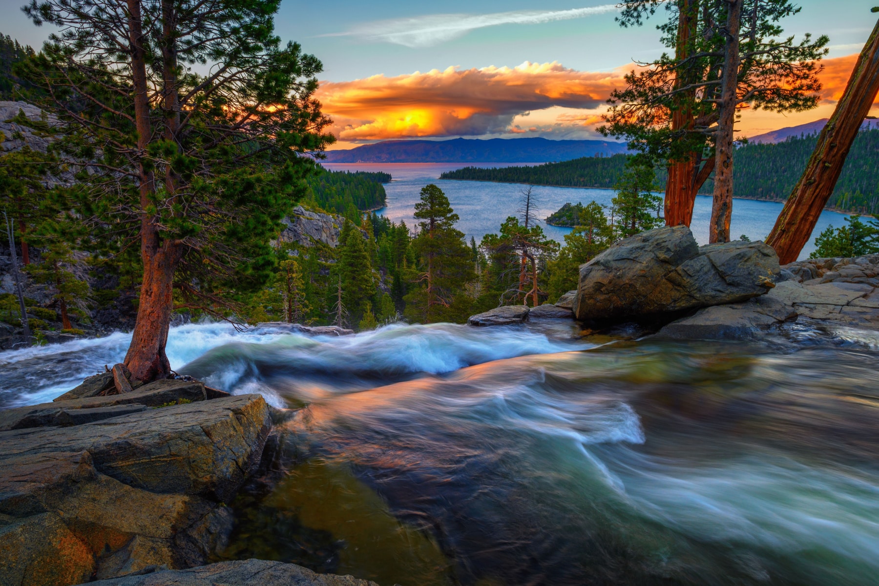
Lake Tahoe Scenic Byway
Length: 28 miles for the scenic byway, 72 miles to complete the look around Lake Tahoe
Duration: 2-3 hours
Seasonal Risks?: Wildfires can close the road any time of year, and winters can cause intermittent closures due to heavy snow.
The Lake Tahoe shoreline has been called “The Most Beautiful Drive in America.”
I’ve driven these California road trips so many times that I can still picture every twist and turn in my mind. The formal Lake Tahoe National Scenic Byway technically spans the Nevada side, from Stateline to Incline Village.
The California leg goes from Kings Beach to Stateline, hugging the western edge of Lake Tahoe for nearly 42 miles.
If you’re a fan of dog-friendly California road trips, mark Carnelian Bay on your map. A dog beach right next to Garwoods makes for a wonderful rest stop.
Along the way, you simply must stop at Emerald Cove and enjoy the scenic overlook before walking down the steep path to the shore. There’s a castle down there, in addition to a tea house island!
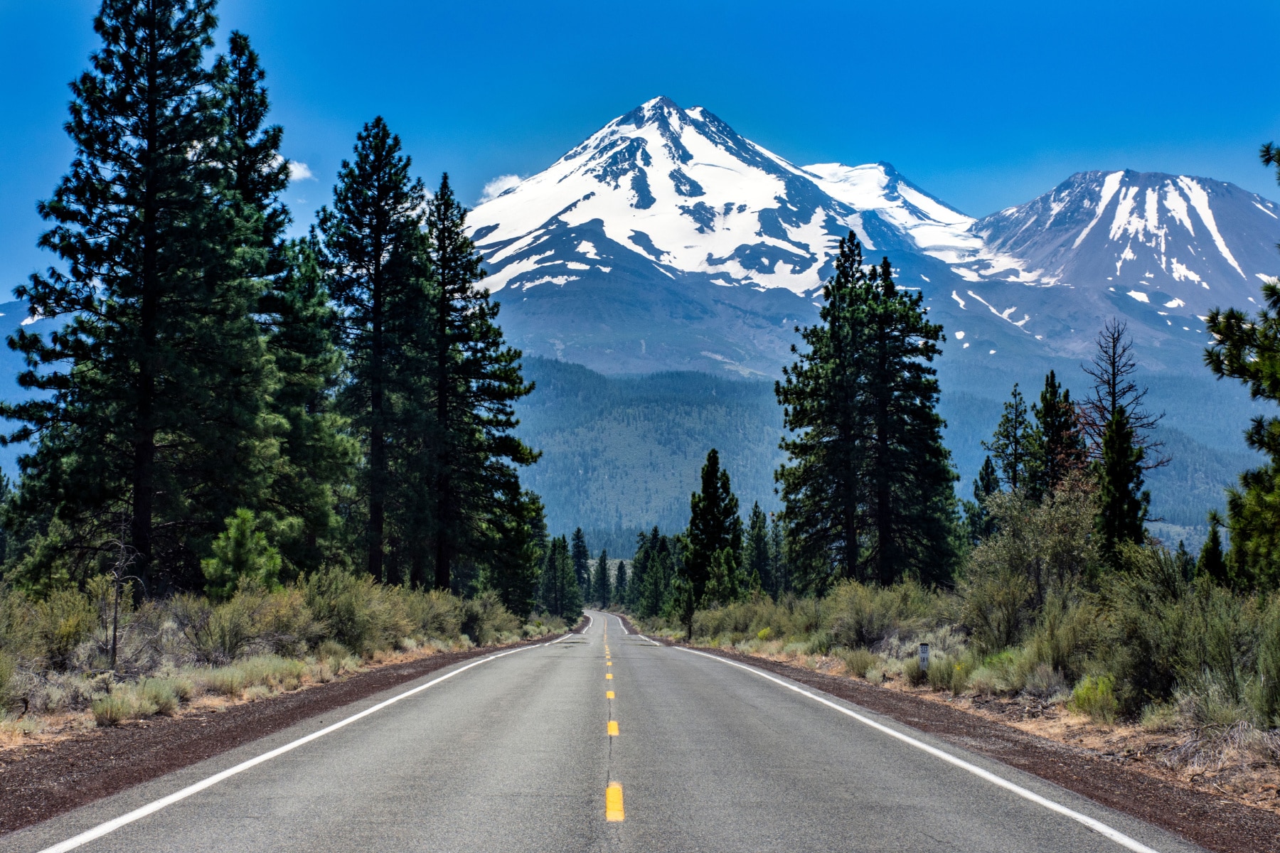
Volcanic Legacy Byway (Mount Shasta)
Length: 445 Miles (but can be taken in smaller sections)
Duration: 10-12 hours, but ideal as a long weekend
Seasonal Risks?:
The California road trip section of the Volcanic Legacy Byway offers an extraordinary journey through a landscape shaped by ancient volcanic forces and takes you through the shadow of the impressive Mount Shasta.
Of all the California road trips that have waterfalls, Burney Falls at McArthur-Burney Falls State Park should be on your driving bucket list. President Theodore Roosevelt called it the “8th Wonder of the World.”
Along the way, you’ll also pass through:
- Lassen Volcanic National Park
- Shasta Trinity National Forest
- Butte Valley National Grassland (The only designated federal grassland in California)
- Butte Valley Wildlife Area
“TRAIN!!”: Fans of the movie Stand By Me should consider a stop at Lake Britton to check out the famous bridge that had all of us terrified to ever cross a train bridge for the rest of our lives. It’s a famous stop on this California road trip.
Map of Mountain California Road Trips
Best Desert California Road Trips
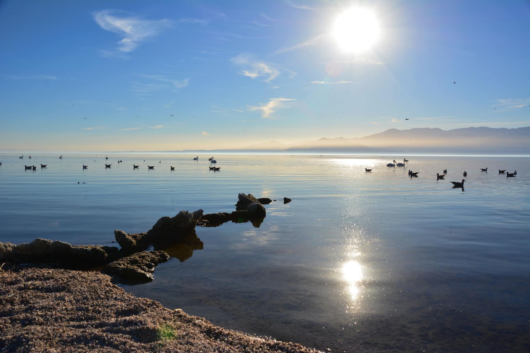
Salton Sea “S22”
Length: 47 miles with an optional 38-mile addition to take The Triangle through Anza-Borrego Desert State Park.
Duration: 1-2 Hours
Seasonal Risks?: Flash flooding could lead to closures. Part of the state park is closed from June 1 through September 30 due to extreme heat.
Of all the desert California road trips, the one to the Salton Sea might be the least appreciated, at least for those not familiar with the state.
Incidentally, it’s not really a sea. It’s a lake. The largest lake in California, about the same size as San Diego, in fact.
Despite its attractive appearance, this place stinks – literally. Accordingly, it’s considered one of the worst environmental disasters in California after a stint as a resort destination. The problem stems from the lack of freshwater inlet and the runoff, mixed with agricultural runoff, that once sent toxic dust plumes to surrounding towns. This is one of the California road trips with an environmental lesson along the way.
Salton Sea Directions
You can take your California road trip down the S22 from the Salton Sea through the desert or start the S22 just off San Felipe Road. You’ll go through typical, low-lying desert landscapes flanked by mountains. Pass through the Montezuma Valley, and you’ll be rewarded with eclectic roadside attractions along the way.
Driving 4WD?: Adventurers who love places like The Narrows of Zion or Wall Street at Bryce Canyon National Park should work the Calcite Mine Trail into this trip. You’ll need a rugged vehicle to get to the trailhead and then explore the slot canyon trail, which is almost four miles out and back.
Once you arrive at the sea (uh, lake), you can enter the Salton Sea Recreation Area and explore the perimeter. Finally, you can look for the mud pots, one of the lake’s thermal features. This road trip is for the eclectic, quirky traveler.
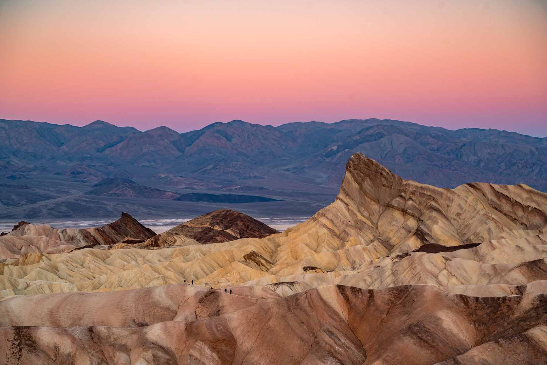
Death Valley Scenic Byway
Length: 130 Miles
Duration: 4 Hours
Seasonal Risks?: Summer heat can be fatal if you aren’t prepared, and flash flooding can cause injuries and damage to travelers and roads. Check road and park conditions first.
The Death Valley Scenic Byway, also known as California State Route 190, offers an unforgettable journey through the stark and mesmerizing landscapes of Death Valley National Park. Without a doubt, it’s one of the most popular California road trips.
Badwater Road takes you to the iconic Badwater Basin, the lowest point in North America, where you can walk out onto the vast salt flats and witness the unique natural formations. In addition, Panamint Valley Road leads you through the rugged Panamint Valley, providing a striking contrast to the salt flats with its towering mountain ranges.
Father Crowley Vista Point Road is a short detour that rewards you with views of the Panamint Mountains and the narrow canyons below.
While on this byway, don’t miss Zabriskie Point (seen below), a famous viewpoint offering a surreal landscape of eroded, multicolored badlands.
Joshua Tree National Park Loop
Length: 80 miles
Duration: 2 Hours
Seasonal Risks?: Summer heat, flash flooding and storms can cause travel troubles. Check park and road conditions before you go.
California road trips need a great playlist, and we recommend putting on U2’s Joshua Tree album before taking the Joshua Tree Scenic Byway. First, look at the route for Park Boulevard. If you’re in a regular vehicle, you’ll be fine. However, if you want to up the adventure on this California road trip, bring a 4WD high clearance vehicle to explore the dirt roads of this desert delight.
A great halfway mark to stretch your legs (or arms, if you’re a climber) is the Hall of Horrors. Don’t worry, it’s only “horrific” if you don’t like tight spaces, as it’s a narrow slot canyon.
Without reservation, I recommend this as one of your California road trips timed to see either the sunrise or sunset (or both!).

Map of Desert Scenic Drives in California
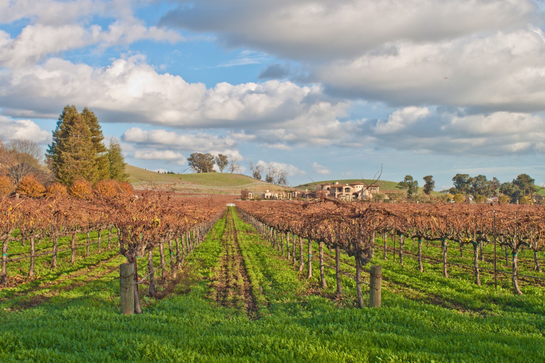
Napa Valley Scenic Drive
Length: 80 miles
Duration: 1 Hour
Seasonal Risks?: Minimal
California road trips through Napa Valley showcase pastoral perfection, but you can also extend that route from the valley to the foothills all the way to Lake Berryessa.
First, you don’t want to take a scenic drive on any of these California road trips if you’ve been sampling the wines. That is why we aren’t going through the wineries on this route. However, you be able to make a must-visit of beautiful places you want to visit when you’re ready to sip the day away.
Second, you’ll want to take the famous Silverado Trail, which runs from Napa to Calistoga. That in itself is one of the best shortened California road trips, spanning about 35 miles. Turning onto Monticello Road (Highway 121), you’ll head into the Vaca Mountains
TRAVEL TIP: Look for Old Man Rock along this California road trip, an outcropping of rocks that look like the face of an old man.
Wine to Waves Highway 128
Length: 142 Miles
Duration: 3-4 Hours
Seasonal Risks?: Minimal, but check road conditions.
To begin with, you should know that this longer California road trip (as the name suggests) takes you from Wine Country to the Pacific Ocean.
You’ll follow Highway 128 from Mendocino to Winters. Along the way, you’ll pass the key locations of St. Helena and tackle the Silverado Trail. You can also stop at the Old Faithful of California if you want to shell out $15 bucks to see it.
Lighthouse lovers should consider extending California road trips to include the Point Cabrillo Lighthouse, just three miles up the road.
Saint Helena to Calistoga Loop
Length: 60 miles
Duration: 1-2 Hours
Seasonal Risks?: Minimal, but check road conditions as wildfires or mudslides could close roads.
Consider this among your California road trip contenders as it hugs the western edge of the Napa Valley mountains. This road is also perfect for those who want to take a long bike ride as a break from the road trip in the car.
In all honesty, you can couple or trifecta these three California road trips to experience the majority of Napa Valley’s scenery, from mountains on both sides of the valley up through the heart of Wine Country.
Get Your Kicks on Route 66
Length: 315 Miles
Duration: 6 Hours
Seasonal Risks?: Flash flooding, extreme heat.
The Mother Road might be mixed in with major highways in California, but there’s still a notable stretch of Route 66 that clings to the “good ole days” of California road trips. That includes a stop in the famous Amboy, where Roy’s Motel Cafe is once again open to weary travelers.
One thing I love most about California road trips is the off-road adventures, Route 66 has the Pisgah Crater and Glove Cave, which is really a lava tube. Please respect private property lines and don’t cross them. The caves have sign-in sheets and the Leave No Trace guidance.
You can also visit the BLM property Amboy Crater to explore public lands. These ancient lava fields give a whole new eerie vibe to the SoCal desert and add value to all California road trips.
Don’t just drive by Victorville, as that’s where the Route 66 museum is located. Once you’re past Bartstow, you’ll take major highways all the way to Santa Monica to complete this most famous of California road trips.
Yuba-Donner Scenic Byway
Length: 115 miles
Duration: 2-3 Hours
Seasonal Risks?: Possible closures in winter due to snow or year-round due to wildfires. Bring snow chains from October through May.
The Yuba-Donner Scenic Byway is a picturesque and historically rich California road trips option located in the Sierra Nevada Mountains of Northern California.
The byway’s best place to start is at Donner Lake State Park. This is the approximate location where the ill-fated Donner Party was stranded for months in 1846-47.
As soon as you reach the parking area, look for the Donner Party statue. The base of the statue shows you the depth of the snow that awful winter as the families resorted to cannibalism to survive.
Watching the movie in the visitor’s center will shed an enlightened light on the rest of any regional California road trip.
Of all the California road trips in the Sierras, this one goes around Tahoe National Forest and through several historic towns.
California Road Trips Tip: Combine the Donner/Yuba scenic drive with the Lake Tahoe loop for six hours and 241 miles of Sierra Nevada history and magic.
Gold Rush Trail
Length: 320 Miles
Duration: 3-4 Hours
Seasonal Risks?: Possible winter weather closures or detours
While all California road trips are gems, this one is pure Gold. The Gold Rush Trail, also known as the Golden Chain Highway, follows Highway 49 through the earliest of Golf Rush towns, including Coloma, where it all started.
The most authentic of Gold Rush towns is at Columbia State Historic Park. For the “Oldest, Richest, Deepest Gold Mines in California,” set your GPS to the Empire Mine State Historic Park. You can pan for your own gold at the Marshall Gold Discovery State Historic Site, with a detour that takes you on California’s “Shortest State Highway,” Route 153.
Finally, you can also make a detour to see the unique Red Hill Recreation Management Area.
DID YOU KNOW?: James Marshall, the man who found the first speck of gold, never reaped the rewards. He found it while building a sawmill, and the discovery that was supposed to be secret leaked. That caused the Gold Rush and all of Marshall’s workers to leave. He spent the rest of his life on the brink of bankruptcy.
Essentials for California Road Trips
We have all the tools you need to plan California road trips and beyond. Check out our Essential Road Trip Packing Guide and click on the image below for the best tools of the road trip trade.
Mountain DRIVING: If you’re taking one of the California road trips through mountains, call the CalTrans Highway Information Network at 1-800-427-7263 ahead of time.
In addition, check wildfire conditions before you head out on a California road trip through CalFire. You’ll want to check the location you plan to travel and see if there’s a prescribed burn or working fire and if the air quality along your route is impacted.
California Driving Age Laws
In California, drivers 16 and 17 years old can get provisional licenses. It’s not until they turn 18 that they can get the full access license. If you are traveling with someone who can drive under the age of 18, they are allowed to drive for up to 10 days after entering the state, provided they have a legal out-of-state license.
California Produce Checkpoints
I wasn’t kidding about that banana. California Border Protection Stations are located along several of the scenic byways. The workers perform agricultural inspections, including checking any fruit, plants, or firewood you’re bringing into the state. This is to stop the spread of invasive species.
Agriculture is a $22.5 billion dollar industry in California, and your desire to have an orange on your hike isn’t going to outweigh the potential risks. To be safe, simply wait until you get to California to buy fruit. Only buy firewood from local vendors near your campsite to protect against other kinds of invasive species.
If you want to tackle the entire coastline/state/mountain ranges/etc. on California road trips, 7-10 days will allow you to travel at your own pace and stop as often as you’d like. California road trips along the PCH will take 10-12 hours, so you could make it in a weekend, but you’d have very few stops. I’d say, at a minimum, plan for 3-5 days.
Late spring is one of the best times to take California road trips on the PCH. It’s before the Santa Ana winds fire up and late enough in the year that you should have great weather all the way. Northern California is outside of its rainy season, too. The worst time to take a California road trip, especially in the desert, is during July and August. Temperatures are scorching in the deserts, and tourism crowds are large statewide.
Some of the most dog-friendly destinations are on the best California road trips. Big Sur offers dog beaches, and Carmel-by-the-Sea is ranked as one of the top dog destinations. Lake Tahoe also loves dogs, with plenty of outdoor dining open to leashed and well-behaved pets. Mammoth Lakes is preferred over Yosemite’s dog restrictions. It’s too hot in the summer for California road trips with dogs in the desert.
It is always ideal to take California road trips with the coast on your right so you and your passenger get direct views of the coastline without traffic or trucks blocking the open views.
Picking the Perfect California Scenic Trip
Without a doubt, the Big Sur stretch of Highway 1 on the PCH is the top California road trips pick for 9 out of 10 people you’ll ever ask. The road was closed due to a massive rockslide in 2026, so check the conditions before you go. This can happen too often on this stretch of road, which is another reason to have a backup road trip plan.
Of course, Tioga Road, Death Valley, Joshua Tree, and Kings Canyon will be additional top picks when you ask around.
What we hope we’ve done here is highlight the major scenic roads but give you more options on less-traveled California road trips. Wherever your adventure takes you, we’d love to see your photos. Share with us on Facebook or Instagram.
Helpful Related Links
- Pacific Coast Highway: The Pacific Coast Highway road trip
- California national parks: The national parks of California
- Things to do in Yosemite: The best things to do in Yosemite
- Death Valley: Things to do in Death Valley
- West Coast parks: The best West Coast national parks
- Oregon road trip: The Oregon road trip
- National park road trips: The best national park road trips