
Established
1906
Size
52,485 acres
Visitors / yr
540K
Entrance
$30
Best season
May through October
Nearest airport
DRO Durango-La Plata County
01
Why Mesa Verde is worth the trip
Colorado · Established 1906
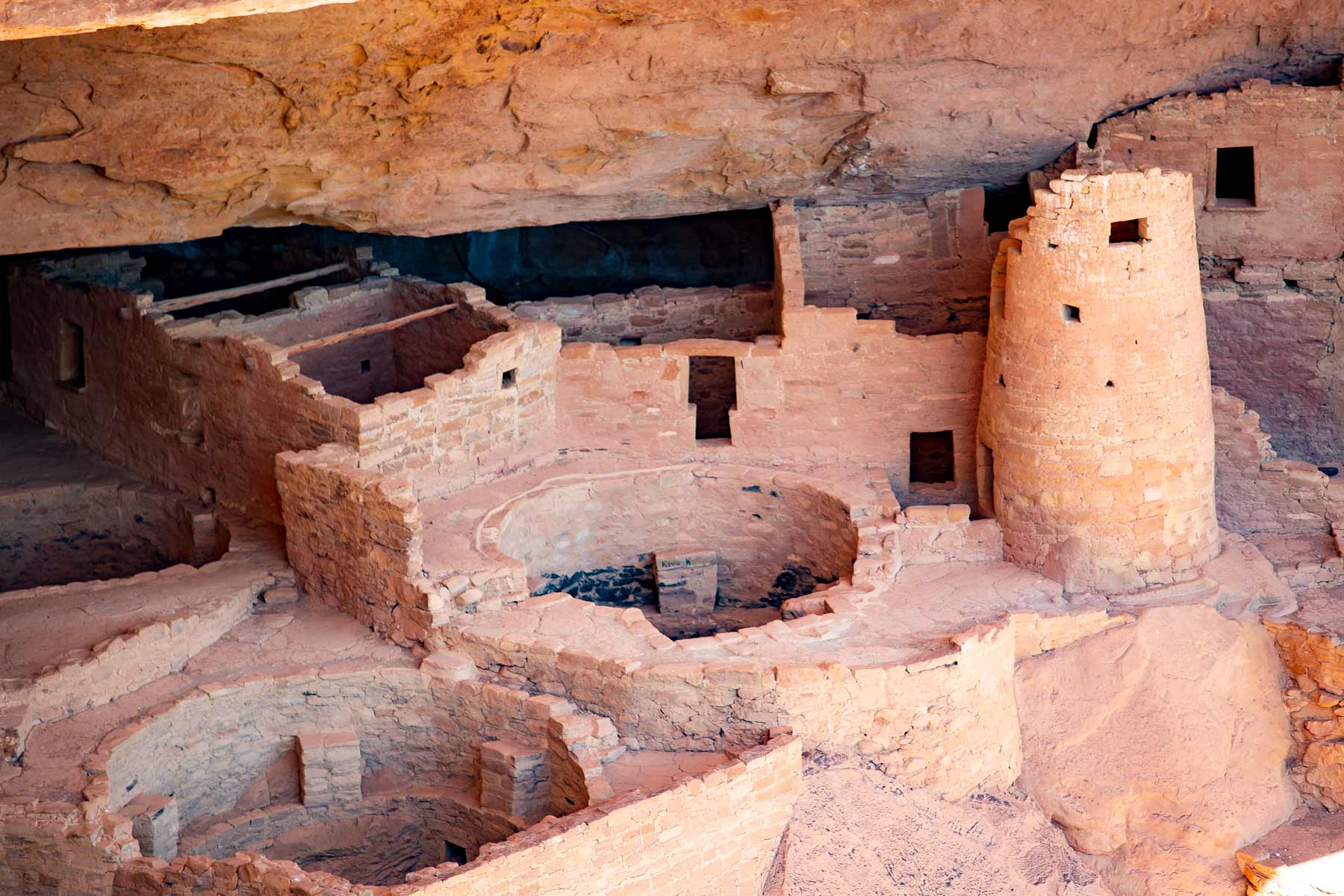
Mesa Verde flips the usual park formula. The scenery is the backdrop; the point is what people built here. Ancestral Pueblo farmers lived on this green Colorado tableland for about 700 years, and near the end of their time they moved into the cliffs, building stone villages in the alcoves, including Cliff Palace, the largest cliff dwelling in North America. When Congress protected it in 1906, it created the first national park dedicated to the works of human beings, more than 5,000 archaeological sites in all.
See the dwellings the right way, on a ranger-guided tour, which means climbing ladders and squeezing through the same passages residents used eight centuries ago. Balcony House is the adventurous one. Book ahead in summer, start early, and leave time for the mesa-top pit houses that show how the story began.
Start with our full Mesa Verde guide, then use the planning below.
02
Top things to do in Mesa Verde
Where we would start, and what we would plan a day around. Read the full guide.

Start here
15 Things to Do in Mesa Verde National Park
Read the guide
01
 Self-Guided Tours - Walking · nps.gov
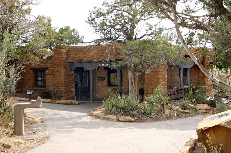
Visit Mesa Verde's Historic Administrative District
Take a walk amid the early park structures that comprise the Historic Administrative District of Mesa Verde National Park. Established in 1987 the historic...
02
Self-Guided Tours - Walking · nps.gov
Visit Mesa Verde's Historic Administrative District
Take a walk amid the early park structures that comprise the Historic Administrative District of Mesa Verde National Park. Established in 1987 the historic...
02
 Self-Guided Tours - Auto · nps.gov
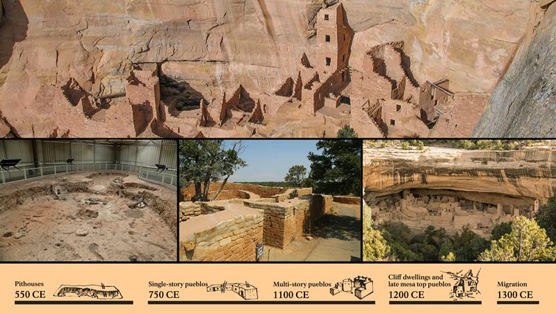
Explore the Mesa Top Loop Road
The 6-mile (10 km) Mesa Top Loop takes you through 700 years of Ancestral Pueblo history. From remains of early pithouses and masonry villages...
Self-Guided Tours - Auto · nps.gov
Explore the Mesa Top Loop Road
The 6-mile (10 km) Mesa Top Loop takes you through 700 years of Ancestral Pueblo history. From remains of early pithouses and masonry villages...
Self-Guided Tours - Walking · nps.gov
Visit Mesa Verde's Historic Administrative District
Take a walk amid the early park structures that comprise the Historic Administrative District of Mesa Verde National Park. Established in 1987 the historic...
02
Self-Guided Tours - Auto · nps.gov
Explore the Mesa Top Loop Road
The 6-mile (10 km) Mesa Top Loop takes you through 700 years of Ancestral Pueblo history. From remains of early pithouses and masonry villages...
Before you go
Get the Mesa Verde heads-up
Permit windows, closures and seasonal alerts, plus our best Mesa Verde guides, in your inbox before you go. Free, no spam.
03
Plan your trip
Our guides for the big decisions, plus the gear, maps and lodging we would actually use for Mesa Verde.
Where to stay
Gateway towns with lodging, food and outfitters.
- Mancos, COGateway town
- Cortez, COGateway town
- Durango, COGateway town
- Morefield Campground 267 sites · Reserve
Maps & guides
Carry paper. Cell service dies fast inside most parks.
America the Beautiful pass
$80 a year. Covers entrance fees at more than 2,000 federal recreation sites.
Get the pass
What to bring
Field-tested picks we bring on park trips.
-
Sun HatFull-brim coverage for exposed trails with zero shade. View on REI
-
Water BottlesCarry at least 2 liters. More in desert heat. View on REI
-
Hiking BootsAnkle support and grip for rocky, uneven terrain. View on REI
-
Sun-Protective ShirtUPF 50+ fabric keeps you cool and blocks UV all day. View on REI
Getting there
- DRO Durango-La Plata County 36 mi
- CEZ Cortez Municipal 12 mi
Some links in this section are affiliate links. If you book or buy through them we earn a small commission at no extra cost to you. We only recommend what we would use ourselves.
Mesa Verde map
VC Visitor Center
CG Campground
Nearby Park
04
When to go
Loading weather...
Month-by-Month Conditions
Tap any month for details
Month
High
Low
Crowds
Roads
Jan
40°
20°
Low
Open
Feb
43°
23°
Low
Open
Mar
51°
30°
Light
Open
Apr
59°
34°
Light
Open
May Best
69°
43°
Heavy
Open
Jun Best
81°
52°
Peak
Open
Jul Best
86°
59°
Peak
Open
Aug Best
84°
57°
Peak
Open
Sep Best
76°
50°
Peak
Open
Oct Best
63°
39°
Heavy
Open
Nov
50°
29°
Low
Open
Dec
40°
20°
Low
Open
Best months to visit
Crowd level (low to peak)
05
More Mesa Verde guides
06
Parks near Mesa Verde
Within reach if you are building a longer trip.
Worth protecting
Mesa Verde belongs to all of us
Protections that took generations to win can be rolled back in a single session of Congress. We keep watch so they hold.
Stay in the Loop
Free dispatches on the parks and the policy fights around them, almost every day. Threats tracked, wins celebrated, no fluff.
Threatened Lands Map
Follow what's happening on federal lands across the country with our interactive map.
View the Tracker