
Established
2003
Size
26,546 acres
Visitors / yr
242K
Entrance
Free
Best season
March through May, September through November
Nearest airport
CAE Columbia Metropolitan
01
Why Congaree is worth the trip
South Carolina · Established 2003
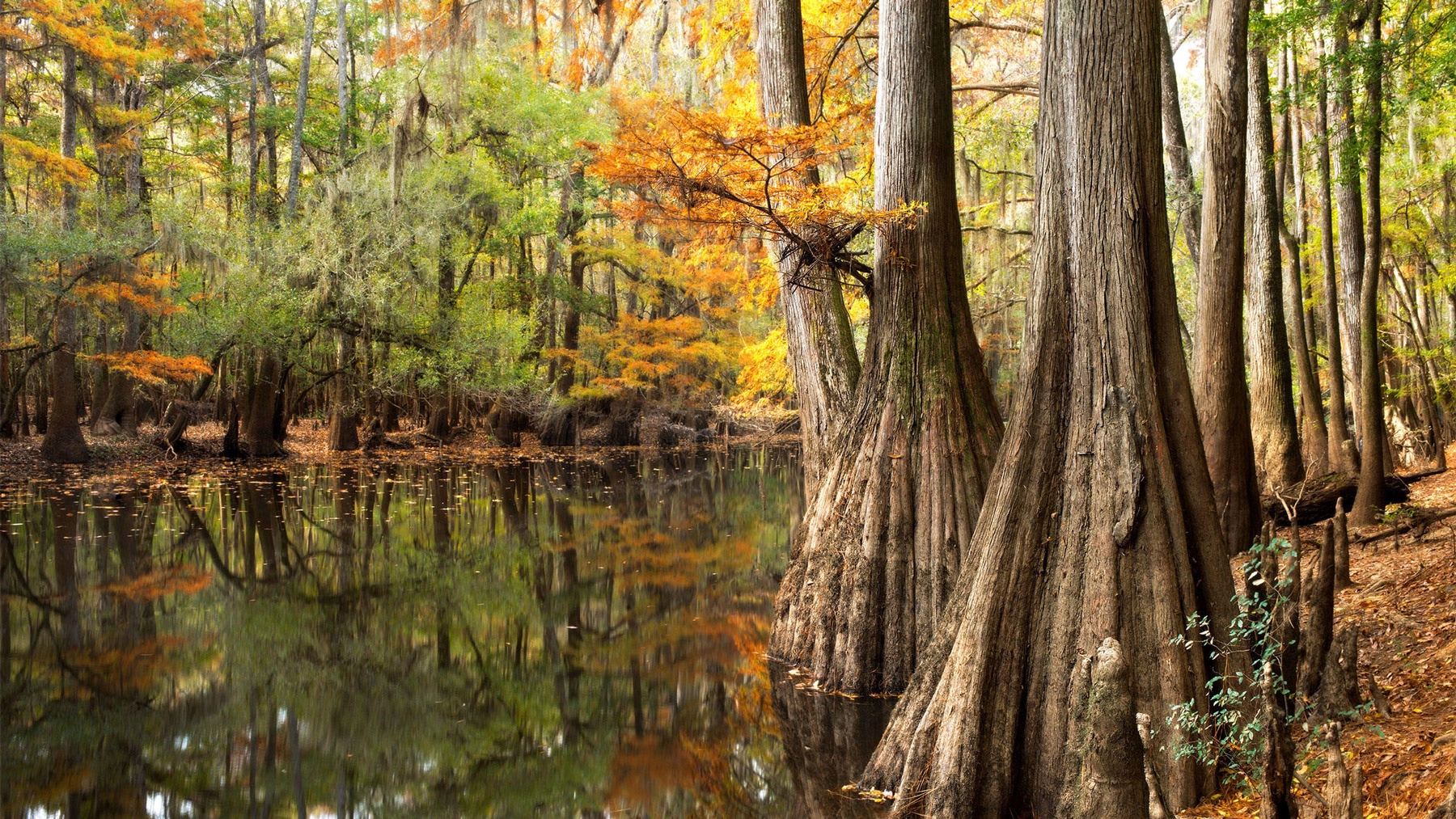
Congaree protects something that barely exists anymore, the largest surviving tract of old-growth bottomland hardwood forest in the Southeast. The loblolly pines and bald cypresses here rank among the tallest trees in eastern North America, a canopy far higher than a floodplain has any business growing. Walk the elevated boardwalk and the scale sneaks up on you, one massive column at a time.
Two experiences set it apart. Paddle Cedar Creek through cypress knees and tannin-dark water, and if you can win the entry lottery for late May or early June, watch the synchronous fireflies flash in unison after dark, a display only a handful of places on the planet can offer. Entry is free and Columbia is minutes away. The mosquitoes get their own rating meter at the visitor center, and no, that is not a joke.
Start with our full Congaree guide, then use the planning below.
02
Top things to do in Congaree
Where we would start, and what we would plan a day around. Read the full guide.

Start here
15 Things to Do at Congaree National Park
Read the guide
01
Known for
Old-growth bottomland hardwood forest
02
Known for
Synchronous firefly display
03
Known for
Elevated boardwalk trail
04
Known for
Cedar Creek paddling
Before you go
Get the Congaree heads-up
Permit windows, closures and seasonal alerts, plus our best Congaree guides, in your inbox before you go. Free, no spam.
03
Plan your trip
Our guides for the big decisions, plus the gear, maps and lodging we would actually use for Congaree.
Where to stay
Gateway towns with lodging, food and outfitters.
Maps & guides
Carry paper. Cell service dies fast inside most parks.
America the Beautiful pass
$80 a year. Covers entrance fees at more than 2,000 federal recreation sites.
Get the pass
What to bring
Field-tested picks we bring on park trips.
-
Trail ShoesLightweight with good traction for maintained trails. View on REI
-
Rain JacketMountain weather turns fast. Pack a shell even on clear mornings. View on REI
-
Merino Hiking SocksPrevent blisters and keep your feet comfortable for miles. View on REI
-
Day Hiking PackA 22-30L pack fits water, layers, snacks, and a first aid kit. View on REI
Getting there
- CAE Columbia Metropolitan 25 mi
Some links in this section are affiliate links. If you book or buy through them we earn a small commission at no extra cost to you. We only recommend what we would use ourselves.
Congaree map
VC Visitor Center
CG Campground
Nearby Park
04
When to go
Loading weather...
Month-by-Month Conditions
Tap any month for details
Month
High
Low
Crowds
Roads
Jan
57°
35°
Light
Open
Feb
61°
37°
Moderate
Open
Mar Best
68°
44°
Heavy
Open
Apr Best
77°
52°
Heavy
Open
May Best
84°
60°
Heavy
Open
Jun
90°
69°
Moderate
Open
Jul
93°
72°
Moderate
Open
Aug
91°
71°
Light
Open
Sep
86°
65°
Moderate
Open
Oct
76°
53°
Moderate
Open
Nov
66°
42°
Moderate
Open
Dec
59°
36°
Moderate
Open
Best months to visit
Crowd level (low to peak)
05
More Congaree guides
06
Parks near Congaree
Within reach if you are building a longer trip.
Worth protecting
Congaree belongs to all of us
Protections that took generations to win can be rolled back in a single session of Congress. We keep watch so they hold.
Stay in the Loop
Free dispatches on the parks and the policy fights around them, almost every day. Threats tracked, wins celebrated, no fluff.
Threatened Lands Map
Follow what's happening on federal lands across the country with our interactive map.
View the Tracker