


North Cascades is the wildest national park in the lower 48 that almost nobody visits. It holds more than 300 glaciers, more than any park outside Alaska, packed into a maze of jagged peaks the locals call the American Alps. Fewer than 40,000 people enter the official park boundary in a year, which is a rounding error next to Yosemite. The catch and the gift is the same thing, you have to work a little to get here, and the reward is solitude in some of the best mountain country in the country.
Below are 20 things to do in North Cascades, ranked and grouped by the drive-up sights, the big hikes, the lakes, and the deep backcountry. Each item lists the trailhead, distance, difficulty, and the best time to go. One thing to know up front, there is no entrance fee here. For the full overview and current road status, start at our North Cascades National Park hub.

At a Glance
| Activity | Type | Distance / Time | Difficulty |
|---|---|---|---|
| Diablo Lake Overlook | Viewpoint | Roadside on Highway 20 | Easy |
| Maple Pass Loop | Hike | 7.2 mi loop, 2,000 ft gain | Moderate to strenuous |
| Cascade Pass | Hike | 7.4 mi RT, 1,800 ft gain | Moderate |
| Blue Lake | Hike | 4.4 mi RT | Moderate |
| Highway 20 Scenic Drive | Drive | Seasonal, snow-closed in winter | Easy |
| Sourdough Mountain | Hike | 10.4 mi RT, 5,000 ft gain | Very strenuous |
| Stehekin | Remote town | Boat or floatplane access | Easy once there |
| Picture Lake | Viewpoint | Short loop | Easy |
Drive-Up Sights and Viewpoints
1. Marvel at the Diablo Lake Overlook

Location: Highway 20, milepost 132. Difficulty: Easy, roadside. Best time: Midday, when the sun lights the water.
The signature view of the park, and the easiest to reach. Diablo Lake glows an unreal turquoise, the result of glacial rock flour suspended in the meltwater. The overlook has parking and interpretive signs right off Highway 20. If you do only one thing here, stand at this rail and let the color do its work.
Love North Cascades? It's one of 117 threatened public lands destinations we're tracking. Get the free briefing.
2. Soak in the Views from Picture Lake

Location: Mount Baker Highway, near the park’s northwest. Difficulty: Easy, short loop. Best time: Calm morning or fall color.
One of the most photographed scenes in Washington, where Mount Shuksan reflects in a small lake ringed by a short walking path. It is technically just outside the national park boundary in the surrounding recreation area, but it is too good to leave off. Come in fall when the blueberry bushes turn the foreground red.
3. Stop at the Ross Lake Overlook

Location: Highway 20, east of Diablo. Difficulty: Easy, roadside. Best time: Any time the highway is open.
A quick pullout with a long view down Ross Lake toward Canada. It is a natural companion stop to the Diablo overlook on a drive across the park. Two minutes out of the car and you understand the scale of these reservoirs that fill the valleys.
4. Explore Thunder Arm
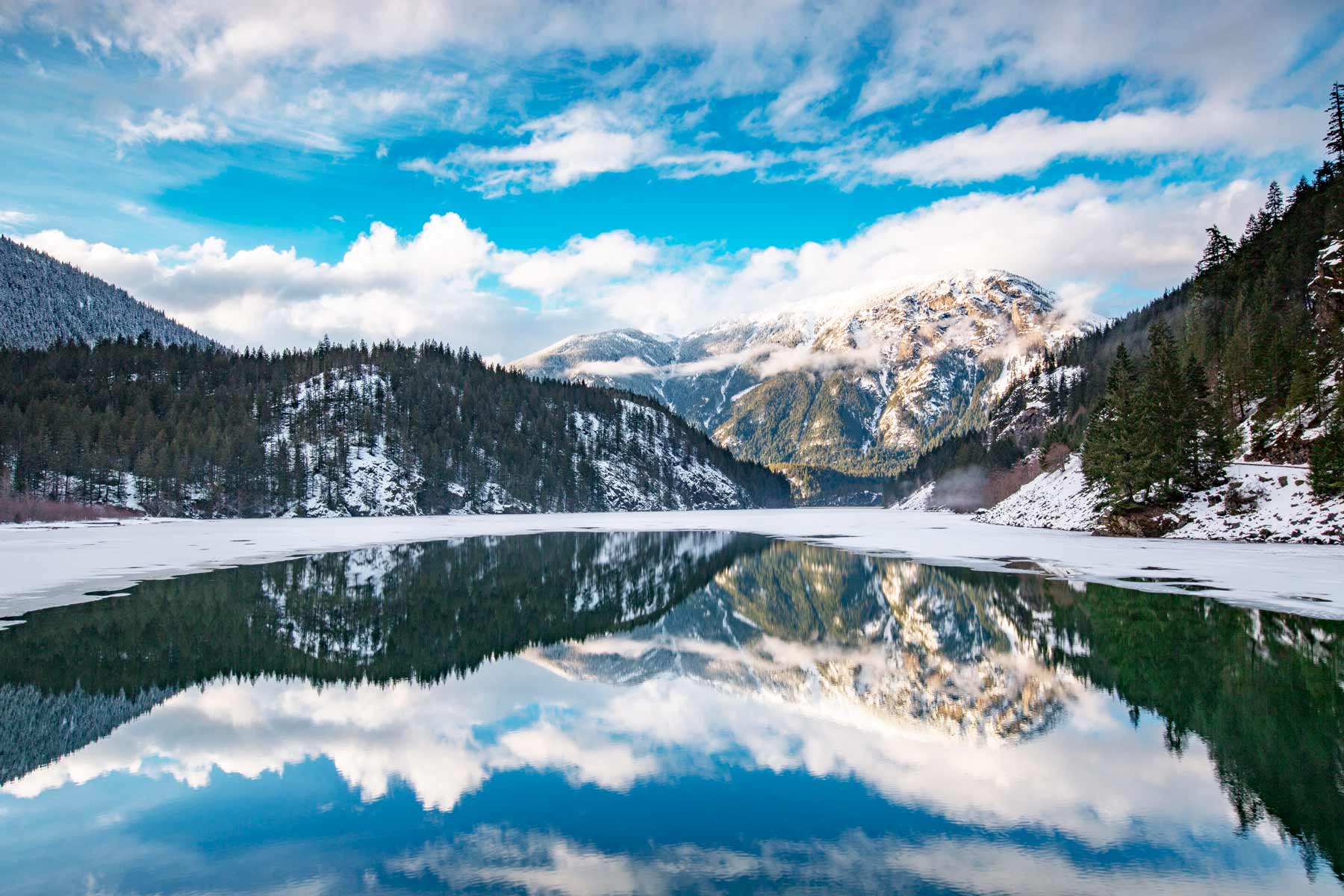
Location: Diablo Lake, near Colonial Creek. Difficulty: Easy. Best time: Morning.
The southern arm of Diablo Lake, reached at the Colonial Creek area, with boat launches, a campground, and easy water access. It is the best spot to get down to the lake itself rather than just look at it from above. Launch a kayak here for a different angle on that turquoise water.
5. Drive the North Cascades Highway
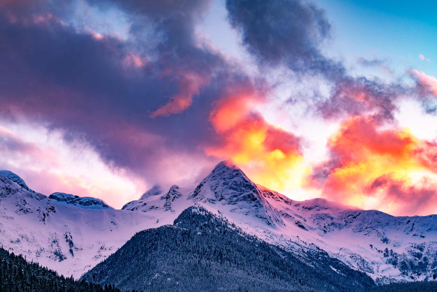
Route: Highway 20 across the park. Difficulty: Easy. Best time: Summer and fall. Note: Closes for snow late fall to mid-spring.
The only paved road across the park, and one of the great scenic drives in America, climbing past the lakes and through the high passes with pullouts at every turn. It closes every winter for snow, often from late November into spring, and heavy winters can push the reopening into June, as happened in 2026. Check the current status before you plan a crossing.
The Best Day Hikes
6. Hike the Maple Pass Loop to Lake Ann

Trailhead: Rainy Pass, off Highway 20. Distance: 7.2-mile loop. Elevation gain: about 2,000 feet. Difficulty: Moderate to strenuous. Best time: Late September for golden larches.
The best day hike in the area, a loop past alpine lakes and meadows with views that open in every direction near the top. In late September the larch trees turn gold and the trail gets famous, so come on a weekday if you can. The trailhead sits on Forest Service land, so you need a Northwest Forest Pass or an interagency pass to park.
7. Hike Cascade Pass
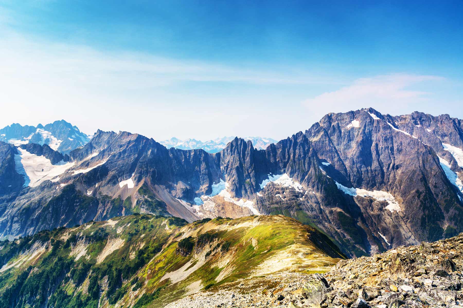
Trailhead: End of Cascade River Road, near Marblemount. Distance: 7.4 miles round trip. Elevation gain: about 1,800 feet. Difficulty: Moderate. Best time: Mid to late summer.
The most popular trail inside the park boundary, climbing well-graded switchbacks to a pass surrounded by glaciated peaks. Extend it up the Sahale Arm for one of the best high-alpine day hikes in the state. The gravel access road is long and rough, so allow extra driving time to reach the trailhead.
8. Hike to Blue Lake
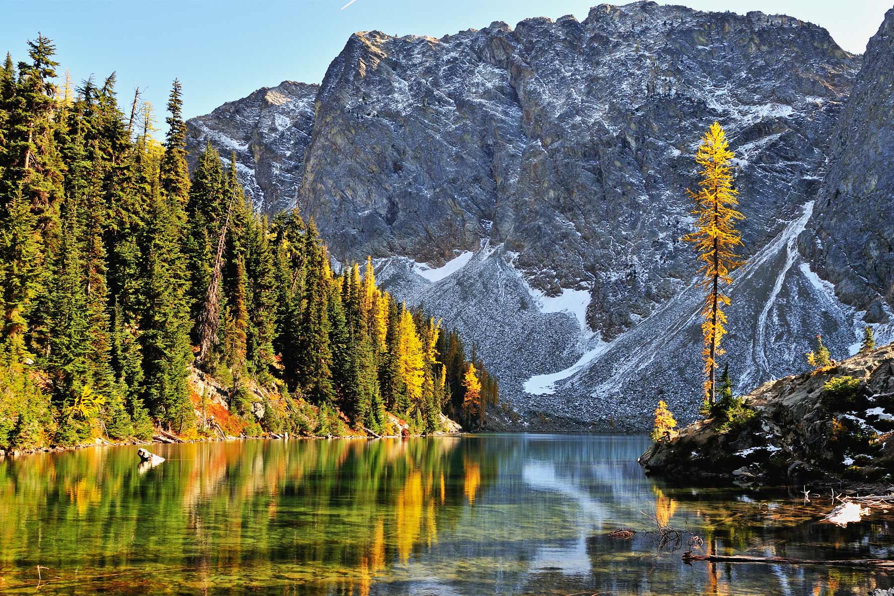
Trailhead: Highway 20, near Washington Pass. Distance: 4.4 miles round trip. Difficulty: Moderate. Best time: Summer and fall.
A shorter alpine hike to a clear lake sitting beneath the spires of Liberty Bell and the Early Winters peaks. It is one of the best payoffs per mile in the area and a good choice when you want big scenery without a full-day effort. Larches ring the lake here too in the fall.
9. Hike Sourdough Mountain

Trailhead: Diablo. Distance: 10.4 miles round trip. Elevation gain: about 5,000 feet. Difficulty: Very strenuous. Best time: Summer.
One of the hardest day hikes in the park, a relentless climb to a historic fire lookout with a bird’s-eye view straight down onto Diablo Lake. There is no easing into it, the trail goes up from the first step. Earn the summit and you get the best view of that turquoise water anywhere in the park.
Lakes, Water, and Wildlife
10. Go Boating on the Lakes

Where: Diablo and Ross Lakes. Difficulty: Easy to moderate. Best time: Calm summer mornings.
Paddling these glacier-fed lakes puts you right under the peaks with the turquoise water beneath your boat. Diablo is the easiest to access from the road, while Ross Lake stretches all the way to Canada. Bring your own boat or rent at Ross Lake Resort, and check wind conditions before heading out.
11. Stay at Ross Lake Resort

Location: Ross Lake, reached by trail and a boat shuttle. Difficulty: Easy once you arrive. Best time: Summer, book far ahead.
A collection of floating cabins on Ross Lake with no road access, reached by a combination of water taxi and trail or a hike in. It is one of the most unique stays in the park system, and it books out a year or more in advance. If you score a cabin, you wake up on the water surrounded by peaks.
12. Go Fishing

Where: Lakes and streams throughout the park. Difficulty: Easy. Best time: Summer.
The lakes and rivers hold trout, and a quiet morning casting on Ross or Diablo is a fine way to slow down. You need a Washington state fishing license, and some waters have special rules, so check the regulations first. It is as much about the setting as the catch.
13. See Mountain Goats

Where: High alpine areas like Cascade Pass and Sahale Arm. Difficulty: Easy to spot once you are up high. Best time: Summer, dawn and dusk.
Mountain goats work the high rock and meadows, and you will often spot them on the alpine hikes like Cascade Pass. Keep your distance and never let them approach for the salt in your sweat, which conditions them to people. Bring a zoom lens and let them stay wild.
14. Go Whitewater Rafting
Where: The Skagit River, via local outfitters. Difficulty: Moderate. Best time: Summer for whitewater, winter for eagles.
The Skagit River runs along the park’s southern edge and outfitters near Marblemount run trips on it. Summer brings the whitewater, while winter brings one of the largest gatherings of bald eagles in the lower 48 to feed on spawning salmon. Book a guided trip rather than going it alone here.
The Deep Backcountry
15. Visit Stehekin

Location: Head of Lake Chelan, no road access. Difficulty: Easy once there. Best time: Summer.
One of the most remote communities in the country, reached only by boat, floatplane, or a long hike. The ferry up Lake Chelan is a destination in itself, and Stehekin rewards you with a famous bakery, a waterfall, and total quiet. Plan around the ferry schedule, since there is no driving in or out.
16. Hike Desolation Peak

Trailhead: Ross Lake, boat access required. Distance: about 9.4 miles round trip from the lake. Elevation gain: about 4,400 feet. Difficulty: Very strenuous. Best time: Summer.
The fire lookout where Jack Kerouac spent a summer in 1956, which he wrote about in his books. Getting there means a boat ride up Ross Lake and a brutal climb, so this is a committed adventure, not a casual hike. The literary history and the solitude make it a pilgrimage for some.
17. Visit Hozomeen at the Canadian Border

Location: North end of Ross Lake, reached via Canada. Difficulty: Easy once there, hard to reach. Best time: Summer.
The far northern tip of the park, so remote it is most easily reached by driving in from British Columbia on a gravel road. The twin spires of Hozomeen Mountain loom over a quiet campground and the north end of Ross Lake. This is for travelers who want the most remote corner of an already remote park.
18. Go Backpacking
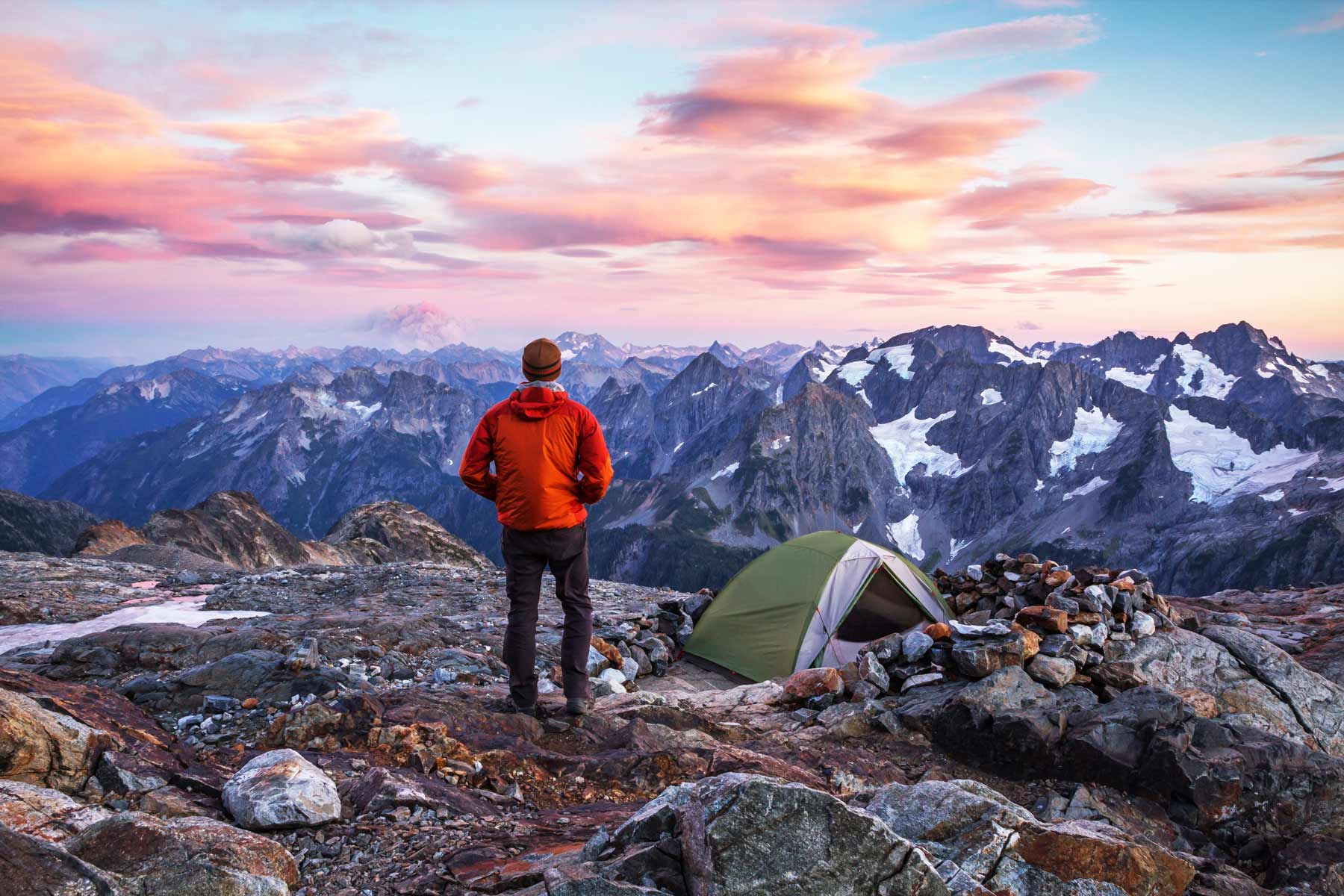
Where: Throughout the wilderness. Difficulty: Moderate to very strenuous. Best time: Mid to late summer. Permit required.
This is a backpacker’s park at heart, with most of its terrain reachable only on foot. Routes like the Sahale Arm camp and the Copper Ridge loop deliver glacier views and solitude in equal measure. You need a backcountry permit, available through Recreation.gov, and you should be ready for real wilderness travel.
Night Skies and Overnight
19. Go Stargazing

Where: Lakeshores and high camps away from any town. Difficulty: Easy. Best time: New moon, clear summer night.
With almost no development for miles, the park’s night sky is genuinely dark once the clouds clear, which is the catch in this damp range. On a clear summer night the Milky Way arcs over the peaks and reflects in the lakes. Camp by the water for the best show.
20. Camp in the Park
Where: Colonial Creek, Newhalem Creek, and Gorge Lake campgrounds. Difficulty: Easy. Best time: Summer.
The roadside campgrounds along Highway 20 put you right in the heart of the park for the night, with Colonial Creek sitting on Diablo Lake. Reserve through Recreation.gov in summer, since the good lakeside sites go fast. Waking up on the water with the peaks overhead is the whole point.
Planning Your North Cascades Visit
Fees and Access
There is no entrance fee for North Cascades National Park, which is rare in the park system. You may still need a Northwest Forest Pass or an America the Beautiful pass to park at some Forest Service trailheads like Maple Pass. Backcountry camping requires a permit through Recreation.gov, and there is no timed-entry system.
How Many Days You Need
One day is enough to drive Highway 20, stop at the Diablo and Ross overlooks, and squeeze in a hike like Blue Lake. Two days lets you tackle a bigger hike like Maple Pass or Cascade Pass and camp on a lake. Three or more days opens up Stehekin, the boat-access adventures, and real backcountry.
Getting Around and Road Notes
Highway 20 is the only paved road across the park, and it closes for snow from late fall into spring, sometimes as late as June after a hard winter. There is no gas inside the park, so fuel up in Marblemount on the west side or Winthrop on the east. Cell service is nonexistent across most of the park, so download maps offline.
Where to Stay
Lodging inside the park is limited to the remote Ross Lake Resort and the North Cascades Environmental Learning Center, plus the cabins in Stehekin. Most visitors camp along Highway 20 or stay in the gateway towns. Marblemount and Newhalem anchor the west side, and the western-themed town of Winthrop sits just east of the park. There is also dispersed camping on the surrounding public lands destinations in the Okanogan-Wenatchee and Mount Baker-Snoqualmie National Forests.
When to Go
Mid to late summer is the reliable window, when Highway 20 is open, the snow has melted off the high trails, and the wildflowers peak. Late September brings the golden larches that draw photographers from across the region. Winter closes the highway and most of the park, though the lower Skagit area draws eagle watchers. Spring is a gamble until the snow clears.
Frequently Asked Questions
Is there an entrance fee for North Cascades?
No. North Cascades National Park has no entrance fee, which makes it one of the most affordable parks to visit. You may still need a Northwest Forest Pass or interagency pass for certain Forest Service trailheads, and a permit for backcountry camping.
Is the North Cascades Highway open?
It depends on the season. Highway 20 across the park closes for snow from late fall into spring, and a heavy winter can delay the reopening into June, as happened in 2026. Check the current road status before planning a crossing.
What is the best hike in North Cascades?
The Maple Pass Loop for the all-around alpine scenery, especially in fall larch season, or Cascade Pass and the Sahale Arm for high-alpine views. For a shorter option, hike to Blue Lake near Washington Pass.
Why is Diablo Lake so blue?
The turquoise color comes from glacial rock flour, fine particles ground up by the glaciers that feed the lake and suspended in the water, which scatters light to produce that vivid blue-green.
Trying to decide between Washington’s parks? Read our comparison of Olympic vs. North Cascades vs. Rainier before you plan.
What to Bring to North Cascades
Gear we recommend for North Cascades. Affiliate links support our work at no cost to you.
More Than Just Parks may earn a small commission from purchases made through these links, at no extra cost to you. We only recommend gear we would actually use.
Affiliate disclosure: Some links on this page earn us a small commission at no extra cost to you. We only recommend gear we actually use.


