
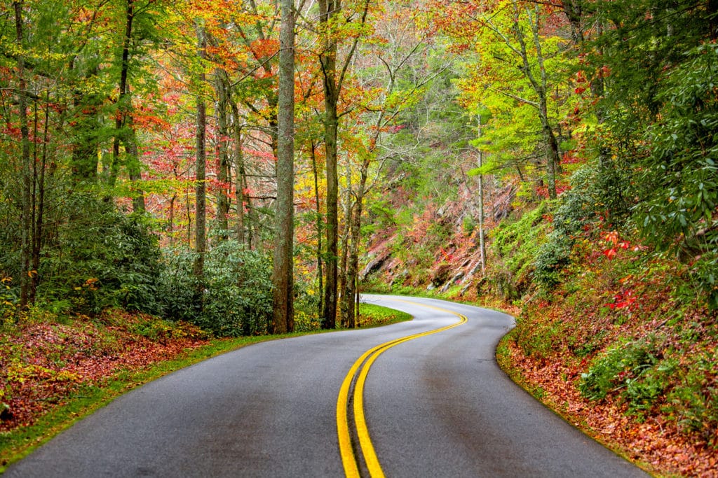
Peak color lands around Nov 4 in most of Tennessee, but it moves 16 days across the state. Here’s where, and when, and how sure we are.
Tennessee’s season, place by place
The 24 places closest to their peak in Tennessee, each set on the calendar at its peak and painted by how far along it is today, Sep 25.
First: Unaka Mountain Wilderness, Oct 21. Last: Tennessee National Wildlife Refuge, Nov 6.
The dashed rule is today; the solid one is the median of the places on this chart, Oct 29. The date at the top of the page is the median county, which includes the low ground between them.
The county map today
Where to go in Tennessee
The destinations we cover in Tennessee, in the order their color arrives. Each carries its own forecast and its own band, because a state isn’t one place.
- Unaka Mountain WildernessToo earlyPeak 21 Oct best 20 to 23 Oct
- Too earlyPeak 22 Oct best 21 to 24 Oct
- Too earlyPeak 22 Oct best 21 to 24 Oct
- Too earlyPeak 23 Oct best 22 to 25 Oct
- Pond Mountain WildernessToo earlyPeak 23 Oct best 22 to 25 Oct
- Too earlyPeak 25 Oct best 24 to 27 Oct
- Sampson Mountain WildernessToo earlyPeak 25 Oct best 24 to 27 Oct
- Big Laurel Branch WildernessToo earlyPeak 25 Oct best 24 to 27 Oct
- Too earlyPeak 26 Oct best 25 to 28 Oct
- Upper Bald River WildernessToo earlyPeak 26 Oct best 25 to 28 Oct
- Cumberland Gap National Historical ParkToo earlyPeak 27 Oct, oak 30 Oct best 26 to 29 Oct
- Big Frog WildernessToo earlyPeak 29 Oct best 28 to 31 Oct
- Bald River Gorge WildernessToo earlyPeak 29 Oct best 28 to 31 Oct
- Cohutta WildernessToo earlyPeak 30 Oct best 29 Oct to 1 Nov
- Little Frog Mountain WildernessToo earlyPeak 30 Oct best 29 Oct to 1 Nov
- Too earlyPeak 31 Oct best 30 Oct to 2 Nov
- Gee Creek WildernessToo earlyPeak 31 Oct best 30 Oct to 2 Nov
- Too earlyPeak 1 Nov best 31 Oct to 3 Nov
- Too earlyPeak 4 Nov, oak 7 Nov best 3 to 6 Nov
- Cross Creeks National Wildlife RefugeToo earlyPeak 5 Nov best 4 to 7 Nov
- Chickamauga and Chattanooga National Military ParkToo earlyPeak 5 Nov best 4 to 7 Nov
- Reelfoot National Wildlife RefugeToo earlyPeak 5 Nov best 4 to 7 Nov
- Fort Donelson National BattlefieldToo earlyPeak 5 Nov, oak 8 Nov best 4 to 7 Nov
- Tennessee National Wildlife RefugeToo earlyPeak 6 Nov best 5 to 8 Nov
Also forecast in TennesseeNatchez Trace Parkway
When to go
Across 95 counties, peak color is forecast to arrive first in Johnson County around Oct 23 and last in Fayette County around Nov 8. Most of the state peaks near Nov 4.
Each date is the middle of the four days we’d aim a trip at, and each place page names them. We score the model against 7 long-running forest monitoring sites in this part of the country and publish what it got wrong.
This autumn is running 6 days late in Tennessee. September has run warmer than the 1991 to 2020 normal so far, and the dates above already include that. It’s a real signal but a modest one: temperature explains under a tenth of how much peak color moves year to year.
Early October at the highest elevations, mid-to-late October at mid-elevations, early November in the valleys is how Tennessee is usually described.
What actually turns
The Great Smoky Mountains produce a warm, layered fall where tulip poplars turn gold, sourwoods go crimson, hickories fade to bronze, and the ridgelines recede in hazy waves of color.
- Tulip Poplar
- Red Maple
- Sourwood
- Hickory
- White Oak
Newfound Gap Road in Great Smoky Mountains National Park crosses the Appalachian Divide at 5,046 feet, and the drive from Gatlinburg to the summit in mid-October is one of the iconic fall experiences in America.
Worth the drive
Sevier County is the Tennessee gateway to the Great Smoky Mountains, containing Gatlinburg and the northern slopes of the park. Newfound Gap Road climbs from 1,462 feet at Sugarlands to 5,046 feet at the gap, creating a vertical gradient of color that is unmatched in the eastern United States. Visit the higher elevations in early October and the lower sections two to three weeks later.
Every county, by peak week
Elevation does most of the work here. Color runs down a mountain at roughly a day per 100 meters, so a ridge and the valley below it can be a week or two apart in the same county.
Carter, Johnson, Unicoi
Anderson, Bledsoe, Blount, Campbell, Claiborne, Clay, Cocke, Cumberland, Fentress, Grainger, Greene, Grundy, Hamblen, Hancock, Hawkins, Jackson, Jefferson, Knox, Loudon, Macon, McMinn, Monroe, Morgan, Overton, Pickett, Polk, Putnam, Rhea, Roane, Robertson, Scott, Sequatchie, Sevier, Sullivan, Sumner, Union, Van Buren, Washington, White
Bedford, Benton, Bradley, Cannon, Carroll, Cheatham, Chester, Coffee, Crockett, Davidson, Decatur, DeKalb, Dickson, Dyer, Fayette, Franklin, Gibson, Giles, Hamilton, Hardeman, Hardin, Haywood, Henderson, Henry, Hickman, Houston, Humphreys, Lake, Lauderdale, Lawrence, Lewis, Lincoln, Madison, Marion, Marshall, Maury, McNairy, Meigs, Montgomery, Moore, Obion, Perry, Rutherford, Shelby, Smith, Stewart, Tipton, Trousdale, Warren, Wayne, Weakley, Williamson, Wilson
Every date on this site is a forecast: a model corrected by ground reports, carrying a measured error, published in full. Check conditions with the land manager before you travel. Last reviewed September 2026. Open the live map