
Wilderness Area·Georgia, North Carolina·23,605 acres
Southern Nantahala Wilderness
Forecast issued Nov 10, 7:57am ET
Higher ground turns first, so the slopes above the road lead the valley by a few days.
Weather Wind to 35 mph Thursday. Color may come down before it turns.
Weather Hard frost Friday night. Peak may come early and go fast.
No new reports from the ground here this week.
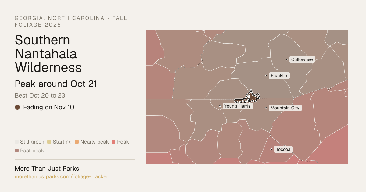
When is peak fall foliage at Southern Nantahala Wilderness in 2026?
Our forecast puts peak color at Southern Nantahala Wilderness around Oct 21, and the four days to aim for are Oct 20 to 23.
The wilderness runs from about 2,582 to 4,719 feet, and the color comes downhill over about 11 days: the high stands around Oct 16, the low ground around Oct 25. That's 3 days later than our model alone would say, because this September has been running warm.
| Week | In the wilderness | Elevation at peak |
|---|---|---|
| Sep 28 to Oct 4 | Starting to turn | |
| Oct 5 to Oct 11 | Starting to turn | |
| Oct 12 to Oct 18 | Nearly peak | 4,000 to 4,500 ft, 4,500 to 5,000 ft |
| Oct 19 to Oct 25 | Peak color | 2,500 to 3,000 ft, 3,000 to 3,500 ft, 3,500 to 4,000 ft |
| Oct 26 to Nov 1 | Just past peak | |
| Nov 2 to Nov 8 | Just past peak |
- 4,500–5,000 ftLeaves downpeak Oct 1612%
- 4,000–4,500 ftLeaves downpeak Oct 1819%
- 3,500–4,000 ftFadingpeak Oct 2120%
- 3,000–3,500 ftFadingpeak Oct 2328%
- 2,500–3,000 ftFadingpeak Oct 2518%
Height off 3DEP inside the wilderness’s own boundary; each band carries the date our model gives that elevation, corrections and all. The percentage is how much of the wilderness stands in it.
That’s 3 days later than our model alone would say. This September has been running warm, which shifts peak color.
Plan this tripIf you can only come on certain days
Set the days you can be here. Everything under them answers for those days, not for peak.
Tuesday, October 20 to Wednesday, October 21
You’ll find it just past peak up high, nearly peak lower down.
Up at 4,500 feet the stands peak around Oct 16; down at 3,000 feet they hold on until about Oct 25. Pick your elevation for the day you come.
- 4,500–5,000 ftJust past peakpeak Oct 16
- 4,000–4,500 ftJust past peakpeak Oct 18
- 3,500–4,000 ftPeak colorpeak Oct 21
- 3,000–3,500 ftNearly peakpeak Oct 23
- 2,500–3,000 ftNearly peakpeak Oct 25
- Where to drive
- Cherohala Skyway, about 33 miles · Newfound Gap Road, about 43 miles · Blue Ridge Parkway (NC Section), about 95 miles
- What turns
- northern red oak, red maple, white oak, shagbark hickory, sugar maple
What turns, and when
- northern red oak28%
- red maple22%
- white oak20%
- shagbark hickory14%
- sugar maple8%
- tulip poplar4%
Also named across North Carolina, outside what the canopy read measures here: Sourwood.
Sourwoods turn deep crimson before anything else, tulip poplars go clear gold, hickories fade to bronze, and the layered ridgelines of the Blue Ridge create that famous smoky depth of warm color.
Questions people ask about Southern Nantahala Wilderness
- When is peak fall foliage at Southern Nantahala Wilderness?
Our forecast puts peak color at Southern Nantahala Wilderness around Oct 21, and the four days to aim for are Oct 20 to 23.
- Where is the best fall color at Southern Nantahala Wilderness right now?
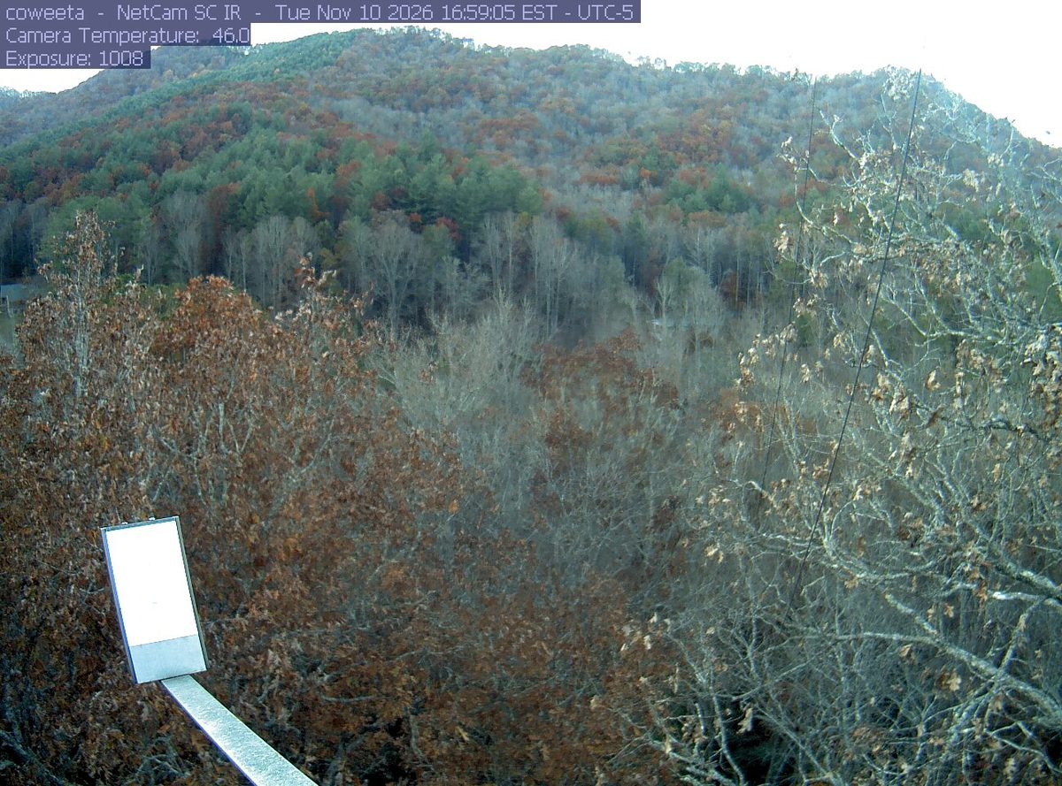
On Nov 10 the wilderness is fading. The last band to peak was 2,500 to 3,000 feet, around Oct 25.
- How long does peak last at Southern Nantahala Wilderness?
About four days at the top, Oct 20 to 23, with a week or so either side that's still worth the drive. Across the wilderness's elevations the color moves over about 11 days, so there's peak color somewhere in it for roughly 15 days.
- Is Southern Nantahala Wilderness past peak?
Yes. Peak was around Oct 21, and on Nov 10 it's fading.
- What trees turn color at Southern Nantahala Wilderness?
Tulip Poplar, Red Maple, Sourwood, Hickory, White Oak. Sourwoods turn deep crimson before anything else, tulip poplars go clear gold, hickories fade to bronze, and the layered ridgelines of the Blue Ridge create that famous smoky depth of warm color.
This forecast is built from the species that stand here, their elevation and this September’s weather, and corrected in season by cameras, foresters and our own crew. We score it here against 16 long-running forest cameras: two dates in three land within 7 days of the camera’s own peak. How this map is made
Nearby, and when they turn
Chattahoochee-Oconee and Joyce Kilmer-Slickrock Wilderness and Great Smoky Mountains are on the map above, with their own date.
- Peak Oct 25 best Oct 24 to 27
- Peak Oct 29 best Oct 28 to 31
- Peak Oct 25 best Oct 24 to 27
Fall color roads near Southern Nantahala Wilderness
Nearest first. Distances are straight-line from the wilderness, so allow more by road.
- Cherohala Skyway
Connects Robbinsville, NC to Tellico Plains, TN across the Unicoi Mountains. Less traffic than the Parkway, equally spectacular.
- Newfound Gap Road
Crosses the spine of the Great Smokies at 5,046 feet. Color peaks at the top in early October and at the base by late October.
- Blue Ridge Parkway (NC Section)
Mile markers 217 to 469. The highest and most dramatic section. Waterrock Knob, Craggy Gardens, and Graveyard Fields are must-stop overlooks.