
Wilderness Area·Colorado·41,281 acres
Buffalo Peaks Wilderness
Forecast issued Nov 9, 5:27pm ET
Higher ground turns first, so the slopes above the road lead the valley by a few days.
Weather Hard frost Tuesday night. Peak may come early and go fast.
Weather Wind to 35 mph Wednesday. Color may come down before it turns.
No new reports from the ground here this week.
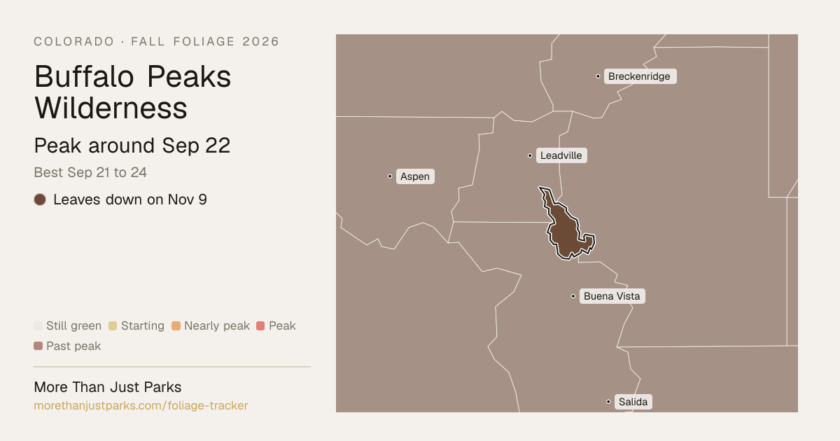
When is peak fall foliage at Buffalo Peaks Wilderness in 2026?
Our forecast puts peak color at Buffalo Peaks Wilderness around Sep 22, and the four days to aim for are Sep 21 to 24.
The wilderness runs from about 9,162 to 12,295 feet, and the color comes downhill over about 9 days: the high stands around Sep 23, the low ground around Sep 26. That's 4 days later than our model alone would say, because this September has been running warm.
| Week | In the wilderness | Elevation at peak |
|---|---|---|
| Aug 31 to Sep 6 | Starting to turn | |
| Sep 7 to Sep 13 | Starting to turn | |
| Sep 14 to Sep 20 | Nearly peak | 10,000 to 11,000 ft |
| Sep 21 to Sep 27 | Peak color | 9,000 to 10,000 ft, 11,000 to 12,000 ft, 12,000 to 13,000 ft |
| Sep 28 to Oct 4 | Just past peak | |
| Oct 5 to Oct 11 | Fading |
- 12,000–13,000 ftLeaves downpeak Sep 2311%
- 11,000–12,000 ftLeaves downpeak Sep 2149%
- 10,000–11,000 ftLeaves downpeak Sep 1927%
- 9,000–10,000 ftLeaves downpeak Sep 2610%
Height off 3DEP inside the wilderness’s own boundary; each band carries the date our model gives that elevation, corrections and all. The percentage is how much of the wilderness stands in it.
That’s 4 days later than our model alone would say. This September has been running warm, which shifts peak color.
Plan this tripIf you can only come on certain days
Set the days you can be here. Everything under them answers for those days, not for peak.
Monday, September 21 to Tuesday, September 22
You’ll find it peak color up high, nearly peak lower down.
Up at 12,000 feet the stands peak around Sep 23; down at 10,000 feet they hold on until about Sep 26. Pick your elevation for the day you come.
- 12,000–13,000 ftPeak colorpeak Sep 23
- 11,000–12,000 ftPeak colorpeak Sep 21
- 10,000–11,000 ftJust past peakpeak Sep 19
- 9,000–10,000 ftNearly peakpeak Sep 26
- Where to drive
- Cottonwood Pass (CO 306), about 19 miles · Independence Pass (CO 82), about 22 miles · Boreas Pass Road, about 28 miles
- What turns
- quaking aspen, narrowleaf cottonwood, willow, water birch
What turns, and when
- quaking aspen40%
- narrowleaf cottonwood30%
- willow20%
- water birch10%
Every one of these turns yellow or gold here. The shades only tell the species apart.
Also named across Colorado, outside what the canopy read measures here: Gambel Oak, Rocky Mountain Maple, Alder.
Colorado aspens are the main event, turning entire mountainsides gold and amber while Gambel oaks add russet and orange at lower elevations and cottonwoods line the rivers in yellow.
Questions people ask about Buffalo Peaks Wilderness
- When is peak fall foliage at Buffalo Peaks Wilderness?
Our forecast puts peak color at Buffalo Peaks Wilderness around Sep 22, and the four days to aim for are Sep 21 to 24.
- Where is the best fall color at Buffalo Peaks Wilderness right now?
On Nov 9 the wilderness is leaves down. The last band to peak was 9,000 to 10,000 feet, around Sep 26.
- How long does peak last at Buffalo Peaks Wilderness?
About four days at the top, Sep 21 to 24, with a week or so either side that's still worth the drive. Across the wilderness's elevations the color moves over about 9 days, so there's peak color somewhere in it for roughly 13 days.
- Is Buffalo Peaks Wilderness past peak?
Yes. Peak was around Sep 22, and on Nov 9 it's leaves down.
- What trees turn color at Buffalo Peaks Wilderness?
Quaking Aspen, Narrowleaf Cottonwood, Gambel Oak, Rocky Mountain Maple, Alder. Colorado aspens are the main event, turning entire mountainsides gold and amber while Gambel oaks add russet and orange at lower elevations and cottonwoods line the rivers in yellow.
This forecast is built from the species that stand here, their elevation and this September’s weather, and corrected in season by cameras, foresters and our own crew. Out here we score it against NASA's satellite record of when the canopy shuts down, read inside each unit’s own boundary: two dates in three land within 12 days of it. How this map is made
Nearby, and when they turn
Hunter-Fryingpan Wilderness and Camp Hale - Continental Divide and Pike-San Isabel are on the map above, with their own date.
- Peak Sep 28 best Sep 27 to 30
- Peak Sep 27 best Sep 26 to 29
- Peak Oct 6 best Oct 5 to 8
Fall color roads near Buffalo Peaks Wilderness
Nearest first. Distances are straight-line from the wilderness, so allow more by road.
- Cottonwood Pass (CO 306)
Buena Vista to Taylor Park, with the aspen on the east side of the pass.
- Independence Pass (CO 82)
Aspen to Twin Lakes up the Roaring Fork. The pass closes for the winter around the first of November.
- Boreas Pass Road
Breckenridge to Como on the old railroad grade, aspen the whole way. Gravel, fine for a car.
- Kenosha Pass (US 285)
The grove at the summit is the Front Range's classic aspen stop, and you can walk into it on the Colorado Trail.
- Maroon Creek Road
The Maroon Bells over a lake ringed with aspen. Shuttle only during the season.
- Guanella Pass
Georgetown to Grant. The aspen on the Georgetown side are some of the closest big groves to Denver.