I’ve hiked in Sequoia National Park at least a dozen times over the past eight years, and every single visit has forced me to recalibrate my sense of scale. You think you understand how big a giant sequoia is until you’re standing at the base of one, craning your neck so far back that your hat falls off. Then multiply that feeling by a few thousand trees and scatter them across one of the most dramatic alpine landscapes in North America.
What I love about hiking in Sequoia is the range. You can spend 30 minutes on a boardwalk loop through the Giant Forest or spend four days pushing toward the summit of Mount Whitney on the most punishing trail in the Sierra Nevada. The park doesn’t care about your fitness level. It just wants you to show up.
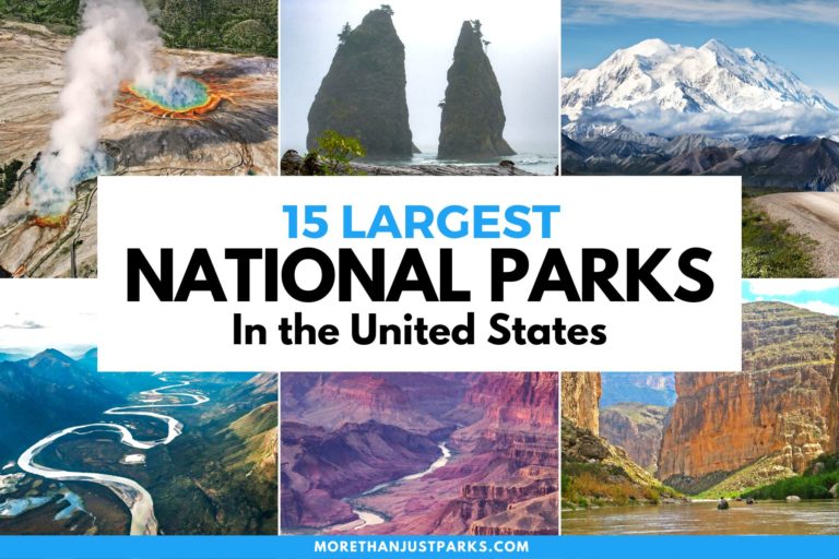
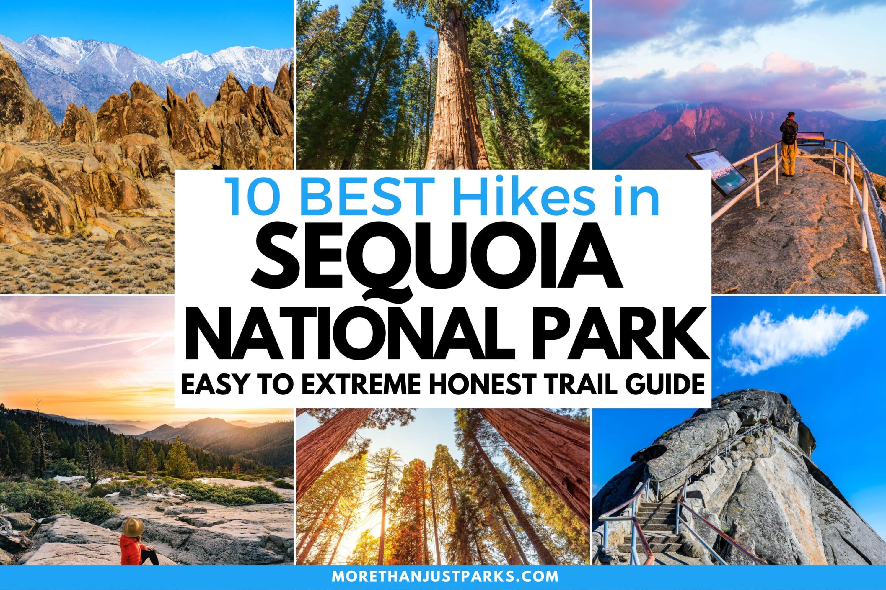
These are the 10 best hikes in Sequoia National Park, ranked by a combination of scenery, uniqueness, and that hard-to-quantify feeling you get when a trail genuinely changes how you see a place. I’ve listed trail stats, honest difficulty assessments, and notes on timing for each one.
If you’re planning a broader trip, check out our guide to 17 things to do in Sequoia National Park for activities beyond the trails.
Love Sequoia? It's one of 109 threatened public lands destinations we're tracking. Get the free weekly briefing.
10. Mount Whitney
- Distance 22 miles round trip
- Difficulty Extreme
- Elevation Gain 6,100+ feet
- Time Required 12-18 hours or multi-day backpack
The highest point in the contiguous United States sits at 14,505 feet, and the trail to get there is every bit as brutal as that number implies. I’ve made the summit twice. The first time I started at 1 a.m. from Whitney Portal and reached the top just after noon. I remember looking out over the Great Western Divide, the Owens Valley dropping away 10,000 feet below, and feeling like I’d walked to the edge of everything.
The Mount Whitney Trail requires a permit through the lottery system (apply in February for summer dates). Most folks do this as a day hike, but a two-night backpack with a camp at Trail Camp (12,000 feet) is far more comfortable. The 97 switchbacks above Trail Camp are the crux. At that altitude, every step feels like two.
Altitude sickness is a real concern. If you’re coming from sea level, spend at least a night in Lone Pine (3,700 feet) and another at the portal (8,300 feet) before attempting the summit.
9. Sunset Rock
- Distance 2.6 miles round trip
- Difficulty Easy
- Elevation Gain 250 feet
- Time Required 1-1.5 hours
This is the sunset spot in Sequoia, and it earns that reputation honestly. The trail leaves from Giant Forest Museum and follows a gentle path through the sequoia groves to a broad granite overlook facing west. When the light drops below the ridgeline and floods the Kaweah River canyon in gold, you’ll understand why photographers camp out here for hours.
I like arriving 45 minutes before sunset. That gives you time to find a perch on the rock, set up your camera, and just sit there as the light does its thing. The walk back is in twilight, so bring a headlamp.
8. Sawtooth Pass and Columbine Lake
- Distance 17 miles round trip
- Difficulty Strenuous
- Elevation Gain 4,800 feet
- Time Required Full day or overnight
If you want solitude and high-altitude drama in Sequoia, Sawtooth Pass delivers both. The trail starts at Mineral King, which is already remote enough that most casual visitors never make the winding 25-mile drive to get there. From the trailhead, you climb through wildflower meadows and past Monarch Lakes before hitting the final push to the 11,630-foot pass.
Sequoia National Park Map
10 trails mapped — click a pin to learn more
Sequoia National Park at a Glance
2 alertsColumbine Lake sits just below the pass in a granite bowl that looks like it was scooped out by a glacier the size of a city block (because it was). The water is a surreal turquoise. I shot some of my favorite Sequoia photographs here because the light at that elevation does something to the water that doesn’t make visual sense until you see it.
Fair warning about Mineral King. The marmots there are infamous for chewing on car hoses and wiring. Wrap your vehicle’s undercarriage in a tarp and secure it with rocks. I’m not joking. The rangers will confirm this.
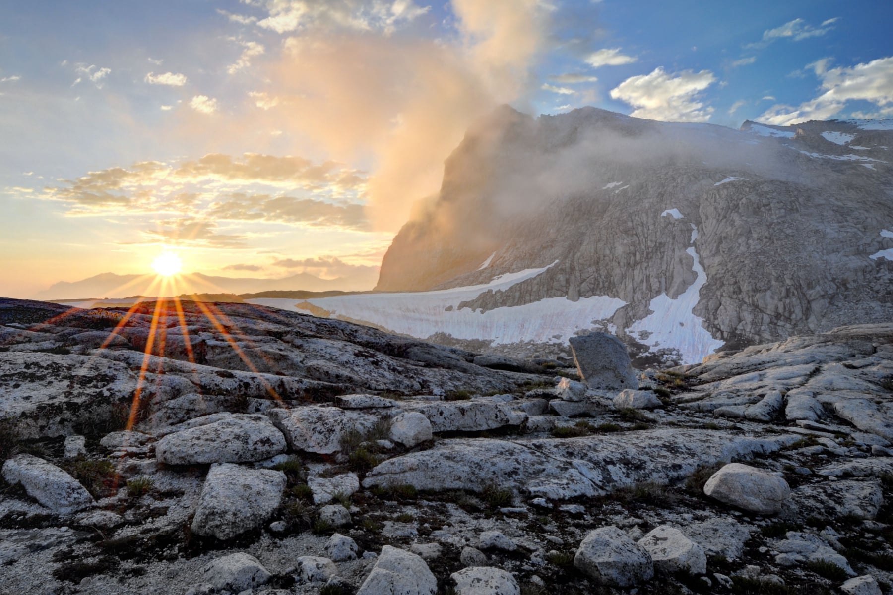
7. Kaweah Gap via High Sierra Trail
- Distance 26 miles round trip
- Difficulty Strenuous
- Elevation Gain 3,600 feet
- Time Required 2-3 day backpack
The High Sierra Trail is one of the great long-distance routes in American hiking, running 72 miles from Crescent Meadow to Mount Whitney. You don’t need to do the whole thing. The 13-mile stretch to Kaweah Gap is the most photogenic section and works as a manageable backpacking trip.
The trail traverses high above the Middle Fork of the Kaweah River on exposed granite shelves. The views are relentless. Castle Rocks, the Great Western Divide, and the Kaweah Peaks Ridge all compete for your attention. When you finally crest Kaweah Gap at 10,700 feet, the Nine Lake Basin opens up below you and the entire backcountry of Sequoia stretches to the horizon.
I’d camp at Hamilton Lakes (mile 8), which sits beneath the sheer granite face of Angel Wings. Get there early because the permitted campsites fill fast during July and August.
6. Moro Rock
- Distance 0.5 miles round trip
- Difficulty Moderate (steep stairs)
- Elevation Gain 300 feet
- Time Required 30-45 minutes
Roughly 400 stone steps climb this granite dome to a railing-enclosed summit with 360-degree views of the Great Western Divide, the Kaweah River canyon, and on clear days, the San Joaquin Valley 50 miles to the west. This is the single best viewpoint you can reach in under 15 minutes of walking in any national park I’ve been to, and I’ve been to 58 of them.
The staircase is narrow in places and fully exposed. If you have a fear of heights, this will test it. If you don’t, you’re in for one of the most exhilarating short hikes in California’s national parks. I prefer Moro Rock at sunrise, when the granite glows pink and you have the summit largely to yourself. By midday it’s packed.

5. Tokopah Falls
- Distance 3.4 miles round trip
- Difficulty Easy
- Elevation Gain 530 feet
- Time Required 1-2 hours
Tokopah Falls is the best waterfall hike in Sequoia and one of the best easy hikes in any Sierra Nevada national park. The falls cascade 1,200 feet down a granite staircase at the head of Tokopah Valley, which is a textbook U-shaped glacial trough. The valley walls tower hundreds of feet above the trail on both sides, and the granite spire called the Watchtower broods over the south rim like something out of a fantasy novel.
The trail starts at Lodgepole Campground and follows the Marble Fork of the Kaweah River through a mixed forest of red fir and lodgepole pine. It’s flat enough that families with kids won’t have trouble, and the payoff at the end is enormous. The best time to visit is late May through mid-June, when snowmelt pushes the falls to their peak flow. By August, the cascade thins to a trickle.
I’ve photographed these falls in every month from May through October. Early June is the sweet spot. The water is thundering, the wildflowers are popping along the trail, and the valley smells like wet granite and pine resin.

4. Alta Peak
- Distance 13.8 miles round trip
- Difficulty Strenuous
- Elevation Gain 3,920 feet
- Time Required 8-10 hours or overnight
If you have strong lungs and legs accustomed to the demands of the High Sierra, one of the most sublime views you’ll experience in a lifetime awaits at the summit of Alta Peak. The mountain soars to 11,204 feet between the Pear and Emerald Lake basins to the north and Alta Meadow to the south, and the panorama from the top is legitimately one of the finest in the entire Sierra Nevada.
A good starting point is Wolverton, taking the Lakes Trail up to Panther Gap and then the Alta Trail to the peak. You’ll rise from towering mixed-conifer forest, including some impressive red firs, into the timberline zone scattered with stout foxtail pines. Those foxtail pines are members of the bristlecone pine clan, found in a bizarrely disjointed range across California’s highest peaks.
The summit views include the Kings-Kaweah Divide, Great Western Divide, Kaweah Peaks, and the enormous granite barrens of the Tableland. Beyond the Great Western Divide, you can spot Mount Whitney. Look west and south to trace the foothills all the way down to the San Joaquin Valley floor. Strong hikers can tackle this as a brutal day hike, but camping at Mehrten Meadows or Alta Meadow makes it far more enjoyable.

3. Congress Trail
- Distance 2.7 miles round trip
- Difficulty Easy
- Elevation Gain 470 feet
- Time Required 1-1.5 hours
For anyone who loves trees, the Congress Trail is non-negotiable. This paved lollipop loop through the Giant Forest Grove leads you past some of the most incredible living organisms on the planet. The rusty-red columns of bark rise 200+ feet overhead, and the silence between them feels genuinely ancient.
The trail starts near the General Sherman Tree and winds through the clustered huddles of sequoias known as the House and Senate groups, which give the trail its name. You’ll also pass the President Tree, which is better than 3,240 years old and was calculated in 2012 to hold more wood than the General Grant Tree in Kings Canyon National Park. By volume, the President is the second most massive tree on Earth after General Sherman.
I’ve walked this trail more times than I can count, and I still stop to stare. The light filtering through the canopy in the late afternoon is unlike anything else I’ve photographed. If you only have time for one sequoia grove trail, this is the one. But if you can spare an extra half hour, connect it to the nearby Big Trees Trail for the full experience.

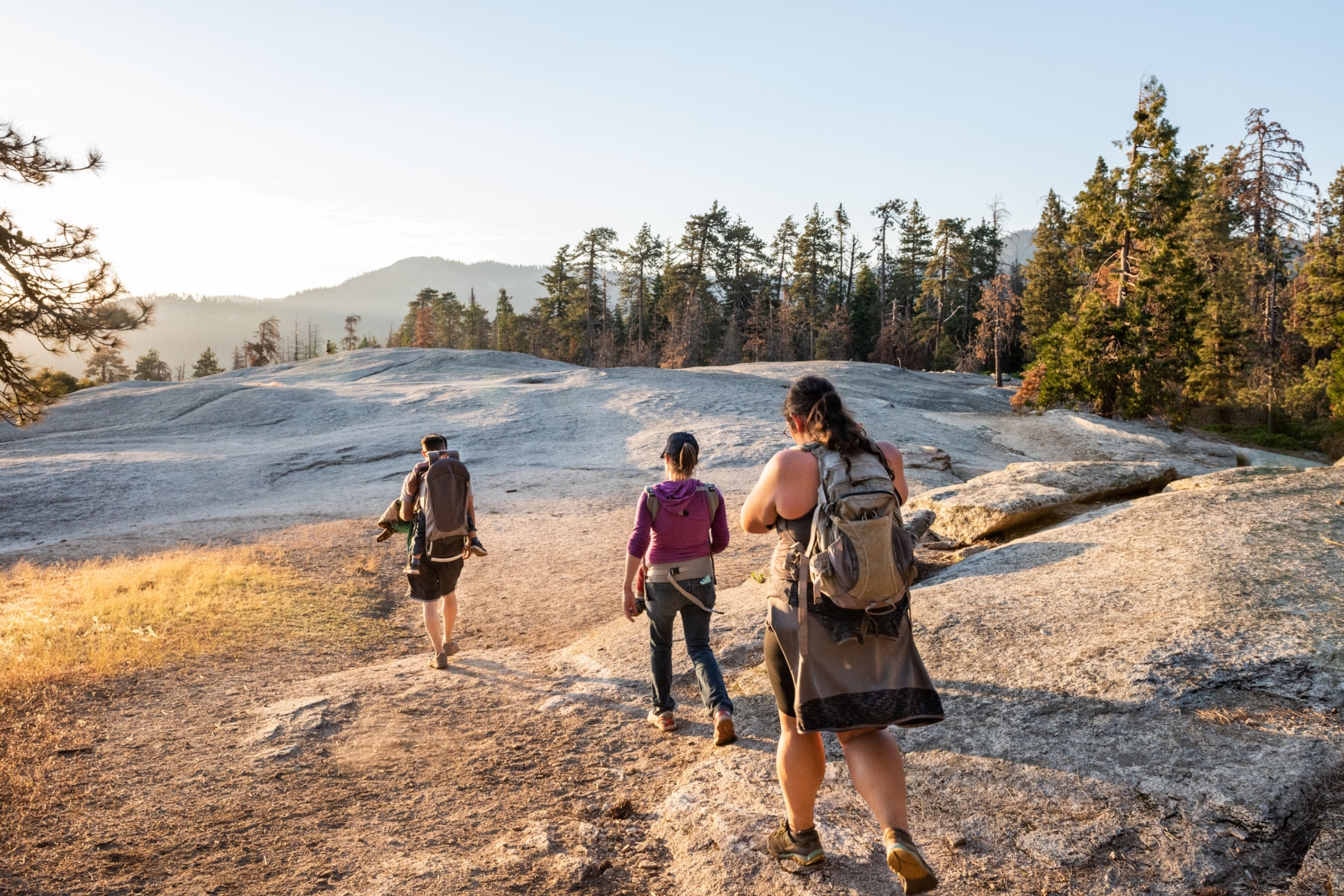
2. Big Trees Trail
- Distance 1.2 miles round trip
- Difficulty Easy
- Elevation Gain Minimal
- Time Required 30-45 minutes
The Big Trees Trail is maybe the quintessential Sequoia National Park hike. This loop circles Round Meadow in the Giant Forest, and the boardwalk section gives you a rare perspective to observe these ancient trees from a bit of distance. That matters. When you’re right at the base of a sequoia, your brain can’t process the scale. From the boardwalk, you see the full silhouette against the sky, and that’s when it hits you.
This is one of the best photography hikes in the park. The boardwalk with a person on it, set against the massive red trunks and green canopy, makes for the kind of image that conveys scale in a way words can’t. The trail is ADA-accessible, making it great for everyone. Interpretive signs along the route explain the ecology of the giant sequoia groves, from fire dependency to the surprisingly shallow root systems that support these 2,000-ton trees.
Pair this with the Congress Trail and the General Sherman Tree walk for a half-day immersion in the Giant Forest. You could also combine it with a drive to Yosemite from Sequoia if you have multiple days in the region.

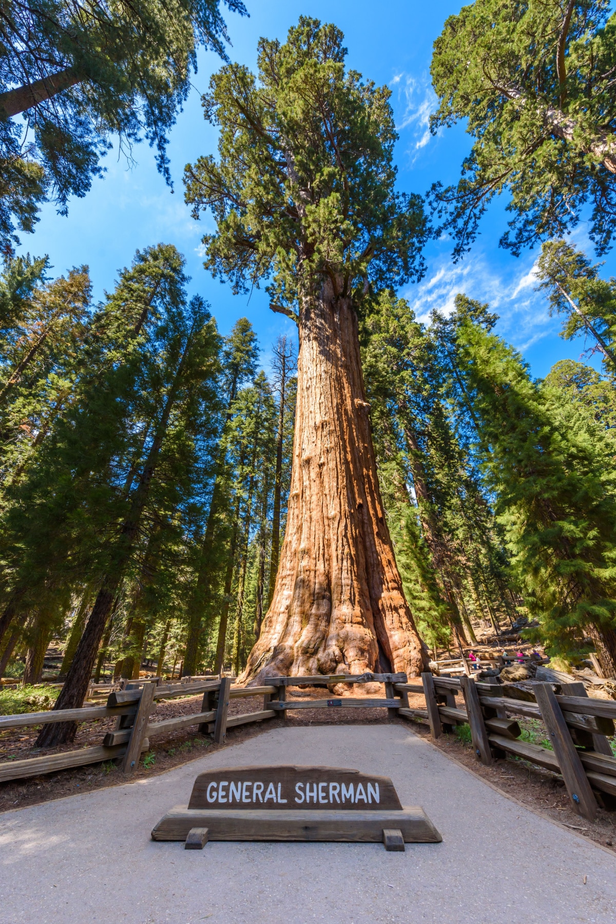
1. General Sherman Tree Trail
- Distance 1 mile round trip
- Difficulty Easy
- Elevation Gain 200 feet
- Time Required 30-45 minutes
Hikes in Sequoia National Park don’t come more one-of-a-kind than the short walk to General Sherman. This is the heftiest single-stem tree on Earth, with a basal circumference of 102.6 feet and more than 52,500 cubic feet of wood contained within its swollen trunk. By some standards, this is the largest single organism in the world.
Reckoned at between 2,300 and 2,700 years old, General Sherman is a genuine ancient, even if it falls short of the nearby President Tree in age (and well short of California’s Great Basin bristlecone pines, which can live nearly 5,000 years). The tree adds roughly one cubic meter of wood per year, which means it’s still growing at a pace that would take most trees several decades to match.
The Main Trail drops down to General Sherman from Wolverton Road via a paved descent that incorporates some stairs. The walk down is easy. The walk back up will remind you that you’re at 6,800 feet. Allow yourself plenty of time to just stand there and take it in. I always feel slightly ridiculous trying to photograph General Sherman because no lens captures what it actually feels like to be next to something that old and that large. You just have to go.
Planning Your Sequoia Hikes
Best Time to Visit
The hiking season in Sequoia runs from roughly mid-May through October. June is my favorite month because the waterfalls are at peak flow, the wildflowers are blooming, and the high country is just opening up. July and August are the busiest months but also the most reliable for clear skies on the longer backpacking routes. September offers warm days, cool nights, and significantly fewer people on the trails.
The Generals Highway (the main road connecting the Giant Forest to the park entrance) stays open year-round, but Mineral King Road and some higher trailheads close with the first heavy snowfall, usually by mid-November.
What to Bring
Sunscreen is non-negotiable at these elevations. I always carry this reef-safe option. For the longer hikes, bring at least 2 liters of water per person and a water filter for backcountry sources. Layers are essential since temperatures can swing 30 degrees between a shaded grove floor and an exposed granite summit.
A good topo map of Sequoia is worth having even if you use a phone app. Cell service is almost nonexistent in the park. For more in-depth route planning, this guidebook covers every trail listed here and dozens more.
Where to Stay
Lodgepole Campground is the most convenient base for the Giant Forest hikes. For a roof over your head, John Muir Lodge in nearby Kings Canyon is our top pick. If you’re combining Sequoia with other parks, our guide to Sequoia and Kings Canyon facts will help you plan the bigger picture.
Frequently Asked Questions
How many days do I need in Sequoia National Park?
I’d recommend two days minimum and add a trip to Kings Canyon National Park, even if you just drive the scenic byway. Ideally, you can see the main attractions of both parks in 3-5 days.
Is Moro Rock scarier than Half Dome?
Not by a long shot. Moro Rock is much smaller, and the trail isn’t nearly as long. It’s a great way to build confidence for exposed hikes. If Half Dome is on your list, check out our guide to the best hikes in Yosemite.
Is Yosemite better than Sequoia?
Yosemite is an icon, but Sequoia and Kings Canyon absolutely hold their own. Even John Muir was known to love this area, calling Kings Canyon a “rival to Yosemite.” That debate has been going since 1873. My honest take is that they’re different enough to deserve separate trips.
Which trails are best for families?
Big Trees Trail, General Sherman Tree Trail, and Tokopah Falls are all family-friendly. Big Trees Trail is fully ADA-accessible. Tokopah Falls adds a bit more distance but stays easy throughout. Kids tend to love the giant sequoias because the trees are genuinely unbelievable to anyone under 4 feet tall.
Explore More
- 17 Things to Do in Sequoia National Park
- 15 Amazing Facts About Sequoia National Park
- 15 Sequoia and Kings Canyon National Parks Facts
- 15 Things to Do in Kings Canyon National Park
- All 9 California National Parks Ranked
- All 63 US National Parks Ranked by Experts
What to Bring to Sequoia
Gear we recommend for Sequoia. Affiliate links support our work at no cost to you.
Affiliate disclosure: Some links on this page earn us a small commission at no extra cost to you. We only recommend gear we actually use.