

Established
1994
Size
795,156 acres
Visitors / yr
3M
Entrance
$30
Best season
October through April
Nearest airport
PSP Palm Springs International
01
Why Joshua Tree is worth the trip
California · Established 1994
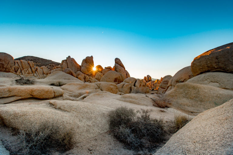
Joshua Tree is where two deserts shake hands. The high Mojave brings the twisted namesake trees and mountains of stacked granite boulders; the low Sonoran side runs to cholla gardens and creosote flats. The seam between them, a few hours from Los Angeles, gives this park a look nothing else can duplicate, half Dr. Seuss, half sculpture garden.
Climbers mapped the place decades ago, with thousands of routes on rough golden granite, but you do not need a rope to get it. Scramble the boulders at Hidden Valley, take in Keys View across the Coachella Valley to the San Andreas Fault, and stay for dark, when winter nights run long, cold, and stuffed with stars. Skip midsummer. The desert means it.
Start with our full Joshua Tree guide, then use the planning below.
02
Top things to do in Joshua Tree
Where we would start, and what we would plan a day around. Read the full guide.

Start here
14 Things to Do at Joshua Tree National Park
Read the guide
01
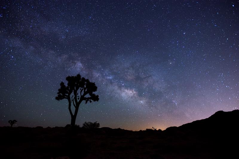 Stargazing · nps.gov
Stargazing at Joshua Tree
Enjoy Joshua Tree National Park's amazing night sky.
02
Stargazing · nps.gov
Stargazing at Joshua Tree
Enjoy Joshua Tree National Park's amazing night sky.
02
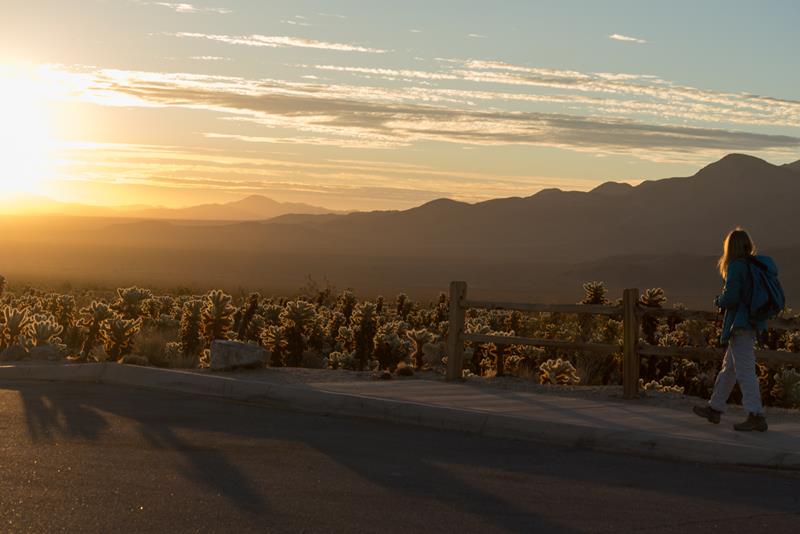 Hiking · nps.gov
Hike Cholla Cactus Garden
An easy quarter mile hike through a cholla patch along Pinto Basin Road.
03
Hiking · nps.gov
Hike Cholla Cactus Garden
An easy quarter mile hike through a cholla patch along Pinto Basin Road.
03
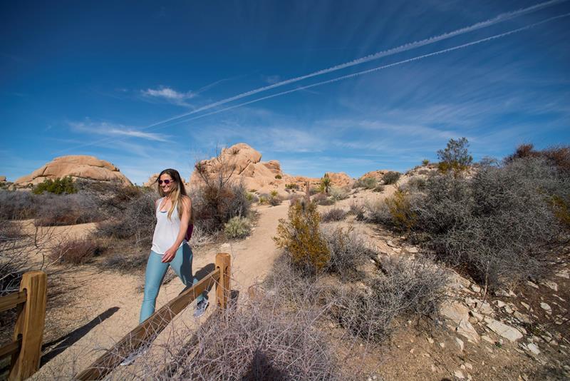 Hiking · nps.gov
Hike Skull Rock
A relatively flat, 1.7-mile loop trail. Hike through the large, granite boulder fields around the Jumbo Rocks area, including one near Park Boulevard that...
04
Hiking · nps.gov
Hike Skull Rock
A relatively flat, 1.7-mile loop trail. Hike through the large, granite boulder fields around the Jumbo Rocks area, including one near Park Boulevard that...
04
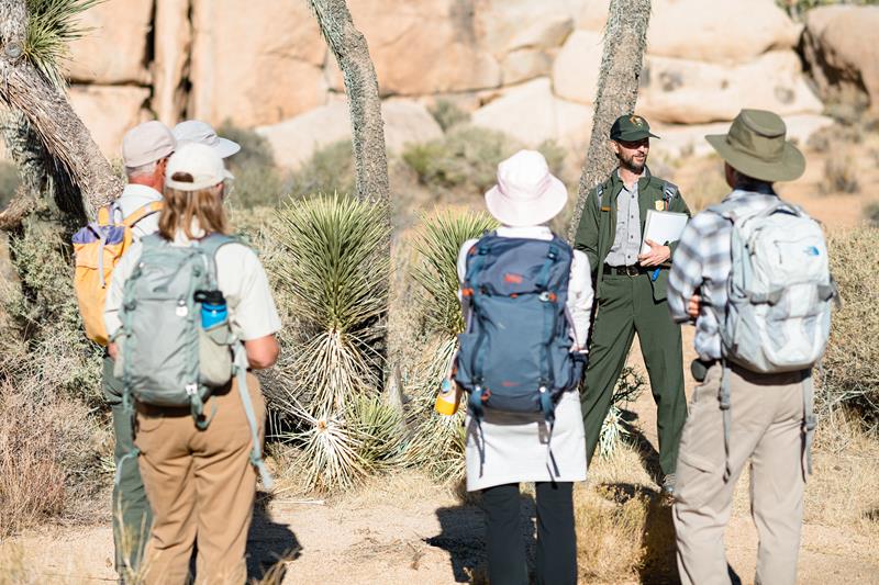 Guided Tours · nps.gov
Attend a Ranger Stroll
Join a ranger on an educational stroll.
Guided Tours · nps.gov
Attend a Ranger Stroll
Join a ranger on an educational stroll.
Stargazing · nps.gov
Stargazing at Joshua Tree
Enjoy Joshua Tree National Park's amazing night sky.
02
Hiking · nps.gov
Hike Cholla Cactus Garden
An easy quarter mile hike through a cholla patch along Pinto Basin Road.
03
Hiking · nps.gov
Hike Skull Rock
A relatively flat, 1.7-mile loop trail. Hike through the large, granite boulder fields around the Jumbo Rocks area, including one near Park Boulevard that...
04
Guided Tours · nps.gov
Attend a Ranger Stroll
Join a ranger on an educational stroll.
03
Best hikes in Joshua Tree
The trails that define the park, with the distance and elevation numbers that decide your day.
1
Cottonwood Spring (Mastadon Peak)
A moderate loop to the best sunset spot in the park.
2
Barker Dam
One of the park's most popular hikes, with a seasonal pool.
3
Cholla Cactus Garden
One of the easiest and best known walks in the park.
4
Hidden Valley
An easy loop through massive boulder piles and Joshua trees.
5
Wall Street Mill
Ruins of an old gold ore mill, the region's most intact.
Before you go
Get the Joshua Tree heads-up
Permit windows, closures and seasonal alerts, plus our best Joshua Tree guides, in your inbox before you go. Free, no spam.
04
Plan your trip
Our guides for the big decisions, plus the gear, maps and lodging we would actually use for Joshua Tree.
Where to stay
Gateway towns with lodging, food and outfitters.
- Joshua Tree, CAGateway town
- Twentynine Palms, CAGateway town
- Yucca Valley, CAGateway town
- Black Rock Campground 99 sites · Reserve
- Belle Campground 18 sites
Maps & guides
Carry paper. Cell service dies fast inside most parks.
America the Beautiful pass
$80 a year. Covers entrance fees at more than 2,000 federal recreation sites.
Get the pass
What to bring
Field-tested picks we bring on park trips.
-
Sun HatFull-brim coverage for exposed trails with zero shade. View on REI
-
Water BottlesCarry at least 2 liters. More in desert heat. View on REI
-
Hiking BootsAnkle support and grip for rocky, uneven terrain. View on REI
-
Sun-Protective ShirtUPF 50+ fabric keeps you cool and blocks UV all day. View on REI
Getting there
- PSP Palm Springs International 40 mi
- LAX Los Angeles International 130 mi
Some links in this section are affiliate links. If you book or buy through them we earn a small commission at no extra cost to you. We only recommend what we would use ourselves.
Joshua Tree map
VC Visitor Center
CG Campground
Nearby Park
05
Read our seasonal guide
When to go
Loading weather...
Month-by-Month Conditions
Tap any month for details
Month
High
Low
Crowds
Roads
Jan Best
60°
38°
Moderate
Open
Feb Best
63°
39°
Heavy
Open
Mar Best
70°
42°
Peak
Open
Apr Best
77°
47°
Heavy
Open
May
86°
54°
Moderate
Open
Jun
95°
61°
Light
Open
Jul
102°
70°
Light
Open
Aug
100°
70°
Light
Open
Sep
93°
64°
Light
Open
Oct Best
82°
52°
Moderate
Open
Nov Best
69°
43°
Heavy
Open
Dec Best
60°
36°
Heavy
Open
Best months to visit
Crowd level (low to peak)

Watch our film
Joshua Tree National Park 4K
We spent close to a month out here chasing those boulder piles and dark skies, and the winter cold was worth every shiver. If you only know Joshua Tree from a quick drive-through, this is the film that shows you what you missed after sundown.
Browse all our national park films06
More Joshua Tree guides
National Parks
Educational Resources
15 Facts About Joshua Tree National Park

National Parks
15 Hikes in Joshua Tree National Park

National Parks
Best Time to Visit Joshua Tree National Park (2026 Guide)

National Parks
Pleasant Valley, Joshua Tree National Park: A Visitor’s Guide

National Parks
Wall Street Mill, Joshua Tree National Park: A Trail Guide
National Parks
14 Things to Do at Joshua Tree National Park

National Parks
Skull Rock, Joshua Tree National Park: A Visitor’s Guide

National Parks
Hidden Valley, Joshua Tree National Park: A Visitor’s Guide
07
Parks near Joshua Tree
Within reach if you are building a longer trip.
Worth protecting
Joshua Tree belongs to all of us
Protections that took generations to win can be rolled back in a single session of Congress. We keep watch so they hold.
Stay in the Loop
Free dispatches on the parks and the policy fights around them, almost every day. Threats tracked, wins celebrated, no fluff.
Threatened Lands Map
Follow what's happening on federal lands across the country with our interactive map.
View the Tracker