National Park of American Samoa
8,257
Acres
22,500/year
Annual Visitors
Free
Entry Fee
May through September
Best Time to Visit
National Park Service
National Park
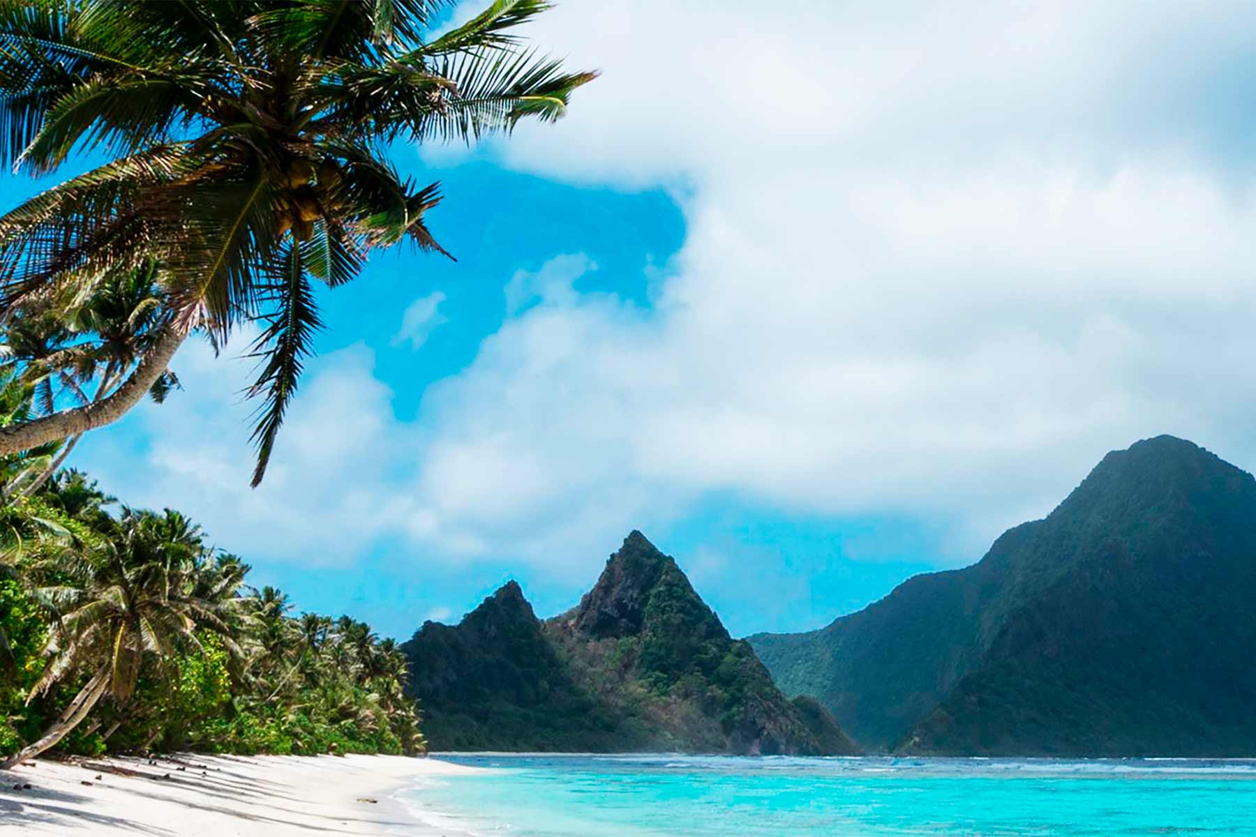
Established in 1988 on the islands of Tutuila, Ofu, and Ta'u in the South Pacific, this is the only US national park south of the equator and the only one where the land is leased from local villages rather than federally owned. It protects one of the last intact tropical rainforests in the Pacific, ancient coral reefs with more than 950 species of fish, and the culture of a Samoan people whose traditions predate Western contact by more than 3,000 years.
Our American Samoa Articles

When to Visit American Samoa
Loading weather...
Month-by-Month Conditions
Tap any month for details
Month
High
Low
Crowds
Roads
Jan
87°
76°
Low
Open
Feb
87°
76°
Low
Open
Mar
87°
76°
Low
Open
Apr
87°
75°
Light
Open
May Best
86°
75°
Heavy
Open
Jun Best
85°
74°
Heavy
Open
Jul Best
84°
73°
Peak
Open
Aug Best
84°
73°
Peak
Open
Sep Best
85°
74°
Heavy
Open
Oct
86°
75°
Light
Open
Nov
87°
75°
Low
Open
Dec
87°
76°
Low
Open
Best months to visit
Crowd level (low to peak)
Trip Essentials
Gear and guides we recommend for American Samoa. Affiliate links help support our work.
Hotels Near American Samoa
Compare lodges, cabins, and hotels near the park
Search on Booking.com
America the Beautiful Pass
$80/year. Covers entrance fees at all 2,000+ federal recreation sites.
Get the Pass
Sun Hat
Full-brim coverage for exposed trails with zero shade.
View on REI
Water Shoes
Quick-drying grip for shorelines, narrows, and river crossings.
View on REI
Sun-Protective Shirt
UPF 50+ fabric keeps you cool and blocks UV all day.
View on REI
Getting to American Samoa
Gateway Towns
- Pago Pago, AS
- Fagatogo, AS
Nearest Airports
- PPG Pago Pago International 5 mi
American Samoa Map
Nearby National Parks
Stay in the Loop
Free weekly dispatches on public lands. Threats tracked, wins celebrated, no fluff.
Subscribe on SubstackPublic Lands Tracker
Follow what's happening on federal lands across the country with our interactive map.
View the Tracker