
Open for comment · closes November 30
Stop the Big Piney logging decision before ESA consultation is done
U.S. Forest Service · VA, WV
- What
- The agency proposes commercial harvest across 2,219 acres and prescribed fire across 7,161 acres while ESA consultation on five endangered bat species and the Rusty Patched Bumble Bee with critical habitat inside the project area is still open.
- Where
- VA, WV
- How much
- 14,904 acres total project area subject to vegetation management; 2,219 acres acres of commercial mechanical timber harvest proposed; 7,161 acres acres of prescribed burning across seven burn blocks
- By when
- Comments to U.S. Forest Service by November 30, 2026.Date from Forest Service CARA comment page ↗, read October 31, 2026.
What to ask forAll 10 points →
The agency should suspend the decision timeline and re-open public comment after USFWS issues final concurrence or a Biological Opinion on all species with open consultations.
Where these four lines come from
- WhatOur plain-English read of the Forest Service project page ↗. Check it against the agency’s own words under Case.
- WhereThe places and states the project page names, as PLAN read them.
- 14,904 acres“Total Vegetation Management Area 14,904 acres” Table 3 Open the document ↗
- 2,219 acres“approximately 2,219 acres of commercial mechanical timber harvest, 462 acres of noncommercial mechanical and chemical treatment” Alternative 1 (Proposed Action) Open the document ↗
- 7,161 acres“Prescribed Burn Blocks 7,161 acres” Table 3 Open the document ↗
- By whenNovember 30, 2026, from Forest Service CARA comment page, the notice text ↗: “requested through 11/30/2026 11:59:59 PM (Eastern Standard Time)”. Read October 31, 2026.
- Read from PLAN’s record October 31, 2026.
Two ways to be heard on this, and both count. Comment for the legal record, then call the members who answer to you.
Comment nowWhat to say
Make these points, in your own words
The EA acknowledges that ESA Section 7 consultation on threatened, endangered, and proposed species was not complete at the time the draft was released.Read the point +
The document states that 'consultation on TEP species was not complete, including final concurrence from USFWS on the effects analysis and determinations.' Five bat species listed as Endangered or Proposed Endangered, the Rusty Patched Bumble Bee (with critical habitat in the project area), and other species all carry open determinations of 'May Affect, Likely to Adversely Affect.' Releasing a draft EA and moving toward a decision before Section 7 consultation is finalized deprives the public of the completed biological analysis and undermines the reasoned basis for the decision. The agency should suspend the decision timeline and re-open public comment after USFWS issues final concurrence or a Biological Opinion on all species with open consultations.
The EA's own eco-departure analysis shows that after full implementation the cove ecological group will depart further from desired conditions, not closer.Read the point +
Table 5 shows cove departure rising from 11 percent pre-project to 17 percent post-project. Yet the document presents the proposed action as uniformly moving the project area toward Forest Plan desired conditions without explaining why increasing departure in cove systems is acceptable or how it is consistent with the project's stated purpose and need. The agency must directly explain this contradiction, quantify the tradeoff, and either adjust the treatment prescriptions in cove systems or justify the increased departure against Forest Plan standards.
The project was canceled in April 2025 and then revived under a new regulatory framework created by merging 36 CFR Part 220 with 7 CFR Part 1B.Read the point +
The EA states: 'The project was canceled in April of 2025. 36 CFR Part 220 was merged with 7 CFR Part 1B to streamline environmental reviews across the department. This new project is in compliance with the Final Rule for 7 CFR Part 1B.' The document does not explain what procedural requirements changed, whether the prior scoping and comment record fully carries over under the new rule, or how the public's right to comment is preserved. Comments submitted after April 2025 (letters 1-#07 and 1-#08 dated August and October 2025) appear to have been accepted but there is no explanation of whether a new formal scoping period was opened under the new rule. The agency should explain in detail how the new rule differs from 36 CFR Part 220, confirm whether a new scoping period was required and conducted, and demonstrate that the public comment process was legally adequate under 7 CFR Part 1B.
The EA dismisses cumulative effects with other nearby timber projects in a single paragraph noting only the Duncan Knob sanitation harvest and the Cubville prescribed burn, without analyzing the Big Piney Project's combined effect with the Archer Knob Project (approximately 12 miles away) or the Dunlap Creek Project (approximately 30 miles away).Read the point +
A scoping commenter noted that Archer Knob and Dunlap Creek together will create 2,571 acres of early-successional habitat before counting Big Piney's 675 regeneration acres. The agency's response to comments simply says it will 'characterize direct, indirect, and reasonably foreseeable effects' but the EA's cumulative effects section does not include these projects or any landscape-scale early-successional acreage total. The agency should quantify cumulative early-successional and open-woodland acres created across all three projects at the district and landscape scale and analyze whether that combined magnitude triggers significance thresholds requiring an EIS.
The EA proposes treating 7,161 acres with prescribed fire and openly acknowledges that the eco-departure modeling assumes 'open and early successional habitat is created at the same rate across all ecological groups' but then concedes that 'observations of actual creation of open canopy forested habitats by prescribed fire has been shown to be variable.'Read the point +
Despite this admission, no confidence interval, range of outcomes, or contingency analysis is provided for the prescribed fire results. The entire justification for not preparing an EIS rests partly on predicted improvements from prescribed fire that the document itself admits are uncertain. The agency should either provide quantified uncertainty bounds on prescribed fire outcomes or prepare an EIS that analyzes a range of fire effectiveness scenarios.
The EA identifies imazapyr as one of the herbicides that may be applied and states in Table 10 that imazapyr has a typical half-life in groundwater of 7 to 10 months and that soil adsorption is weak to moderate.Read the point +
The project area is in a karst landscape with over 50 sinkholes identified during field surveys. DCR specifically flagged that sinkholes are direct conduits to groundwater and that nearby residents use private wells. Yet the only karst-specific herbicide restriction noted is that imazapyr 'would not be applied in management-prescription areas, per 9A1 Source Water Protection Watersheds,' without confirming whether all karst recharge zones fall within 9A1 or are otherwise protected. The agency should map all karst recharge zones, confirm which herbicide restrictions apply to each, and explain how imazapyr applications will be kept out of sinkhole catchments that connect to private wells.
The old-growth survey began in March 2025 and was completed in April 2026, which means it concluded after the project's original cancellation date and overlaps with or postdates the preparation of this EA.Read the point +
Table 8 identifies only 43.9 total acres of confirmed old growth across 11 patches, yet a scoping commenter cited Forest Service documentation suggesting the Warm Springs Mountain area 'may contain 1,838 acres of possible old growth.' The EA does not reconcile this large discrepancy, does not disclose the survey methodology in enough detail to allow independent evaluation, and does not explain why the identified patches are small (1 to 11.4 acres) relative to the possible old-growth estimate. The agency should release the old-growth tally sheets, explain the methodology used to distinguish possible from confirmed old growth, and analyze how surrounding treatment units affect the old-growth network as a whole rather than treating each patch as an isolated polygon.
The EA proposes 27 miles of skid trails, up to 9 miles of temporary roads (7 existing and 2 new), 92 landings, and 3.7 miles of dozer line, yet states that the effects analysis 'assumes that all access will follow Forest Plan standards' and that 'measurable long-term water quality effects should not occur' if standards are followed.Read the point +
The document identifies at least 11 potential perennial channel crossings and numerous additional crossings of intermittent and ephemeral streams. However, the quantitative sediment loading analysis is absent: the EA does not model predicted sediment delivery to streams, does not compare predicted loads to thresholds for brook trout or James Spinymussel habitat, and relies entirely on BMP compliance as a surrogate for impact analysis. The agency should provide a quantitative sediment delivery estimate for the subwatersheds most heavily affected by roads and skid trails and compare those estimates to known thresholds for aquatic species before making a final decision.
The EA eliminates from detailed study a 'No New Temporary Road Construction Alternative' that would have confined treatments to units accessible from existing roads, dismissing it solely because it 'would only allow modest improvements to forest stand structure and critical habitat.'Read the point +
No acreage estimate, no eco-departure improvement estimate, and no comparative environmental analysis is provided for this eliminated alternative. NEPA requires that alternatives be given serious consideration and that the reasons for eliminating them be substantive, not merely that they fall short of the agency's preferred outcome. The agency should either carry this alternative into detailed analysis with quantified eco-departure outcomes, or provide a documented, data-supported explanation of why modest improvement is categorically insufficient to meet the purpose and need.
The EA's socioeconomic dismissal states that 'this project would not affect timber prices or demand, nor result in considerable indirect or induced effects in the surrounding communities' but provides no data, no economic analysis, and no estimate of board feet, stumpage value, or local employment associated with the 2,219 acres of commercial harvest.Read the point +
Nearby residents raised concerns about road damage from log trucks, and at least one commenter asked how timber revenues would be used and whether reseeding and maintenance would be adequately funded. The agency cannot simultaneously claim no considerable socioeconomic effect while authorizing commercial harvest across 2,219 acres without any quantified analysis. The agency should disclose estimated timber volume, projected revenues, projected truck trips on state roads, and a funding plan for post-harvest non-commercial activities before the decision is made.
Say something only you can say. The law requires the agency to consider and respond to substantive comments, and specifics are what make a comment substantive.
Affects public lands
The agency proposes commercial harvest across 2,219 acres and prescribed fire across 7,161 acres while ESA consultation on five endangered bat species and the Rusty Patched Bumble Bee with critical habitat inside the project area is still open.
What’s at risk
If this goes through
Our plain-English read of the official notice ↗. Check it against the agency’s own words below.
By the numbers, from the agency’s own document
- Total project area subject to vegetation management
- Acres of commercial mechanical timber harvest proposed
Alternative 1 (Proposed Action)
Open the document ↗“approximately 2,219 acres of commercial mechanical timber harvest, 462 acres of noncommercial mechanical and chemical treatment”
- Acres of prescribed burning across seven burn blocks
- Miles of skid trails proposed (existing and new)
- Miles of temporary roads (7 existing plus 2 new)
- Confirmed old-growth acres identified in harvest units
Table 8
Open the document ↗“The Big Piney Project area contains patches from 1-11.4 acres in size that met the criteria for old growth.”
Source: the agency’s document ↗
The agency’s case, tested
What the agency argues, and whether its own record backs it
- 2
- Not backed yet
The Forest Service wants to change vegetation across about 14,904 acres of the George Washington National Forest in Bath County, Virginia. It says the project area is mostly late successional forest and is short on young forest, early successional habitat and more structurally complex older stands.
“The project area is dominated by forest stands that fall within the late successional stage. While this successional stage can provide habitat, there is a lack of young forest, early successional habitat, and more structurally complex late successional stand conditions in the project area.”
Big Piney Vegetation Management Project 2026
Each Ask below goes into your letter when you write it with PLAN on this page, matched to what you tell it about how this land reaches you.
Purpose and needNot backed yetThe project area lacks young forest, early successional habitat and more structurally complex late successional stand conditions.
The agency's best support is that it pairs this statement with another: the project area is dominated by forest stands in the late successional stage. That would help explain why young forest and early successional habitat are scarce. Still, the notice doesn't give current acres or percentages of young forest or early successional habitat. It doesn't name a target amount or say where a target would come from. It doesn't define "structurally complex," and it doesn't explain why late successional stands lack that structure. The project is listed as Pre NEPA, so the notice states the condition without showing the data behind it.
AskState how many acres of young forest and early successional habitat exist now, the target amount and its source, and what "structurally complex" means in measurable terms.
The agency’s words +Hide the words
The agency says
“While this successional stage can provide habitat, there is a lack of young forest, early successional habitat, and more structurally complex late successional stand conditions in the project area.”
Big Piney Vegetation Management Project 2026
Purpose and needNot backed yetMost forest stands in the approximately 14,904-acre project area are in the late successional stage.
The notice gives the size of the project area, approximately 14,904 acres in the Muddy Run and Jordans Run areas. It doesn't break those acres down by stand age or successional stage, cite a stand inventory, or define the age at which a stand counts as late successional. Any such data would be in the project documents, which aren't in this text.
AskPublish the acres in each age class or successional stage across the 14,904 acres, the inventory those figures come from, and the age cutoff used for late successional.
The agency’s words +Hide the words
The agency says
“The project area is dominated by forest stands that fall within the late successional stage.”
Big Piney Vegetation Management Project 2026
How this was read
Read from the agency’s own notice ↗, the notice that opens this window; the full analysis comes later, so what it leaves unsupported is what to ask it to show. Every quote is checked word for word against it, a claim marked contradicted stands on a quote from the same document, and a second reading argued the agency’s side of every verdict before it was published. The verdicts are our reading; the quotes are the agency’s. A court can set aside agency action it finds “arbitrary, capricious, an abuse of discretion, or otherwise not in accordance with law” (5 U.S.C. 706(2)(A) ↗), which is why these gaps are worth putting in the record.
In the agency’s own words
The project area is dominated by forest stands that fall within the late successional stage. While this successional stage can provide habitat, there is a lack of young forest, early successional habitat, and more structurally complex late successional stand conditions in the project area.
The groups on this fight
4 groups predicted likely to care in Virginia and West Virginia
Predicted likely to care is a guess from the group's sourced work in Virginia and West Virginia, with no link to this decision. Give straight to them; nothing routes through us.
- Friends of the Allegheny Front
Predicted likely to care · a guess
Works West Virginia: They work only in West Virginia.
- Mountain Institute
Predicted likely to care · a guess
Works West Virginia: West Virginia is one of the 2 states they work in.
- Shenandoah National Park Association
Predicted likely to care · a guess
Shenandoah National Park, Virginia: A nonprofit partner of Shenandoah National Park.
- Shenandoah National Park Trust
Predicted likely to care · a guess
Shenandoah National Park, Virginia: A nonprofit partner of Shenandoah National Park.
Every group above is on STAND for Public Lands, with its court record, its filings and who backs it.
Who signs it
The notice names no signer PLAN could read. PLAN names a decision-maker only when the document names one.
The ground
This fight isn’t bound to a map place in PLAN’s record yet. The notice names no place (VA, WV); none is a unit on the threatened lands map, so there’s no place page to open or watch.
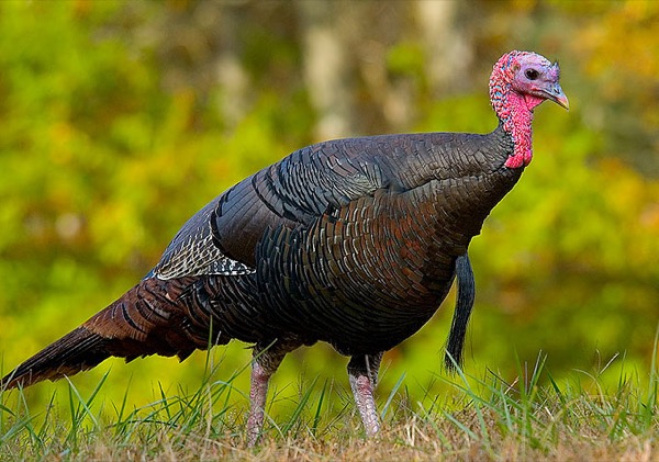
The photograph on this page: Wild turkey in hardwood forest. It’s the country this decision sits in, not the site itself. More Than Just Parks.
In court on this ground
This fight isn’t bound to a land unit in PLAN’s record yet, so there are no court cases to show for its ground.
Who holds the vote
PLAN’s record doesn’t tie a member of Congress to this fight yet. The scorecard grades the votes and bills that decide public lands; nothing joins a vote or a bill to this decision, so there’s no member to name here without guessing.
See how your members vote ↗Calling your two senators and your representative is the Call door on this page.
Forest ServiceWe track this on the agency’s own system of record, where most on-the-ground decisions live.
Know an open comment period we are missing, or spotted a wrong deadline? .
More fights that need you
Go deeper, free
See how your members of Congress vote on public lands
Every representative, graded on the votes that decide the fate of parks, forests, and refuges.
Open ↗The mapSee the places under active threat
A live map of the parks, monuments, and wild country in the crosshairs right now.
Open ↗A wrong fact, a dead link, a form that wouldn’t take your letter: one tap and it comes to the people who build PLAN, with this fight attached.