
Open for comment · closes November 4
Burns District BLM would add 10 herbicides and drone spraying
Bureau of Land Management · Burns District, Andrews Field Office
- What
- BLM wants to expand chemical treatment options and allow drone spraying across southeastern Oregon public lands.
- Where
- Burns District, Andrews Field Office, OR
- How much
- Wildlife, water sources, and recreationists in the Burns District face exposure to 10 newly approved herbicide ingredients applied via ground and drone.
- By when
- Comments to Bureau of Land Management by November 4, 2026.Date from BLM ePlanning project page ↗, read October 28, 2026.
What to ask forAll 4 points →
This proposal adds 10 new herbicide active ingredients to Burns District public lands in southeastern Oregon, including aminocyclopyrachlor, indaziflam, and flumioxazin, significantly expanding the chemical toolkit used on shared public land.
Where these four lines come from
- WhatOur plain-English read of the BLM NEPA Register DOI-BLM-ORWA-B060-2026-0001-EA ↗. Check it against the agency’s own words under Case.
- WhereThe places and states the notice names, as PLAN read them.
- How muchThe first sentence of our What’s at risk read of the notice; the whole read is under Case.
- By whenNovember 4, 2026, from BLM ePlanning project page, its public participation period ↗. Read October 28, 2026.
- Read from PLAN’s record October 28, 2026.
Two ways to be heard on this, and both count. Comment for the legal record, then call the members who answer to you.
Comment now4 holes in the agency’s own analysis
Make these points, in your own words
- This proposal adds 10 new herbicide active ingredients to Burns District public lands in southeastern Oregon, including aminocyclopyrachlor, indaziflam, and flumioxazin, significantly expanding the chemical toolkit used on shared public land.
- The Burns District BLM plans to authorize drone-based aerial herbicide application across the district, a new delivery method that has not previously been used in this program.
- Expanding treatment acreage under this updated plan means more of the Andrews Field Office and surrounding Burns District lands will be subject to herbicide treatments than under the existing program.
- The prior environmental analyses cited for these herbicides were programmatic and broad, not specific to the Burns District landscape, wildlife, and waterways that would actually receive these chemical applications.
Say something only you can say. The law requires the agency to consider and respond to substantive comments, and specifics are what make a comment substantive.
Affects public lands
BLM wants to expand chemical treatment options and allow drone spraying across southeastern Oregon public lands.
What’s at risk
If this goes through
Our plain-English read of the official notice ↗. Check it against the agency’s own words below.
In the agency’s own words
The District is proposing to update and expand this program by: • Adding 10 additional herbicide active ingredients (aminocyclopyrachlor, aminopyralid, clethodim, fluazifop-P-butyl, flumioxazin, fluroxypyr, imazamox, indaziflam, oryzalin, and rimsulfuron) to the list of herbicides available for use on the Burns District for invasive plant management; • Including the use of new technology such as drones for aerial applications and monitoring; and • Updating the proposed treatment acres from the existing Burns Integrated Invasive Plant Management EA to include the areas on which the new herbicides would be used in…
The groups on this fight
4 groups predicted likely to care in Oregon
Predicted likely to care is a guess from the group's sourced work in Oregon, with no link to this decision. Give straight to them; nothing routes through us.
- Cascadia Wildlands
Predicted likely to care · a guess
42 Divide Timber Project, Oregon: Plaintiff in the January 2026 suit against the Roseburg BLM plan to log nearly 7,000 acres near Camas Valley.
- Crag Law Center
Predicted likely to care · a guess
Elliott State Research Forest, Oregon: Represented Bird Alliance of Oregon, the Center for Biological Diversity, and Cascadia Wildlands in the 2012 Endangered Species Act suit over logging occupied murrelet habitat, which ended in the 2014 settlement canceling 28 timber sales.
- Oregon Natural Desert Association
Predicted likely to care · a guess
McDermitt Caldera, Oregon: Anchors the McDermitt Caldera Coalition on the Oregon side and fought the BLM's December 2025 approval of the Jindalee/HiTech lithium exploration project through the permitting process.
- Oregon Wild
Predicted likely to care · a guess
Western Oregon O&C Lands, Oregon: Its attorneys, with Cascadia Wildlands and Crag Law Center, represent the groups challenging BLM's Blue and Gold old-growth logging project in the Coast Range.
Every group above is on STAND for Public Lands, with its court record, its filings and who backs it.
Who signs it
The notice names no signer PLAN could read. PLAN names a decision-maker only when the document names one.
The ground
This fight isn’t bound to a map place in PLAN’s record yet. The notice names Burns District, Andrews Field Office (OR); none is a unit on the threatened lands map, so there’s no place page to open or watch.
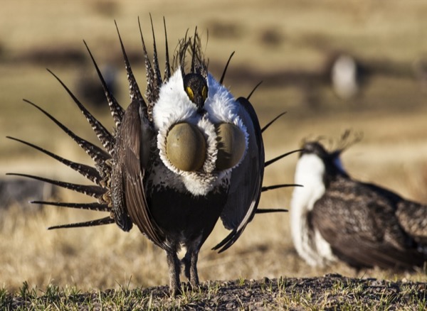
The photograph on this page: Greater sage-grouse displaying on a lek in sagebrush country. It’s the country this decision sits in, not the site itself. More Than Just Parks.
Who holds the vote
PLAN’s record doesn’t tie a member of Congress to this fight yet. The scorecard grades the votes and bills that decide public lands; nothing joins a vote or a bill to this decision, so there’s no member to name here without guessing.
See how your members vote ↗Calling your two senators and your representative is the Call door on this page.
BLM ePlanningWe track this on the agency’s own system of record, where most on-the-ground decisions live.
Know an open comment period we are missing, or spotted a wrong deadline? .
More fights that need you
Go deeper, free
See how your members of Congress vote on public lands
Every representative, graded on the votes that decide the fate of parks, forests, and refuges.
Open ↗The mapSee the places under active threat
A live map of the parks, monuments, and wild country in the crosshairs right now.
Open ↗A wrong fact, a dead link, a form that wouldn’t take your letter: one tap and it comes to the people who build PLAN, with this fight attached.