
Open for comment · closes October 26
Stop the Emergency Logging Plan Before Steelhead Consultation Finishes
U.S. Forest Service · Nez Perce-Clearwater National Forest, Palouse Ranger District
- What
- The agency proposes 637 acres of regeneration harvest, 12 miles of temporary road, and one mile of permanent road in a steelhead-critical-habitat watershed while ESA Section 7 consultation with NMFS remains unfinished.
- Where
- Nez Perce-Clearwater National Forest, Palouse Ranger District, ID
- How much
- 637 acres acres of regeneration harvest proposed; approximately 12 miles miles of temporary road construction proposed; 20 miles miles of new non-motorized trail proposed
- By when
- Comments to U.S. Forest Service by October 26, 2026.Date from Forest Service CARA comment page ↗, read October 15, 2026.
What to ask forAll 10 points →
The agency should provide a project-level analysis explaining exactly how each statutory criterion for emergency action is satisfied here, rather than relying on a blanket landscape-level designation to eliminate the public's right to administrative review.
Where these four lines come from
- WhatOur plain-English read of the U.S. Forest Service project page ↗. Check it against the agency’s own words under Case.
- WhereThe places and states the notice names, as PLAN read them.
- 637 acres“637 acres of regeneration harvest, 52 acres of commercial thinning (intermediate harvest), and 2,208 acres of non-commercial thinning” Forest Vegetation Open the document ↗
- approximately 12 miles“Approximately 12 miles of temporary road with 8 stream crossings will be constructed to facilitate timber harvest” Water and Aquatic Ecosystems (including Riparian Management Zones) Open the document ↗
- 20 miles“The proposed action to expand the Feather Creek non-motorized trail system will add an additional twenty (20) miles of non-motorized trail.” Sustainable Recreation (including Recreation A&R) Open the document ↗
- By whenOctober 26, 2026, from Forest Service CARA comment page, the notice text ↗: “requested through 10/26/2026 11:59:59 PM (Pacific Standard Time)”. Read October 15, 2026.
- Read from PLAN’s record October 15, 2026.
Two ways to be heard on this, and both count. Comment for the legal record, then call the members who answer to you.
Comment now10 holes in the agency’s own analysis
Make these points, in your own words
The agency invoked a Secretarial Emergency Situation Determination to strip this project of pre-decisional administrative review under 36 CFR part 218, yet the document never demonstrates that the Feather Creek project independently meets the statutory criteria for emergency designation under IIJA Section 40807.Read the point +
The document states only that the project area 'falls within the landscape identified by Secretary Rollins' and that use of the authority is 'appropriate.' That circular reasoning is not a site-specific legal finding. The agency should provide a project-level analysis explaining exactly how each statutory criterion for emergency action is satisfied here, rather than relying on a blanket landscape-level designation to eliminate the public's right to administrative review.
The Section 7 ESA consultation for Snake River Basin Steelhead is listed as 'ongoing' at the time this document was published, yet the agency describes in detail the proposed in-water construction, culvert work, and fish-salvage activities that are already designed and presented as the proposed action.Read the point +
A LAA determination for a federally threatened species requires a completed Biological Opinion before the agency can proceed. The document does not explain how it will incorporate the outcome of an unfinished consultation into this decision. The agency should complete consultation and receive a Biological Opinion before finalizing the EA and FONSI.
The document acknowledges that the Potlatch River temperature TMDL establishes load allocations based on effective shade, and that relocating FSR 377 will require clearing riparian vegetation including live overstory within the inner RMZ at up to 10 new stream crossings.Read the point +
The document then explicitly states that 'the current project record does not quantify the final inner-RMZ clearing footprint' and that restoration benefits from the old road removal 'do not substitute for evaluating the effects of new-road clearing in relation to applicable temperature TMDL allocations and FW-STD-WTR-06.' The agency has identified a gap in its own analysis but has not filled it. The agency should quantify the RMZ clearing footprint at each new crossing and demonstrate compliance with the Potlatch River temperature TMDL before issuing a FONSI.
The document states that vegetation treatments will raise equivalent clearcut area (ECA) from 2 percent to 9.7 percent on Forest Service lands, just below the 10 percent LMP screening threshold for low potential to alter peak and low flows.Read the point +
However, the scope of analysis for forestlands explicitly excluded a geographically disconnected 4,600-acre 'tail' of Forest Service acreage within the same HUC12 subwatershed. If that acreage and any existing ECA within it were included in the denominator, the resulting ECA percentage could be different. The agency should recalculate ECA using the full HUC12 Forest Service land base or explain in quantitative terms why excluding the 4,600-acre tail does not affect the threshold finding.
The document dismisses forestland, wildlife, soils, fire management, and recreation from detailed analysis by relying on the LMP FEIS as already-analyzed programmatic coverage.Read the point +
At the same time, it acknowledges site-specific conditions that the LMP FEIS does not address: the document states explicitly that 'The LMP and LMP FEIS does not address this, because it is a highly specific area of concern with the continued flooding over and into the current FSR 377.' If the LMP FEIS did not address the most distinctive site condition driving this project, the agency cannot credibly claim that the same FEIS provides adequate detailed analysis for effects flowing from that condition. The agency should conduct project-level detailed analysis of effects on forestland and soils that are tied to the specific meadow-flooding hydrology not covered by the programmatic FEIS.
The document proposes 12 miles of temporary road construction with 8 stream crossings but dismisses effects on water and aquatic ecosystems from temporary roads as non-substantive because LMP constraints will apply.Read the point +
The document simultaneously acknowledges that 'because of the increase in log-haul there is a higher potential risk of sediment delivery to stream, especially from roads adjacent to or hydrologically connected to streams.' No quantitative estimate of sediment delivery from 12 miles of temporary road and 8 crossings is provided, and no monitoring plan with measurable thresholds is specified. The agency should provide a site-specific sediment delivery estimate for the temporary road system and commit to enforceable, measurable monitoring triggers before issuing a FONSI.
The document states that desired conditions for legacy trees larger than 20 inches and larger snags larger than 15 inches are 'likely not being met,' yet forestlands are dismissed from detailed analysis on the ground that plan components will 'provide for snag recruitment in the future.'Read the point +
Regeneration harvest on 637 acres will convert existing stands to openings and plantations, which by definition removes current mature-tree structure. The document never analyzes how many legacy trees or large snags will be lost to harvest or what the trajectory to recovery looks like. The agency should provide a stand-level accounting of legacy tree and large-snag removal in the 637 acres of regeneration harvest before dismissing forestland effects from detailed analysis.
The Nez Perce Tribe was invited to three quarterly meetings and presented with the cultural resource inventory on August 11, 2026, but the document states that 'Nez Perce Tribe staff did not provide input.'Read the point +
The document also acknowledges that Traditional Use Areas and Sacred Sites 'may not be possible to identify through literature review or archaeological survey methods.' With the project anticipated for implementation on November 24, 2026, only about three months elapsed between the inventory submission and the planned start date. The agency should document whether the Tribe was given adequate time to respond given the compressed timeline created by the emergency authority, and extend the consultation window if the Tribe has not had a meaningful opportunity to identify non-archaeological cultural sites.
The document proposes constructing 20 miles of new non-motorized trail, including 4 intermittent and 3 perennial stream crossings, but dismisses trail effects on water and aquatic resources as non-substantive because potential effects 'would not exceed the thresholds.'Read the point +
No trail-specific erosion or sediment analysis is provided. The document also states that FW-GDL-ARREC-04 requires trail construction on lands with high mass wasting potential to be planned by an interdisciplinary team, but does not confirm whether any of the 20 miles crosses high mass wasting potential terrain or what the interdisciplinary team found. The agency should disclose the mass wasting potential findings for all 20 miles of proposed trail and provide stream-crossing-specific sediment analysis before dismissing trail effects.
The document proposes removing fuel accumulations on up to 420 acres along nine miles of system roads within 500 feet on either side, including commercial tree removal, and treats this as a fuels action dismissed from detailed analysis.Read the point +
However, 420 acres of commercial removal adjacent to roads falls within the same analysis area where the SCIA already found riparian condition and riparian plant composition to be 'departed and functioning at a low level.' The document does not analyze whether commercial removal within 500 feet of roads in this already-impaired riparian context will retard or advance attainment of riparian desired conditions. The agency should provide a site-specific analysis of how the 420-acre roadside commercial treatment interacts with the low-functioning riparian indicators before dismissing fire management effects.
Say something only you can say. The law requires the agency to consider and respond to substantive comments, and specifics are what make a comment substantive.
Affects public lands
The agency proposes 637 acres of regeneration harvest, 12 miles of temporary road, and one mile of permanent road in a steelhead-critical-habitat watershed while ESA Section 7 consultation with NMFS remains unfinished.
What’s at risk
If this goes through
Our plain-English read of the official notice ↗. Check it against the agency’s own words below.
By the numbers, from the agency’s own document
- Acres of regeneration harvest proposed
- 637 acres
- Miles of temporary road construction proposed
- approximately 12 miles
- Miles of new non-motorized trail proposed
- 20 miles
- Equivalent clearcut area after treatment
- 9.7 percent (up from 2 percent)
- Acres of roadside commercial fuel removal
- up to 420 acres along nine miles of system roads
- LMP annual timber sale objective
- 190-210 million board feet per year
Forest Vegetation
Open the document ↗“637 acres of regeneration harvest, 52 acres of commercial thinning (intermediate harvest), and 2,208 acres of non-commercial thinning”
Water and Aquatic Ecosystems (including Riparian Management Zones)
Open the document ↗“Approximately 12 miles of temporary road with 8 stream crossings will be constructed to facilitate timber harvest”
Sustainable Recreation (including Recreation A&R)
Open the document ↗“The proposed action to expand the Feather Creek non-motorized trail system will add an additional twenty (20) miles of non-motorized trail.”
Water and Aquatic Ecosystems (including Riparian Management Zones)
Open the document ↗“increasing the equivalent clearcut area (ECA) on FS lands within the analysis area from an existing 2% to 9.7%”
Fire Management
Open the document ↗“removal of fuel accumulation of dead and dying trees on up to 420 acres along nine miles of system roads”
Table 1. LMP Objective
Open the document ↗“FW-OBJ-TBR-01 Timber Offer 190-210 million board feet timber sale per year”
Source: the agency’s document ↗
The agency’s own analysis
What the notice says, and what it leaves out
Each one is a point a letter can put on the record.
The agency says
“The Feather Creek Landscape Restoration project area falls within the landscape identified by Secretary Rollins, and use of this authority is appropriate”
The agency invoked a Secretarial Emergency Situation Determination to strip this project of pre-decisional administrative review under 36 CFR part 218, yet the document never demonstrates that the Feather Creek project independently meets the statutory criteria for emergency designation under IIJA Section 40807.
Table 3: Effect Determinations for TEPC Species/Critical Habitat ↗
The agency says
“Consultation with the National Marine Fisheries Service under Section 7 of the Endangered Species Act is ongoing for Snake River Basin Steelhead and designated critical habitat.”
The Section 7 ESA consultation for Snake River Basin Steelhead is listed as 'ongoing' at the time this document was published, yet the agency describes in detail the proposed in-water construction, culvert work, and fish-salvage activities that are already designed and presented as the proposed action.
Water and Aquatic Ecosystems (including Riparian Management Zones) ↗
The agency says
“the current project record identifies approximately 1 mile of relocated permanent road with up to 10 stream crossings but does not quantify the final inner-RMZ clearing footprint.”
The document acknowledges that the Potlatch River temperature TMDL establishes load allocations based on effective shade, and that relocating FSR 377 will require clearing riparian vegetation including live overstory within the inner RMZ at up to 10 new stream crossings.
The agency says
“This landscape area was pared down from the full West Fork Potlatch subwatershed to exclude private lands and a geographically disconnected 4,600 acre 'tail' of Forest Service acreage within the subwatershed.”
The document states that vegetation treatments will raise equivalent clearcut area (ECA) from 2 percent to 9.7 percent on Forest Service lands, just below the 10 percent LMP screening threshold for low potential to alter peak and low flows.
Meadows, Grasslands, Shrublands ↗
The agency says
“The LMP and LMP FEIS does not address this, because it is a highly specific area of concern with the continued flooding over and into the current FSR 377.”
The document dismisses forestland, wildlife, soils, fire management, and recreation from detailed analysis by relying on the LMP FEIS as already-analyzed programmatic coverage.
Water and Aquatic Ecosystems (including Riparian Management Zones) ↗
The agency says
“Approximately 12 miles of temporary road with 8 stream crossings will be constructed to facilitate timber harvest and contribute to the attainment of FW-DC-TBR-01 and FW-DC-ES-01.”
The document proposes 12 miles of temporary road construction with 8 stream crossings but dismisses effects on water and aquatic ecosystems from temporary roads as non-substantive because LMP constraints will apply.
Table 3 Forestland Issue Dismissal Table ↗
The agency says
“the analysis found that desired conditions for legacy trees (>20") and larger snags (>15") (FW-DC-FOR-07) were likely not being met.”
The document states that desired conditions for legacy trees larger than 20 inches and larger snags larger than 15 inches are 'likely not being met,' yet forestlands are dismissed from detailed analysis on the ground that plan components will 'provide for snag recruitment in the future.' Regeneration harvest on 637 acres will convert existing stands to openings and plantations, which by definition removes current mature-tree structure.
Consultation with Federally Recognized Tribes ↗
The agency says
“Consultation with the Tribe also provides them with an opportunity to provide information to the Forest regarding non-archaeological cultural sites such as Traditional Use Areas and Sacred Sites, which may not be possible to identify through literature review or archaeological survey methods.”
The Nez Perce Tribe was invited to three quarterly meetings and presented with the cultural resource inventory on August 11, 2026, but the document states that 'Nez Perce Tribe staff did not provide input.' The document also acknowledges that Traditional Use Areas and Sacred Sites 'may not be possible to identify through literature review or archaeological survey methods.' With the project anticipated for implementation on November 24, 2026, only about three months elapsed between the inventory submission and the planned start date.
Sustainable Recreation (including Recreation A&R) ↗
The agency says
“The proposed action to expand the Feather Creek non-motorized trail system will add an additional twenty (20) miles of non-motorized trail.”
The document proposes constructing 20 miles of new non-motorized trail, including 4 intermittent and 3 perennial stream crossings, but dismisses trail effects on water and aquatic resources as non-substantive because potential effects 'would not exceed the thresholds.' No trail-specific erosion or sediment analysis is provided.
The agency says
“removal of fuel accumulation of dead and dying trees on up to 420 acres along nine miles of system roads would promote public safety and assist in protecting watershed resources”
The document proposes removing fuel accumulations on up to 420 acres along nine miles of system roads within 500 feet on either side, including commercial tree removal, and treats this as a fuels action dismissed from detailed analysis.
In the agency’s own words
Relocate FSR 377 out of floodplain to promote restoration. Promote forest resiliency with 637 acres of regen., 52 acres commercial thin, 2208 acres non-commercial thinning. Mechanical and hand fuel treatments on 800 in WUI. Establish new day use area, add to trail system, expanded parking.
The groups on this fight
4 groups predicted likely to care in Idaho
Predicted likely to care is a guess from the group's sourced work in Idaho, with no link to this decision. Give straight to them; nothing routes through us.
- Advocates for the West
Predicted likely to care · a guess
Bruneau-Jarbidge Rivers, Idaho: Represented Western Watersheds Project in the Jarbidge grazing litigation, winning 2004 and 2005 NEPA rulings, a 2009 injunction that grazing-as-usual must end, and a 2011 order closing 17 allotments across the 625,000-acre resource area.
- Center for Biological Diversity
Predicted likely to care · a guess
Stibnite Mine / Boise National Forest, Idaho: Plaintiff and co-counsel in the February 2025 lawsuit arguing federal wildlife agencies violated the Endangered Species Act by failing to protect salmon, steelhead, bull trout, and wolverine from the mine.
- Idaho Conservation League
Predicted likely to care · a guess
Craters of the Moon National Monument, Idaho: Mobilized Idahoans to file Interior Department comments defending Craters of the Moon during the 2017 national monument review, arguing shrinkage would damage the economies of Blaine, Butte, Minidoka, and Power counties.
- Western Watersheds Project
Predicted likely to care · a guess
Bruneau-Jarbidge Rivers, Idaho: Challenging BLM's grazing management across 1.4 million acres of the Jarbidge and Bruneau river canyonlands, where it won an injunction blocking ranchers from grazing beyond their permit limits.
Every group above is on STAND for Public Lands, with its court record, its filings and who backs it.
Who signs it
The notice names no signer PLAN could read. PLAN names a decision-maker only when the document names one.
The ground
This fight isn’t bound to a map place in PLAN’s record yet. The notice names Nez Perce-Clearwater National Forest, Palouse Ranger District (ID); none is a unit on the threatened lands map, so there’s no place page to open or watch.
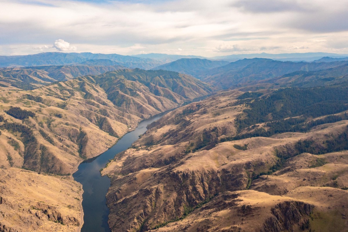
The photograph on this page: Nez Perce-Clearwater National Forests, Idaho. More Than Just Parks.
Who holds the vote
PLAN’s record doesn’t tie a member of Congress to this fight yet. The scorecard grades the votes and bills that decide public lands; nothing joins a vote or a bill to this decision, so there’s no member to name here without guessing.
See how your members vote ↗Calling your two senators and your representative is the Call door on this page.
Forest ServiceWe track this on the agency’s own system of record, where most on-the-ground decisions live.
Know an open comment period we are missing, or spotted a wrong deadline? .
More fights that need you
Go deeper, free
See how your members of Congress vote on public lands
Every representative, graded on the votes that decide the fate of parks, forests, and refuges.
Open ↗The mapSee the places under active threat
A live map of the parks, monuments, and wild country in the crosshairs right now.
Open ↗A wrong fact, a dead link, a form that wouldn’t take your letter: one tap and it comes to the people who build PLAN, with this fight attached.