
Open for comment · closes December 2
Approve 16 miles of new trails across a Civil War battlefield without completing historic resource review
National Park Service · Gettysburg National Military Park, Eisenhower National Historic Site
- What
- The plan would add approximately 16.3 miles of new trails and cost $5.8 million to build, but the agency admits Section 106 review of effects on National Register properties will not happen until after the approval decision is signed.
- Where
- Gettysburg National Military Park, Eisenhower National Historic Site, PA
- How much
- approximately 3.0 miles new multi-use (bike/pedestrian) trail miles proposed; approximately 13.3 miles new pedestrian trail miles proposed; approximately $5.8 million (2026 dollars) estimated capital cost to implement the Proposed Action
- By when
- Comments to National Park Service by December 2, 2026.Date from National Park Service PEPC project page ↗, read November 3, 2026.
What to ask forAll 9 points →
The agency should complete at minimum a programmatic agreement with the SHPO and Advisory Council on Historic Preservation before signing the FONSI, not after.
Where these four lines come from
- WhatOur plain-English read of the NPS Planning (PEPC) project page ↗. Check it against the agency’s own words under Case.
- WhereThe places and states the project page names, as PLAN read them.
- approximately 3.0 miles“The Proposed Action includes approximately 3.0 miles of new multi-use trails for pedestrians and bicyclists.” 2.2 Open the document ↗
- approximately 13.3 miles“The Trails Plan includes approximately 13.3 miles of new pedestrian facilities.” 2.2 Open the document ↗
- approximately $5.8 million (2026 dollars)“The estimated capital cost to implement the Proposed Action is approximately $5.8 million (2026 dollars), including contingency.” 2.2 Open the document ↗
- By whenDecember 2, 2026, from National Park Service PEPC project page, the document’s comment period ↗. Read November 3, 2026.
- Read from PLAN’s record November 3, 2026.
Two ways to be heard on this, and both count. Comment for the legal record, then call the members who answer to you.
Comment nowWhat to say
Make these points, in your own words
The EA defers all Section 106 consultation to future project-level reviews, yet the document itself acknowledges that proposed trails traverse areas of high archeological potential and that portions of several proposed trails and trailheads are within known archeological sites registered in the NPS Cultural Resources Inventory System.Read the point +
Approving a programmatic plan without completing Section 106 assessment of effects first, then promising consultation later, does not satisfy the requirement that NEPA and Section 106 run concurrently. Section 3.2.3 states that 'further Section 106 consultation, including Section 106 assessment of effects to historic properties, would take place once the Trails Plan has been completed and the Finding of No Significant Impact (FONSI) has been signed.' That sequence is backwards: the FONSI cannot legally precede the Section 106 determination of effect on National Register properties. The agency should complete at minimum a programmatic agreement with the SHPO and Advisory Council on Historic Preservation before signing the FONSI, not after.
The EA dismisses wildlife from detailed analysis by asserting that 'local wildlife is habituated to human use of the landscape,' yet Section 3.5.1 documents that the least shrew, a Pennsylvania state-endangered species, may have one of its most extensive populations within Eisenhower NHS, and that a new least shrew survey is currently underway and not yet complete.Read the point +
The agency cannot make a reasoned significance determination about a species whose population data it admittedly does not yet have. Section 3.5.3 concedes that the Camp Colt Trail may intersect least shrew habitat but defers avoidance measures to future design. The agency should wait for the ongoing least shrew survey to be completed and incorporate its findings before approving the plan, or at minimum prepare a biological assessment for the least shrew as a condition of FONSI.
The EA dismisses water resources and water quality from detailed analysis on the grounds that crossings would span bank to bank and that mitigation would be applied, yet Section 3.3.3 estimates approximately 0.36 acre of potential wetland disturbance from proposed trails alone, plus an additional 0.02 to 0.03 acres from the Willoughby Run pedestrian bridge.Read the point +
The document also lists the Pennsylvania Fish and Boat Commission's concern about freshwater isopods and amphipods in Section 1.4.2 but dismisses that topic too, promising only to provide the Commission an opportunity to review erosion and sediment control plans. Neither dismissal is accompanied by any quantitative analysis of water quality effects. The agency should restore water resources and water quality as a retained impact topic and provide quantitative analysis of sedimentation and turbidity effects on the named stream segments.
The EA concludes that the Proposed Action would have 'No Effect' on the monarch butterfly and the green floater clam without providing any site-specific habitat analysis for either species.Read the point +
For the green floater, a proposed threatened clam dependent on clean water and stream-bank integrity, the document simultaneously dismisses water quality from detailed analysis and dismisses the species from any effect. Section 3.5.3 states only that 'the NPS has determined that due to the nature of the work and that no critical habitat is found in the area, the Proposed Action would have No Effect on the monarch butterfly or the green floater.' Absence of designated critical habitat is not the same as absence of suitable habitat or absence of effect. The agency should provide the supporting species-specific habitat evaluation that underlies each No Effect determination, or elevate the determinations to Not Likely to Adversely Affect with formal USFWS concurrence.
The EA identifies grasslands as 'one of the most endangered ecosystems globally' and notes that the parks are designated Important Bird Areas, yet dismisses wildlife from detailed analysis and provides no quantitative analysis of how 13.3 miles of new mowed pedestrian trails cutting through grassland and pastoral habitats would affect grassland-dependent bird species.Read the point +
Section 3.4.1 states that 'grassland birds require large contiguous patches of grassland habitat for successful breeding' and that fragmentation causes a decrease in breeding birds, but Section 3.4.3 does not apply this information to the proposed mowing corridors. The agency should analyze the fragmentation footprint of proposed mowed trails on Important Bird Area grassland patches and either retain grassland birds as an impact topic or explain quantitatively why fragmentation effects are non-significant.
The EA authorizes bicycle use on trails it classifies as within 'developed areas,' which exempts them from the special-regulation rulemaking otherwise required by 36 CFR 4.30 for new bicycle trails outside developed areas.Read the point +
Section 1.5 states 'all proposed bicycle trails identified in this plan are within developed areas,' but the document never maps the developed-area boundary or demonstrates that each of the six proposed bicycle routes falls within a zone depicted on the park's land management and use map, as the regulatory definition requires. Without that demonstration, the developed-area classification is an unsupported legal conclusion. The agency should publish the park land management and use map showing developed-area boundaries and confirm, trail by trail, that each bicycle designation falls within a mapped developed zone, or initiate the required special-regulation rulemaking.
The EA estimates annual maintenance cost at approximately $140,000 per year and claims this would be approximately 30 percent lower than under the No Action Alternative, yet it provides no baseline figure for current maintenance spending against which that 30 percent reduction can be verified.Read the point +
Section 2.2 also acknowledges that implementation depends on 'available appropriations, philanthropic support, grants, and staff capacity' without any analysis of funding risk over the stated 10 to 15 year implementation horizon. An unfunded $5.8 million capital plan implemented over 15 years, with annual maintenance dependent on unappropriated funds, carries a real risk of partially constructed trails that degrade and damage the cultural landscape. The agency should disclose current annual maintenance expenditures, assess the probability of sustained funding, and analyze the environmental consequences of partial implementation.
The EA describes tribal consultation with the Delaware Nation, Delaware Tribe of Indians, and Seneca-Cayuga Tribe of Oklahoma in Section 4.2, but provides no information about the substance, dates, or outcomes of that consultation, and defers all Section 106 tribal consultation to future project-level reviews.Read the point +
Given that the document acknowledges the parks contain areas of high archeological sensitivity with intact battlefield deposits and that construction could unearth previously undiscovered cultural resources, including potentially human remains triggering NAGPRA, deferring tribal engagement is inadequate at the programmatic stage. The agency should disclose what each tribe was asked, what responses were received, and what commitments were made, and should complete government-to-government consultation on the programmatic plan before the FONSI is signed.
The EA proposes closing Carman Avenue and Williams Avenue to vehicles as part of the Proposed Action but states in Section 2.2 that 'the proposed closure would need to be field tested with a tour bus to ensure it remains a feasible option.'Read the point +
Approving an alternative that includes an action whose feasibility has not yet been confirmed is an unreasoned gap: if the field test fails, the traffic routing that supports the Spangler's Spring multi-use trail loop collapses, yet no contingency analysis is provided. The agency should either complete the bus field test before the FONSI is signed and incorporate results into the EA, or analyze an alternative traffic scenario in which the avenue closures prove infeasible.
Say something only you can say. The law requires the agency to consider and respond to substantive comments, and specifics are what make a comment substantive.
Affects public lands
The plan would add approximately 16.3 miles of new trails and cost $5.8 million to build, but the agency admits Section 106 review of effects on National Register properties will not happen until after the approval decision is signed.
What’s at risk
If this goes through
Our plain-English read of the official notice ↗. Check it against the agency’s own words below.
By the numbers, from the agency’s own document
- New multi-use (bike/pedestrian) trail miles proposed
2.2
Open the document ↗“The Proposed Action includes approximately 3.0 miles of new multi-use trails for pedestrians and bicyclists.”
- New pedestrian trail miles proposed
2.2
Open the document ↗“The Trails Plan includes approximately 13.3 miles of new pedestrian facilities.”
- Estimated capital cost to implement the Proposed Action
2.2
Open the document ↗“The estimated capital cost to implement the Proposed Action is approximately $5.8 million (2026 dollars), including contingency.”
- Estimated wetland disturbance from proposed trails
3.3.3
Open the document ↗“the plan estimates approximately 0.36 acre of potential wetland disturbance, primarily associated with proposed mowed trails.”
- Total wetland acreage within the parks
3.3.1
Open the document ↗“Currently there are approximately 404 acres of wetlands within the parks, with roughly 241 acres classified as perennial riverine wetlands.”
- Estimated annual maintenance cost under Proposed Action
2.2
Open the document ↗“Annual maintenance of the proposed trail system is estimated at approximately $140,000 per year, including mowing, vegetation management, drainage maintenance, trail inspections, sign replacement, periodic surface repairs.”
Source: the agency’s document ↗
The agency’s case, tested
What the agency argues, and whether its own record backs it
- 1
- Holds up
- 5
- Not fully backed
- 3
- Never analyzed
The National Park Service wants to adopt a trails plan for Gettysburg National Military Park and Eisenhower National Historic Site over approximately 10 to 15 years. The plan adds approximately 3.0 miles of multi-use trails and 13.3 miles of pedestrian trails, closes social trails and shifts two avenue segments from cars to bikes and walkers. The agency says this would improve safety and access, link the two parks to each other and to regional trails, and reduce damage from informal visitor use.
Each Ask below goes into your letter when you write it with PLAN on this page, matched to what you tell it about how this land reaches you.
EffectsNot fully backedWith mitigation, building the trails would avoid disturbing archeological resources in most cases, and trail use wouldn't cause long-term impacts.
The agency's support is a list of procedures: surveys, rerouting, building on fill, monitoring and data recovery. But Section 3.2.3 also says several trails cross areas of high archeological potential and that parts of some sit inside registered sites. It puts off the Section 106 assessment of effects until after the finding of no significant impact is signed. No site count or survey result backs "most instances."
AskIdentify which proposed trails and trailheads fall within registered archeological sites, and complete the Section 106 assessment of effects before signing any finding of no significant impact.
The agency’s words, the record and the law +Hide the words
The agency says
“With these mitigation measures, disturbance to archeological resources would be avoided in most instances.”
3.2.3
Elsewhere in the same document
“Portions of several proposed trails and trailheads are within known archeological sites that have been documented and registered in the NPS Cultural Resources Inventory System.”
3.2.3
“Several of the proposed trails traverse areas of high archeological potential.”
3.2.3
The law
“shall take into account the effect of the undertaking on any historic property.” National Historic Preservation Act, 54 U.S.C. 306108 ↗
EffectsNot fully backedProposed trails were designed to avoid delineated wetlands, which keeps wetland disturbance to a minimum.
The agency's strongest support is its record of moving routes away from wetlands. Table 2 says the Gettysburg Recreational Park Connection's "previously proposed alignment impacted wetlands, adjusted alignment does not." The Alternatives section dropped two Eisenhower National Historic Site trails and two equestrian trails partly because of wetland crossings. Section 3.3.3 adds boardwalks for crossings that can't be avoided, sediment controls, and replanting with native species. Still, the same section says wetlands along the proposed routes would be delineated before final locations are chosen, so it isn't clear which delineated wetlands were already avoided. A 12-foot buffer screening against National Wetlands Inventory maps still estimates approximately 0.36 acre of potential wetland disturbance, plus 0.02 to 0.03 acres for the Willoughby Run bridge.
AskDelineate wetlands along proposed alignments before deciding, and explain why the plan would disturb more wetland acreage than existing formal and social trails combined.
The agency’s words, the record +Hide the words
The agency says
“Throughout the planning process, the NPS designed proposed trail segments to avoid delineated wetland areas.”
3.3.3
Elsewhere in the same document
“Wetlands along proposed alignments would be delineated before final trail locations are selected.”
3.3.3
“Using a 12-foot buffer around proposed trail alignments and National Wetlands Inventory polygons, the plan estimates approximately 0.36 acre of potential wetland disturbance, primarily associated with proposed mowed trails.”
3.3.3
EffectsNot fully backedThe trails would have no effect on the monarch butterfly or the green floater, largely because no critical habitat is in the area.
The agency rests on "the nature of the work" and a U.S. Fish and Wildlife Service planning search that found no critical habitat. Elsewhere the document says stream crossings would span bank to bank with no structures in the waterway. It also says strict erosion and sediment controls would be used, and the Pennsylvania Fish and Boat Commission could review the sediment plans. But Table 5 lists both species as potentially occurring in the project area, and having no critical habitat doesn't mean a species is absent. For the green floater, a clam, the document's own isopod discussion admits that construction sediment reaching nearby waterways could cause adverse impacts. The controls would minimize that risk, not rule it out.
AskExplain the basis for a no effect finding on species the document says may occur, including surveys for the green floater in streams the trails would cross.
The agency’s words, the record and the law +Hide the words
The agency says
“The NPS has determined that due to the nature of the work and that no critical habitat is found in the area, the Proposed Action would have No Effect on the monarch butterfly or the green floater.”
3.5.3
Elsewhere in the same document
“Freshwater isopods and amphipods may be present within the project area, and increased sedimentation from the transport of construction-related byproducts into nearby waterways could result in adverse impacts to the species.”
Freshwater Isopods and Amphipods
The law
“An agency shall issue an environmental impact statement with respect to a proposed agency action requiring an environmental document that has a reasonably foreseeable significant effect on the quality of the human environment.” National Environmental Policy Act, 42 U.S.C. 4336(b)(1) ↗
Show 2 more claims +Show fewer
EffectsNot fully backedProposed trails would avoid identified least shrew habitat, with a possible exception along the Camp Colt Trail.
The agency limits its statement to identified least shrew habitat and openly flags the one possible exception, the Camp Colt Trail. Park mowing protocols generally discourage mowed paths through the wet habitat the shrew prefers. Final design and project-level review would apply avoidance or minimization measures. Section 3.5.1 says a new survey is still underway, so the identified habitat may grow. The document doesn't show, though, that the Eisenhower trails along field edges and fence lines cross the wetter areas the shrew favors.
AskFinish the least shrew survey before approving mowed trails at Eisenhower National Historic Site, and avoid construction and new mowing during the early spring mating season.
The agency’s words, the record +Hide the words
The agency says
“Proposed trails are intended to avoid identified least-shrew habitat, with a possible exception along the proposed mowed Camp Colt Trail where potential habitat may be adjacent to or intersect the alignment.”
3.5.3
Elsewhere in the same document
“A new least shrew survey is currently underway at the parks to better understand the location and abundance of the resident shrew populations.”
3.5.1
“The least shrew primarily lives in meadows, pastures, old fields, and other non-forested habitats, and like most shrews, prefers wetter areas within these habitats.”
3.5.1
EffectsNot fully backedDespite more mixing of user groups, the trail plan would be safer overall than leaving things as they are.
The agency's strongest support is the specific routes that would take people off roads. The Baltimore Pike (East) trail avoids a state highway with high traffic and high speeds. The Eisenhower intersection trail avoids conflict at Emmitsburg Road. Carman and Williams Avenues would become traffic-separated lanes, and the plan adds crosswalks plus design features such as 8 to 10 foot widths and sightline clearing. But many of those features apply only "where feasible," the document gives no crash or conflict data, and Section 3.1.3 admits more commingling may raise safety concerns. Table 4 also adds 10.9 miles of recommended on-road pedestrian routes and 21.7 miles of on-road bike routes without saying what safety improvements, if any, come with them.
AskProvide crash and conflict data for current routes, and explain how adding 21.7 miles of recommended on-road bike routes improves safety.
The agency’s words, the record +Hide the words
The agency says
“However, adopting the Trails Plan would overall be safer compared to the No Action Alternative because it incorporates more options for visitors to safely experience the parks on foot or via bicycle.”
3.1.3
Elsewhere in the same document
“The additional commingling may in turn raise safety concerns due to user conflicts.”
3.1.3
“Where dedicated non-motorized facilities are absent, pedestrians and bicyclists must use roadways with vehicles, increasing the potential for user conflicts and safety concerns.”
Safety and User Conflicts
What the document never analyzes
Not analyzedCumulative effects with other projects
The document notes that the Spangler Farm Trail is under construction and plans links to borough and regional trails. It never weighs the trails plan together with other past, present or planned projects.
Searched all 56 pages for ‘cumulative’, ‘other projects’, ‘reasonably foreseeable’. None appear.
AskAnalyze the cumulative effects of the trails plan together with the Spangler Farm Trail and other park, borough and regional projects.
Not analyzedEffects on guides, tour and riding businesses
The plan would relocate commercial horse users to a Taneytown Road access point and close avenue segments to vehicles. The agency consulted riding stables and bike and Segway tour companies but never analyzes effects on these businesses.
Searched all 56 pages for ‘socioeconomic’, ‘local economy’, ‘tourism’. None appear.
AskAnalyze how avenue closures, trail changes and the commercial horse user relocation would affect licensed guides, tour companies and riding stables.
Not analyzedFossils in the parks' geologic units
Section 3.2.1 says the parks' geologic units contain microfossils, plants, fossil pollen and trace fossils. The document never analyzes whether trail grading or excavation could disturb them.
Searched all 56 pages for ‘paleontological’, ‘paleontology’. None appear.
AskAssess whether trail construction could disturb fossils in the parks' geologic units, and add measures to protect any that are found.
Where its own record backs the agency
EconomicsBuilding the plan would cost much less than usual because approximately 80 percent of the network is existing mowed pathways.Why it holds +
The cost point rests mainly on surface type. Table 2 shows 13.3 miles of mowed grass or footpath trails, against approximately 3.0 miles of asphalt or compacted gravel multi-use trails. The agency says these routes need only minor grading, drainage work, signs and continued mowing, not new hardened surfaces. The maintenance discussion says the plan would "formalize existing mowed routes," and several entries describe improving existing footpaths or following existing road traces. The four capital items add up to approximately $5.8 million. The document does call the 13.3 miles "new pedestrian facilities" and gives no list of which routes are already mowed, and the Class C estimates carry a stated range of plus or minus 25 to 40 percent.
The agency says
“Because approximately 80 percent of the proposed trail network consists of existing mowed pathways, implementation costs are substantially lower than would be expected for a system requiring extensive new trail construction.”
Implementation Process and Costs
Its own record backs it
“The Trails Plan includes approximately 13.3 miles of new pedestrian facilities.”
Construction of Pedestrian Trails
How this was read
Read from the agency’s own decision document ↗, all 56 pages. Every quote is checked word for word against it, a claim marked contradicted stands on a quote from the same document, and a second reading argued the agency’s side of every verdict before it was published. The verdicts are our reading; the quotes are the agency’s. A court can set aside agency action it finds “arbitrary, capricious, an abuse of discretion, or otherwise not in accordance with law” (5 U.S.C. 706(2)(A) ↗), which is why these gaps are worth putting in the record.
In the agency’s own words
Gettysburg National Military Park and Eisenhower National Historic Site Trails Plan Draft Environmental Assessment November 2026
The groups on this fight
4 groups predicted likely to care in Pennsylvania
Predicted likely to care is a guess from the group's sourced work in Pennsylvania, with no link to this decision. Give straight to them; nothing routes through us.
- Center for Biological Diversity
Predicted likely to care · a guess
Allegheny National Forest, Pennsylvania: Fighting the current logging surge on the Allegheny as a threat to endangered bats and hellbenders.
- Environment America
Predicted likely to care · a guess
Allegheny National Forest, Pennsylvania: Its Pennsylvania arm documented the forest's exposure to logging and gas drilling in a dedicated report.
- Gettysburg Foundation
Predicted likely to care · a guess
Works Pennsylvania: They work only in Pennsylvania.
- Sierra Club
Predicted likely to care · a guess
Allegheny National Forest, Pennsylvania: Longtime co-plaintiff in litigation against Forest Service timber projects on the Allegheny, including the East Side clearcutting case.
Every group above is on STAND for Public Lands, with its court record, its filings and who backs it.
Who signs it
The notice names no signer PLAN could read. PLAN names a decision-maker only when the document names one.
The ground
Gettysburg National Military Park
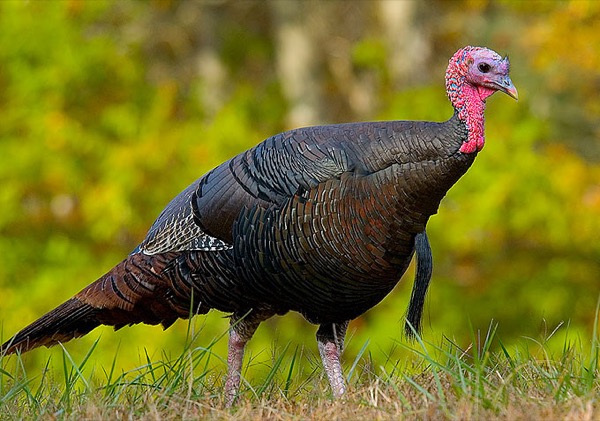
The photograph on this page: Wild turkey in hardwood forest. It’s the country this decision sits in, not the site itself. More Than Just Parks.
In court on this ground
This fight isn’t bound to a land unit in PLAN’s record yet, so there are no court cases to show for its ground.
Who holds the vote
PLAN’s record doesn’t tie a member of Congress to this fight yet. The scorecard grades the votes and bills that decide public lands; nothing joins a vote or a bill to this decision, so there’s no member to name here without guessing.
See how your members vote ↗Calling your two senators and your representative is the Call door on this page.
NPS PEPCWe track this on the agency’s own system of record, where most on-the-ground decisions live.
Know an open comment period we are missing, or spotted a wrong deadline? .
More fights that need you
Go deeper, free
See how your members of Congress vote on public lands
Every representative, graded on the votes that decide the fate of parks, forests, and refuges.
Open ↗The mapSee the places under active threat
A live map of the parks, monuments, and wild country in the crosshairs right now.
Open ↗A wrong fact, a dead link, a form that wouldn’t take your letter: one tap and it comes to the people who build PLAN, with this fight attached.