More Than Just ParksFoliage TrackerPowered byPublic Lands Intelligence

Forecast issued 25 Sep, 5:21pm ET

Back to the map

Park·Maryland·1,937 acres

Piscataway Park

Forecast issued 25 Sep, 5:21pm ET

Peak color1 NovAim for 31 Oct to 3 Nov
In the area today, Sep 25Still green
SepOctNov

Roadsides and wetland edges turn first, and the woods behind them run a few days later.

1 report came in from Prince George's County this week, 1 of them at peak. Our date held. See the county on the map.

Washington County, peak Oct 23Allegany County, peak Oct 20Caroline County, peak Oct 28City of Charlottesville, peak Oct 30King George County, peak Nov 2Richmond County, peak Nov 2Rappahannock County, peak Oct 25Greene County, peak Oct 25Louisa County, peak Oct 30City of Falls Church, peak Oct 27Cumberland County, peak Oct 31Lancaster County, peak Oct 23Loudoun County, peak Oct 26Henrico County, peak Nov 1Wicomico County, peak Oct 30Cumberland County, peak Oct 28King William County, peak Nov 1St. Mary's County, peak Nov 1Bedford County, peak Oct 18Chester County, peak Oct 24Carroll County, peak Oct 23New Castle County, peak Oct 28Dorchester County, peak Nov 1Goochland County, peak Oct 31Albemarle County, peak Oct 27Kent County, peak Oct 29Montgomery County, peak Oct 26Talbot County, peak Oct 31City of Baltimore, peak Oct 28Fulton County, peak Oct 21Caroline County, peak Oct 31Fluvanna County, peak Oct 30Northumberland County, peak Nov 2City of Manassas Park, peak Oct 28King and Queen County, peak Nov 2Clarke County, peak Oct 26Arlington County, peak Oct 30Warren County, peak Oct 26Somerset County, peak Oct 15Mineral County, peak Oct 23City of Winchester, peak Oct 25Page County, peak Oct 24Shenandoah County, peak Oct 22Cecil County, peak Oct 28Howard County, peak Oct 25Kent County, peak Oct 28Hampshire County, peak Oct 22Culpeper County, peak Oct 28Fauquier County, peak Oct 27Orange County, peak Oct 29Frederick County, peak Oct 24Morgan County, peak Oct 24Powhatan County, peak Oct 31Hanover County, peak Oct 31Jefferson County, peak Oct 25Spotsylvania County, peak Oct 29Stafford County, peak Oct 31Calvert County, peak Nov 1Accomack County, peak Nov 3Queen Anne's County, peak Oct 30Berkeley County, peak Oct 24Rockingham County, peak Oct 22Charles County, peak Oct 31Somerset County, peak Nov 2Worcester County, peak Oct 31District of Columbia County, peak Oct 27Middlesex County, peak Nov 4City of Alexandria, peak Oct 30City of Fairfax, peak Oct 27Sussex County, peak Oct 30City of Manassas, peak Oct 29Anne Arundel County, peak Oct 30Prince William County, peak Oct 29Buckingham County, peak Oct 30Salem County, peak Oct 27Augusta County, peak Oct 21Harford County, peak Oct 27Adams County, peak Oct 23Madison County, peak Oct 26Fairfax County, peak Oct 28Westmoreland County, peak Nov 2Lancaster County, peak Nov 4Essex County, peak Nov 2York County, peak Oct 23Baltimore County, peak Oct 26Frederick County, peak Oct 23City of Fredericksburg, peak Oct 31Nelson County, peak Oct 28Gloucester County, peak Oct 26Hardy County, peak Oct 20Prince George's County, peak Oct 29Franklin County, peak Oct 20I-95I-81US 50I-97WashingtonAlexandriaWaldorfDale CitySilver SpringFort HuntCentrevilleSuitland-Silver HillNational Capital Parkspeak 26 OctShenandoahpeak 20 OctPiscataway Park
Washington County, peak Oct 23Caroline County, peak Oct 28King George County, peak Nov 2Richmond County, peak Nov 2Rappahannock County, peak Oct 25Louisa County, peak Oct 30City of Falls Church, peak Oct 27Cumberland County, peak Oct 31Lancaster County, peak Oct 23Loudoun County, peak Oct 26Henrico County, peak Nov 1Wicomico County, peak Oct 30King William County, peak Nov 1St. Mary's County, peak Nov 1Bedford County, peak Oct 18Chester County, peak Oct 24Carroll County, peak Oct 23Dorchester County, peak Nov 1Goochland County, peak Oct 31Albemarle County, peak Oct 27Kent County, peak Oct 29Montgomery County, peak Oct 26Talbot County, peak Oct 31City of Baltimore, peak Oct 28Fulton County, peak Oct 21Caroline County, peak Oct 31Fluvanna County, peak Oct 30Northumberland County, peak Nov 2City of Manassas Park, peak Oct 28King and Queen County, peak Nov 2Clarke County, peak Oct 26Arlington County, peak Oct 30Warren County, peak Oct 26City of Winchester, peak Oct 25Cecil County, peak Oct 28Howard County, peak Oct 25Culpeper County, peak Oct 28Fauquier County, peak Oct 27Orange County, peak Oct 29Frederick County, peak Oct 24Morgan County, peak Oct 24Powhatan County, peak Oct 31Hanover County, peak Oct 31Jefferson County, peak Oct 25Spotsylvania County, peak Oct 29Stafford County, peak Oct 31Calvert County, peak Nov 1Accomack County, peak Nov 3Queen Anne's County, peak Oct 30Berkeley County, peak Oct 24Charles County, peak Oct 31Somerset County, peak Nov 2District of Columbia County, peak Oct 27Middlesex County, peak Nov 4City of Alexandria, peak Oct 30City of Fairfax, peak Oct 27City of Manassas, peak Oct 29Anne Arundel County, peak Oct 30Prince William County, peak Oct 29Buckingham County, peak Oct 30Harford County, peak Oct 27Adams County, peak Oct 23Madison County, peak Oct 26Fairfax County, peak Oct 28Westmoreland County, peak Nov 2Lancaster County, peak Nov 4Essex County, peak Nov 2York County, peak Oct 23Baltimore County, peak Oct 26Frederick County, peak Oct 23City of Fredericksburg, peak Oct 31Prince George's County, peak Oct 29Franklin County, peak Oct 20I-95US 50I-97I-270WashingtonAlexandriaWaldorfDale CityHybla ValleySilver SpringCentrevilleCherry HillNational Capital Parkspeak 26 OctPiscataway Park
Still greenStartingNearly peakPeakPast peakNo fall canopy we forecastInside the line, each band of elevation is painted on its own date.
Around Piscataway Park Prince George's County holds most of the area and is still green today. Charles County, to the south, is 2 days behind.
By elevation The area runs from about -1 to 59 feet. It turns together: there isn’t enough relief here for the color to come down in stages.
  1. 0–1,000 ftStill greenpeak Nov 178%
  2. -1,000–0 ftStill greenpeak Nov 122%

Height off 3DEP inside the area’s own boundary; each band carries the date our model gives that elevation, corrections and all. The percentage is how much of the area stands in it.
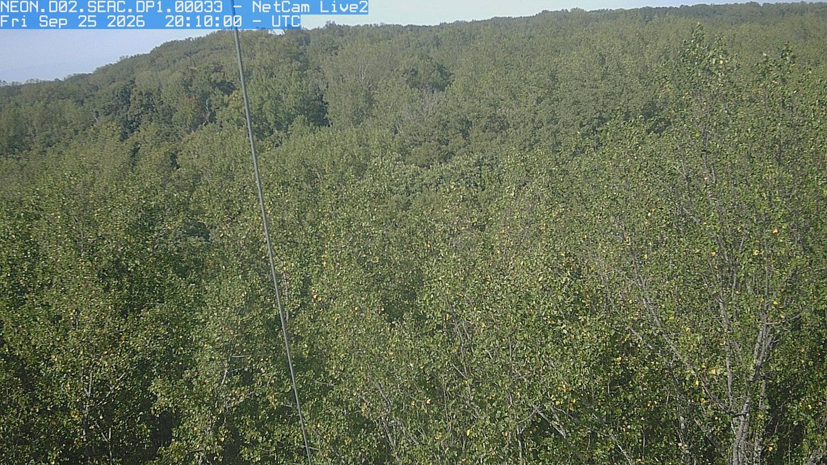
Today from the NEON.D02.SERC.DP1.00033 camera, 31 km from Piscataway Park
See it now PhenoCam Network, Smithsonian Environmental Research Center camera, 31 km away, captured Sep 25.

That’s 3 days later than our model alone would say. This September has been running warm, which shifts peak color.

Plan this trip

If you can only come on certain days

Set the days you can be here. Everything under them answers for those days, not for peak.

Saturday 31 October to Sunday 1 November

You’ll find it peak color.

That's the day our forecast puts peak color here.

  • 0–1,000 ftPeak colorpeak Nov 1
  • -1,000–0 ftPeak colorpeak Nov 1
Where to drive
Skyline Drive, about 73 miles · Route 39 (Goshen Pass), about 140 miles
What turns
sweetgum, blackgum, red maple, water oak, white oak

What turns, and when

Also named across Maryland, outside what the canopy read measures here: Tulip Poplar, Hickory.

Western Maryland's Allegheny ridges turn gold and russet with oaks and hickories while sweetgums in the Piedmont produce vivid purple and red.

This forecast is built from the species that stand here, their elevation and this September’s weather, and corrected in season by cameras, foresters and our own crew. We score it here against 7 long-running forest cameras: two dates in three land within 13 days of the camera’s own peak. How this map is made

All of Maryland