
Wilderness Area·California·231,586 acres
Ansel Adams Wilderness
Forecast issued Nov 9, 5:27pm ET
Higher ground turns first, so the slopes above the road lead the valley by a few days.
Weather Hard frost Sunday night. Peak may come early and go fast.
No new reports from the ground here this week.
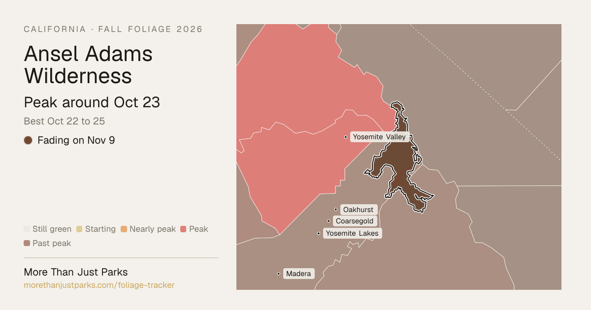
When is peak fall foliage at Ansel Adams Wilderness in 2026?
Our forecast puts peak color at Ansel Adams Wilderness around Oct 23, and the four days to aim for are Oct 22 to 25.
The wilderness runs from about 5,506 to 11,230 feet, and the color comes downhill over about 38 days: the high stands around Sep 18, the low ground around Oct 26.
| Week | In the wilderness | Elevation at peak |
|---|---|---|
| Aug 31 to Sep 6 | Still green | |
| Sep 7 to Sep 13 | Still green | |
| Sep 14 to Sep 20 | Still green | 10,000 to 12,000 ft |
| Sep 21 to Sep 27 | Still green | |
| Sep 28 to Oct 4 | Starting to turn | 8,000 to 10,000 ft |
| Oct 5 to Oct 11 | Starting to turn | |
| Oct 12 to Oct 18 | Nearly peak | 6,000 to 8,000 ft |
| Oct 19 to Oct 25 | Peak color | |
| Oct 26 to Nov 1 | Just past peak | 4,000 to 6,000 ft |
| Nov 2 to Nov 8 | Just past peak |
- 10,000–12,000 ftLeaves downpeak Sep 1822%
- 8,000–10,000 ftLeaves downpeak Sep 3040%
- 6,000–8,000 ftLeaves downpeak Oct 1331%
- 4,000–6,000 ftFadingpeak Oct 268%
Height off 3DEP inside the wilderness’s own boundary; each band carries the date our model gives that elevation, corrections and all. The percentage is how much of the wilderness stands in it.
If you can only come on certain days
Set the days you can be here. Everything under them answers for those days, not for peak.
Thursday, October 22 to Friday, October 23
You’ll find it leaves down up high, just past peak lower down.
Up at 10,000 feet the stands peak around Sep 18; down at 8,000 feet they hold on until about Oct 13. Pick your elevation for the day you come.
- 10,000–12,000 ftLeaves downpeak Sep 18
- 8,000–10,000 ftLeaves downpeak Sep 30
- 6,000–8,000 ftJust past peakpeak Oct 13
- Where to drive
- June Lake Loop (Route 158), about 14 miles · US Route 395 (Eastern Sierra), about 21 miles · Bishop Creek Road (Route 168), about 42 miles
- What turns
- Fremont cottonwood, quaking aspen, white alder, willow, California black oak
What turns, and when
- Fremont cottonwood25%
- quaking aspen18%
- white alder17%
- willow17%
- California black oak10%
- blue oak6%
Also named across California, outside what the canopy read measures here: Bigleaf Maple.
Eastern Sierra aspens turn brilliant gold against granite walls, black oaks in Yosemite Valley go bronze and russet, and cottonwoods line the desert creeks in pale yellow.
Questions people ask about Ansel Adams Wilderness
- When is peak fall foliage at Ansel Adams Wilderness?
Our forecast puts peak color at Ansel Adams Wilderness around Oct 23, and the four days to aim for are Oct 22 to 25.
- Where is the best fall color at Ansel Adams Wilderness right now?
On Nov 9 the wilderness is fading. The last band to peak was 4,000 to 6,000 feet, around Oct 26.
- How long does peak last at Ansel Adams Wilderness?
About four days at the top, Oct 22 to 25, with a week or so either side that's still worth the drive. Across the wilderness's elevations the color moves over about 38 days, so there's peak color somewhere in it for roughly 42 days.
- Is Ansel Adams Wilderness past peak?
Yes. Peak was around Oct 23, and on Nov 9 it's fading.
- What trees turn color at Ansel Adams Wilderness?
Quaking Aspen, Black Oak, Bigleaf Maple, Fremont Cottonwood, White Alder. Eastern Sierra aspens turn brilliant gold against granite walls, black oaks in Yosemite Valley go bronze and russet, and cottonwoods line the desert creeks in pale yellow.
This forecast is built from the species that stand here, their elevation and this September’s weather, and corrected in season by cameras, foresters and our own crew. Out here we score it against NASA's satellite record of when the canopy shuts down, read inside each unit’s own boundary: two dates in three land within 12 days of it. How this map is made
Nearby, and when they turn
Yosemite and Mono Basin National Scenic Area and Dinkey Lakes Wilderness and John Muir Wilderness and Hoover Wilderness are on the map above, with their own date.
- Peak Oct 7 best Oct 6 to 9
Fall color roads near Ansel Adams Wilderness
Nearest first. Distances are straight-line from the wilderness, so allow more by road.
- June Lake Loop (Route 158)
A short loop off US 395 with dense aspen groves around four alpine lakes. The most concentrated aspen color in California.
- US Route 395 (Eastern Sierra)
The stretch from Bridgeport to Lone Pine. Every canyon draining the Sierra's east side holds aspens, and the backdrop of 14,000-foot peaks is unmatched.
- Bishop Creek Road (Route 168)
Climbs from the Owens Valley to South Lake and Lake Sabrina. Aspens line the creek the entire way, peaking in early-to-mid October.
- Sonora Pass (Route 108)
A remote Sierra crossing with scattered aspen groves and wide alpine meadows. Less visited than 395 but equally beautiful.