If You Only Do One Hike: Make it South Kaibab Trail to Ooh Aah Point. The name is not ironic. You will say “ooh” and you will say “aah.” You get the full Grand Canyon drop-off experience in a manageable 1.8-mile round trip, and nothing else in the park gives you this much canyon for this little effort.
Grand Canyon National Park Map
4 trails mapped — click a pin to learn more
Grand Canyon National Park at a Glance
4 alertsRELATED: Planning the whole trip? See our full Grand Canyon National Park guide for where to stay, when to go, and what else to do.
| Trail | Rim | Distance | Elevation Change | Difficulty | Time |
|---|---|---|---|---|---|
| Bright Angel (to Havasupai Garden) | South | 9.6 mi RT | 3,040 ft | Strenuous | 6-9 hrs |
| South Kaibab (to Skeleton Point) | South | 6.0 mi RT | 2,040 ft | Hard | 4-6 hrs |
| North Kaibab (to Roaring Springs) | North | 9.4 mi RT | 3,050 ft | Strenuous | 7-8 hrs |
| Hermit Trail (to Santa Maria Spring) | South | 4.9 mi RT | 1,680 ft | Strenuous | 3-5 hrs |
| Rim Trail | South | Up to 13 mi one-way | Minimal | Easy | Varies |
| Grandview Trail (to Horseshoe Mesa) | South | 6.4 mi RT | 2,540 ft | Very Strenuous | 5-7 hrs |
| Cliff Springs Trail | North | 1.0 mi RT | 252 ft | Moderate | 1 hr |
| Point Imperial Trail | North | 4.0 mi RT | 442 ft | Easy | 2 hrs |
| Cape Final Trail | North | 4.0 mi RT | 495 ft | Easy | 2 hrs |
| Widforss Trail (closed 2026) | North | 10 mi RT | 1,082 ft | Moderate | 5 hrs |
| Uncle Jim Trail (closed 2026) | North | 5.0 mi RT | 731 ft | Moderate | 3 hrs |
| Ken Patrick Trail (east half open) | North | 9.8 mi one-way | 1,269 ft | Moderate | 6 hrs |
| Bridle Trail | North | 2.5 mi RT | 259 ft | Easy | 1 hr |
| Tanner Trail | South | 14.3 mi RT | 5,416 ft | Very Strenuous | 2 days rec. |
| Transept Trail (closed 2026) | North | 3.0 mi RT | 347 ft | Easy | 1.5 hrs |
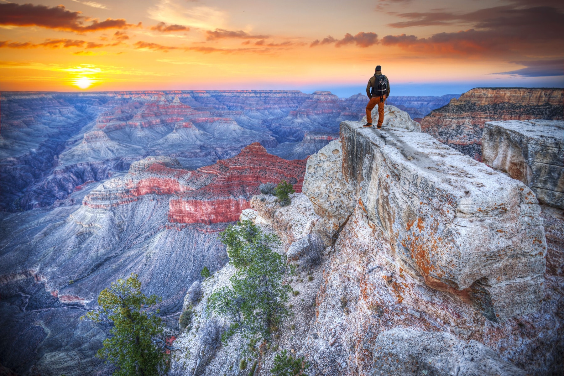
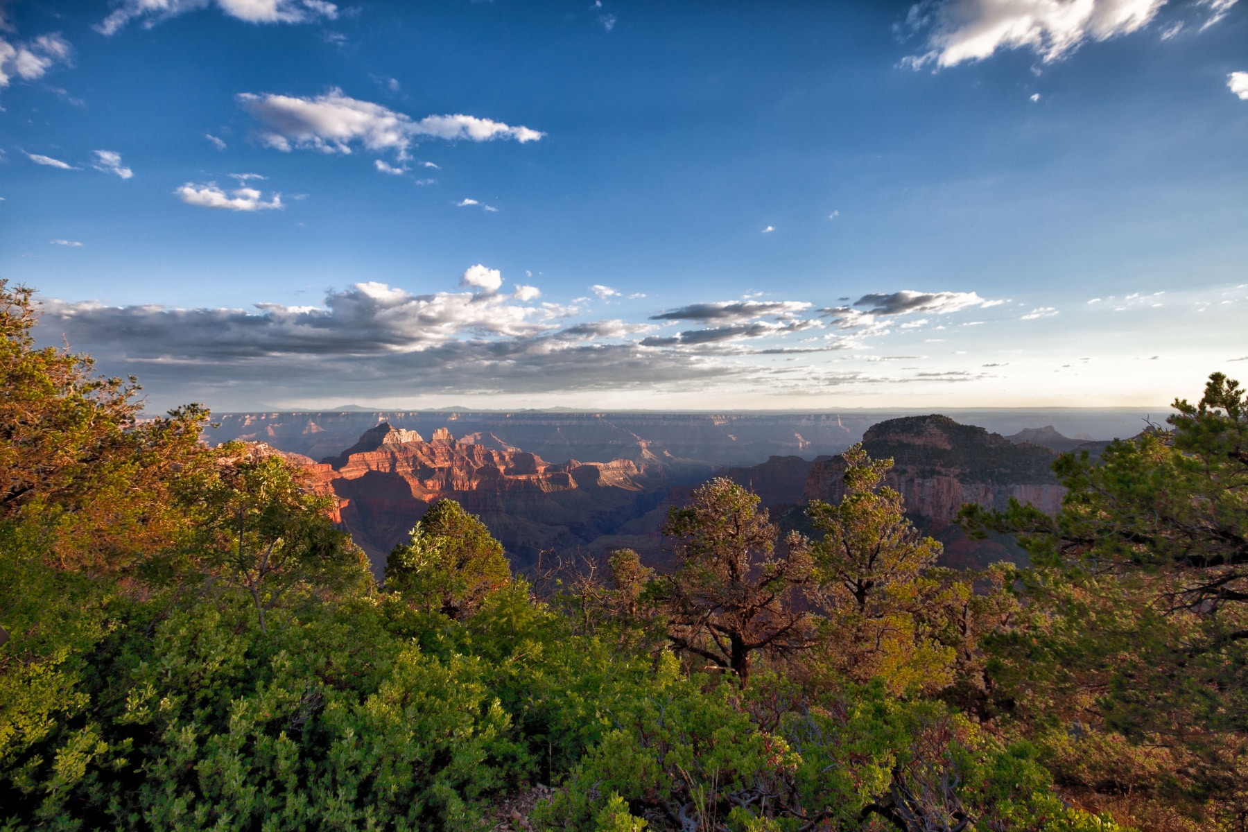
The rim is the trailer. The hike is the movie. Drop even half a mile down South Kaibab and the canyon stops being a postcard and becomes a place with weather, switchbacks, and 270 million years of rock stacked between you and the river. That is the line between the millions who photograph the Grand Canyon every year and the small fraction who actually walk into it. This list runs from gentle rim strolls to the brutal rim-to-river descents rangers will beg you not to attempt in a single summer day, ranked so you can find your level fast.
Love Grand Canyon? It's one of 109 threatened public lands destinations we're tracking. Get the free weekly briefing.
2026 Update: Two big stories this year. First, the North Rim reopened May 15, 2026 for day use after the 2025 Dragon Bravo Fire, which destroyed the Grand Canyon Lodge and over 100 structures. There is no lodging on the North Rim in 2026, services are minimal, and several rim trails remain closed (Transept, Widforss, Uncle Jim, Bright Angel Point, and the west half of Ken Patrick). The North Kaibab Trail is open to foot traffic, though the section between Redwall Bridge and Cottonwood closes October 15, 2026 for waterline repairs. Second, on the South Rim, the Transcanyon Waterline project keeps the River Trail east of River Resthouse, Silver Bridge, and Plateau Point Trail closed through June 30, 2026. Inner canyon hikers cross the Colorado on Black Bridge via South Kaibab. Mule rides are cancelled through June 30, 2026. Check the park’s Critical Backcountry Updates page before any hike.
- The entrance fee is $20 per person or $35 per car, valid for seven days. A non-resident surcharge of $100/person is also in effect (January 2026). First, check to see if you qualify for a free National Park access pass.
- No matter what time of year, bring sunscreen and reapply often. We like Thinksport SPF 50 for how it holds up during physical activity and the eco-friendly ingredients.
- Bring a paper map, because mobile service is spotty at best. A guidebook earns its weight too, and a thermal cover protects your phone from overheating in the inner canyon or freezing on the winter rim.
- If you’re looking for a place to stay near the South Rim, we always opt for The Grand Hotel outside the park, but you can choose one of the options inside the park. On the North Rim, the Grand Canyon Lodge was the only lodging inside the park until the Dragon Bravo Fire destroyed it in July 2025. No overnight lodging is available on the North Rim for the 2026 season.
- The North Rim normally operates mid-May to mid-October. For 2026, it reopened May 15 for day use only, with a general store and 24-hour self-serve gas through October 15 and limited water. The North Rim Campground opened June 1 (no water or hookups). Always check the park’s North Rim status page before planning a hike on that side.
The best hikes in the Grand Canyon are safe hikes. Here’s what you need to know before choosing your Grand Canyon day hike or longer adventure.
Permit vs. Day Hikes
You do not need a permit for hiking the Grand Canyon as long as it’s a day hike. However, listen to the park about not hiking rim to river, or rim to rim, in one day. People die ignoring that advice every year.
Backcountry hikes (camping) do require a permit issued through a lottery.
Water. Water. Water.
Only a handful of trails, like Bright Angel Trail, have potable water stations. Never rely on that supply. Pipeline breaks shut stations off without warning.
Above all, carry up to one gallon of water per person and a way to treat spring water.
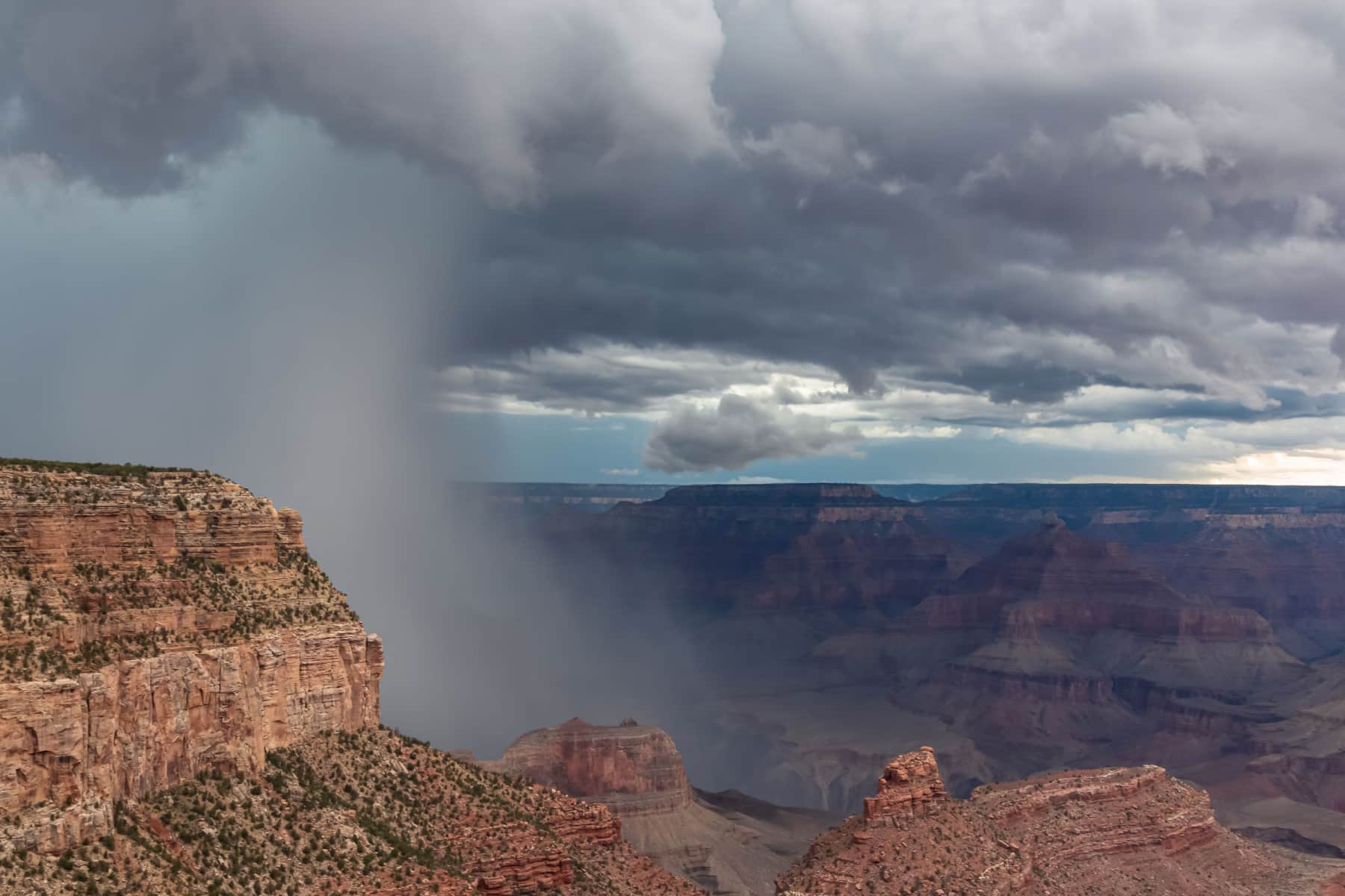
Weather
Check the weather and temperature forecast before you plan a hike. Summer monsoons bring flash flooding and lightning dangers at least a few times a week.
Expect a 5-6°F change in temperatures for every 1,000 feet you descend or ascend. The canyon floor easily reaches triple digits by noon in summer, if not earlier.
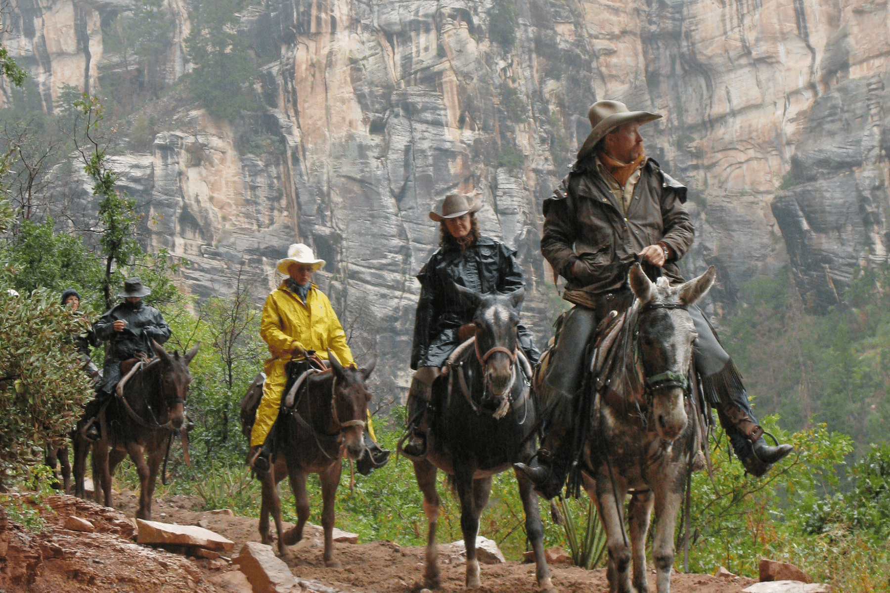
Mules
Some of the best hikes in the Grand Canyon are shared with mule trains, like Bright Angel Trail and North Kaibab Trail.
Mule groups always have the right of way, and yes, they leave evidence on the trail. (Rides are cancelled through June 30, 2026 during waterline work.)
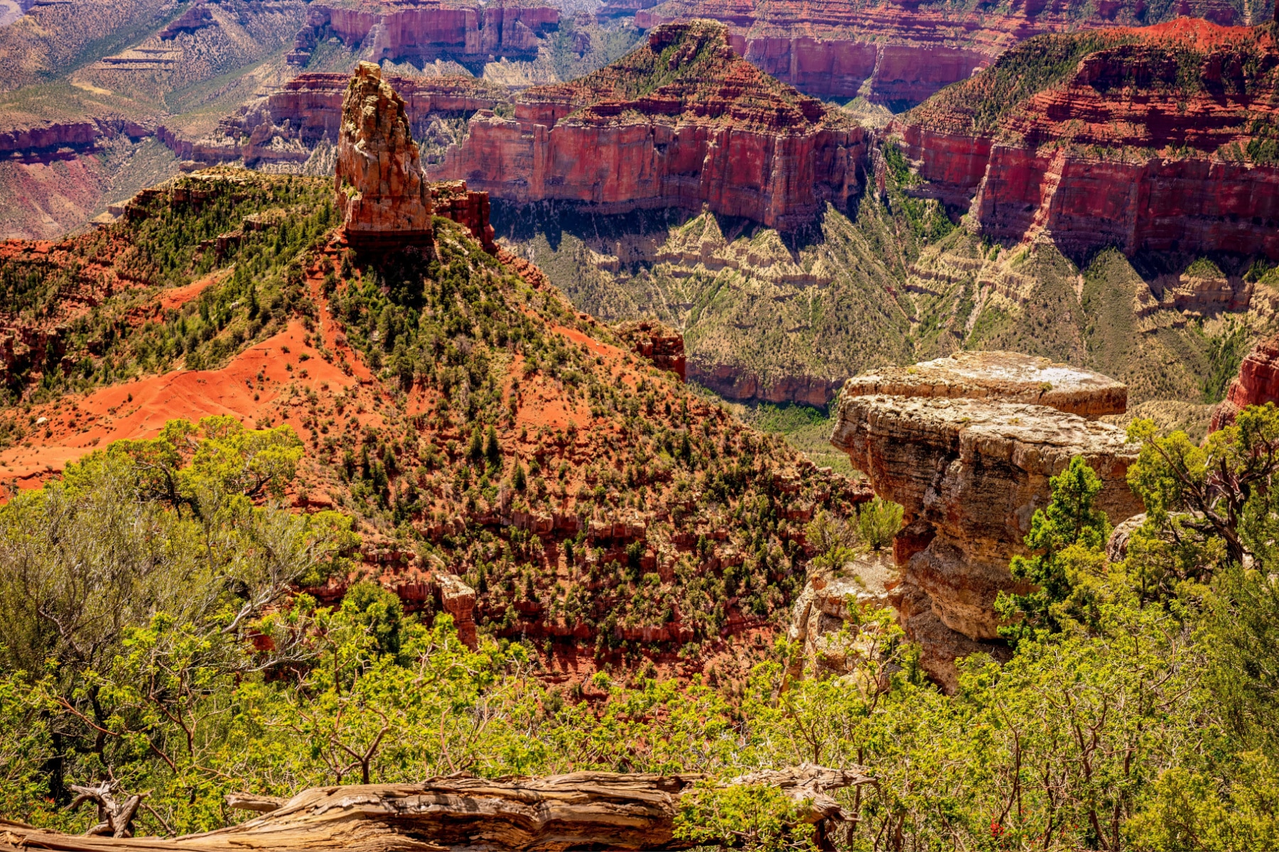
15. Transept Trail
Transept Trail
Location: North Rim
2026 STATUS: CLOSED. The Transept Trail is closed this season due to Dragon Bravo Fire damage. We’re keeping it on the list because it has earned its place, and we’ll update here when it reopens.
- Distance: 3 miles round-trip
- Difficulty: Easy to Moderate
- Elevation Change: 347 ft
- Time Required: Approximately 1.5 hours round-trip
The Transept Trail is an out-and-back route of roughly three miles. With a minimal elevation change of 347 feet, this is one of the best hikes in the Grand Canyon for beginners. You’ll still face some steep drops shortly after beginning.
The trail offers easy terrain (by Grand Canyon standards) and steady views into The Transept, the side canyon it follows. Various spots along the way let you walk closer to the edge for panoramic photos.
Related: all 63 national parks
The round trip takes about 1.5 hours, making the Transept Trail a manageable outing for anyone exploring the North Rim area.
14. Tanner Trail
Tanner Trail
Location: South Rim
- Distance: 14.3 miles roundtrip
- Difficulty: Strenuous
- Elevation Change: 5,416 ft
- Time Required: Around 8-10 hours (the park recommends two days)
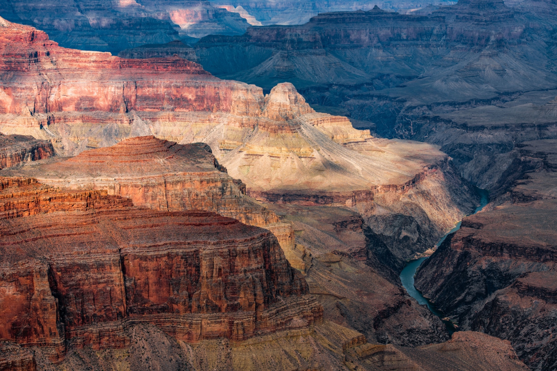
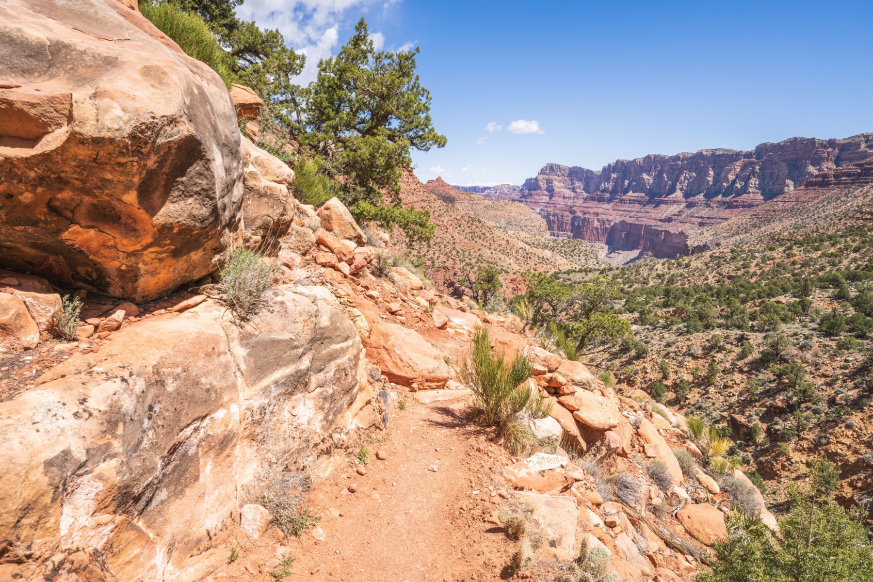
The Tanner Trail is the best hike on the South Rim for experienced canyon hikers. The people who run the park consider it the toughest trail on this side. While the other rim-to-river routes were engineered by humans, the Tanner follows a natural path to the river and the easternmost section of the canyon.
The Tanner Trail is unmaintained and ranks as one of the most difficult and demanding south side trails, but for an experienced canyon walker the
aesthetic bounty of the area will be adequate compensation.Grand Canyon NPS
The upper section is narrow, badly eroded, and hard to follow, especially after winter storms. Rock slides have buried parts of the original trail, which means improvising. Be careful and take your time.
If you can make it, the views down the eastern canyon and the sunsets are the payoff. The Tanner Trail awaits those seeking a difficult but worth it adventure.
13. Bridle Trail
Bridle Trail
Location: North Rim near North Kaibab Trailhead
- Distance: 2.5 miles round-trip
- Difficulty: Easy to Moderate
- Elevation Change: 259 ft
- Time Required: 1 hour round-trip
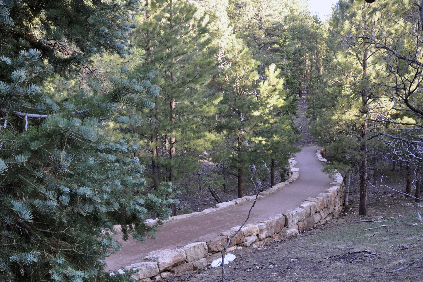
The Bridle Trail is a convenient, accessible path that follows the road connecting the former Grand Canyon Lodge site with the North Kaibab Trailhead, 1.2 miles one-way. This is the best hike in the Grand Canyon for folks traveling with pets, and one of the only trails where pets are allowed at all. Check current conditions at the park’s North Rim status page before counting on it this season.
The Bridle Trail has a hard-packed surface, making it stable and relatively easy. If you prefer to explore on two wheels, bicycles are also allowed on this trail.
12. Ken Patrick Trail
Ken Patrick Trail
Location: North Rim
2026 STATUS: PARTIALLY OPEN. The east section of the Ken Patrick Trail is open. The west section near the North Kaibab Trailhead is closed due to fire damage. Hike it from the Point Imperial side this season.
- Distance: 9.8 miles one-way
- Difficulty: Moderate
- Elevation Change: 1,269 ft
- Time Required: 6 hours
The Ken Patrick Trail is the best hike in the Grand Canyon for being alone. It’s the least-used trail on the least-visited rim, and it’s a wonderful rim walk to the highest viewpoint of the North Rim.
In a normal year, the full route runs between the North Kaibab Trailhead parking lot and Point Imperial, which stands at 8,803 feet. Doing the full trail as a day hike requires shuffling cars, because there is no shuttle service on the North Rim.
Related: best hiking apps
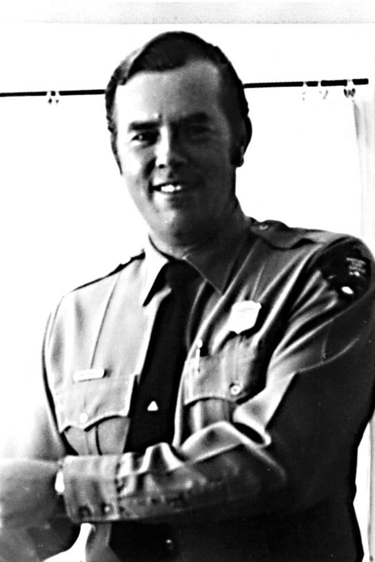
Who was Ken Patrick?
Ken Patrick grew up in the Grand Canyon. His father ran the Phantom Ranch. Ken’s career took him to the Arizona Department of Public Safety, Organ Pipe Cactus National Monument, and Point Reyes National Seashore.
It was at the seashore his end of watch came on August 5, 1973, when he approached deer poachers.
His killers were caught and convicted of several crimes, including murder.
“May the memory of his devotion to all people and to that fine country of our national parks and the splendor of his soul inspire and remain with us.” – On Patrick’s tombstone

11. Uncle Jim Trail
Uncle Jim Trail
Location: North Kaibab Trail Parking Lot in the North Rim
2026 STATUS: CLOSED. The Uncle Jim Trail is closed this season due to Dragon Bravo Fire impacts.
- Distance: 5 miles round-trip
- Difficulty: Easy
- Elevation Change: 731 ft
- Time Required: 3 hours round-trip
In a normal season, the Uncle Jim Trail is the North Rim’s classic mule trail. Whether on two feet or four, you start on the Ken Patrick Trail, then turn onto the Uncle Jim loop with a stop at Uncle Jim Overlook.
Who is Uncle Jim? Uncle Jim Owens was the first game warden of the Grand Canyon Game Preserve (a precursor to the park we know today) in 1906. He led hunting expeditions with many people, including President Teddy Roosevelt.
That history matters, because much of this trail runs through tall, dense woods with sections gutted by past wildfires. Without the backstory, you might think we’ve sent you to a flat, boring forest walk. Then the trees open up to a view of the canyon and the switchbacks of the North Kaibab Trail below, and the trail makes its case.
You’ll likely have it nearly to yourself compared to other North Rim hikes.
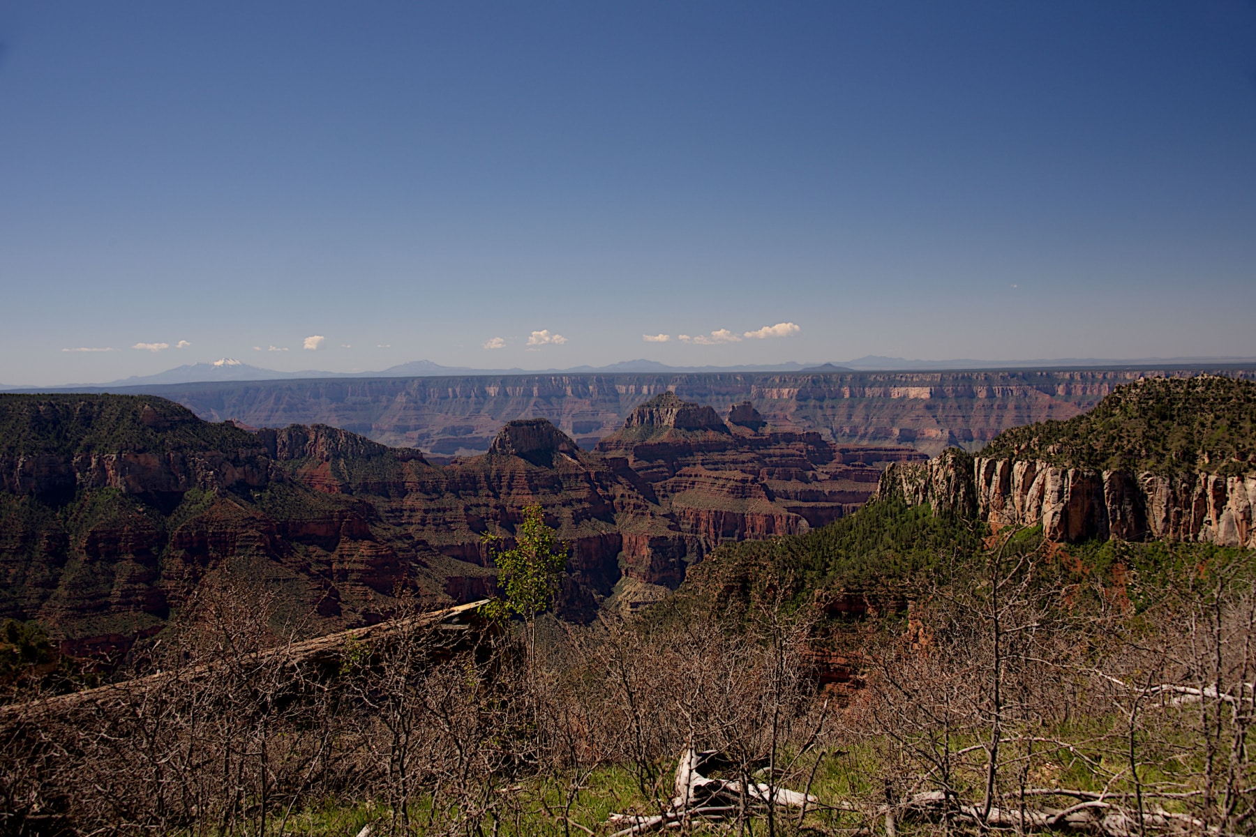
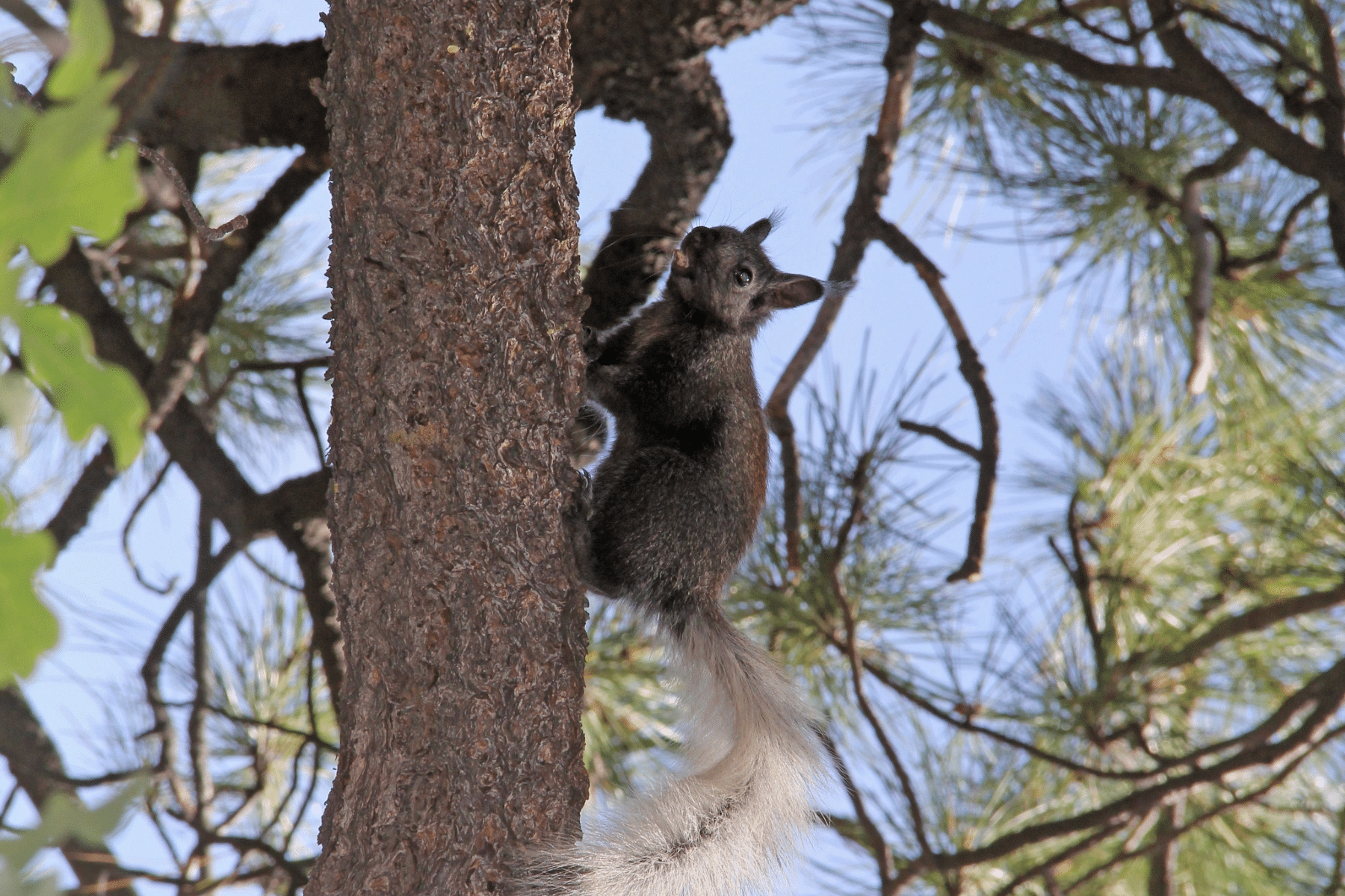
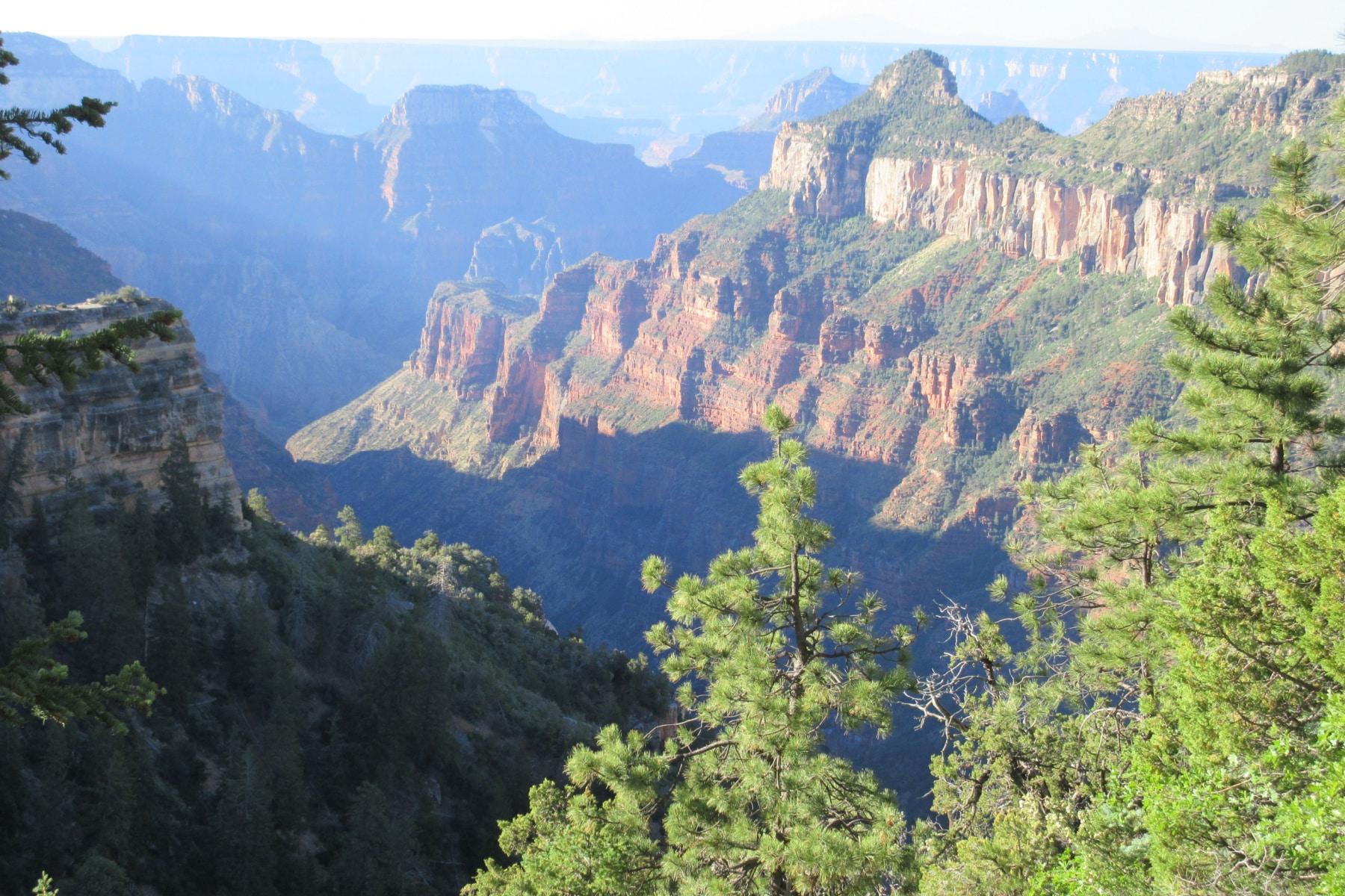
10. Widforss Trail
Widforss Trail
Location: North Rim
2026 STATUS: CLOSED. The Widforss Trail is closed this season due to Dragon Bravo Fire impacts. Expect the forest here to look different for years.
- Distance: 10 miles round-trip
- Difficulty: Moderate
- Elevation Change: 1,082 ft
- Time Required: 5 hours round-trip
The Widforss Trail is the rim hike for folks who love forest as much as canyon. It weaves between the rim and stands of ponderosa pine, and it has long been the best trail in the park for forestry and wildlife.
The Kaibab squirrel, found only in the forests of this plateau, lives along this trail. Spot the white tail and tufted ears and you’ve seen one of the rarest squirrels in America.
One of the world’s largest ponderosa pines stands on this trail, and the views into The Transept side canyon are the equal of any overlook with a parking lot. Visit in fall (when it reopens) and the aspens glow.
Related: national park road trips
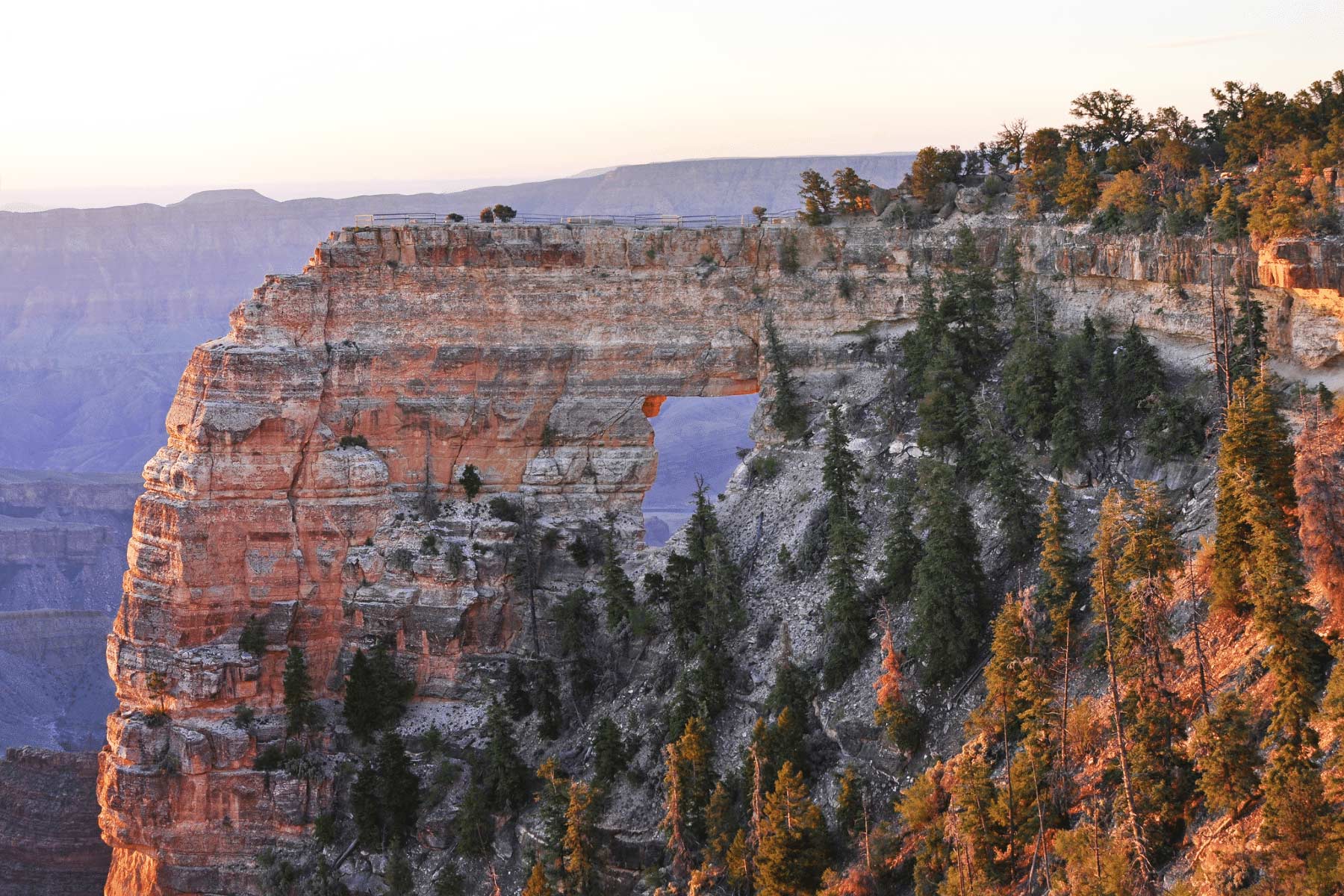
9. Cape Final Trail
Cape Final Trail
Location: North Rim (open in 2026 via Cape Royal Road)
- Distance: 4 miles round-trip
- Difficulty: Easy
- Elevation Change: 495 ft
- Time Required: 2 hours round-trip
The Cape Final Trail hides the best secret on this entire list.
Most of the trail runs through shaded forest. Then the final stretch delivers an enormous view east over the canyon, with Angels Window visible in the distance.
The trail is generally easy, though rocky for the first third of a mile with a slight steady incline to the point. The overlook at the end is what we’d call a “Makes Your Momma Nervous” drop-off. Respect the edge.
Now the secret. There’s one backcountry campsite here right at the edge of the rim (permit required, obviously). Position your tent right and you’ll watch the sun rise and set from one of the best campsites in the Grand Canyon.
8. Point Imperial Trail
Point Imperial Trail
Location: North Rim (open in 2026)
- Distance: 4 miles round-trip
- Difficulty: Easy
- Elevation Change: 442 ft
- Time Required: 2 hours round-trip
This easy(ish) trail crosses ground burned in the 2000 Outlet Fire, a 25-year head start on the recovery you’ll now watch unfold across the rest of the North Rim. It’s also the short way to Point Imperial without committing to the much longer Ken Patrick Trail.
The contrast between the burn scars and the recovering forest is the whole story of this landscape. Visit in spring or summer and the regrowth comes with wildflowers.
Mind the trail conditions and posted guidelines. Sections may still show fire effects, old and new.
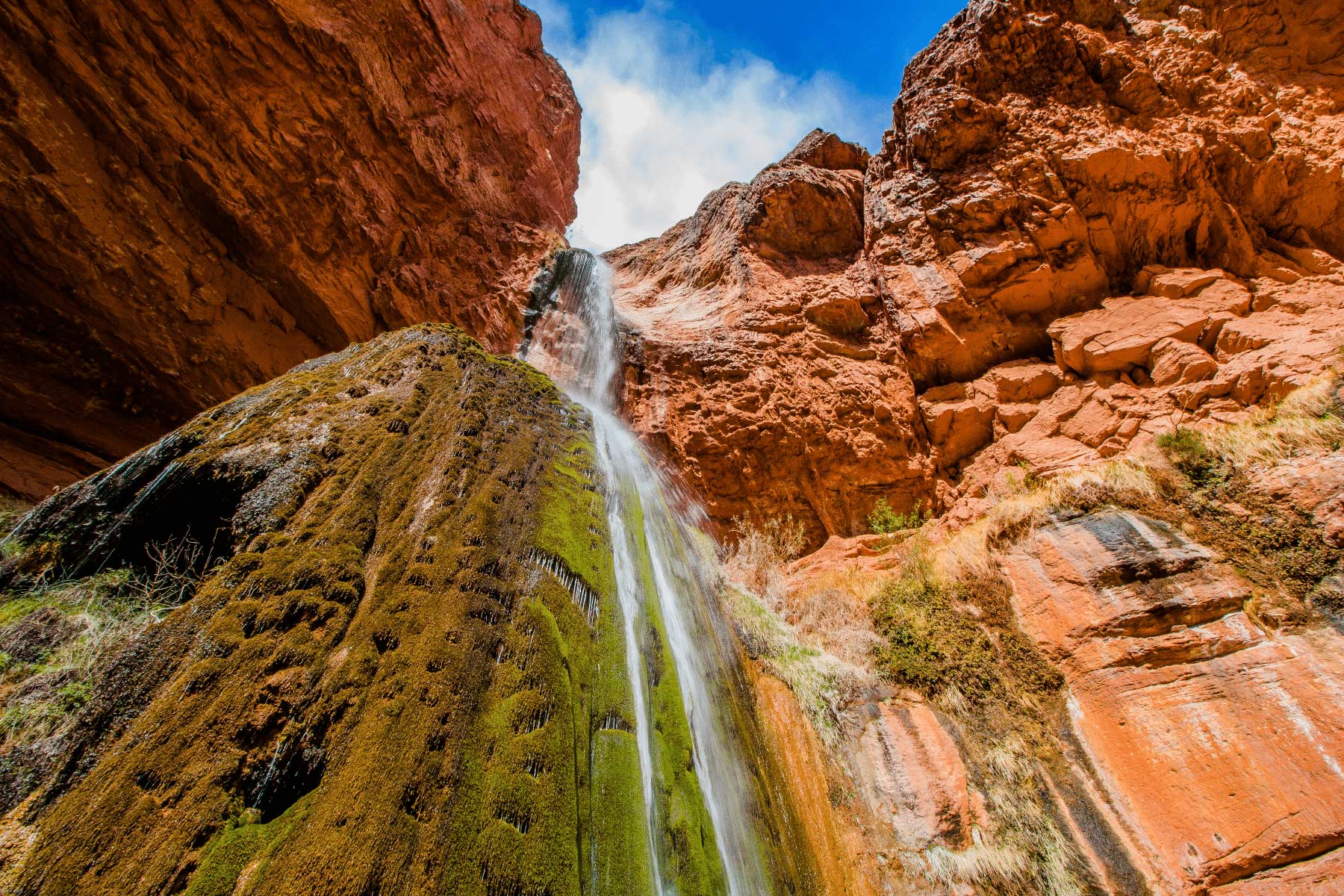
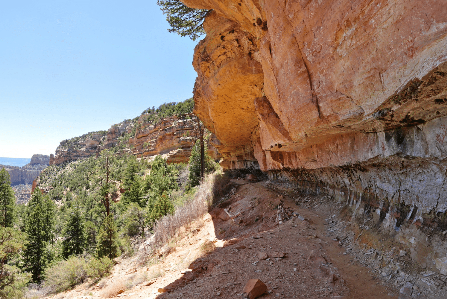
7. Cliff Springs Trail
Cliff Springs Trail
Location: North Rim (open in 2026 via Cape Royal Road)
- Distance: 1 mile round-trip
- Difficulty: Easy to Moderate
- Elevation Change: 252 ft
- Time Required: 30 minutes round-trip
The Cliff Springs Trail is short, beautiful, and mildly nail-biting all at once. A quick walk through pristine forest with a natural spring at the end? Sign us up. The ease of the walking and the exposure of the route make an odd, memorable pairing.
The trail eventually narrows to a thread of space along the canyon walls. You’ll also pass an ancestral granary built into the rock. Look, don’t enter. Short as it is, the trail has real drops alongside the path.
Don’t drink the spring water untreated.
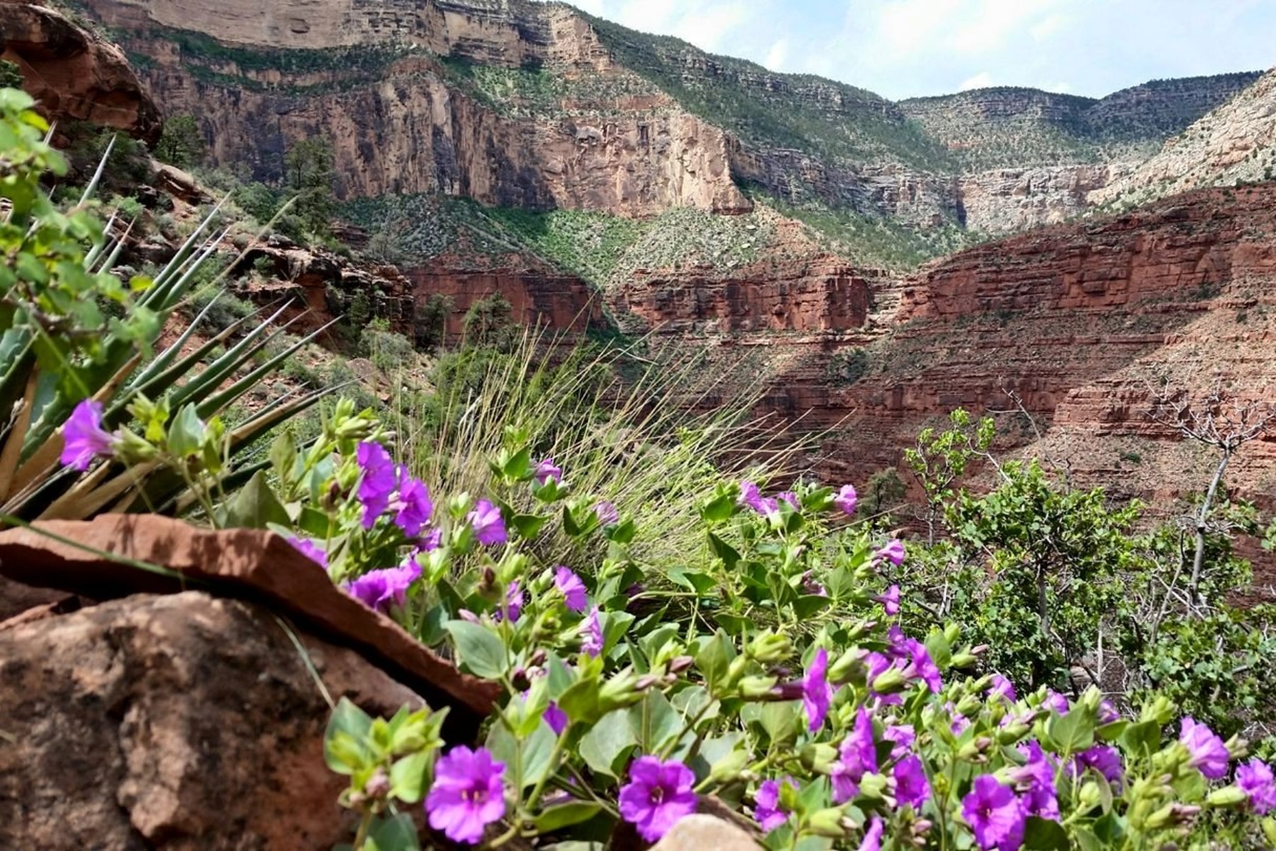
6. Grandview Trail
Grandview Trail
Location: Canyon side of Grandview Point on Desert View Drive
Related: best West Coast national parks
- Distance: 6.4 miles round trip to Horseshoe Mesa
- Difficulty: Strenuous
- Elevation Change: 2,540 ft
- Time Required: 5-7 hours
The Grandview Trail might be the toughest hike on this list mile for mile. The folks who know these trails best consider it far more dangerous than Bright Angel or South Kaibab.
“Built in 1893 as a mining route, this rocky, exposed, and strenuous trail requires
caution. Large steps and extreme dropoffs intensify the steepness of the trail.”NPS Grandview Trail Guide
The trail drops to Horseshoe Mesa, where old mine areas are closed off because the ore left elevated radiation behind. From the mesa you can add the Tonto Trail or detour toward Cottonwood Creek.
Do not drink or touch the water near the old mine workings. It carries high levels of arsenic.
There’s an “easier version” of this tough hike. Descend just 1.1 miles to the Coconino Saddle and turn around. That short version still involves scrambling on steep cobblestone ramps, takes most folks far longer than the mileage suggests, and tells you everything you need to know about whether to continue. No shame in making the saddle your summit.
5. Rim Trail
Rim Trail
Location: South Rim
- Distance: Approximately 13 miles from South Kaibab Trailhead to Hermits Rest
- Difficulty: Easy
- Elevation Change: 583 ft
- Time Required: 4 hours 30 minutes (full length)
The Rim Trail stretches from the Village area to Hermits Rest, and you can hike as much or as little of it as you want. Start from any viewpoint in the Village or along Hermit Road. It’s the best easy hike in the park, full stop.
NOTE: This is not the same thing as the Rim-to-Rim trail.
If 13 miles is too much, the Grand Canyon shuttle stops at viewpoints along the way, so you can walk a stretch, ride a stretch, and bail out whenever the heat or the heights say so.
A few of the best stops on this trail.
- Mohave Point: Great sunset views.
- Pima Point: You can see and hear the roar of the Colorado River.
- Hopi Point: Extends farther into the canyon than any other on this trail.
The Rim Trail has paved and unpaved sections, with some portions accessible for folks with mobility challenges or those pushing strollers.

4. Hermit Trail (2 Trails)
Hermit Trail
Location: South Rim
Hermits Rest to Santa Maria Spring:
- Distance: 4.9 miles (round trip)
- Difficulty: Moderate to Strenuous
- Elevation Change: about 1,680 ft
- Time Required: 3-5 hours
To Dripping Springs:
Related: things to do in Joshua Tree
- Distance: about 7 miles (round trip)
- Difficulty: Strenuous
- Elevation Change: about 1,700 ft
- Time Required: 5-7 hours
The Hermit Trail is the steeper, rougher choice for experienced hikers who want the canyon without the corridor crowds. Two primary day-hike destinations, Santa Maria Spring and Dripping Springs, and both are tough and rewarding.
The hike to Santa Maria Spring from Hermits Rest is about 4.9 miles round trip. The trail is unmaintained and steep, so hike with additional care.
The Hermit of Hermit Trail
Louis Boucher earned the nickname “Hermit” by claiming and living off this rural stretch of canyon, preferring the company of his white mule, Calamity Jane, to most humans.
All that said, he was actually quite social in his community and even gave tours in the early days of Grand Canyon tourism.

For a more demanding day, continue to Dripping Springs, about 7 miles round trip with a turnoff onto the Dripping Springs Trail.
If you have any doubts about your hiking ability, don’t take the Hermit Trail.
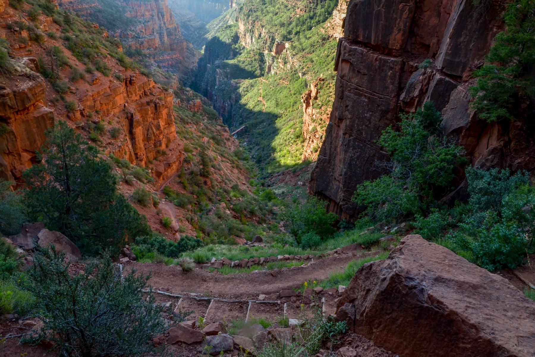
3. North Kaibab (4 Trails)
North Kaibab Trail
Location: North Rim
2026 STATUS: OPEN to foot traffic (stock use suspended). The section between Redwall Bridge and Cottonwood Campground closes October 15, 2026 for waterline repairs. Check current conditions before committing to the longer destinations.
Coconino Overlook:
- Distance: 1.5 miles round-trip
- Difficulty: Easy to Moderate
- Elevation Change: Approximately 600 feet
- Time Required: 1-2 hours
Supai Tunnel:
- Distance: 4 miles round-trip
- Difficulty: Moderate
- Elevation Change: Approximately 1,450 feet
- Time Required: 2-3 hours
Roaring Springs:
- Distance: 9.4 miles round-trip
- Difficulty: Strenuous
- Elevation Change: 3,050 feet
- Time Required: 7-8 hours
Colorado River (Not recommended as a day hike):
- Distance: 28 miles round-trip
- Difficulty: Extremely Strenuous
- Elevation Change: Almost 6,000 feet
- Time Required: Multiple days
The North Kaibab Trail is the only maintained route into the canyon from the North Rim, and it’s the northern leg of every rim-to-rim crossing. The shorter destinations above let you sample it without signing up for the whole thing.
Most day hikers will be satisfied with Coconino Overlook at 1.5 miles round-trip or Supai Tunnel at 4 miles round-trip.
If you want a serious day, Roaring Springs is the full meal at 7 to 8 hours, and it challenges strong hikers. Here’s a preview of what you’ll find.
Related: best USA road trips
This trail effectively closes in winter. The snow and ice on this side of the canyon are not worth gambling against.
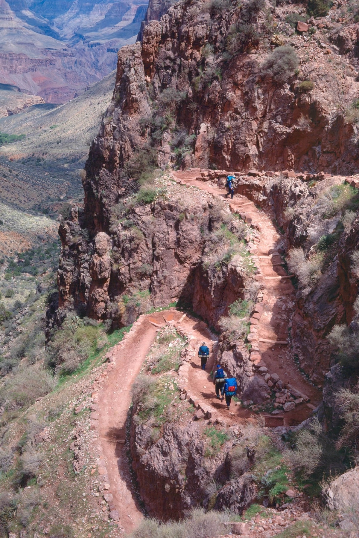
2. South Kaibab Trail
South Kaibab Trail
Location: South Rim
- Distance: 7 miles (one way to the river); Ooh Aah Point 1.8 mi RT, Cedar Ridge 3 mi RT, Skeleton Point 6 mi RT
- Difficulty: Strenuous
- Elevation Change: 4,780 feet rim to river
- Time Required: 4-6 hours (one way)
With so many people on Bright Angel, the South Kaibab Trail is the shorter, quieter route toward the river. It follows a ridgeline instead of a drainage, which means the views are constant and enormous from the first switchback.
The trade-off is real. There is very little shade and there are no water stations. The only mules you’ll typically see here are hauling supplies to Phantom Ranch.
The steepness is deceiving on the way down. Plan for the return hike to take twice as long as the descent. Skeleton Point is the park’s recommended day-hike limit, and in summer they advise turning around at Cedar Ridge.

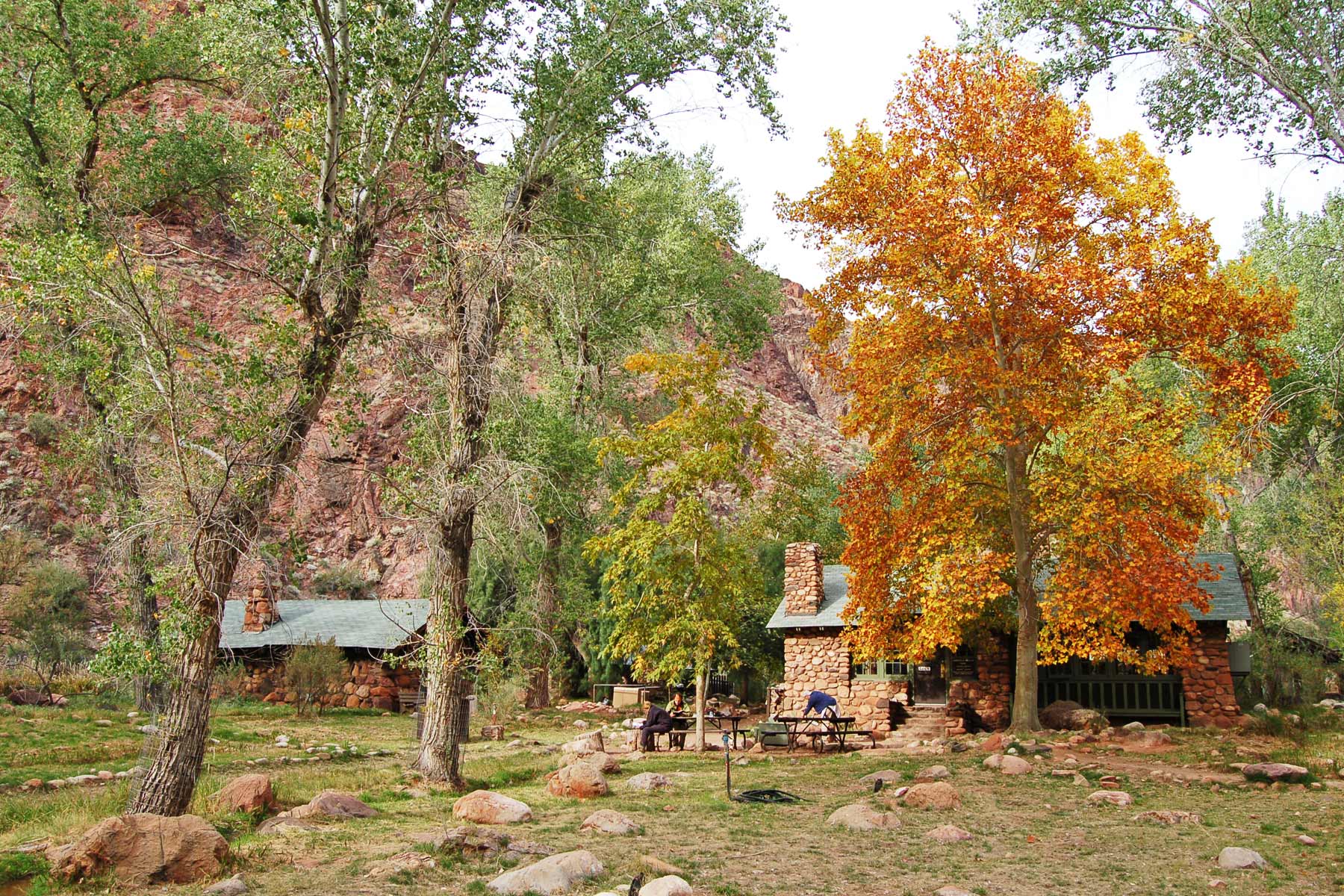
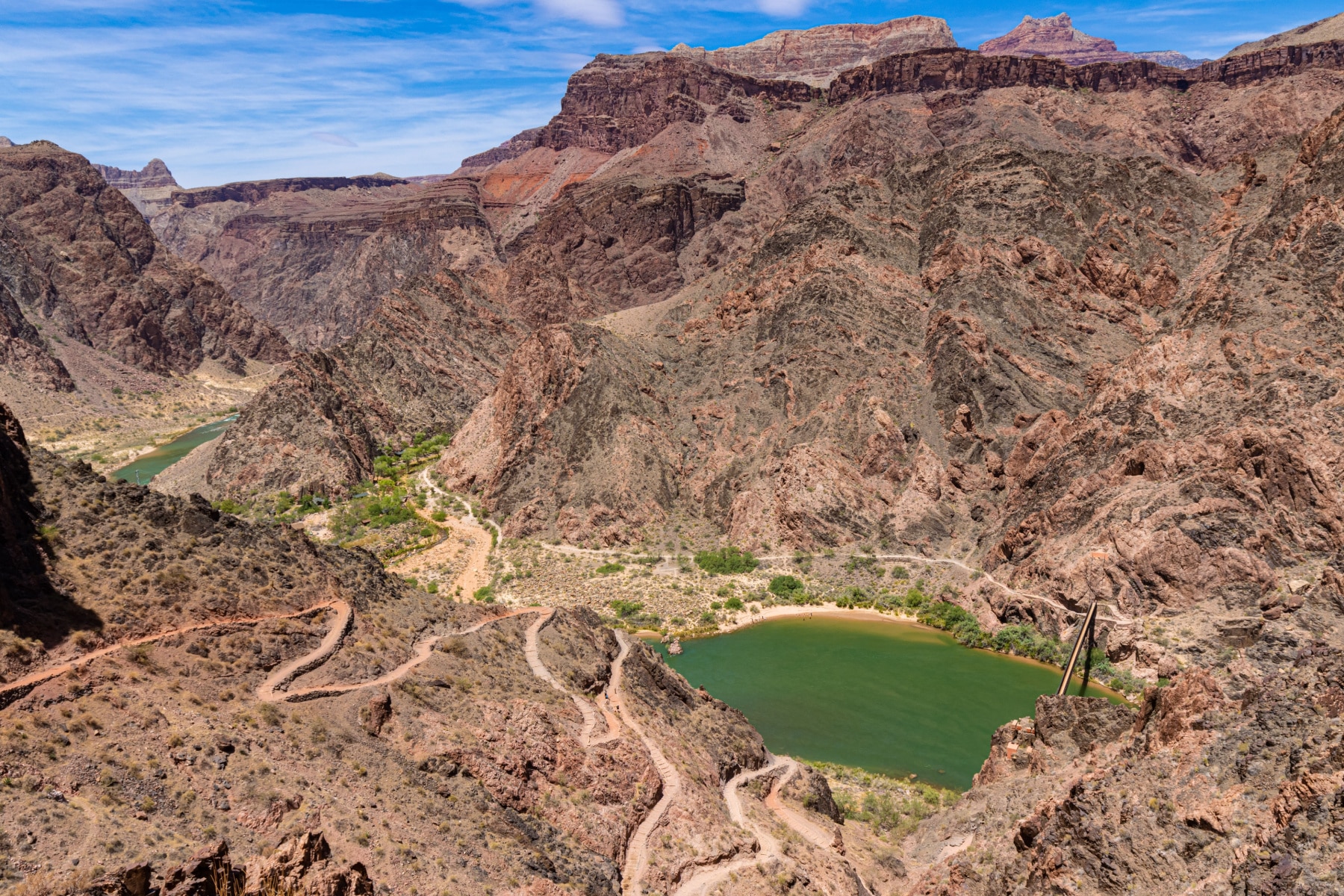
1. Bright Angel Trail
Bright Angel Trail
Location: South Rim of Grand Canyon National Park
- Distance: up to 9.6 miles round-trip as a day hike (Havasupai Garden)
- Difficulty: Strenuous
- Elevation Change: 3,040 ft to Havasupai Garden (4,380 ft rim to river)
- Time Required: 6-9 hours to Havasupai Garden and back
The Bright Angel Trail is the most famous hike in the Grand Canyon, and one of the most famous in the world. It earns the reputation.
It has the best infrastructure of any trail below the rim. Well-maintained switchbacks, rest houses, shade, and seasonal water stations in the first three miles. It descends from the South Rim toward the Colorado River, and you choose your distance based on your skill level and the season.
- 1.5-Mile Resthouse (3 miles round-trip): The typical day hike for the average hiker. You get the thrill of the switchbacks without the exhaustion of the full trail. Water seasonally.
- 3-Mile Resthouse (6 miles round-trip): Another chance to rest, hydrate, and cool off before the climb back.
- Havasupai Garden (9.6 miles round-trip): At 4.8 miles from the trailhead, this shaded oasis (formerly known as Indian Garden) has year-round water and a campground for permit holders. Do not press a day hike any further, especially in summer.
- Colorado River: About 7.8 miles from the trailhead. A rim-to-river-to-rim day hike is strongly discouraged by park officials, and the rangers who carry people out mean it. Note that with Silver Bridge and the River Trail closed through June 30, 2026, river crossings use Black Bridge via South Kaibab.
As of this writing, the water stations at 1.5-Mile Resthouse, 3-Mile Resthouse, and Havasupai Garden are all on, but pipeline breaks change that without notice. Confirm on the park’s Critical Backcountry Updates page the week you hike, and carry a filter regardless.
- Bright Angel Trail
- South Kaibab Trail
- North Kaibab Trail
- Hermit Trail
- Rim Trail
- Grandview Trail
- Cliff Springs Trail
- Point Imperial Trail
- Cape Final Trail
- Widforss Trail
- Uncle Jim Trail
- Ken Patrick Trail
- Bridle Trail
- Tanner Trail
- Transept Trail
The toughest hike in Grand Canyon National Park is the rim-to-rim, done by pairing the Bright Angel Trail or South Kaibab Trail with the North Kaibab Trail.
It’s not for the faint of heart. You should be in prime physical condition and lucky as a lottery winner to score the overnight permits the smart version of that trek requires.
Thinking about rim-to-rim? The standard crossing is about 24 miles with roughly 6,000 feet of climbing on the far side. The park is blunt about it: do not attempt rim-to-rim, or even rim-to-river-to-rim, in a single day. The smart approach is one or two nights at Bright Angel or Cottonwood, which means winning the highly competitive backcountry permit lottery. Most people cross north to south to put the brutal North Kaibab climb at the start. For the full logistics, permit timeline, water stops, and shuttle details, read our complete Grand Canyon rim-to-rim guide.
Related Reading: Best National Parks in the USA / National Parks Road Trip / National Parks by State
What’s your favorite Grand Canyon trail we missed? The canyon has dozens of routes we didn’t cover here, from unmaintained routes to backcountry gems. Drop your pick in the comments.
Related: How To Use The Grand Canyon Shuttle System
Grand Canyon Hiking FAQ
What is the best hike in the Grand Canyon?
For most visitors, South Kaibab Trail down to Ooh Aah Point is the best hike. In a 1.8-mile round trip you get the full sensation of dropping into the canyon, with sweeping views the entire way. If you want to go deeper, South Kaibab to Cedar Ridge or Bright Angel to the 1.5-Mile Resthouse are the next steps. Just remember that going down is the easy half.
Do you need a permit to hike the Grand Canyon?
No permit is required for day hiking, no matter how far down you go. Permits are only required for overnight backcountry trips, including the multi-day rim-to-rim. Those backcountry permits are issued by lottery and are very competitive, so plan months ahead if you want to camp below the rim.
Can you hike rim-to-rim in one day?
The park strongly advises against it, and people die every year attempting rim-to-rim or rim-to-river-to-rim in a single day. The standard crossing is roughly 24 miles with about 6,000 feet of climbing, often in extreme heat. The safe way to do it is with one or two nights in the canyon on a backcountry permit. See our full rim-to-rim guide for the details.
How hard is hiking in the Grand Canyon?
Harder than it looks, because the difficulty is reversed from most hikes. You descend first while you are fresh, then climb back out when you are tired and the day is hottest. A good rule is to turn around when you have used a third of your energy, carry far more water than you think you need, and never hike to the river and back in a day.
Is the North Rim open in 2026?
The North Rim reopened for day use on May 15, 2026 after the 2025 Dragon Bravo Fire, but there is no lodging this season, services are minimal, and several rim trails (Transept, Widforss, Uncle Jim, Bright Angel Point, and the west half of Ken Patrick) remain closed. The North Kaibab Trail is open to foot traffic. Always check the park’s Critical Backcountry Updates page before you go.
Helpful Related Articles
Things to Do North Rim Grand Canyon: 15 Grand Things to Do at the North Rim of the Grand Canyon
Grand Canyon Viewpoints: 20 Best Views of the Grand Canyon (National Park)
Grand Canyon South Rim Things to Do: 15 Remarkable Things to Do at the Grand Canyon South Rim
Things to Do at the Grand Canyon: Our list of things to do at Grand Canyon National Park
Grand Canyon Park Guide: Our complete guide to Grand Canyon National Park
Rim-to-Rim Guide: How to plan a Grand Canyon rim-to-rim crossing
Closest Cities to the Grand Canyon: 10 Closest Cities Near the Grand Canyon
Grand Canyon Facts: 15 Fascinating Grand Canyon National Park Facts
Grand Canyon in Winter: Visiting the Grand Canyon in December (Winter Guide)
Desert View Watchtower: Explore the Historic Desert View Watchtower
Arizona National Parks: 24 Grand Arizona National Parks to Visit (Photos + Guide)
Affiliate disclosure: Some links on this page earn us a small commission at no extra cost to you. We only recommend gear we actually use.