


From our years filming and traveling across the country, we’ve driven just about every major scenic route in the national park system. The East Coast doesn’t get the road trip respect the West does, and that’s a mistake. Eleven national parks sit east of the Mississippi, and you can string together the Smokies, the Blue Ridge, the Everglades, and the Maine coast on routes that fit a normal vacation.
What follows are five routes, with seasonal weather realities and honest notes on what’s worth your time.
The 5 East Coast Road Trips Compared
| Route | Miles | Drive Time | National Parks | Best Season |
|---|---|---|---|---|
| 1. Blue Ridge Parkway | 469 | 10-12 hours | Great Smoky Mountains, Shenandoah | Fall, then spring |
| 2. The South Route | 1,396 | 23 hours | Great Smoky Mountains, Congaree, Shenandoah, New River Gorge, Mammoth Cave | Spring and fall |
| 3. Florida | 229 | 6 hours | Biscayne, Everglades, Dry Tortugas | Winter to early spring |
| 4. Go North | 1,219 | 19 hours | Indiana Dunes, Cuyahoga Valley, Acadia | Summer to early fall |
| 5. Route 1 | 2,369 | 2+ weeks | Acadia plus all three Florida parks | Spring and fall |
Where National Parks Are Located on the East Coast
For the purposes of this article, we’re sticking with the parks east of the Mississippi River. That includes states like Indiana, Tennessee, and Kentucky, which arguably belong to the Midwest, the South, or Appalachia. We won’t tell if you won’t.
As you can see in the map below, the full spread runs from offshore Florida to as far west as Indiana and as far north as Maine. Of the 63 designated National Parks, 11 of them group into the East Coast region.
117 public lands destinations are under threat. Get the free briefing that 27,000+ people use to stay informed and take action.

3 Quick Helpful Tips for East Coast Road Trips
The season of travel shapes any East Coast national parks road trip. The warm states sit south of the 33rd Parallel, which for our purposes means South Carolina and Florida. The rest are cold states where winter brings snow and ice, with higher elevations getting more of both.

- Buy an America the Beautiful interagency pass for the best value. For $80, the pass covers more than 2,000 public lands, including national forests, all NPS sites, and BLM land along your route. It admits the passholder and everyone in a passenger car, with kids under 16 free anyway. Note that it does not replace the Smokies parking tag, which we cover below.
- Most of these parks sit in the Eastern Time Zone. Mammoth Cave and Indiana Dunes run on Central Time, one hour behind. Tours and reservations book in the park’s time zone, not yours.
- Download the National Park Service mobile app to keep every park in your pocket. Save your favorite locations, check off the parks you visit, and download offline maps before you lose signal. Google Maps does offline maps too. Grab them while you still have a strong connection.
East Coast Road Trip Weather Planning

Hurricanes
Hurricane season runs from June 1 through November 30 across the Atlantic Seaboard. The most active stretch is August through October. Traveling then? Keep an eye on the National Hurricane Center.

A few things worth knowing for your safety.
- Storm surge, not wind, accounts for the most hurricane deaths.
- Once hurricanes move over land, the remnants reach as far inland as the Midwest as heavy rain, severe thunderstorms, and even tornadoes. Hurricane Helene proved that brutally in September 2024, devastating mountain towns 300 miles from the coast.
- Offshore “fish storms” can still send rough surf and dangerous rip currents to the beaches.
Severe Weather
Most folks associate tornadoes with Oklahoma and Kansas, but Dixie Alley in the South and the Upper Midwest run their own severe weather season, usually March through May.
If you’re caught in a severe storm or tornado on the road, do not park under an overpass. It funnels the wind and makes things worse.
In New England, nor’easter season runs November through April. These storms arrive as wind machines or rainmakers, and sometimes both. In January 2024, Acadia National Park lost parts of Ocean Path and Seawall to a fierce storm.
Why does this matter? Parks hit by storms can close for days, weeks, or in the Blue Ridge Parkway’s case, years. Every park posts updates on its Park Conditions page and social channels. Check before you drive.
Red Tide and Blue-Green Algae
Florida’s beaches come with a catch nobody puts in the brochures. Red Tide is a harmful algae bloom that moves in off the coast and kills fish by the ton. Like its freshwater cousin, blue-green algae, it peaks in summer heat. If the algae stench doesn’t get to you, the rotting fish will.
Blue-green algae in freshwater is a growing problem nationwide. It might just make you itch, but it can kill a dog that swam in it within hours. Keep the pets out of suspect water.
Heat Index and Wind Chill
The cliche is true. The desert really is a dry heat. Any East Coast road trip brings higher humidity than Yellowstone or Utah’s Mighty 5, and humidity changes how the temperature treats you.
- Mount Washington, New Hampshire, is the highest peak in the Northeast and famous mostly for punishing weather. In February 2023 it recorded a wind chill of -108 degrees F, the coldest ever measured in the United States.
- On the flip side, Miami’s summer of 2023 ran a heat index of 100 degrees F or higher for 46 straight days. That same July, the water at Manatee Bay near Everglades National Park hit 101 degrees F. Bathwater, with sharks.
- Humid late spring and summer bring the bugs. Pack repellent and you’ll still be miserable in the Everglades or Congaree in July. Go in the cooler months instead.
Now the routes. We’ve grouped the parks and public lands to maximize what you see per mile.
1. Blue Ridge Parkway, America’s Favorite Drive
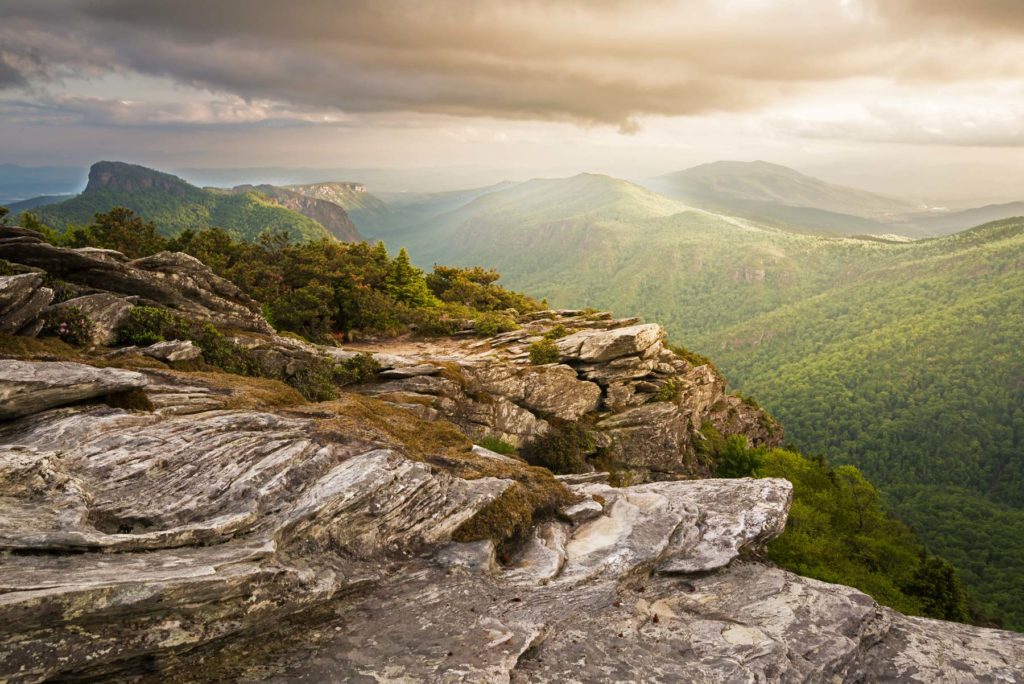
The Blue Ridge Parkway starts where Skyline Drive ends at the southern tip of Shenandoah National Park. Mile markers begin at 0 there and climb toward Great Smoky Mountains National Park, almost 470 miles away, roughly paralleling the Appalachian Trail the whole way.

Length: 469 Miles
Travel Time: 10-12 Hours (without stops)
Visitation: 16.5 million (2025)
Elevation: Highest point is 6,053 feet. Lowest point is 650 feet.
2026 status check. Hurricane Helene tore up the parkway near Asheville in September 2024, causing $1.7 billion in damage. About 35 miles between Linville Gorge and Mount Mitchell State Park remain closed, with full reopening expected by the end of 2026. Check the official road status page before committing to the North Carolina high country section.
About the Blue Ridge Parkway

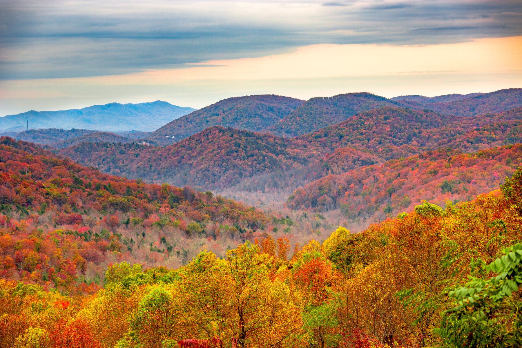
Start this drive from the Great Smoky Mountains end and you’ll be on the outside lane for the best views. The busiest and best time is autumn, when the color sweeps down the elevations week by week. Spring ranks a close second for the waterfalls.

Winter brings closures along the road, but posted updates show what’s open.
Great Smoky Mountains National Park
The Blue Ridge Parkway meets Great Smoky Mountains National Park at Cherokee, North Carolina. The park charges no entrance fee, but you’ll need a parking tag ($5 daily, $15 weekly, $40 annual) to park longer than 15 minutes. Newfound Gap Road cuts across the park north to south and is the easiest way to reach Kuwohi, formerly known as Clingmans Dome, the highest point in the Smokies at 6,643 feet.
Our favorite spots in the Smokies include the following.
- Andrews Bald
- Cades Cove
- Mount LeConte
- Roaring Fork Motor Nature Trail
- Chimney Tops
Great Smoky Mountains National Park Resources: Map | Guide | Visitor’s Guide | Facts | Park Conditions
Shenandoah National Park
The parkway starts at Shenandoah, and from either end you’ll want to add the 105 miles of Skyline Drive. The mountains here top out around 4,050 feet, lower than the Smokies, but unlike the Smokies, the main road through Shenandoah rides the ridgeline the entire way.
Shenandoah covers about 200,000 acres to the Smokies’ 522,000, but it’s a long, narrow park, and Skyline Drive delivers you near most of the best spots. At Great Smoky Mountains, you’re hoofing it a good distance to many of the best peaks and views.
The crowd math favors Shenandoah too. It sees about 1.5 million folks a year. Great Smoky Mountains is the most visited national park in the country, with 11.5 million visits in 2025.
The spots worth your time in Shenandoah include the following.
- Old Rag (a $2 day-use ticket is required March 1 through November 30, bought in advance on Recreation.gov)
- Hawksbill Loop (highest point)
- Stony Man Mountain
- Rose River Falls
- Dark Hollow Falls
Shenandoah National Park Resources: Things to Do | Map | Guide | Where to Stay | Park Conditions | Best Hikes
Final Thoughts on the Blue Ridge Parkway Road Trip
If you want more park time and less time on the meandering, never-faster-than-45 parkway, add New River Gorge National Park to this route.

Some of the country’s best rafting and rock climbing wait at America’s newest national park. From Shenandoah, the New River Gorge detour adds about three hours.
Bears live along the entire Blue Ridge and throughout the Smokies, so stay bear-aware on trails and leave them alone. During peak foliage in October 2023, an eight-mile section of the parkway closed after people tried to feed and hold a bear. Don’t be those people.
2. The South Route East Coast Road Trip
If you like your road trips the way the South likes sweet tea, this one delivers a full dose of Dixie. Full disclosure, we drew this route ourselves. The loop works no matter where you start, and you get the three parks above plus two more.

Length: 1,396 Miles
Travel Time: 23 Hours
States: North Carolina, South Carolina, Tennessee, Virginia, West Virginia, Kentucky
Parks: Great Smoky Mountains, Congaree, Shenandoah, New River Gorge, Mammoth Cave
The South Route Covers 5 National Parks
Congaree and Mammoth Cave sit off on their own in separate states, which makes looping them in the hard part. The upside is that most of this route runs on interstate, so the miles move fast.
South Carolina’s Congaree protects an old-growth bottomland hardwood forest with some of the tallest trees in the eastern United States. The floodplain holds towering cypress and tupelo, and hiking, canoeing, and birdwatching rank as the most popular activities.

Kentucky’s Mammoth Cave is the world’s longest known cave system, with more than 400 miles of explored passageways. Guided tours take you into the underground labyrinth that gives the park its geological and historical weight.
One recommendation on the South Route. Take the Blue Ridge Parkway from Great Smoky Mountains for 76 miles until it meets I-26 south of Asheville. That stretch of waterfalls, overlooks, and roadside hikes through Pisgah National Forest dazzles every time. Just check the Helene closure map first, since some of that corridor reopens in stages through 2026.
3. Florida East Coast Road Trip

Length: 229 Miles
Travel Time: 6 Hours (without stops)
Parks: Biscayne, Everglades, Dry Tortugas
Elevation: At or near sea level.
About Florida National Parks
One of the easiest East Coast road trips sits at the bottom of Florida. Here you’ll find Dry Tortugas National Park, Everglades National Park, and Biscayne National Park. Give it four to five days to do it right, three if you push.
The best part is that all three parks sit south of Miami and its traffic. Biscayne is just 33 miles from Miami International Airport. The best time to visit is winter or early spring. Summer is heat, humidity, mosquitoes, and hurricane watch, in that order. Note that Everglades is one of the 11 parks charging international folks the new $100 surcharge in 2026.
A brief overview of each park.
Biscayne National Park
Biscayne is 95% water, with coral reefs and a serious marine life roster. Snorkelers and divers get coral gardens, shipwrecks on the Maritime Heritage Trail, and thriving fish populations.
Above the surface, paddle the mangroves, watch for manatees and sea turtles, or boat out to Boca Chita, Elliott, and Adams Keys, the northernmost of the Florida Keys.
Biscayne National Park Resources: Things to Do | Facts | Guidebook | Hotel | Park Conditions

Everglades National Park
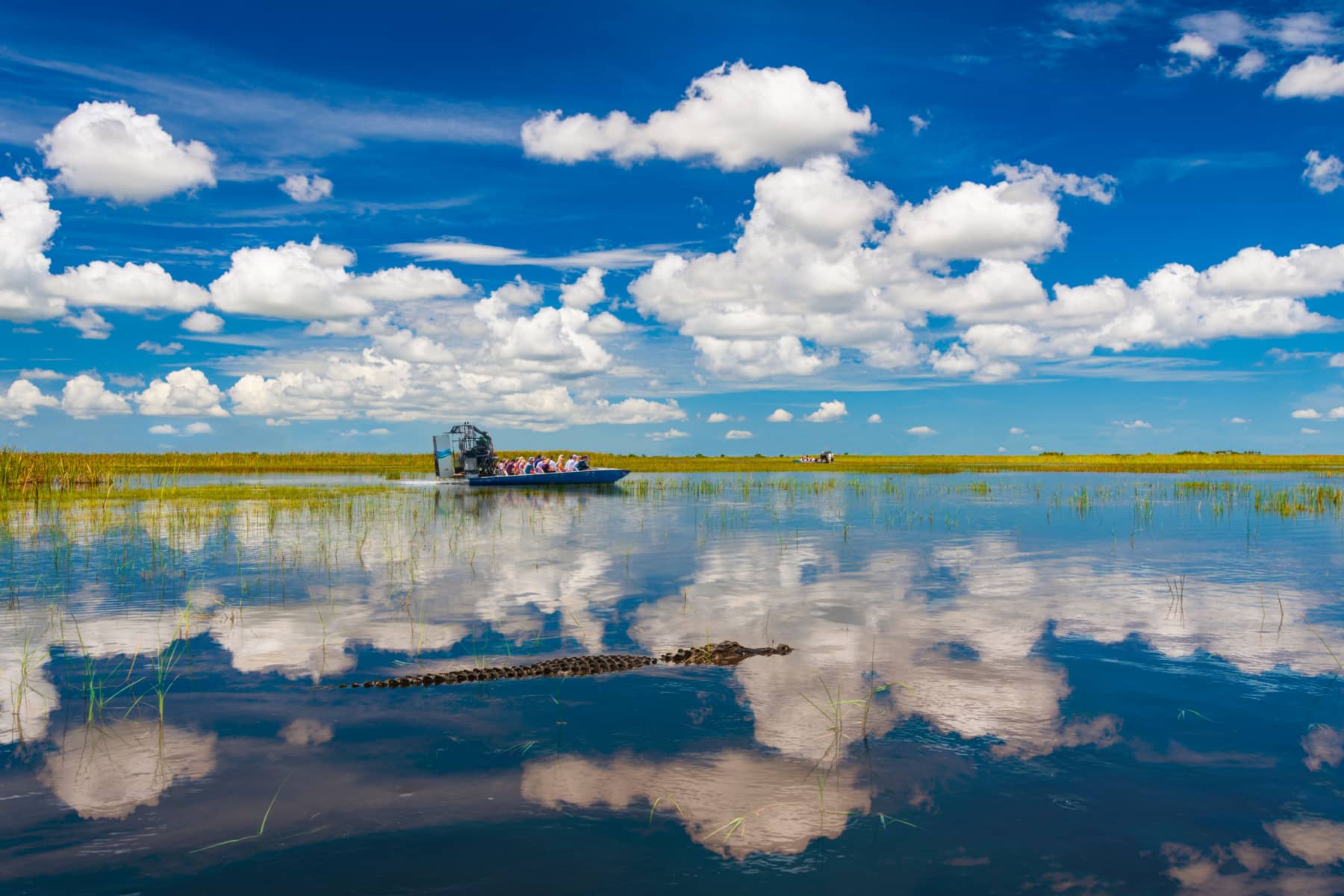
Everglades National Park, a UNESCO World Heritage Site and International Biosphere Reserve, is the largest tropical wilderness in the United States.
Its wetlands, mangroves, and sawgrass prairies shelter endangered species like the Florida panther and the American crocodile. Alligators (native) and Burmese pythons (very much not) share the water.
Everglades has three entrances at Miami, Homestead, and Everglades City. The drive between them runs just short of 100 miles, with Everglades City the farthest out. Before heading there, check the status of the Gulf Coast visitor center, which has been rebuilding for years.
Everglades National Park Resources: Things to Do | Facts | Map | Guidebook | Hotel | Park Conditions
Dry Tortugas National Park
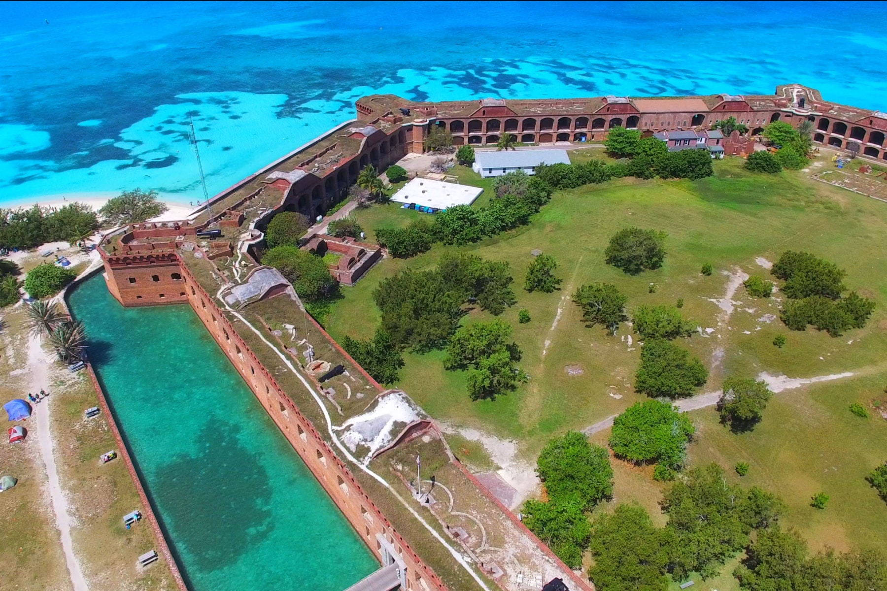
Here’s the paradox of Dry Tortugas. It’s one of the least visited national parks and simultaneously one of the hardest to book. Unless you have your own boat, the Yankee Freedom ferry or a seaplane is your only way out there.
The park is 99% water and sits 70 miles west of Key West. The remote archipelago centers on the historic Fort Jefferson. Dive the wrecks, watch the seabirds, and yes, tortugas means turtles in Spanish, and you’ll see those too.
With limited camping and no services on the islands, a day trip makes the most sense for most folks. Without a boat, you won’t have a choice.
Dry Tortugas National Park Resources: Things to Do | Dry Tortugas Ferry | Park Conditions | Guidebook | Hotel (Key West)
4. The Go North East Coast Road Trip

Length: 1,219 Miles
Travel Time: 19 Hours (without stops)
Parks Covered: Indiana Dunes, Cuyahoga Valley, Acadia
Cities on Route: Chicago, Cleveland, Buffalo (Niagara Falls), Boston, Portland (ME)
Go North Route Details
Three East Coast national parks sit well north of the Mason-Dixon Line, and this route strings them together. Start in Chicago, ride the Lake Erie shoreline to Niagara Falls, skirt the Adirondacks, and cross the Berkshires of Massachusetts.
If you’re up for it, take a 110-mile detour to Cape Cod National Seashore before heading north to Downeast Maine, where the coastline views start long before Mount Desert Island. Hit the Maine outlets in Kittery or Freeport, home of the L.L. Bean flagship, or spend a night in Portland.
Before the lobster roll, the parks.
Indiana Dunes National Park
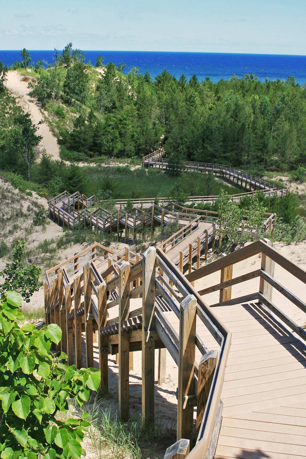
Indiana Dunes National Park pairs with Indiana Dunes State Park on the southern shore of Lake Michigan. Towering sand dunes, clean beaches, and one of the most biodiverse small parks in the system make this a beach and birding stop. Its 15,000 protected acres cover dune fields, wetlands, and oak savannas.
Indiana Dunes Resources: Things to Do | Indiana Dunes State Park | Geology of Indiana Dunes | Park Conditions
Cuyahoga Valley National Park
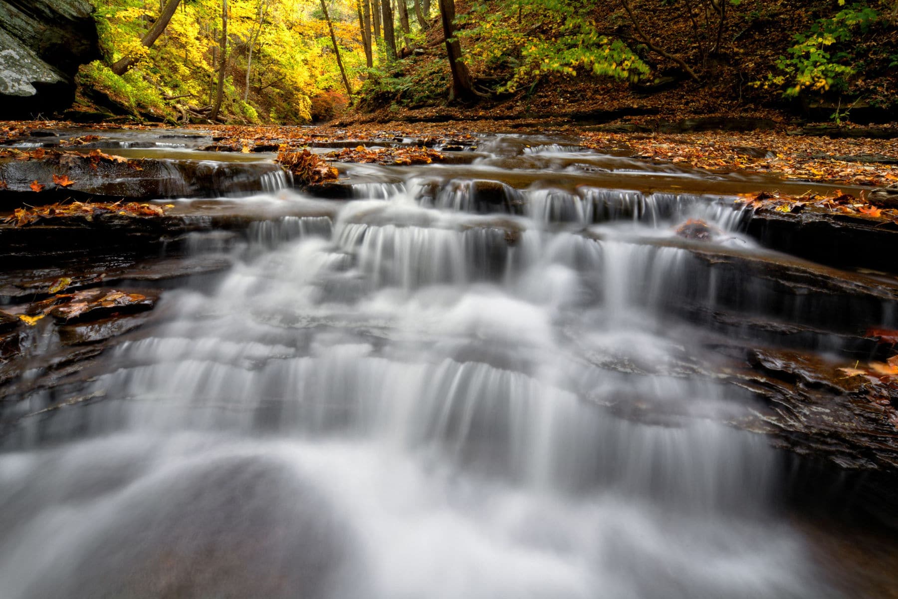
Cuyahoga Valley National Park sits improbably between Akron and Cleveland, following the Cuyahoga River. Its 33,000 acres hold forests, rolling hills, and waterfalls including Brandywine Falls. Hike or bike the Ohio & Erie Canal Towpath Trail, paddle the river, or ride the scenic railroad through the valley.
Cuyahoga Valley Resources: Things to Do | Facts | Park Conditions
Acadia National Park
Acadia, on the rugged coast of Maine, blends rocky shorelines, dense forests, and granite peaks. It’s the oldest national park east of the Mississippi, and Cadillac Mountain is the highest point on the US Atlantic seaboard.
Two planning notes. Driving Cadillac Summit Road requires a $6 vehicle reservation from May 20 through October 25, 2026, booked on Recreation.gov, and they are not sold at the park. And Acadia is one of the 11 parks charging international folks the $100 surcharge in 2026.
Acadia National Park Resources: Park Guide | East Coast Parks | Video Tour | Park Conditions
5. Route 1 East Coast Road Trip
Length: 2,369 Miles
Travel Time: Plan for at least 2 weeks
Parks Covered: Acadia, Biscayne, Everglades, Dry Tortugas, plus numerous national seashores and historic sites
Cities on Route: Portland (ME), Boston, New York, Philadelphia, Baltimore, Washington D.C., Richmond, Jacksonville, Miami, Key West
Planning Tool: The Great American Road Trip: U.S. 1, Maine to Florida
America’s First Highway, Route 1
Most minds jump to the Pacific Coast Highway when they hear Route 1. This one runs from Fort Kent, Maine, to Key West, Florida, on one of the oldest and longest highways in the country. The “other” Route 1 is technically Highway 1, a California state road. We’ll die on this hill.
The highway spans nearly 2,400 miles and rides the coastline for long stretches. Plan at least two weeks on the road for the full run.
Route 1 offers fewer scenic miles than the Blue Ridge Parkway, but the stops along the way rival Route 66. A sample.
- Maine: Fort Kent, Houlton (also the end of I-95), Machias, Rockland, Brunswick, Portland
- New Hampshire: Portsmouth, Seabrook
- Massachusetts: Newburyport, Boston
- Rhode Island: Providence, Narragansett Pier
- Connecticut: New London, New Haven, Bridgeport
- New York: New York City
- New Jersey: Jersey City, Newark, Trenton
- Pennsylvania: Morrisville, South Langhorne, Philadelphia, Oxford
- Maryland: Bel Air, Baltimore
- Washington, D.C.
- Virginia: Alexandria, Fredericksburg, Richmond, Petersburg
- North Carolina: Henderson, Raleigh, Rockingham
- South Carolina: Cheraw, Columbia (Congaree National Park!), Aiken
- Georgia: Augusta, Swainsboro, Waycross
- Florida: Jacksonville, St. Augustine, Miami, Key West
Search for NPS sites near the places you’d like to stop. This helpful tool from NPS covers more than national parks. Monuments, historical parks, and seashores all show up along the way.
East Coast Road Trip Map
List of East Coast Road Trip National Parks
Here’s the full list of East Coast national parks to consider for your road trip.
- Dry Tortugas National Park
- Everglades National Park
- Biscayne National Park
- Congaree National Park
- Great Smoky Mountains National Park
- Shenandoah National Park
- New River Gorge National Park
- Mammoth Cave National Park
- Indiana Dunes National Park
- Cuyahoga Valley National Park
- Acadia National Park
Helpful Related Links
- East Coast national parks: The national parks of the East Coast
- National park road trips: The best national park road trips
- Pacific Coast Highway: The Pacific Coast Highway road trip
- Arizona road trip: The Arizona road trip
- Oregon road trip: The Oregon road trip
- Utah parks road trip: The Utah national parks road trip
- Largest national parks: The largest national parks in the US
- Road trip planning tools: The best road trip planning tools and apps
- Road trip essentials: Road trip essentials and packing tips
Affiliate disclosure: Some links on this page earn us a small commission at no extra cost to you. We only recommend gear we actually use.


