 MORE THAN JUST PARKS
PART III · WHAT IT WOULD COST CHAPTER 4 The substitution
There are few known sheefish spawning areas in Alaska, and two are in the project area. The salmon these communities ate are already gone, for reasons the federal record never examines, and the fish they turned to instead are the ones the road is aimed at.
What this chapter finds
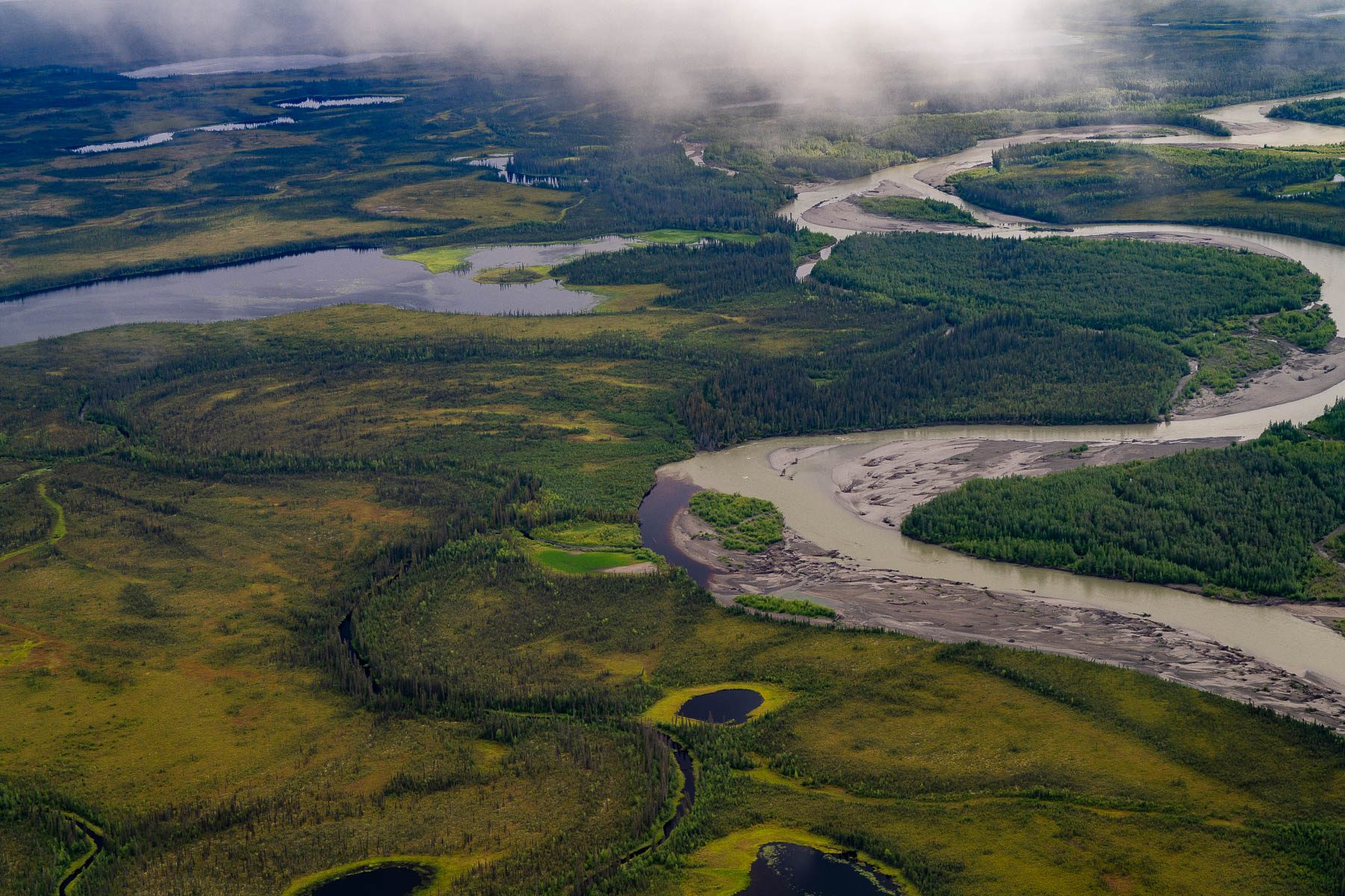
Sheefish are the largest whitefish in the world, a predator that matures late and eats other fish, and they come back to the same gravel to spawn, "not only to spawning streams but to specific areas within a reach of stream." The federal review is unusually direct about where those places are. The upper Kobuk supports "the largest spawning population of sheefish in northwestern Alaska." In the Koyukuk drainage, the Alatna River, which the road bridges, is the most important sheefish and whitefish spawning area. And the record of decision:
"There are few known sheefish spawning areas in Alaska, and two are in the project area." 2024 Record of Decision
A Shungnak Elder told the Bureau of Land Management that sheefish spawn at the mouths of the Mauneluk and Pah rivers in such numbers that "he can hear their fins splash as they broadcast spawn from his Kobuk River camp." The road crosses the Mauneluk on a large bridge. The review's own words on what it would do: sheefish "may be especially vulnerable to population-level effects from mine related dewatering, large scale spills, or leaching of acid rock into waterways," and "could be particularly vulnerable to toxic bioaccumulation... including mercury and various PAHs" because they mature late and eat other fish.
2024 Final SEIS, Vol. 1: Kobuk spawning population (Scanlon 2009; Taube and Wuttig 1998), Alatna (Brown 2009), the Kobuk tributaries, spawning site fidelity, bioaccumulation (Matz et al. 2017), the Shungnak Elder's testimony. 2024 Record of Decision: spawning areas, vulnerability to dewatering, spills and acid rock. Household use: SEIS Appendix L, Table 5. The metals chain is the ground chapter; every crossing is the water chapter.
| What the road does to fish, in the record's own findings | Where |
|---|---|
| "The road would impact fish habitat and alter free fish passage based on likely changes to channels, flows, and sedimentation, and due to impacts caused by culverts, bridge piers, alteration of surface and subsurface flow patterns." | ROD p. 14, p. 23 |
| The road "could cause population level impacts to fish and a reduction in the abundance of harvestable fish" for 17 named communities | ROD p. 19 |
| The road may "accelerate the predicted rate of climate-driven permafrost degradation, which would further degrade downstream water quality, potentially inhibit fish movement, and may alter species distribution and abundance and influence fish populations" | ROD p. 14 |
| 17 crossings of known anadromous streams and 23 of assumed ones, 40 in all; 13 crossings of essential fish habitat; 8 gravel mines within 300 feet of an anadromous stream | SEIS App. E, Table 16 |
| 121 to 1,010 hazardous-material truck accidents on the new road over its life, and 196 to 1,634 more on the Dalton Highway. "Once contaminants reach unfrozen waterbodies, clean up and removal would be difficult." | SEIS Vol. 1 |
Nothing about this road can be judged without the number the record of decision itself concedes: "Since the 1990s, chum and Chinook salmon returns have declined... In the past few years Chum and Chinook salmon runs have declined even further, leading to subsistence closures in the Yukon River watershed." Here's what that looked like in 2025, from the state's own season summaries.
| Yukon River, 2025 | The figure |
|---|---|
| Chinook past the Pilot Station sonar | 60,442, the fourth lowest on record, 38 percent of the 2005 to 2024 average |
| Chinook past the Eagle sonar, near the Canadian border | 23,863, the third lowest season total for the project, against a border passage objective of 71,000; the final border figure isn't in yet |
| Escapement goals met | "No escapement goals were met this year for Chinook salmon." None for summer chum either |
| Commercial summer chum harvest | 576,700 fish in 2018. Zero every year from 2021 through 2025 |
| Fall chum subsistence harvest, Upper Yukon District 5 | 44,946 fish in 2019. 71 in 2021 |
| Fall subsistence season | Closed, the sixth consecutive year |
| Ceremonial and funerary Chinook harvest, whole drainage | 24 fish |
ADF&G, 2025 Yukon summer and fall season summaries. The United States and Canada Yukon River Chinook agreement of April 1, 2024 is a seven-year agreement, 2024 through 2030, to conserve and rebuild Canadian-origin Chinook.
One honest exception, and we report it: in 2026 the summer chum run "met or exceeded the drainage-wide escapement goal" of 500,000 to 1.2 million fish, the federal in-season manager opened a selective-gear chum fishery on the Koyukuk from July 6 to July 25, and on August 17, 2026 reopened salmon subsistence fishing on the Koyukuk and Innoko drainages with gillnets of six-inch mesh or smaller, for the federal waters serving Huslia, Hughes, Allakaket, Alatna, Evansville, Bettles, Coldfoot and Wiseman. The Yukon mainstem stayed closed. The collapse found a floor, and one run came back this year.
Office of Subsistence Management, U.S. Department of the Interior, Yukon Area bulletins: the selective-gear summer chum opening effective July 6, 2026, and the Koyukuk and Innoko reopening effective August 17, 2026, which records the drainage-wide summer chum escapement. Both are in our record.
This is the sentence the chapter turns on, and it isn't ours. In government-to-government consultation on the road, the Bureau of Land Management summed up what the upper Koyukuk villages of Alatna and Allakaket suggested:
"Villages on the Upper Koyukuk suggested that as the salmon fishery declined on the Yukon River, the keystone fish species in the region has shifted to whitefish, sheefish, and Arctic grayling." 2024 Final SEIS, Volume 1, the BLM's summary of consultation with Alatna and Allakaket
The salmon went. The communities shifted to sheefish and whitefish. The road crosses the streams that feed the Kobuk's sheefish spawning grounds, 12 to 15 miles upstream of them. Three clauses, every one of them in the government's own record. In the villages the road would cross, chum was more than half of the total subsistence harvest in Hughes and nearly half in Huslia, Allakaket and Alatna in the study years, most of them before the collapse. What replaced it is the fish under the bridges.
2024 Final SEIS, Vol. 1; Appendix L, Tables 5 and 18 (Hughes 56.8 percent of harvest by weight, 603 pounds per person; Huslia 49.3; Allakaket 48; Alatna 44). Sheefish rated "High" importance for Ambler, Kiana, Kobuk and Noorvik, Appendix F, Table 31.
The Yukon's salmon collapsed for reasons that begin in the ocean and in Canada. The single largest disputed factor is bycatch: chum and Chinook killed in the Bering Sea pollock trawl fishery. We searched the full text of both volumes of the 2024 supplemental review and the record of decision. The words "bycatch" and "trawl" appear a combined one time, a species table listing round whitefish as incidental subsistence bycatch. "Trawl" appears zero times. Before trusting an absence we ran a control term: "caribou" returns 777 hits in Volume 1 alone. The search works. The absence is real.
Here's what the record leaves out: the chum taken as bycatch in the Bering Sea pollock fishery, which federal catch accounting reports every year. In 2021, by ADF&G's count, the Yukon fall chum run was the lowest on record, about 93,000, and the Upper Yukon subsistence harvest fell to 71 fish. We don't assert a share. What fraction of bycatch chum were Yukon fish is a genetics question we haven't resolved from the primary reports; reporting that cites the fishery council puts the Yukon-bound share of recent bycatch at a small fraction, which, if it holds, substantially weakens the simple story that bycatch alone emptied the river. That is why the road's effect on fish lands on people who have already lost their fish to something else, and why the record's own forecast of "population level impacts to fish" isn't an abstraction here.
NOAA Alaska Region catch accounting, non-Chinook mortality, BSAI pollock, 2011 to 2026. ADF&G 2021 fall summary. Yukon-origin fractions as reported by Julia O'Malley, High Country News, October 31, 2024, citing the North Pacific Fishery Management Council; the primary genetics reports are not in our record and we do not print those fractions as ours. Word counts run against the full text in our document record, with "caribou" as the control term.
Fish camp is the mechanism by which the culture is transmitted, and it's already failing for reasons that have nothing to do with the road. Alaska's own subsistence division documented the decline a decade ago, and its explanation is the honest one:
"The decline of fish camps has not been a simple direct result of fewer salmon, or any other single cause, but rather has resulted from a complex suite of realities on the river over time. The demands of wage labor, low salmon returns, increased regulation and restrictions, and ever-increasing gas prices all have combined to make most fish camps cost prohibitive today." ADF&G Division of Subsistence, Technical Paper 398, 2015
The corridor's own camps are on the record by name. A 1989 study of the upper Kobuk counted nine fish camps along a 22-mile reach from the mouth of Old Channel to the mouth of the Mauneluk, six of them inside eight miles, seven belonging to Shungnak residents an hour or two by boat from the village. "Fish camp is the highlight of the subsistence year for many upper Kobuk residents, particularly women, who dominate and direct fish camp activities." The road's large bridge over the Mauneluk lands at the end of that reach.
And the camps downstream, in the study year 2022, the second consecutive closure year, in the words of the people who hold them:
"Because why would they go out to fish camp anymore if they can't get, you know, salmon?... it's just losing a way of life and that's hard." Huslia respondent, ADF&G Technical Paper 505, interviewed March 2023
"I can't feed my family, like I used to or even my community. And I can't teach the younger people, the younger generation, the things that [we were brought up on]." Koyukuk respondent, ADF&G Technical Paper 505, interviewed April 2023
ADF&G Technical Paper 398 (Brown and Godduhn, eds., 2015), pp. 125 to 126; Technical Paper 175 (upper Kobuk, 1989); Technical Paper 505 (Koyukuk, fieldwork 2023), respondent identifiers 03242023HSL03 and 04072023KYU08.
There's a peer-reviewed paper about this exact road. In 2016 four researchers, one of them a Park Service scientist at Gates of the Arctic, modeled the subsistence economy of the project zone against communities elsewhere in Alaska, and found a gradient that's the whole argument in three numbers.
| Subsistence harvest per person per year | Kilograms |
|---|---|
| Project-zone communities off the road system | 245.1 |
| Road-connected communities outside the project zone | 118.9 |
| Project-zone communities on the road system | 46.6 |
| Ambler, the highest in the project zone | 276.7 |
| Coldfoot, on the Dalton, the lowest | 17.3 |
| Rural Alaska average | 137 |
Proximity to a road, not region, predicts the collapse in harvest. Caribou, moose and fish are 92 percent of subsistence production in the larger project-zone communities, and for Kobuk and Allakaket the fish harvest alone exceeded caribou and moose combined. If the road opened to the public and harvest in the project zone shifted to match road-connected communities, the paper's cost is $6,900 to $10,500 per household per year at replacement value.
State the condition exactly. AIDEA proposes a private, controlled-access road. The figure is what happens if it doesn't stay that way, and the federal record itself says the road "eventually may be opened to the public for hunting, fishing and other uses," based on the two closest precedents. In the scoping comments and Indigenous Knowledge interviews the review summarizes, "many residents do not believe that the road will remain private." The modeled cost and that worry belong on the same page.
Guettabi, Greenberg, Little and Joly, "Evaluating Potential Economic Effects of an Industrial Road on Subsistence in North-Central Alaska," Arctic 69(3), 2016, pp. 305 to 317, doi 10.14430/arctic4583; companion report NPS/GAAR/NRR-2016/1280. Replacement value $17.64 per kilogram (Fall 2014). Public access: 2024 Final SEIS, Vol. 1, p. 375, and the road chapter.
Winter gasoline in Hughes and Alatna this year was $11.50 a gallon; in Fairbanks, $3.34. Heating fuel in Hughes, $13.00. A decade ago harvesters in the Upper Yukon Flats reported putting off monthly bills to buy gas for subsistence, and a median of $200 a month was what a household could spend on it without sacrifice. That's the strongest fact the case for the road has, and it's the same fact as "fish camps are cost prohibitive." The cost of living is the condition both sides are arguing from.
One verified gap: Ambler, Shungnak, Kobuk, Selawik, Allakaket and Bettles return no records at all in the state's own fuel price survey, in any year. The villages closest to the mining district are absent from Alaska's fuel price data entirely. We don't print a fuel price for them.
Alaska DCCED fuel price survey, winter 2026, via the department's map service. Brinkman et al., "Impact of fuel costs on high-latitude subsistence activities," Ecology and Society 19(4), 2014.
What this chapter doesn't say
It doesn't say the road caused the salmon collapse. The collapse predates the road and its drivers are in the ocean and upstream in Canada. The road arrives into it.
It doesn't say bycatch emptied the Yukon. The numbers sit side by side. The genetics that would assign a share aren't in our record, and the reporting that cites them suggests the share is small.
It doesn't say the road costs each household $10,500. That figure is conditioned on the road becoming public. The record says it may; the applicant says it won't.
It doesn't flatten the split. Ruby's Tribal Council passed a resolution supporting the road in 2024. Ruby also sits on the Yukon, where no Chinook escapement goal was met in 2025. Same village, both truths, and the people chapter reports positions at the level of the institution that holds them.
Sheefish first. The upper Kobuk holds "the largest spawning population of sheefish in northwestern Alaska," and the road would cross the Kobuk "and more than 20 of its tributary streams that flow directly into the Kobuk River sheefish spawning grounds," 12 to 15 miles upstream of the known spawning grounds. Ninety-four percent of households in the village of Kobuk use sheefish.
2024 Record of Decision; 2024 Final SEIS, Volume 1.Because the salmon are already gone. On the Yukon in 2025 no Chinook escapement goal was met, the commercial summer chum harvest was zero for the fifth year, and the fall subsistence season was closed for the sixth. The BLM wrote that upper Koyukuk villages "suggested that as the salmon fishery declined on the Yukon River, the keystone fish species in the region has shifted to whitefish, sheefish, and Arctic grayling."
ADF&G Yukon season summaries, 2025; Office of Subsistence Management bulletins, 2026; 2024 Final SEIS.A peer-reviewed study of this road found that people in the project zone harvest 245 kilograms per person a year off the road system and 47 kilograms in project-zone communities on it. If the road ends up public, which the record itself says it may, the modeled cost is $6,900 to $10,500 per household per year.
Guettabi et al. 2016, Arctic 69(3); 2024 Final SEIS.The fish findings are the federal record's own, the collapse is the state's own season data, the camps are the state's own subsistence studies with respondent identifiers, and the harvest gradient is a peer-reviewed paper about this specific road. Where the primary is missing, the bycatch genetics and the 2010 fish-camp participation study, this page says so rather than borrowing the number.
The two weirs that count the fish these communities have left, the Gisasa and Henshaw River weirs run by Tanana Chiefs Conference, didn't operate in 2025 "due to lack of funding," and the Andreafsky weir was discontinued. A road across the sheefish spawning grounds is being permitted while the counting stops. That's a line item with a name. Ask your delegation whether the weirs run in 2027.
If you're a reporter, the question for the Bureau of Land Management is where its analysis of the road's effect on subsistence fish accounts for the marine causes of the collapse it describes. The answer, on the text, is that it doesn't.