


Mount Rainier is the kind of mountain that makes its own weather and its own gravity. At 14,411 feet it is the most heavily glaciated peak in the lower 48, and on a clear day you can see it from Seattle, looming like a second moon. Up close it trades the postcard view for wildflower meadows, old-growth forest, waterfalls around every bend, and some of the best day hiking in the country.
Below are 20 things to do at Mount Rainier, ranked by what I would tell a first-timer to prioritize, grouped so you can plan around Paradise, Sunrise, and the quieter corners. Each item lists the trailhead, distance, difficulty, and the best time to be there. For the full park overview and seasonal road status, start with our Mount Rainier National Park hub.

At a Glance
| Activity | Type | Distance / Time | Difficulty |
|---|---|---|---|
| Skyline Trail Loop | Hike | 5.5 to 6.2 mi loop, 4 to 6 hrs | Strenuous |
| Pinnacle Peak Saddle | Hike | 2.5 mi RT, 2 hrs | Moderate to strenuous |
| Mt. Fremont Lookout | Hike | 5.6 mi RT, 3 to 4 hrs | Moderate |
| Reflection Lakes | Viewpoint | Roadside | Easy |
| Wonderland Trail | Backpacking | 93 mi loop, 7 to 12 days | Very strenuous |
| Christine Falls | Roadside | 0.1 mi | Easy |
| Tolmie Peak Lookout | Hike | 6.5 mi RT, 4 hrs | Moderate to strenuous |
| Tipsoo Lake | Loop walk | 0.5 mi, 30 min | Easy |
The Best Hikes at Mount Rainier
1. Hike the Skyline Trail Loop

Trailhead: Paradise, behind the Jackson Visitor Center. Distance: 5.5 to 6.2 miles loop. Elevation gain: about 1,800 feet. Difficulty: Strenuous. Best time: Start early, peak wildflowers late July into August.
This is the signature hike of the park, and the one I would do if I only had time for one. The loop climbs through wildflower meadows to Panorama Point, where on a clear day you stare straight up the Nisqually Glacier at the summit. Go clockwise for the steeper climb up front and easier views on the way down, and bring layers because the wind up top has teeth even in August.
Love Mount Rainier? It's one of 117 threatened public lands destinations we're tracking. Get the free briefing.
2. Soak in the Views from Pinnacle Peak

Trailhead: Across from Reflection Lakes. Distance: 2.5 miles round trip to the saddle. Elevation gain: about 1,050 feet. Difficulty: Moderate to strenuous. Best time: Late morning once snow clears, usually August.
Short but steep, and it pays off with a head-on view of Rainier across the valley. The maintained trail ends at the saddle. The scramble to the actual summit is loose and exposed, so most people stop at the saddle and that is plenty. Snow lingers here into midsummer, so check conditions first.
3. Trek to the Mt. Fremont Fire Lookout

Trailhead: Sunrise. Distance: 5.6 miles round trip. Elevation gain: about 1,200 feet. Difficulty: Moderate. Best time: Clear morning for the view, dusk for mountain goats.
One of the few staffed-era lookouts you can still hike to here, perched on a ridge with a clean look at the north face. The trail runs across open subalpine ridgeline the whole way, so the views start early and never quit. Watch for mountain goats on the slopes below the lookout.
4. Hike to Van Trump Park

Trailhead: Comet Falls trailhead on the Nisqually road. Distance: 5.8 miles round trip. Elevation gain: about 2,200 feet. Difficulty: Strenuous. Best time: Wildflower season, late July.
You pass 320-foot Comet Falls on the way up, which would be a destination on its own anywhere else. Keep climbing and the trail opens into the meadows of Van Trump Park, right under the glaciers. It is a steep grind but far less crowded than Paradise for similar scenery.
5. Hike the Sourdough Ridge Trail
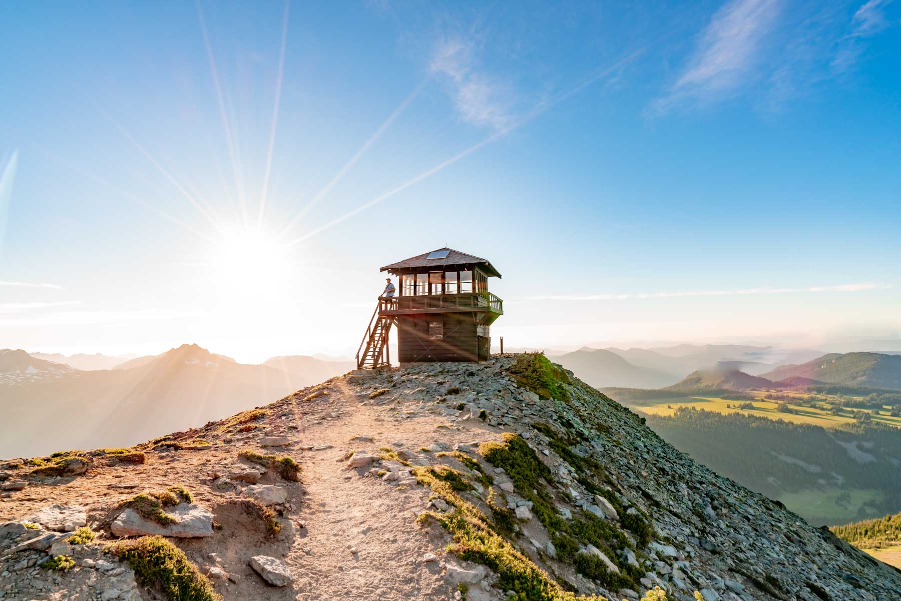
Trailhead: Sunrise. Distance: 2.5 miles round trip for the loop. Elevation gain: about 500 feet. Difficulty: Easy to moderate. Best time: Morning.
The easiest big-view hike at Sunrise. A short climb puts you on the ridge with the mountain on one side and the Cascades rolling off on the other. It is the hike I send people on when they want the Sunrise payoff without committing to Mt. Fremont.
6. Hike to the Tolmie Peak Fire Lookout

Trailhead: Mowich Lake, in the northwest corner. Distance: 6.5 miles round trip. Elevation gain: about 1,100 feet. Difficulty: Moderate to strenuous. Best time: Clear day for the reflection in Eunice Lake.
The road to Mowich Lake is rough gravel, which keeps the crowds thin. The trail passes Eunice Lake, where Rainier reflects on a still morning, then climbs to a lookout with one of the best framed views in the park. Plan extra time for the drive in.
7. Hike the Wonderland Trail

Trailhead: Multiple, commonly Longmire. Distance: 93 miles around the mountain. Elevation gain: about 22,000 feet total. Difficulty: Very strenuous. Best time: Late July through September. Permit required.
The big one. The Wonderland circles the entire mountain over 7 to 12 days, crossing every drainage and climbing the equivalent of summiting a few times over. Backcountry permits are competitive and run through an early reservation lottery on Recreation.gov, so plan months ahead. Most visitors will only ever sample a section, and even a day on it is worth it.
Waterfalls and Easy Walks
8. Admire Christine Falls

Location: Nisqually to Paradise road. Distance: Roadside. Difficulty: Easy. Best time: Overcast days for soft light.
The classic Rainier waterfall shot, framed under a stone highway bridge arch. There is a small pullout and a short path to the viewpoint. It takes five minutes and it is right on the way to Paradise, so there is no reason to skip it.
9. Visit Narada Falls

Location: Paradise road. Distance: 0.2 miles round trip to the lower view. Difficulty: Easy, short but steep. Best time: Midday when sun catches the mist for rainbows.
A 168-foot curtain of water that throws spray and rainbows on a sunny afternoon. A short paved path drops to the lower viewpoint, where you will get wet if the wind is right. Watch your footing on the steps when they are slick.
10. See Sunbeam Falls

Location: Stevens Canyon road. Distance: Roadside. Difficulty: Easy. Best time: Any time, quick stop.
An easy-to-miss roadside cascade tucked into mossy forest. It is not the biggest falls in the park, but the green setting makes it one of the prettiest. Pull over, take it in, and keep moving toward Reflection Lakes.
11. Visit Tipsoo Lake
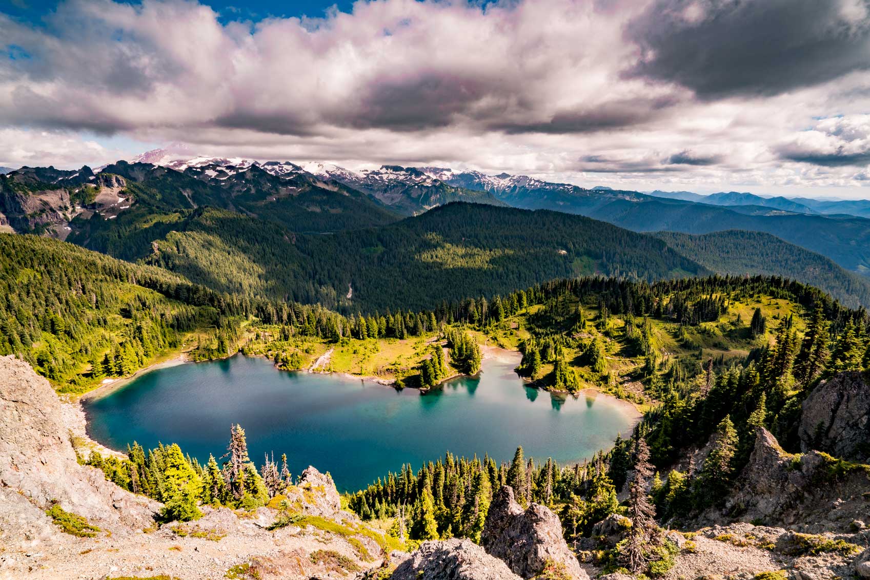
Location: Chinook Pass, Highway 410. Distance: 0.5-mile loop. Difficulty: Easy. Best time: Sunrise, wildflower season.
A small subalpine lake that reflects Rainier when the water is calm, ringed by wildflowers in late summer. The loop is short enough for anyone, and the sunrise light here is some of the best roadside photography in the park. It sits high, so it opens later in the season than Paradise.
12. Walk the Eastside and Silver Falls Trails

Trailhead: Ohanapecosh. Distance: 3-mile Silver Falls loop. Difficulty: Easy to moderate. Best time: Any time, great on a hot day.
The beloved Grove of the Patriarchs trail has been closed since 2021 after flooding destroyed its suspension bridge, and a replacement is not expected before 2027. The good news is the Ohanapecosh area still delivers, with the Eastside Trail running through old-growth forest and the Silver Falls loop following the turquoise Ohanapecosh River to a powerful cascade. This is the cool, shaded corner of the park.
Viewpoints and Scenic Stops
13. Admire Reflection Lakes

Location: Stevens Canyon road. Distance: Roadside. Difficulty: Easy. Best time: Dead-calm sunrise.
The most famous reflection in the park, and worth setting an alarm for. Get here before sunrise on a windless morning and the mountain doubles in the water. Later in the day the breeze ripples the surface and the magic is gone, so this is a dawn play.
14. Catch a Sunrise at Sunrise
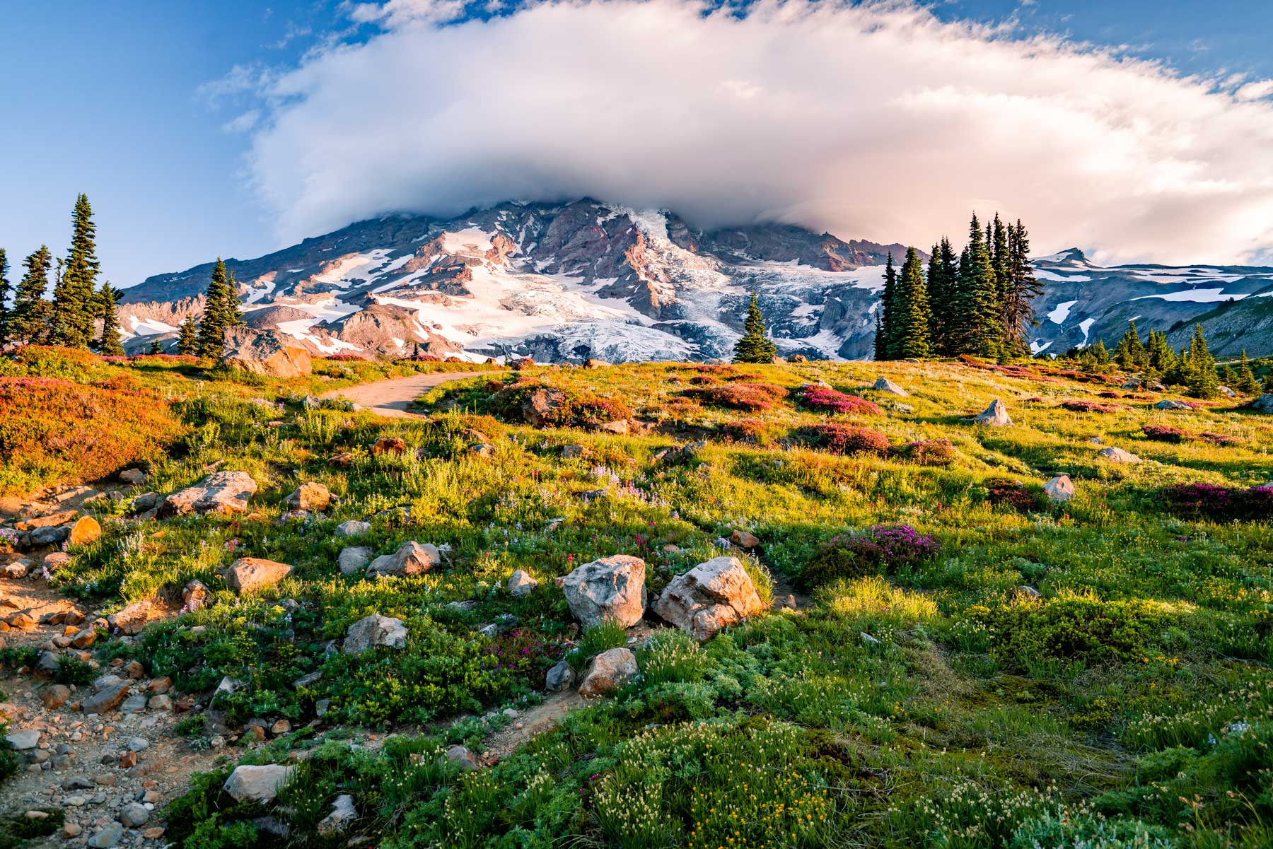
Location: Sunrise, the highest point you can drive to in the park. Difficulty: Easy access, hikes from here vary. Best time: Sunrise, naturally. Note: Road typically open July to early October.
At 6,400 feet, Sunrise is the highest you can drive in the park and the best place to watch first light hit the mountain. It is also the trailhead hub for Mt. Fremont, Sourdough Ridge, and Burroughs Mountain. The road is one of the last to open each summer, so check status before you commit to the drive.
15. Explore the White River Area

Location: White River, on the Sunrise road. Difficulty: Easy. Best time: Summer.
The glacial White River braids across a wide gravel bed below the mountain, milky with rock flour. There is a campground and easy river access, and it makes a good base for the Sunrise hikes. Stand at the river and you are looking at meltwater that was glacier ice a few hours ago.
Forest, Wildlife, and History
16. Explore Longmire

Location: Longmire, near the Nisqually entrance. Difficulty: Easy. Best time: Any time, good rainy-day option.
The historic heart of the park, with a museum, the National Park Inn, and the easy Trail of the Shadows loop through meadow and mineral springs. It is the first thing you reach coming in the Nisqually entrance and a good place to get oriented or wait out weather. The architecture here defined the National Park Service rustic style.
17. Go Wildlife Viewing

Where: Subalpine meadows at Paradise and Sunrise. Difficulty: Easy. Best time: Dawn and dusk.
The meadows are full of marmots whistling from the rocks, black-tailed deer browsing the edges, and mountain goats high on the slopes. Black bears turn up in the berry patches in late summer. Keep your distance, never feed anything, and a zoom lens beats getting closer every time.
18. Go Wildflower Peeping

Where: Paradise and Sunrise meadows. Difficulty: Easy. Best time: Late July into August.
For a few weeks in midsummer the meadows explode with lupine, paintbrush, avalanche lily, and bistort, and Paradise lives up to its name. Timing shifts year to year with the snowpack, so check the park’s wildflower report before you go. Stay on the trails, because these meadows take decades to recover from a footprint.
After Dark and Overnight
19. Go Stargazing

Where: Sunrise, Paradise, or Tipsoo Lake. Difficulty: Easy. Best time: New moon, clear night.
When the marine clouds clear, the high meadows away from city light deliver a serious night sky, with the Milky Way over the silhouette of the mountain. Sunrise and Tipsoo Lake are favorites because you can take in both the stars and the peak. Bring warm layers, because even August nights up high get cold.
20. Camp at Cougar Rock
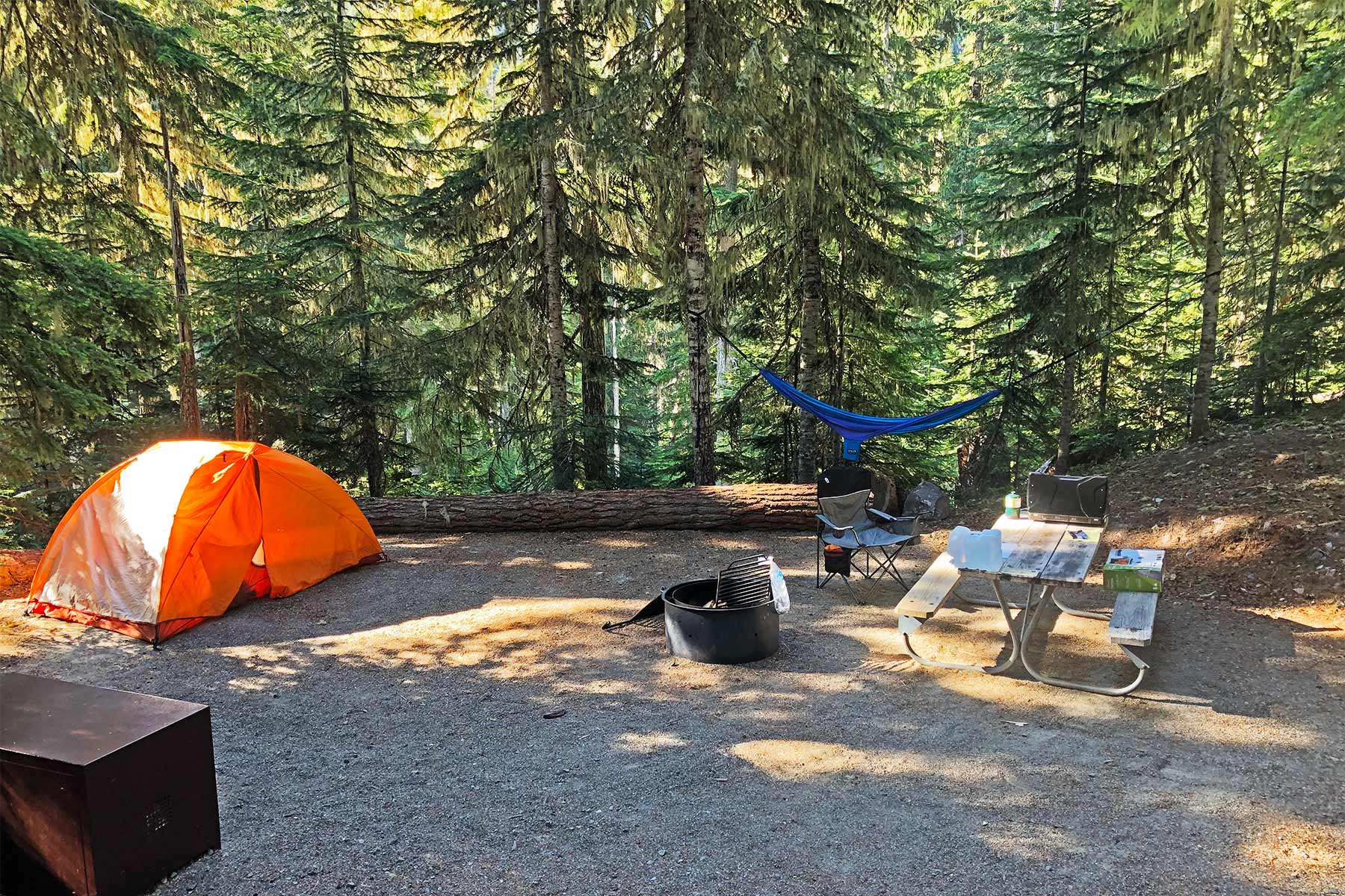
Location: Between Longmire and Paradise. Difficulty: Easy. Best time: Summer, reserve ahead.
The most convenient campground for the Paradise side of the park, set in the forest along the Nisqually. It books up fast in summer, so reserve through Recreation.gov as early as you can. From here you are minutes from the Skyline Trail and the waterfalls along the road.
Planning Your Mount Rainier Visit
Fees and Reservations
The entrance fee is $30 per private vehicle, $25 per motorcycle, or $15 per person, good for seven days, and an America the Beautiful annual pass covers it. Mount Rainier ran a timed-entry pilot in recent summers, but the park has confirmed it will not require timed-entry reservations anywhere in the park in 2026. The only reservations you need are for campgrounds and Wonderland Trail backcountry permits.
How Many Days You Need
One day is enough to focus on Paradise, hike part of the Skyline Trail, and catch the waterfalls along the road. Two days lets you add Sunrise, which is a long drive from Paradise, plus the lookouts and Reflection Lakes. Three days opens up the quieter northwest corner at Mowich Lake and the forest at Ohanapecosh.
Where to Stay
Inside the park, the National Park Inn at Longmire stays open year-round and the Paradise Inn runs in summer, both rustic and historic. For camping, Cougar Rock and Ohanapecosh are the main reservable options and fill early. Outside the park, Ashford near the Nisqually entrance and Packwood to the southeast both make practical bases. There is also dispersed camping on the surrounding public lands destinations in the Gifford Pinchot National Forest.
When to Go
The park is a summer destination at heart. The high roads to Paradise and Sunrise are typically snow-free from July into early October, and that window is also peak wildflower season. Visit in late summer for the best combination of open trails, flowers, and stable weather. Winter brings snow play at Paradise but closes most of the high country.
Frequently Asked Questions
Do I need a reservation to enter Mount Rainier in 2026?
No. The park has confirmed it will not require timed-entry reservations in 2026. You still pay the standard entrance fee, and you still need reservations for campgrounds and Wonderland Trail permits.
What is the best hike at Mount Rainier?
The Skyline Trail Loop out of Paradise is the standout, with wildflower meadows, glacier views, and Panorama Point in one 5.5 to 6.2-mile loop. For a shorter big-view option, try Sourdough Ridge at Sunrise.
Is the Grove of the Patriarchs open?
No. The trail has been closed since 2021 after flooding destroyed its access bridge, and a replacement is not expected before 2027. For old-growth forest in the same area, walk the Eastside Trail or the Silver Falls loop at Ohanapecosh instead.
When do the wildflowers bloom?
Usually late July into August, though it shifts year to year with the snowpack. Check the park’s wildflower report before you go to catch peak bloom in the Paradise and Sunrise meadows.
Sorting out which Washington park to visit? Read our comparison of Olympic vs. North Cascades vs. Rainier, and dig deeper into the trails with our guide to the best Mount Rainier hikes ranked.
What to Bring to Mount Rainier
Gear we recommend for Mount Rainier. Affiliate links support our work at no cost to you.
More Than Just Parks may earn a small commission from purchases made through these links, at no extra cost to you. We only recommend gear we would actually use.
Affiliate disclosure: Some links on this page earn us a small commission at no extra cost to you. We only recommend gear we actually use.


