
Comments closed October 5
Stop the 25-year Swamped logging plan near Libby, Montana
U.S. Forest Service · Kootenai National Forest, ID
- What
- The Swamped project would log 6,883 acres, including 173 acres inside existing old growth, and create openings up to 252 acres. It runs under an emergency determination that skips the public objection process, so this comment period is the public's say.
- Where
- Kootenai National Forest, ID, MT
- How much
- 8,569 acres total acres treated in initial treatments; 6,883 acres acres proposed for timber harvest; 40 to 252 acres each, 2,113 acres total size and total acreage of clearcut-style openings
- Decided
- Comments closed October 5, 2026. No decision document is on file yet.Date from Forest Service CARA comment page ↗, read October 29, 2026.
Where these four lines come from
- WhatOur plain-English read of the Forest Service project page ↗. Check it against the agency’s own words under Case.
- WhereThe places and states the project page names, as PLAN read them.
- 8,569 acres“Under the proposal, a total of 8,569 acres would be treated through initial treatments (Table 1 and Table 2).” Proposed Activities Open the document ↗
- 6,883 acres“About 6,883 acres are proposed for harvest treatments (Table 1).” Harvest Treatments Open the document ↗
- 40 to 252 acres each, 2,113 acres total“some units include more than one harvest treatment (Table 6) and range in size from 40 to 252 acres.” Table 6 Open the document ↗
- DecidedOctober 5, 2026, from Forest Service CARA comment page, the notice text ↗: “requested through 10/5/2026 11:59:59 PM (Eastern Standard Time)”. Read October 29, 2026. The decision document is the one on file in PLAN’s record.
- Read from PLAN’s record November 9, 2026.
What the proposal said, and what the decision did
No figure from the proposal has been checked against the decision on this fight yet. What the record does hold is the issues ledger below.
No decision document is on PLAN’s record for this fight yet. When the agency’s decision lands, what it answered goes here.
PLAN's read: high threat
The Swamped project would log 6,883 acres, including 173 acres inside existing old growth, and create openings up to 252 acres. It runs under an emergency determination that skips the public objection process, so this comment period is the public's say.
What’s at risk
If this goes through
Our plain-English read of the official notice ↗. Check it against the agency’s own words below.
By the numbers, from the agency’s own document
- Total acres treated in initial treatments
Proposed Activities
Open the document ↗“Under the proposal, a total of 8,569 acres would be treated through initial treatments (Table 1 and Table 2).”
- Acres proposed for timber harvest
Harvest Treatments
Open the document ↗“About 6,883 acres are proposed for harvest treatments (Table 1).”
- Size and total acreage of clearcut-style openings
Table 6
Open the document ↗“some units include more than one harvest treatment (Table 6) and range in size from 40 to 252 acres.”
- Old growth acres logged or treated
Treatment of Existing Old Growth Stands
Open the document ↗“Approximately 173 acres of harvest and 49 acres of other vegetation treatments are proposed within existing old growth.”
- New permanent road miles built
New Forest System Road Construction
Open the document ↗“Approximately 10.8 miles of new permanent system road would be built for harvesting purposes (Table 9).”
- Total implementation timeframe
Proposed Activities
Open the document ↗“last up to 20 years for harvest treatments and an additional 5 years to complete harvest associated treatments”
Source: the agency’s document ↗
The agency’s case, tested
What the agency argues, and whether its own record backs it
- 6
- Not fully backed
- 1
- Contradicted by its own record
- 2
- Never analyzed
The Kootenai National Forest proposes to log about 6,883 acres and treat 8,569 acres in all, 15 miles south of Libby, Montana, over up to 25 years, building approximately 10.8 miles of new permanent road. It says the work is needed to shift dense Douglas-fir forests toward ponderosa pine and western larch, lower wildfire risk near homes, improve big game winter range and supply timber.
“Wildfire, insects, and disease are natural components of these ecosystems, and the proposed action would provide long-term benefits by improving the forest’s ability to withstand these disturbances while also creating safer, more effective conditions for fire management.”
Determination of No Significant Impacts
EffectsContradicted by its own recordThe project won't affect any waters, including wetlands, so no further Clean Water Act permits or changes are needed.
The hydrology summary says sediment increases would be brief and kept down by best management practices. But the finding of no significant impact itself predicts higher sediment delivery to streams. The aquatics summary expects short-term effects from culvert work, and the project puts wood directly into Elliot Creek. Those effects can't coexist with a finding that no waters are affected.
The agency’s words, the record and the law +Hide the words
The agency says
“The hydrologist has reviewed the proposed action and the project will not affect any waters, including wetlands, and no further permits or modifications are needed to ensure compliance.”
Clean Water Act
Elsewhere in the same document
“Short-term increases in traffic and off-road equipment use would produce temporary adverse impacts to hydrologic and soil resources, including higher sediment delivery to streams and increased soil disturbance.”
Determination of No Significant Impacts
“The proposal to add small woody material to the stream, such that it interacts with the stream bed and floodplain, would help increase floodplain complexity and fine sediment retention in Elliot Creek.”
Elliot Creek Small Wood Addition
The law
“An agency shall issue an environmental impact statement with respect to a proposed agency action requiring an environmental document that has a reasonably foreseeable significant effect on the quality of the human environment.” National Environmental Policy Act, 42 U.S.C. 4336(b)(1) ↗
Purpose and needNot fully backedA century of fire suppression has built up hazardous fuels, so treatments are needed to lower wildfire risk to people and private land near Libby.
The fire history backs this. The largest fire year was 1917, only about 500 acres have burned since then, and a nearby study found a fire return interval averaging 12 years. About 91 percent of treatments are in the wildland urban interface. One flaw: the finding of no significant impact names Forest Road 2253, Big Beaver Creek Road and White Pine Creek Road, which the environmental assessment never mentions.
The agency’s words, the record +Hide the words
The agency says
“Because of fire suppression, most of the area has not burned for the last 100 plus years.”
Hazardous Forest Fuels
Elsewhere in the same document
“The largest fire year for the project area was in 1917 with about 1,130 acres burning, mostly on National Forest System lands.”
Hazardous Forest Fuels
“Over 7,870 acres or 91 percent of the vegetation treatments are proposed within the wildland urban interface on National Forest System lands in a combination of harvest (6,265 acres), pre-commercial thin (395 acres), slashing (1,117 acres), and ecosystem burning (95 acres).”
Vegetation Management Treatments
EffectsNot fully backedThe finding of no significant impact says the effects on every species listed under the Endangered Species Act are not likely to be adverse.
The species write-ups describe only brief, minor, localized disturbance for grizzly bear and minimal overlap with whitebark pine habitat. The Endangered Species Act section says a biological assessment was prepared and consultation is complete. Table 18 gives grizzly bear and whitebark pine the code "MALAA" and gives lynx and wolverine "MANLAA." The document doesn't define either code, so this text can't show the blanket "not likely to adversely affect" statement is wrong. It also doesn't explain why the codes differ.
The agency’s words, the record and the law +Hide the words
The agency says
“Effects on ESA-listed species are “Not Likely to Adversely Affect,” and no irreversible habitat loss is expected.”
Wildlife and Habitat
Elsewhere in the same document
“Grizzly Bear (Ursus arctos horribilis) Threatened MALAA The action area lies within the Fisher Bears Outside Recovery Zone (BORZ) polygon of the Cabinet-Yaak Ecosystem (CYE) and the Libby Grizzly Bear Analysis Unit (GBAU).”
Table 18
“Whitebark Pine (Pinus albicaulis) Threatened MALAA A small portion of the project area overlaps with potential habitat.”
Table 18
The law
“Each Federal agency shall, in consultation with and with the assistance of the Secretary, insure that any action authorized, funded, or carried out by such agency (hereinafter in this section referred to as an "agency action") is not likely to jeopardize the continued existence of any endangered species or threatened species” Endangered Species Act, 16 U.S.C. 1536(a)(2) ↗
Show 4 more claims +Show fewer
EffectsNot fully backedDetrimental soil disturbance won't exceed the Forest Plan's 15 percent threshold, so no long-term soil impacts are expected.
The soil design features limit slopes, equipment passes and skid trail spacing. Where monitoring shows disturbance above 15 percent, they require restoration back to 15 percent or less. But the soil restoration section says some units could exceed 15 percent after harvest, and the design features name units 39, 67 and 101 as currently over the threshold or predicted to exceed it. Units already over 15 percent only have to be restored to their pre-existing level. The finding of no significant impact doesn't reconcile those units with its statement that disturbance won't exceed 15 percent.
The agency’s words, the record and the law +Hide the words
The agency says
“Sediment levels are expected to return to pre-project conditions within one to two years following implementation, and detrimental soil disturbance is not expected to exceed the Forest Plan’s 15-percent threshold; therefore, long-term impacts to soils are not anticipated.”
Determination of No Significant Impacts
Elsewhere in the same document
“Required in units currently exceeding or predicted to exceed 15 percent detrimental soil disturbance following proposed activities.”
Soils
“Soil restoration for harvest units currently exceeding the 15 percent detrimental soil disturbance guideline for soil productivity; monitoring of the restoration work; other potential soil monitoring of Knutson-Vandenberg projects.”
Table 17
The law
“Resource plans and permits, contracts, and other instruments for the use and occupancy of National Forest System lands shall be consistent with the land management plans.” National Forest Management Act, 16 U.S.C. 1604(i) ↗
EffectsNot fully backedThe project will have no effect on yellow-billed cuckoo because no work will happen in riparian areas.
Riparian buffers keep out ground-based equipment and commercial harvest. Cutting in riparian habitat conservation areas is limited to hand slashing of trees 4 inches or less, no closer than 25 feet from the flood prone area, with no piling or jackpot burning. Still, the document plans hand slashing inside riparian habitat conservation areas. It also plans to fell about 30 trees per mile from the Elliot Creek riparian habitat conservation area and place them to interact with the stream bed and floodplain. That doesn't square with the stated reason that no work will occur in riparian areas.
The agency’s words, the record and the law +Hide the words
The agency says
“Although the project area overlaps with Yellow-billed cuckoo area of influence, project activities will not be occurring in riparian areas.”
Table 18
Elsewhere in the same document
“Limited hand slashing would occur within riparian habitat conservation areas to reduce small tree ladder fuels.”
Slashing within Riparian Habitat Conservation Areas
“Approximately 30 trees per mile would be hand felled whole from the riparian habitat conservation area in overstocked areas, selecting trees generally 6 inches in diameter at breast height or less.”
Elliot Creek Small Wood Addition
The law
“An agency shall issue an environmental impact statement with respect to a proposed agency action requiring an environmental document that has a reasonably foreseeable significant effect on the quality of the human environment.” National Environmental Policy Act, 42 U.S.C. 4336(b)(1) ↗
EffectsNot fully backedEvery regeneration opening, including those up to 252 acres, will fit the Forest Plan's desired patch sizes for its biophysical setting.
A design feature caps group L at 200 acres in the warm/dry setting, where the desired patch size is 20 to 200 acres. But Table 6 also lists group C at 218 acres, D at 237 and O at 239. The project area is mostly warm/dry, yet the document never gives these groups' settings or applies a similar cap to them.
The agency’s words, the record and the law +Hide the words
The agency says
“All patch sizes would be consistent with Forest Plan desired conditions for the biophysical setting in which they occur.”
Regeneration Harvest and Openings Greater than 40 Acres
Elsewhere in the same document
“In order to meet the desired patch size of 20-200 acres for the warm/dry biophysical setting (FW-DC-VEG-11), the combined acreage within the warm/dry biophysical setting of units 76, 77, 78, and 171 cannot exceed 200 acres.”
Forest Vegetation
The law
“Resource plans and permits, contracts, and other instruments for the use and occupancy of National Forest System lands shall be consistent with the land management plans.” National Forest Management Act, 16 U.S.C. 1604(i) ↗
EffectsNot fully backedHarvest and other treatments in old growth won't cost any stand its old growth status, and the amount of old growth will stay the same.
The document cites a Forest Plan guideline (FW-GDL-VEG-01) that allows treatment in old growth only if old growth characteristics are kept. It says all prescriptions are designed to keep stands meeting the definition and describes thinning from below around large ponderosa pine, western larch and Douglas-fir. Table 7 shows zero stands no longer meeting old growth criteria. Units 11A, 78 and 171 need old growth surveys first, and the prescriptions there would be adjusted or the treatment dropped based on the results. The document doesn't give before-and-after stand measures, but its binding design commitments support the claim.
The agency’s words and the law +Hide the words
The agency says
“The amount of old growth and recruitment potential old growth thoroughly inventoried in the project area would remain the same under the action alternative with greater likelihood of persisting into the future under a changing climate.”
Treatment of Existing Old Growth Stands
The law
“Resource plans and permits, contracts, and other instruments for the use and occupancy of National Forest System lands shall be consistent with the land management plans.” National Forest Management Act, 16 U.S.C. 1604(i) ↗
What the document never analyzes
Not analyzedContamination from the Libby Superfund site
The document notes the Libby area is on the Superfund list because of a former vermiculite mine but never says whether contamination reaches the project area or could be stirred up by logging, dust or burning.
Searched all 78 pages for ‘asbestos’, ‘amphibole’, ‘tremolite’. None appear.
Not analyzedGroundwater and household water sources
Many residences sit along U.S. Highway 2 on the project's western edge, and road work crosses springs, but the document never discusses groundwater or household water downslope.
Searched all 78 pages for ‘groundwater’, ‘aquifer’, ‘domestic well’. None appear.
How this was read
Read from the agency’s own decision document ↗, all 78 pages. Every quote is checked word for word against it, a claim marked contradicted stands on a quote from the same document, and a second reading argued the agency’s side of every verdict before it was published. The verdicts are our reading; the quotes are the agency’s. A court can set aside agency action it finds “arbitrary, capricious, an abuse of discretion, or otherwise not in accordance with law” (5 U.S.C. 706(2)(A) ↗), which is why these gaps are worth putting in the record.
In the agency’s own words
7,870 acre vegetation management project to address desired conditions and hazardous fuels.
The groups on this fight
4 groups predicted likely to care in Idaho and Montana
Predicted likely to care is a guess from the group's sourced work in Idaho and Montana, with no link to this decision. Give straight to them; nothing routes through us.
- American Prairie
Predicted likely to care · a guess
American Prairie, Montana: Defending its own bison herd, formally protesting BLM's revocation of grazing permits on 63,000 public-land acres.
- Earthjustice
Predicted likely to care · a guess
Cabinet Mountains Wilderness, Montana: Counsel in the long-running litigation against the Rock Creek and Montanore mines proposed beneath the wilderness.
- Idaho Conservation League
Predicted likely to care · a guess
Craters of the Moon National Monument, Idaho: Mobilized Idahoans to file Interior Department comments defending Craters of the Moon during the 2017 national monument review, arguing shrinkage would damage the economies of Blaine, Butte, Minidoka, and Power counties.
- Western Watersheds Project
Predicted likely to care · a guess
Bruneau-Jarbidge Rivers, Idaho: Challenging BLM's grazing management across 1.4 million acres of the Jarbidge and Bruneau river canyonlands, where it won an injunction blocking ranchers from grazing beyond their permit limits.
Every group above is on STAND for Public Lands, with its court record, its filings and who backs it.
Who signs it
The notice names no signer PLAN could read. PLAN names a decision-maker only when the document names one.
The ground
The window has closed, so there’s no watch to set on it here.
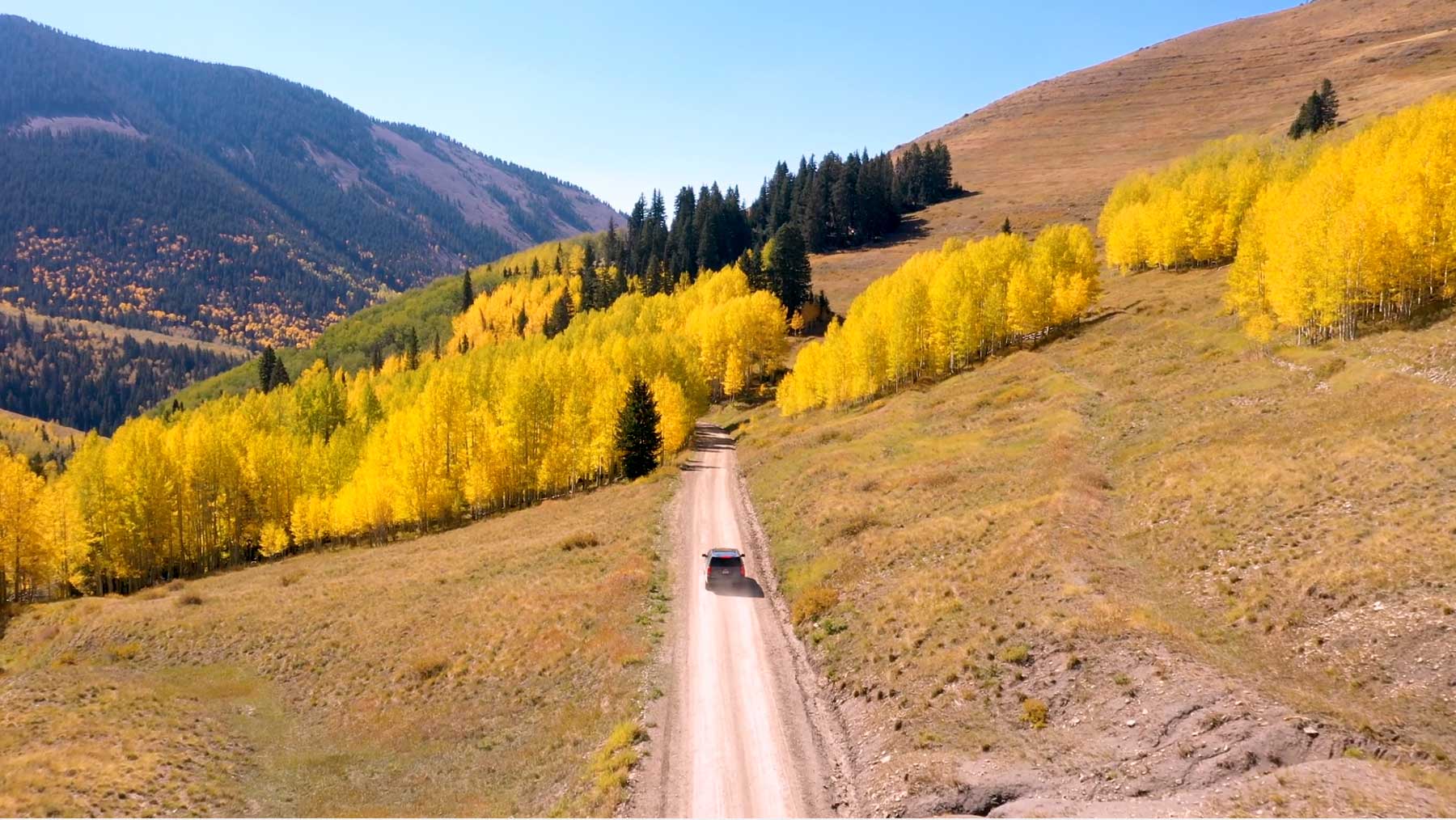
The photograph on this page: An unpaved national forest road climbing through autumn aspens. It’s the country this decision sits in, not the site itself. More Than Just Parks.
In court on this ground
One court case is over Kootenai National Forest, newest first.
Ruled · July 26, 2018
Alliance for the Wild Rockies v. Christopher Savage
The court: “REVERSED and REMANDED in part; VACATED”
Who holds the vote
PLAN’s record doesn’t tie a member of Congress to this fight yet. The scorecard grades the votes and bills that decide public lands; nothing joins a vote or a bill to this decision, so there’s no member to name here without guessing.
See how your members vote ↗Forest ServiceWe track this on the agency’s own system of record, where most on-the-ground decisions live.
Know an open comment period we are missing, or spotted a wrong deadline? .
More fights that need you
Go deeper, free
See how your members of Congress vote on public lands
Every representative, graded on the votes that decide the fate of parks, forests, and refuges.
Open ↗The mapSee the places under active threat
A live map of the parks, monuments, and wild country in the crosshairs right now.
Open ↗A wrong fact, a dead link, a form that wouldn’t take your letter: one tap and it comes to the people who build PLAN, with this fight attached.