
Stop reopening Oculina Bank coral habitat to shrimp trawling
Coral, Coral Reefs, and Live/Hardbottom Habitats of the South Atlantic and the Shrimp Fishery of the South Atlantic Region; Amendments 11/12
National Oceanic and Atmospheric Administration· Oculina Bank Habitat Area of Particular Concern, South AtlanticFederal Register 2026-19182 ↗
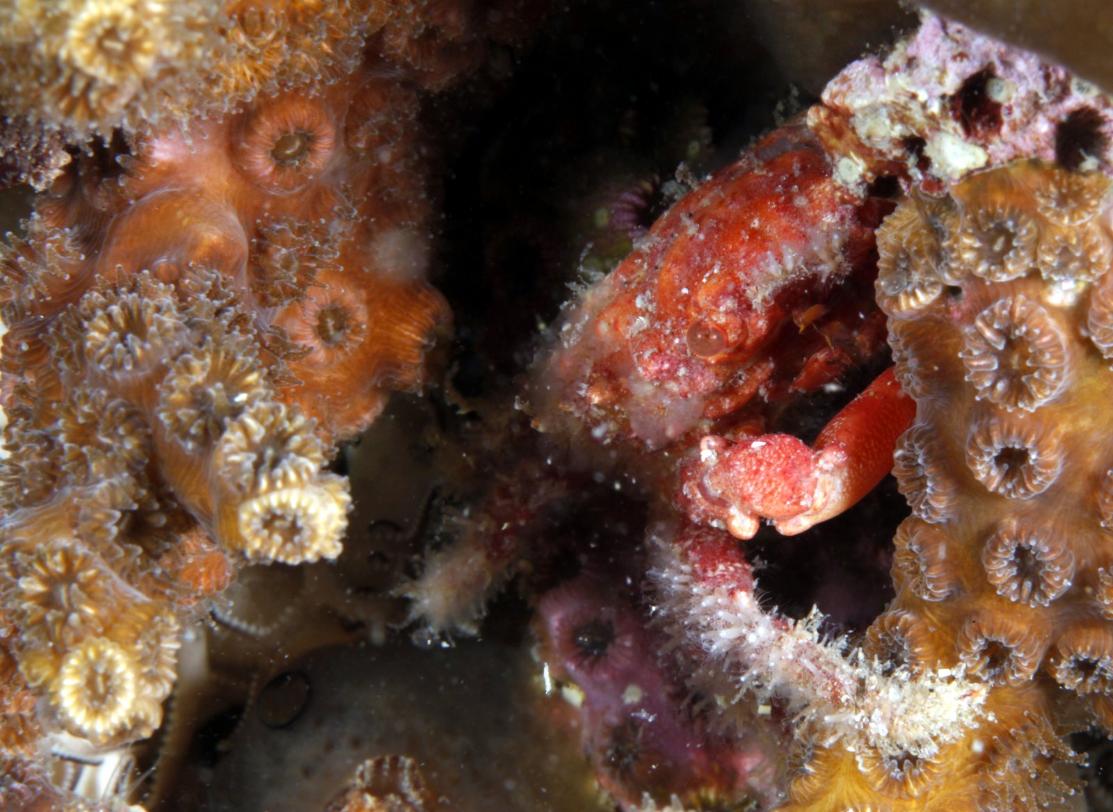
NOAA would allow rock shrimp trawlers back into a protected deep-water coral zone off the Southeast U.S. coast.
What’s at risk
The Oculina Bank Habitat Area of Particular Concern shelters rare deep-water Oculina coral that current rules protect from trawling. This proposal would carve out a shrimp fishery access area along the northern extension's eastern boundary, putting that coral ecosystem directly in the path of trawl gear.
If this goes through
Rock shrimp trawling would be permanently reinstated in a portion of the Oculina Bank that has been off-limits specifically to protect deep-water coral.
Our plain-English read of the official notice ↗. Check it against the agency’s own words below.
The agency’s case, tested
What the agency argues, and whether its own record backs it
- 1
- Holds up
- 6
- No support given
The National Marine Fisheries Service is taking comment on fishery plan amendments that would open an approximately 14.10 square nautical mile strip of the protected Oculina Bank coral area to bottom trawling for rock shrimp. The reasons given are to restore access to historic fishing grounds and reach optimum yield in the rock shrimp fishery while keeping harm to deep-water corals low.
“The purpose of Amendments 11/12 is to reinstate access to historic rock shrimp fishing grounds, achieve optimum yield (OY) in the rock shrimp fishery, while minimizing impacts to deep-water corals in the OHAPC.”
Summary
Each Ask below goes into your letter when you write it with PLAN on this page, matched to what you tell it about how this land reaches you.
Authority
No support given
The new amendments fix the problems that led the agency to disapprove Amendment 10 on protecting essential fish habitat and minimizing bycatch.
The disapproval of Amendment 10 said its analyses didn't adequately demonstrate habitat protection and bycatch minimization. It didn't reject the boundary itself. Amendments 11/12 add two new surveys: a 2022 towed camera survey found no live, dead or rubble Oculina in the strip, and an April 2025 acoustic mapping expedition found low-relief sandy and muddy bottom. They also add a bycatch practicability analysis that reviewed observer data from 2018 through 2022 and found negligible snapper-grouper bycatch. They cite a buffer of approximately 360 to 1,580 meters from known pinnacles. Still, the notice states its sedimentation and bycatch mortality conclusions without showing plume, rate or mortality figures, and the coordinates are identical to Amendment 10's. So the notice itself doesn't show the fixes are complete.
AskExplain what changed in the analysis since the 2022 disapproval, given the identical boundary, and show why a smaller area or wider coral buffer isn't practicable.
The agency’s words, the record +Hide the words
The agency says
“Amendments 11/12 address the deficiencies of Coral Amendment 10 through inclusion of recent scientific surveys in the OHAPC and analysis on EFH, bycatch and habitat impacts as well as how the proposed action meet the objectives of the FMPs.”
Background
Elsewhere in the same document
“During the development of Amendments 11/12, these conflicting AP viewpoints on Amendment 10 were considered by the Council because the coordinates for the SFAA proposed by Amendment 10 and Amendments 11/12 are identical.”
Background
Alternatives
No support given
The proposed strip is the best balance between historic rock shrimp access and coral habitat protection.
The Council weighed conflicting advisory panel views, with shrimp panel support on one side and coral and habitat panel concerns about sediment on the other. It cites new survey data showing no coral in the strip, ongoing vessel monitoring, and a buffer of approximately 360 to 1,580 meters from known pinnacles. But the notice doesn't describe any other boundary, buffer width, seasonal limit or no-action comparison, and it says the coordinates are identical to Amendment 10's. A best balance finding needs other options to weigh against, and none are shown here.
AskDescribe the other boundaries, buffer widths or seasonal limits the Council considered and explain why each was rejected.
The agency’s words and the law +Hide the words
The agency says
“The Council ultimately recommended the implementation of the SFAA, which is supported by new survey data and ongoing VMS monitoring, finding that it provides the best balance between historical rock shrimp fishing access and habitat protection.”
Background
The law
“consistent with the provisions of this chapter, study, develop, and describe technically and economically feasible alternatives;” National Environmental Policy Act, 42 U.S.C. 4332(2)(F) ↗
Effects
No support given
A buffer of about 360 to 1,580 meters from known coral pinnacles, plus local currents, will keep trawling sediment plumes from harming coral as far as practicable.
The notice gives the buffer distances and names the currents, but offers no data on how far trawl plumes travel or which way currents carry them. The Coral and Habitat and Ecosystem advisory panels warned that fine particles stirred up by trawling can travel considerable distances and smother coral polyps or larvae. The notice doesn't answer that warning with numbers.
AskPublish plume distance and current direction data showing sediment from trawling won't reach coral pinnacles as close as 360 meters away, and respond to the advisory panels' smothering concern.
The agency’s words, the record +Hide the words
The agency says
“Based on the location of the proposed SFAA which is approximately 360 to 1,580 meters away from known coral pinnacles and the oceanographic currents in the area, this buffer is expected to minimize the risk of sedimentation plumes impacts to habitat to the extent practicable.”
Background
Elsewhere in the same document
“The boundary of the proposed SFAA also includes a buffer between it and known Oculina coral pinnacles to aid in decreasing potential sedimentation impacts from bottom trawling.”
Background
Show 3 more claims +Show fewer
Effects
No support given
Turtle excluder and bycatch reduction devices, combined with the sandy bottom, effectively minimize bycatch deaths from trawling in the new area.
The bycatch analysis reviewed fishery observer data from 2018 through 2022 and says bycatch is mostly unmanaged invertebrates, with negligible snapper-grouper. But the notice gives no bycatch rates, no mortality figures and no device performance data, and the observer data come from fishing outside this strip, which has been closed to trawling since the 2015 expansion.
AskReport bycatch amounts and death rates by species, including any sea turtle interactions, and explain how data from other grounds apply to this strip.
The agency’s words, the record +Hide the words
The agency says
“The BPA also concludes the use of specialized gear (Turtle Excluder Devices and Bycatch Reduction Devices), which combined with the sandy and muddy-bottom location of the SFAA, effectively minimizes bycatch mortality.”
Background
Elsewhere in the same document
“The BPA reviews rock shrimp fishery observer data from 2018 through 2022 and documents that bycatch in the rock shrimp fishery is primarily composed of non-managed invertebrates.”
Background
“The occurrence of South Atlantic snapper-grouper species managed by the Council and NMFS is negligible in any bycatch from the rock shrimp fishery.”
Background
Effects
No support given
Vessel monitoring at one position every 5 minutes is enough to keep trawlers inside the narrow strip and out of the surrounding coral area.
The agency says the current rate of one position every 5 minutes is considered effective in monitoring fishing within and near the protected area. That same rate has applied to vessels transiting the area since Amendment 8, along with a 5-knot minimum transit speed and a requirement that gear be stowed. The shrimp advisory panel said shrimpers use high-resolution navigation and vessel monitoring to avoid sensitive habitat. But the notice gives no compliance record, no count of past incursions and no analysis of whether 5-minute pings can detect trawling just outside a narrow strip beside closed coral.
AskProvide the vessel monitoring compliance record in and near the coral area and show that 5-minute position reports can detect trawling outside the strip's boundary.
The agency’s words +Hide the words
The agency says
“The current transmission rate is considered effective in monitoring fishing activity within and near the OHAPC.”
Action Contained in Amendments 11/12
Economics
No support given
Reopening this strip will help the rock shrimp fishery, now well below optimum yield, reach optimum yield and gain economic benefits.
The notice says the fishery runs well below optimum yield and industry calls the strip critical in some years. It gives no landings, effort or revenue figures for the strip, and it says use of the area is variable. It also notes the Council earlier lacked data on effort and yield of historic fishing there. No link is shown between the shortfall and this closure.
AskProvide historic landings and revenue from the strip and estimate how much reopening it would raise catch relative to optimum yield.
The agency’s words +Hide the words
The agency says
“As discussed in Coral Amendment 10, the rock shrimp portion of the shrimp fishery has been consistently operating well below OY and maximum sustainable yield levels.”
Background
Where its own record backs the agency
ScienceNew surveys show the proposed trawling strip holds no Oculina coral and is low-relief sand and mud.Why it holds +
The notice cites two surveys: a 2022 towed camera survey covering approximately 35 kilometers that found no live, dead or rubble Oculina in the strip, and an April 2025 acoustic mapping expedition showing low-relief sandy and muddy bottom without the high-relief mounds Oculina needs. The notice doesn't say how many camera transects crossed the strip itself, but both surveys point the same way.
The agency says
“In 2022, a NMFS Southeast Fisheries Science Center visual survey using a towed camera system covered approximately 35 kilometers over an area that included the proposed SFAA and found no evidence of live, dead, or rubble Oculina coral within the proposed SFAA.”
Background
Its own record backs it
“This mapping data confirms that the proposed SFAA consists of low-relief sandy and muddy bottoms, lacking the high-relief mounds required to support Oculina colonies.”
Background
Read from the agency’s own decision document ↗, all 3 pages. Every quote is checked word for word against it, a claim marked contradicted stands on a quote from the same document, and a second reading argued the agency’s side of every verdict before it was published. The verdicts are our reading; the quotes are the agency’s. A court can set aside agency action it finds “arbitrary, capricious, an abuse of discretion, or otherwise not in accordance with law” (5 U.S.C. 706(2)(A) ↗), which is why these gaps are worth putting in the record.
What to say
Make these points, in your own words
- I oppose this action as proposed, and I ask the agency to weigh the specific harms below.
- The document acknowledges that the Coral AP and the Habitat and Ecosystem AP both expressed concern that sedimentation plumes from trawling 'can travel considerable distances and potentially smother coral polyps or larvae,' yet the BPA dismisses this risk based solely on a 360-to-1,580-meter buffer and general oceanographic currents, with no quantitative modeling of plume dispersal distances or sediment deposition rates on coral pinnacles. The agency never reconciles the AP's concern with its own conclusion that the buffer 'minimizes' risk. NMFS should require a quantitative sedimentation plume dispersal analysis before approving the SFAA.
- The proposed SFAA coordinates in Amendments 11/12 are identical to those in Coral Amendment 10, which NMFS already disapproved on July 28, 2022, finding the analysis inadequate. The document states 'the coordinates for the SFAA proposed by Amendment 10 and Amendments 11/12 are identical,' yet does not explain why the same geographic boundary is now adequate given that the prior disapproval was in part about EFH impacts within that exact boundary. NMFS should provide a section-by-section explanation of how each identified deficiency from the 2022 disapproval letter is specifically remedied by the new analysis.
- The 2022 towed-camera survey covered approximately 35 kilometers, and the 2025 acoustic mapping confirmed low-relief sandy and muddy bottoms in the proposed SFAA, but neither survey result is described with enough geographic precision to confirm that the full 14.10 NM2 SFAA was surveyed at a resolution sufficient to detect small coral colonies or rubble patches. The document provides no information on survey track spacing, camera field of view, or acoustic resolution. NMFS should require the agency to disclose survey methodology and coverage density before concluding there is 'no evidence' of coral within the SFAA.
- The BPA's bycatch observer data covers only 2018 through 2022, a period during which trawling inside the OHAPC northern extension was prohibited. That means the observer data reflects fishing effort outside the SFAA, not within it, so the conclusion that bycatch from rock shrimp trawling in the SFAA will be primarily non-managed invertebrates is not directly supported by data from the specific area being opened. NMFS should explain how observer data from outside a closed area can reliably predict bycatch composition inside that area, or require additional analysis.
Show all 12 points from the document
- The document states the purpose of Amendments 11/12 is to 'achieve optimum yield (OY) in the rock shrimp fishery' and notes the fishery has been 'consistently operating well below OY and maximum sustainable yield levels,' but provides no analysis of whether opening 14.10 NM2 of the SFAA will actually move the fishery toward OY or whether other limiting factors (fleet size, market conditions, effort) would prevent that outcome regardless. Without this causal link, the OY rationale is an unreasoned assertion. NMFS should require analysis demonstrating that access to the SFAA is sufficient to achieve or meaningfully advance OY.
- The document invokes Executive Order 13921 on Seafood Competitiveness to justify reopening the area, but that E.O. was revoked in January 2021. The document does not acknowledge whether E.O. 13921 remains in legal effect or whether an alternative legal or policy basis supports the same objective. Citing a revoked executive order as a justification without addressing its status is an analytical gap. NMFS should clarify the current legal authority under which the E.O. rationale is being applied or remove the reliance on E.O. 13921 from the record.
- The document states that the Deep-water Shrimp AP noted 'shrimpers are experienced professionals who use high-resolution navigation and VMS to avoid sensitive habitat,' but the OHAPC was originally closed precisely because VMS and navigation skill were not considered adequate protection for coral. The document does not resolve this contradiction or explain what has changed to make VMS-based avoidance now sufficient inside the OHAPC. NMFS should require the agency to directly address why VMS monitoring, previously deemed insufficient to protect coral, is now considered adequate within the SFAA.
- The document notes that rock shrimp follow the Gulf Stream to the 'offshore side of the reef' during certain periods, making use of the SFAA variable and dependent on environmental conditions, yet there is no analysis of how climate-driven shifts in Gulf Stream position or rock shrimp distribution could increase or redistribute trawling pressure within or near the OHAPC over time. Given that the OHAPC protects slow-growing coral, long-term habitat risk from changing oceanographic conditions is a material omission. NMFS should require an analysis of how environmental variability and climate change could affect trawling patterns and associated impacts within the SFAA.
- The document states that anchoring by all fishing vessels remains prohibited within the OHAPC, and that all other existing gear restrictions continue to apply in the proposed SFAA, but does not address enforcement capacity: specifically, how NMFS will detect and respond to illegal gear use or anchoring violations within a 14.10 NM2 area embedded in a larger closed zone, particularly during night operations or poor weather. VMS records position but does not distinguish trawling from transiting unless speed and ping rate thresholds are met. The document provides no enforcement analysis. NMFS should require a detailed enforcement plan demonstrating that compliance can be verified within the SFAA.
- The document states that a proposed rule to implement Amendments 11/12 'has been drafted' but has not yet been published, meaning the public is being asked to comment on the amendments before seeing the specific regulatory text that will implement them. This creates a procedural gap: the regulatory details (such as the precise SFAA boundaries in CFR language, monitoring requirements, and enforcement provisions) are not yet available for public review alongside the amendments. NMFS should publish the proposed rule concurrently with or before the close of the comment period on Amendments 11/12 so the public can evaluate both documents together.
- Say something only you can say. The law requires the agency to consider and respond to substantive comments, and specifics are what make a comment substantive.
In the agency’s own words
The South Atlantic Fishery Management Council (Council) has submitted Amendment 11 to the Fishery Management Plan for Coral, Coral Reefs, and Live/Hardbottom Habitats of the South Atlantic (Coral FMP) and Amendment 12 to the Fishery Management Plan for the Shrimp Fishery of the South Atlantic Region (Shrimp FMP; jointly Amendments 11/12) for review, approval, and implementation by NMFS. If approved, Amendments 11/12 would establish a shrimp fishery access area (SFAA) along the eastern boundary of the northern extension of the Oculina Bank Habitat Area of Particular Concern (OHAPC) where trawling for rock shrimp i…
Federal Register 2026-19182 ↗Read the docket on regulations.gov ↗
Did the agency answer?
10 issues are on this record. The agency has not published its decision document yet, so each one stays pending until the agency answers.
Issues on the record, awaiting the decision
- PendingThe document acknowledges that the Coral AP and the Habitat and Ecosystem AP both expressed concern that sedimentation plumes from trawling 'can travel considerable distances and potentially smother c
The document acknowledges that the Coral AP and the Habitat and Ecosystem AP both expressed concern that sedimentation plumes from trawling 'can travel considerable distances and potentially smother coral polyps or larvae,' yet the BPA dismisses this risk based solely on a 360-to-1,580-meter buffer and general oceanographic currents, with no quantitative modeling of plume dispersal distances or sediment deposition rates on coral pinnacles. The agency never reconciles the AP's concern with its own conclusion that the buffer 'minimizes' risk. NMFS should require a quantitative sedimentation plume dispersal analysis before approving the SFAA.
A hole PLAN found in the agency’s own analysis, quote verified against the document
- PendingThe proposed SFAA coordinates in Amendments 11/12 are identical to those in Coral Amendment 10, which NMFS already disapproved on July 28, 2022, finding the analysis inadequate.
The proposed SFAA coordinates in Amendments 11/12 are identical to those in Coral Amendment 10, which NMFS already disapproved on July 28, 2022, finding the analysis inadequate. The document states 'the coordinates for the SFAA proposed by Amendment 10 and Amendments 11/12 are identical,' yet does not explain why the same geographic boundary is now adequate given that the prior disapproval was in part about EFH impacts within that exact boundary. NMFS should provide a section-by-section explanation of how each identified deficiency from the 2022 disapproval letter is specifically remedied by the new analysis.
A hole PLAN found in the agency’s own analysis, quote verified against the document
- PendingThe 2022 towed-camera survey covered approximately 35 kilometers, and the 2025 acoustic mapping confirmed low-relief sandy and muddy bottoms in the proposed SFAA, but neither survey result is describe
The 2022 towed-camera survey covered approximately 35 kilometers, and the 2025 acoustic mapping confirmed low-relief sandy and muddy bottoms in the proposed SFAA, but neither survey result is described with enough geographic precision to confirm that the full 14.10 NM2 SFAA was surveyed at a resolution sufficient to detect small coral colonies or rubble patches. The document provides no information on survey track spacing, camera field of view, or acoustic resolution. NMFS should require the agency to disclose survey methodology and coverage density before concluding there is 'no evidence' of coral within the SFAA.
A hole PLAN found in the agency’s own analysis, quote verified against the document
- PendingThe BPA's bycatch observer data covers only 2018 through 2022, a period during which trawling inside the OHAPC northern extension was prohibited.
The BPA's bycatch observer data covers only 2018 through 2022, a period during which trawling inside the OHAPC northern extension was prohibited. That means the observer data reflects fishing effort outside the SFAA, not within it, so the conclusion that bycatch from rock shrimp trawling in the SFAA will be primarily non-managed invertebrates is not directly supported by data from the specific area being opened. NMFS should explain how observer data from outside a closed area can reliably predict bycatch composition inside that area, or require additional analysis.
A hole PLAN found in the agency’s own analysis, quote verified against the document
- PendingThe document states the purpose of Amendments 11/12 is to 'achieve optimum yield (OY) in the rock shrimp fishery' and notes the fishery has been 'consistently operating well below OY and maximum susta
The document states the purpose of Amendments 11/12 is to 'achieve optimum yield (OY) in the rock shrimp fishery' and notes the fishery has been 'consistently operating well below OY and maximum sustainable yield levels,' but provides no analysis of whether opening 14.10 NM2 of the SFAA will actually move the fishery toward OY or whether other limiting factors (fleet size, market conditions, effort) would prevent that outcome regardless. Without this causal link, the OY rationale is an unreasoned assertion. NMFS should require analysis demonstrating that access to the SFAA is sufficient to achieve or meaningfully advance OY.
A hole PLAN found in the agency’s own analysis, quote verified against the document
- PendingThe document invokes Executive Order 13921 on Seafood Competitiveness to justify reopening the area, but that E.O.
The document invokes Executive Order 13921 on Seafood Competitiveness to justify reopening the area, but that E.O. was revoked in January 2021. The document does not acknowledge whether E.O. 13921 remains in legal effect or whether an alternative legal or policy basis supports the same objective. Citing a revoked executive order as a justification without addressing its status is an analytical gap. NMFS should clarify the current legal authority under which the E.O. rationale is being applied or remove the reliance on E.O. 13921 from the record.
A hole PLAN found in the agency’s own analysis, quote verified against the document
- PendingThe document states that the Deep-water Shrimp AP noted 'shrimpers are experienced professionals who use high-resolution navigation and VMS to avoid sensitive habitat,' but the OHAPC was originally cl
The document states that the Deep-water Shrimp AP noted 'shrimpers are experienced professionals who use high-resolution navigation and VMS to avoid sensitive habitat,' but the OHAPC was originally closed precisely because VMS and navigation skill were not considered adequate protection for coral. The document does not resolve this contradiction or explain what has changed to make VMS-based avoidance now sufficient inside the OHAPC. NMFS should require the agency to directly address why VMS monitoring, previously deemed insufficient to protect coral, is now considered adequate within the SFAA.
A hole PLAN found in the agency’s own analysis, quote verified against the document
- PendingThe document notes that rock shrimp follow the Gulf Stream to the 'offshore side of the reef' during certain periods, making use of the SFAA variable and dependent on environmental conditions, yet the
The document notes that rock shrimp follow the Gulf Stream to the 'offshore side of the reef' during certain periods, making use of the SFAA variable and dependent on environmental conditions, yet there is no analysis of how climate-driven shifts in Gulf Stream position or rock shrimp distribution could increase or redistribute trawling pressure within or near the OHAPC over time. Given that the OHAPC protects slow-growing coral, long-term habitat risk from changing oceanographic conditions is a material omission. NMFS should require an analysis of how environmental variability and climate change could affect trawling patterns and associated impacts within the SFAA.
A hole PLAN found in the agency’s own analysis, quote verified against the document
- PendingThe document states that anchoring by all fishing vessels remains prohibited within the OHAPC, and that all other existing gear restrictions continue to apply in the proposed SFAA, but does not addres
The document states that anchoring by all fishing vessels remains prohibited within the OHAPC, and that all other existing gear restrictions continue to apply in the proposed SFAA, but does not address enforcement capacity: specifically, how NMFS will detect and respond to illegal gear use or anchoring violations within a 14.10 NM2 area embedded in a larger closed zone, particularly during night operations or poor weather. VMS records position but does not distinguish trawling from transiting unless speed and ping rate thresholds are met. The document provides no enforcement analysis. NMFS should require a detailed enforcement plan demonstrating that compliance can be verified within the SFAA.
A hole PLAN found in the agency’s own analysis, quote verified against the document
- PendingThe document states that a proposed rule to implement Amendments 11/12 'has been drafted' but has not yet been published, meaning the public is being asked to comment on the amendments before seeing t
The document states that a proposed rule to implement Amendments 11/12 'has been drafted' but has not yet been published, meaning the public is being asked to comment on the amendments before seeing the specific regulatory text that will implement them. This creates a procedural gap: the regulatory details (such as the precise SFAA boundaries in CFR language, monitoring requirements, and enforcement provisions) are not yet available for public review alongside the amendments. NMFS should publish the proposed rule concurrently with or before the close of the comment period on Amendments 11/12 so the public can evaluate both documents together.
A hole PLAN found in the agency’s own analysis, quote verified against the document
The reporting behind this
From More Than Just ParksMore actions that need you
Go deeper, free
See how your members of Congress vote on public lands
Every representative, graded on the votes that decide the fate of parks, forests, and refuges.
Open ↗The mapSee the places under active threat
A live map of the parks, monuments, and wild country in the crosshairs right now.
Open ↗A wrong fact, a dead link, a form that wouldn’t take your letter: one tap and it comes to the people who build PLAN, with this fight attached.
Know an open comment period we are missing, or spotted a wrong deadline? .