
Comments closed October 14
Demand full review of Roca Honda's 366-acre, 21-year mine plan
U.S. Forest Service · Cibola National Forest, NM
- What
- The Forest Service is scoping a 21-year underground uranium mine that would disturb about 87 acres of national forest and 279 acres of additional state and private land, with only 30 days for public comment.
- Where
- Cibola National Forest, NM
- How much
- approximately 87 acres national Forest System land disturbed; approximately 279 acres state and private land disturbed off NFS; 21 years total, 11 years production total project lifespan vs. years of actual mining
- Decided
- Comments closed October 14, 2026. No decision document is on file yet.Date from Forest Service CARA comment page ↗, read October 9, 2026.
Where these four lines come from
- WhatOur plain-English read of the Forest Service project page ↗. Check it against the agency’s own words under Case.
- WhereThe places and states the project page names, as PLAN read them.
- approximately 87 acres“approximately 87 acres of disturbance for dewatering wells, vent shafts, dewatering influent pipelines, development drilling, utility corridors, access roads” Proposed Activities Open the document ↗
- approximately 279 acres“resulting in approximately 279 acres of additional disturbance off NFS lands” Proposed Activities Open the document ↗
- 21 years total, 11 years production“The estimated lifespan of the Project is approximately 21 years, of which 11 years would be mineral production” Plan of Operations Open the document ↗
- DecidedOctober 14, 2026, from Forest Service CARA comment page, the notice text ↗: “requested through 10/14/2026 11:59:59 PM (Mountain Standard Time)”. Read October 9, 2026. The decision document is the one on file in PLAN’s record.
- Read from PLAN’s record October 25, 2026.
What the proposal said, and what the decision did
No figure from the proposal has been checked against the decision on this fight yet. What the record does hold is the issues ledger below.
No decision document is on PLAN’s record for this fight yet. When the agency’s decision lands, what it answered goes here.
PLAN's read: critical threat
The Forest Service is scoping a 21-year underground uranium mine that would disturb about 87 acres of national forest and 279 acres of additional state and private land, with only 30 days for public comment.
What’s at risk
If this goes through
Our plain-English read of the official notice ↗. Check it against the agency’s own words below.
By the numbers, from the agency’s own document
- National Forest System land disturbed
Proposed Activities
Open the document ↗“approximately 87 acres of disturbance for dewatering wells, vent shafts, dewatering influent pipelines, development drilling, utility corridors, access roads”
- State and private land disturbed off NFS
Proposed Activities
Open the document ↗“resulting in approximately 279 acres of additional disturbance off NFS lands”
- Total project lifespan vs. years of actual mining
Plan of Operations
Open the document ↗“The estimated lifespan of the Project is approximately 21 years, of which 11 years would be mineral production”
- Public scoping comment period length
SUMMARY
Open the document ↗“This notice announces the beginning of a 30-day comment period to solicit comments and identify issues”
Source: the agency’s document ↗
The agency’s own analysis
What the notice says, and what it leaves out
The window has closed; the record of what was missing stays.
The agency says
“except the project from certain desired conditions related to tribal, cultural, and water resources to provide consistency with the Cibola National Forest Land Management Plan”
The Forest Service says the project will need a Forest Plan amendment to exempt the mine from existing protective 'desired conditions' covering tribal, cultural, and water resources, but admits it has not yet decided which specific plan components will be waived.
List of Substantive Issues and Expected Impacts ↗
The agency says
“local air quality, in particular, exposure of the public to radioactive radon gas vented from mine shafts”
The notice lists 'exposure of the public to radioactive radon gas vented from mine shafts' as a substantive issue to be evaluated, but the scoping notice gives no baseline radon data, no monitoring commitment, and no distance-based risk information for the community of San Mateo, located about three miles from the project.
The agency says
“Some Section 17 surface facilities, particularly the water treatment plant, would remain operational throughout the life of the mine”
The Plan of Operations states that the water treatment plant on Section 17 'would remain operational throughout the life of the mine,' while full site reclamation is not completed until roughly six years after mining ends.
The agency says
“which will be discharged into a non-perennial segment of Rio San Jose, in the town of Milan, New Mexico”
The proposed action discharges treated mine wastewater into 'a non-perennial segment of Rio San Jose,' meaning the receiving stream does not flow year-round, yet the notice does not explain how a non-perennial channel will assimilate continuous treated discharge during dry periods or what that means for downstream water users.
The agency says
“Other alternatives to be considered in the EIS are expected to be variations of mine and facility configuration based on resource issues identified through the public comment process”
The notice says other action alternatives are merely 'expected to be variations of mine and facility configuration based on resource issues identified through the public comment process,' with no criteria, no defined range, and no agency-proposed resource-protective alternative.
The agency says
“Ore-bearing materials would be hauled off-site by truck to the White Mesa Mill in Blanding, Utah for processing”
Ore-bearing material from the mine would be hauled entirely by truck across state lines to the White Mesa Mill in Blanding, Utah, yet the notice gives no truck trip counts, no haul route analysis, and no discussion of radiological or transportation safety risk along that corridor despite listing community health and safety as an issue.
The agency says
“A draft EIS was published in 2013; however, due to the submission of a new proposal and updates to applicable regulations, the project is being reinitiated as a new project”
The notice discloses that a draft EIS was already published on this project in 2013, but the current proposal discards that analysis entirely and restarts as a brand-new project without explaining what data, studies, or baseline information from that prior effort will be carried forward.
List of Substantive Issues and Expected Impacts ↗
The agency says
“cultural and historic resources; Tribal and traditional communities and uses; local and state workforce and economy”
Tribal and traditional communities and uses appear only as one bullet in a long list of substantive issues, with no detail on which tribes are affiliated, the status of government-to-government consultation, or how the decision to except tribal-resource desired conditions in the plan amendment was reached.
The agency says
“This notice announces the beginning of a 30-day comment period to solicit comments and identify issues”
The agency has set only a 30-day scoping comment period for a multi-jurisdictional underground uranium mine spanning National Forest, BLM, state, and private lands with an estimated 21-year lifespan and at least a dozen required permits from multiple state and federal agencies.
Comments and the Objection Process ↗
The agency says
“This project and the associated ROD may be subject to the revised administrative review process if the final 36 CFR 218 rule is published”
The notice states the project's administrative objection process 'may be subject to' a revised 36 CFR 218 rule that has not yet been finalized, creating uncertainty for commenters about which review process will ultimately govern their right to object.
In the agency’s own words
Proposal submitted by Roca Honda Resources LLC on and near Jesus Mesa to conduct developmental drilling, develop infrastructure and construct access roads on NFS lands. These activities will support the underground uranium mine and water treatment plant proposed on adjacent state and private lands.
The groups on this fight
4 groups predicted likely to care in New Mexico
Predicted likely to care is a guess from the group's sourced work in New Mexico, with no link to this decision. Give straight to them; nothing routes through us.
- Greater Chaco Coalition
Predicted likely to care · a guess
Chaco Culture National Historical Park, New Mexico: The coalition of Diné and Pueblo communities fighting drilling around Chaco.
- New Mexico Wild
Predicted likely to care · a guess
Organ Mountains-Desert Peaks National Monument, New Mexico: Led the community campaign for the 2014 designation and executive director Mark Allison spoke at the June 2025 Las Cruces rally against monument reductions and the Senate public land sell-off provisions.
- San Juan Citizens Alliance
Predicted likely to care · a guess
Chaco Culture National Historical Park, New Mexico: The San Juan Basin watchdog on the ground in greater Chaco.
- WildEarth Guardians
Predicted likely to care · a guess
Chaco Culture National Historical Park, New Mexico: Serial litigant over greater Chaco drilling permits.
Every group above is on STAND for Public Lands, with its court record, its filings and who backs it.
Who signs it
The notice names no signer PLAN could read. PLAN names a decision-maker only when the document names one.
The ground
The window has closed, so there’s no watch to set on it here.
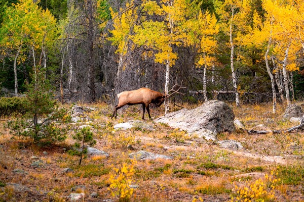
The photograph on this page: Bull elk in autumn aspens. It’s the country this decision sits in, not the site itself. More Than Just Parks.
Who holds the vote
PLAN’s record doesn’t tie a member of Congress to this fight yet. The scorecard grades the votes and bills that decide public lands; nothing joins a vote or a bill to this decision, so there’s no member to name here without guessing.
See how your members vote ↗Forest ServiceWe track this on the agency’s own system of record, where most on-the-ground decisions live.
On the record for this fight
6 people told us they filed on this fight through PLAN; we haven’t found any of their letters on the agency’s record yet.
- Al, California37 seals
- Daniel T., Arizona14 seals
- Karen W.55 seals
- and 3 more stewards
Ranked on letters found on the agency’s record, then letters filed. Readers appear as first name and last initial, or as a steward in their state; switch yours off in your record. All boards
Know an open comment period we are missing, or spotted a wrong deadline? .
More fights that need you
Go deeper, free
See how your members of Congress vote on public lands
Every representative, graded on the votes that decide the fate of parks, forests, and refuges.
Open ↗The mapSee the places under active threat
A live map of the parks, monuments, and wild country in the crosshairs right now.
Open ↗A wrong fact, a dead link, a form that wouldn’t take your letter: one tap and it comes to the people who build PLAN, with this fight attached.