
Open for comment · closes December 14
Stop rock shrimp trawling on Oculina Bank's eastern edge
National Oceanic and Atmospheric Administration · Oculina Bank Habitat Area of Particular Concern, South Atlantic deep-water coral habitats
- What
- NOAA wants to let rock shrimp boats trawl a new area on the edge of the Oculina Bank, where trawling is now banned to protect fragile deep-water coral.
- Where
- Oculina Bank Habitat Area of Particular Concern, South Atlantic deep-water coral habitats
- How much
- approximately 14.10 NM2 proposed shrimp access area; 360 to 1,580 meters buffer from SFAA to known coral pinnacles; approximately 35 kilometers towed camera survey length
- By when
- Comments to National Oceanic and Atmospheric Administration by December 14, 2026.Date from Federal Register ↗, read November 12, 2026.
What to ask forAll 9 points →
The ask: NMFS should publish the sediment transport analysis behind the buffer, explain why the shortest distance (360 meters) is protective, and add monitoring and a trigger to close the area if coral damage appears.
Where these four lines come from
- WhatOur plain-English read of the Federal Register 2026-23020 ↗. Check it against the agency’s own words under Case.
- WhereThe places and states the notice names, as PLAN read them.
- approximately 14.10 NM2“This proposed rule would establish an approximately 14.10 NM\2\ SFAA along the eastern boundary of the northern extension of the OHAPC” Management Measure Contained in This Proposed Rule Open the document ↗
- 360 to 1,580 meters“which is approximately 360 to 1,580 meters away from known coral pinnacles and the oceanographic currents in the area” Background Open the document ↗
- approximately 35 kilometers“covered approximately 35 kilometers over an area that included the proposed SFAA and found no evidence of live, dead, or rubble Oculina coral” Background Open the document ↗
- By whenDecember 14, 2026, from Federal Register, the document’s comment close date (federalregister.gov) ↗. Read November 12, 2026.
- Read from PLAN’s record November 12, 2026.
Two ways to be heard on this, and both count. Comment for the legal record, then call the members who answer to you.
Comment now9 holes in the agency’s own analysis
Make these points, in your own words
The sedimentation protection rests on an assertion.Read the point +
The Coral AP and the Habitat and Ecosystem AP warned that trawl-stirred fine particles travel considerable distances and can smother coral polyps or larvae. The Background section answers with a buffer of roughly 360 to 1,580 meters, which it says is 'expected to' minimize risk 'to the extent practicable.' It gives no plume modeling, no current data and no threshold for coral harm. The ask: NMFS should publish the sediment transport analysis behind the buffer, explain why the shortest distance (360 meters) is protective, and add monitoring and a trigger to close the area if coral damage appears.
The Council's own advisory panels disagreed, and the notice resolves the conflict by pointing out that the coordinates are 'identical' to the area NMFS disapproved in 2022.Read the point +
NMFS found then that Amendment 10 did not show consistency with the EFH minimization and bycatch standards. Nothing in the notice says the boundary was changed to address the habitat concerns. Only the supporting analysis changed. The ask: NMFS should explain why the same footprint now meets Section 303(a)(7) and Section 301(a)(9), and should analyze a smaller or differently shaped area or an alternative boundary.
The claim that the area holds no Oculina coral rests on a limited survey.Read the point +
A 2022 towed-camera survey covered about 35 kilometers, and an April 2025 acoustic map showed low-relief bottom. The notice gives no survey design, no transect spacing and no coverage of the full 14.10 NM2 area, and it does not say how much of the area a 35 km line represents. Yet it uses the result to treat the area as free of coral habitat. The ask: NMFS should publish the survey coverage, show it against the SFAA boundary, and explain how a single camera track supports a finding for the whole area.
The bycatch conclusion is stated, not shown.Read the point +
The notice says the BPA used observer data from 2018 through 2022 and found bycatch 'negligible' for managed species. The SFAA is an area that was closed to rock shrimp trawling, so the notice does not explain how that data predicts bycatch there. It also says TEDs, BRDs and sandy bottom 'effectively' minimize bycatch mortality, with no mortality rate, no protected species figures and no comparison to the standard. The ask: NMFS should publish the BPA numbers, explain how the 2018-2022 data applies to this specific area, and justify the 'practicable' finding under Section 301(a)(9).
The notice says access is 'critical' to the fleet's viability.Read the point +
In the Classification section, NMFS says the economic effects 'cannot be quantified' and the net benefits are 'not expected to be significant.' Both cannot carry the decision. If benefits are unquantifiable and small, the notice does not show that the need to 'achieve OY' justifies putting trawl gear in a Habitat Area of Particular Concern. The ask: NMFS should quantify the expected landings and revenue, using the effort and yield data the Council said it lacked, and weigh them against the habitat risk.
The industry's coordinates and effort and yield data were never verified in Amendment 8.Read the point +
The Council said it lacked 'verification of the provided coordinates' and data on historic effort and yield. The notice does not say that verification was later done. It says only that 'new survey data' and VMS monitoring support the decision, and those surveys concern coral, not fishing history. The ask: NMFS should publish the verified historic effort and yield data showing this specific strip is an important traditional fishing ground.
Enforcement and monitoring depend on a VMS ping every 5 minutes, which the notice calls 'effective' with no supporting evidence.Read the point +
The rule adds no observer coverage, no effort limit, no seasonal limit and no review point. It also states that no new reporting or recordkeeping is introduced. Once the area opens, there is no way to detect or respond to coral damage or to anchoring and gear violations inside a Habitat Area of Particular Concern. The ask: NMFS should justify the ping rate with data, and add observer coverage, a monitoring plan and a sunset or review trigger.
The notice supports only an environmental assessment for a rule that opens a unique coral ecosystem to bottom trawling, and it states that no initial regulatory flexibility analysis was prepared.Read the point +
Given the unresolved sedimentation dispute, the unquantified economic effect and the earlier disapproval, a finding of no significant impact is hard to sustain on the face of the notice. The ask: NMFS should prepare an environmental impact statement, or explain in the record why the effects are not significant.
The comment window is short for a technical amendment that rests on survey data, a bycatch analysis and an economic analysis kept in separate documents.Read the point +
The notice appeared November 12, 2026, and comments are due December 14, 2026, over the holiday season. The ask: NMFS should extend the comment period, and post the Nancy Foster mapping data and the BPA data so the public can check the key claims.
Say something only you can say. The law requires the agency to consider and respond to substantive comments, and specifics are what make a comment substantive.
Affects public lands
NOAA wants to let rock shrimp boats trawl a new area on the edge of the Oculina Bank, where trawling is now banned to protect fragile deep-water coral.
What’s at risk
If this goes through
Our plain-English read of the official notice ↗. Check it against the agency’s own words below.
By the numbers, from the agency’s own document
- Proposed shrimp access area
Management Measure Contained in This Proposed Rule
Open the document ↗“This proposed rule would establish an approximately 14.10 NM\2\ SFAA along the eastern boundary of the northern extension of the OHAPC”
- Buffer from SFAA to known coral pinnacles
Background
Open the document ↗“which is approximately 360 to 1,580 meters away from known coral pinnacles and the oceanographic currents in the area”
- Towed camera survey length
Background
Open the document ↗“covered approximately 35 kilometers over an area that included the proposed SFAA and found no evidence of live, dead, or rubble Oculina coral”
- Vessels with rock shrimp permits
Classification
Open the document ↗“As of December 17, 2025, there were 100 vessels with a valid or renewable commercial vessel permit for rock shrimp.”
- Average active rock shrimp vessels, 2019-2023
Classification
Open the document ↗“was 23, with a maximum of 35 vessels harvesting rock shrimp from the South Atlantic Federal waters in 2022.”
- Original OHAPC designation size
Background
Open the document ↗“the designation of a 92-square nautical mile (NM\2\) portion of the Oculina Bank as the OHAPC”
Source: the agency’s document ↗
The agency’s own analysis
What the notice says, and what it leaves out
Each one is a point a letter can put on the record.
The agency says
“this buffer is expected to minimize the risk of impacts from sedimentation plumes to coral habitat to the extent practicable.”
The sedimentation protection rests on an assertion.
The agency says
“the coordinates for the SFAA proposed by Amendment 10 and Amendments 11/12 are identical.”
The Council's own advisory panels disagreed, and the notice resolves the conflict by pointing out that the coordinates are 'identical' to the area NMFS disapproved in 2022.
The agency says
“covered approximately 35 kilometers over an area that included the proposed SFAA and found no evidence of live, dead, or rubble Oculina coral within the proposed SFAA.”
The claim that the area holds no Oculina coral rests on a limited survey.
The agency says
“The BPA also concludes the use of specialized gear (Turtle Excluder Devices and Bycatch Reduction Devices), which combined with the sandy and muddy-bottom location of the SFAA, effectively minimizes bycatch mortality.”
The bycatch conclusion is stated, not shown.
The agency says
“the economic effects of allowing currently permitted vessels to harvest rock shrimp from the proposed access area cannot be quantified.”
The notice says access is 'critical' to the fleet's viability.
The agency says
“verification of the provided coordinates, as well as data on effort and yield of historic rock shrimp fishing in the proposed area.”
The industry's coordinates and effort and yield data were never verified in Amendment 8.
Management Measure Contained in This Proposed Rule ↗
The agency says
“The current transmission rate is considered effective in monitoring fishing activity within and near the OHAPC.”
Enforcement and monitoring depend on a VMS ping every 5 minutes, which the notice calls 'effective' with no supporting evidence.
The agency says
“Amendments 11/12 include an environmental assessment, a Regulatory Flexibility Act (RFA) analysis, regulatory impact review, and fishery impact statement.”
The notice supports only an environmental assessment for a rule that opens a unique coral ecosystem to bottom trawling, and it states that no initial regulatory flexibility analysis was prepared.
The agency says
“Written comments on the proposed rule must be received on or before December 14, 2026.”
The comment window is short for a technical amendment that rests on survey data, a bycatch analysis and an economic analysis kept in separate documents.
In the agency’s own words
NMFS issues this proposed rule to implement Amendment 11 to the Fishery Management Plan for Coral, Coral Reefs, and Live/Hardbottom Habitats of the South Atlantic (Coral FMP) and to implement Amendment 12 to the Fishery Management Plan for the Shrimp Fishery of the South Atlantic Region (Shrimp FMP) (jointly Amendments 11/12), as prepared and submitted by the South Atlantic Fishery Management Council (Council). If implemented, this proposed rule would establish a shrimp fishery access area (SFAA) along the eastern boundary of the northern extension of the Oculina Bank Habitat Area of Particular Concern (OHAPC) wh…
Who signs it
The notice names no signer PLAN could read. PLAN names a decision-maker only when the document names one.
The ground
This fight isn’t bound to a map place in PLAN’s record yet. The notice names Oculina Bank Habitat Area of Particular Concern, South Atlantic deep-water coral habitats; none is a unit on the threatened lands map, so there’s no place page to open or watch.
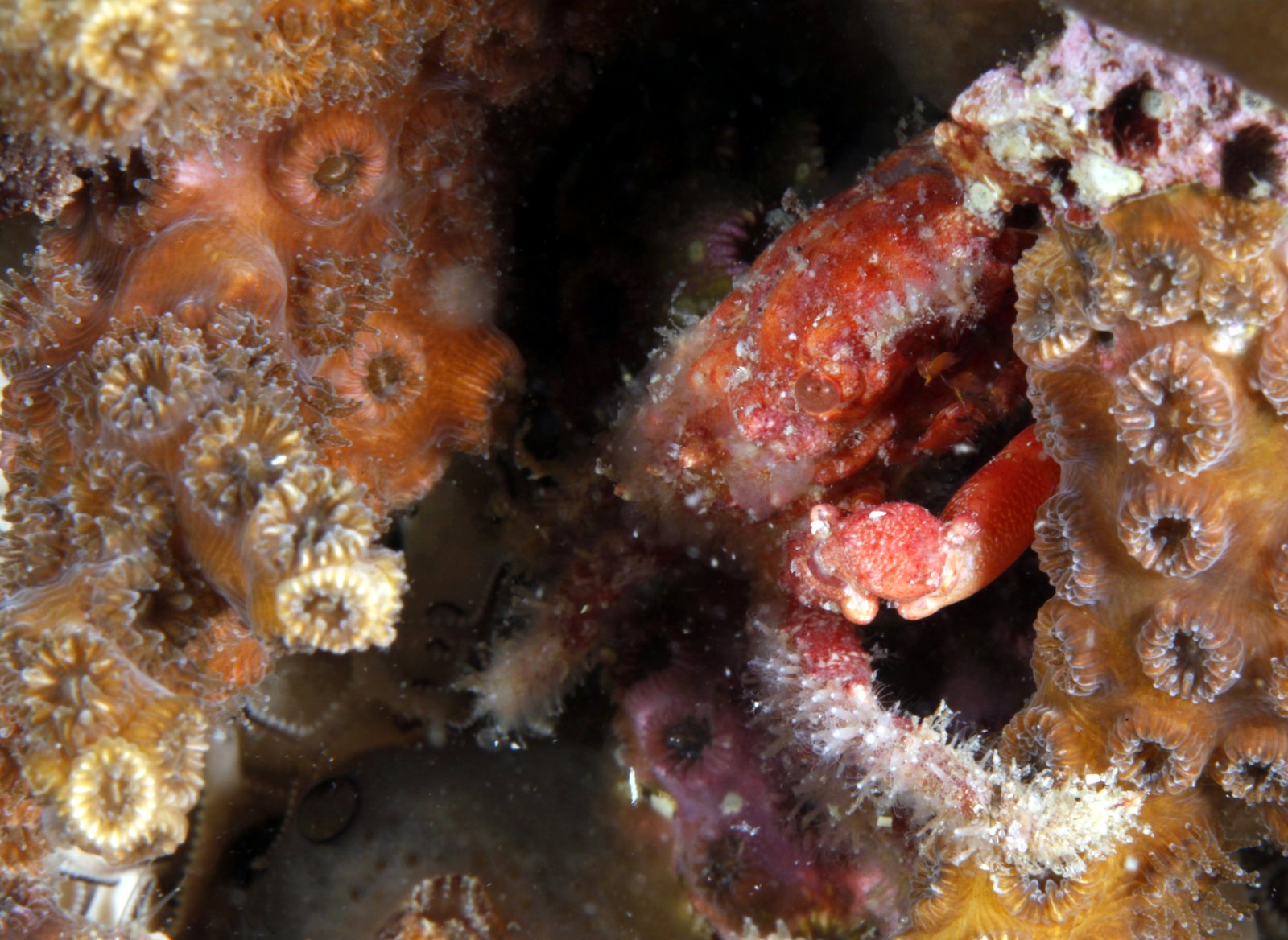
The photograph on this page: Oculina coral, Gray's Reef National Marine Sanctuary, Georgia (NOAA photo). More Than Just Parks.
In court on this ground
This fight isn’t bound to a land unit in PLAN’s record yet, so there are no court cases to show for its ground.
Who holds the vote
PLAN’s record doesn’t tie a member of Congress to this fight yet. The scorecard grades the votes and bills that decide public lands; nothing joins a vote or a bill to this decision, so there’s no member to name here without guessing.
See how your members vote ↗Calling your two senators and your representative is the Call door on this page.
More fights that need you
Go deeper for free
See how your members of Congress vote on public lands
Every representative, graded on the votes that decide the fate of parks, forests, and refuges.
Open ↗The mapSee the places under active threat
A live map of the parks, monuments, and wild country in the crosshairs right now.
Open ↗A wrong fact, a dead link, a form that wouldn’t take your letter: one tap and it comes to the people who build PLAN, with this fight attached.