
Open for comment · closes November 18
Stop the 2,885-Acre Commercial Timber Harvest on the Ozark-St. Francis National Forest
U.S. Forest Service · Ozark-St. Francis National Forests, AR
- What
- The Forest Service proposes to treat 9,250 acres and construct approximately 40 miles of temporary roads across three sub-watersheds where sediment already runs up to 680% above undisturbed levels, with no administrative objection process available to affected parties.
- Where
- Ozark-St. Francis National Forests, AR
- How much
- 9,250 acres total acres proposed for all vegetation treatment; 2,885 total commercial treatment acres commercial timber harvest acres; 1,370 acres, 10.4% of project area regeneration harvest acres (clear-cut-equivalent methods)
- By when
- Comments to U.S. Forest Service by November 18, 2026.Date from Forest Service CARA comment page ↗, read November 3, 2026.
What to ask forAll 10 points →
The agency should produce the completed Biological Opinion coverage and any incidental take statement for public review, or explain in writing how the LAA determinations are fully addressed, before authorizing any ground-disturbing activity.
Where these four lines come from
- WhatOur plain-English read of the Forest Service project page ↗. Check it against the agency’s own words under Case.
- WhereThe places and states the project page names, as PLAN read them.
- 9,250 acres“Total Non-Commercial Treatment Acres 7,734 Total Treatment Acres 9,250” Table 1 Open the document ↗
- 2,885 total commercial treatment acres“Regeneration Harvest- Shelterwood w/wo Reserves 39 Woodland Thinning 661 Total Commercial Treatment Acres 2,885” Table 1 Open the document ↗
- 1,370 acres, 10.4% of project area“Regeneration harvest on 1,370 acres (10.4%) out of the project area of 13,205 acres would move towards a more balanced age class distribution” Proposed Actions Open the document ↗
- By whenNovember 18, 2026, from Forest Service CARA comment page, the notice text ↗: “requested through 11/18/2026 11:59:59 PM (Central Standard Time)”. Read November 3, 2026.
- Read from PLAN’s record November 4, 2026.
Two ways to be heard on this, and both count. Comment for the legal record, then call the members who answer to you.
There’s no public docket to check this letter against yet
What to say
Make these points, in your own words
Table 3 gives Indiana bat, northern long-eared bat, and tricolored bat a "likely to adversely affect" (LAA) determination, which triggers mandatory formal Section 7 consultation and requires a completed incidental take statement before ground disturbance begins.Read the point +
But a footnote to that same table states these species "have potential habitats in the project area, but are not present." If the species are confirmed absent, the standard determination would be NE or NLAA, not LAA. If they might be present given the habitat, the footnote's "not present" language is unsupportable. The EA cites a 2023 Programmatic Biological Opinion for imperiled bats but does not confirm whether that instrument covers this project's specific LAA-level effects or whether a project-specific incidental take statement is in hand. The agency should produce the completed Biological Opinion coverage and any incidental take statement for public review, or explain in writing how the LAA determinations are fully addressed, before authorizing any ground-disturbing activity.
The Project Overview states that "Projects authorized under Section 40807 determination are not subject to Forest Service Objection Review processes."Read the point +
The administrative objection is the binding pre-decisional mechanism by which any party with a legal interest can require the agency to respond to specific legal and factual errors before implementation begins. Eliminating it through an ESD invocation while still offering a voluntary comment period leaves the public without any enforceable pre-decisional remedy. The document does not explain whether invoking ESD authority for this project was mandatory or discretionary, and it describes no alternative administrative recourse for affected parties after the decision is signed. The agency should disclose whether the ESD invocation was required or optional for this specific project and should explain what procedural remedy, if any, remains for parties who identify legal errors in this EA.
Table 6 shows the Upper Clear Creek sub-watershed already carries sediment at 680% above undisturbed conditions and is classified at the highest concern level before any project activity begins.Read the point +
The proposed action raises that figure to 749%, still classified High. The document explains the pre-existing elevation by noting the sub-watershed is "only approximately 20% National Forest management" and approximately 30% pasture, but it proposes no targeted mitigation for this pre-impaired watershed beyond the same design features applied uniformly across all three sub-watersheds. No analysis asks whether adding treatment-generated sediment to a system already at 680% constitutes a significant impact warranting an EIS. The agency should provide a watershed-specific analysis of whether the Upper Clear Creek's pre-existing High classification and the proposed increase to 749% represent a significant impact, and if it cannot demonstrate otherwise, it should prepare an Environmental Impact Statement.
The Project Overview states that prescribed burning "may also be carried out in conjunction with vegetation management" but that "this analysis only covers those activities described in the proposed action section below."Read the point +
The Clean Air Act section confirms: "The project does not analyze prescribed burning as a proposed action." Yet site preparation for regeneration harvest explicitly includes "hand-applied herbicide site preparation and/or site preparation burning," and the document describes prescribed burning as directly enhancing the vegetation management treatments in this EA. Under NEPA, connected actions must be analyzed together; fragmenting them into separate authorizations prevents cumulative analysis of smoke, air quality, and community health effects. The agency should either incorporate prescribed burning as a connected action in this EA and analyze cumulative air quality effects, or provide specific regulatory evidence demonstrating the two authorizations are genuinely independent actions.
The No Action Alternative section states that the no-action alternative is "not specifically assessed as a standalone section" and instead "serves as a baseline when specialists consider reasonably foreseeable effects to their resource."Read the point +
NEPA requires the No Action alternative to receive full comparative analysis equivalent to the proposed action across all resource areas, not merely serve as a backdrop against which specialists frame other analyses. Without a standalone No Action analysis, readers cannot compare the full range of environmental effects or evaluate whether the proposed action's benefits justify its costs across each resource category. The agency should prepare a full standalone No Action analysis covering all resource areas, including water quality, wildlife, air quality, and socioeconomics, before signing the decision.
The section Where is the Kincannon Project states that "The surrounding communities depend on the creeks within these sub-watersheds and privately owned wells to support their water sources."Read the point +
Yet the hydrology analysis in Table 6 addresses only sediment percentage increases and assigns concern levels of Low, Moderate, or High without translating those designations into effects on drinking water quality, municipal treatment costs, or private well safety. Upper Clear Creek is already at the highest concern level and will increase further. No turbidity thresholds, no well-impact pathway analysis, and no coordination with state drinking water authorities appear anywhere in the document. The agency should analyze the specific effects of increased sediment and altered hydrology on community drinking water sources and private wells, including any required water treatment to address project-related turbidity changes.
Table 2 proposes approximately 40 miles of temporary road construction, and the document states these roads "would be decommissioned at the completion of the project and would not be added to the Forest Transportation System."Read the point +
No completion timeline is defined, no financial assurance is described, and no site-specific sediment contribution from temporary roads is broken out in Table 6's watershed analysis. All three sub-watersheds already exceed undisturbed sediment conditions; the incremental load from 40 miles of new temporary roads across those same watersheds is an unquantified gap in the cumulative analysis. The agency should provide a site-specific sediment analysis for temporary road construction in each sub-watershed and establish a binding decommissioning timeline with enforceable performance standards before the decision is signed.
The Proposed Actions section states that "Regeneration harvest on 1,370 acres (10.4%) out of the project area of 13,205 acres would move towards a more balanced age class distribution without exceeding the 30% maximum of Forest Wide Standard FW04."Read the point +
However, Table 1 shows total commercial treatment acres are 2,885, which is approximately 21.8% of the 13,205-acre project area. The 30% compliance claim is made only for the regeneration harvest subset, not for the full commercial treatment footprint that also includes 855 acres of intermediate thinning and 661 acres of woodland thinning. The EA does not state whether FW04's 30% maximum applies to regeneration harvest only or to all commercial treatments. The agency should clarify which activities are subject to FW04's 30% maximum and demonstrate with an explicit calculation that the full commercial treatment footprint is consistent with that Forest Plan standard.
Table 6 notes that "Percent increases to sediment include those caused by activities on private land within the project boundary."Read the point +
The document explains the Upper Clear Creek sub-watershed's pre-existing High concern level is partly due to private pastureland, yet no analysis addresses whether Forest Service vegetation treatments will trigger offsetting or worsening land management responses on adjacent private parcels, and no coordination with private landowners or state agencies is described. Because private lands account for the majority of the cumulative sediment load in at least one sub-watershed, the EA cannot demonstrate that Forest Service treatments will improve net watershed conditions without accounting for reasonably foreseeable private-land activities. The agency should provide a cumulative watershed analysis that explicitly accounts for private land management and demonstrates the net effect on sediment and water quality.
Table 2 shows 59.08 miles of existing National Forest System roads proposed for timber haul, then states: "Other roads such as county roads and state highways would also be used for timber haul and are not included in these numbers."Read the point +
No analysis of traffic volume, road damage, dust, noise, or public safety effects on county and state roads appears anywhere in the EA. These roads pass through communities whose residents, wells, and local infrastructure would bear direct and ongoing impacts during the life of the project. The agency should analyze the effects of timber haul truck traffic on county and state roads, including estimated trip counts, road degradation costs, and community impacts, and disclose these findings before the decision is made.
Say something only you can say. The law requires the agency to consider and respond to substantive comments, and specifics are what make a comment substantive.
PLAN's read: high threat
The Forest Service proposes to treat 9,250 acres and construct approximately 40 miles of temporary roads across three sub-watersheds where sediment already runs up to 680% above undisturbed levels, with no administrative objection process available to affected parties.
What’s at risk
If this goes through
Our plain-English read of the official notice ↗. Check it against the agency’s own words below.
By the numbers, from the agency’s own document
- Total acres proposed for all vegetation treatment
- Commercial timber harvest acres
Table 1
Open the document ↗“Regeneration Harvest- Shelterwood w/wo Reserves 39 Woodland Thinning 661 Total Commercial Treatment Acres 2,885”
- Regeneration harvest acres (clear-cut-equivalent methods)
Proposed Actions
Open the document ↗“Regeneration harvest on 1,370 acres (10.4%) out of the project area of 13,205 acres would move towards a more balanced age class distribution”
- Temporary road construction proposed
Table 2
Open the document ↗“Temporary Road Construction (Using existing templates and allowing for new construction) ~40.0”
- Upper Clear Creek sediment: current vs. proposed action
Table 6
Open the document ↗“Brock Creek 294 Low 322 Low 311 Low Upper Clear Creek 680 High 749 High 716 High”
- Project acres within wildland urban interface
Where is the Kincannon Project
Open the document ↗“About 26% (3,394 acres) of the project area is within the wildland urban interface (WUI).”
Source: the agency’s document ↗
The agency’s case, tested
What the agency argues, and whether its own record backs it
- 8
- Not fully backed
The Forest Service proposes 2,885 acres of commercial timber harvest and thinning, 7,734 acres of non-commercial treatments, and road work in the Kincannon project area. It says dense, mature stands and built-up fuels put the area at risk from insects, disease and catastrophic wildfire, and that emergency authority lets it treat the area faster.
“The Ozark-St. Francis National Forest proposes to implement active vegetation management activities, including timber harvest, non-commercial thinning, and reforestation to address hazardous fuels, promote forest resiliency, and respond to insect and disease outbreaks.”
Project Overview
Each Ask below goes into your letter when you write it with PLAN on this page, matched to what you tell it about how this land reaches you.
Purpose and needNot fully backedDense, mature stands in the project area are declining and dying from insects and disease, and that's why treatment is needed.
The agency points to Southern Pine Beetle damage shown in Figure 3 and lists other insects and diseases in the landscape. But the document gives no stand density, basal area, mortality acreage or infestation maps, and it says the insects and disease occur in randomly localized areas. The silvicultural analysis it mentions isn't in this text.
AskPublish the stand density, basal area and acres of current insect and disease mortality for the treatment units, and show how the 2,885 commercial acres were picked using that data.
The agency’s words, the record +Hide the words
The agency says
“The project area exhibits stand densities contributing to decline in stand health including tree mortality caused by insects and disease.”
Purpose 1, Species Composition and Forest Structure
Elsewhere in the same document
“These insects and disease occur in randomly localized areas throughout the project area.”
Insects and Disease
AuthorityNot fully backedThe project qualifies for emergency procedures because the area was designated in 2018 and included in the 2025 emergency determination for insect and disease risk.
The document states that the area was designated in 2018 under section 602(d) of the Healthy Forests Restoration Act. It says the 2025 emergency determination covers 112,646,000 acres of designated land, including the Kincannon Project Area, because those acres were at risk of substantially increased tree mortality from insects and disease, and that the Secretary named designated acres as the priority for treatment. That directly supports the claim. The document doesn't spell out how each treatment fits the listed emergency actions, which include reducing hazardous fuels and other activities that enhance natural regeneration and restore forest species.
AskExplain which listed emergency action covers each commercial treatment and the temporary roads, and why the exemption from objection review applies to timber harvest in this project.
The agency’s words +Hide the words
The agency says
“These acres were chosen because they were at risk of substantially increased tree mortality from insect infestations and disease outbreaks.”
Project Overview
AlternativesNot fully backedNo other alternative deserved detailed study because the others failed the purpose and need, conflicted with the Forest Plan or weren't feasible.
The agency says it found no issues that would require creating or modifying an alternative or that presented unresolved conflict with the proposed action. It explains that no action wouldn't move the area toward Forest Plan desired conditions and that no action serves as the baseline for specialists' effects review. But it says the alternatives that got the most consideration are described, and the only one described is no action. It doesn't name any dropped action alternative or test one against the purpose and need.
AskDescribe each alternative that was considered and dropped, and analyze one with less commercial harvest or less temporary road construction.
The agency’s words, the record +Hide the words
The agency says
“Other alternatives were considered but not proposed for detailed study because they did not meet the project Purpose and Need, were inconsistent with Forest Plan management direction, or were not feasible due to existing conditions in the project area.”
Alternatives to the Proposed Action: Are there other ways to meet the purpose and need?
Elsewhere in the same document
“Potential alternatives that received the most consideration but dropped from detailed analysis are described below.”
Alternatives to the Proposed Action: Are there other ways to meet the purpose and need?
Show 5 more claims +Show fewer
EffectsNot fully backedOverall the project won't cause significant effects, and the area will trend toward Forest Plan desired conditions.
The agency bases this on consistency with laws and plan standards, on impacts it calls well known from past projects on the forest, on effects that stay local and outside ecologically critical areas, and on the state historic preservation office's agreement. Table 6 shows sediment concern levels under the proposed action staying the same as current conditions in all three sub-watersheds, and the note to Table 3 says the bats aren't present. Still, sediment rises in all three sub-watersheds, Table 3 lists likely adverse effects on three bat species, and the document doesn't explain why those effects aren't significant. The Forest Plan Consistency Checklist and specialist reports it relies on aren't in this text.
AskExplain in the environmental assessment itself why the sediment increases in Table 6 and the bat findings in Table 3 aren't significant, and publish the Forest Plan Consistency Checklist.
The agency’s words, the record and the law +Hide the words
The agency says
“Some short-term negative effects will occur as described below and in applicable technical reports, but overall, no significant effects will occur, and the project area will trend towards Forest Plan desired conditions.”
Consideration of the Proposed Action: What would happen if we implemented the proposal?
Elsewhere in the same document
“Adherence of the proposed activities with Forest Plan direction will be documented in the Forest Plan Consistency Checklist in the project record.”
National Forest Management Act (NFMA), Land Management Plan Consistency
“These impacts are well known, as the proposed activities have all previously occurred on the Ozark-St. Francis National Forests.”
Potentially Affected Environment
The law
“Resource plans and permits, contracts, and other instruments for the use and occupancy of National Forest System lands shall be consistent with the land management plans.” National Forest Management Act, 16 U.S.C. 1604(i) ↗
EffectsNot fully backedStreamside buffers and best management practices will keep the project in compliance with the Clean Water Act.
The agency assigns 20-foot buffers on perennial streams and 5-foot buffers on intermittent streams, applies Forest Service best management practices, and says all permits were received. Table 6 shows concern levels under the proposed action unchanged from current conditions in every sub-watershed. The document explains that Upper Clear Creek starts at high concern because it's only approximately 20% National Forest and approximately 30% pasture, and that the figures include activity on private land. Even so, sediment above undisturbed conditions under the proposed action exceeds the no action level in every sub-watershed, reaching 749 percent in Upper Clear Creek. The hydrology report that may explain this isn't in this text.
AskExplain why 5-foot and 20-foot buffers are enough given Table 6, and add measures to keep Upper Clear Creek sediment from rising above current levels, since residents rely on these creeks.
The agency’s words, the record +Hide the words
The agency says
“Modifications/design features have been included to ensure compliance with Clean Water Act is met.”
Clean Water Act
Elsewhere in the same document
“Streamside management zones (SMZ’s) have been assigned to buffer perennial (20 feet) and intermittent (5 feet) stream channels.”
Clean Water Act
“The surrounding communities depend on the creeks within these sub-watersheds and privately owned wells to support their water sources.”
Where is the Kincannon Project
EffectsNot fully backedAir quality won't be significantly affected because this assessment doesn't analyze prescribed burning as a proposed action, and burning is covered under separate authorizations.
The agency says this assessment doesn't analyze prescribed burning, that burning under separate authorizations will be used to enhance these treatments, and that air quality effects are covered in the records for those authorizations. The overview says the same. But the descriptions of regeneration harvest and species establishment list site preparation burning and prescribed fire as options ("and/or") for this project's treatments, and the document doesn't say which authorization covers that burning. The air quality analysis it points to isn't in this text.
AskAnalyze smoke and air quality effects of the site preparation burning in the regeneration harvest and planting treatments, or remove burning from those treatments.
The agency’s words, the record and the law +Hide the words
The agency says
“The project does not analyze prescribed burning as a proposed action, therefore no significant effects to air quality are expected.”
Clean Air Act
Elsewhere in the same document
“These harvests would include hand-applied herbicide site preparation and/or site preparation burning, planting on-site specific species, and manual or herbicide release treatments.”
Regeneration Harvest
“Site preparation would consist of herbicide application and/or prescribed fire.”
Native or Suitable Species Establishment
The law
“An agency shall issue an environmental impact statement with respect to a proposed agency action requiring an environmental document that has a reasonably foreseeable significant effect on the quality of the human environment.” National Environmental Policy Act, 42 U.S.C. 4336(b)(1) ↗
EffectsNot fully backedThe effect findings for listed bats rest on the best available science and comply with the Endangered Species Act.
The agency says it consulted the U.S. Fish and Wildlife Service. It says its biological evaluation is meant to ensure compliance with the April 19, 2023 Programmatic Biological Opinion and Conference Opinion for imperiled bats on the forest, and that it would reinitiate consultation under federal rules if needed. But Table 3 lists likely adverse effects on the Indiana, northern long-eared and tricolored bats while its note says they aren't present, and the table gives none of the rationale the document says it summarizes. The Biological Assessment that holds that rationale isn't in this text.
AskExplain the basis for the likely adverse effect findings for three bats, and confirm whether the 2023 programmatic biological opinion covers this project, including any required protective measures.
The agency’s words, the record and the law +Hide the words
The agency says
“The best available science was used in the site-specific analysis for all species covered in this BE.”
Endangered Species Act (Threatened, Endangered, Proposed, and Candidate Species and Critical Habitat)
Elsewhere in the same document
“Rationale supporting the determination of effect for species that are addressed in the Biological Assessment are briefly summarized below in Table 3.”
Endangered Species Act (Threatened, Endangered, Proposed, and Candidate Species and Critical Habitat)
The law
“Each Federal agency shall, in consultation with and with the assistance of the Secretary, insure that any action authorized, funded, or carried out by such agency (hereinafter in this section referred to as an "agency action") is not likely to jeopardize the continued existence of any endangered species or threatened species” Endangered Species Act, 16 U.S.C. 1536(a)(2) ↗
EffectsNot fully backedThe project won't adversely affect historic properties.
The document reports that Section 106 review is complete and that the Arkansas State Historic Preservation Office agreed with the finding on August 25th, 2026. Eligible sites are in the project area, and the finding depends on avoidance and mitigation stipulations being followed. Those stipulations aren't spelled out here, but the state's agreement supports the finding.
The agency’s words, the record and the law +Hide the words
The agency says
“The Ozark-St. Francis National Forests finds the current proposed action will have No Adverse Effect to historic properties.”
National Historic Preservation Act, Section 106 Review
Elsewhere in the same document
“On August 25th, 2026, the Arkansas State Historic Preservation Office (SHPO) concurred with the Forest’s findings.”
National Historic Preservation Act, Section 106 Review
“Section 106 Review has been completed, and National Register eligible cultural sites are located within the project area.”
National Historic Preservation Act, Section 106 Review
The law
“shall take into account the effect of the undertaking on any historic property.” National Historic Preservation Act, 54 U.S.C. 306108 ↗
How this was read
Read from the agency’s own decision document ↗, all 23 pages. Every quote is checked word for word against it, a claim marked contradicted stands on a quote from the same document, and a second reading argued the agency’s side of every verdict before it was published. The verdicts are our reading; the quotes are the agency’s. A court can set aside agency action it finds “arbitrary, capricious, an abuse of discretion, or otherwise not in accordance with law” (5 U.S.C. 706(2)(A) ↗), which is why these gaps are worth putting in the record.
In the agency’s own words
The Ozark-St. Francis National Forests proposes active vegetation management activities, including timber harvest, non-commercial thinning, and reforestation to address hazardous fuels, promote forest resiliency, and respond to insect and disease outbreaks.
The groups on this fight
One group predicted likely to care in Arkansas
Predicted likely to care is a guess from the group's sourced work in Arkansas, with no link to this decision. Give straight to them; nothing routes through us.
- Friends of Hot Springs National Park
Predicted likely to care · a guess
Works Arkansas: They work only in Arkansas.
Every group above is on STAND for Public Lands, with its court record, its filings and who backs it.
Who signs it
The notice names no signer PLAN could read. PLAN names a decision-maker only when the document names one.
The ground
This fight isn’t bound to a map place in PLAN’s record yet. The notice names Ozark-St. Francis National Forests (AR); none is a unit on the threatened lands map, so there’s no place page to open or watch.
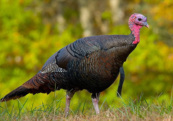
The photograph on this page: Wild turkey in hardwood forest. It’s the country this decision sits in, not the site itself. More Than Just Parks.
In court on this ground
No court case we track is over Ozark National Forest and St. Francis National Forest.
Who holds the vote
PLAN’s record doesn’t tie a member of Congress to this fight yet. The scorecard grades the votes and bills that decide public lands; nothing joins a vote or a bill to this decision, so there’s no member to name here without guessing.
See how your members vote ↗Calling your two senators and your representative is the Call door on this page.
Forest ServiceWe track this on the agency’s own system of record, where most on-the-ground decisions live.
On the record for this fight
1 person told us they filed on this fight through PLAN; we haven’t found that letter on the agency’s record yet.
- Al, California44 seals
Ranked on letters found on the agency’s record, then letters filed. Readers appear as first name and last initial, or as a steward in their state; switch yours off in your record. All boards
Know an open comment period we are missing, or spotted a wrong deadline? .
More fights that need you
Go deeper, free
See how your members of Congress vote on public lands
Every representative, graded on the votes that decide the fate of parks, forests, and refuges.
Open ↗The mapSee the places under active threat
A live map of the parks, monuments, and wild country in the crosshairs right now.
Open ↗A wrong fact, a dead link, a form that wouldn’t take your letter: one tap and it comes to the people who build PLAN, with this fight attached.