
National Parks Facts. In this article, we’re providing you with fascinating facts about EVERY national park in America. That’s right! Sixty-three national parks facts for 63 national parks!
More Than Just Parks is your one-stop-shop for learning everything you’ll need to know about America’s national parks. We’ve got expert guides, beautiful photos, helpful tips, breathtaking films and so much more.
I’ve been to so many of these amazing places since retiring from teaching in 2018. Did I mention that I taught history? I spent a lifetime teaching about the history behind some of these natural wonders. Then I got to see them firsthand.
And now I’m sharing some of the incredible stories about these beautiful places with you. It doesn’t get any better than that!
More Than Just Parks takes a deeper dive with its national parks facts. We’ve done our homework so that you’ll get more than you bargained for.
let’s get started.
Table Of Contents
National Parks Facts
Some General Facts About America’s National Parks
Here are some general facts about America’s national parks:
- The first national park in the United States was Yellowstone National Park, established in 1872.
- Currently, there are 63 national parks in the United States.
- The National Park Service (NPS) is the federal agency that manages all national parks in the United States.
- The parks cover a total of over 84 million acres, including natural wonders such as mountains, deserts, forests, and coastlines.
- Each park has unique features, such as the Grand Canyon’s immense size, Yosemite’s granite cliffs and waterfalls, and Yellowstone’s geysers and hot springs.
- The parks offer a wide range of recreational activities, including hiking, camping, fishing, boating, and wildlife watching.
- National parks also serve as important habitats for endangered and threatened species, and protect important cultural and historical sites.
- Entrance fees for national parks vary depending on the park, with some parks being free to enter, while others charge fees ranging from $5 to $35 per vehicle.
- The most visited national park in the United States is Great Smoky Mountains National Park, followed by Grand Canyon National Park and Zion National Park.
- National parks are an important part of America’s heritage and are protected to ensure that future generations can enjoy and appreciate these natural wonders.

National Parks Facts – From Acadia To Biscayne National Park
1. Acadia National Park – Basic Facts
- Location: Maine
- Acreage: Acadia National Park encompasses more than 48,000 acres on Mount Desert Island, Schoodic Peninsula, Isle Au Haut, and many smaller coastal islands.
- Visitation: Glacier Bay had a total of 89,768 visitors in 2021.
- Highest Elevation: With several peaks over 10,000 feet and the tallest, Mount Fairweather, at 15,300 feet, this is one of the highest coastal mountain ranges in the world.
- Lowest Elevation: Flying Mountain is at 284 feet (lowest elevation in the park).
- Average annual precipitation: Annual rainfall is 48 inches.
- When Did It Become A National Park? In 1919, President Wilson signed the act establishing Lafayette National Park.

Fact – Acadia National Park Was Largely Created Through The Tireless Efforts Of One Man
There’s another old saying. “One person can make a difference.” In the case of Acadia National Park, he most certainly did.
As a retired history teacher and lifelong history buff, I love the stories behind these wonderful places which so many of us take for granted. One of those stories concerns a gentleman scholar and Harvard University graduate who fell in love with a place and decided to share it with the world.
For over four decades, he worked tirelessly to acquire tracts of land for protection, build trails and lay plans as a member of civic groups which founded Acadia National Park.
Another fascinating Acadia National Park Fact is that the man who would become the “Father of Acadia National Park” actually donated parcels of his own land and persuaded others to do likewise or donate funds instead.
It was his vision and his passion which ensured these lands would be set aside for the enjoyment of generations yet to come.

George Dorr’s Gift To The World
So who was this man? What was his story? Now that I’ve peaked your curiosity, it’s time to share the incredible story of George Dorr.
Dorr was a private citizen whose life covered the last half of the 19th and the first half of the 20th centuries. He was a child of privilege, the son of affluent Bostonians. He inherited fortunes from both of his parents and traveled widely in Europe with his parents.
George Dorr also had a love of nature. In 1869, he first visited Mount Desert Island on a vacation with his parents. It was then that he made the decision to make the island his primary home.
Dorr, however, wanted to do much more than that. He wanted to share the natural beauty of this magical place with the rest of the world. That became his life’s passion and his life’s wor

If you’re interested in learning more about this amazing park then check out More Than Just Parks article: Facts About Acadia National Park
2. Arches National Park – Basic Facts
- Location: Utah
- Acreage: 76,519 acres or 119 square miles
- Visitation: 1.8 million in 2021
- Highest Elevation: Elephant Butte 5,653 feet
- Lowest Elevation: Visitor Center 4,085 feet
- Average annual precipitation: 8-10 inches
- When Did It Become A National Park? In 1971, Congress changed the status of Arches to National Park.

Fact – Arches Has The Densest Concentration Of Natural Stone Arches In The World
Arches National Park has the densest concentration of natural stone arches in the world. In fact, there are over 2,000 documented arches in the park, plus pinnacles, balanced rocks, fins and other geologic formations.
If you’re interested in exploring all of them then good luck. It would take weeks to hike to and investigate each of these geologic wonders.
You should be forewarned, however, that the park’s desert location can make it a difficult place to hike in the summer sun when it often reaches over 100 degrees during the day.
I would recommend, instead, taking the Arches Scenic Drive, which is 19 miles in length. It’s the one road that travels through the park. Along the way, you’ll be able to see many magnificent arches.

If you’re interested in learning more about this amazing park then check out More Than Just Parks article: Facts About Arches National Park
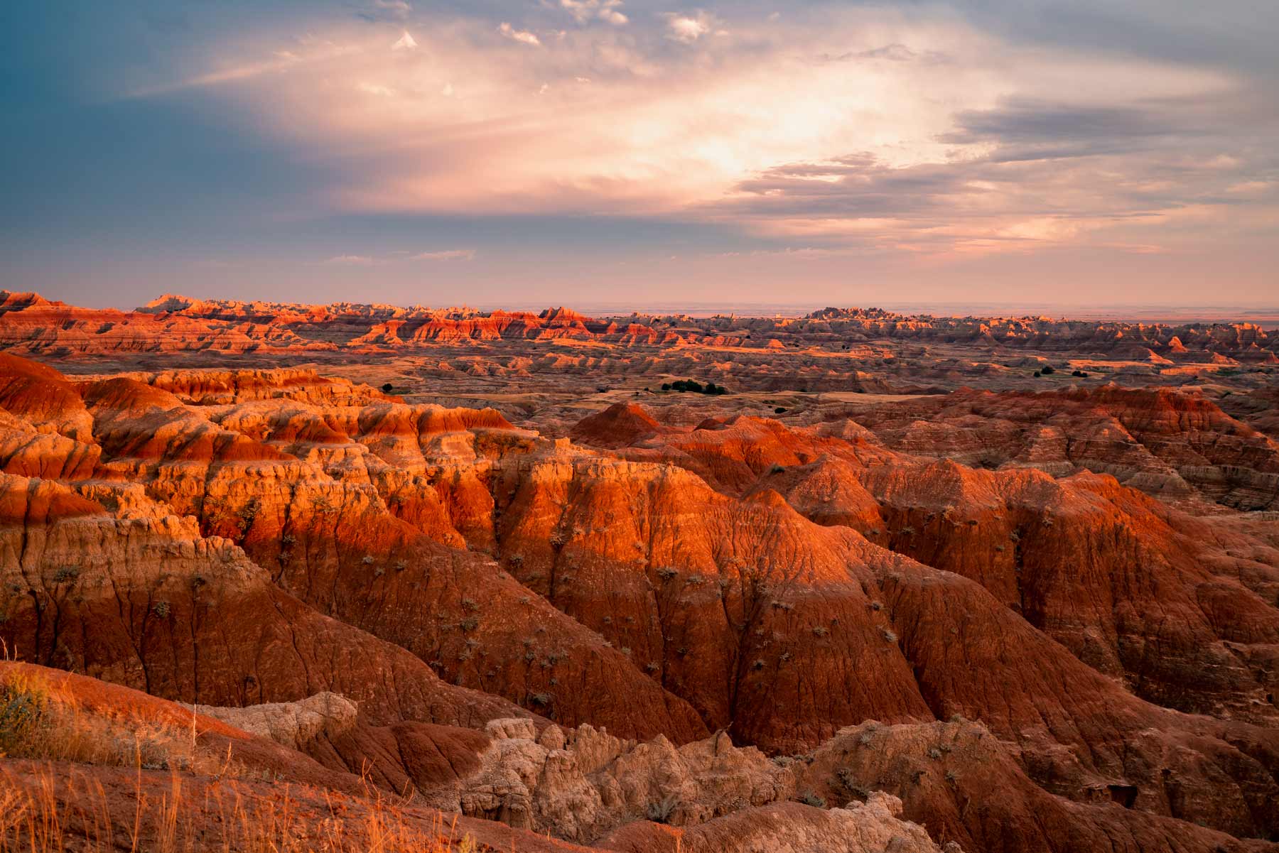
3. Badlands National Park – Basic Facts
- Location: South Dakota
- Acreage: 244,000 acres
- Visitation: 970,998 in 2019
- Highest Elevation: 3,247 feet at Sheep Mountain
- Lowest Elevation: 2460 feet along Sage Creek
- Average annual precipitation: 16 inches annually, most of which falls during the warmer months
- When Did It Become A National Park? Badlands was established as a national monument in 1939 and designated a national park in 1978.
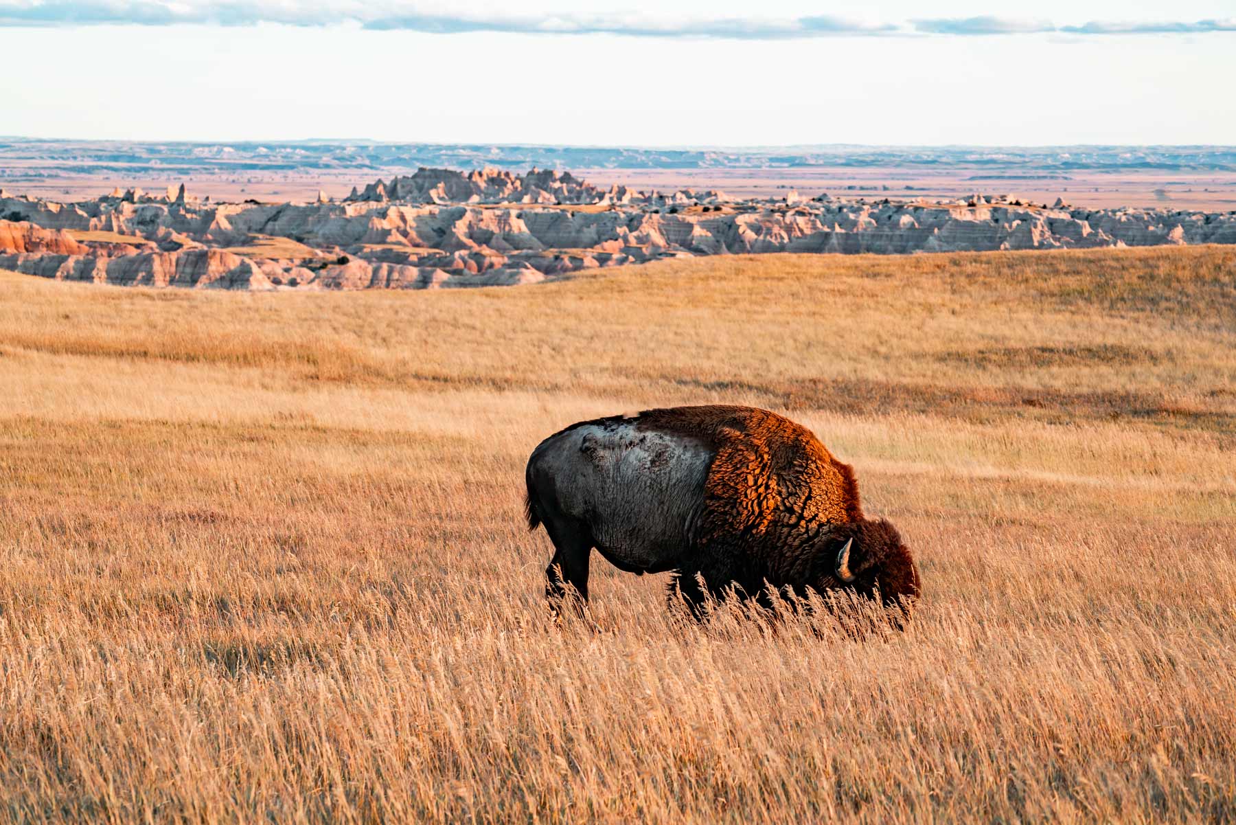
Fact – Badlands Is Home To Some Of the Most Endangered Species In North America
Badlands National Park is home to many resilient creatures, including some of the most endangered species in North America.
These species include the following:
- The American Bison: The Bison once roamed freely and their population was estimated to be 30 million before the arrival of Native Americans and Indo-Europeans. In 1884, there were only 325 left in America. Today, however, they are alive and well in Badlands National Park.
- Black Footed Ferrets: They were another endangered species. Ferrets live in abandoned prairie dog burrows to maximize their proximity to food sources, raise their young, and escape harsh weather and predators.
- Bighorn Sheep: Their population went from 2,000,000 to just 20,000 in 1940. Today visitors will see them on the cliffs and hillsides of the Badlands.
- Prairie Dogs: They are an abundant species at the Badlands. Prairie dogs tend to be around 14-17 inches in length and weigh 1-3 pounds each. They’re fun to watch and can be seen at Roberts Prairie Dog Town.
If you’re interested in learning more about this amazing park then check out More Than Just Parks article: Facts About Badlands National Park
4. Big Bend National Park – Basic Facts
- Location: Texas
- Acreage: 801,163 acres
- Visitation: 581,000 visitors in 2021
- Highest Elevation: 7,825 feet at Emory Peak
- Lowest Elevation: 1,715 feet at the Rio Grande River
- Average annual precipitation: 13.78 inches
- When Did It Become A National Park? The State of Texas delivered the deed to the Federal Government in September, 1943 and Big Bend National Park was officially established as America’s 27th national park on June 12, 1944

Fact – A Retired Texas Ranger Was Instrumental In Gaining National Park Status For Big Bend
Everett Ewing Townsend played a significant role in the creation of Big Bend National Park. Townsend was a Texas state senator who worked tirelessly to establish the park in the early 20th century.
In 1927, Townsend introduced a bill to the Texas legislature proposing the creation of a state park in the Big Bend region. Although the bill was initially unsuccessful, Townsend continued to advocate for the creation of the park, and in 1933, he successfully sponsored a bill that led to the establishment of Big Bend State Park.
However, Townsend’s vision for the park went beyond a state-level designation. He believed that the unique natural beauty and cultural significance of the Big Bend region warranted national recognition and protection.
Townsend worked with the National Park Service to have the area designated as a national park, and in 1944, Big Bend National Park was established.

If you’re interested in learning more about this amazing park then check out More Than Just Parks article: Facts About Big Bend National Park
5. Biscayne National Park – Basic Facts
- Location: Florida
- Acreage: 172,971 acres
- Visitation: 709.000 visitors in 2019
- Highest Elevation: 9 feet on Totten Key
- Lowest Elevation: 0 feet at the Atlantic Ocean
- Average annual precipitation: The average rainfall for the area is 2.17 inches in January and 3.95 inches in July
- When Did It Become A National Park? Authorized as Biscayne National Monument in 1968 (with a boundary change in 1974), it became a national park in 1980.

Fact – Biscayne National Park Offers Its Visitors The Opportunity To Explore Shipwrecks
For remarkable Biscayne National Parks Facts then how about this one: How many national parks offer their visitors the opportunity to explore shipwrecks? Biscayne National Park does!
According to the National Park Service, Biscayne National Park’s Maritime Heritage Trail offers an exciting opportunity to explore the remains of some of the park’s many shipwrecks.
There are at least 44 shipwrecks in park waters.
If you’re interested in learning more about this amazing park then check out More Than Just Parks article: Facts About Gateway Arch National Park

If you’re interested in learning more about this amazing park then check out More Than Just Parks article: Facts About Biscayne National Park
National Parks Facts – From Black Canyon Of The Gunnison To Carlsbad Caverns National Park
6. Black Canyon Of The Gunnison National Park – Basic Facts
- Location: Colorado
- Acreage: The encompasses roughly 30,750 acres of wilderness.
- Visitation: A total of 432,818 in 2019
- Elevation: From river to rim it stands 2250 feet
- Average annual precipitation: The average annual precipitation is 2.73 inches per year
- When Did It Become A National Park? The Black Canyon of the Gunnison was established as a national monument on March 2, 1933, and was re-designated a national park on October 21, 1999.

Fact – Two Brothers, Who Invented Tourism Photography, Made A Historic Trip Through The Canyon
For Black Canyon of the Gunnison Facts, as someone who has two sons who are themselves, this is the one which hits closest to home.
In 1902, two intrepid brothers named Ellsworth and Emery Kolb became full-time residents of the Grand Canyon. They spent their days trekking, exploring, and documenting everything with photographs.
Ellsworth and Emery established themselves as both photographers and adventurers during the next 12 years. Their photographs of visitors and lesser-known areas of the canyon supported their chosen career path.
In the process, the Kolb Brothers basically invented tourism photography.
Ellsworth and Emery Kolb bought a photography studio in Williams, Arizona for $425; Emery operated it for a year, mainly photographing saloon girls.
They understood the new demand for tourist photographs while people visited the canyon so they moved the studio there.

One Of The Kolb Brothers Leads An Expedition Through The Black Canyon
The first person who came to the Black Canyon of the Gunnison for a lengthy recreational trip was Ellsworth Kolb.
According to the National Park Service, in 1916, Kolb met up with two of his three partners on the Lake Fork of the Gunnison River near Lake City in July. He oriented them to the photographic equipment, including his cineometograph, and to the canvas boats that were to take them down the river.
After running the Lake Fork they met Julius Stone, financier for many of the Kolb’s trips, at Cimarron .
Kolb set out, with cameras ready. Nearly out of sight of the crowd was a large “pinwheel” rapid, or a perpendicular whirlpool. Running the rapid like “a bronc at the end of a lasso,” he stayed with it, until the river turned him over. Likewise for the second boat and a small life-raft they had brought along.

If you’re interested in learning more about this amazing park then check out More Than Just Parks article: Black Canyon Of The Gunnison Facts
7. Bryce Canyon National Park – Basic Facts
- Location: Utah
- Acreage: 35,835 acres
- Visitation: 2,679,478 recreational visits in 2018
- Highest Elevation: 9,100 feet Rainbow Point
- Lowest Elevation: 6,620 feet Yellow Creek
- When Did It Become A National Park? On June 7, 1924, Congress passed a bill to establish Utah National Park, when all land within the national monument would become the property of the United States. The land was acquired and the name was restored to Bryce Canyon. On February 25, 1928, Bryce Canyon officially became a national park.
Fact – Popular Films Have Been Shot In Bryce Canon
If you’re looking for one of the remarkable Bryce Canyon National Park Facts then consider the fact that Bryce Canyon National Park and its surrounding areas are so unique that film producers simply can’t stay away.
hroughout its more recent history, this hoodoo-filled area has been a movie hot spot.
Films That Have Been Made In Bryce Canyon Include The Following:
- The Deadwood Coach (1924) which was Hollywood’s first production in Utah. It was filmed in Cedar City, Zion National Park, and Bryce Canyon National Park.
- Bonneville (2006) which is the story of three women who decide to honor the last request of one of the woman’s recently-deceased husbands to scatter his ashes at places they visited throughout their twenty-year-long marriage. Along the way, the women visit Bryce Canyon National Park and Lake Powell among other Utah sites.
- Thunderhead-Son Of Flicka (1945) which was the sequel to the popular film My Friend Flicka. It’s the story of a boy who tries to train Thunderhead to be a champion racehorse. Filming many outdoor western scenes with Bryce Canyon National Park as the backdrop.
- Sergeants 3 (1962) which you likely never heard of, but I’ll bet you’ve heard of some of the people who starred in it–classic actors such as Frank Sinatra and Dean Martin. Based in 1870, this motion picture is about three brawling U.S. Cavalry sergeants stationed in Indian Territory. Bryce Canyon is the great western scenery, as the characters Mike and Chip strive to prevent Larry from fulfilling his decision to leave the Army and marry his love, Amelia Parent.
- Outlaw Trail: The Treasure Of Butch Cassidy (2006) is loosely based on the legends of Butch Cassidy. Three boy scouts, one a great-nephew of Butch Cassidy, and a girlfriend hunt for the famous outlaw’s lost treasure in Utah. Bryce Canyon National Park along with multiple other Utah locations was used in the filming process. (Source: Utah’s Bryce Canyon Country)

If you’re interested in learning more about this amazing park then check out More Than Just Parks article: Facts About Bryce Canyon National Park
8. Canyonlands National Park – Basic Facts
- Location: Utah
- Acreage: 257,640 acres
- Visitation: 733,996 visitors in 2019
- Highest Elevation: 7,120 feet in the Needles District
- Lowest Elevation: 3,700 feet in the Big Drop Rapids section in Cataract Canyon on the Colorado River
- When Did It Become A National Park? On September 12, 1964 President Lyndon B. Johnson signed Public Law 88-590 establishing Canyonlands National Park.

Fact – Canyonlands Has A Diversity Of Wildlife
As someone who loves to see wildlife, one of my favorite Canyonlands National Parks Facts is that Canyonlands has quite a diversity of wildlife to see.
Mammals that roam this park include: badgers, bats, black bears, bobcats, coyotes, desert bighorn sheep, elk, kangaroo rats, mule deer, pronghorns and skunks.
At least 273 species of birds inhabit the park including several special of eagles, hawks and owls.
Several reptiles can be found, including eleven species of lizards and eight species of snake.
The park is home to six confirmed amphibian species, including the red-spotted toad and tiger salamander.
If you’re interested in learning more about this amazing park then check out More Than Just Parks article: Facts About Canyonlands National Park
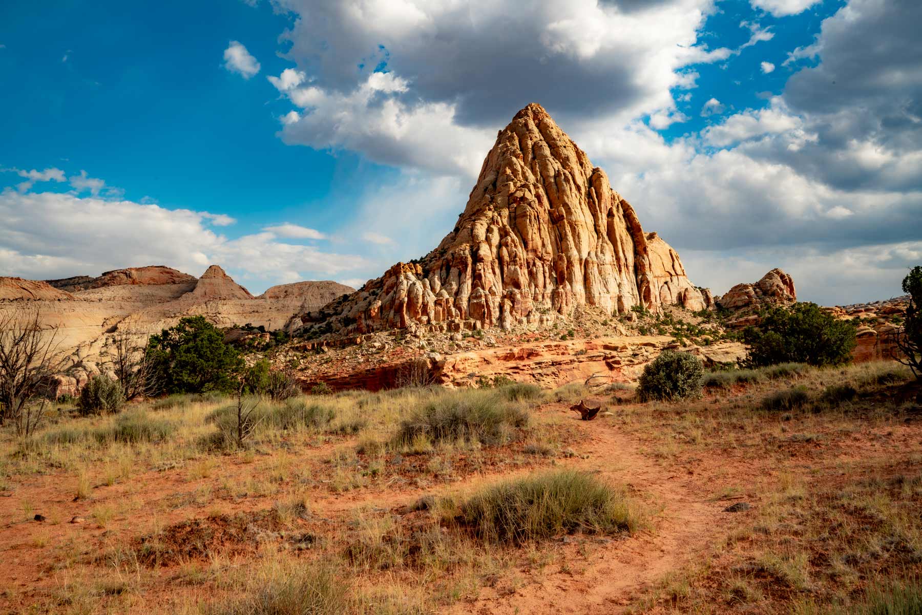
9. Capitol Reef National Park – Basic Facts
- Location: Utah
- Acreage: The park, which occupies 378 square miles
- Visitation: 1.4 million visitors in 2021
- Highest Elevation: The Golden Throne at 7,042 feet
- Lowest Elevation: Hall’s Creek at 3,877 feet
- Average Annual Precipitation: The Park has an arid climate with precipitation averaging 7.91 inches
- When Did It Become A National Park? An Act to Establish the Capitol Reef National Park in the State of Utah, became Public Law 92-207 when it was signed by President Richard Nixon on December 18, 1971.
Fact – Capitol Reef Was Originally To Be Named “Wayne Wonderland”
Perhaps the least known of our Capitol Reef National Park Facts is that, long before Capitol Reef was designated as a national monument, the Utah Legislature had created a Board of State Park Commissioners whose goal was to establish new state parks including one named “Wayne Wonderland State Park.”
That’s right! Capitol Reef almost became Wayne’s Wonderland instead.
In 1935, two years before it became a national monument, national and state officials went back and forth on Capitol Reef’s proposed boundaries.
While some wanted to name the monument “Wayne Wonderland,” Ephraim Pectol and Roger Toll thought that the name was inappropriate because it suggested a much more locally focused area.
It was Pectol and Toll who thought that it should be named Capitol Reef.

Why Capitol Reef?
Why did they come up with that name you might ask?
Early settlers had first noted that the white domes of Navajo Sandstone resemble the dome of the Capitol building in Washington, DC.
In recognition of its unusual geography, Pectol and Toll thought “Capitol Reef” would be the perfect name for the new national monument.
If you’re interested in learning more about this amazing park then check out More Than Just Parks article: Facts About Capitol Reef National Park
10. Carlsbad Caverns National Park – Basic Facts
- Location: New Mexico
- Acreage: 73.07 miles
- Visitation: 440,691 visitors in 2019
- Lowest Elevation: Of the three major levels, the deepest is 1,027 feet belowground.
- Average annual precipitation: The park averages 14.9 inches of annual precipitation
- When Did It Become A National Park? On October 25, 1923, President Calvin Coolidge created Carlsbad Caverns National Park

Fact – The Largest Cave In Carlsbad Caverns Is Over 100 Miles
One of my favorite Carlsbad Caverns National Park Facts is that, since 1984, explorers have mapped over 145 miles of passages and have pushed the depth of the cave to 1,604 feet (489 m).
As of July 2019, Lechuguilla is one of the ten longest caves in the world (one of the four longest in the United States) and the second deepest limestone cave in the country.

A Fascinating Backstory
The cave has a fascinating backstory. According to the National Park Service, Lechuguilla Cave was known until 1986 as a small, fairly insignificant historic site in the park’s backcountry. Small amounts of bat guano were mined from the entrance passages for a year under a mining claim filed in 1914.
The historic cave contained a 90-foot entrance pit which led to 400 feet of dry, dead-end passages.
The cave was visited infrequently after mining activities ceased. However, in the 1950s, cavers heard wind roaring up from the rubble-choked floor of the cave. Although there was no obvious route, different people concluded that cave passages must lay below the rubble.
A group of Colorado cavers gained permission from the National Park Service and began digging in 1984.
The breakthrough, into large walking passages, occurred on May 26, 1986.
What followed has become some of the world’s most exciting cave exploration in one of the finest known caves on the planet.

If you’re interested in learning more about this amazing park then check out More Than Just Parks article: Facts About Carlsbad Caverns National Park
National Parks Facts – From Channel Islands To Death Valley National Park
11. Channel Islands National Park – Basic Facts
Channel Islands National Park is a national park located off the coast of the state of California. It consists of five islands: Anacapa, Santa Cruz, Santa Rosa, San Miguel, and Santa Barbara. The park covers an area of 249,354 acres and is known for its stunning views, clear blue waters, and diverse plant and animal life.
The park is home to a variety of plant and animal life, including over 2,000 species of plants and animals that are found nowhere else in the world. It is also home to a number of historic and cultural sites, including the Santa Barbara Visitor Center and the Island Packers Visitor Center, which offer visitors a chance to learn about the history and culture of the area.
In addition to its natural beauty, Channel Islands National Park offers a range of recreational activities, including hiking, rock climbing, and boating. The park also offers guided tours and ranger-led programs, which provide visitors with the opportunity to learn more about the park’s natural and cultural history.
Channel Islands National Park is a popular destination for visitors, with millions of people visiting each year to enjoy its natural beauty and recreational opportunities.

Fact – The Channel Islands Inspired A Book And Film About The Last Indigenous Native
Though it’s not one of the five islands comprising the Channel Islands National Park, San Nicholas has its own place in the history of these magical islands.
Another of the extraordinary Channel Islands National Park Facts involves the incredible story of The Lone Woman of San Nicholas.
The native population of San Nicholas was removed to the mainland. Then a story began circulating about a lone woman who remained on the island. In 1850, a Franciscan of the Santa Barbara Mission offered a reward of $200 to anyone who could find this illusive woman.
It was the adventurer George Nidever, of Channel Islands fame, who went out as part of a hunting and fishing party. According to Frederic Chiles, on the west end of the island that discovered a windbreak made of whale ribs and sticks which were covered with brush.
Inside, to their amazement, was a woman clothed in a dress of skins and feathers. She followed the men to their boat and made the trip to Santa Barbara where she was hailed as a local sensation.
Island Of The Blue Dolphins
Nidever took her to his house where she entertained the locals with sign language and pantomime. Unfortunately, no one could speak her language.
Nevertheless, the people who encountered her were fascinated. She was given foods that she had not tasted before which included fruit, meat and vegetables. This would prove to be her undoing, however, as her system was unable to cope.
Seven weeks after she began eating these foods, she died of an intestinal disorder. She was given the name of Juana Maria by the Franciscans and buried in the Santa Barbara Mission Cemetery.
Her story was the inspiration for Scott O’Dell’s successful 1960 novel titled, Island of the Blue Dolphins.
In 1964, it was made into a film of the same name.
If you’re interested in learning more about this amazing park then check out More Than Just Parks article: Channel Islands National Park Facts
12. Congaree National Park – Basic Facts
- Location: South Carolina
- Acreage: Congaree National Park contains over 20,000 acres of federally designated wilderness that visitors can explore by either foot, kayak or canoe.
- Visitation: The park had 215,181 recreation visits in 2021.
- Elevation: Maximum elevation is 140 feet.
- Average annual precipitation: The month with the most wet days in Congaree National Park is July, with an average of 14.1 days with at least 0.04 inches of precipitation.
- When Did It Become A National Park? Congress established Congaree Swamp National Monument in 1976. In 2003, Congress changed the park’s name and designation and established Congaree National Park.

Fact – Congaree Was A Refuge From Slavery
Perhaps the least known of our Congaree National Park Facts is that while Congaree was ideal for establishing farms it was also ideal for escaping from the oppressive plantation economy, which characterized the South prior to the Civil War.
The area is a jungle-like wilderness which served as a refuge.
Some people made the long journey north, but many opted instead to flee to the woods where they were able to remain near family and supplies.
These people were called maroons. They made the difficult decision to exist in the wilderness, sometimes for years, rather than submit to the cruelty of slavery.
If you’re interested in learning more about this amazing park then check out More Than Just Parks article: 1Congaree National Park Facts
13. Crater Lake National Park – Basic Facts
- Location: Crater Lake is located in Southern Oregon on the crest of the Cascade Mountain range, 100 miles (160 km) east of the Pacific Ocean.
- Acreage: 183,224 acres
- Visitation: 647,651 visitors in 2021
- Highest Elevation: Hillman Peak, 8,156 feet, is highest point on crater rim
- Lowest Elevation: 1,949 feet
- Annual Precipitation: 66.8 inches
- When Did It Become A National Park? May 22, 1902
Fact – Crater Lake Was Discovered By A Young Prospector
For me, one of the most intriguing of the Crater Lake National Park Facts is that, according to the historical record, the first people to know about Crater Lake were the Klamath Indians.
While they knew of its existence, they seldom went there. According to their legends, they regarded the lake and the mountain as the “battleground of the gods.”
Fast forward to American fortune hunters in the nineteenth century. Like Death Valley, Crater Lake’s history features prospectors looking for buried treasure.
Crater Lake was discovered by a young prospector on June 12, 1853. His name was John Wesley Hillman.
Hillman was leading a party in search of the “Lost Cabin Mine.” Having failed in their efforts, Hillman’s group returned to Jacksonville, a mining camp in the Rogue River Valley. It was there that they reported their discovery which they had named Deep Blue Lake.
If you’re interested in learning more about this amazing park then check out More Than Just Parks article: Crater Lake National Park Facts
14. Cuyahoga Valley National Park – Basic Facts
- Location: Ohio
- Acreage: 32,570 acres
- Visitation: Cuyahoga Valley National Park generally receives more than 2.2 million recreational visits each year, making it one of the most-visited national parks in the United States.
- Highest Elevation: 1170+ feet
- Lowest Elevation: 590 feet at Cuyahoga River
- When Did It Become A National Park? Cuyahoga National Park, established as a national recreation area in 1974 and re-designated as a national park in 2000.

Fact – Cuyahoga Valley Has A Railroad Running Through It
How many national parks can offer you a train ride? Cuyahoga Valley can!
The Cuyahoga Valley National Park Train is a scenic train ride operated by the Cuyahoga Valley Scenic Railroad, a non-profit organization that runs excursions throughout the year.
The train offers visitors a unique opportunity to experience the beauty of the Cuyahoga Valley National Park, which covers 33,000 acres of natural beauty, including waterfalls, forests, and wildlife. The train ride takes approximately 2.5 hours to complete and covers a distance of 26 miles, running from Independence to Akron.
Passengers can choose from a variety of seating options, including coach class, first-class, and dome cars, which provide an elevated view of the surrounding scenery. The train is also equipped with a snack bar, restrooms, and open-air observation cars.
Throughout the journey, passengers can learn about the history and ecology of the park through onboard interpretive programs and narration. The train also offers special events throughout the year, including wine-tasting excursions, dinner trains, and holiday-themed rides.

If you’re interested in learning more about this amazing park then check out More Than Just Parks article: Facts About Cuyahoga Valley National Park
15. Death Valley National Park – Basic Facts
- Location: California
- Acreage: 3.373 million acres
- Visitation: Death Valley National Park welcomed 1,146,551 visitors in 2021.
- Elevation: Death Valley is the lowest point in North America.
- Annual Precipitation: Death Valley typically gets 2.20 inches of rainfall annually.
- When Did It Become A National Park? Oct. 31, 1994
Fact – Death Valley Is The Hottest Place on the Planet
For remarkable Death Valley National Parks Facts then how about this one: Death Valley holds the record as being the hottest place on earth. On July 10, 1913, a temperature of 134°F was measured at Furnace Creek. Summer temperatures are regularly high, often exceeding 120°F .
What’s even more amazing is that this was the same year Death Valley recorded its lowest temperature. The temperature dipped to 15°F at Furnace Creek on January 8, 1913.
As a matter of fact, Death Valley National Park scorched a world record for high temperatures in September of 2022.
The park’s Furnace Creek hit 127 degrees marking a world record for the hottest temperature ever recorded according to CBS News.

If you’re interested in learning more about this amazing park then check out More Than Just Parks article: 15 (Fascinating) Death Valley National Park Facts You Probably Didn’t Know
National Parks Facts – From Denali To Gateway Arch National Park
16. Denali National Park – Basic Facts
- Location: Alaska
- Acreage: 4.741 million acres
- Visitation: Denali National Park in Alaska had 229,521 visitors in 2021
- Highest Elevation: With a peak at 6,190 meters (20,310 feet), Alaska’s Denali has the highest elevation in North America.
- Lowest Elevation: Denali’s base sits at about 2,000 feet above sea level and rises over three and one-half miles to its 20,310 foot summit.
- When Did It Become A National Park? The park was established as Mt. McKinley National Park on Feb. 26, 1917. The original park was designated a wilderness area, the first national park created specifically to protect wildlife, and incorporated into Denali National Park and Preserve in 1980.

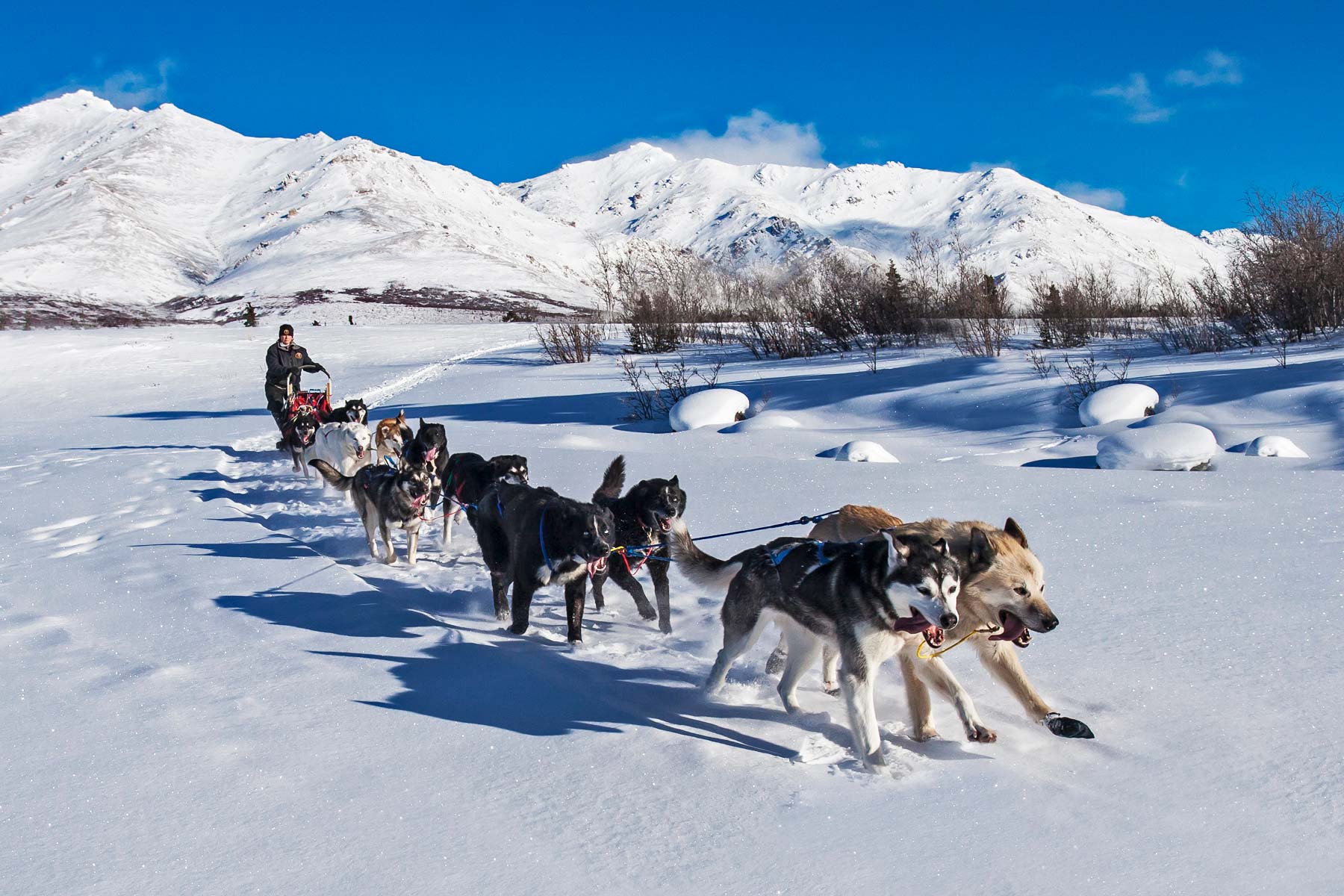
Fact – Denali Is The Only National Park With A Working Sled Dog Kennel
Sled Dogs have been helping rangers patrol the park since it opened in the 1920s.
Another of the most interesting yet little known Denali National Park Facts is that they are the only sled dogs in the United States that work in a national park And, Denali is the only national park with a working sled dog kennel.
Because these dogs play such an integral part in the operation of the park, breeding of sled dogs take place there.
Breeding pairs are matched specifically to produce dogs that display the personality traits and possess the physical attributes necessary to perform the job of a sled dog.

If you’re interested in learning more about this amazing park then check out More Than Just Parks article: Facts About Denali National Park
17. Dry Tortugas National Park – Basic Facts
- Location: Florida
- Acreage: The park comprises 47,125 acres.
- Visitation: .More than 80,000 people a year come to see and explore this secluded oasis and all of its eco-wonders.
- Elevation: 10 feet.
- Average annual precipitation: Throughout the year, in Dry Tortugas National Park, there are 87.8 rainfall days, and 36.42″ (925.1mm) of precipitation is accumulated.
- When Did It Become A National Park? Fort Jefferson National Monument was designated by President Franklin D. Roosevelt under the Antiquities Act on January 4, 1935. The monument was expanded in 1983 and re-designated as Dry Tortugas National Park on October 26, 1992 by an act of Congress.

Fact – A Historic Fort Was Built At Dry Tortugas
After America’s Louisiana Purchase, there was a significant increase in goods travelling along the Mississippi River down to New Orleans and around the tip of Florida.
The United States decided that it needed to increase the number of forts along the eastern seaboard so Congress appropriated funds in 1844 to build a fort at Garden Key.
Under the leadership of Chief Engineer Joseph Totten and the U.S. Army Corps of Engineers, the fort was designed as an elongated hexagon with four sides measuring 477 feet long and two sides at 325 feet, to be made of brick and masonry and surrounded by a moat that would be 70 feet wide.
It was the largest all-masonry fort in the United States.
The fort, which was named after America’s third president, Thomas Jefferson, was built between 1846 and 1875 to protect the nation’s gateway to the Gulf of Mexico.
The fort was occupied by Union forces during the American Civil War and served as a military prison shortly after the beginning of the war.
If you’re interested in learning more about this amazing park then check out More Than Just Parks article: Facts About Dry Tortugas National Park
18. Everglades National Park – Basic Facts
- Location: Florida
- Acreage: 1.509 million acres
- Visitation: At least one million people from all over the world visit the Everglades each year.
- Elevation: The elevation typically ranges from 0 to 8 feet (2.4 m) above sea level, but a Calusa-built shell mound on the Gulf Coast rises 20 feet (6.1 m) above sea level.
- Annual Precipitation: The Everglades receives an average of 60 inches of rain a year.
- When Did It Become A National Park? Everglades National Park was established on December 6, 1947.

Fact – Everglades Was Home To One Of Television’s Most Beloved Characters
Everglades National Park played a significant role in the television series “Gentle Ben.” The series, which aired from 1967 to 1969, was set in the park and followed the adventures of a young boy named Mark and his pet black bear named Ben.
Many scenes from the show were filmed on location in the Everglades, showcasing the park’s unique natural beauty and wildlife. The show also highlighted the importance of conservation and environmental protection, with Mark and his father, a park ranger, working to protect the animals and ecosystems of the park.
The success of “Gentle Ben” helped to increase public awareness and appreciation of the Everglades and the need to protect it. The show also contributed to the popularity of the black bear as a symbol of American wilderness, and helped to raise awareness of the challenges facing bears and other wildlife in their natural habitats.

If you’re interested in learning more about this amazing park then check out More Than Just Parks article: Everglades National Park Facts
19. Gates Of The Arctic National Park – Basic Facts
- Location: Alaska
- Acreage: 8.4 million acres
- Visitation: Gates of the Arctic is the least-visited national park in America. The park receives around 10-11,000 visitors per year.
- Highest Elevation: Mount Igikpak is the highest peak in the Schwatka Mountains region of the Brooks Range. It is also the tallest mountain in Gates of the Arctic National Park, located in the US state of Alaska. Some sources list the height of its summit at 8,510′.
- Lowest Elevation: The lowest elevation found in Gates of the Arctic is 280 feet at Kobuk River.
- How Cold Does It Get? Snow falls during 8 or 9 months of the year, averaging 60-80 inches. Average minimum and maximum winter temperatures are -67F and 33F. Snow has been recorded in every month of the year and the annual average is 45 inches.
- When Did It Become A National Park? First protected as a U.S. National Monument on December 1, 1978, the area was officially designated as a national park and preserve in 1980 with the passage of the Alaska National Interest Lands Conservation Act.
Fact – Sport Hunting & Trapping Are Permitted In The Gates Of The Arctic National Preserve
Sport hunting and trapping are permitted in Gates of the Arctic National Preserve, but not in Gates of the Arctic National Park.
Of course, to hunt and trap in the preserve, you must have all required licenses and permits and follow all other state regulations.
An Alaska State hunting license is required for all hunters age 16 or older. Bag and possession limits vary by species and by area. Always check current Alaska state hunting regulations.

If you’re interested in learning more about this amazing park then check out More Than Just Parks article: Facts About Gates Of The Arctic National Park
20. Gateway Arch National Park – Basic Facts
- Location: Missouri
- Acreage: 91 acres
- Visitation: The number of visitors to the the Gateway Arch National Park increased to approximately 1.15 million in 2021.
- Highest Elevation: 630 feet
- Lowest Elevation: The lowest elevation found in Gateway Arch is 446 feet.
- Average Annual Precipitation: The average amount of precipitation for the year in Indiana Dunes is 16.82 inches.
- When Did It Become A National Park? The Gateway Arch was completed on October 28, 1965; the area surrounding it was re-designated as the “Gateway Arch National Park” in 2018.
Fact – It’s The Smallest National Park
At a mere 91 acres, Gateway Arch National Park is the smallest national park in America. It doesn’t even have a natural area.
So why, you might ask, is it a national park? That’s a good question. Unfortunately, it’s not one that I can safely answer other to say that these decision are sometimes made on the basis of political considerations and having powerful friends in Congress never hurts whether your state’s park is deserving of national park status or not.

National Parks Facts – From Glacier Bay To Great Basin National Park
21. Glacier Bay National Park – Basic Facts
- Location: Alaska
- Acreage: Covering 3.3 million acres of rugged mountains, dynamic glaciers, temperate rain forest, wild coastlines and deep sheltered fjords, Glacier Bay National Park is a highlight of Alaska’s Inside Passage and part of a 25-million acre World Heritage Site, one of the world’s largest international protected areas.
- Visitation: Glacier Bay had a total of 89,768 visitors in 2021.
- Highest Elevation: The coastal mountains of Glacier Bay National Park and Preserve, topped by the 15,300 foot Mt. Fairweather represent the park’s highest elevation.
- Lowest Elevation: The lowest elevation found in Glacier Bay is 0 feet at the Pacific Ocean.
- Average annual precipitation: Bartlett Cove receives about 70 inches of precipitation annually.
- When Did It Become A National Park? It was proclaimed a national monument in 1925, established as a national park and preserve in 1980 and designated a UNESCO World Heritage site in 1992.

Fact – There Are Over 1,000 Glaciers at Glacier Bay
There’s a reason that this park is named “Glacier Bay” and that reason is that there are over 1,000 glaciers.
The fjord which comprises the majority of the park was covered by the 40-mile-wide Grand Pacific Glacier as recently as 200 years ago.
As the original glacier continued to retreat over the years, it would eventually divide into smaller glaciers.
These glaciers routinely break off into the water with such force that some of them cannot be safely approached from a certain distance.

If you’re interested in learning more about this amazing park then check out More Than Just Parks article: Facts About Glacier Bay National Park
22. Glacier National Park – Basic Facts
- Location: Montana
- Acreage: The country’s 10th national park, Montana’s Glacier preserves 1 million acres of glacier-carved peaks and valleys, pristine turquoise lakes and streams, and dense ancient forests for all to enjoy.
- Visitation: Glacier National Park in the United States attracted a total of approximately three million visitors in 2021.
- Highest Elevation: Mt. Cleveland is the park’s tallest peak, listed at 10,466 feet.
- Lowest Elevation: The lowest is the Middle Fork River near West Glacier at 3,215′.
- Average annual precipitation: In the driest corners of the park, along the northeast and northwest edges, rainfall averages 23 inches (58.4 cm) a year, while the lowlands of the west side receive about 30 inches (76.2 cm) of precipitation on average.
- When Did It Become A National Park? On May 11, 1910, President William Howard Taft signed a bill into law establishing Glacier National Park.
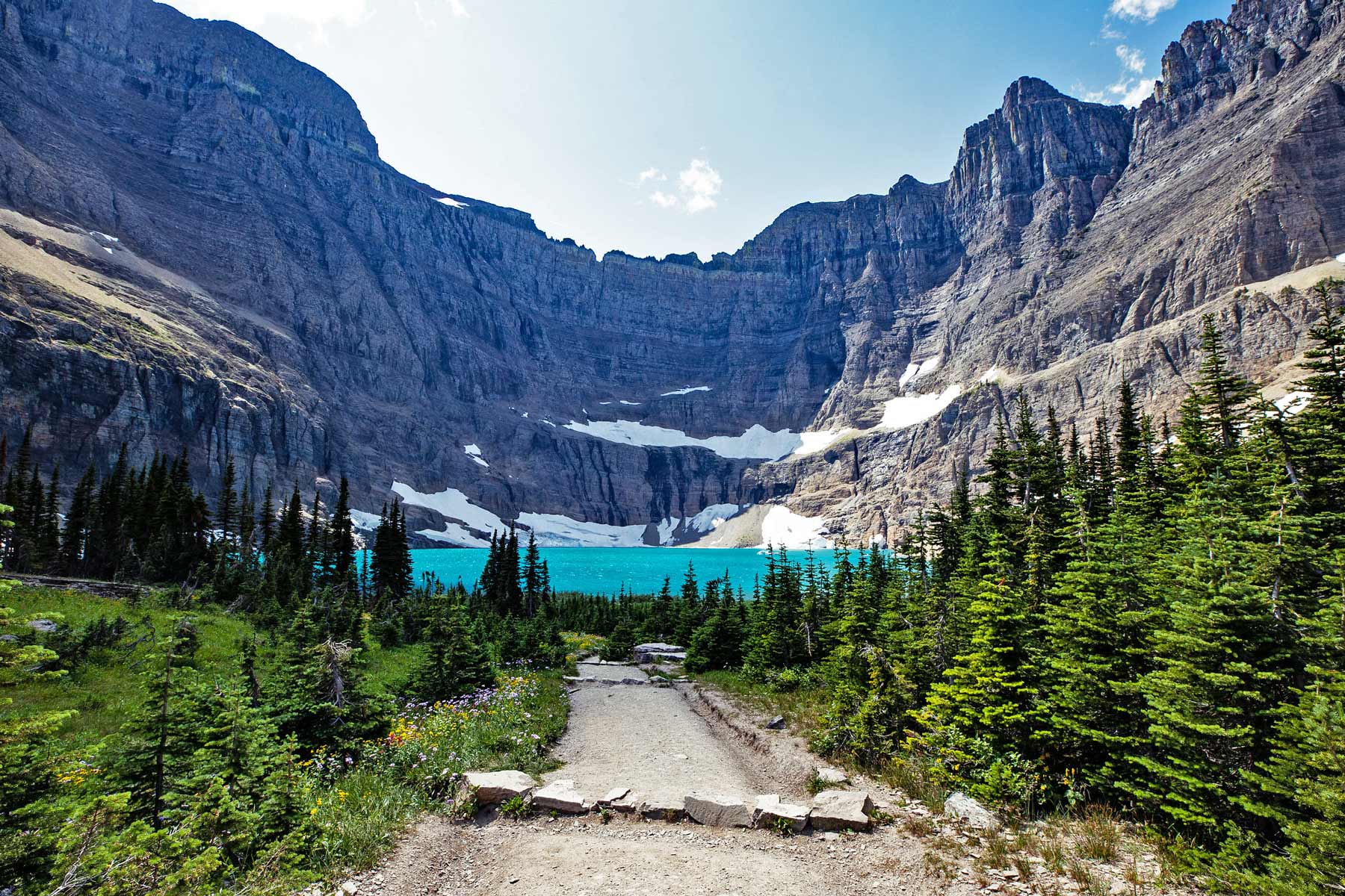
Fact – An Influential Editor & Conservationist Nicknamed Glacier The “Crown Of The Continent”
One of my favorite Glacier National Park Facts involves George Bird Grinnell: America’s First Environmentalist.
Grinnell was the editor of Forest and Stream magazine. He first came to Glacier National Park in 1885. He would return for the rest of his life.
Grinnell gave the park its nickname: the “crown of the continent.”
Now how many folks actually have a national park landmark named after them? George Bird Grinnell had three!
As one of the first Americans to visit and record his impressions of Glacier, Grinnell would have the honor of having a glacier, a lake and a mountain named after him
From the time he first dreamt of it becoming a national park in 1891, he worked tirelessly to gather support for this idea. Grinnell’s editorials in Forest and Stream, as well as his efforts to lobby political leaders such as Theodore Roosevelt and William Howard Taft, would finally bear fruit when Glacier became a national park in 1910.
To learn more about George Bird Grinnell, I recommend: Grinnell: America’s Environmental Pioneer and His Restless Drive to Save the West by John Taliaferro.

If you’re interested in learning more about this amazing park then check out More Than Just Parks article: Facts About Glacier National Park
23. Grand Canyon National Park – Basic Facts
- Location: Arizona
- Acreage: Grand Canyon National Park covers a total area of 1,217,403 acres
- Visitation: A total of 4.53 million in 2021
- Highest Elevation: 9,165 feet at North Rim Entrance
- Lowest Elevation: 1,200 feet at the Colorado River
- Average annual precipitation: The South Rim receives 17 inches (43 cm) of annual precipitation on average, while the North Rim receives 26 (66 cm) inches of annual precipitation on average
- When Did It Become A National Park? In 1903, President Theodore Roosevelt visited the canyon. He designated it a national monument in 1908. In 1919, President Woodrow Wilson made Grand Canyon a national park to protect the land and the resources within it, managed by the National Park Service.
Fact – The Grand Canyon Was Explored By A Real Life “Indiana Jones”
John Wesley Powell played a significant role in the exploration of the Grand Canyon. Powell was an American geologist, explorer, and soldier who is best known for leading the first scientific expedition down the Colorado River through the Grand Canyon in 1869.
Powell’s expedition, known as the Powell Geographic Expedition, set out from Green River, Wyoming with the goal of exploring and mapping the Colorado River and its canyons. The expedition consisted of ten men, including Powell himself, and two boats, which they navigated through the treacherous rapids and steep canyons of the Colorado River.
The journey was extremely challenging and dangerous, with the team facing numerous obstacles, including rough waters, dangerous rapids, and scarce food and water supplies. Despite these difficulties, Powell and his team persevered, and over the course of three months, they successfully completed the first scientific survey of the Grand Canyon.
Powell’s expedition had a significant impact on the understanding and exploration of the Grand Canyon. His detailed maps and scientific observations helped to create a greater understanding of the geology and ecology of the region, and his reports and publications helped to popularize the canyon as a destination for tourists and adventurers.
If you’re interested in learning more about this amazing park then check out More Than Just Parks article: 16+ Fascinating Grand Canyon Facts
24. Grand Teton National Park – Basic Facts
- Location: Wyoming
- Acreage: Park boundaries include approximately 310,000 acres, 485 square miles.
- Visitation: Grand Teton National Park hosted 3,885,230 recreation visits in 2021, the highest number of recreation visits for one year in the park’s history.
- Highest Elevation: Grand Teton, located at 13,775 feet is the highest point of the Teton Range and the second highest peak in the U.S. state of Wyoming after Gannett Peak. The peak extends from southern Alaska to northern New Mexico.
- Lowest Elevation: Fish Creek at south boundary, 6,320 feet.
- Average annual precipitation: On average, Jackson Hole receives just over 21 inches of precipitation each year, with roughly half of that falling as snow during the winter months. During the summer months daytime temperatures can reach into the 80s; however, overnight lows throughout the park can drop down into the 30s, and snow can fall anytime.
- When Did It Become A National Park? Grand Teton National Park was established in 1929; Jackson Hole National Monument was created in 1943. The two units were combined to become the present Grand Teton National Park in 1950.

Fact – Grand Teton Was A Family Affair
Now what, exactly, do I mean by a “family affair?” In recent years, the park has seen a massive influx in folks (like the Pattiz Family) who want to get a glimpse of this breathtaking destination.
Who can blame us! In 2016, all four of us managed to make the trek. It’s one amazing trip that I’ll never forget.
And, together we produced a film for More Than Just Parks.
As a matter of fact, it’s the only time that four Pattizes let their powers combine to make a breathtaking short film about one of America’s most magnificent national parks.
So Grand Teton National Park truly was a family affair!

If you’re interested in learning more about this amazing park then check out More Than Just Parks article: Facts About Grand Teton National Park
25. Great Basin National Park – Basic Facts
- Location: Nevada
- Acreage: Great Basin National Park is a place of extremes. From rugged mountain peaks to vast underground caverns, this 77,100-acre park in Nevada appears barren and desolate at a glance, yet supports a vast array of plant and animal life.
- Visitation: The park receives approximately 90,000 visitors per year.
- Highest Elevation: The highest point in the park is the pinnacle of Wheeler Peak, which stands 13,060 feet above sea level.
- Lowest Elevation: The lowest trail is Mountain View Nature Trail, 6,825 feet above sea level.
- Average annual precipitation: The annual rainfall of 6 to 12 inches in the basin supports little more than sparse desert or semi-desert vegetation. The Great Basin is particularly noted for its internal drainage system, in which precipitation falling on the surface leads eventually to closed valleys and does not reach the sea.
- When Did It Become A National Park? Great Basin National Park is established and Lehman Caves National Monument is incorporated into the Park on October 27th, 1986.

Fact – The Great Basin Includes Some Of The Oldest Trees Found On Earth
Some of the oldest trees on earth can be found at Great Basin.
As a matter of fact, the rare Great Basin bristlecone pine grows in isolated groves near the tree line, where it can survive for 4,000 years or more under extremely harsh conditions.
The park also features the remains of the famous Prometheus tree, a Great Basin Bristlecone pine once recorded as the oldest tree in the world, estimated between 4700-5000 years-old.

If you’re interested in learning more about this amazing park then check out More Than Just Parks article: Facts About Great Basin National Park
National Parks Facts – From Great Sand Dunes To Hawaii Volcanoes National Park
26. Great Sand Dunes National Park – Basic Facts
- Location: Colorado
- Acreage: 149,000 acres
- Visitation: Over half million visitors annually.
- Elevation: The elevation within the park and preserve ranges from a low of 7,520 feet (near San Luis Lakes ) to a high of 13,604 feet above sea level (Tijeras Peak) – a difference of 6,084 feet! The elevation at the Visitor Center is 8170 feet.
- Average annual precipitation: The Great Sand Dunes receive an average annual precipitation of 11 inches including an average snowfall of 37 inches.
- When Did It Become A National Park? The park was originally established as Great Sand Dunes National Monument on March 17, 1932 by President Herbert Hoover. Congress authorized a boundary change and re-designation as a national park in 2004.

Fact – Great Sand Dunes Features The Largest Sand Dune In North America
One of my favorite Great Sand Dunes National Park Facts has to do with the size of the sand dunes.
Star Dune is one of the tallest dunes in North America, tied with Hidden Dune at 741 feet from base to summit.
To reach the summit of Star Dune, visitors can take a hike from the summit of High Dune on First Ridge, or they can access the base of the dune along the Medano Creek bed.
The hike from the Dunes Parking Lot is about 2 miles south down the Medano Creek bed, and once the massive pyramid-shaped Star Dune comes into view, visitors can follow a ridge to its summit.
Visitors are allowed to climb and explore any part of the 30 square mile dune field, but it’s recommended to do so in the early mornings or evenings to avoid the high surface temperatures during the summer.

If you’re interested in learning more about this amazing park then check out More Than Just Parks article: Facts About Great Sand Dunes National Park
27 Great Smoky Mountains National Park – Basic Facts
- Location: Great Smoky Mountains National Park straddles the borders of the states of Tennessee and North Carolina. The three main entrances to the park are in Gatlinburg, TN; Townsend, TN; and Cherokee, NC.
Acreage: Great Smoky Mountains National Park covers 522,427 acres, divided almost evenly between the states of North Carolina and Tennessee.
Visitation: The Great Smoky Mountains National Park reached its highest number of recreational visitors in 2021, reporting 14.161 million visitors, an increase from the previous value of around 12.4 million in 2020.
Highest Elevation: At 6,643 feet, Clingmans Dome is the highest point in Great Smoky Mountains National Park. It is the highest point in Tennessee.
Lowest Elevation: Abrams Creek at 840 feet.
When Did It Become A National Park? President Franklin D. Roosevelt dedicated the Great Smoky Mountains National Park on September 2, 1940, “for the permanent enjoyment of the people.”
Fact – Great Smoky Mountain National Park Is America’s Most Popular National Park
One of my favorite Great Smoky Mountains National Park Facts is that it’s America’s most popular national park.
In 2021, the park had over 14 million visitors. That made it the #1 most visited national park in America and it wasn’t even close! Zion National Park came in at #2 with 5 million visitors.

There’s A Difference Between National Parks & National Park Sites
Now there’s a difference between “National Parks” vs “National Park Sites.”
The National Park System encompasses 423 national park sites in the United States.
They span across more than 84 million acres, with parks in each state and extending into the territories, including parks in Puerto Rico, the Virgin Islands, American Samoa, and Guam.
Only 63 of these sites, however, are capital letter national parks and not every state has one. The difference has to do with the level of federal protection that the area receives.

If you’re interested in learning more about this amazing park then check out More Than Just Parks article: Facts About Great Smoky Mountains National Park
28. Guadalupe Mountains National Park – Basic Facts
- Location: Texas
Acreage: The park comprises 76,293 acres of mountain and desert land in West Texas.
Visitation: Guadalupe Mountains National Park drew a record 243,000 recreational visits during 2021.
Highest Elevation: Guadalupe Peak is the highest point in Texas, reaching 8,751 feet.
Lowest Elevation: The lowest elevation in the park is 3,640 feet in the Salt Basin Dunes.
When Did Guadalupe Mountains Become A National Park? September 30, 1972.
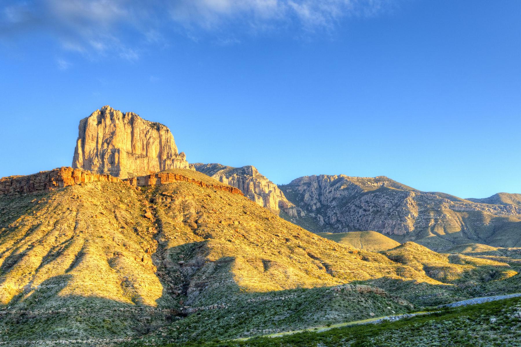
Fact – The Highest Point In Texas Is In Guadalupe Mountains National Park
Guadalupe Peak, the highest point in Texas, offers hikers a challenging and rewarding experience with an 8.5-mile round trip hike and a 3,000-foot elevation gain.
The hike takes hikers through different ecosystems, including the high desert and high elevation forests.
On a clear day, hikers are rewarded with stunning views of the surrounding mountains and desert. It is a challenging hike that will take 6-8 hours to complete, so hikers should be prepared for the physical exertion and bring enough water and snacks.
It is important to be aware of the weather conditions, as the trail can be dangerous in extreme heat or cold.
The view from the summit is well worth the effort, so hikers should take time to enjoy it before starting their descent.

If you’re interested in learning more about this amazing park then check out More Than Just Parks article: Facts About Guadalupe Mountains National Park
29. Haleakala National Park – Basic Facts
- Location: Hawaii
Acreage: Of its 30,183 acres, 24,719 acres are designated wilderness.
Visitation: In 2020, 319,147 people visited Haleakala National Park.
Highest Elevation: Haleakala’s highest point, Puu Ulaula Summit, is 10,023 feet.
Lowest Elevation: The lowest elevation found in Haleakala is 0 feet at the Pacific Ocean.
When Did It Become A National Park? Haleakala National Park was established on August 1, 1916.

Fact – Haleakala Is Taller Than Mount Everest
One of the most interesting of the Haleakala National Park Facts is that, believe it or not, Haleakala is taller than Mount Everest.
And it doesn’t stop there. Haleakala is also taller than Mount Kilimanjaro (19,341 feet), Mount McKinley (20,320 feet) and K2 (28,251 feet).
Combined, Haleakala tops off at 29,704 feet from its base on the ocean floor to its sky-high summit.
Now that’s tall!

If you’re interested in learning more about this amazing park then check out More Than Just Parks article: Facts About Haleakala National Park
30. Hawaii Volcanoes National Park – Basic Facts
- Location: Hawaii
Acreage: Hawaii Volcanoes National Park encompasses 335,259 acres or about 523 square miles.
Visitation: In 2021, Hawaii Volcanoes National Park welcomed 1,262,747 people to the park.
Highest Elevation: 13,681 feet.
Lowest Elevation: The lowest elevation found in Hawaii Volcanoes is 0 feet at the Pacific Ocean.
When Did It Become A National Park? Hawai’i Volcanoes National Park was established in 1916.

Fact – Hawaii Volcanoes Features Amazing Lava Tubes
One of my favorite Hawaii Volcanoes National Park Facts has to do with the amazing lava tubes which visitors can explore.
A lava tube, or pyroduct, is a natural conduit formed by flowing lava from a volcanic vent that moves beneath the hardened surface of a lava flow. If lava in the tube empties, it will leave a cave.
When the lava flow stops or gets diverted, the tube becomes an empty cave.
These lava tubes can be found in Hawaiian Volcanoes National Park, home of the Kilauea and Mauna Loa volcanoes, and they offer a unique opportunity to witness volcanic activity.
When active, lava travels through these tubes at temperatures that exceed 2,000º F (1090º C). The intense heat can cause winds of superheated fumes to blast through the tunnel, but the only sound may be the constant soft hiss of the relentless flow.
These tubes are not only geological wonders but also provide habitat for unique ecosystem of troglobites, animals specifically adapted to live in the dark and isolated environment.
Distinct species of crickets and spiders develop alongside special microbial colonies that can only be found in these lava tubes.

If you’re interested in learning more about this amazing park then check out More Than Just Parks article: Facts About Hawaii Volcanoes National Park
National Parks Facts – From Hot Springs To Katmai National Park
31. Hot Springs National Park – Basic Facts
- Location: Hot Springs National Park is an American national park in Garland County, Arkansas, adjacent to the city of Hot Springs, the county seat.
- Acreage: At 5,550 acres, Hot Springs National Park is the smallest national park in the United States.
- Visitation: Hot Springs National Park had 2,162,884 recreational visits in 2021, topping the previous visitation record set in 1970. the park surpassed 100 million accumulated recreation visits since reporting began in 1904.
- Highest Elevation: The highest point in the park, Music Mountain at 1405 feet. It’s located within the West Mountain section at the westernmost point of Sunset Trail.
- When Did It Become A National Park? In 1916 the National Park Service was formed and, in 1921, Hot Springs Reservation changed its name to Hot Springs National Park. This change made it the 18th National Park in the Service.

Fact – Hot Springs Is “America’s Spa”
Hot Springs National Park is often referred to as “America’s Spa” because of its famous natural hot springs. The park is home to 47 hot springs that flow from the southwestern slope of Hot Springs Mountain. These thermal waters are heated by the geothermal energy from the Earth’s core and are said to have healing properties.
Visitors to Hot Springs National Park can experience the hot springs in a variety of ways, including taking a bath in one of the traditional bathhouses that line Bathhouse Row, hiking the trails that lead to the hot springs, or simply enjoying the scenery and the park’s other attractions.

If you’re interested in learning more about this amazing park then check out More Than Just Parks article: 12 Fantastic Facts About Hot Springs National Park
32. Indiana Dunes National Park – Basic Facts
- Location: Indiana
- Acreage: Indiana Dunes consists of 2,182 acres of primitive, beautiful, historic, and unique Hoosier landscape. It lies at the north end of State Road 49 in Porter County and includes more than three miles of beautiful beach along Lake Michigan’s southern shore.
- Visitation: The number of visitors to Indiana Dunes National Lakeshore amounted to approximately 3.18 million in 2021.
- Highest Elevation: At 192 feet above Lake Michigan, Mount Tom is the highest dune in the state of Indiana.
- Lowest Elevation: The lowest elevation found in Indiana Dunes is 597 feet at Lake Michigan.
- Average Annual Precipitation: The average amount of precipitation for the year in St. Louis – Gateway Arch is 40.3″ inches.
- When Did It Become A National Park? It was authorized by Congress in 1966 as the Indiana Dunes National Lakeshore and was re-designated as the nation’s 61st national park on February 15, 2019.

Fact – Indiana Dunes Is A Treasure Trove Of Nature
The park, which is located on the southern shore of Lake Michigan in Indiana, is home to a diverse array of ecosystems and wildlife, including pristine beaches, sand dunes, wetlands, forests, and rare plant and animal species.
The park’s sand dunes are some of the tallest in the world, with the highest dune towering over 200 feet above Lake Michigan. The dunes are home to a unique array of plant and animal species that are specially adapted to the harsh and shifting conditions of the sand.
In addition to the dunes, Indiana Dunes National Park is home to more than 350 species of birds, making it one of the best birding destinations in the Midwest. The park’s wetlands and marshes provide critical habitat for a variety of waterfowl and migratory birds, while its forests and woodlands are home to a diverse array of songbirds and raptors.
The park is also home to several rare and endangered species, including the Indiana bat, the eastern massasauga rattlesnake, and the Eastern hognose snake. The park’s protected status helps to ensure that these species and their habitats are preserved for future generations.

If you’re interested in learning more about this amazing park then check out More Than Just Parks article: Facts About Indiana Dunes National Park
33. Isle Royale National Park – Basic Facts
- Location: Michigan
- Acreage: 572,000 acres
- Visitation: Isle Royale is one of the least-visited national parks in the U.S., averaging around 20,000 visitors per year, according to the National Park Service website.
- Highest Elevation: The highest elevation on the island is Ishpeming Point, 705 feet above the level of the lake.
- Lowest Elevation: The lowest elevation found in Isle Royale is 601 feet at Lake Superior.
- Average Annual Precipitation: The rainy period of the year lasts for 8.4 months, from March 23 to December 2, with a sliding 31-day rainfall of at least 0.5 inches.
- When Did It Become A National Park? Isle Royale National Park was authorized by Congress on March 3, 1931 by President Herbert Hoover “to conserve a prime example of North Woods Wilderness.” Isle Royale National Park was established on April 3, 1940 by President Franklin D. Roosevelt.

Fact – Isle Royale Is A UNESCO International Biosphere Reserve
One of my favorite Isle Royale National Park Facts is that, in 1980, the park was named a UNESCO International Biosphere Reserve.
What are “biosphere reserves?” Biosphere reserves are ‘learning places for sustainable development.’ They are sites for testing interdisciplinary approaches to understanding and managing changes and interactions between social and ecological systems, including conflict prevention and management of biodiversity.
They are also places which provide local solutions to global challenges.
Biosphere reserves include terrestrial, marine and coastal ecosystems. Each site promotes solutions reconciling the conservation of biodiversity with its sustainable use.

If you’re interested in learning more about this amazing park then check out More Than Just Parks article: Facts About Isle Royale National Park
34. Joshua Tree National Park – Basic Facts
- Location: California
- Acreage: 795,156 gross acres including private and state in-holdings.
- Visitation: 3,064,400 visitors in 2021.
- Highest Elevation: 5,814 ft at the summit of Quail Mountain.
- Lowest Elevation: 536 ft at the southeastern boundary of the park.
- Average Annual Precipitation: Joshua Tree gets 8 inches of rain, on average, per year.
- When Did It Become A National Park? Joshua Tree was designated a national monument in 1936 by President Franklin Delano Roosevelt and accorded national park status in 1994.

Fact – The Joshua Tree Area Was Actually Popular For Its Health Benefits
Now one doesn’t typically think of an arid desert as conducive to good health, but it actually can be. One of my favorite Joshua Tree National Park Facts has to due with the role played by this area after World War One.
While many homesteaders failed due to the hot, dry desert climate, it was actually considered beneficial to veterans of World War One who were suffering from the effects of mustard gas.
If you’re unfamiliar with this lethal weapon it’s probably because it has been banned as a weapon of war since World War One.
Mustard gas was introduced by the Germans in 1917. It causes chemical burns on contact, with blisters oozing yellow fluid. Initial exposure is symptomless, and by the time skin irritation begins, it is too late to take preventative measures.
The mortality rate from mustard gas was only 2-3%, but those who suffered chemical burns and respiratory problems had long hospitalizations and if they recovered were thought to be at higher risk of developing cancers during later life.
In 1925, the Geneva Gas Protocol Treaty was signed by most of the world’s countries banning the use of chemical and biological weapons in warfare.
If you’re interested in learning more about this amazing park then check out More Than Just Parks article: Facts About Joshua Tree National Park
35. Katmai National Park – Basic Facts
- Location: Alaska
- Acreage: Katmai National Park and Preserve spans over four million acres of remote, wild, and spectacular country.
- Visitation: Since the park was established in 1980, it has averaged total annual visits of more than 37,000.
- Elevation: Mount Katmai, the namesake of the park, reaches a height of 6,716 feet. It is a stratovolcano with a crater lake at the top.
- Climate and Average Weather Year Round: In Katmai National Park, the summers are cool and mostly cloudy and the winters are long, freezing, snowy, windy, and partly cloudy. Over the course of the year, the temperature typically varies from 11°F to 64°F and is rarely below -19°F or above 73°F.
- When Did It Become A National Park? As word of Katmai’s brown bears spread during the 1980s, the Brooks River area, and later the Katmai coast, became popular wildlife viewing spots. In 1980, Katmai National Monument was expanded to its present size and became Katmai National Park and Preserve.

Fact – The Park Was Expanded By Jimmy Carter As Part Of The Largest Single Act Of Conservation In U.S. History
Second, the Act resolved longstanding disputes between the state of Alaska, Native American tribes, and conservation groups over land ownership and resource management. The Act provided Native Alaskan tribes with land for traditional subsistence hunting and fishing, while also protecting their cultural heritage and traditional ways of life.
The Alaska Lands Act
The Alaska National Interest Lands Conservation Act (ANILCA), commonly known as the Alaska Lands Act, is a landmark piece of US legislation that was signed into law by President Jimmy Carter in 1980.
The Act provided comprehensive protection and conservation for more than 157 million acres of land in Alaska, making it one of the most significant conservation measures in American history.
The Alaska Lands Act was important for several reasons. First, it recognized and protected Alaska’s unique natural resources and ecosystems, including vast wilderness areas, wildlife habitats, and important fisheries. The Act established more than 50 new wildlife refuges, national parks, and wilderness areas, protecting them from development and ensuring that they would be preserved for future generations.

Third, the Act had important implications for environmental policy and the future of conservation in the United States. The Alaska Lands Act represented a major victory for the environmental movement, which had long advocated for stronger protections for wilderness areas and wildlife habitats.
The Act set a precedent for future conservation measures, demonstrating the importance of protecting our natural resources and ecosystems for future generations.
If you’re interested in learning more about this amazing park then check out More Than Just Parks article: Facts About Katmai Park & Preserve
National Parks Facts – From Kenai Fjords To Lassen Volcanic National Park
36. Kenai Fjords National Park – Basic Facts
- Location: Alaska
- Acreage: Sweeping from rocky coastline to glacier-crowned peaks, Kenai Fjords National Park encompasses 607,805 acres of unspoiled wilderness on the southeast coast of Alaska’s Kenai Peninsula.
- Visitation: Kenai Fjords had 356,601 visitors in 2019.
- Elevation: The highest surface on the Harding Icefield is approximately 5,200 feet above sea level. The highest peak within the boundaries of Kenai Fjords, at 6,450 feet, is unnamed.
- Climate and Average Weather Year Round: In Kenai Fjords National Park, the summers are cool, wet, and overcast and the winters are long, freezing, snowy, windy, and mostly cloudy. Over the course of the year, the temperature typically varies from 22°F to 62°F and is rarely below 5°F or above 70°F.
- When Did It Become A National Park? Established as a national monument in 1978, Kenai Fjords became a national park under the Alaska National Interest Lands Conservation Act (ANILCA) of 1980.

Fact – Kenai Fjords National Park Is A Birder’s Paradise
The park is home to a wide variety of bird species, including seabirds, shorebirds, waterfowl, raptors, and songbirds. The park’s coastal cliffs and islands are particularly good places to see seabirds such as puffins, murres, auklets, and kittiwakes.
In addition, the park is home to several species of waterfowl, including loons, grebes, and ducks. Bald eagles and peregrine falcons can also be seen soaring overhead.
Birdwatching tours and guided walks are available in the park, and the park’s visitor centers can provide information on the best places to see specific bird species.
The park features over 190 species of birds and other creatures who call this place home.

If you’re interested in learning more about this amazing park then check out More Than Just Parks article: Facts About Kenai Fjords National Park
37. Kings Canyon National Park – Basic Facts
- Location: California
- Acreage: 461,901 acres
- Visitation: Annual visitation is 415,077.
- Highest Elevation: The Palisades, along the park’s eastern boundary, have four peaks over 14,000 feet including the highest point in the park, 14,248 feet at the summit of North Palisade.
- Lowest Elevation: The Middle Fork of Kings River flows through the steep and narrow Kings Canyon, near 2,500 feet deep and 1 to 2 miles wide at the rim. Lowest elevations at the western boundary where the two Forks of the Kings River exit the National Park are near 4,000 feet.
- Average annual precipitation: These elevations receive an average of 40 to 45 inches of precipitation annually. Much of this falls during the winter, resulting in a deep blanket of snow from December to May. Sub-zero temperatures, however, are rare.
- When Did It Become A National Park? On March 4, 1940, Congress established Kings Canyon National Park, which is adjacent to the north boundary of Sequoia National Park.

Fact – Before Becoming Kings Canyon, The Park Featured America’s First African-American Superintendent
Charles Young was a highly respected Army officer and one of the first African Americans to achieve the rank of colonel in the U.S. Army. He played an important role in the creation and development of Kings Canyon National Park.
In 1903, Young was appointed as the superintendent of Sequoia and General Grant National Parks, which at the time included the land that would eventually become Kings Canyon National Park.
As superintendent, Young was responsible for overseeing the management and development of the parks, including the protection of their natural resources and the construction of park infrastructure.
Young was a strong advocate for conservation and believed that national parks should be preserved and protected for future generations. He was instrumental in the establishment of the first fire control program in the parks, and he worked tirelessly to protect the parks’ natural resources from damage caused by wildfires, logging, and mining.
He also explored and mapped many of the rugged canyons and high peaks of the Sierra Nevada, including the area that would eventually become Kings Canyon National Park.

If you’re interested in learning more about this amazing park then check out More Than Just Parks article: Facts About Kings Canyon National Park
38. Kobuk Valley National Park – Basic Facts
- Location: Alaska
- Acreage: Kobuk Valley National Park covers 1.75 million acres of boreal forest and mountains in northwestern Alaska and includes the Great Kobuk Sand Dunes, the largest active, high-latitude, dune field on Earth.
- Visitation: In previous years Kobuk Valley has ranked as the least visited national park in America but such was not the case for 2021. Last year Kobuk Valley saw a whopping 11,540 visitors.
- Elevation: Kobuk Valley National Park is just slightly larger than the state of Delaware and is home to four named mountains, the highest and most prominent of which is Mount Angayukaqsraq at 4,629 feet.
- Climate and Average Weather Year Round: In Kobuk Valley National Park, the summers are cool and mostly cloudy and the winters are long, frigid, snowy, windy, and partly cloudy. Over the course of the year, the temperature typically varies from -11°F to 70°F and is rarely below -41°F or above 80°F.
- When Did It Become A National Park? The park was designated in 1980 by the Alaska National Interest Lands Conservation Act to preserve the 100 feet high Great Kobuk Sand Dunes and the surrounding area which includes caribou migration routes.

Fact – The Great Kobuk Sand Dunes Are The Largest Active, High-Latitude, Dune Field On Earth
While I taught history, I was also fascinated by geology. One of my favorite Kobuk Valley National Park Facts pertains to the amazing geology of this area.
If you’re planning to visit then you should know that one of Kobuk Valley National Park’s most iconic sights is the Great Kobuk Sand Dunes.
The Great Kobuk Sand Dunes is the largest active, high-latitude, dune field on Earth.
You will see them rising unexpectedly out of the tundra and trees.
These dunes, along with the smaller Little Kobuk Sand Dunes and Hunt River Sand Dunes, create 30 square miles of towering sand that would look more at home in the Sahara than 35 miles above the Arctic Circle.

If you’re interested in learning more about this amazing park then check out More Than Just Parks article: Facts About Kobuk Valley National Park
39. Lake Clark National Park – Basic Facts
- Location: Alaska
- Acreage: Comprised of 4 million acres on the Alaska Peninsula in southwest Alaska, Lake Clark is one of the nation’s most remote national park units.
- Visitation: With beautiful scenery, close proximity to Anchorage and Homer, and less than 20,000 visitors a year, this park is an undiscovered jewel.
- Climate: Lake Clark National Park and Preserve has two distinct climate areas: the coast and the interior. The coast is often foggy and wet, with an average annual rainfall of 40 to 80 inches.
- When Did It Become A National Park? Lake Clark National Park and Preserve was created in 1980 by the Alaska National Interest Lands Conservation Act (ANILCA), which also provided for continued subsistence use of the park by local residents.

Fact – Lake Clark Was The Setting For One Man’s Alaska
Of all the Lake Clark National Park Facts, this one is my favorite. My wife, three sons and I were inspired by a film which we saw on Public Television over twenty years ago. Little did I realize at the time that I would have the opportunity to write about the extraordinary man who captured our imaginations with his Alaskan Odyssey.
The film is a documentary profile of conservationist and wildlife photographer, Dick Proenneke, at his home in the Lake Clark area of Alaska. It features close-up scenes of native wildlife, dramatic panoramas of the change of seasons and clips of Proenneke carving his log cabin out of the wilderness.
According to the National Park Service, Proenneke arrived at the Carrither’s on Upper Twin Lake in 1967 at the age of 51 determined to scout out the best construction site for his own cabin. The ideal location was 200 yards west of the Carrither’s guest cabin.
Another friend from Kodiak, Herb Wright, had applied for a Small Track Lease on the site in 1960; however, in a sad turn of events, Wright became terminally ill. He encouraged Proenneke to use the site instead.

He Would Spend The Next 30 Years Living There
In 1968, Dick Proenneke began construction on what would become his cabin and wilderness home in an isolated area.
He was a master craftsman who dedicated himself to living simply on the land, using local materials, simple tools, and human ingenuity to craft a home and life in keeping with the wilderness.
Proenneke chose to live without electricity, running water, telephone, or other modern necessities, making him the original “Survivor Man” long before Bear Grylls and others came along to show how it could be done.
Despite his remote location and fierce independence, Proenneke was not a hermit and maintained friendships and corresponded with anyone who sent him a letter.
He saw his correspondence, films, and journals as a way to share a life untethered to the commercial world and his observations have inspired several books and videos.

If you’re interested in learning more about this amazing park then check out More Than Just Parks article: Facts About Lake Clark National Park & Preserve To Know
40. Lassen Volcanic National Park – Basic Facts
- Location: California
- Acreage: 106,452 acres.
- Visitation: In 2021, Lassen Volcanic National Park had 359,635 park visitors.
- Elevation: The park ranges in elevation from 5,650 feet to 10,457 feet.
- Climate: Winter weather and conditions exists approximately November to May and summer conditions exist June through October. Spring and fall tend to be shoulder seasons. Winter conditions usually persist well into June in the higher elevations of the park (Lassen Peak area). Spring snow storms can occur as late as June.
- When Did It Become A National Park? In August of 1916, Lassen Volcanic National Park was established. The park and Lassen Peak take their name from Peter Lassen, one of the first white settlers in the northern Sacramento Valley, who discovered of a route through the mountains called the Lassen Trail.

Fact – An Eruption At Lassen Peak Devastated Nearby Areas & Rained Volcanic Ash As Far Away As 200 Miles
A fascinating Lassen Volcanic National Park Fact involves the explosive volcanic eruption of May 22nd, 1915, which forever changed this area.
According to the U.S. Geological Survey, on May 30, 1914, Lassen Peak awoke from a 27,000-year-long slumber when it was shaken by a steam explosion.
That first explosion created a small crater at the summit of Lassen Peak, and each of more than 180 subsequent steam explosions enlarged it.
Over more than 11 months, these steam explosions blasted out a crater 1,000 feet across. In mid-May 1915, the character of the eruption changed dramatically.
On the evening of May 14, 1915, incandescent blocks of lava could be seen bouncing down the flanks of Lassen Peak from as far away as Manton, 20 miles to the west.
By the next morning, a growing lava dome had filled the crater at the summit of Lassen Peak.

If you’re interested in learning more about this amazing park then check out More Than Just Parks article: Facts About Lassen Volcanic National Park
National Parks Facts – From Mammoth Cave To New River Gorge National Park
41. Mammoth Cave National Park – Basic Facts
- Location: Kentucky
- Acreage: Today, Mammoth Cave National Park (the park) comprises approximately 52,830 acres in Edmonson, Hart, and Barren counties in the Commonwealth of Kentucky.
- Visitation: Over 2 million people a year visit the park and more than 500,000 of them take a cave tour.
- Highest Surface Elevation: 852 feet (260 meters) Brooks Knob.
- Lowest Surface Elevation: 411 feet (125 meters) Green River near Brownsville.
- Climate: Mammoth Cave National Park has a moderate climate, with often warm and humid conditions. Summers are very warm, and winters are cool but not usually cold. Southern Kentucky receives the highest average precipitation for the state, about 50 inches a year.
- When Did It Become A National Park? Mammoth Cave National Park was officially dedicated at as a national park by 1941. It then became a World Heritage Site in 1981 and an International Biosphere Reserve in 1990.

Fact – An NPS Guide Is The Descendant Of Slaves Who Served As Mammoth Cave Guides
For me, the most surprising and most incredible of the Mammoth Cave National Park Facts has to do with the amazing story of Jerry Bransford.
Sharing honors with Stephen Bishop were two other slave guides. They were brothers Mat and Nick Bransford.
When Matt Bransford died in 1886, his mantle descended to his son, Henry. Then it passed on to Henry’s sons, Mat and Louis.
It finally passed to his great grandson, Elzie Bransford.
For over 100 years, one or more members of the Bransford family guided visitors through Mammoth Cave.

If you’re interested in learning more about this amazing park then check out More Than Just Parks article: 12 Surprising Facts About Mammoth Cave National Park
42. Mesa Verde National Park – Basic Facts
- Location: Colorado
- Acreage: 52,485 acres
- Visitation: Since 2016, the park has averaged over half a million visitors annually.
- Highest Elevation: Point Lookout is an 8,427-foot elevation sandstone summit located in Mesa Verde National Park.
- Lowest Elevation: The lowest elevation found in Mesa Verde is 6,015 feet at Soda Canyon.
- Average annual precipitation: With an average annual precipitation of just 18 inches, Mesa Verde remains dry despite being between 6,000 and 8,572 feet high. June is the driest month, with just over 1/2 inch of rain, and August is the wettest, with 2 inches. The park typically receives 80 inches of snow in a season.
- When Did It Become A National Park? On June 29, 1906, President Theodore Roosevelt established Mesa Verde National Park to “preserve the works of man,” the first national park of its kind.

Fact – Mesa Verde Is An International Dark Sky Park
Mesa Verde National Park has special status as an International Dark Sky Park.
The park was established as the world’s 100th International Dark Sky Park in 2021 in recognition of the remarkable quality of the night sky and opportunities for visitors to experience astronomy-based interpretive programs.
An IDA International Dark Sky Park (IDSP) is a land possessing an exceptional or distinguished quality of starry nights and a nocturnal environment that is specifically protected for its scientific, natural, educational, cultural heritage, and/or public enjoyment.

If you’re interested in learning more about this amazing park then check out More Than Just Parks article: Facts About Mesa Verde National Park To Know
43. Mount Rainier National Park – Basic Facts
- Mt Rainier Height: 14,411 feet
- First Ascent of Mt Rainier: August 17, 1870
- Mt Rainier Last Eruption: 1894
- Mt Rainier Mountain Range: Cascades Mountains
- Mt. Rainier Native Name: Tahoma
- Mt Rainier Closest Major City: Seattle, Washington
- Mt Rainier Type of Volcano: Stratovolcano
- Number of Major Glaciers on Mt Rainier: 25
- Mt Rainier is the tallest mountain in the state of Washington
- Mt Rainier is the most heavily glaciated peak in the contiguous US
- Mt Rainier is the highest peak in the Cascade Range

Fact – An Air Force Lieutenant Landed A Plane On The Summit
Now here’s the strangest of the Mount Rainier National Park Facts.
Mount Rainier’s summit is over 14,000 feet so it’s easy to understand why someone wouldn’t want to climb it. How about taking an airplane instead?
That’s what John W. Hodgkin, an Air Force lieutenant, did on April 12, 1951. Hodgkin equipped his plane with skis and landed it on the summit of Mount Rainier at 14,410 feet.
At the time, this was a world record for a high-altitude landing.
And his story gets even more interesting. Hodgkin tried taking off again, but his plane wouldn’t start!
He was stranded near the top of the more than 14,000-feet-high peak. Hodgkin ended up spending the night in his plane in below-zero temperatures. Talk about a chill!

If you’re interested in learning more about this amazing park then check out More Than Just Parks article: Mount Rainier Facts
44. National Park Of American Samoa – Basic Facts
The National Park of American Samoa is a United States National Park located in the territory of American Samoa in the South Pacific. The park covers 9,000 acres and is made up of coral reefs, rainforests, and volcanic mountains.
It is home to a diverse array of plant and animal life, including over 1,000 species of fish, 180 species of birds, and over 100 species of ferns.
The park is also home to the Samoan culture, with many village sites and cultural artifacts found within its borders.
It’s a popular destination for snorkeling, hiking, and birdwatching.

Fact – It’s Located In A Tropical Rainforest
The tropical geography of this unique park creates some unusual opportunities for its visitors.
In fact, the park is located in a tropical rainforest, with an average annual temperature of 82 degrees Fahrenheit.
If you’re planning a trip then keep in mind that American Samoa is in the South Pacific Ocean, between the Equator and the Tropic of Capricorn.
This means that a tropical climate prevails. Temperatures are warm or hot year-round (high 70’s to low 90’s F) with high humidity. Rain showers are frequent.
They may last only for a few minutes, or it can last for the entire day.
The average annual rainfall in the drier portions of the island is 125 inches to as much as 300 inches in the highest mountains. Tropical storms are more prevalent during the rainy season (November to May).

If you’re interested in learning more about this amazing park then check out More Than Just Parks article: Facts About The National Park Of American Samoa
45. New River Gorge National Park – Basic Facts
- Location: West Virginia
- Acreage: The park encompasses over 70,000 acres of land along the New River, is rich in cultural and natural history, and offers an abundance of scenic and recreational opportunities.
- Visitation: The park, which routinely draws more than 1 million visitors each year, is located in southeast West Virginia, just north of Fayetteville.
- Elevation: The park contains 10 named mountains, the highest of which is Swell Mountain (3,291ft/1,003m), and the most prominent of which is Stretcher Neck (1,955ft/596m).
- Climate and Average Weather Year Round: Weather in the Appalachian Mountains can be unpredictable and can change quickly. Always be prepared for the possibility of sudden storms. Weather in the mountains is often cooler and wetter than the surrounding area. On average, the warmest month is July. The maximum average precipitation also occurs in July.
- When Did It Become A National Park? Congress established the park in 1978 to preserve and protect this important free-flowing waterway. Today 53 miles of the river and its gorge and 40 miles of tributaries are preserved as New River Gorge National Park & Preserve, Gauley River National Recreation Area, and Bluestone National Scenic River.

New River Gorge National Park
Fact – The Park Includes The Fifth Longest Single-Span Arch Bridge In The World
The park features the 5th longest single-span arch bridge in the world.
The bridge is 876 feet tall and spans over 3,000 feet in length. This makes it the 2nd largest single span steel arch bridge in the Western Hemisphere.
Taking nearly three years to finish and $37 million (equivalent to $175 million in today’s dollars), the New River Gorge Bridge officially opened on October 22, 1977.
The bridge is a well-known landmark of the Gorge. It has some pretty impressive stats, including being the fifth-longest single-span arch bridge in the world and the third-highest vehicular bridge in the United States.
The New River Gorge Bridge was listed on the National Register of Historic Places in 2013.

The Bridge Is A Popular Spot
It is also a popular spot for adventure activities, such as bridge-walking and bungee jumping.
Every year, thousands of people gather at the bridge for the annual Bridge Day event to witness base jumpers leap from the bridge, making it one of the largest extreme sports events in the world.
The bridge also serves as a symbol of the ingenuity and determination of the people who built it, and the natural beauty of the New River Gorge and the surrounding area.
If you’re interested in learning more about this amazing park then check out More Than Just Parks article: Facts About New River Gorge National Park To Know
National Parks Facts – North Cascades Through Redwood National Park
46. North Cascades National Park – Basic Facts
- Location: Washington
- Acreage: It is a “park complex,” composed of a national park (505,000 acres) made up of northern and southern units, and two national recreation areas.
- Highest Elevation: Within the park boundaries, Goode Mountain is the tallest at 9,220 feet.
- Lowest Elevation: The lowest elevation found in North Cascades is 605 feet at Goodell Creek.
- Climate: The climate west of the Cascade Mountains is influenced by the proximity of the Pacific Ocean. Winters are mild, and rainfall is frequent and at times heavy. Snowfall is rare west of the Cascades except at the higher elevations of those mountains and in the Coast Range.
- When Did It Become A National Park: On October 2, 1968, after a lengthy and controversial struggle, Congress protected around 700,000 acres of this range, some of the nation’s finest alpine wilderness, as North Cascades National Park.

Fact – A Scottish Explorer Was The First Non Indigenous Person Known To Have Visited North Cascades
A fascinating North Cascades National Park Fact has to do with the first non Native American to spend time in the area. He was a Scottish explorer by the name of Alexander Ross.

Alexander Ross played an important role in the early exploration of the North Cascades region in Washington state.
In the early 1800s, Ross was employed by the Pacific Fur Company, which was owned by the American entrepreneur John Jacob Astor. Ross was sent to the Pacific Northwest to establish trading relationships with the local Native American tribes and to search for new areas of fur-bearing animals.
In 1814, Ross led an expedition into the North Cascades region, becoming one of the first European explorers to visit the area. He was impressed by the rugged beauty of the mountains, but also noted the challenges that the terrain presented for travel and exploration.
Ross’s expedition helped to open up the North Cascades region to further exploration and settlement. Over the years, other explorers and settlers followed in Ross’s footsteps, including surveyors, miners, and homesteaders.

If you’re interested in learning more about this amazing park then check out More Than Just Parks article: Facts About North Cascades National Park To Know
47. Olympic National Park – Basic Facts
- Location: Washington
- Acreage: Covering nearly one million acres, Olympic National Park provides three distinct ecosystems, glaciated mountains, rugged Pacific coastline, and lush temperate forests, and their distinct flora and fauna for nature-lovers to explore.
- Visitation: The number of visitors to Olympic National Park increased to approximately 2.72 million in 2021, around 200 thousand more than the number of attendees recorded in the previous year.
- Elevation: Elevations range from sea level to 7,983 feet at Mt. Olympus.
- Climate: The climate on the Olympic Peninsula is primarily influenced by wind direction, ocean surface temperatures, terrain, and intensity of high and low pressure centers over the North Pacific Ocean. These conditions produce a marine climate.
- When Did It Become A National Park? Olympus National Monument, established in 1909, was designated as Olympic National Park in 1938 by Franklin D. Roosevelt.

Fact – Olympic National Park Contains The Largest Remaining Old-Growth Forest In The Pacific Northwest
I’m a historian, but I’ve become a true nature lover since getting involved with the Pattiz Brothers at More Than Just Parks. As a nature lover, one of my favorite Olympic National Park Facts has to do with its rainforests.
Olympic National Park contains the largest remaining old-growth forest in the Pacific Northwest.
In fact, Olympic National Park is one of the premier areas to see old-growth forest in Washington state.
It features a varied landscape from coasts, to mountains, to old-growth forests across the Olympic Peninsula. West of the Olympic Mountains are temperate rain forests, with abundant rainfall and verdant mossy forests.
The park’s rainforests are home to towering trees, including Douglas firs and western hemlocks, that can reach up to 300 feet tall.
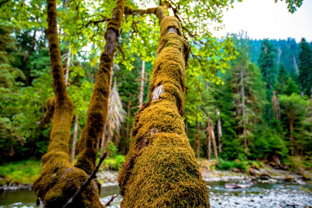
The Park Contains Some Of The Most Magnificent Rainforests You’re Ever Likely To See
If you’re looking to see some of the most magnificent rainforests that you’re ever likely to see then my advice is to head West of the Olympic Mountains.
There you’ll experience firsthand temperate rain forests, with abundant rainfall and verdant mossy forests.
Across Olympic National Park are multiple access points to lowland old-growth forests with, as mentioned above, towering Douglas fir and western Hemlocks. Some are up to 1,000 years old.
This area has a rich diversity of conifers, also including Sitka Spruce, Grand Fir, Western Redcedar, Western White Pine, and Lodgepole Pine.

If you’re interested in learning more about this amazing park then check out More Than Just Parks article: 16 (Fascinating) Olympic National Park Facts You Probably Didn’t Know
48. Petrified Forest National Park – Basic Facts
- Location: Arizona
- Acreage: 146,900 acres
- Visitation: The park averages about 645,000 visitors each year.
- Elevation: Petrified Forest National Park ranges in elevation from 5,307 to 6,262 feet and spans the Semi-Desert Grassland / Shrub Steppe and Pinyon-Juniper Woodland life zones.
- Climate: Petrified Forest National Park is a semi-arid grassland. Temperatures range from above 100° F to well below freezing. About 10 inches of moisture comes during infrequent snow in the winter and often violent summer thunder-storms.
- When Did It Become A National Park? Petrified Forest National Park was established by an act of Congress, disestablishing the national monument. President Dwight D. Eisenhower first approved the legislation in 1958, but President John F. Kennedy saw it completed in 1962.
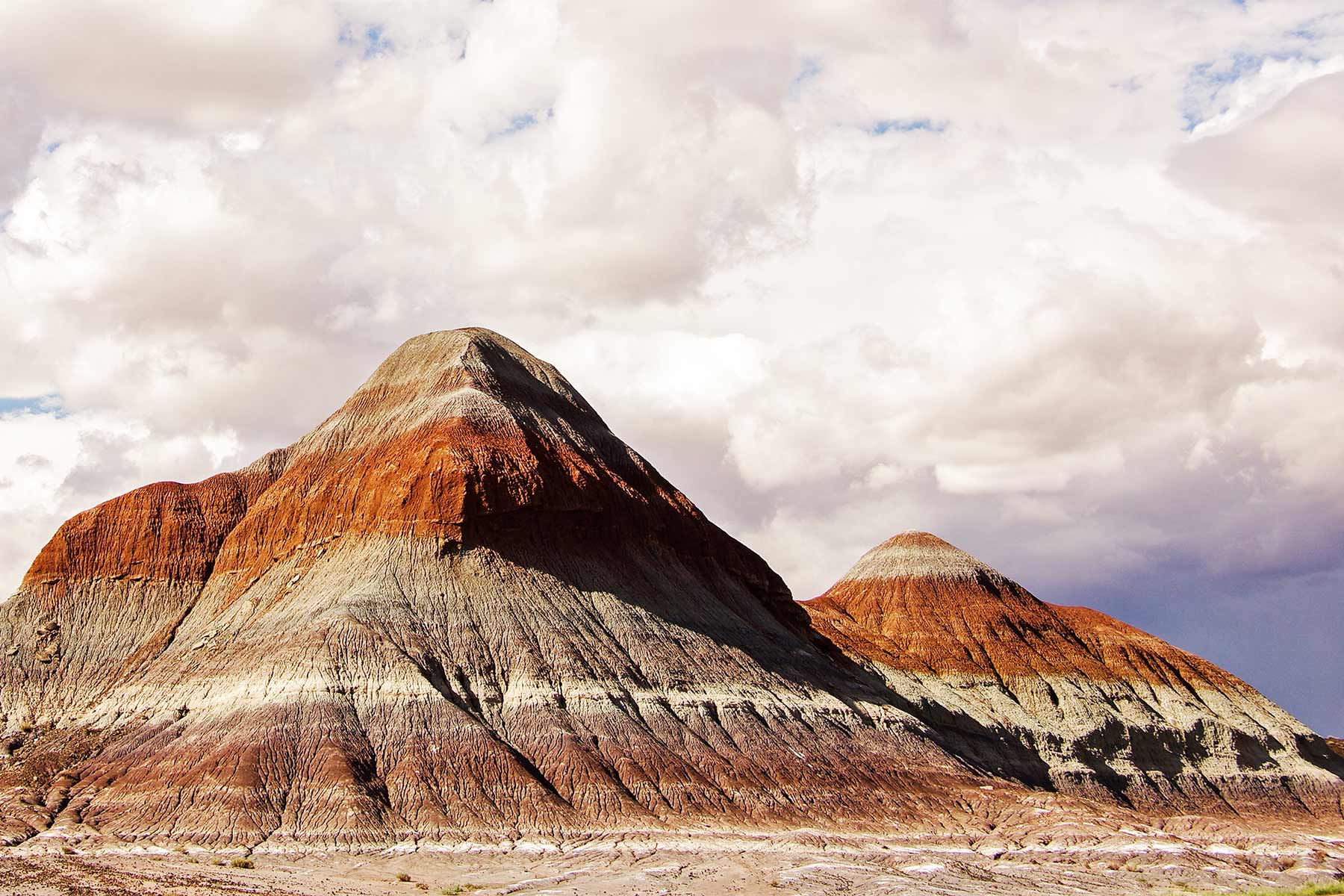
Fact – The Park Features One Of The Largest Petrified Forests In The World
Traveling to Petrified National Park can be an otherworldly experience at the park features one of the largest petrified forests in the world.
Petrified wood found in the park and the surrounding region is made up of almost solid quartz. Each piece is like a giant crystal, often sparkling in the sunlight as if covered by glitter. The rainbow of colors is produced by impurities in the quartz, such as iron, carbon, and manganese.
Over 200 million years ago, the logs washed into an ancient river system and were buried quickly and deeply enough by massive amounts of sediment and debris carried in the water, that oxygen was cut off and decay slowed to a process that would now take centuries.
Minerals, including silica dissolved from volcanic ash, absorbed into the porous wood over hundreds and thousands of years crystallized within the cellular structure, replacing the organic material as it broke down over time.
Sometimes crushing or decay left cracks in the logs, where large jewel-like crystals of clear quartz, purple amethyst, yellow citrine, and smoky quartz formed.

If you’re interested in learning more about this amazing park then check out More Than Just Parks article: Facts About Petrified Forest National Park
49. Pinnacles National Park – Basic Facts
- Location: California
- Acreage: It includes over 26,000 acres, much of which is designated wilderness.
- Visitation: In 2021, about 348,000 people visited Pinnacles National Park, one of the least visited parks in the National Park Service system and California’s newest, incorporated from a national monument in 2012.
- Climate: The climate of Pinnacles is typical of the Mediterranean climate of California, with cool wet winters and hot dry summers. Average rainfall is 16 inches per year, falling mostly from January through March.
- When Did It Become A National Park? Since 1908, Pinnacles National Monument has increased in bits and pieces to its present size of about 26,000 acres. On January 10, 2013 President Barack Obama signed legislation passed by Congress that re-designated the monument as a National Park.

Fact – Condors Played A Major Role In The Mythology Of Local Native American Tribes
One of the fascinating Pinnacles National Park Facts is the role played by condors in the mythology of the native peoples.
California condors held a special place in the lives and ceremonies of California natives. They were a revered creature, a master of the spirit, who gave power to humans for a variety of world renewal and cosmic purposes.
It was associated with death and mourning as well as rebirth and renewal. Indigenous peoples of North America have great respect for the California condor and see it as a symbol of power, often referred to as the “thunderbird” because of its large wings and powerful flight.
The condor was believed to escort the spirits of deceased relatives to the next world across the sea. A condor ceremony was traditionally held approximately every two years to honor and communicate with the dead.
The Amah Mutsun conducted a ceremony in 2011 to celebrate the return of the condor to Pinnacles National Park and work towards the conservation and recovery of all threatened and endangered species.

If you’re interested in learning more about this amazing park then check out More Than Just Parks article: 10 AMAZING Facts About Pinnacles National Park
50. Redwood National Park – Basic Facts
- Location: California
- Acreage: It covers an area of 172 square miles (445 square km), of which more than one-third is old-growth forest, and includes land held in three state parks: Jedediah Smith Redwoods, Del Norte Coast Redwoods, and Prairie Creek Redwoods.
- Visitation: Redwood National Park had 504,722 in 2019.
- Elevation: Elevations range from sea level to just over 3,000 feet.
- Climate: Coastal daytime temperatures range from the 50s in winter to the 60s in summer with occasional days in the 70s, although a greater range is found over inland areas.
- When Did It Become A National Park? After much controversy and compromise with timber companies, Congress finally approved a federal park, and on October 2, 1968, President Lyndon B. Johnson signed into law the act that established Redwood National Park.
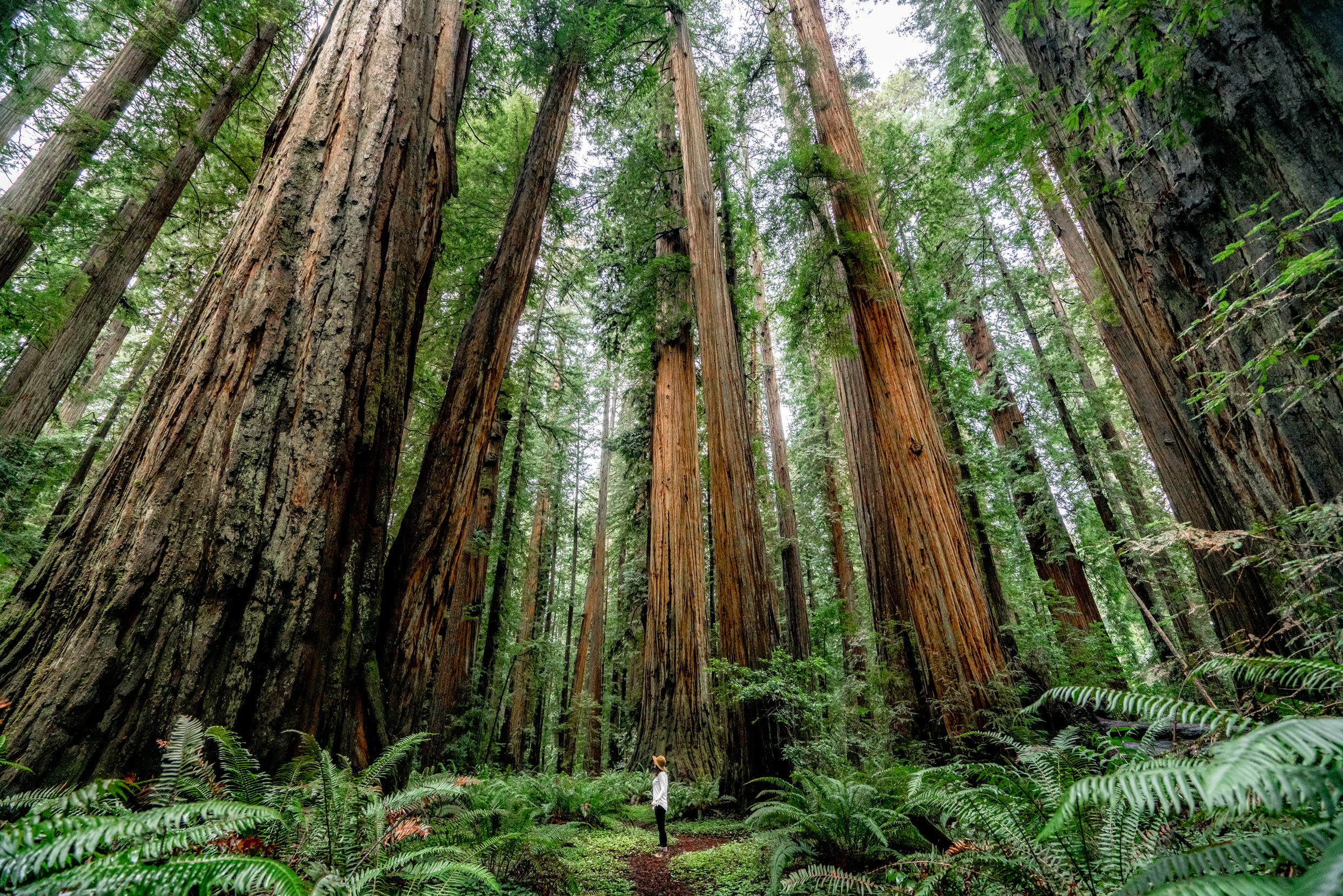
Fact – One Of The Most Spectacular Places To Visit Is The Lady Bird Johnson Grove
Among my favorite Redwood National Park Facts is one which honors a woman who was the most influential First Lady when it came to conservation.
The Lady Bird Johnson Grove is one of the most spectacular groves of ancient, old-growth Redwoods in the world. This grove is located near the town of Orick at about 1,000ft above sea level and is one of the most popular hikes in the park.
The trail itself is only about 1.3 miles long with little elevation gain making it great for folks of all ages and fitness levels.
Along with the Stout Grove, this is one of the most visited groves of Redwoods in the park.

If you’re interested in learning more about this amazing park then check out More Than Just Parks article: Facts About Redwood National Park To Know
National Parks Facts – From Rocky Mountain To Theodore Roosevelt National Park
51. Rocky Mountain National Park – Basic Facts
- Location: Colorado
- Acreage: Rocky Mountain National Park’s 415 square miles (265,807 acres) encompasses a spectacular range of mountain environments.
- Visitation: With over 4.5 million visitors every year, Rocky Mountain is one of the most visited parks within the National Park System.
- Elevation: Rocky Mountain is one of the nation’s highest national parks. With elevations from 7,860 feet to 14,259 feet, Rocky Mountain makes you feel like you are on top of the world. Within the park’s boundaries are 77 mountain peaks over 12,000 feet high and the Continental Divide.
- Climate: The Rocky Mountain Region encompasses a wide range of climates, from the semiarid shortgrass prairies to the cold and windy alpine tundra. The regional climate is influenced by moist air masses from the Pacific Ocean and the Gulf of Mexico, as well as by cold, dry air masses from Canada.
- When Did It Become A National Park? The park was established in 1915 when President Woodrow Wilson signed the Rocky Mountain National Park Act.

Fact – Most Of Rocky Mountain Is Wilderness
If you’re looking for a “true” wilderness” experience then Rocky Mountain National Park is a great place to visit.
Rocky Mountain National Park is known for its stunning wilderness areas, which cover a large portion of the park’s total land area. In fact, more than 95% of the park is designated as wilderness, making it one of the largest and most wilderness areas in the United States.
The wilderness areas of Rocky Mountain National Park are home to a range of plant and animal species, including elk, bighorn sheep, black bears, mountain lions, and many others.
Visitors to the park can enjoy a variety of outdoor activities in these wilderness areas, such as hiking, camping, and wildlife watching, all while surrounded by some of the most beautiful natural scenery in the world.

If you’re interested in learning more about this amazing park then check out More Than Just Parks article: Facts About Rocky Mountain National Park
52. Saguaro National Park – Basic Facts
- Location: Arizona
- Acreage: Saguaro National Park encompasses 91,327 acres in its two districts. The Eastern Rincon Mountain District rises to over 8,000 feet and includes over 128 miles of trails.
- Visitation: The national park had more than 1 million visitors in 2021.
- Elevation: The Tucson Mountain District of Saguaro National Park ranges from an elevation of 2,180 feet to 4,687 feet and contains 2 biotic communities, desert scrub, and desert grassland.
- Climate: The best time to visit Saguaro National Park is in the winter (December, February). Visitation during this time of year is low, temperatures are mild and pleasant with a few cold snaps possible here and there.
- When Did It Become A National Park? After setting aside vast areas as wilderness, Congress elevated Saguaro to National Park status in 1994.

Fact – Saguaro Has Some Of The World’s Best Hiking Trails
If you love to hike then you’ll find some of the most amazing hiking trails on the planet at Saguaro National Park.
Some of my favorites include:
- Freeman Homestead Trail (1 mile): Interpretive signs concerning the history and plant life along the way will take you deeper into the meaning of this “home in the desert”.
- Loma Verde Loop (3.8 miles, 60 feet elevation): Beyond a seasonally flowing wash (pictured), you’ll climb a bluff onto the bajada, the Spanish word for a gravel plain at the base of a mountain. Pass the Loma Verde Mine, and take a right on the Pink Hill Trail. A short spur trail leads to a fine overlook of the cactus forest and Tanque Verde Ridge.
- Hope Camp and Ridgeview Trail (2 miles, 400 feet elevation): Towards the end of the trail, incredible panoramic views and brilliant seasonal wildflowers fill the hillside. The trail ends at the top, which shows an incredible view into Box Canyon, a major drainage in the park. Waterfalls can be seen on the ridge during wetter times.
- Garwood Dam and Wildhorse Tank (6.4 miles): You’ll enter the kind of cactus forest that inspired the creation of this park in 1933. Stay on the Garwood trail until you hit the Carrillo trail, and take a left. A steep section will lead to the Garwood Dam, built by Nelson Gardwood in the 1950’s. (Source: NPS)

If you’re interested in learning more about this amazing park then check out More Than Just Parks article: Facts About Saguaro National Park
53. Sequoia National Park – Basic Facts
- Location: California
- Acreage: 328,315 acres
- Visitation: More than 1 million visitors come to take in the sights and experience the sequoia groves each year.
- Highest Elevation: Encompassing a vertical relief of nearly 13,000 feet (4,000 m), the park contains the highest point in the contiguous United States, Mount Whitney, at 14,505 feet above sea level.
- Lowest Elevation: The lower elevations of Sequoia National Park, up to about 4,000 feet in elevation. Forests of sequoias and other conifers in Sequoia, between about 5,000 and 7,000 feet in elevation.
- Average annual precipitation: These elevations receive an average of 40 to 45 inches of precipitation annually. Much of this falls during the winter, resulting in a deep blanket of snow from December to May.
- When Did It Become A National Park? Sequoia National Park was established on September 25, 1890, making it our country’s second national park. [Please Note:: Fifty years later, on March 4, 1940, Congress established Kings Canyon National Park, which is adjacent to the north boundary of Sequoia.]

Fact – Sequoia Features The Nation’s Largest Tree
The General Sherman Tree, located in Sequoia National Park, is widely considered to be the largest tree in the world. This massive tree is a giant sequoia, a species of tree known for its enormous size and long lifespan.
The General Sherman Tree stands at a height of 275 feet (83.8 meters) and has a diameter of 25 feet (7.7 meters) at its base. Its estimated age is between 2,300 and 2,700 years old, making it one of the oldest living organisms on the planet.
Visitors to Sequoia National Park can see the General Sherman Tree up close by taking a short walk along a paved trail that leads to the tree’s base. The park also offers a variety of other activities and attractions, including hiking, camping, and stunning mountain scenery.

How Did the General Sherman Tree Get its Name?
How did the General Sherman Tree get its name? That’s an interesting story. In 1879, a cowboy and fur trapper by the name of James Wolverton is reported to have discovered the tree. It was the biggest tree Wolverton had ever seen.
Wolverton had served under General William Tecumseh Sherman as a lieutenant in the 9th Indiana Calvary. He therefore decided to name the tree after his commanding officer.
The tree itself is located on the General’s Highway with the second largest tree in the world (named after another general) located just down the road.
William Tweed set out to prove whether, in fact, this story is true. He writes, “Not until 1897, in fact, did soldiers first write down the name “General Sherman Tree” in a report. That summer, they placed a sign on the tree with that name.”
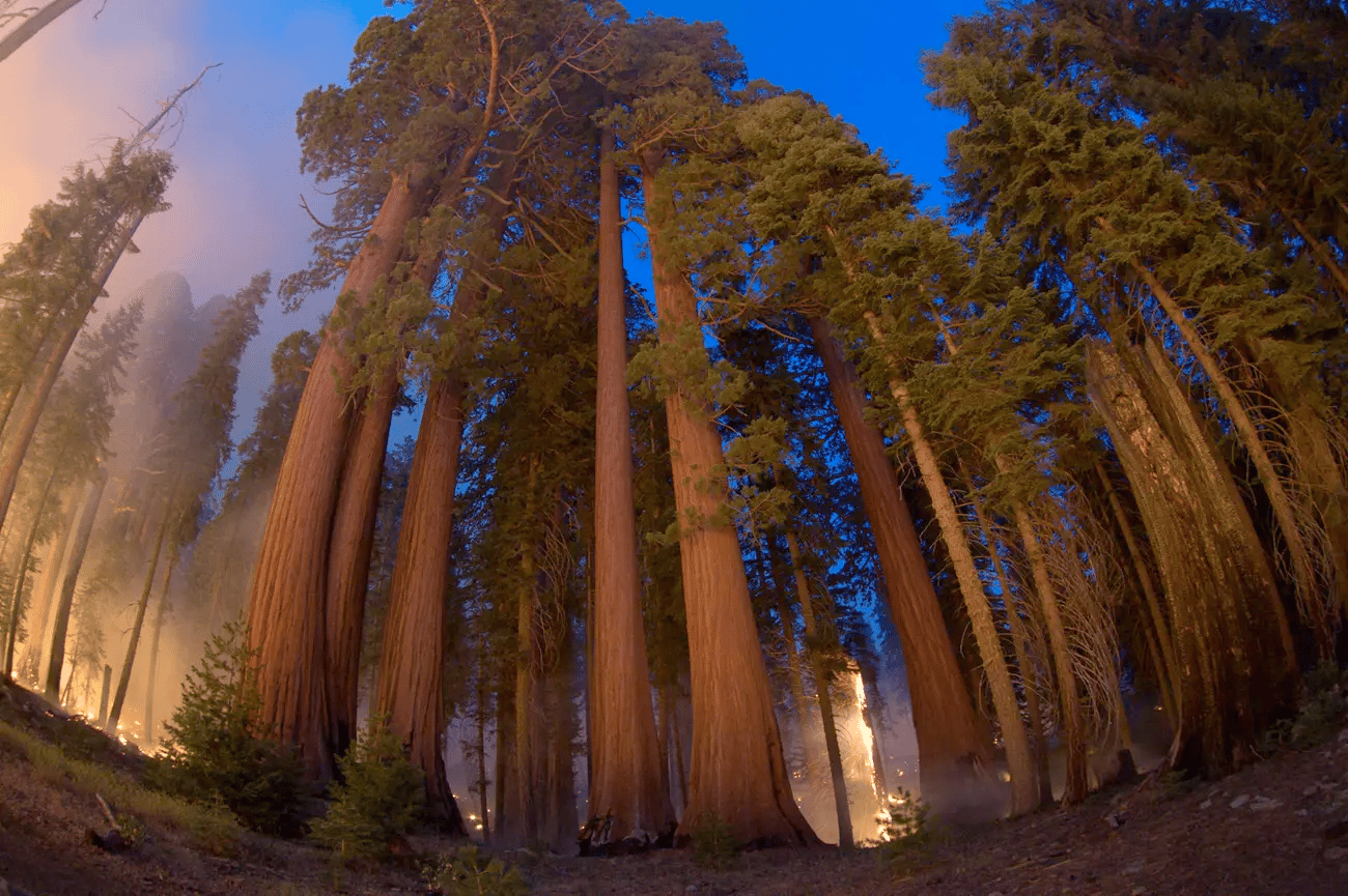
If you’re interested in learning more about this amazing park then check out More Than Just Parks article: Facts About Sequoia National Park
54. Shenandoah National Park – Basic Facts
- Location: Virginia
- Acreage: 199,200 acres
- Visitation: Over a million people enter Shenandoah National Park’s gates each year, most taking the Skyline Drive to vantage points along 105 miles of the Blue Ridge Mountains.
- Highest Elevation: The highest point in Shenandoah is the summit of Hawksbill Mountain at 4,050 feet. Getting to the summit entails a relatively short hike of less than 2 miles.
- Lowest Elevation: The park contains a wide array of ecology as it rises from a mere 550 feet at its lowest elevation to over 4,049 feet at its highest atop Hawksbill.
- Climate: In Shenandoah, the summers are warm and humid, the winters are very cold and snowy, and it is partly cloudy year round. Over the course of the year, the temperature typically varies from 26°F to 86°F and is rarely below 12°F or above 93°F.
- When Did It Become A National Park? Shenandoah National Park in the northern Blue Ridge Mountains of Virginia was created in 1926 to preserve an area of natural beauty and provide recreational opportunities for the people in the surrounding region.

Fact – The Park Was Created By The Civilian Conservation Corps
For a history buff such as myself, one of the more intriguing Shenandoah National Park Facts is the role played by the Civilian Conservation Corps in its creation.
As part of the New Deal Program, to help lift the United States out of the Great Depression, President Franklin D. Roosevelt established the Civilian Conservation Corps (CCC) in 1933.
The CCC allowed single men between the ages of 18 and 25 to enlist in work programs to improve America’s public lands, forests, and parks.
The first Civilian Conservation Corps camps in a national park were in Shenandoah with the very first one being in the Skyland area in 1933.
It housed the workers that built the Blue Ridge Parkway and created the infrastructure to support Shenandoah National Park.
As a matter of fact, President Roosevelt took a highly publicized trip to visit a Civilian Conservation Core camp in the Shenandoah National Park.
Considered by many to be one of the most successful of Roosevelt’s New Deal programs, the CCC planted more than three billion trees and constructed trails and shelters in more than 800 parks nationwide during its nine years of existence. The CCC helped to shape the modern national and state park systems we enjoy today.

If you’re interested in learning more about this amazing park then check out More Than Just Parks article: Facts About Shenandoah National Park
55. Theodore Roosevelt National Park – Basic Facts
- Location: North Dakota
- Acreage: Theodore Roosevelt National Park protects more than 70,000 acres over three park units. Of the 70,446.89 total acres, 29,920 acres are designated Wilderness Area.
- Visitation: Theodore Roosevelt National Park receives nearly 600,000 visitors each year. Although the park is open year-round, the busiest months are June, July, and August.
- Elevation: The park’s highest elevation is 2198 feet.
- Climate: Summers are warm with average high temperatures in the 70s and 80s°F. Winters are cold with average lows in the single digits December through February. Wind is considerable year-round.
- When Did It Become A National Park? On April 25, 1947, after several compromises, President Truman signed the bill (PL-38) that created Theodore Roosevelt National Memorial Park. This included lands that roughly make up the South Unit and the Elkhorn Ranch site today.
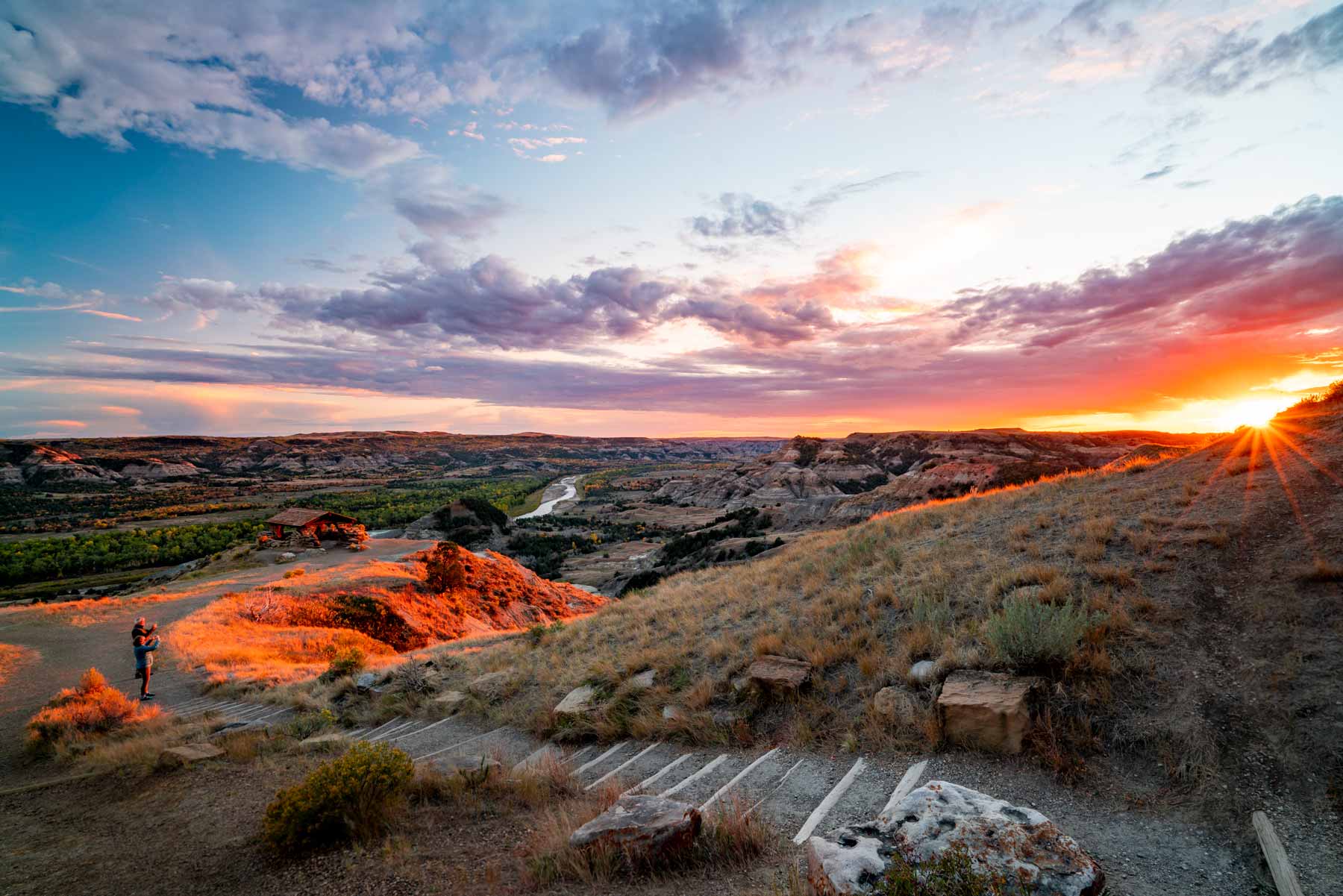
Fact – Theodore Roosevelt Spent His Formative Years In The Badlands
It’s not possible to examine the fascinating facts surrounding Theodore Roosevelt National Park without focusing on the man whom the park is named after.
It was Theodore Roosevelt himself who once said, “I would not have been president had it not been for my experience in North Dakota.”
In 1883, at the age of 24, young Theodore Roosevelt was lured in to the Badlands by an acquaintance promoting the area as prime ranch lands.
Excited about the prospects for an open-range cattle industry, he invested in a ranch along the Little Missouri River near Medora before returning to New York.
His aim then was to kill a bison before there were no more left on the continent and to get a taste of the real American west.
Upon arriving he was quickly mesmerized by the otherworldly landscapes and natural beauty of the area. The clean air was also a great remedy for his chronic asthma.

If you’re interested in learning more about this amazing park then check out More Than Just Parks article: Facts About Theodore Roosevelt National Park
National Parks Facts – From Virgin Islands To Wrangell-St. Elias National Park
56. Virgin Islands National Park – Basic Facts
Virgin Islands National Park is a United States National Park that is located on the island of St. John in the United States Virgin Islands.
The park covers about two-thirds of the island and is home to a wide variety of plant and animal life, as well as several historical and cultural sites.
Its beaches, reefs, and forests are popular with visitors for activities such as hiking, snorkeling, and picnicking.
The park also includes several historical sites, such as the Annaberg Sugar Plantation and the Caneel Bay Plantation, which offer a glimpse into the island’s past.
Virgin Islands National Park is known for its beauty and ecological importance. It’s a popular destination for both tourists and researchers.

Fact – Virgin Islands Has Some Amazing Beaches
Of course, when you’re thinking about a trip to Virgin Islands National Park, the first thought that likely comes to mind is spending time on some amazing beaches. Trust me, this park will not disappoint you.
One of my favorite Virgin Islands National Park Facts has to do with the amazing beaches available to visitors at this park.

Check Out My Favorite Beaches At Virgin Islands National Park
Below are some of my favorite beaches to visit:
- Salomon/Honeymoon Bay: This place features two white-sand beaches, can be accessed by a short hike from the Virgin Islands National Park sign off North Shore Road, Caneel Bay or by boat. A narrow reef follows the shoreline east of Honeymoon to Caneel Bay. These reef areas provide shelter for a wide variety of colorful fish and other marine creatures.
- Hawksnest Bay: This beach offers three fingers of coral reefs that jut out directly from the shoreline. It is not advisable to snorkel directly over the reef but rather stick to the perimeter of the reefs.The shallow water directly above the reef is dangerous for snorkelers, especially when sea conditions are less than ideal. Snorkeling around the fingers you will see many juvenile fish and other reef creatures in and among the branches of the Elkhorn corals.
- Trunk Bay: It’s the most famous beach in Virgin Islands National Park, often listed among the most beautiful beaches in the world. Trunk Bay is the only beach on St. John with an amenity fee, which is $5 per entrant. These amenities include showers, foot rinses, food and beverage concessions, snorkel rentals, and more. Trunk Bay is also home to the Underwater Snorkel Trial, a great place for beginners and anyone who wants to learn about marine life by reading the plaques along the trail. (Source: NPS)

If you’re interested in learning more about this amazing park then check out More Than Just Parks article: Facts About Virgin Islands National Park
57. Voyageurs National Park – Basic Facts
- Location: Minnesota
- Acreage: Voyageurs National Park is one of the nation’s wildest, most remote, and unique national parks, stretches 55 miles along the Minnesota-Ontario border, encompassing 218,055 acres of land and water. Over 900 acres of privately-owned properties remain within the park.
- Visitation: There were 232,974 visitors in 2019.
- Elevation: Voyageurs’ lowest point is 1,108 feet at Rainy Lake. The highest point in Voyageurs is 1,410 feet near Mead Wood Road.
- Climate: Voyageurs National Park has a warm summer continental climate, which means it has short, mild summers followed by long winters. Spring, and more especially autumn, are short, mild transition seasons. The air is temperate during June, July, and August when periods of mild weather prevail.
- When Did It Become A National Park? Voyageurs National Park was established in 1975.

Fact – Voyageurs Is A Water-Based Park
Voyageurs National Park is primarily a water-based park, with over 40% of its area consisting of lakes, rivers, and wetlands. The park’s landscape was shaped by glaciers thousands of years ago, leaving behind a network of interconnected waterways that make it a popular destination for boating, fishing, and other water-based activities.
The park also has numerous hiking trails, campsites, and other recreational opportunities, but its focus on water-based activities is what sets it apart from many other national parks.

If you’re interested in learning more about this amazing park then check out More Than Just Parks article: Voyageurs National Park Facts
58. White Sands National Park – Basic Facts
- Location: New Mexico
- Acreage: 145,800 acres
- Visitation: White Sands National Park is the most visited NPS site in New Mexico, visited by 782,469 people in 2021.
- Elevation: The elevation at White Sands is 4,235 feet.
- Climate: June through August, daytime temperatures average 95ºF (35ºC), with some days reaching as high as 110ºF (38º). Evenings are much cooler, ranging from 50-65ºF (10-18ºC).
- When Did It Become A National Park? White Sands was established as a national monument in 1933 and re-desginated as a national park in 2019.

Fact – White Sands Has The Largest Gypsum Dune Field In The World
White Sands National Park has the largest gypsum dune field in the world. The dunes cover over 275 square miles (710 square kilometers) of the park’s total area of 145,000 acres (58,000 hectares).
Gypsum is a soft, white mineral that forms the dunes at White Sands, and the constant shifting of the sand creates ever-changing patterns and shapes on the dunes.
The park is a popular destination for hiking, picnicking, and sledding down the dunes, and it also offers opportunities for camping, stargazing, and wildlife watching.

If you’re interested in learning more about this amazing park then check out More Than Just Parks article: 10 Fantastic Facts About White Sands National Park
59. Wind Cave National Park – Basic Facts
- Location: South Dakota
- Acreage: The park covers an area of approximately 28,295 acres.
- Visitation: The park averages around 125,000 visitors yearly.
- Elevation: Situated at an elevation of 5,013 feet, the highest point in the national park, the tower provides a panoramic view of southeastern Black Hills and the surrounding Great Plains.
- Climate: Wind Cave National Park and the southern Black Hills are generally warmer and drier than the northern hills. Winter snowfall averages 30 inches annually. Spring and fall days vary from sunny and warm to cool, rainy, and windy. Summer brings warm daytime temperatures with cool evenings. Severe thunderstorms are common in June and July and can produce large hail and severe lightning. Slow moving storms can dump large amounts of rain over a small area, leading to flash flooding. (Source: NPS)
- When Did It Become A National Park? President Theodore Roosevelt signed legislation making Wind Cave a National Park on January 9, 1903.

Fact – It’s The 6th Longest Mapped Cave In The World
Wind Cave is the 6th longest mapped cave in the world because of its extensive and complex network of passages and chambers.
The cave is a “complex maze” type, meaning it has a large number of interconnected passages and a high degree of interconnection, making it difficult to fully map. The total length of the mapped passages in Wind Cave is over 140 miles (225 km), making it one of the longest caves in the world.
Wind Cave was formed by the dissolution of limestone and dolomite rock by groundwater. Over thousands of years, the water eroded the rock and created the extensive passages that make up the cave today.
The constant flow of air through the cave’s entrance is caused by differences in atmospheric pressure between the inside and outside of the cave, which creates a “wind” effect. This wind has helped to keep the passages of the cave open and accessible, allowing for further exploration and mapping of its interior.
Mapping the cave is a long and challenging process that involves surveying and measuring each passage, chamber, and formation in the cave.
The map is constantly being updated as new passages are discovered and explored. The length of the cave and its complex network of passages make Wind Cave one of the most fascinating and intriguing geological features in the world.
If you’re interested in learning more about this amazing park then check out More Than Just Parks article: Facts About Wind Cave National Park
60. Wrangell-St. Elias National Park – Basic Facts
- Location: Alaska
- Acreage: America’s Largest National Park. Wrangell-St. Elias is a vast national park that rises from the ocean all the way up to 18,008 ft. At 13.2 million acres, the park is the same size as Yellowstone National Park, Yosemite National Park, and Switzerland combined!
- Visitation: The park had slightly under 75,000 visitors in 2019.
- Elevation: Elias, at 18,008 feet (5.5km), is the second highest peak in the United States. Nine of the 16 highest peaks in the United States. Mt. Wrangell, at 14,163 feet (4.3km), is one of the largest active volcanoes in North America.
- Climate: Wrangell St. Elias has an interior continental climate (long, extremely cold winters, and short, warm, relatively dry summers).
- When Did It Become A National Park? On November 12, 1980, President Carter designated 13.2 million acres of land as Wrangell St. Elias National Park and Preserve.
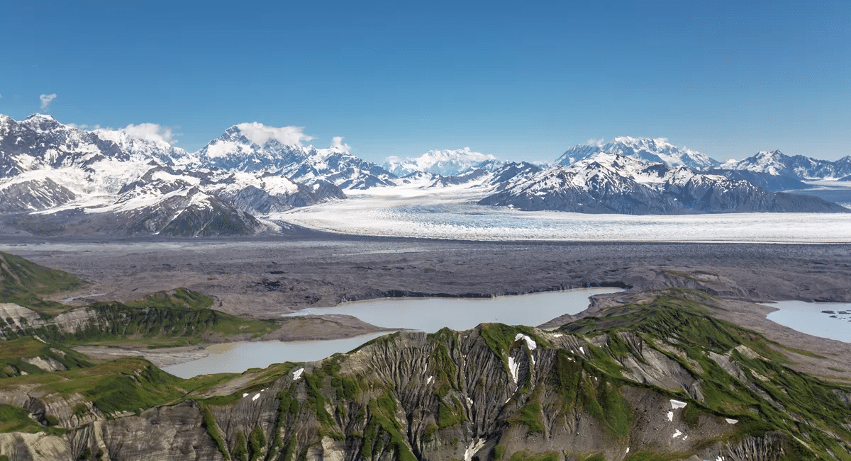
Fact – The Park Features A Historic Landmark
The Kennecott Mines National Historic Landmark, located in Wrangell-St. Elias National Park and Preserve in Alaska, was once one of the richest copper mines in the world.
The mines were discovered in 1900 by a group of prospectors and were operated by the Kennecott Copper Corporation from 1911 to 1938. During its peak years, the Kennecott Mines produced millions of dollars’ worth of copper ore and helped spur the development of the region and the growth of the Alaskan economy.
The town of Kennecott, which was built near the mines to support the mining operations, was a thriving community, with a population of over 2,000 people at its peak.
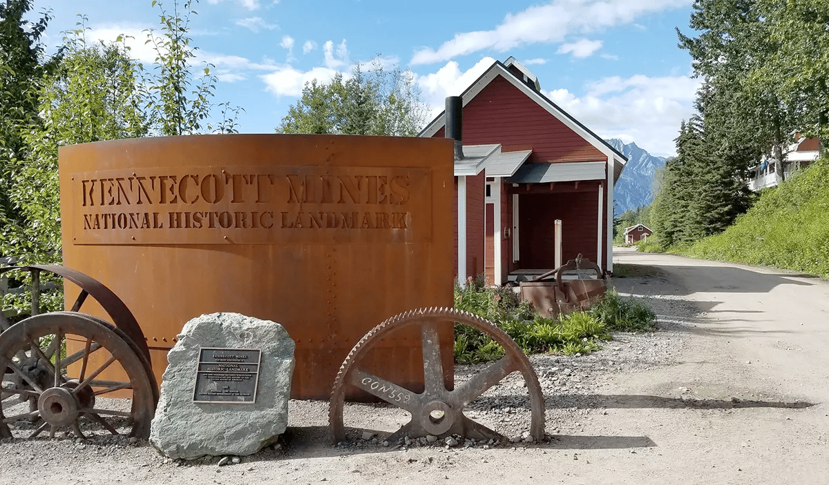
Things To Do
The Kennecott Mines National Historic Landmark in Alaska offers several things to see and do, including:
- Guided tours of the historic copper mine and mill town
- Visiting the museum and exhibits showcasing the history of mining in the area
- Hiking the scenic trails in the surrounding wilderness
- Photography opportunities of the unique mining structures and scenic views
- Panning for gold in the nearby creeks.
Visitors can learn about the history of copper mining and the role it played in the development of Alaska and the United States. The site provides a unique opportunity to see a well-preserved example of early 20th century mining operations.
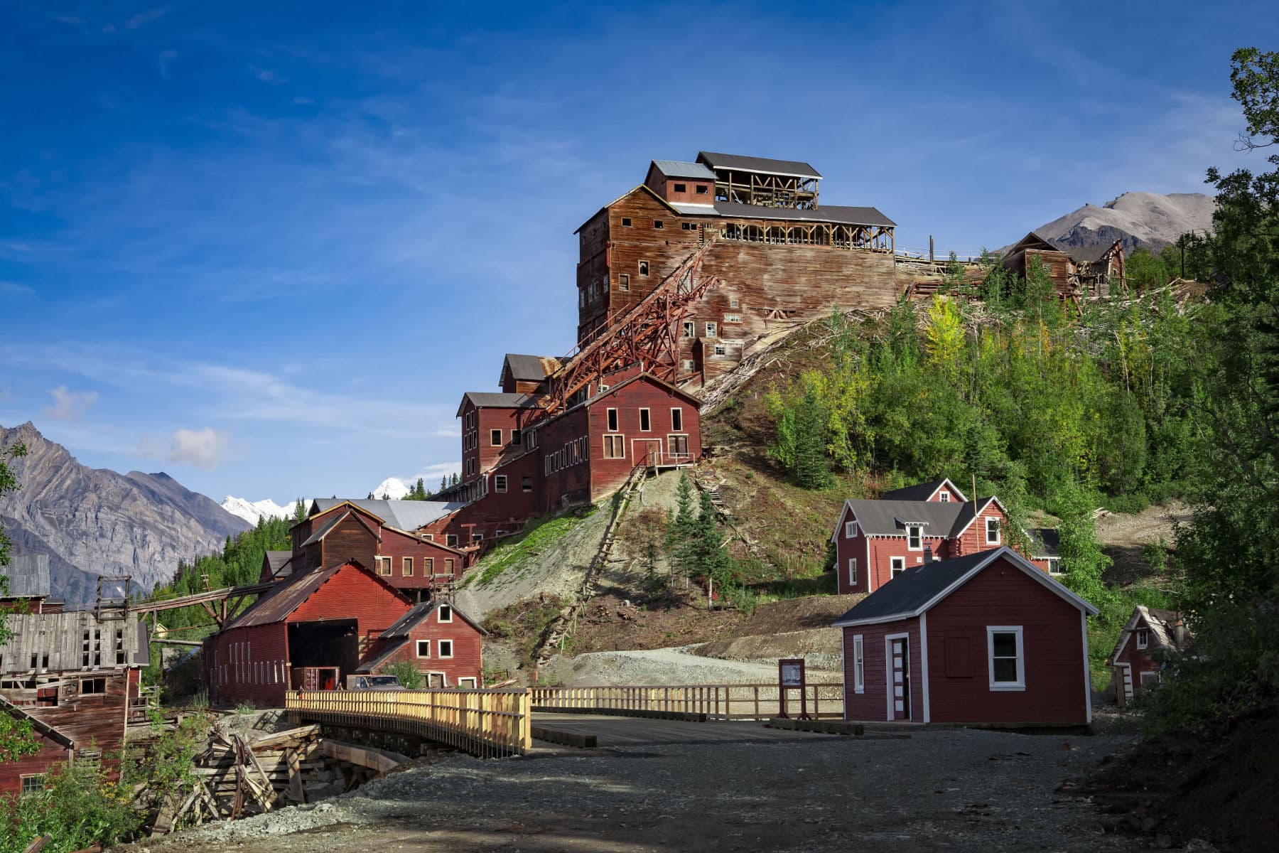
If you’re interested in learning more about this amazing park then check out More Than Just Parks article: Facts About Wrangell-St. Elias National Park
National Parks Fact – Yellowstone Through Zion National Park
61. Yellowstone National Park – Basic Facts
- Location: Idaho, Montana & Wyoming
- Acreage: Yellowstone encompasses 3,472 square miles (2,221,766 acres) which makes it larger than Rhode Island and Delaware combined.
- Visitation: The park hosted 4,860,537 recreation visits in 2021, up 28% from 2020 (3,806,306 visits), making it the busiest year on record.
- Highest Elevation: 11,372 feet.
- Lowest Elevation: The lowest point in Yellowstone is Reese Creek at 5,282 feet.
- Climate: In Yellowstone National Park, the summers are short, comfortable, dry, and mostly clear and the winters are freezing, snowy, and partly cloudy. Over the course of the year, the temperature typically varies from 4°F to 76°F and is rarely below -15°F or above 84°F.
- When Did It Become A National Park? Yellowstone became a national park on March 1, 1872. When President Ulysses S. Grant signed the Yellowstone National Park Protection Act into law, it protected more than 2 million acres of mountain wilderness, amazing geysers and vibrant landscapes for future generations to enjoy.

Fact – More Than 1,850 Archaeological Sites Have Been Documented In Yellowstone National Park
One of the fascinating Yellowstone National Park Facts has to do with the incredible number of documented archaeological sites in the park.
There are also several historic period sites in the park that date back to the early 1800s when Euro-American explorers, mountain men, and settlers first arrived in the area.
These sites include trapper cabins, homesteads, and mining operations.
The park also contains several historic buildings from the early days of the park, including the Old Faithful Inn, which was built in 1903 and is considered one of the best examples of National Park Service rustic architecture.
Overall, the rich cultural history of Yellowstone provides a glimpse into the lives and experiences of the people who have lived and traveled through the park over thousands of years.
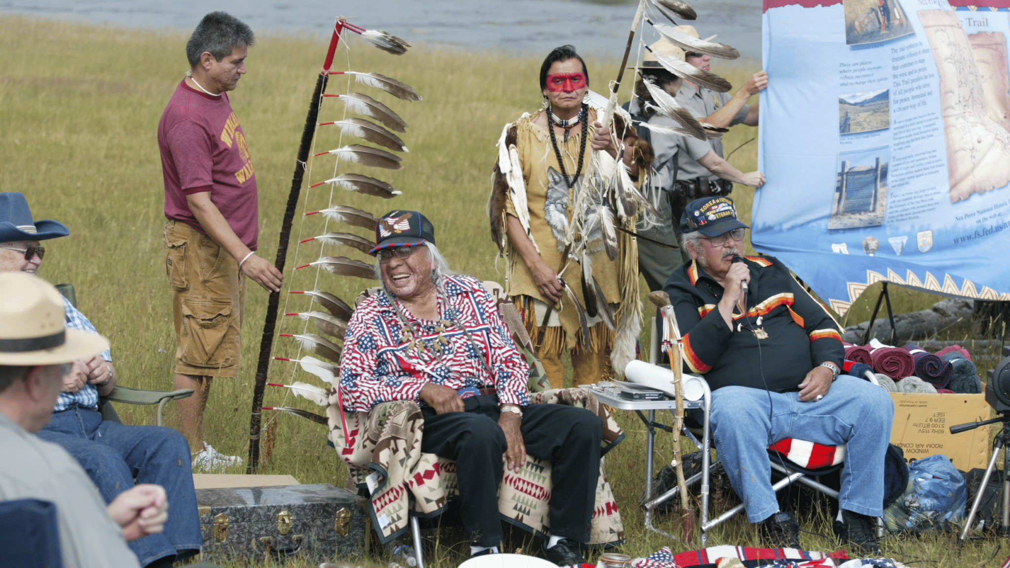
Clovis People In Yellowstone
The Paleoindian Period refers to a time approximately 12,000 years ago at the end of the last ice age when humans first appeared in the archeological record in North America.
One of the original groups to enter what is now Canada and the United States was the Clovis culture. Based on archaeological evidence, approximately 11,000 years ago Clovis peoples were traveling across Yellowstone.

If you’re interested in learning more about this amazing park then check out More Than Just Parks article: 18 (Fascinating) Yellowstone National Parks Facts You Probably Didn’t Realize
62. Yosemite National Park – Basic Facts
- Location: California
- Acreage: Yosemite National Park covers an area of 747,956 acres along the central western slopes of the Sierra Nevada mountain range in east-central California.
- Visitation: Yosemite had 3.3 million visitors in 2021.
- Highest Elevation: Mount Lyell is the highest point in Yosemite National Park, at 13,114 feet (3,997 m). It is located at the southeast end of the Cathedral Range, 11⁄4 miles (2 kilometers) northwest of Rodgers Peak. The peak as well as nearby Lyell Canyon is named after Charles Lyell, a well-known 19th century geologist.
- Lowest Elevation: The lowest elevations in Yosemite are found on the western boundary of the park at the El Portal Administrative Site, which is at approximately 1,800 feet (549 m). This is the foothill-woodland zone, an area that is hot and dry in the summer with very little or no snow in the winter.
- Climate: Weather tends to be quite variable. It can be hot, cold, dry, rainy, or snowy. Winter generally lasts from December until March. Weather is usually snowy and cold, but sunny and mild days do occur.
- When Did It Become A National Park? On October 1, 1890, Yosemite became a national park.

Fact – Yosemite Is Our Nation’s Third National Park, But It Shaped The Idea Of The National Parks
Yosemite was the first park actually protected by the federal government, but the third national park.
President Abraham Lincoln signed the Yosemite Valley Grant Act, Senate Bill 203, on June 30, 1864.
The legislation gave California the Yosemite Valley and the nearby Mariposa Big Tree Grove “upon the express conditions that the premises shall be held for public use, resort, and recreation.”
This action extended protection to the Mariposa Grove and Yosemite Valley.

Every blade of grass is a study; and to produce two, where there was but one, is both a profit and a pleasure.
-president abraham lincoln
Setting An Important Precedent
This was the first time the federal government acted to protect land because of its natural beauty. It established an important precedent that the government could do this.
Future presidents, beginning with Ulysses S. Grant eight years later, used Lincoln’s action to justify further moves to protect additional public lands.
So, while Yosemite was America’s third national park, the important precedent which it established formed the pattern for future park acquisitions.

America’s First National Park? Not So Fast…
Some would argue that Lincoln’s action made Yosemite the nation’s first national park, but, in fact, he made the lands a public trust of the state of California not the United States of America.
The first time public lands were set aside as a “national” park would be in 1872 when President Ulysses S. Grant signed legislation creating Yellowstone National Park.

If you’re interested in learning more about this amazing park then check out More Than Just Parks article: 16 Yosemite National Park Facts Which Will Amaze You
63. Zion National Park – Basic Facts
- Size: Approximately 229 square miles (593 square kilometers).
- Elevation: The elevation at the park ranges from 4,000 feet (1,220 meters) to 8,726 feet (2,660 meters) at the summit of Horse Ranch Mountain.
- Climate: The park experiences a semi-arid climate, with hot summers and cool winters.
- Geology: Zion is famous for its spectacular rock formations, including towering sandstone cliffs, deep canyons, and unique rock formations such as the iconic “Checkerboard Mesa.”
- Wildlife: The park is home to a variety of wildlife, including deer, mountain lions, bighorn sheep, and more.
- Visitors: Zion National Park receives over 4 million visitors annually, making it one of the most popular national parks in the United States.
- Recreational opportunities: The park offers a variety of recreational opportunities, including hiking, camping, rock climbing, and scenic drives. The most famous hike is Angels Landing, which provides breathtaking views of the surrounding landscape.

Fact – An American President Marveled At The Wonders Of Zion National Park
One of the fascinating Zion National Park Facts is the story of an American President who journeyed to the region and marveled at the wonders of what was then one of America’s newest national parks.
In 1923, four years after Zion had become a national park, President Warren G. Harding made a visit to southern Utah was part of a broader tour of the western United States designed to bring him “closer to the people and their conditions.”
Harding was impressed by the natural beauty of Zion National Park and the surrounding area and predicted that future Presidents would follow in his footsteps and visit the area.
This visit helped to bring national attention to Zion National Park and helped to establish it as a popular tourist destination.

If you’re interested in learning more about this amazing park then check out More Than Just Parks article: 12 Fantastic Facts About Zion National Park
Map Of America’s National Parks
List Of America’s National Parks
- Acadia National Park, Maine
- Arches National Park, Utah
- Badlands National Park, South Dakota
- Big Bend National Park, Texas
- Biscayne National Park, Florida
- Black Canyon of the Gunnison National Park, Colorado
- Bryce Canyon National Park, Utah
- Canyonlands National Park, Utah
- Capitol Reef National Park, Utah
- Carlsbad Caverns National Park, New Mexico
- Channel Islands National Park, California
- Congaree National Park, South Carolina
- Crater Lake National Park, Oregon
- Cuyahoga Valley National Park, Ohio
- Death Valley National Park, California & Nevada
- Denali National Park, Alaska
- Dry Tortugas National Park, Florida
- Everglades National Park, Florida
- Gates of the Arctic National Park, Alaska
- Gateway Arch National Park, Missouri
- Glacier Bay National Park, Alaska
- Glacier National Park, Montana
- Grand Canyon National Park, Arizona
- Grand Teton National Park, Wyoming
- Great Basin National Park, Nevada
- Great Sand Dunes National Park, Colorado
- Great Smoky Mountains National Park, North Carolina and Tennessee
- Guadalupe Mountains National Park, Texas
- Haleakala National Park, Hawaii
- Hawai’i Volcanoes National Park, Hawaii
- Hot Springs National Park, Arkansas
- Indiana Dunes National Park, Indiana
- Isle Royale National Park, Michigan
- Joshua Tree National Park, California
- Katmai National Park, Alaska
- Kenai Fjords National Park, Alaska
- Kings Canyon National Park, California
- Kobuk Valley National Park, Alaska
- Lake Clark National Park, Alaska
- Lassen Volcanic National Park, California
- Mammoth Cave National Park, Kentucky
- Mesa Verde National Park, Colorado
- Mount Rainier National Park, Washington
- National Park of American Samoa, American Samoa
- New River Gorge National Park, West Virginia
- North Cascades National Park, Washington
- Olympic National Park, Washington
- Petrified Forest National Park, Arizona
- Pinnacles National Park, California
- Redwood National Park, California
- Rocky Mountain National Park, Colorado
- Saguaro National Park, Arizona
- Sequoia National Park, California
- Shenandoah National Park, Virginia
- Theodore Roosevelt National Park, North Dakota
- Virgin Islands National Park, Virgin Islands
- Voyageurs National Park, Minnesota
- White Sands National Park, New Mexico
- Wind Cave National Park, South Dakota
- Wrangell-St. Elias National Park, Alaska
- Yellowstone National Park, Idaho, Montana, and Wyoming
- Yosemite National Park, California
- Zion National Park, Utah
Meet The Parks Brothers

We Hope You’ll Follow Our Journey
Our goal here at More Than Just Parks is to share the beauty of America’s national parks and public lands through stunning short films in an effort to get Americans and the world to see the true value in land conservation.
We hope you’ll follow our journey through the parks and help us to keep them the incredible places that they are. If you’re interested in joining the adventure then sign up below!
Helpful Articles
America's National Parks: All 63 US National Parks Ranked By Experts
America’s National Park Rangers: A Brief (& Informative) History Of America’s National Park Rangers
National Monuments: Ultimate List Of National Monuments
National Landmarks: 25 Bucket List Famous Landmarks In America (Must-SEE)


