We’ve hiked in Guadalupe Mountains National Park and made it to the top of Guadalupe Peak, the highest point in Texas. It’s one of the more under-the-radar parks in the Southwest, and that low profile means you’ll have the trails largely to yourself. If you’re pairing it with a Carlsbad Caverns visit, don’t skip it.
At the same time, you get the beauty of spring wildflowers like Death Valley, sand dunes similar to White Sands National Park, and hikes to challenge Zion and Yosemite. Not to mention that the underbelly of this reef is walkable at Carlsbad Caverns National Park just 30 minutes away.
About as many people visit Zion National Park in December as visit Guadalupe Mountains National Park in a year. Just the way I like it.
Table Of Contents: 12 BEST Guadalupe Mountains National Park Hikes
10 Quick Planning Tips for Guadalupe
- The entrance fee is $10 per person, which can be purchased on Recreation.gov or at severe locations within Guadalupe Mountains National Park. If you have the Interagency “America the Beautiful” Pass, it will allow three adults with you to enter for free.
- The closest gas stations to the park sit anywhere from 35 to 120 miles away. Gas up accordingly.
- Guadalupe Mountains National Park is in the Mountain Time Zone, and the odds are that your mobile phone or vehicle will display the wrong time.
- You’ll cover a lot of ground here, and mobile service is spotty at best. I recommend a map of Guadalupe Mountains National Park and a guidebook to help you plan your trip.
- Our hotel recommendation is in Carlsbad, but keep in mind that the remoteness of Guadalupe Mountains National Park means you won’t find developed rows of hotels any closer.
- The Guadalupe Mountains National Park HQ nixes rock climbing, saying the limestone rock fractures and crumbles too easily.
- “The highest point in Texas is not a toilet.” Those park superintendent words started a requirement that all backcountry explorers show proof of a commercial toilet bag that is landfill-safe. Here’s a trail toilet we recommend.
- No central road or scenic drive connects different areas of the park. Plan for a lot of driving if you want to see different areas. Bring a high-clearance vehicle to explore all the roads.
- Guadalupe Mountains National Park hikes are known for being windy, especially from late fall through March. Exposed trails increase in difficulty in winds higher than 40 miles per hour. Never hike in more than 55 miles per hour winds.
- It’s pronounced “Gwad-uh-loop-pay” Mountains, not “Guad-uh-loop.”
Guadalupe Mountains National Park Overview
If you want to skip the overview and park sections, you can go right to the Best Guadalupe Mountains National Park Hikes.
You’ll find eight of the tallest peaks in Texas inside Guadalupe Mountains National Park. The mountain range extends beyond the park boundaries, connecting to Lincoln National Forest to the north and Carlsbad Caverns National Park to the northeast.
Where You’re Going, You Won’t Need Roads
This rather roadless region of 686,400 acres suffered less from a lack of planning and more from the timeline of its inception into the National Park system. The park was authorized in 1966, but not established until 1972. After wilderness designations, all but 5% of this park is in the designated wilderness or eligible wilderness.
The potential downside is that getting from Dog Canyon to Pine Springs, a seven-mile route as the crow flies, takes a 100-mile driving detour around the mountains. However, each nook of the park offers a new landscape to explore. I have a few side roads for you, too.
Guadalupe Mountains National Park Map
13 trails mapped — click a pin to learn more
Guadalupe Mountains National Park at a Glance
3 alertsI won’t go too scientific on you for this, but there are so many cool things to know as you meander through valleys, deserts, and waterways.
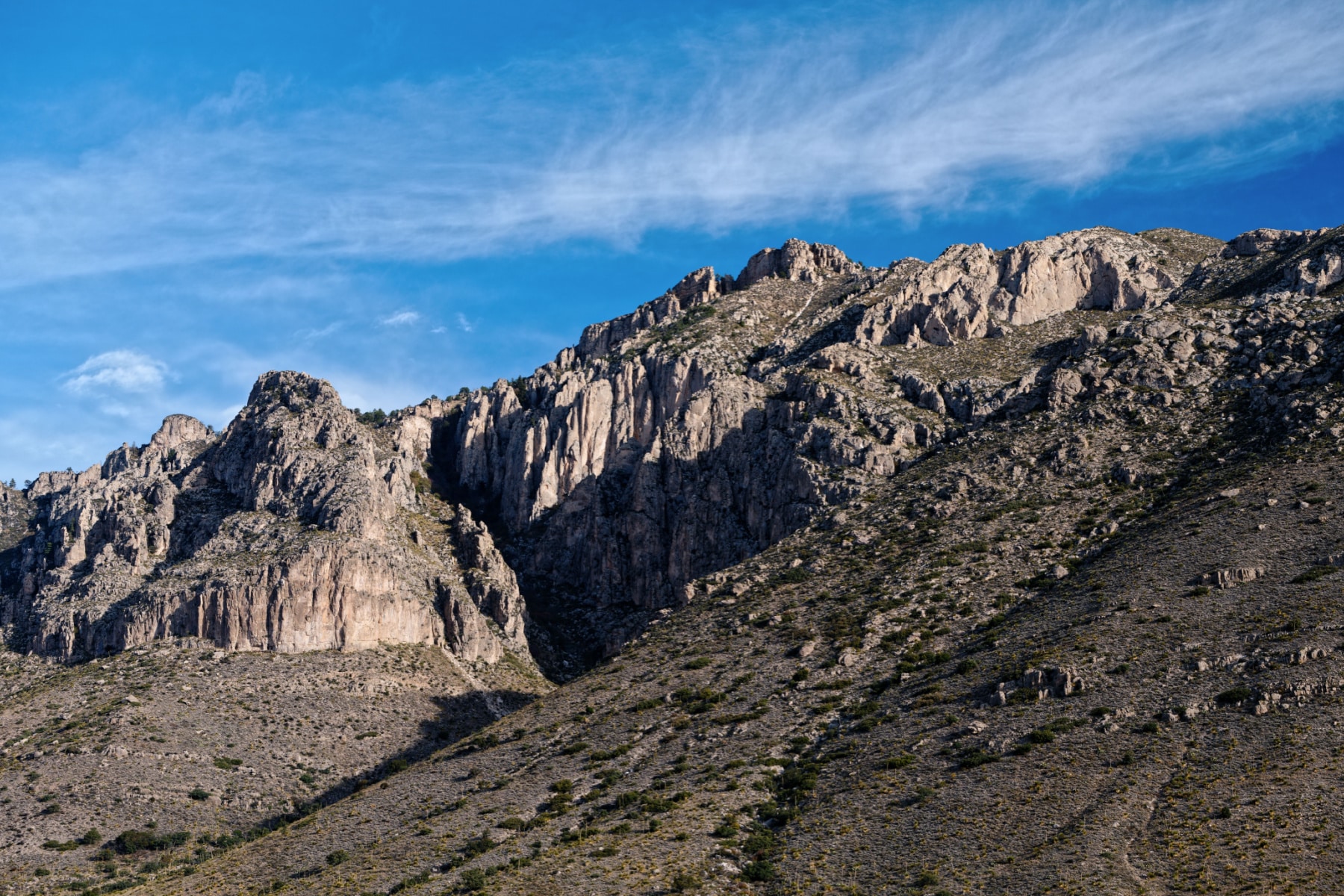
About 250 million or so years ago (Permian era), what we know now at the Guadalupe Mountains was the reef of a small sea. That explains the escarpment (dropoff) of the range. The reef became buried by sediments as the climate dried out. Then, 25 million years ago, an uplift caused part of the reef to protrude. That’s the section of the mountains we see today.
At nearby Carlsbad Caverns National Park, the area did not lift as much, and the caves were carved by water. The tectonic forces exposed gypsum bedrock, which eroded at the same time a nearby lake dried up. That’s how the salt dunes were formed.
So, in short, the Permian Reef is a fossil hotspot, and hikers are immersed in a landscape literally made of ancient life!

Travel Guide Map for Guadalupe Mountains National Park
Dog Canyon offers hikers outstanding views of the seldom-visited northern end of the Guadalupe Mountains. Temperatures are cooler here, and the canyon protects visitors from the worst of the winds. The road to Dog Canyon is the Guadalupe Backcountry Byway. The best time to visit Dog Canyon is fall when the foliage peaks.
Sections of Guadalupe Mountains National Park
The road entrances to the canyon lead in from all sides but don’t connect. With up to 100 miles between entrances, choose your destinations ahead of time. Several cross-mountain trails connect for long-distance hikers. In fact, consider bringing two cars when you choose the long hikes. No shuttle system is available in the park.
Dog Canyon
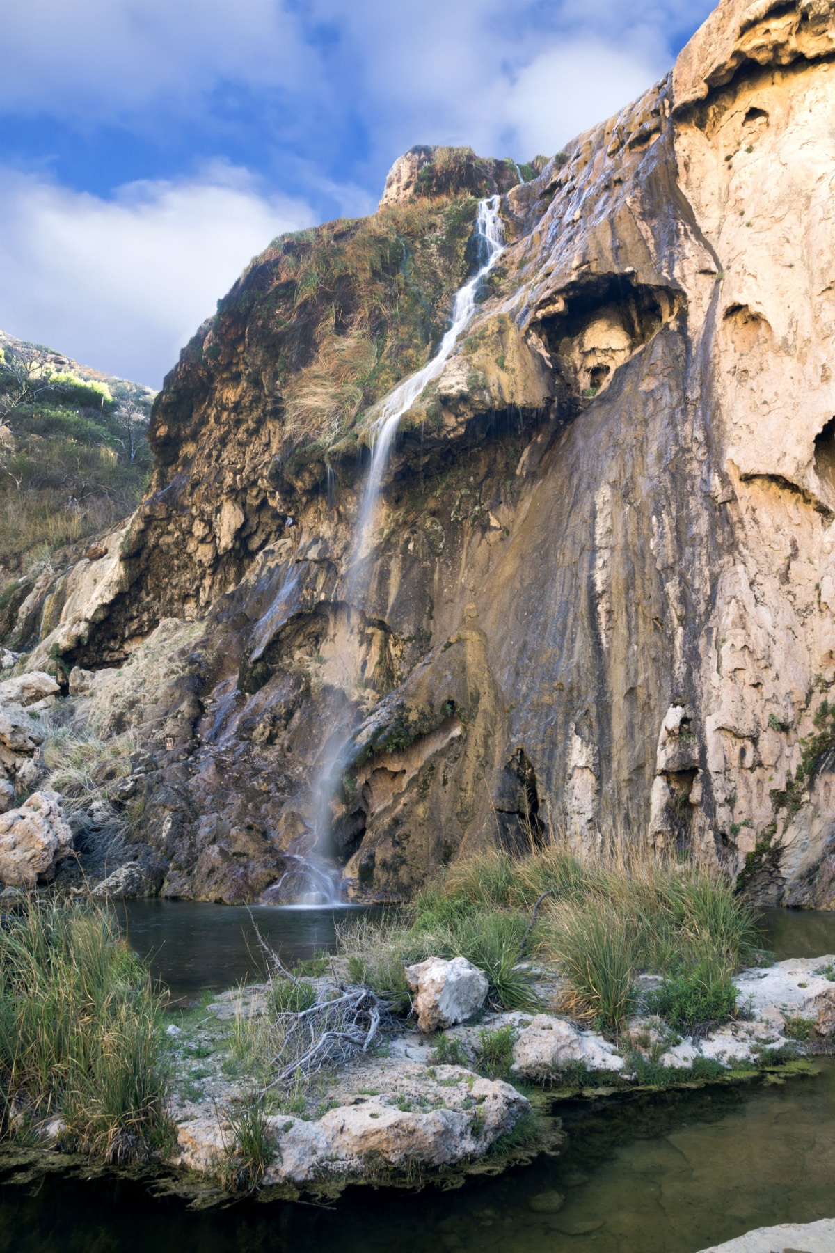
I highly recommend anyone who takes this route does the eight-mile side road to Sitting Bull Falls Recreation Area in Lincoln National Forest. The photo below explains why. (Plus, that interagency pass gets you free access.)
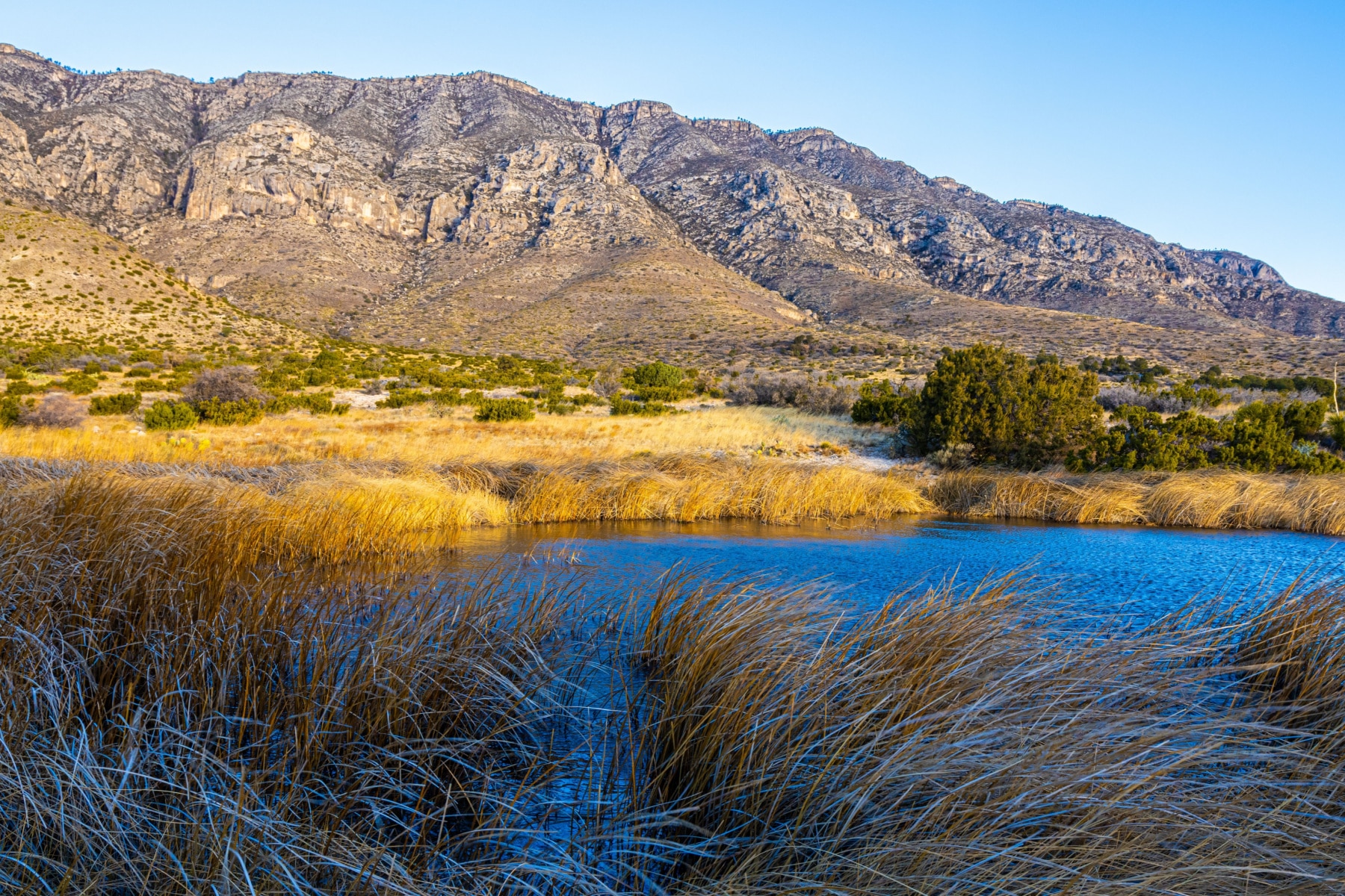
Frijole Ranch
Frijole Canyon is home to the historic Frijole Ranch House museum. Trails follow Frijole Creek through maple, oak and other riparian vegetation. Hikers may spot deer, elk, coyotes, and many species of birds along the trail. Some of the shorter and easier trails start here, as Frijole Ranch rests on the lower edge of the escarpment.
McKittrick Canyon
Considered by many to be the most scenic area of the park, McKittrick Canyon is known for its fall colors when bigtooth maple trees burst into hues of yellow, orange and red. A trail follows the canyon past historic Pratt Cabin and through oak, maple and pine trees to the Grotto Picnic Area and McKittrick Ridge. This canyon stretches into Lincoln National Forest.
HEADS UP: McKittrick Canyon only opens for day use; gates open at 8am and the gates close at 5pm Mountain Time. Those with a wilderness permit can park overnight.
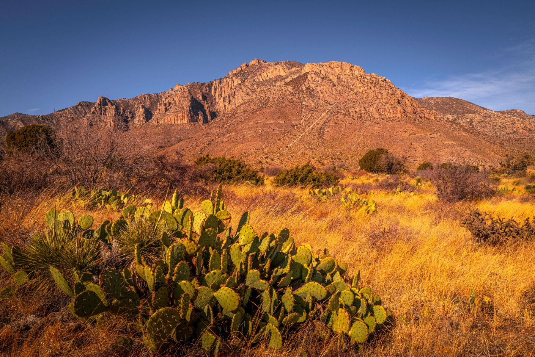
Pine Springs
The Pine Springs area is the main hub of activity in the park, with a visitor center, campground, and trails radiating out from the area. The Permian Reef Trail climbs over the fossil-studded Capitan Reef, offering spectacular views. Other trails lead to scenic spots like the Hunter Peak, offering more versatility to access and still sits just 380 feet shorter than Guadalupe Peak.
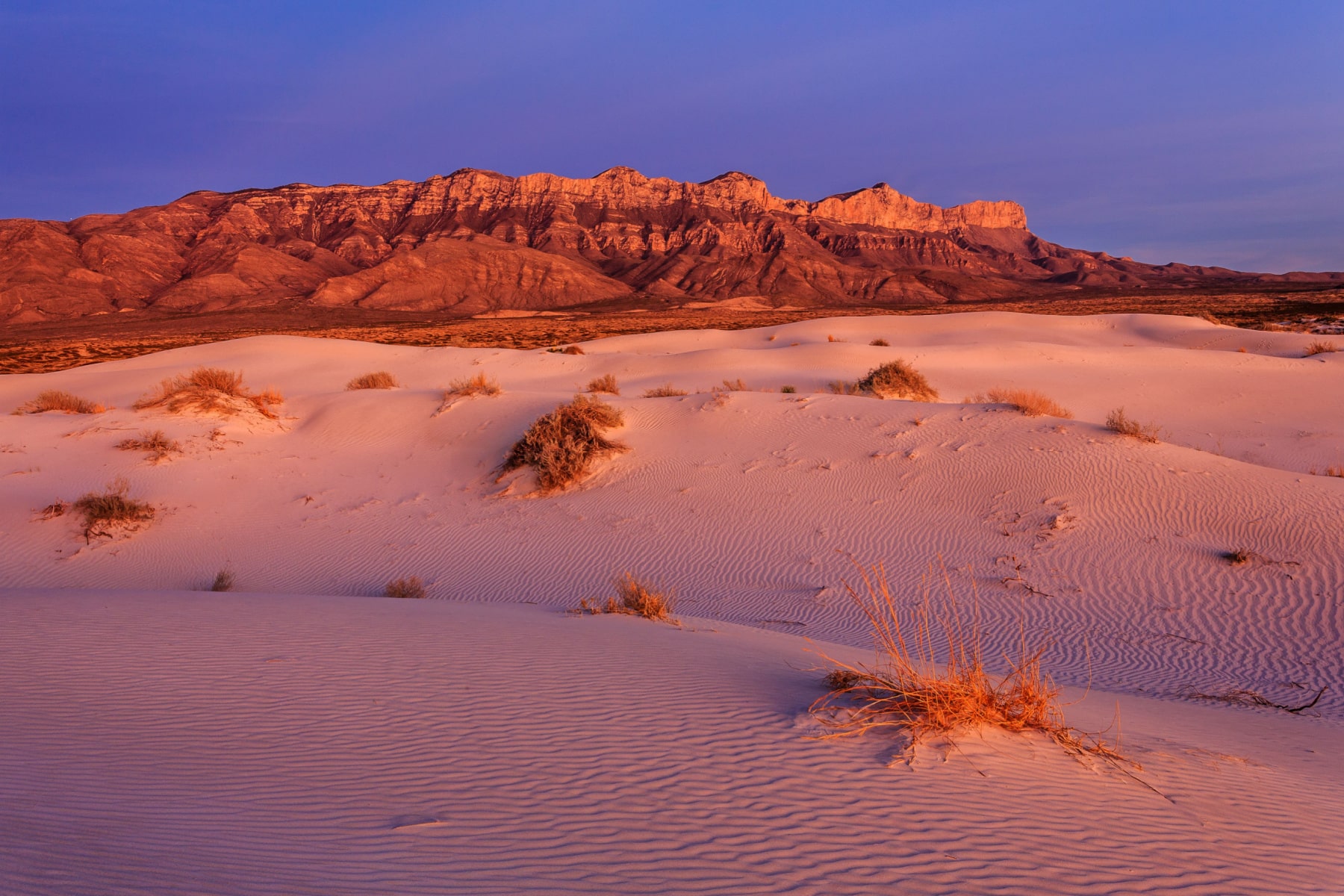
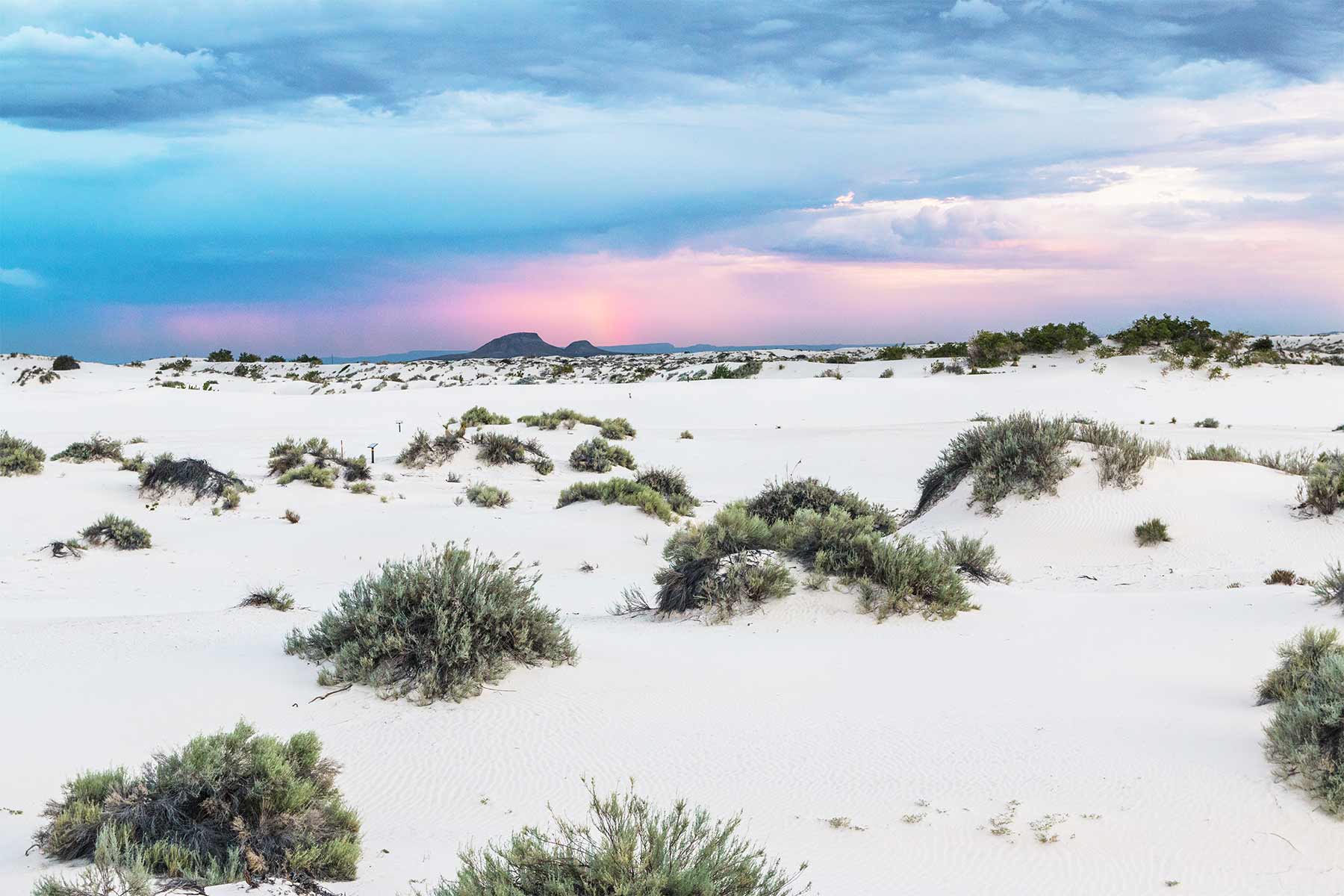
Salt Basin Dunes
The dazzling white gypsum dunes of the Salt Basin provide a stark contrast to the rocky slopes of the Guadalupe Mountains. Hiking trails traverse windswept dunes and cross massive salt flats. The dunes attract visitors searching for bright white sand and desert landscapes more reminiscent of White Sands than West Texas.
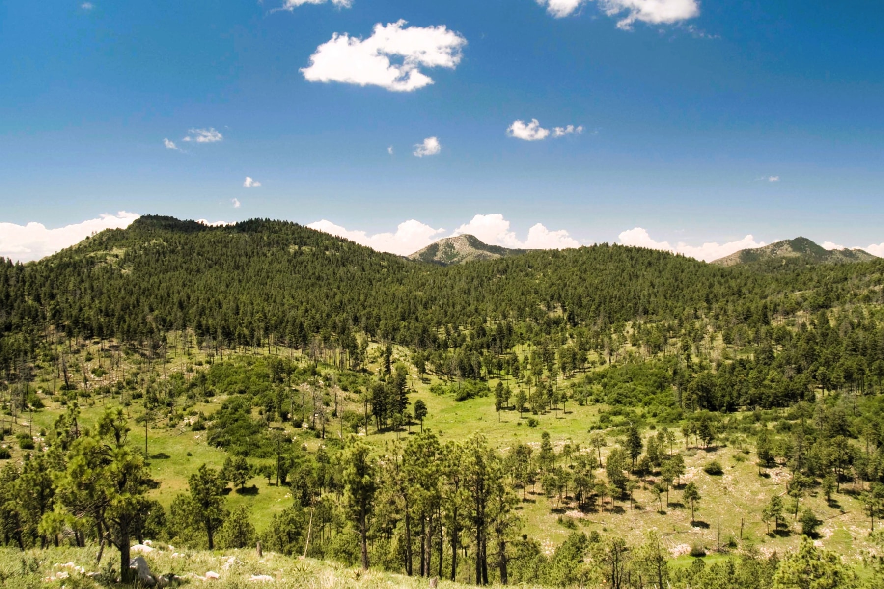
The Bowl
The Bowl is a geological formation located in the western escarpment of Guadalupe Mountains National Park. Surrounded by taller peaks and ridges, this sheltered area is a major habitat zone within the Chihuahuan Desert ecosystem. The Bowl’s relatively cooler temperatures and protection from drying winds allow more dense and diverse vegetation to thrive. That, in turn, attracts wildlife.
Getting to The Bowl requires strenuous, steep climbs in and out, but they reward visitors with gorgeous views of the geological layers forming the ancient Guadalupe Reef.
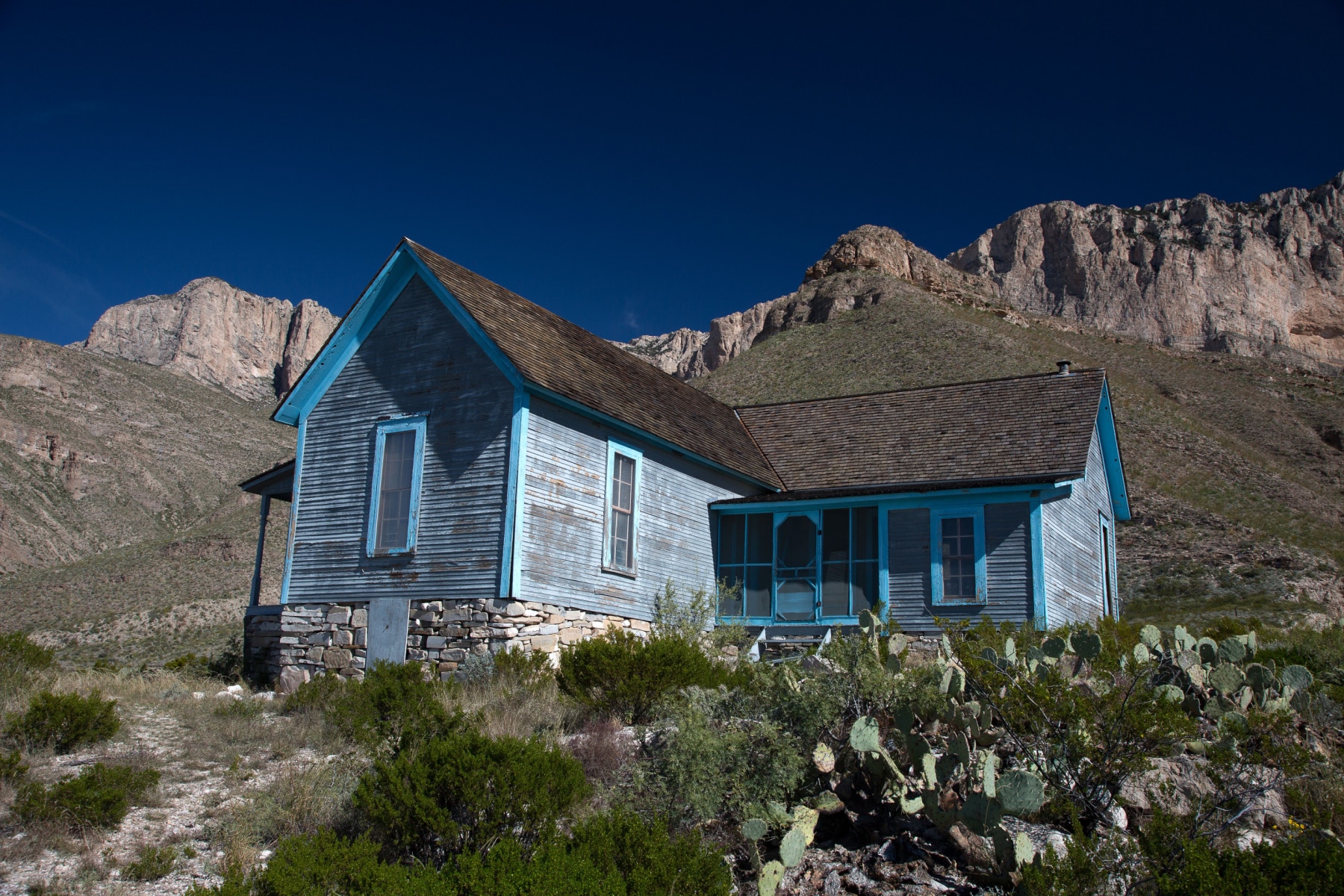
Williams Ranch
Historic Williams Ranch played an important role in the early ranching history of the Guadalupe Mountains. Visitors can tour the ranch house, a limestone structure built in the early 20th century. Trails lead past old corrals, line shacks, and the stagecoach station to scenic views of the McKittrick Canyon valley.
NOTE: Check access conditions before planning a visit. Under ideal conditions, a 4X4 vehicle is needed on the road. Hiker access comes from the El Capitan Trail.
Five entrances lead you to different trailheads, but those who like long-distance hikes will appreciate the connections made between the various sections. More than 80 miles of trails span the mountains, canyons, and dunes.
12. Pinery Trail
Section of Park/Trailhead: Pine Springs/Butterfield Stage Station
- Length: < 1 Mile
- Hours: 30 minutes
- Elevation Change: No more than 50 feet
- Difficulty: Easy
This easy trail from the Pine Springs Visitor Center can be even easier by stopping at the parking area off the main highway to Butterfield Stage Station. It’s part of the Buttery Overland National Historic Trail, which carried mail, packages, and people from the Mississippi River across a southern scoop of the U.S. ending in San Francisco. The route was also a precursor to the Pony Express.
The short trail and limited remains of the crumbling station mean more to those who know the history. As one passenger said when arriving here in 1858, “it seems as if nature had saved all her ruggedness to pile it up in this form of the Guadalupe Peak.” This trail is the only one where dogs are allowed in the park.
11. Smith Spring Trail Loop
Section of Park/Trailhead: Frijole Ranch
- Length: 2.5 Miles Roundtrip
- Time: 1-2 Hours
- Elevation Change: 400 Feet
- Difficulty: Easy
This deceivingly easy appearance of this trail brings a little spunk as you ascend through rocky pathways and along some slopes. The challenge is watching your feet while enjoying the views around you. The path leads to Manzanita Spring and Smith Spring.
Smith Spring Trail is perfect for families who are used to being outdoors.
10. Hunter Peak
Section of Park/Trailhead: Pine Springs
- Length: 8.7 Mile Loop
- Time: 6-8 Hours
- Elevation Change: 2,700 Feet
- Difficulty: Strenuous
Hunter Peak isn’t the tallest in the park, but it does have mind-boggling views. Unless you’re a determined “highest point” hiker, put this in your Top 3 choices for a long day hike.
One thing I love about the Hunter Peak trail is that the entire length is an adventure. From the Bear Canyon incline that goes 2,000 feet in less than two miles to new views unfolding with every switchback and corner.
From Pine Springs, the trails taking you to the cross-park trails or The Bowl start at either Tejas or Frijoles Trail. This one, in particular, strongly suggests you go counterclockwise, tackling steep Bear Canyon on the upside instead of trying to navigate down on rocks with steep drops.
For additional mileage, take the two-mile loop around The Bowl. This is one of the best Guadalupe Mountains National Park hikes for those who want the elevation but not the crowds of Guadalupe Peak.
9. Bush Mountain Trail
Section of Park/Trailhead: Pine Springs or Dog Canyon
- Length: 13-20 Miles (Out & Back or Thru Hike)
- Time: 9-12 Hours
- Elevation Change: 2,770 Feet
- Difficulty: Strenuous
If you’re not looking for a strenuous, long, challenging day hike or a multi-day wilderness adventure, keep scrolling.
Bush Mountain Trail is one of the best hikes in Guadalupe Mountains National Parks for the views and diversity of terrain, but it’s tough. In addition, you have several routes that lead from two opposite sides of the park entrances. Starting at Pine Springs and making it out and back is the shortest route we’ve profiled above, at just over 13 miles.
You can take the Tejas trail in Pine Springs to Blue Mountain Trail or continue Tejas to Blue Ridge and circle around to Bush Mountain, doing a lollipop. The hike across the mountains is 16 miles.
8. The Bowl Trail
Section of Park/Trailhead: Wilderness; Accessed from Pine Springs or Dog Canyon
- Length: *2 Mile Loop
- Time: *1 Hour
- Elevation Change: *266 Feet
- Difficulty: *Strenuous
The beauty of this two-mile trail makes the beast of a hike to get there worth the effort. Notice the asterisks? That’s because that information applies just to The Bowl Trail, with access from Pine Springs via Bear Canyon (+4 miles), the Pine Springs Tejas Trail access point to The Bowl Trail (+5 miles) or the Dog Canyon Tejas Trail to the Juniper Trail (+9 miles).
Once you’re at the bowl, enjoy the high-country wilderness with wildlife, canyon views, and forest exploration. You get access to those amazing Hunter Peak views, too.
7. Tejas Trail
Section of Park/Trailhead: Accessed from Pine Springs or Dog Canyon
- Length: 12 Miles
- Time: 9-11 Hours or Overnight
- Elevation Change: 3,000 Feet
- Difficulty: Strenuous
While you can do the Tejas Trail on one (long) day, you’ll miss too much rushing through it. Make this a multi-day trip if you can. The trail connects Pine Springs to Dog Canyon.
Tejas Trail on the south side offers a series of switchbacks with epic views. Upon reaching the high country of the wilderness, forest paths lead the way. Lost Peak is along the way, but a summit trail isn’t available. You’ll gradually descend to Dog Canyon, less crowded than most other sections of the park.
Since Tejas Trail runs as a central artery through Guadalupe Mountains National Park, you’ll have different trails to extend the length or explore if you’re on a multi-day trip, like The Bowl or McKittrick Canyon.
This is one of the best overall hikes in Guadalupe Mountains National Park, but high winds and cold winter night temperatures can lessen the experience.
6. Permian Reef Trail
Section of Park/Trailhead: McKittrick Canyon
- Length: 9.4 Miles Roundtrip
- Time: 5-7 Hours
- Elevation Change: 2,380 Feet
- Difficulty: Strenuous
If you’ve spent any time reading my More Than Just Parks adventures, you know I love to avoid crowds. That means I’m always off the beaten path, and Permiam Reef is the mothership of crowd-free adventures.
You can take the Permian Reef Trail as far as you’d like, but at least make it four miles to the top of the ridge. You can continue along Wilderness Ridge into the forest along the edge with peek-a-boo views.
The trail continues into Lincoln National Forest boundary (and state line), but you’ll get the best of the trail in the park boundaries.
This is one of the best hikes in Guadalupe Mountains National Park to see fossils. The organisms lived before the last extinction cycle that wiped out all but 20% of species.
Quick notes on this trail:
- Wear long pants. The infrequently used trail can be overgrown and have thorns or spikes on cacti, even when you’re on the trail.
- This trail has some steep drops. It’s not the best for those afraid of heights.
- Permian Reef is best explored outside of summer. The exposed path and relentless summer sun can cause dehydration, heat exhaustion, or heat stroke.
As noted above, this trailhead closes at 5:00pm. Be sure to time your hiking – understand that the descent takes just as much, if not more, time due to the loose rocks and slope. Bring trekking poles.
5. Salt Basin Dunes Trail
Section of Park/Trailhead: Salt Basin Dunes
- Length: Up to 4 Miles
- Time: 1-3 Hours
- Elevation Change: Sproadic, but up to 60-foot dunes
- Difficulty: Moderate
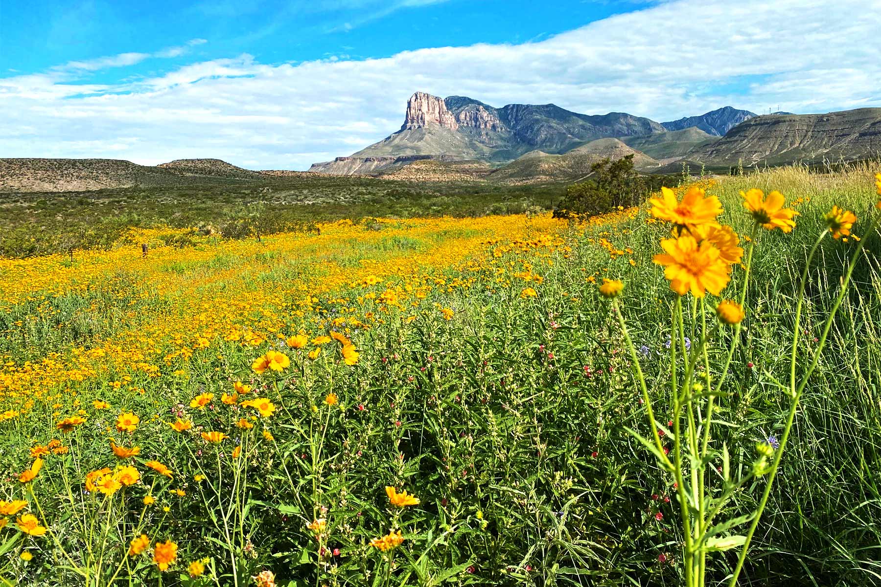
Among the 250 million-year-old footprint of the reef, the Salt Basin Dunes are infants at just a few thousand years young. The escarpment prevents winds from blowing eroded gypsum, so it pools here in this bright white valley. The view gives you a mix of the Utah Salt Flats, White Sands National Park, and Death Valley’s Badwater Basin.
The drive from Pine Springs to the Salt Basin Dunes trailhead sits somewhere between 45 minutes and an hour. At least 30 miles of the last stretch of the road requires 4WD or high-clearance vehicles for the safest ride. Avoid this area during rain since the clay in the road material makes it tricky to navigate – even in a Jeep.
Once you arrive, walk a flat mile to the sandy section, where the trail is as hard or easy as you make it. Dunes top 60 feet here, and you should expect to bear crawl at times if you want to reach the top.
While the gypsum in the sand makes it tolerant for your feet in summer, the blazing sun and reflective properties of the sand make this a better sunrise or sunset spot, if anything.
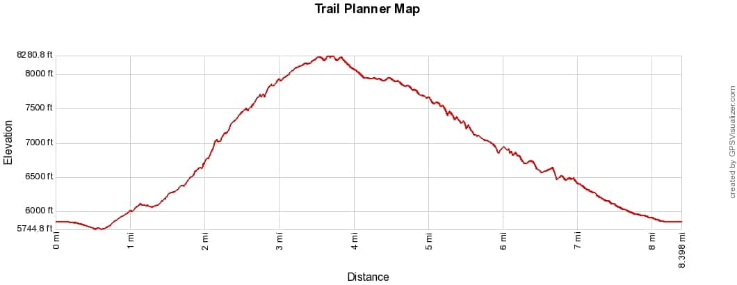
4. McKittrick Canyon Trail
Section of Park/Trailhead: McKittrick Canyon
- Length: Up to 21 miles roundtrip
- Time: Up to 12 hours/Multi-night
- Elevation Change: 2,820 Feet
- Difficulty: Depends Which Trail
McKittrick Canyon’s 21 miles hold mesmerizing sights within but keep in mind there’s no summit or trial end. After 11 miles, it meets up with Tejas Trail. You can take that trail to Dog Canyon for a total of 15 miles or Pine Springs adding up to 19 miles.
However, the trail holds several waypoints worth exploring, depending on your arrival time and fitness level. The first three to four miles are relatively flat, making it an easy hike. As the path wears on, you could end up on the “Toughest Trail in Texas.”
First, you should know the landscape of McKittrick Canyon makes it EPIC for fall colors and wildflowers. Lush in a desert never looked so good. Second, know that stream crossings are inevitable in the first few miles.
McKittrick Canyon Trail Options
Here are the notable points along the way:
- Pratt Cabin: (5 miles roundtrip) A former summer home for an oil geologist, Pratt Cabin is now an interpretive historic site open to visitors when rangers are there. This is the shortest hike and a great picnic spot if you aren’t going to the next point.
- The Grotto: (8 miles roundtrip) Ideally, you make it at least this far when choosing McKittrick Canyon.
- The Notch: (10 miles roundtrip) After The Grotto, the trail goes from easy/moderate to strenuous quickly. A series of switchbacks provide little relief for the quick ascent.
- McKittrick Ridge: (14 miles roundtrip) An overnight stay is recommended at the McKittrick Wilderness Campground due to the exhaustive nature of this trail above the Grotto. You can also reach the ridge via Dog Canyon, with only a 1,600-foot elevation change over the seven-mile one-way trip, and you don’t need to worry about parking lot closures at Dog Canyon.
A popular belief is that if you pick between Guadalupe Peak and McKittrick Canyon, pick the canyon. You also lose most of the crowds after The Grotto.
AGAIN: The gates open promptly at 8am and close at 5pm. That’s Mountain Time, which is likely going to be an hour behind what your car or mobile device displays due to the closeness to the time zone boundary.
3. El Capitan Trail
Section of Park/Trailhead: Pine Springs
- Length: 9 Miles Out & Back
- Time: 4-6 Hours
- Elevation Change: 1,650 Feet
- Difficulty: Moderate
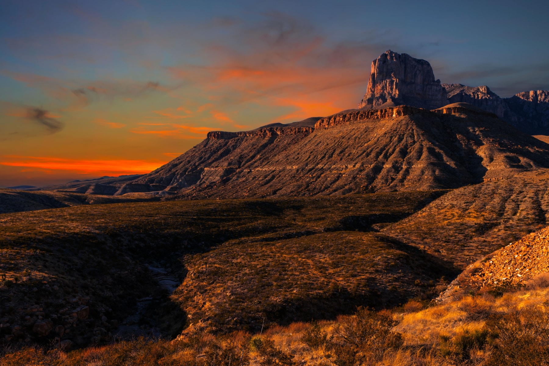
While the name El Capitan might remind you of a certain Yosemite National Park icon, this El Cap stands a good 500 feet taller than its California cousin. This prominent peak might be only the eighth tallest in Texas, but it’s one of the signature sights of the Lone Star State.
You get a couple of options here, but at the shortest, you’re working nine miles through ups and downs, totaling 1,650 feet of elevation change. As the only trail on the western edge of the mountains, you get plenty of solitude. Eyeball that elevation chart to see a lot of ups and downs, so the elevation change feels more intense than it is.
Add 3.5 miles to take the Salt Basin Overlook Trial to loop back around to the El Capitan or just walk about 700 feet off the spur trail to see the overlook of Sand Dunes. You can also take the 10-mile one-way trip to Williams Ranch.
NOTE: This trail is exposed, and this is not a smart trial to take on windy or hot days.
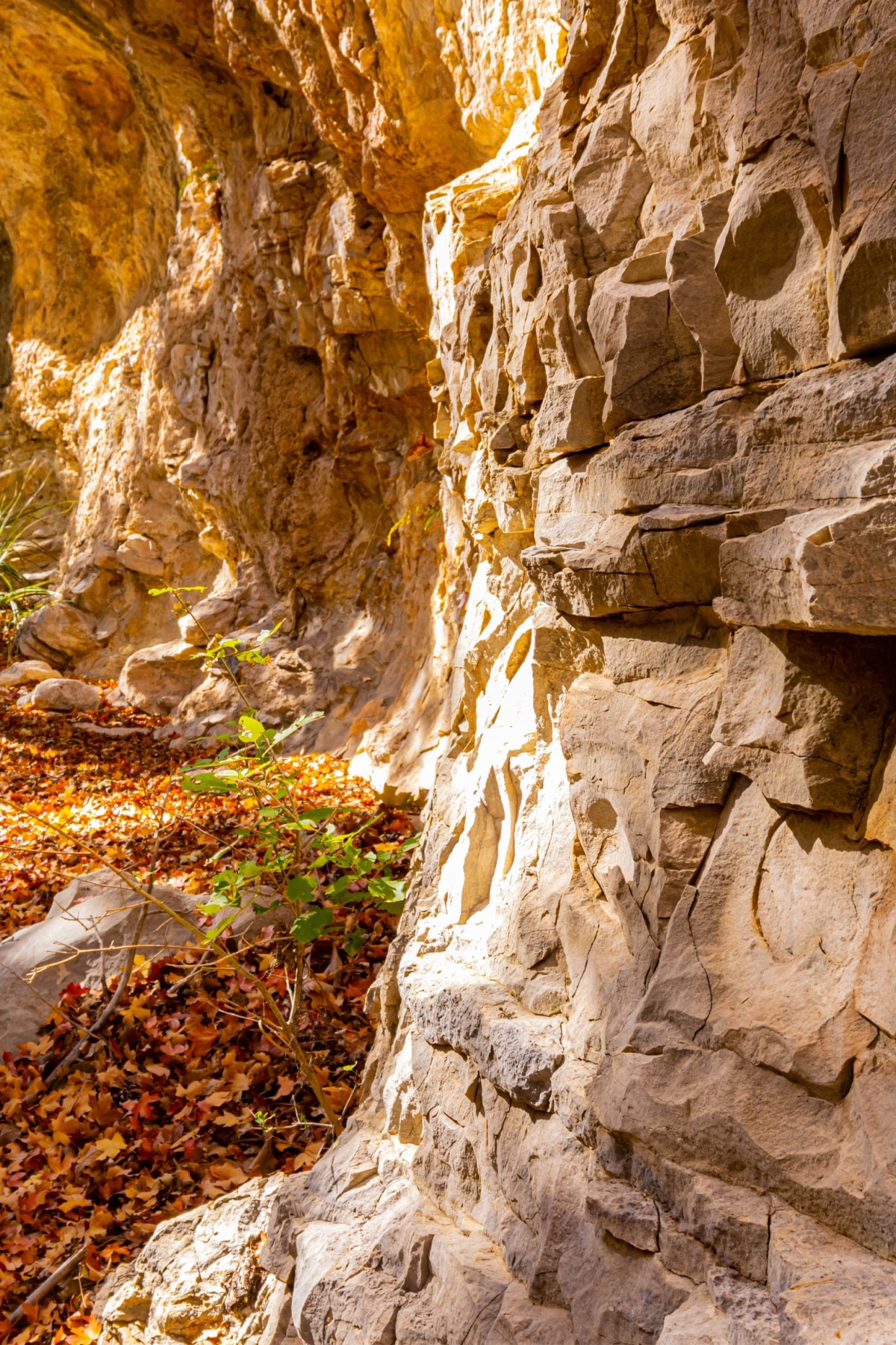
2. Devil’s Hall Trail
Section of Park/Trailhead: Pine Springs
- Length: 4.2 Miles Out & Back
- Time: 3-5 Hours
- Elevation Change: 548 Feet
- Difficulty: Strenuous
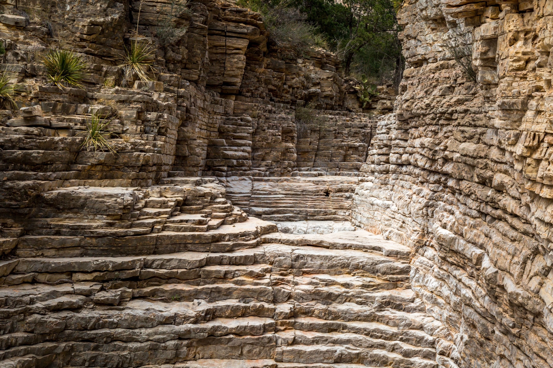
The exquisite rock formations and towering narrow canyon walls make the brutal knee work and scrambling worth it. Even at just four miles, you really only “hike” a mile, and the rest is walking through a wash, scrambling, bouldering, and stair-stepping up the side of layers that resemble rustic backsplash.
The unique route challenges every muscle in your body while putting off this eerily quiet vibe where silence is deafening. It’s amazing.
Heed all warnings from the park about this trail. You don’t want to be caught here in a storm.
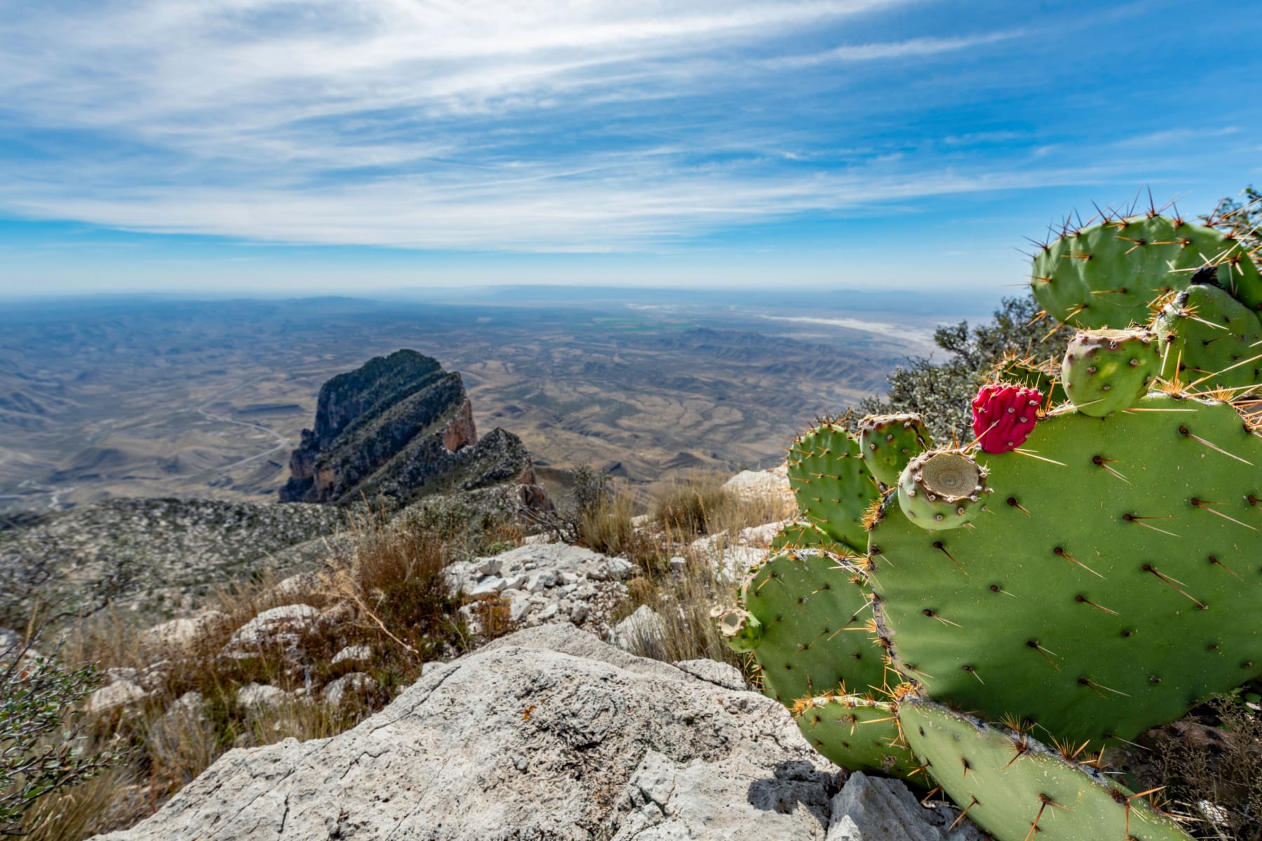
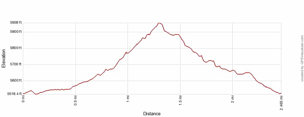
1. Guadalupe Peak

Section of Park/Trailhead: Pine Springs
- Length: 8.4 Miles Roundtrip
- Time: 4-6 Hours
- Elevation Change: 3,150 feet
- Difficulty: Strenuous
Reaching the high point of Texas takes as much energy ascending 3,000 feet as it does to navigate down on loose rocks and narrow edges. Even a breeze at the trailhead can feel like a hurricane on the exposed sections of this trail. The last half mile is a doozy.
Even a minor fear of heights will rattle you if the winds are humming – there are some vertigo-inducing moments, especially when the trail is moving with each step on gravel and rocks. It takes about five hours to hike Guadalupe Peak, but take your time and plan for at least six.
A stock trail puts another mile on in either direction, but it also eases the elevation gain to a more manageable experience. I used it on the way down because my knees think they are old.
Guadalupe Mountains National Park Weather
Before we get to the best Guadalupe Mountains National Park hikes, it’s imperative to know the weather conditions here throughout the year. If there’s one thing I learned living in the desert, it’s that the number of sunny days means squat if the wind is sandpapering your face and sending projectiles around you.
The windy season runs from November through March, with the monsoon season starting in May and running through October. Rarely are there rainout days, but intense storms pop up quickly.
Guadalupe Mountains National Park made our list of best national parks to visit in March, largely because of its ideal weather, and that sentiment goes through the spring. Temperatures are comfortably in the 70s during the day, with chilly nights in the upper 30s and 40s. Winds will be the biggest concern, with occasional snow.
Wildflowers burst in spring but are most impressive throughout the summer during the rainy season.
Temperatures in the summer hover near the upper 80s, and the intense sun mixed with exposed trails could mean excessive heat dangers. Plan for canyons and shaded areas in the heat of the day, or hike as early as possible. Summer thunderstorms usually build in the afternoon.
If you aren’t familiar with the desert, you’ll be amazed at how fast it goes from clear skies to a cute little cloud to a thunderhead looming. Stay out of canyons in heavy rain and lower your elevation if there’s lightning.
One of the best months to visit the Guadalupe Mountains is October, due to the general calming of weather, temperatures in the upper 60s, and the unique foliage that pops among the desert climate. Fall temperatures drop about 10 degrees every month of fall, and higher elevations will be colder. Average highs for the season are in the low 70s.
You’ll get sunny days in the 50s but nights that regularly reach freezing. A snow day here and there in winter is possible, and the chance of freezing fog turning to snow or ice increases at higher elevations. Crampons will be helpful, just in case.
Wildlife in Guadalupe Mountains
Mountain lions and black bears live in Guadalupe Mountains National Park. The park discourages bringing bear spray, claiming it is “generally unnecessary” and poses a larger risk to people in the event of an accidental spray.
Never turn your back on wildlife. With bears, speaking in a calm tone and back away slowly. Mountain lions generally avoid people, but I’ve stumbled on one in Colorado, and that sucker was side-eyeing me. You want to appear as “big” as possible and keep your gaze locked on it.
The park also has several variations of rattlesnakes. Keep an eye on those narrow and overgrown trails – use trekking poles to check for snakes and stay on the trail. Overnight campers should bring a black light to check for scorpions, as at least five varieties roam here. Here are more safety tips when facing wildlife.
Camping in Guadalupe Mountains National Park
As noted earlier, Guadalupe Mountains National Park lodging is located at least 30 minutes away. The park offers several camping options.
Guadalupe Mountains Nat’l Park Campgrounds
Three designated campgrounds circle the park. One at Dog Canyon, another at Pine Springs, and a third at Frijole Ranch (Frijole Horse Corrall Campground), which is the only suitable overnight stop for those with horses. Reservations open six months in advance for year-round dates.
Wilderness Camping in Guadalupe Mountains Nat’l Park
Across the mountains, valleys, and forests, 60 wilderness campsites cover the stretch of Guadalupe Mountains National Park. Wilderness permits are required for all overnight trips, with purchase and pickup only available at the Pine Springs ranger station.
The locations span across 10 wilderness areas and pair well with the best hikes in the Guadalupe Mountains National Park:
- Guadalupe Peak Wilderness Campground
- Pine Top Wilderness Campground
- Bush Mountain Wilderness Campground
- Blue Ridge Wilderness Campground
- Mescalero Wilderness Campground
- Marcus Wilderness Campground
- McKittrick Ridge Wilderness Campground
- Wilderness Ridge Wilderness Campground
- Shumard Canyon Wilderness Campground
- Tejas Wilderness Campground
Again, our travel guide map shows you all these locations dispersed throughout the park.
Stargazing in Guadalupe Mountains National Park
While Guadalupe Mountains National Park remains without Dark Sky Park designation, the stargazing is phenomenal. Due to the light pollution from the Permian Oil Fields, the park can’t comply with the elite requirements for the designation. Don’t let that deter your inner astrologer.
Plus, various plants, flowers, and wildlife become more active at night, making the moonglow experience that much more exciting.
Other National Parks Near Guadalupe Mountains
Guadalupe Mountains National Park is one of two West Texas national parks. The other one is Big Bend National Park, which cradles the international border.
Guadalupe Mountains vs. Big Bend
I get asked a lot if you could only pick one – which would it be – the Guadalupe Mountains or Big Bend? My answer is always the same: “What mood am I in?”
Big Bend offers about twice as many miles of trails, scenic drives (from paved to rugged), and river experiences on the Rio Grande. It also has the Dark Sky Park designation. Guadalupe Mountains holds the highest peak in the state and higher elevations throughout.
Big Bend National Park’s highest peak awaits at Emory Peak, 7,825 feet above sea level. Most of Guadalupe Mountains National Park peaks top 8,000, and Guadalupe Peak is almost 1,000 feet higher than Mount Emory. You also get the salt dunes and more vibrant fall colors.
For those considering visiting both, from Guadalupe Mountains National Park to Big Bend National Park is 260 miles and four hours on the road.
Other National Parks Near Guadalupe Mountains National Park
Many people chose to pair Carlsbad Caverns with Guadalupe Mountains National Park.
Since this is a hiker’s park, you should know the Guadalupe Ridge Trail goes between the Guadalupe Mountains National Park and Carlsbad Caverns National Park (no, nothing underground). The trail spans an immense 100 miles and at least five days. The trail’s northern terminus waits in White’s City, New Mexico.
- Carlsbad Caverns National Park: 45 minutes/42 miles northeast
- White Sands National Park: 3 hours/193 miles north/northwest
If you have 5-7 days, you could feasibly hit all four parks in one trip. From White Sands National Park to Big Bend, considering all the stops at visitor centers, the distance comes in at 493 miles with 8 hours of drive time.
Is Guadalupe Mountains National Park an Unpopular Park?
Not by any means is Guadalupe Mountains National Park underrated or unpopular. The challenge with ranking a park on the visitor numbers and calling it “least-visited” lies in the implication that “least visited” means “undesirable.”
In 2026, Guadalupe Mountains National Park ranked 53rd among visitors, putting it in the Top 10 Least Visited National Parks of 2026. At the same time, in spring and fall, you’re lucky if you find a parking spot. With no backup lots or parking allowed on the highway shoulder, you’ll end up needing a backup plan to drive to a whole other section of the park.
In fact, between 2022 and 2026, park attendance was up 4%. Experienced hikers love the challenge of this park, but beginners shouldn’t shy away because of the limited roads. Every trail can easily be out and back as far as your body can go!
List of Best Hikes in Guadalupe Mountains National Park
- Guadalupe Peak
- Devil’s Hall Trail
- El Capitan Trail
- McKittrick Canyon Trail
- Salt Basin Dunes Trail
- Permian Reef Trail
- Tejas Trail
- The Bowl Trail
- Bush Mountain Trail
- Hunter Peak
- Smith Spring Trail Loop
- Pinery Trail