More Than Just ParksAmerica's Critical LandsPowered byPublic Lands IntelligenceComment

Press · America's Critical Lands

For reporters: the map, the numbers and the rule.

America's Critical Lands is a free public map of every Area of Critical Environmental Concern on the Bureau of Land Management's map: 1,120 areas covering 25,007,674 acres of the West, each with its own page carrying BLM's own findings for it and what's authorized inside its boundary. It's from More Than Just Parks, powered by Public Lands Intelligence.

The story in brief

BLM's proposed rule rewriting how it drafts every land use plan, and how it designates, sizes and removes ACECs, is Federal Register document 2026-22860, RIN 1004-AF53, docket BLM-2026-0298. The comment window is open. It closes January 11, 2027. The rule page sets its text beside today's rule, word for word.

Inside the boundaries today, by our count: at least 11,740 active mining claims and leases, at least 6,353 more claims filed and pending, 4,646 rights of way, and grazing allotments touching 789 areas. BLM's serial index lists 563,300 open mining claims; we read all of them, so the claim counts are floors, and the tool says so.

BLM's map stopped showing 50 areas in New Mexico in August 2026. While the White House review office held the rule, outside groups had 7 meetings with it.
Where to start

Images and clips

Free to use with credit: More Than Just Parks, America's Critical Lands, and a link to morethanjustparks.com/critical-lands where you can.

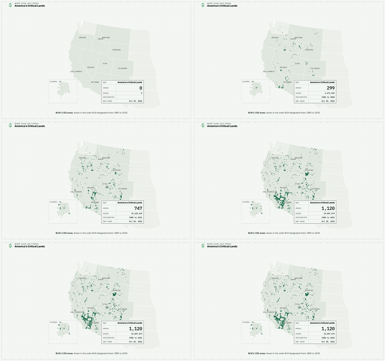
Animation of BLM Areas of Critical Environmental Concern appearing on a map of the West in order of designation, 1980 to 2025
The map drawing itselfThe opening: every ACEC inked in the order BLM designated it, 1980 to 2025, the count and acres climbing in the title block.MP4, 1,920 by 1,200, 0.16 MBGIF, 960 wide, 0.26 MBThe page it shows
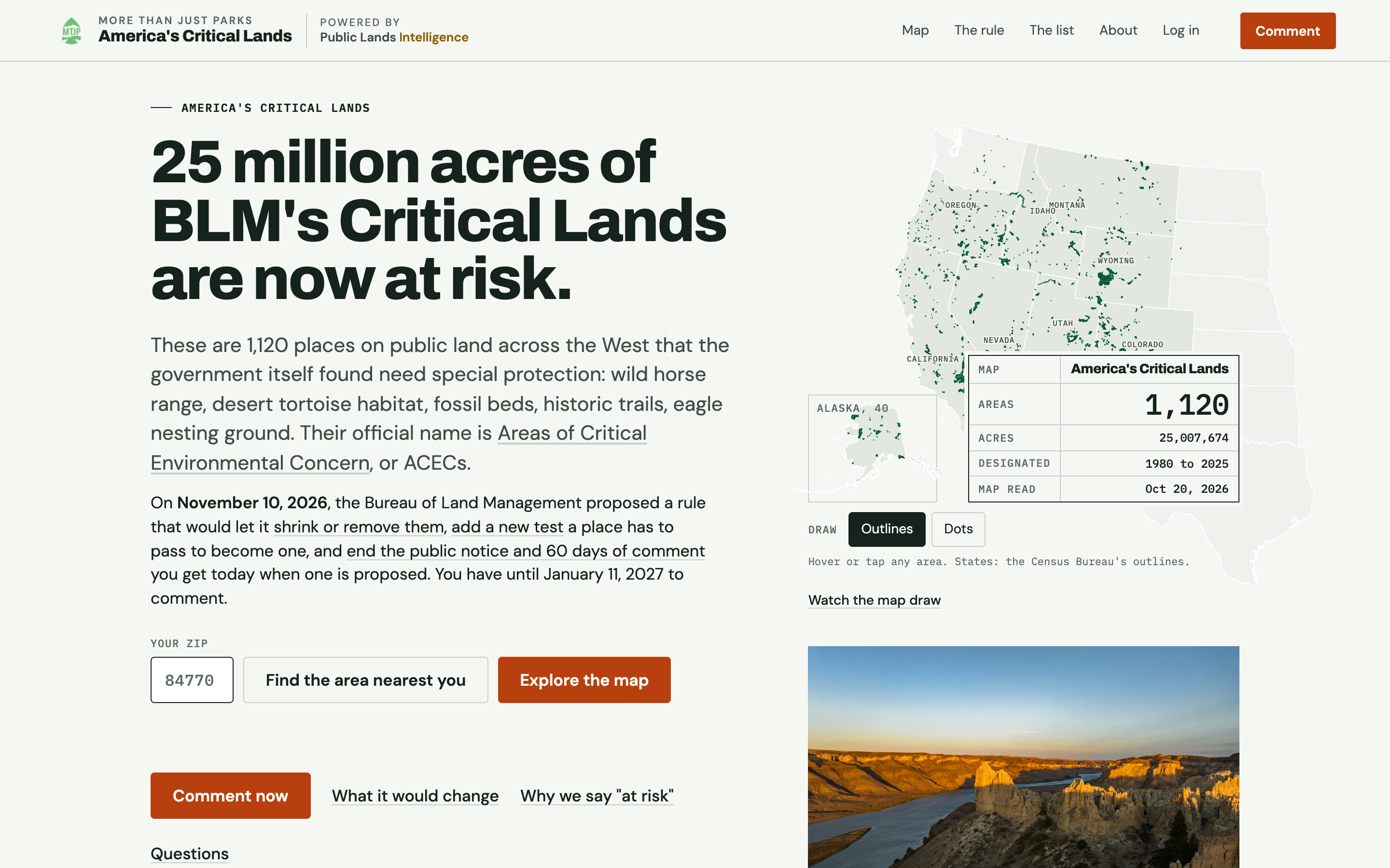
The home page of America's Critical Lands with its headline, a ZIP code field and a map of the West
The home pageThe home page as it opens: the headline, the ZIP field and the map of every area.PNG, 2,880 by 1,800, 1.0 MBThe page it shows
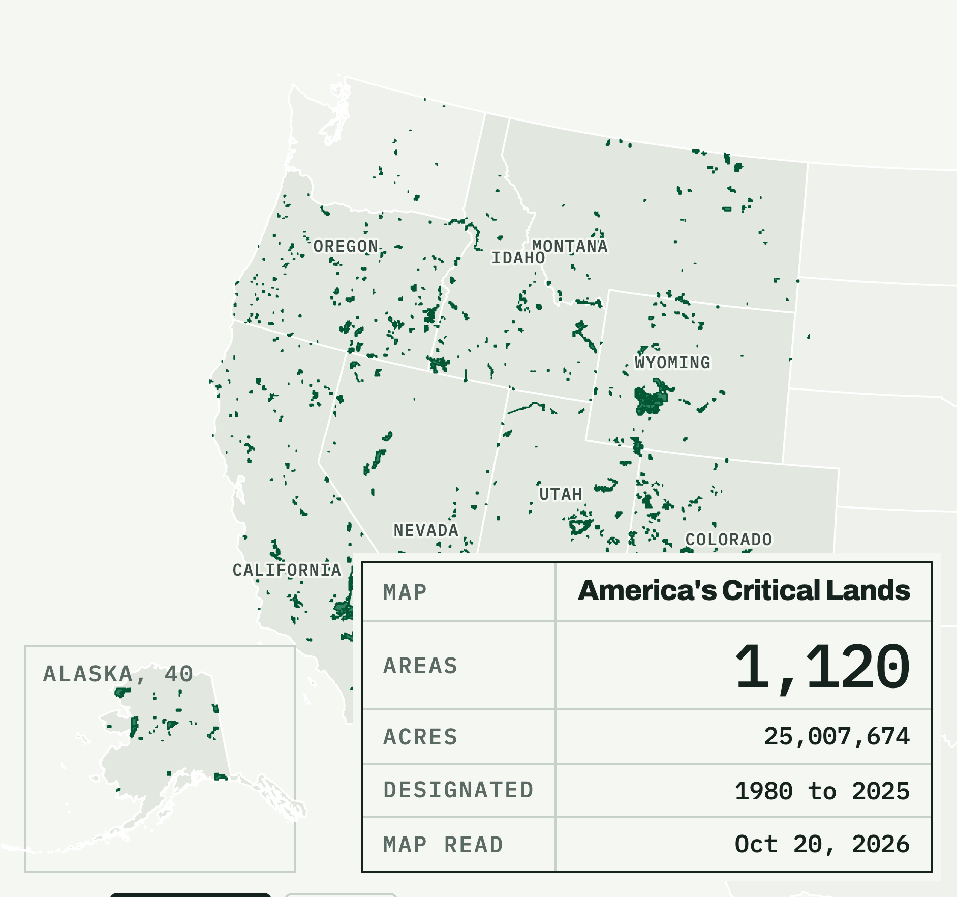
Map of BLM's 1,120 Areas of Critical Environmental Concern with an Alaska inset and a title block: 1,120 areas, 25,007,674 acres
Every ACEC on BLM's map, with the countThe same map as the site opens on it: Alaska inset and the sheet title block with the count, acres and read date.PNG, 1,883 by 1,764, 0.22 MBThe page it shows
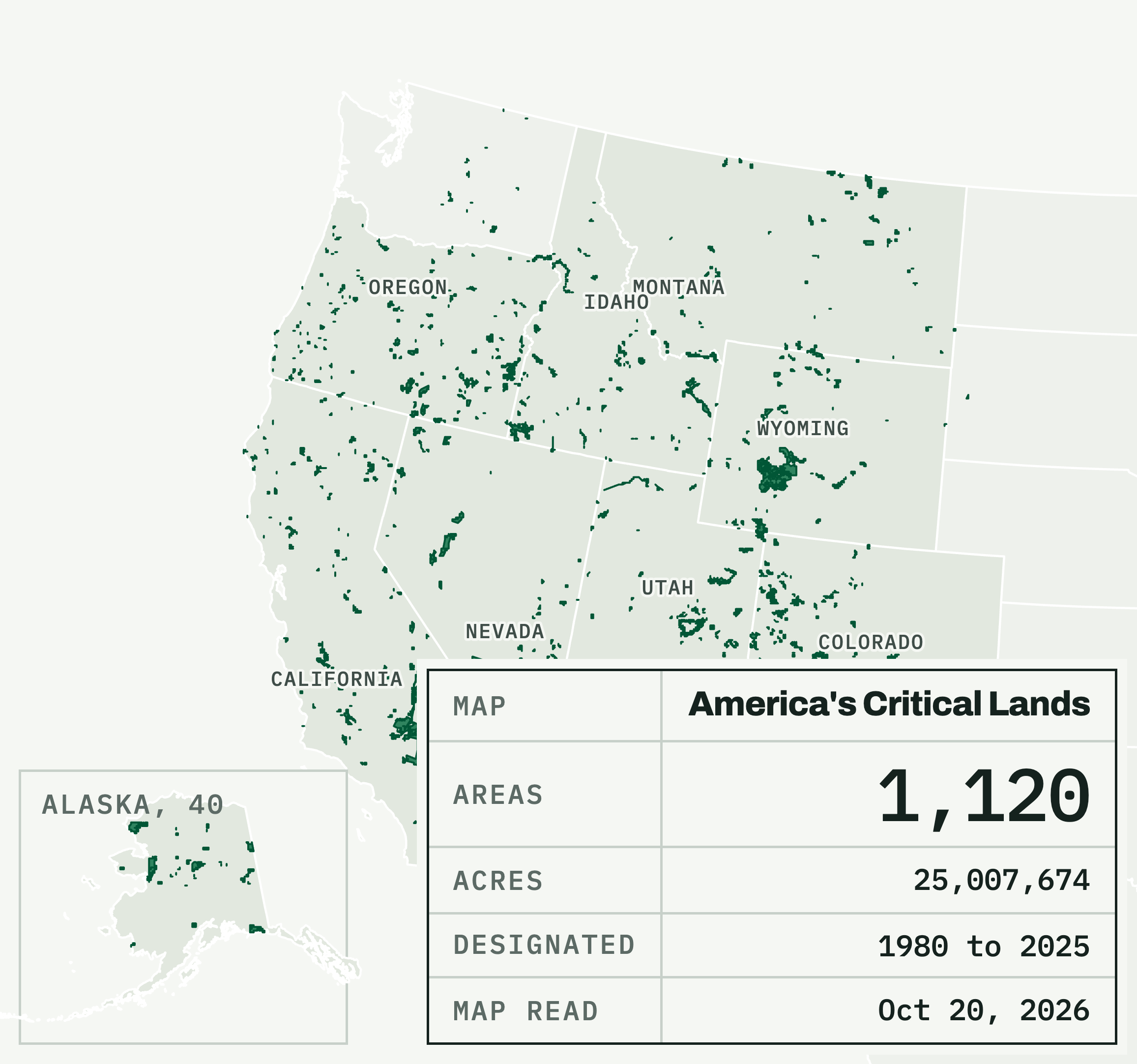
Map of the western United States with BLM's 1,120 mapped Areas of Critical Environmental Concern drawn in dark green
Every ACEC, the map aloneThe West with every one of BLM's 1,120 mapped ACEC boundaries drawn on it, Alaska in its own inset on the site.PNG, 2,313 by 2,164, 0.27 MBThe page it shows
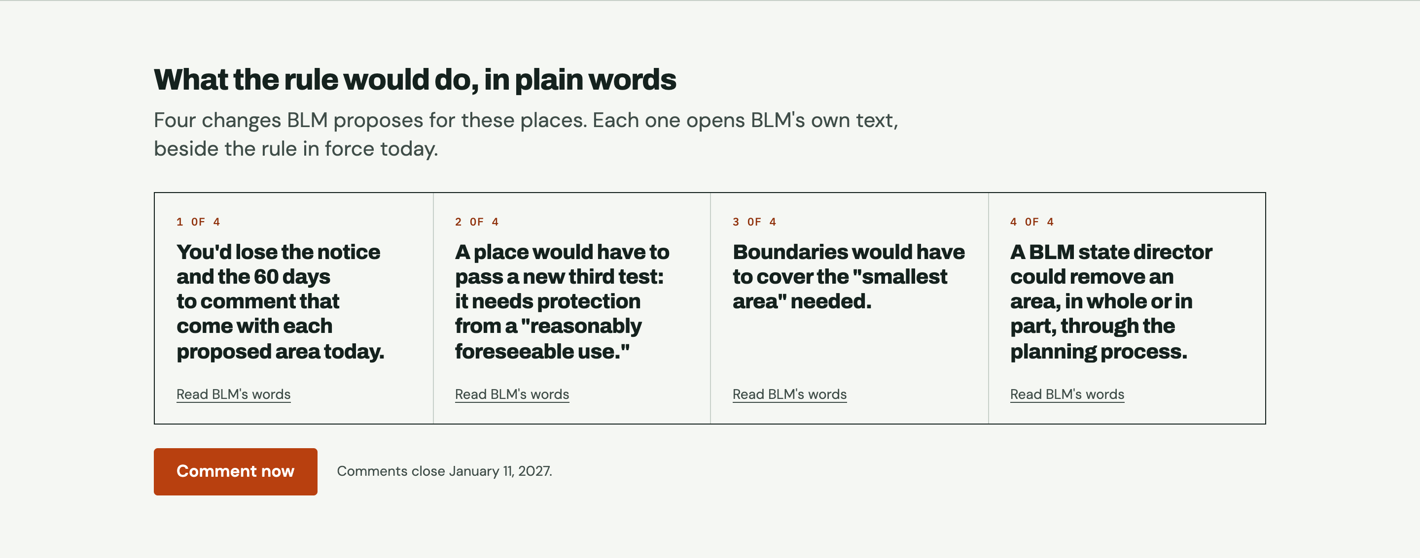
Four plain-language cards on America's Critical Lands describing what BLM's proposed rule would change
What the rule would change, in plain wordsWhat the proposed rule would change, in plain words, from the home page.PNG, 2,880 by 1,133, 0.16 MBThe page it shows
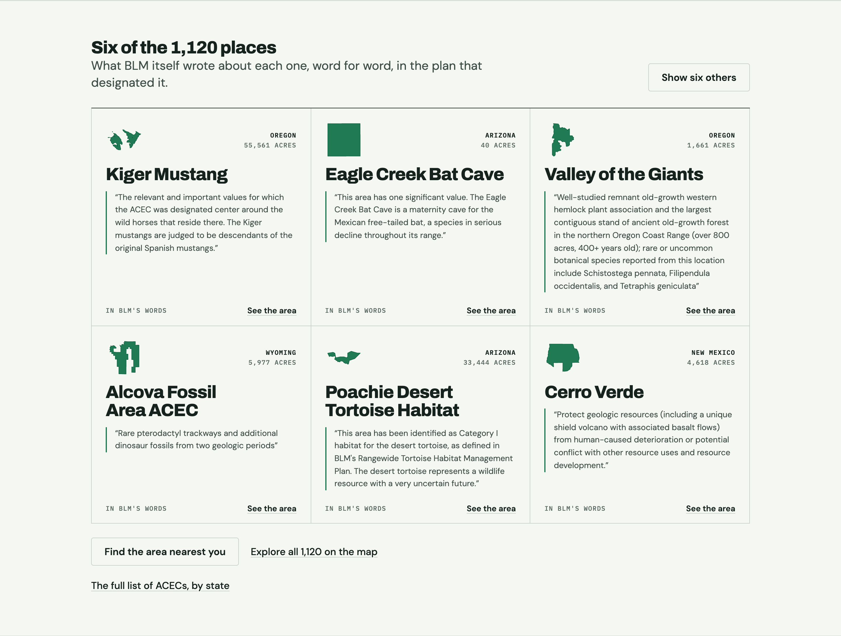
Six Areas of Critical Environmental Concern on America's Critical Lands, each with its outline and a quote from BLM
Six of the placesSix of the areas, each with its outline and BLM's own words for why it was set aside; the six change on every visit.PNG, 2,880 by 2,178, 0.42 MBThe page it shows
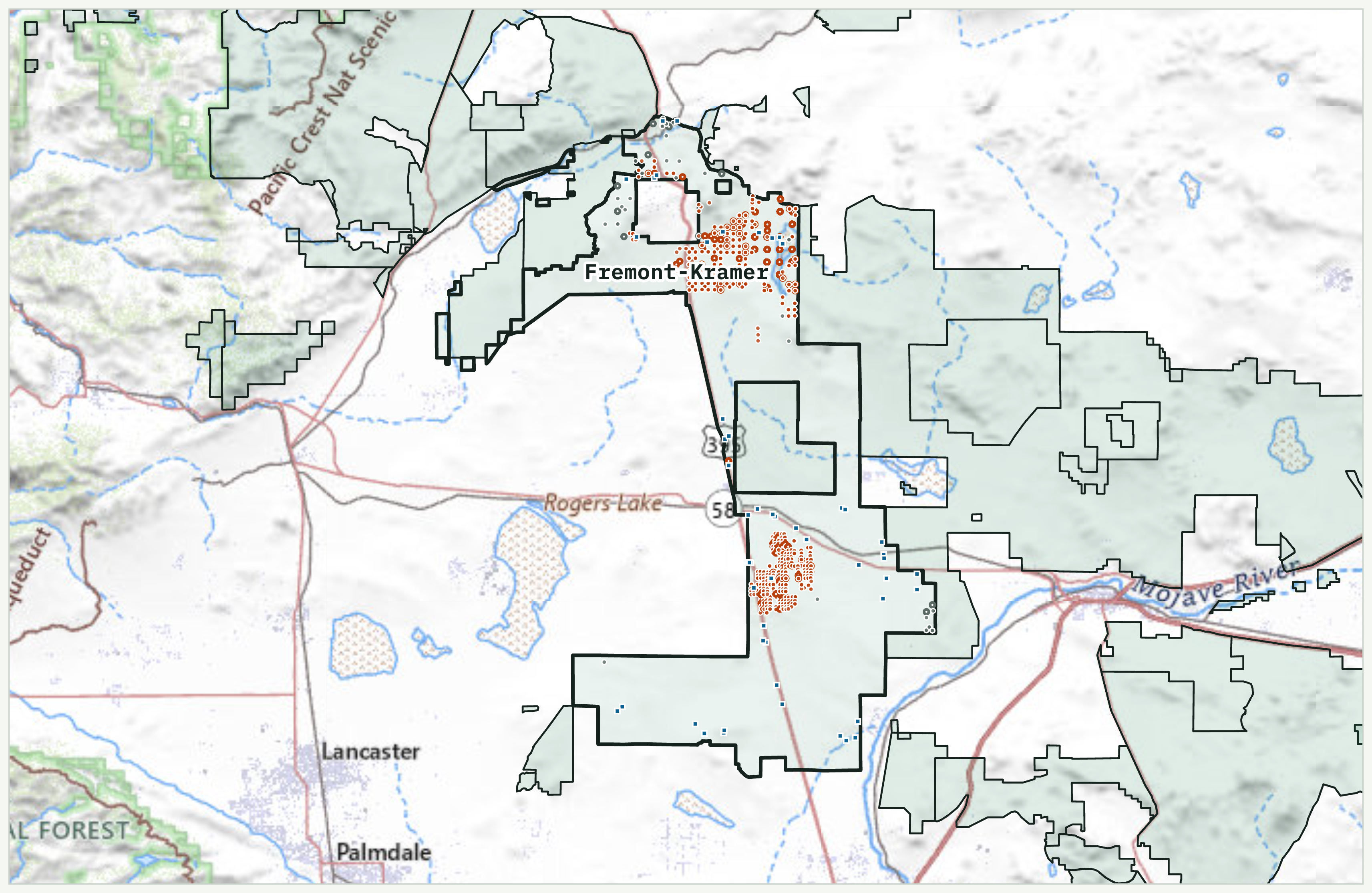
Map of the Fremont-Kramer Area of Critical Environmental Concern in California with mining claims and rights of way marked inside its boundary
Fremont-Kramer, California, and what sits inside itFremont-Kramer ACEC, California: its boundary drawn heavy on topographic ground, the mining claims and rights of way placed inside it.PNG, 3,426 by 2,229, 4.3 MBThe page it shows
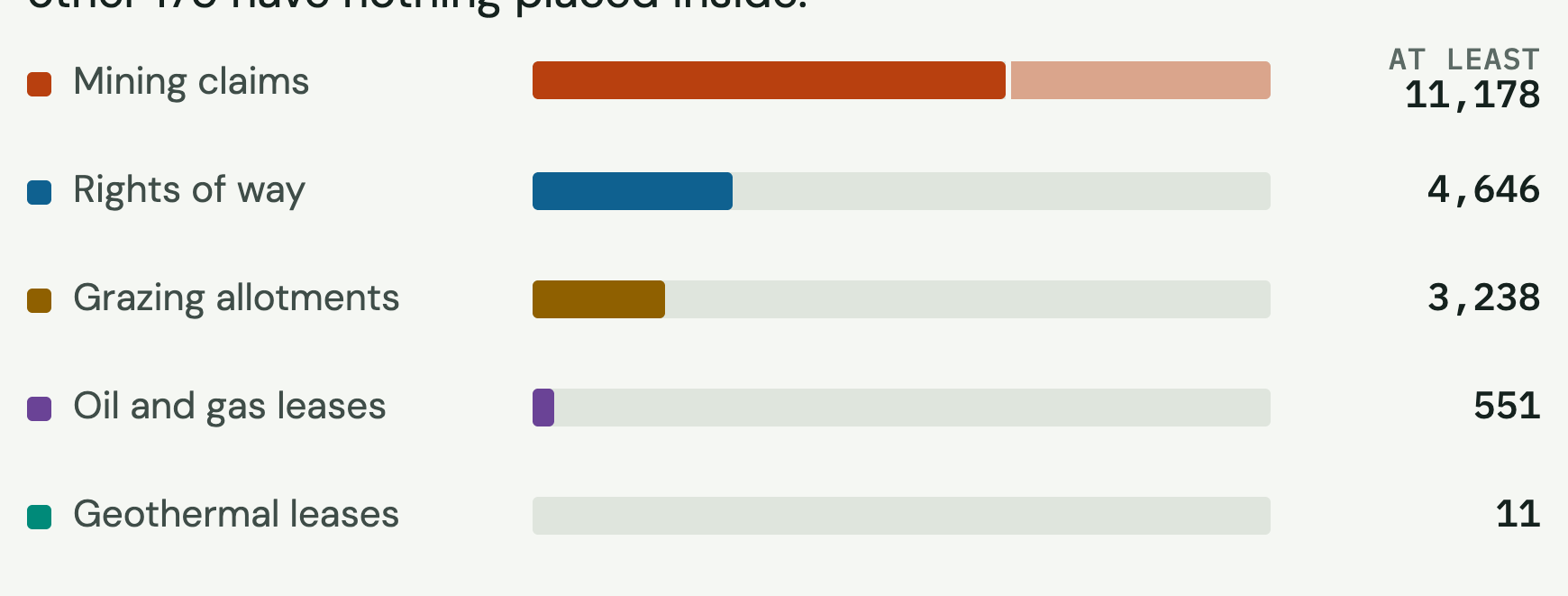
Bar chart of the mining claims, rights of way, grazing allotments and leases inside BLM Areas of Critical Environmental Concern
What's inside the boundaries, by kindWhat sits inside the boundaries, by kind: mining claims, rights of way, grazing allotments, oil and gas and geothermal leases.PNG, 1,740 by 661, 0.06 MBThe page it shows
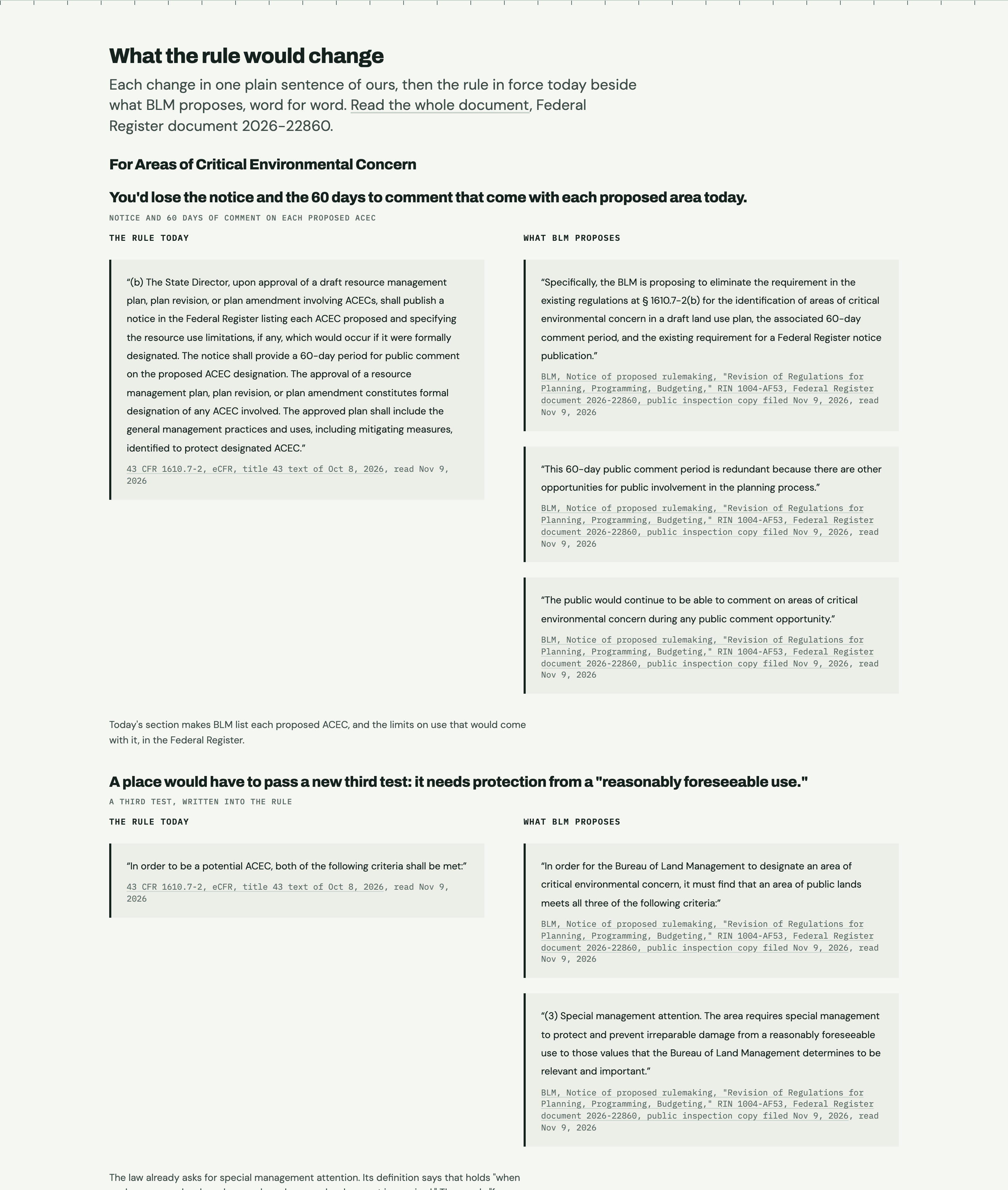
Screenshot comparing today's ACEC rule with BLM's proposed text, side by side
Today's rule beside the proposed textToday's ACEC rule beside the proposed text, word for word, from the rule page.PNG, 2,880 by 3,400, 0.73 MBThe page it shows
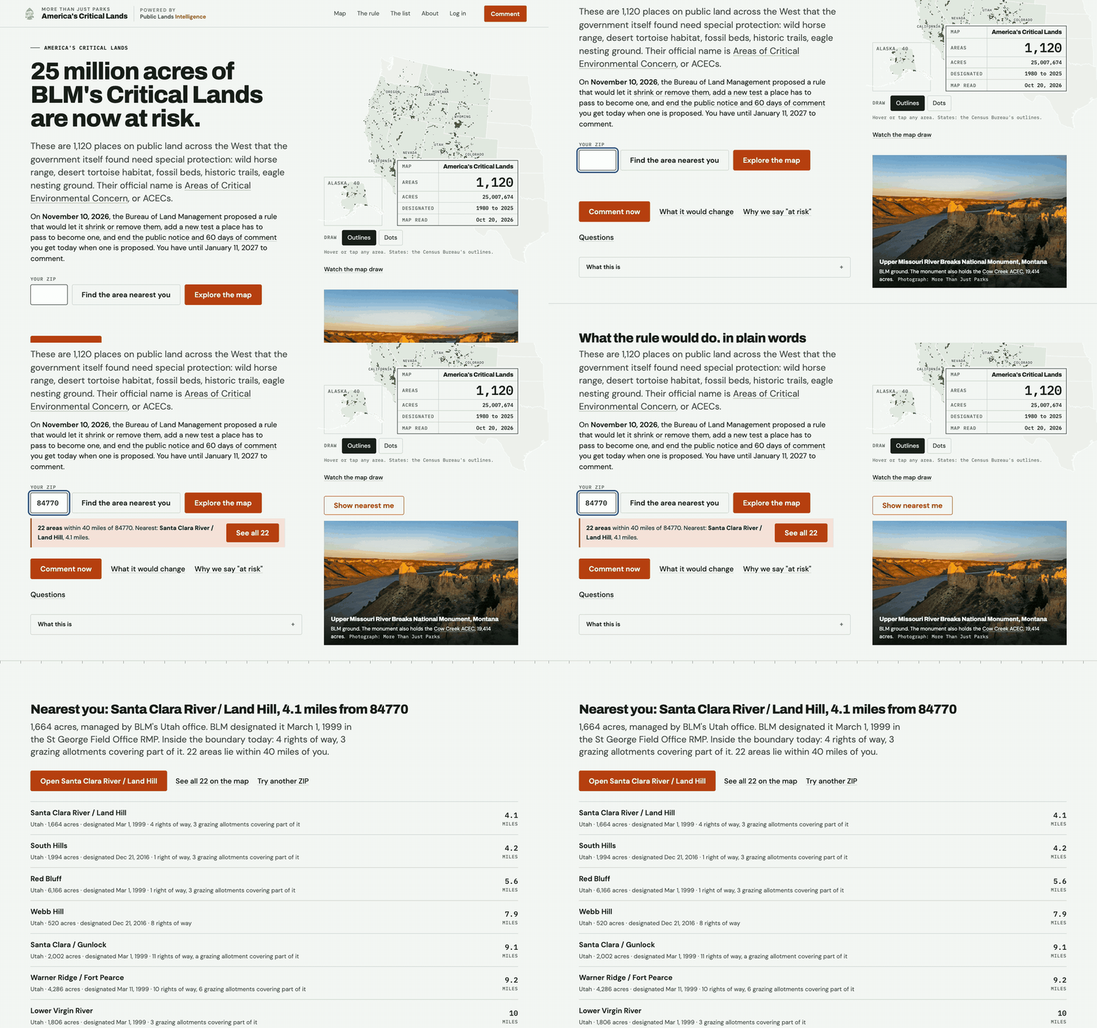
A ZIP code typed into America's Critical Lands returning the protected areas within 40 miles
Find the areas near youType a ZIP, get every protected area within 40 miles, nearest first, each with its acres, designation date and what is inside.MP4, 1,920 by 1,200, 3.3 MBGIF, 960 wide, 2.5 MBThe page it shows
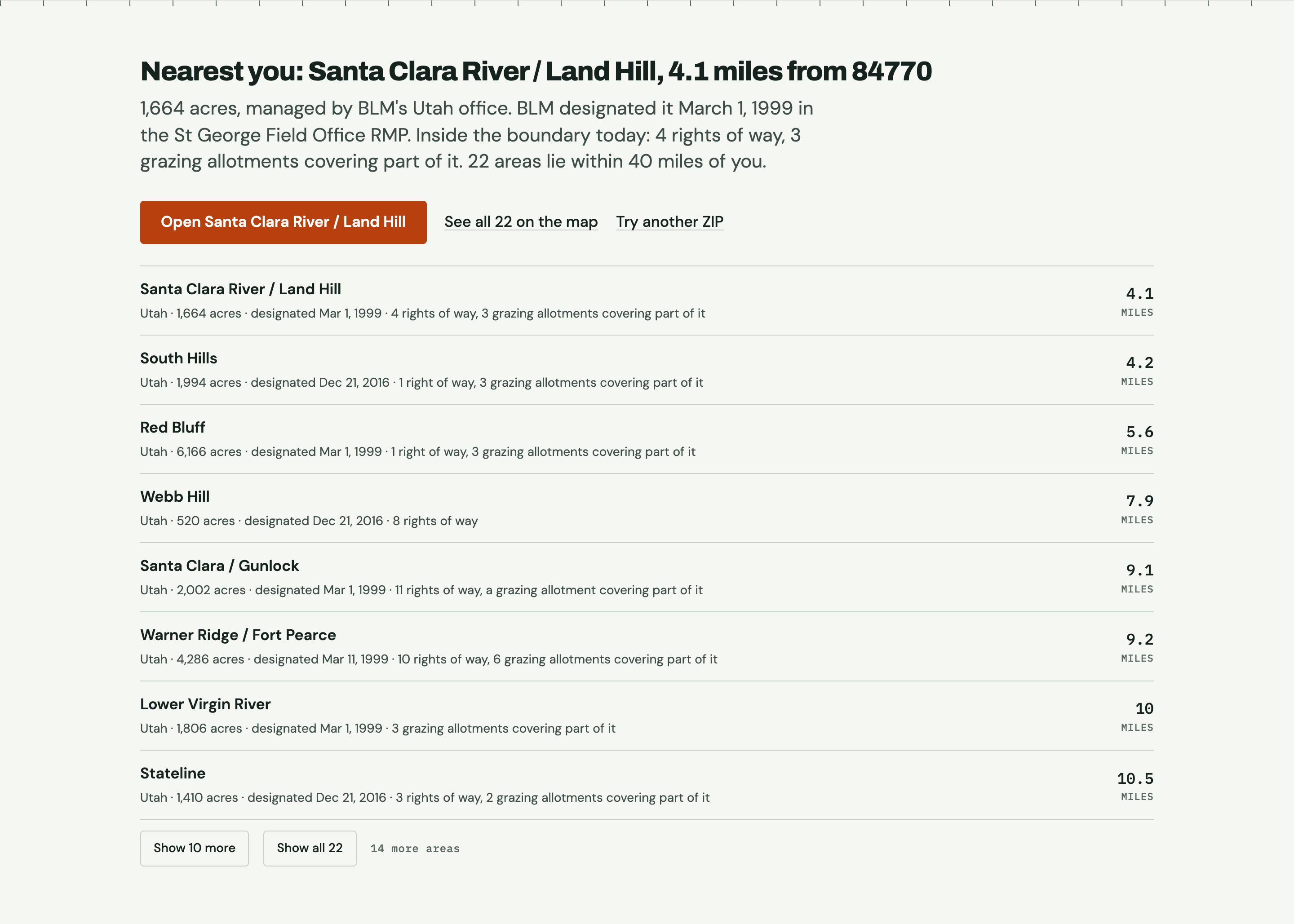
The ZIP lookup on America's Critical Lands listing the protected areas within 40 miles of St. George, Utah
The areas near a ZIPThe ZIP lookup: every area within 40 miles of a ZIP, here 84770 (St. George, Utah).PNG, 2,880 by 1,913, 0.33 MBThe page it shows
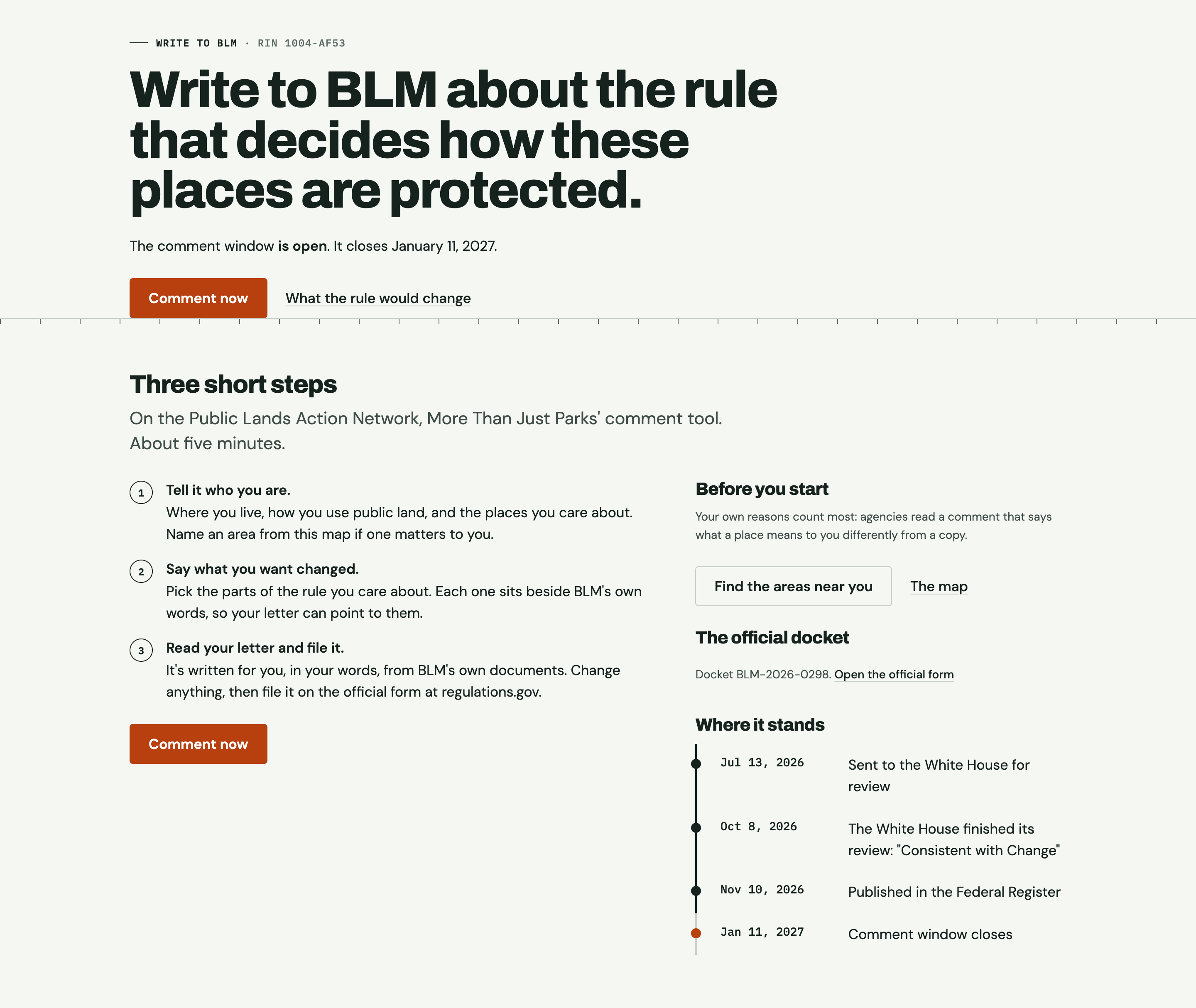
The comment page on America's Critical Lands, with three steps for writing to BLM about the proposed rule
The comment pageThe comment page: three short steps to a letter in BLM's docket, written in the reader's own words.PNG, 2,880 by 2,428, 0.39 MBThe page it shows
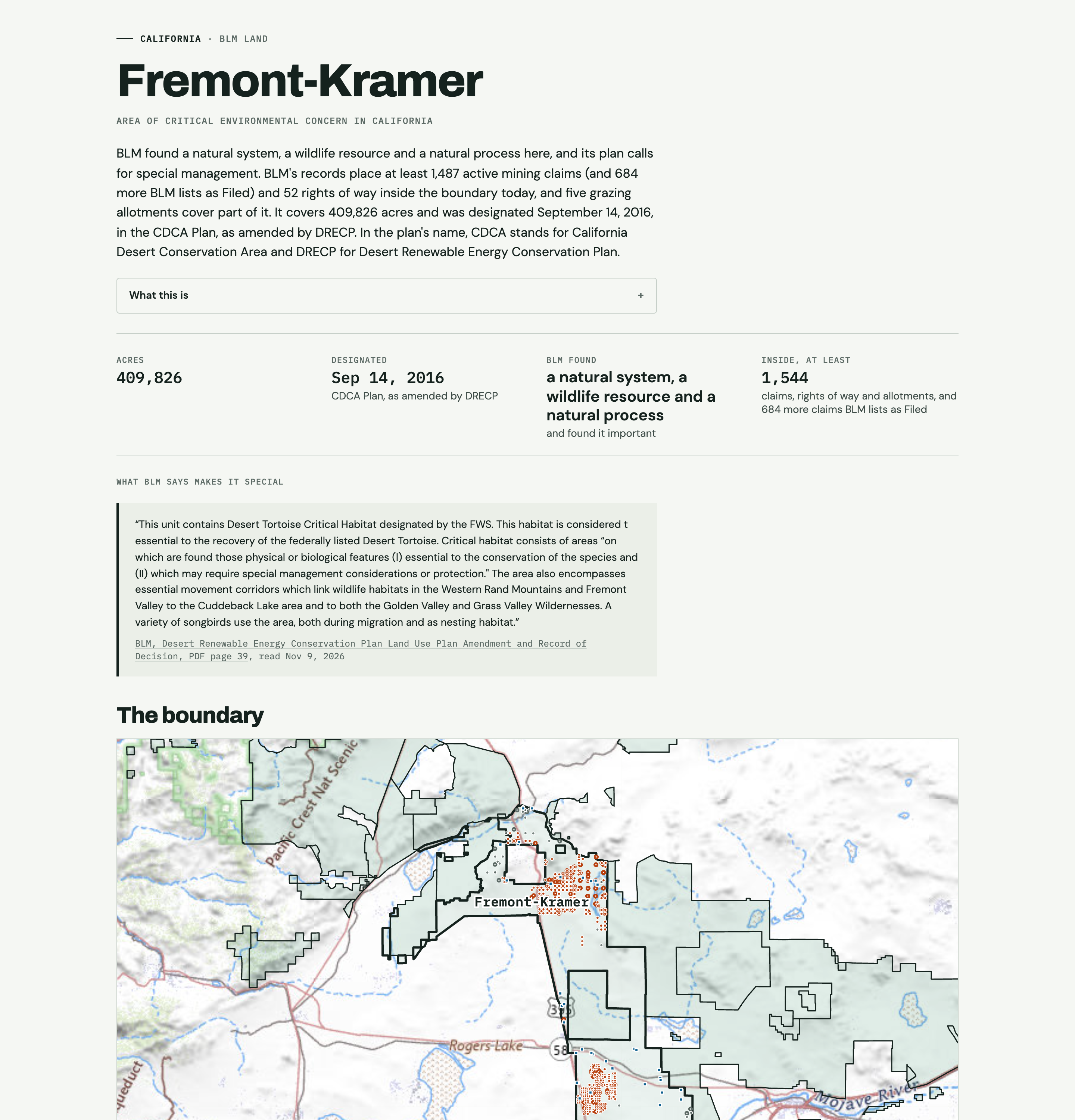
Screenshot of the Fremont-Kramer area page on America's Critical Lands
An area's own pageFremont-Kramer's own page: BLM's findings for it and what's inside, as a reader sees it.PNG, 2,880 by 3,000, 2.2 MBThe page it shows
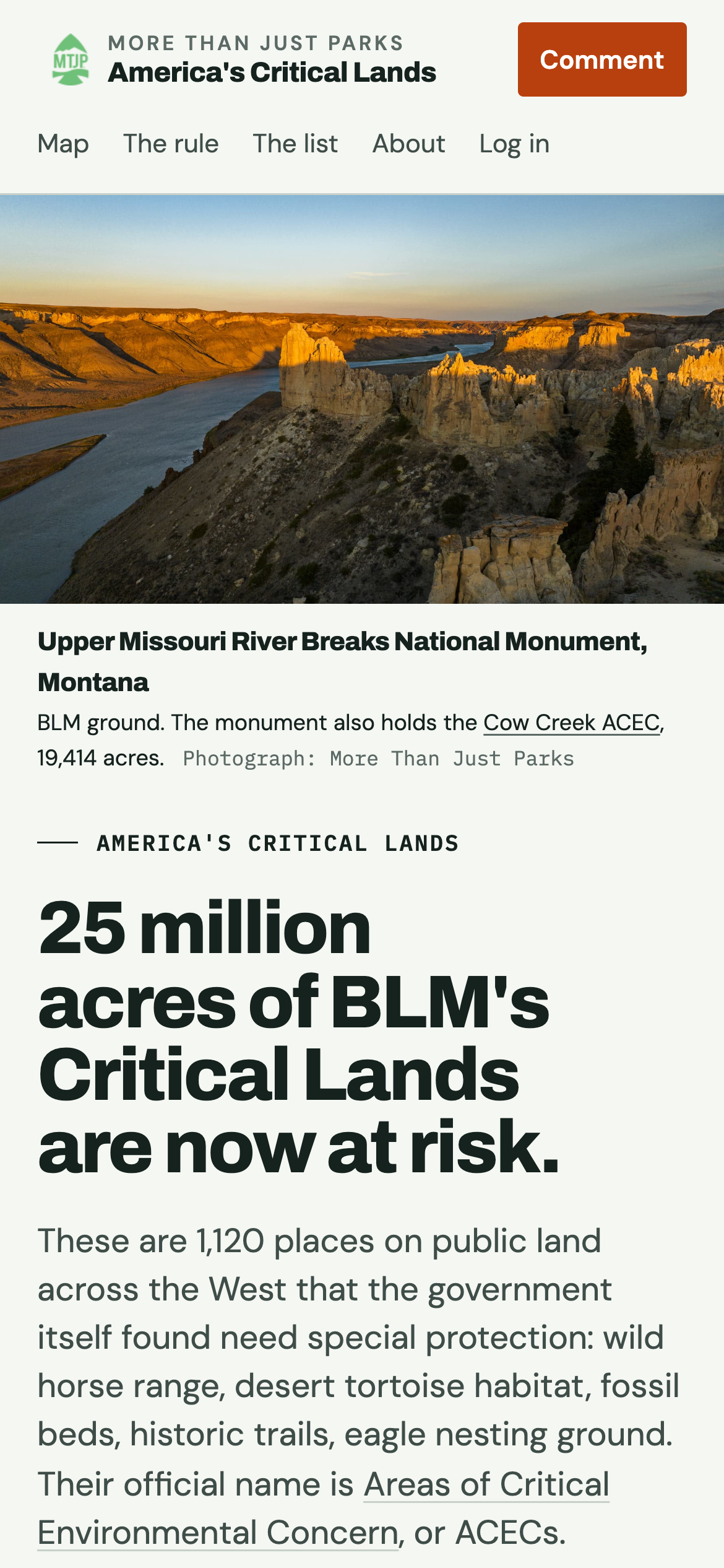
The home page of America's Critical Lands on a phone
The home page on a phoneThe home page on a phone.PNG, 1,170 by 2,532, 1.3 MBThe page it shows

The mark and the share card

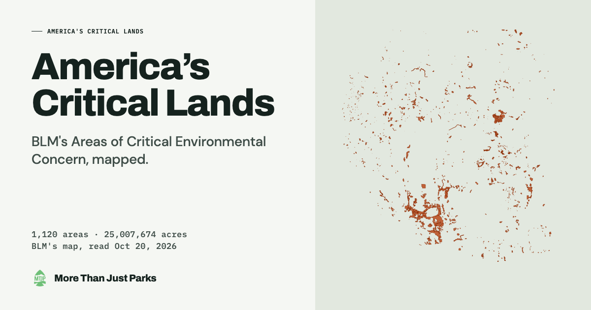
The share card for America's Critical Lands: the name, the count of areas and acres, and BLM's areas drawn across the West

More Than Just Parks logo, PNG, 2,000 by 2,000, 0.12 MBThe share card, PNG, 1,200 by 630

Write to us

For an interview, the underlying records, or anything that looks wrong: ask@morethanjustparks.com. A correction is fixed on the page and listed on How we know.