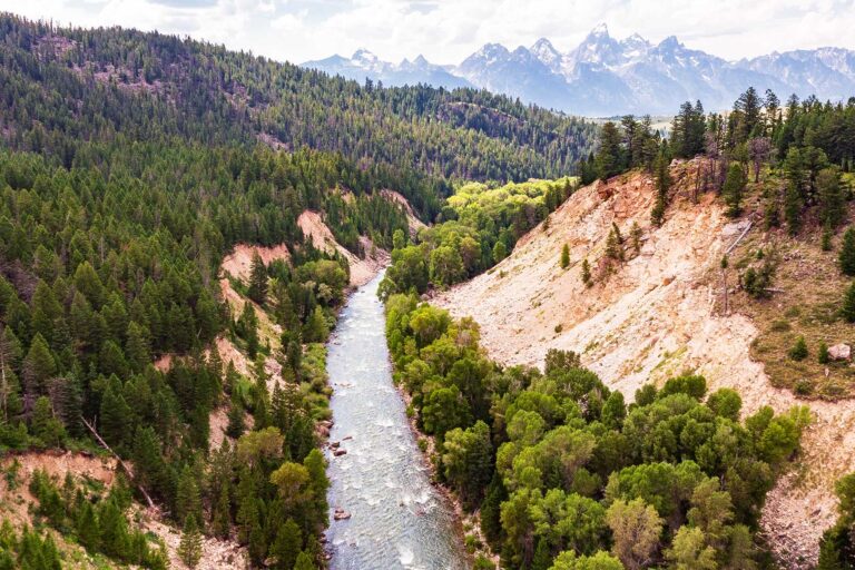
The Black Hills rise out of the northern plains like an island of dark pine forest, which is exactly how they got their name from the Lakota, who call this sacred country Paha Sapa. Spread across western South Dakota and into Wyoming, the Black Hills National Forest covers more than a million acres of granite peaks, ponderosa pine, clear creeks, and winding mountain roads. It surrounds some of the country’s best-known landmarks and holds plenty of its own.
One important thing to get right from the start: this is a National Forest, managed by the US Forest Service, not a national park run by the Park Service. That distinction matters for the rules, the fees, and the way you use the land. If you want the background, we wrote about why in our piece on national forest versus national park.
What Makes the Black Hills Special
The forest spans roughly 1.2 million acres and includes Black Elk Peak, which at 7,242 feet is the highest point in the United States east of the Rocky Mountains. Within and around the forest you will find granite spires, deep limestone canyons, caves, reservoirs, and mile after mile of pine. Bison, elk, deer, and mountain goats range across the hills, and the area carries deep significance for the Lakota and other Plains tribes.
What makes a trip here so rich is the density of things to do in a small radius. The national forest wraps around national park sites, state parks, scenic byways, and historic mining towns, so a single base puts an enormous variety of country within a short drive.
117 public lands destinations are under threat. Get the free briefing that 27,000+ people use to stay informed and take action.
How to Get There
The gateway is Rapid City, South Dakota, served by Rapid City Regional Airport (RAP), which sits just east of the hills. From there you are within an hour of most of the major attractions. The forest is also an easy drive from the Badlands to the east on Interstate 90, which makes pairing the two a natural road trip.
Useful towns inside and around the forest include Custer, Hill City, Keystone, Spearfish, Deadwood, and Lead. Highways and scenic byways link them, and you will want a vehicle, since this is spread-out mountain country with no transit between sights.
Best Time to Visit
Summer, from June through August, is peak season, with warm days, every road and trail open, and the most events and services running. It is also the busiest, especially during the early-August motorcycle rally based in nearby Sturgis, which fills lodging across the region, so plan around it.
Fall is a favorite, with cooler air, golden aspen mixed into the pines, and thinner crowds. Spring is pleasant but can be wet and snowy at elevation early on. Winter turns the hills into a snow destination for skiing, snowmobiling, and quiet, but mountain roads can close with storms and many seasonal services shut down. Check conditions before heading into the high country off-season.
Top Things to Do
- Black Elk Peak. Hike to the highest point east of the Rockies, topped by a historic stone lookout, for a long view across the hills. The popular route starts near Sylvan Lake.
- Spearfish Canyon Scenic Byway. A drive through a deep limestone canyon with waterfalls like Bridal Veil and Roughlock, at its best in fall.
- Needles Highway and the granite spires. The famous Needles Highway threads narrow tunnels among the granite needles in the southern hills.
- Pactola Reservoir and the lakes. Clear mountain reservoirs for swimming, fishing, paddling, and camping.
- Mickelson Trail. A 109-mile rail-trail running the length of the hills, good for biking and walking past old mining country.
- Caves and historic towns. Explore limestone caves and the old gold-mining towns of Deadwood and Lead.
Several of the region’s headline attractions sit on adjoining park and state lands rather than in the forest itself. For nearby ideas, see our guides to things to do near Mount Rushmore, visiting Mount Rushmore, and the things to do at nearby Wind Cave National Park.
Where to Stay
The Forest Service runs more than two dozen campgrounds across the Black Hills, many of them on the reservation system and the rest first-come, first-served, set among the pines and along the lakes and creeks. Dispersed camping is also allowed in much of the forest under Forest Service rules, which is a real advantage of national forest land.
For lodges, cabins, and hotels, the towns of Custer, Hill City, Keystone, Deadwood, and Spearfish all make good bases, and Rapid City offers the widest range of rooms. Book well ahead for summer and especially around the August rally, when the entire region fills up.
Fees, Reservations, and Permits for 2026
Because this is national forest rather than a national park, there is no general entrance fee to the Black Hills National Forest itself. You can drive most of its roads and access most trailheads for free. Fees apply at developed campgrounds, certain day-use areas, and some special sites, and the federal interagency pass can cover day-use fees at participating Forest Service sites.
Note that nearby park and state sites have their own separate fees and rules, so the Mount Rushmore parking fee, national park entrance fees, and state park passes are all separate from the forest. Dispersed camping, campfires, and motorized use are governed by Forest Service regulations and seasonal fire restrictions, which tighten in dry years. Confirm current campground reservations, fees, and any fire or road restrictions with the Black Hills National Forest before you go.
How Many Days to Spend
Two days lets you sample the scenic drives and one good hike. Three to five days is ideal for combining the forest’s trails, byways, and lakes with the surrounding attractions like Mount Rushmore, Custer State Park, Wind Cave, and the mining towns. The whole region works best as a multi-day road trip from a single base.
Sample 2-Day Itinerary
- Day 1, the southern hills. Drive the Needles Highway through the granite spires, then hike Black Elk Peak from the Sylvan Lake area. Spend the afternoon at a mountain lake and base near Custer or Hill City.
- Day 2, the northern hills. Drive the Spearfish Canyon Scenic Byway, stopping at the waterfalls. Explore the historic mining towns of Deadwood and Lead, and ride or walk a stretch of the Mickelson Trail.
Safety and Practical Tips
- Wildlife on the roads. Deer, elk, and bison cross mountain highways, especially at dawn and dusk. Drive carefully and keep your distance from bison.
- Mountain weather. Conditions change fast at elevation, and summer brings afternoon thunderstorms with lightning. Get off exposed peaks like Black Elk if a storm builds.
- Fire restrictions. Dry summers bring campfire bans and fireworks prohibitions. Check current rules and never leave a fire unattended.
- Plan around the rally. The early-August motorcycle rally fills lodging and traffic across the region. Either join the energy or avoid those dates.
- Respect sacred ground. The Black Hills are sacred to the Lakota and other tribes. Travel with that in mind, especially at culturally significant sites.
Plan the Rest of Your Trip
The Black Hills make a strong anchor for a wider South Dakota loop. Pair this guide with our nearby guides to things to do near Mount Rushmore and Wind Cave National Park, and add the Badlands an hour to the east. Give yourself a few days, drive the byways, climb Black Elk Peak, and let the dark hills show you why this country is held sacred.