
Comments closed October 26
Fix eroding Road 250 crossings near Snag Lake
U.S. Army Corps of Engineers · Snag Lake (local water body near Cordova, Alaska), 0.68 acres of palustrine wetlands
- What
- Realigning 1.6 miles of Forest Service Road 250 would stop chronic sediment runoff into Snag Lake area streams.
- Where
- Snag Lake (local water body near Cordova, Alaska), 0.68 acres of palustrine wetlands, 0.18 acres of streambed, AK
- How much
- Palustrine wetlands permanently filled: 0.68 acres. Streambed permanently filled: 0.18 acres. Road realignment length: approximately 1.6 miles.
- Decided
- Comments closed October 26, 2026. No decision document is on file yet.Date from Army Corps public notice (Regulatory Request System) ↗, read September 30, 2026.
Where these four lines come from
- WhatOur plain-English read of the Army Corps public notice ↗. Check it against the agency’s own words under Case.
- WhereThe places and states the notice names, as PLAN read them.
- 0.68 acres“place 350 cubic yards of fill material into 0.68-acre of palustrine wetlands” PROPOSED WORK Open the document ↗
- 0.18 acres“206 cubic yards of fill material into 0.18-acre of streambed” PROPOSED WORK Open the document ↗
- approximately 1.6 miles“to realign approximately 1.6-mile of Forest Service (FS) Road 250” PROPOSED WORK Open the document ↗
- DecidedOctober 26, 2026, from Army Corps public notice (Regulatory Request System), its comment end date ↗. Read September 30, 2026. The decision document is the one on file in PLAN’s record.
- Read from PLAN’s record November 15, 2026.
What the proposal said, and what the decision did
No figure from the proposal has been checked against the decision on this fight yet. What the record does hold is the issues ledger below.
No decision document is on PLAN’s record for this fight yet. When the agency’s decision lands, what it answered goes here.
Protective action worth supporting
Realigning 1.6 miles of Forest Service Road 250 would stop chronic sediment runoff into Snag Lake area streams.
What’s at risk
If we stay silent
Our plain-English read of the official notice ↗. Check it against the agency’s own words below.
By the numbers, from the agency’s own document
- Palustrine wetlands permanently filled
PROPOSED WORK
Open the document ↗“place 350 cubic yards of fill material into 0.68-acre of palustrine wetlands”
- Streambed permanently filled
- Road realignment length
- Stream crossings to be reclaimed
PROPOSED WORK
Open the document ↗“reclaim four (4) perennial stream crossings and one (1) crossing with intermittent flow within the 18-Mile Creek system”
- Current road entrenchment depth
PROPOSED WORK
Open the document ↗“entrenched by two (2) to three (3) feet and has not experienced routine maintenance”
Source: the agency’s document ↗
The agency’s own analysis
What the notice says, and what it leaves out
The window has closed; the record of what was missing stays.
The agency says
“reclaim four (4) perennial stream crossings and one (1) crossing with intermittent flow within the 18-Mile Creek system”
The project fills 0.18 acres of streambed and reclaims four perennial stream crossings in the 18-Mile Creek system, yet the notice names no fish species and discloses no ESA Section 7 consultation.
The agency says
“place 350 cubic yards of fill material into 0.68-acre of palustrine wetlands and 206 cubic yards of fill material into 0.18-acre of streambed”
The project's stated purpose is to stop sediment from entering the local water body, but placing fill directly into wetlands and streambed during construction will generate turbidity and sediment in those same waters.
The agency says
“would prevent sediment from entering the local water body as compared to the existing alignment”
The project's purpose is to reduce erosion into 'the local water body,' and the new alignment is described as preventing sediment from entering that same body, but the notice never names it.
The agency says
“206 cubic yards of fill material into 0.18-acre of streambed”
The project requires substantial fill material but the notice says nothing about where it comes from.
The agency says
“The road is currently entrenched by two (2) to three (3) feet and has not experienced routine maintenance”
The notice states the road has not experienced routine maintenance and is now entrenched two to three feet, but it does not disclose when maintenance obligations arose, how long the road has been in its degraded state, or whether the absence of maintenance violated any permit, travel management plan, or Forest Service maintenance schedule.
In the agency’s own words
Hampton Coogle, United States Forest Service (USFS), stated the purpose is to rehabilitate the road to provide better public access and reduce erosion into the local water body. This project would be reclaiming and decommissioning sections of road and ford crossing locations. The new alignment would not require any ford crossings and would prevent sediment from entering the local water body as compared to the existing alignment. PROPOSED WORK: The USFS proposes to place 350 cubic yards of fill material into 0.68-acre of palustrine wetlands and 206 cubic yards of fill material into 0.18-acre of streambed to realig…
Who signs it
The notice names no signer PLAN could read. PLAN names a decision-maker only when the document names one.
The ground
The window has closed, so there’s no watch to set on it here.
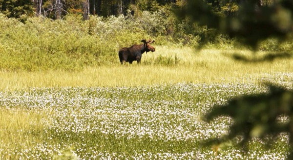
The photograph on this page: Moose in a summer wildflower meadow. It’s the country this decision sits in, not the site itself. More Than Just Parks.
In court on this ground
This fight isn’t bound to a land unit in PLAN’s record yet, so there are no court cases to show for its ground.
Who holds the vote
PLAN’s record doesn’t tie a member of Congress to this fight yet. The scorecard grades the votes and bills that decide public lands; nothing joins a vote or a bill to this decision, so there’s no member to name here without guessing.
See how your members vote ↗Army CorpsWe track this on the agency’s own system of record, where most on-the-ground decisions live.
On the record for this fight
1 person told us they filed on this fight through PLAN; we haven’t found that letter on the agency’s record yet.
- Judith A.60 seals
Ranked on letters found on the agency’s record, then letters filed. Readers appear as first name and last initial, or as a steward in their state; switch yours off in your record. All boards
Know an open comment period we are missing, or spotted a wrong deadline? .
More fights that need you
Go deeper for free
See how your members of Congress vote on public lands
Every representative, graded on the votes that decide the fate of parks, forests, and refuges.
Open ↗The mapSee the places under active threat
A live map of the parks, monuments, and wild country in the crosshairs right now.
Open ↗A wrong fact, a dead link, a form that wouldn’t take your letter: one tap and it comes to the people who build PLAN, with this fight attached.