
Stop bike expansion from harming Brandywine Valley trails
BRVA- Comprehensive Trail Plan
National Park Service· First State National Historical Park, Brandywine Valley UnitNPS Planning (PEPC) project page ↗
NPS PEPCWe track this on the agency’s own system of record, where most on-the-ground decisions live.
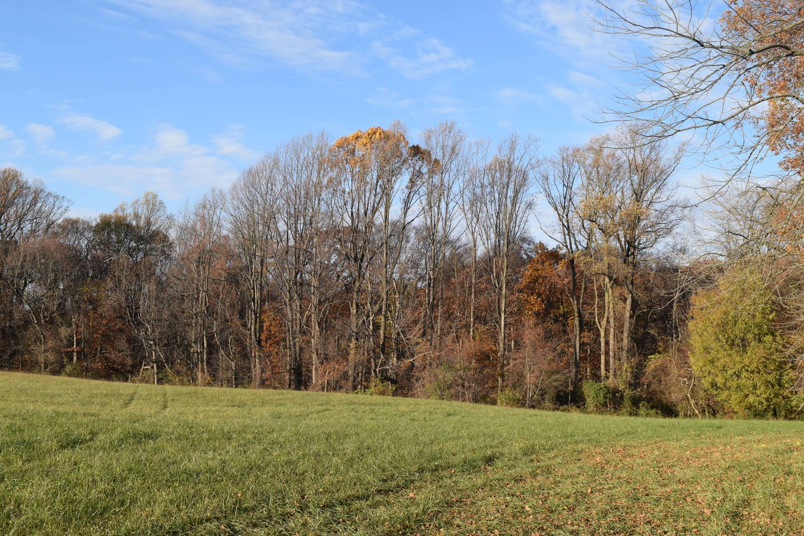
New cycling rules could permanently alter trails shared by hikers, equestrians, and wildlife in this historical park.
What’s at risk
Natural habitat and cultural resources at the Brandywine Valley Unit face damage from expanded or poorly managed bicycle access. Trail conflicts between cyclists, hikers, and equestrians could degrade the park's ecological and historical character.
If this goes through
Once the bike use rules are formally adopted, trail designations and access changes become the governing standard and are difficult to reverse.
Our plain-English read of the official notice ↗. Check it against the agency’s own words below.
The agency’s case, tested
What the agency argues, and whether its own record backs it
- 1
- Holds up
- 6
- No support given
The National Park Service has determined that allowing bicycles on about 25 miles of multi-use trails in the Brandywine Valley unit of First State National Historical Park protects the park's natural and scenic values, safety and management goals, and won't disturb wildlife or park resources. It relies on a trail plan environmental assessment and a finding of no significant impact signed November 11, 2024.
“The EA identifies a preferred alternative that would allow bicycle use on approximately 25 miles of trails in the Brandywine Valley.”
BACKGROUND
Each Ask below goes into your letter when you write it with PLAN on this page, matched to what you tell it about how this land reaches you.
Purpose and need
No support given
Engineering improvements will let the redesigned trail system handle visitor use levels sustainably.
The agency's support is a full-scale redevelopment that closes steep, eroding trails and replaces them with loops at more sustainable grades. But the document gives no current visitation counts, no projected use with expanded biking, and no capacity figures, so the claim that the system can handle use levels sustainably can't be checked from this text.
AskDisclose current and projected visitor and bicycle use numbers and the trail capacity the design is meant to handle.
The agency’s words +Hide the words
The agency says
“Engineering improvements will enable the trail system to accommodate visitor use levels on a sustainable basis.”
Management Objectives
Effects
No support given
Consultations and mitigation measures will protect wetlands and the federally threatened bog turtle during trail construction and bike use.
The agency points to state reviews, a Phase I investigation, construction monitoring, and timing changes. But the same section says Phase II surveys to find whether bog turtles are present are still underway, and wetland construction is avoided only 'wherever practicable.' The only consultations named are with state agencies, and no survey results or wetland acreage are given.
AskFinish the Phase II bog turtle surveys and disclose the results, name which trails cross or border potential habitat, and explain the federal wildlife agency's role before bike trails open there.
The agency’s words, the record +Hide the words
The agency says
“Taken together, these consultations and mitigation measures will ensure that the NPS continues to protect wetlands, sensitive species such as the bog turtle, and the broader cultural and natural resources of the Brandywine Valley unit throughout trail construction and subsequent visitor-use activities, including bicycling.”
Wildlife and Park Resources
Elsewhere in the same document
“Based on a Phase I investigation, the NPS incorporated these wetlands into project planning and is conducting Phase II surveys to determine presence or probable absence of the species.”
Wildlife and Park Resources
“Wetland impacts will also be minimized through best management practices and by avoiding new trail construction in wetlands wherever practicable.”
Wildlife and Park Resources
Effects
No support given
Local wildlife is used to people, so continued and expanded trail use, including bikes, won't harm wildlife.
The agency's support is that the area already gets frequent human visitors, the listed species are common ones, and visitors generally stay on or close to trails, so habitat loss is limited. But no wildlife surveys or disturbance data back the habituation claim. The plan also adds 8.5 miles of new trails with temporary and permanent vegetation clearing, and the document doesn't say whether those routes reach areas that see little use now.
AskProvide wildlife data showing how animals respond to bike traffic, especially along the 8.5 miles of new trails in areas that don't currently have trails.
The agency’s words, the record +Hide the words
The agency says
“Local wildlife is habituated to human use of the landscape and typically avoid encounters with humans; as a result, continued public use of trails would not adversely affect wildlife.”
Wildlife and Park Resources
Elsewhere in the same document
“The trail plan would be implemented in an area that receives frequent human visitation.”
Wildlife and Park Resources
“The proposed construction of 8.5 miles of new shared-use trails and site-specific trail modifications and upgrades on 15 miles of existing trails would result in temporary and permanent vegetation clearing.”
Natural, Scenic, and Aesthetic Values
Show 3 more claims +Show fewer
Effects
No support given
Biking has no unique visual effects compared to hiking or horseback riding because it doesn't change vegetation or widen the trail's visible footprint.
The agency relies on natural surfacing, narrow tread widths of 24 to 48 inches, and the point that bikes add no infrastructure. The Wildlife and Park Resources section admits 'short-term impacts along trail edges when bikers occasionally travel off trail,' which it says design and education can mitigate. That creates tension with the claim, but it isn't a direct contradiction. The document gives no comparison of bike, hiker and horse effects to support the 'no unique visual impacts' conclusion.
AskReconcile the finding of no unique visual effects with the admitted off-trail vegetation damage from bikes, and explain how trail-edge widening will be measured and prevented.
The agency’s words, the record +Hide the words
The agency says
“Bicycle use on such trails has no unique visual impacts compared to hiking or equestrian use, as the activity does not change vegetation patterns, introduce new infrastructure, or expand the visible footprint of the trail.”
Natural, Scenic, and Aesthetic Values
Elsewhere in the same document
“Although trails that allow bicycle use are prone to short-term impacts along trail edges when bikers occasionally travel off trail into vegetated areas, the NPS can mitigate these impacts through trail design and visitor education.”
Wildlife and Park Resources
Effects
No support given
Fewer stream crossings and rock-armored crossings will reduce harm to water resources.
The agency's support is that the plan cuts the number of stream crossings and uses design features like rock armoring at at-grade crossings. The reasoning is plausible. But the document doesn't say how many crossings exist now, how many will remain, or how many the new trails add, so the net reduction can't be checked from this text.
AskList the current and planned number of stream crossings, including any on the 8.5 miles of new trails, and describe expected sediment effects from bike use at crossings.
The agency’s words +Hide the words
The agency says
“Further, by reducing the number of locations where recreational users cross streams, and by implementing design features such as rock armoring through at-grade water crossings, adverse impacts on water resources would be reduced.”
Wildlife and Park Resources
Effects
No support given
Adaptive monitoring will keep growing visitor use from causing crowding, conflict, or degraded trails.
The document lists possible tools such as trail counters, patrols, and incident reports. It sets no thresholds, triggers, or specific actions such as closing a trail to bikes if conditions decline, so there's no way to tell when or how monitoring would change management.
AskSet measurable thresholds for crowding, user conflict, and trail damage, and name the specific actions, including restricting bikes, the park will take when they're crossed.
The agency’s words, the record +Hide the words
The agency says
“The park will use an adaptive monitoring program to help guide future management decisions so that increasing or changing patterns of visitor use do not lead to crowding, conflict, degraded trail conditions, or diminished enjoyment of park resources.”
Safety Considerations
Elsewhere in the same document
“Monitoring may include tracking visitation through tools such as trail counters and transportation data, along with periodic data collection to understand visitor use patterns, user characteristics, and potential conflicts.”
Safety Considerations
Where its own record backs the agency
EffectsThe trail system is designed to improve safety through closures, reroutes, and new construction.Why it holds +
The document backs this with specific examples: closing or rerouting trails near surface mines, realigning trails at unsafe road crossings along Ramsey Road, and replacing steep Rocky Run trails with gentler loops that limit downhill speed and improve visibility. It gives no accident data, but the design changes are concrete and tied to named hazards.
The agency says
“The proposed trail system is intentionally designed to enhance visitor safety through targeted realignments, closures, and new construction.”
Safety Considerations
Its own record backs it
“For example, trails located near surface mines will be closed or rerouted because their proximity poses direct safety risks to visitors.”
Safety Considerations
Read from the agency’s own decision document ↗, all 6 pages. Every quote is checked word for word against it, a claim marked contradicted stands on a quote from the same document, and a second reading argued the agency’s side of every verdict before it was published. The verdicts are our reading; the quotes are the agency’s. A court can set aside agency action it finds “arbitrary, capricious, an abuse of discretion, or otherwise not in accordance with law” (5 U.S.C. 706(2)(A) ↗), which is why these gaps are worth putting in the record.
What to say
Make these points, in your own words
- I oppose this action as proposed, and I ask the agency to weigh the specific harms below.
- The agency acknowledges that Phase II bog turtle surveys have not been completed before approving construction of 8.5 miles of new trails near potential habitat, yet the FONSI was signed on November 11, 2024 anyway. The section on Wildlife and Park Resources states only that the NPS 'is conducting Phase II surveys to determine presence or probable absence of the species.' Approving ground-disturbing construction before presence/absence data exist for a federally threatened species is a classic NEPA deficiency: the agency cannot rationally conclude no significant impact without first knowing whether the species is present. The agency should suspend trail construction near wetland areas until Phase II surveys are complete and results are disclosed for public review, or prepare an EIS that analyzes the full range of impacts under scenarios where bog turtles are present.
- The Written Determination states that bicycle use 'will not disturb wildlife or park resources,' as required by 36 CFR 4.30, yet the same document concedes that 'trails that allow bicycle use are prone to short-term impacts along trail edges when bikers occasionally travel off trail into vegetated areas.' The agency cannot simultaneously certify no disturbance to wildlife while acknowledging documented off-trail incursions into vegetated habitat. The section on Wildlife and Park Resources contains this internal contradiction. The agency should provide a reasoned, quantitative analysis reconciling these two statements and explain how the regulatory standard of no wildlife disturbance is met given the admitted off-trail impact pattern.
- The Safety Considerations section promises an 'adaptive monitoring program' with trail counters and periodic data collection to prevent crowding, conflict, and degraded conditions, but sets no numeric thresholds, no timelines for data review, and no defined triggers that would prompt management action or trail closure. An adaptive management commitment with no enforceable triggers is not a mitigation measure; it is a placeholder. This matters because 25 miles of new bicycle access will generate substantially higher visitation. The agency should disclose the specific monitoring metrics, threshold values, review intervals, and corrective actions before the FONSI is finalized, or treat the absence of such specifics as a significant unresolved issue requiring an EIS.
- The document states that 'approximately 48 percent of the unit's land is agricultural fields and pastures' and that the trail plan will 'ensure consistency with leased agricultural operations,' but nowhere analyzes how 8.5 miles of new shared-use trails and significantly increased bicycle traffic will affect active farm leases, soil compaction near fields, livestock disturbance, or the agricultural character that is central to the park's stated significance. The Natural, Scenic, and Aesthetic Values section and the Management Objectives section both reference agriculture but neither contains any impact analysis. The agency should provide a specific analysis of trail-agriculture interaction effects before construction begins.
Show all 11 points from the document
- The significance statement for the Brandywine Valley unit centers on William Poole Bancroft's philanthropic vision for 'open park lands and the conservation of green space.' The document does not analyze whether adding 25 miles of bicycle-designated trails, new signage, trail counters, and 8.5 miles of construction alters the character of a landscape whose national significance is explicitly tied to quiet, conservation-oriented open space. The Natural, Scenic, and Aesthetic Values section dismisses visual impact by saying bicycle use 'does not change vegetation patterns' but does not address the experiential and character-of-place dimension of the significance statement. The agency should analyze whether the selected alternative is consistent with the park's own significance statement and explain that reasoning explicitly.
- The document states that the NPS 'consulted with the Delaware Nation, Delaware Tribe of Indians, and the State Historic Preservation Offices' and that a programmatic agreement was executed, but it does not disclose what, if any, adverse effects on cultural resources were identified, what mitigation measures the programmatic agreement requires, or whether the Tribes expressed concerns about trail construction through areas reflecting 'early Quaker settlement patterns and Native American migration.' The Background section notes the land 'reflects early Quaker settlement patterns and Native American migration' yet Section 106 outcomes are described only in procedural terms. The agency should release the programmatic agreement and any supporting cultural resource inventory findings for public review before construction proceeds.
- The Written Determination concludes that bicycle use will not disturb wildlife, yet the wildlife inventory in the document is limited to common generalist species and mentions only a brief Phase I investigation for bog turtles. No analysis addresses migratory birds, breeding-season disturbance windows, amphibian migration periods for the salamanders and frogs listed, or snake hibernation timing, even though the document itself lists these species as present. The Wildlife and Park Resources section names these taxa but contains no seasonal-sensitivity analysis. The agency should conduct and disclose a seasonal-use analysis for sensitive wildlife before authorizing year-round bicycle use on new trails adjacent to wetland and forest-edge habitat.
- The document states that trail construction 'would avoid clearing large trees to the extent feasible' when describing 8.5 miles of new construction, but provides no definition of 'large trees,' no acreage or canopy-cover estimate for total permanent vegetation clearing, and no analysis of whether clearing would affect the forested character that contributes to the park's scenic and aesthetic values or to wildlife corridor function. The Natural, Scenic, and Aesthetic Values section contains this commitment without any supporting data. The agency should disclose the estimated total area of permanent vegetation clearing, define the tree-size threshold, and analyze impacts to forest canopy and wildlife movement corridors before construction begins.
- The e-bike issue is referenced in the Safety Considerations section, where the document states that online information will help visitors understand 'rules related to bicycle and e-bike use,' but nowhere in the Written Determination is there a trail-by-trail or class-by-class determination for e-bikes under 36 CFR 4.30. E-bikes have different speed, noise, and off-trail-incursion profiles than conventional bicycles, and the regulatory determination must address each use separately. The agency should issue a separate written determination for e-bike use on each designated trail, or explicitly exclude e-bikes from authorization until such an analysis is complete.
- Say something only you can say. The law requires the agency to consider and respond to substantive comments, and specifics are what make a comment substantive.
In the agency’s own words
FRST_Bike_Rule-Written_Determination_7.29.2026_Brandywine Valley Unit
Did the agency answer?
17 issues are on this record. The agency has not published its decision document yet, so each one stays pending until the agency answers.
Issues on the record, awaiting the decision
- PendingThe document gives specific elevation figures for the highest ridges and lowest point along Brandywine Creek, which could be checked with a GPS or altimeter while standing at those locations.
The document gives specific elevation figures for the highest ridges and lowest point along Brandywine Creek, which could be checked with a GPS or altimeter while standing at those locations.
- PendingThe document asserts the current trail network is composed of historical farm roads and singletrack trails with natural, unpaved surfacing, a claim directly checkable by walking any trail segment.
The document asserts the current trail network is composed of historical farm roads and singletrack trails with natural, unpaved surfacing, a claim directly checkable by walking any trail segment.
- PendingThe document specifies a tread width range for singletrack trails, which a volunteer could measure directly with a tape measure on the ground.
The document specifies a tread width range for singletrack trails, which a volunteer could measure directly with a tape measure on the ground.
- PendingThe document states that trails near surface mines will be closed or rerouted due to direct safety risks, a claim checkable by locating those trail segments and the adjacent mine features.
The document states that trails near surface mines will be closed or rerouted due to direct safety risks, a claim checkable by locating those trail segments and the adjacent mine features.
- PendingThe document claims that in the Rocky Run area, steep trails present safety hazards and erosion problems and will be closed and replaced with looped options, which a volunteer could confirm by inspect
The document claims that in the Rocky Run area, steep trails present safety hazards and erosion problems and will be closed and replaced with looped options, which a volunteer could confirm by inspecting current grade, erosion, and trail alignment.
- PendingThe document identifies unsafe road-trail intersections along the Ramsey Road corridor, a claim checkable by observing sightlines, traffic speed, and trail crossing conditions at that road.
The document identifies unsafe road-trail intersections along the Ramsey Road corridor, a claim checkable by observing sightlines, traffic speed, and trail crossing conditions at that road.
- PendingThe document asserts wetlands within or near the project area may provide potential habitat for the federally threatened bog turtle, a claim checkable by locating and photographing the identified wetl
The document asserts wetlands within or near the project area may provide potential habitat for the federally threatened bog turtle, a claim checkable by locating and photographing the identified wetland areas.
- PendingThe document names specific trails designed to reach scenic overlooks and historic structures, including a sawmill site, which a volunteer could visit to confirm the described views and interpretive f
The document names specific trails designed to reach scenic overlooks and historic structures, including a sawmill site, which a volunteer could visit to confirm the described views and interpretive features exist.
- PendingThe agency acknowledges that Phase II bog turtle surveys have not been completed before approving construction of 8.5 miles of new trails near potential habitat, yet the FONSI was signed on November 1
The agency acknowledges that Phase II bog turtle surveys have not been completed before approving construction of 8.5 miles of new trails near potential habitat, yet the FONSI was signed on November 11, 2024 anyway. The section on Wildlife and Park Resources states only that the NPS 'is conducting Phase II surveys to determine presence or probable absence of the species.' Approving ground-disturbing construction before presence/absence data exist for a federally threatened species is a classic NEPA deficiency: the agency cannot rationally conclude no significant impact without first knowing whether the species is present. The agency should suspend trail construction near wetland areas until Phase II surveys are complete and results are disclosed for public review, or prepare an EIS that analyzes the full range of impacts under scenarios where bog turtles are present.
A hole PLAN found in the agency’s own analysis, quote verified against the document
- PendingThe Written Determination states that bicycle use 'will not disturb wildlife or park resources,' as required by 36 CFR 4.30, yet the same document concedes that 'trails that allow bicycle use are pron
The Written Determination states that bicycle use 'will not disturb wildlife or park resources,' as required by 36 CFR 4.30, yet the same document concedes that 'trails that allow bicycle use are prone to short-term impacts along trail edges when bikers occasionally travel off trail into vegetated areas.' The agency cannot simultaneously certify no disturbance to wildlife while acknowledging documented off-trail incursions into vegetated habitat. The section on Wildlife and Park Resources contains this internal contradiction. The agency should provide a reasoned, quantitative analysis reconciling these two statements and explain how the regulatory standard of no wildlife disturbance is met given the admitted off-trail impact pattern.
A hole PLAN found in the agency’s own analysis, quote verified against the document
- PendingThe Safety Considerations section promises an 'adaptive monitoring program' with trail counters and periodic data collection to prevent crowding, conflict, and degraded conditions, but sets no numeric
The Safety Considerations section promises an 'adaptive monitoring program' with trail counters and periodic data collection to prevent crowding, conflict, and degraded conditions, but sets no numeric thresholds, no timelines for data review, and no defined triggers that would prompt management action or trail closure. An adaptive management commitment with no enforceable triggers is not a mitigation measure; it is a placeholder. This matters because 25 miles of new bicycle access will generate substantially higher visitation. The agency should disclose the specific monitoring metrics, threshold values, review intervals, and corrective actions before the FONSI is finalized, or treat the absence of such specifics as a significant unresolved issue requiring an EIS.
A hole PLAN found in the agency’s own analysis, quote verified against the document
- PendingThe document states that 'approximately 48 percent of the unit's land is agricultural fields and pastures' and that the trail plan will 'ensure consistency with leased agricultural operations,' but no
The document states that 'approximately 48 percent of the unit's land is agricultural fields and pastures' and that the trail plan will 'ensure consistency with leased agricultural operations,' but nowhere analyzes how 8.5 miles of new shared-use trails and significantly increased bicycle traffic will affect active farm leases, soil compaction near fields, livestock disturbance, or the agricultural character that is central to the park's stated significance. The Natural, Scenic, and Aesthetic Values section and the Management Objectives section both reference agriculture but neither contains any impact analysis. The agency should provide a specific analysis of trail-agriculture interaction effects before construction begins.
A hole PLAN found in the agency’s own analysis, quote verified against the document
- PendingThe significance statement for the Brandywine Valley unit centers on William Poole Bancroft's philanthropic vision for 'open park lands and the conservation of green space.' The document does not anal
The significance statement for the Brandywine Valley unit centers on William Poole Bancroft's philanthropic vision for 'open park lands and the conservation of green space.' The document does not analyze whether adding 25 miles of bicycle-designated trails, new signage, trail counters, and 8.5 miles of construction alters the character of a landscape whose national significance is explicitly tied to quiet, conservation-oriented open space. The Natural, Scenic, and Aesthetic Values section dismisses visual impact by saying bicycle use 'does not change vegetation patterns' but does not address the experiential and character-of-place dimension of the significance statement. The agency should analyze whether the selected alternative is consistent with the park's own significance statement and explain that reasoning explicitly.
A hole PLAN found in the agency’s own analysis, quote verified against the document
- PendingThe document states that the NPS 'consulted with the Delaware Nation, Delaware Tribe of Indians, and the State Historic Preservation Offices' and that a programmatic agreement was executed, but it doe
The document states that the NPS 'consulted with the Delaware Nation, Delaware Tribe of Indians, and the State Historic Preservation Offices' and that a programmatic agreement was executed, but it does not disclose what, if any, adverse effects on cultural resources were identified, what mitigation measures the programmatic agreement requires, or whether the Tribes expressed concerns about trail construction through areas reflecting 'early Quaker settlement patterns and Native American migration.' The Background section notes the land 'reflects early Quaker settlement patterns and Native American migration' yet Section 106 outcomes are described only in procedural terms. The agency should release the programmatic agreement and any supporting cultural resource inventory findings for public review before construction proceeds.
A hole PLAN found in the agency’s own analysis, quote verified against the document
- PendingThe Written Determination concludes that bicycle use will not disturb wildlife, yet the wildlife inventory in the document is limited to common generalist species and mentions only a brief Phase I inv
The Written Determination concludes that bicycle use will not disturb wildlife, yet the wildlife inventory in the document is limited to common generalist species and mentions only a brief Phase I investigation for bog turtles. No analysis addresses migratory birds, breeding-season disturbance windows, amphibian migration periods for the salamanders and frogs listed, or snake hibernation timing, even though the document itself lists these species as present. The Wildlife and Park Resources section names these taxa but contains no seasonal-sensitivity analysis. The agency should conduct and disclose a seasonal-use analysis for sensitive wildlife before authorizing year-round bicycle use on new trails adjacent to wetland and forest-edge habitat.
A hole PLAN found in the agency’s own analysis, quote verified against the document
- PendingThe document states that trail construction 'would avoid clearing large trees to the extent feasible' when describing 8.5 miles of new construction, but provides no definition of 'large trees,' no acr
The document states that trail construction 'would avoid clearing large trees to the extent feasible' when describing 8.5 miles of new construction, but provides no definition of 'large trees,' no acreage or canopy-cover estimate for total permanent vegetation clearing, and no analysis of whether clearing would affect the forested character that contributes to the park's scenic and aesthetic values or to wildlife corridor function. The Natural, Scenic, and Aesthetic Values section contains this commitment without any supporting data. The agency should disclose the estimated total area of permanent vegetation clearing, define the tree-size threshold, and analyze impacts to forest canopy and wildlife movement corridors before construction begins.
A hole PLAN found in the agency’s own analysis, quote verified against the document
- PendingThe e-bike issue is referenced in the Safety Considerations section, where the document states that online information will help visitors understand 'rules related to bicycle and e-bike use,' but nowh
The e-bike issue is referenced in the Safety Considerations section, where the document states that online information will help visitors understand 'rules related to bicycle and e-bike use,' but nowhere in the Written Determination is there a trail-by-trail or class-by-class determination for e-bikes under 36 CFR 4.30. E-bikes have different speed, noise, and off-trail-incursion profiles than conventional bicycles, and the regulatory determination must address each use separately. The agency should issue a separate written determination for e-bike use on each designated trail, or explicitly exclude e-bikes from authorization until such an analysis is complete.
A hole PLAN found in the agency’s own analysis, quote verified against the document
The reporting behind this
From More Than Just ParksA judge in Anchorage ruled that once the federal government hands public land to a state, no citizen can sue to undo it. Nothing in his reasoning stops at Alaska.
After more than a decade chasing peak color across America, we built the foliage map we always wanted.
Another foreign mining company wants a piece of America’s public lands. This one comes with millions of gallons of groundwater pumping and radioactive radon.
More actions that need you
Go deeper, free
See how your members of Congress vote on public lands
Every representative, graded on the votes that decide the fate of parks, forests, and refuges.
Open ↗The mapSee the places under active threat
A live map of the parks, monuments, and wild country in the crosshairs right now.
Open ↗A wrong fact, a dead link, a form that wouldn’t take your letter: one tap and it comes to the people who build PLAN, with this fight attached.
Know an open comment period we are missing, or spotted a wrong deadline? .