
Objection window · closes December 2
Demand a full review of Snowmass's 441-acre expansion in lynx habitat
U.S. Forest Service · White River National Forest, Aspen-Sopris Ranger District
- What
- The Forest Service plans about 441.5 acres of disturbance at Snowmass, including 317.5 acres of glading, while calling a 16% loss of suitable lynx habitat in the Action Area insignificant, with only 15 days to comment.
- Where
- White River National Forest, Aspen-Sopris Ranger District, Elk Camp area, CO
- How much
- Total ground disturbance proposed: approximately 441.5 acres. Glading acres proposed: approximately 317.5 acres. Lynx habitat affected in Action Area: 345.2 acres, 16% of suitable habitat.
- By when
- Objections to U.S. Forest Service by December 2, 2026; only people who commented earlier may file one.Date from Forest Service CARA comment page ↗, read November 18, 2026.
Where these four lines come from
- WhatOur plain-English read of the Forest Service project page ↗. Check it against the agency’s own words under Case.
- WhereThe places and states the project page names, as PLAN read them.
- approximately 441.5 acres“In total, there are approximately 441.5 acres that would be impacted by the Proposed Action.” Project Proposal (Proposed Action) Open the document ↗
- approximately 317.5 acres“ASC proposes to glade approximately 317.5 acres of forest stands at Snowmass” Glading Open the document ↗
- 345.2 acres, 16% of suitable habitat“The Proposed Action would have a short term adverse effect on approximately 345.2 acres or 16% of the total suitable lynx habitat available in the project area” Effects of Proposed Action Open the document ↗
- By whenDecember 2, 2026, from Forest Service CARA comment page, the notice text ↗: “requested through 12/2/2026 11:59:59 PM (Mountain Standard Time)”. Read November 18, 2026. 36 CFR 218.6(c) runs an objection clock from the legal notice in the newspaper of record, so take the date from that notice.
- Read from PLAN’s record November 18, 2026.
This is not a comment period
The comment round on this one is over
What is open now is a pre-decisional objection period. Only individuals and entities that already submitted timely, specific written comments during an earlier public comment opportunity on this project may file an objection (36 CFR 218.5(a)). If you commented, this is your round. If you did not, no filing you send here will be accepted, and the honest thing for us to say is that this door is closed to you rather than to hand you a form.
An organization’s comments count for the organization only. Being a member of a group that commented does not make you eligible; you had to comment in your own name (36 CFR 218.5(c)).
Do not file on our date. Get it from the notice. The objection clock runs from the day the legal notice was published in the forest’s newspaper of record, and that publication date is the exclusive means of calculating it. Objectors may not rely on a date from any other source (36 CFR 218.6(c)). The agency has to post that notice on the web within four days of publishing it (36 CFR 218.7(d)), so it is on the project page.
For what it is worth, the Forest Service comment portal listed December 2, 2026 for this project when we read it. That is the portal’s own field, not the legal notice, and we have not reconciled the two. We would rather show you where it came from than let it stand in for the law.
The comment round on this one is closed and only people who commented then can object now. What everyone can still do is call the members who answer to them and put the signature on the record.
What to say
Make these points, in your own words
The comment window is only 15 days (Nov 18 to Dec 2, 2026), yet the proposal covers about 441.5 acres of disturbance, 317.5 acres of glading, 18 miles of trail work, a new road, a zipline and four resource analyses with technical specialist reports kept in the project record.Read the point +
That is far too short for the public to review and respond to this much. Ask the agency to extend the comment period substantially and make the specialist reports available with the draft EA.
The Lynx section brushes off a 16 percent loss of suitable habitat in the Action Area by calling it insignificant at the 2 percent LAU scale.Read the point +
The agency itself says the Action Area holds only 12 percent of the LAU's habitat, so the percentage depends entirely on the denominator chosen. The agency's own table also shows 325.1 acres of primary habitat affected. It never explains why the LAU-wide denominator, rather than the area where the loss actually lands, is the right measure. Ask the agency to justify the denominator and analyze the loss at the scale where it occurs.
The EA argues the habitat is already so degraded that further loss does not matter, because human use is already inhibiting lynx and the habitat is 'minimally effective.'Read the point +
That reasoning sets the baseline at the damaged condition and then treats new damage as insignificant. It also conflicts with the agency's own Table 5, which classifies several survey units as lynx forage/travel habitat with moderate to high snowshoe hare density, and with the finding that winter glade maintenance reduces winter cover. Ask the agency to analyze the cumulative effect of this added fragmentation directly instead of discounting it.
The EA concludes the ski area provides none of the physical and biological features of lynx critical habitat, based on one March 12 skier-count assessment and a June 22-26 survey, even though the area was designated within the Southern Rockies critical habitat unit on July 16, 2026.Read the point +
The document admits the project area 'does provide suitable winter conditions' and that some tree islands show hare sign. The EA also gives the habitat area as 2,137 acres while it was identified for its own critical habitat analysis only days before. Ask the agency to wait for USFWS consultation on the Biological Assessment, submitted September 29, 2026, and incorporate the USFWS response before issuing any decision.
The watershed analysis leans on small percentage changes from the Proposed Action while admitting that the watersheds are already hugely altered: East Fork Brush Creek peak flow is already 332 percent above baseline, and Brush Creek Tributary 1 is 435 percent above.Read the point +
The hydrology report sets no numerical significance threshold, and the document concedes the model cannot predict localized erosion or sediment delivery at crossings. Calling these additions minor compounds an already degraded system. Ask the agency to analyze cumulative effects against the baseline and set a defensible significance threshold.
The EA expects design criteria to maintain watershed condition but admits that the WCPH 10 percent connected-network criterion is not shown to remain satisfied after construction.Read the point +
Projected new connected disturbed area has not been quantified for all six watersheds, and only two were field-verified. A decision cannot rest on mitigation whose adequacy has not been demonstrated. Ask the agency to quantify the new connected disturbed area in all six watersheds and show compliance before deciding, or prepare an EIS.
The Water Resources numbers contradict each other.Read the point +
The text says tree removal impacts 1.758 acres of wetlands, but Table 20 lists 3.828 acres of wetlands indirectly impacted and 1.139 acres of ponds, while earthwork impacts are given as 0.022 acres in the text and 0.027 acres in the table and in the Environmental Impacts section. The significance threshold is also stated as 300 linear feet and 0.01 acre in Table 17 but 0.1 acre in the conclusion, a tenfold difference, and the 0.027 acres of direct wetland impact exceeds the 0.01 acre figure. Ask the agency to reconcile these figures and re-run the significance finding with consistent thresholds.
The soils analysis relies on strict adherence to design criteria and approvals that are not yet done, such as field review and Forest Service approval of any work on slopes over 40 percent, and professional-engineer plans for the Frog Pond road.Read the point +
Yet the numbers are large: 110.64 acres of glading on steep-slope areas, and a 2,800-foot road with about 27 percent of its alignment on slopes exceeding 40 percent in soil unit 220B. The EA defers the key decisions to later approvals instead of analyzing them now. Ask the agency to complete the site-specific steep-slope and road analysis before deciding, and to make those approvals enforceable conditions.
The EA considers only the No Action and the Proposed Action.Read the point +
It says no other alternatives were developed because the agency is 'only required to analyze' the applicant's proposal, even though this project would clear 317.5 acres of glading in lynx habitat in designated critical habitat and heavily altered watersheds. No reduced-footprint alternative, such as fewer glades or dropping the Frog Pond road, was considered. Ask the agency to analyze at least one alternative that reduces glading and stream-adjacent work, or explain why none can achieve the stated purpose.
Tribal consultation is declared complete although the Ute Mountain Ute Tribe never responded and the Southern Ute Tribe deferred.Read the point +
The EA also dismisses cultural resources and recreation effects with little analysis, and says the Section 106 survey found a site outside the direct area of potential effects. Silence from a consulted Tribe is not a finding of no effect. Ask the agency to follow up with the Ute Mountain Ute Tribe, document the outcome, and not treat the lack of response as concurrence.
Say something only you can say. The law requires the agency to consider and respond to substantive comments, and specifics are what make a comment substantive.
Affects public lands
The Forest Service plans about 441.5 acres of disturbance at Snowmass, including 317.5 acres of glading, while calling a 16% loss of suitable lynx habitat in the Action Area insignificant, with only 15 days to comment.
What’s at risk
If this goes through
Our plain-English read of the official notice ↗. Check it against the agency’s own words below.
By the numbers, from the agency’s own document
- Total ground disturbance proposed
Project Proposal (Proposed Action)
Open the document ↗“In total, there are approximately 441.5 acres that would be impacted by the Proposed Action.”
- Glading acres proposed
Glading
Open the document ↗“ASC proposes to glade approximately 317.5 acres of forest stands at Snowmass”
- Lynx habitat affected in Action Area
Effects of Proposed Action
Open the document ↗“The Proposed Action would have a short term adverse effect on approximately 345.2 acres or 16% of the total suitable lynx habitat available in the project area”
- New snowmaking water demand
Effects of Proposed Action
Open the document ↗“require an estimated 42.8 AF of additional annual snowmaking water at the average application rate of 0.82 AF per acre”
- East Fork Brush Creek peak flow vs. baseline
- Comment period length
Public Involvement
Open the document ↗“The Forest Service initiated a 15-day opportunity to comment period (November 18, 2026 – December 2, 2026 )”
Source: the agency’s document ↗
Testing the agency’s case
What the agency argues, and whether its own record backs it
- 1
- Holds up
- 6
- Not fully backed
- 1
- Contradicted by its own record
- 3
- Never analyzed
Aspen Skiing Company wants to build six new ski trails, glade about 317.5 acres of forest for tree skiing, and add Elk Camp snowmaking with a new pumphouse. It also wants new hiking and mountain biking trails, a nature exhibit and a zipline, together affecting approximately 441.5 acres. The agency says the project is needed to add downhill capacity, ease skier congestion and improve the guest experience at Snowmass.
“The overall purpose of the project proposal is to improve, expand and enhance visitor guest experience at Snowmass. There is a need to increase downhill capacity, improve skier circulation, reduce skier congestion, increase operational efficiency and provide additional recreational amenities.”
Purpose and Need for the Project
Each Ask below goes into your letter when you write it with PLAN on this page, matched to what you tell it about how this land reaches you.
EffectsContradicted by its own recordThe ski area doesn't provide the physical and biological features of lynx critical habitat, so the project won't adversely affect or modify that designated habitat.
The agency gives several reasons the area isn't providing the features. Hares are scarce. There's heavy human recreation, which lynx avoid. Tree islands are cut off from foraging habitat. And there are only about 2,137 acres, or about 3.3 square miles, of habitat, against the 483 square miles needed to support breeding. It also says most of Snowmass likely falls under the exemption for developed ski runs, tree islands, lifts and infrastructure. But its own review of the five features says the project area does provide suitable winter conditions for lynx. It also says tree islands hold downed trees and coarse woody debris and are mostly big enough for denning. Table 5 records moderate to high hare density in Sneaky's North, Alpine Springs 1 and 3, and P8. The area within the special use permit boundary was designated critical habitat in 2026.
AskReassess each critical habitat feature using the Table 5 hare data and the admitted winter snow and denning conditions, and release the Fish and Wildlife Service consultation result before deciding.
The agency’s words, the record +Hide the words
The agency says
“Additionally, the ski area does not provide the PBF’s required to for critical habitat. Therefore, the Proposed Action would not affect PBFs and subsequently would not likely result in adverse effects or modification of designated Canada lynx critical habitat.”
Conclusion
Elsewhere in the same document
“The project area does provide suitable winter conditions for lynx however there is a high level of human recreation which lynx are known to avoid (Olson, 2018).”
Existing Baseline Condition and Potentially Affected Environment
“Down trees and coarse woody debris occur within the tree islands available throughout the project area.”
Existing Baseline Condition and Potentially Affected Environment
AuthorityNot fully backedThe project is consistent with the Forest Plan's standards and guidelines for the ski area management area.
The document says the project is designed to conform to the Forest Plan and the Southern Rockies Lynx Amendment. It finds the lynx effects in line with that amendment's human use objectives and guidelines. It uses the Forest Plan soil standards as the soils threshold, and Appendix A makes meeting the Forest Plan a design feature. But it never lists or tests the management area 8.25 standards on Forest Plan pages 3-80 to 83 that it cites. Its Forest Plan discussion instead describes vegetation management aimed at commercial forest products for the timber industry and at wildfire control lines. This proposal never states those purposes.
AskList the management area 8.25 standards and guidelines and show how each project part meets them, and correct the description of this project's purposes in the Forest Plan section.
The agency’s words and the law +Hide the words
The agency says
“The project proposal is consistent with standards and guidelines in Forest Plan Management Areas: 8.25 Ski Areas – Existing and Potential (Forest Plan, pp. 3-80 to 83).”
Other Environmental Review
The law
“Resource plans and permits, contracts, and other instruments for the use and occupancy of National Forest System lands shall be consistent with the land management plans.” National Forest Management Act, 16 U.S.C. 1604(i) ↗
AlternativesNot fully backedNo alternative beyond no action and the company's proposal was needed, because the agency only has to analyze the proposal it accepted under the special use permit.
The agency says its interdisciplinary team reviewed the proposal in an iterative process. It says site visits changed the proposal's scale and scope, and alignments were refined to avoid wetlands and drainages. For example, P9 was relocated to avoid tree removal in a stream channel. The agency cites section 1b.5(c)(2)(iii) of title 7 of the Code of Federal Regulations for its rationale. But the document doesn't quote any rule saying it may analyze only the company's proposal. It also doesn't weigh a smaller glading footprint, even though 325.1 acres of primary lynx habitat are affected and 110.64 acres of glading sit on mapped steep slopes.
AskAnalyze at least one reduced alternative, such as less glading in primary lynx habitat or on slopes over 40 percent, or explain the source of the single-proposal limit.
The agency’s words, the record and the law +Hide the words
The agency says
“The agency is only required to analyze ASC’s project proposal alternative accepted by the USDA Forest Service associated with the SUP.”
Alternatives Considered but Not Analyzed in Detail
Elsewhere in the same document
“P9 was originally planned as a novice skiway connecting No Name to the lower section of Galavant; however, it was relocated to connect P7 and P8 in order to minimize or avoid tree removal in a stream channel.”
Ski Trails
The law
“consistent with the provisions of this chapter, study, develop, and describe technically and economically feasible alternatives;” National Environmental Policy Act, 42 U.S.C. 4332(2)(F) ↗
Show 4 more claims +Show fewer
EffectsNot fully backedDirect impacts to streams and wetlands fall below the significance thresholds, so the project won't significantly harm aquatic resources.
Direct stream impacts of about 23 linear feet are well under the 300 linear foot threshold in both places it appears. The conclusion says the specialist report finds effects below quantitative thresholds. But the wetland threshold differs: 0.1 acres in the conclusion and 0.01 acre in Table 17. Direct wetland impacts of 0.022 acres in the text, or 0.027 acres in Table 20, fall under the first figure and above the second. The document doesn't say which threshold governs. The wetland figures for tree removal also differ: 1.758 acres in the text and 3.828 acres in Table 20.
AskReconcile the 0.01 and 0.1 acre wetland thresholds and the conflicting wetland impact figures, and explain whether 0.022 to 0.027 acres of direct wetland loss exceeds the Table 17 threshold.
The agency’s words, the record and the law +Hide the words
The agency says
“The quantitative threshold of significance for impacts to aquatic resources for Issues 1 and 2 is 300 linear feet of direct impacts to streams and 0.1 acres direct impacts to wetlands. The proposed impacts to streams, wetlands, and ponds lie under this threshold of significance.”
Conclusion
Elsewhere in the same document
“Direct impacts and loss of 0.01 acre of wetland, 0.03 acre of streambed or 300 linear feet of stream”
Table 17
“The Water Resources Specialist Report identifies approximately 0.022 acres of direct wetland impacts and 23 linear feet of direct stream impacts.”
Water Resources
The law
“An agency shall issue an environmental impact statement with respect to a proposed agency action requiring an environmental document that has a reasonably foreseeable significant effect on the quality of the human environment.” National Environmental Policy Act, 42 U.S.C. 4336(b)(1) ↗
EffectsNot fully backedThe project would only temporarily affect lynx passing through and wouldn't appreciably change habitat suitability, so a 2 percent loss in the lynx analysis unit is insignificant.
The agency says habitat in the permit area is already fragmented and of low to moderate quality. It says people use it so heavily that lynx rarely do, with one detection in the last decade. It says the 345.2 affected acres are about 2 percent of habitat in the Maroon Lake lynx analysis unit and lie inside the already developed permit area. It says they won't affect undeveloped habitat outside it, so the loss doesn't stop lynx from using the unit, which is the threshold in Table 3. But its effects section says new ski runs would make any existing lynx habitat unsuitable. It also says glades would be kept open long term, which reduces winter cover. Both are hard to square with no appreciable change in suitability. And it calls the 345.2 acres a short-term effect while describing long-term maintenance.
AskExplain how permanent ski runs and long-term glade maintenance on 345.2 acres don't alter habitat suitability, and analyze long-term lynx effects separately from short-term ones.
The agency’s words, the record and the law +Hide the words
The agency says
“Additional disturbance created by the Proposed Action both during the implementation and the subsequent operation and maintenance of the ski area may temporarily affect any lynx opportunistically moving through the project area, but would not cause any adverse effects by appreciably altering existing habitat suitability.”
Conclusion
Elsewhere in the same document
“Similarly, proposed ski runs would make any existing lynx habitat unsuitable, an adverse effect, as they would be clear cut and then maintained in an early successional state for the long-term.”
Effects of Proposed Action
“However, glades would be maintained in the long-term to provide open understory conditions in the winter, reducing winter cover opportunities, having an adverse effect.”
Effects of Proposed Action
The law
“An agency shall issue an environmental impact statement with respect to a proposed agency action requiring an environmental document that has a reasonably foreseeable significant effect on the quality of the human environment.” National Environmental Policy Act, 42 U.S.C. 4336(b)(1) ↗
EffectsNot fully backedDrainage fixes and erosion controls are expected to maintain or improve overall watershed condition.
Modeled annual water yield would rise about 0 to 3 percent and 6-day average peak flows 0.6 to 4.7 percent, with no appreciable change in peak timing. Appendix A requires a drainage management plan for all action areas. For snowmaking work, it requires grading disturbed areas to drain to undisturbed soils. The agency also states its expectation as conditional. But the analysis sets no numerical threshold for the modeled changes, and it hasn't quantified new connected disturbed area in all six watersheds. It says the specialist report doesn't show that the 10 percent connected-network limit in the Watershed Conservation Practices Handbook will still be met. Appendix A doesn't require the high-priority fixes in the 2025 drainage plan to be finished before construction.
AskQuantify new connected disturbed area in all six watersheds, and make finishing the 2025 drainage plan's high-priority fixes a binding condition before construction starts.
The agency’s words, the record +Hide the words
The agency says
“If incorporated as enforceable project design criteria and implemented effectively, these measures are expected to maintain or improve overall watershed condition.”
Conclusion
Elsewhere in the same document
“However, the final WIZ/wetland overlay, projected CDA/network expansion, and project monitoring commitments require confirmation; the specialist report does not independently demonstrate that the WCPH 10 percent connected-network criterion will remain satisfied after construction in all study watersheds (Schenk 2026).”
Conclusion
“The proposed increase in CDA acreage and stream-network connectivity has not yet been quantified for all six watersheds (Schenk 2026).”
Effects of Proposed Action
EffectsNot fully backedDesign criteria and best management practices would keep effects on soils and slope stability limited.
The steep-slope rule is in Appendix A, and the soil profile supports a stable snowmaking alignment. But the five soil samples came from snowmaking, staging and terrain park sites. None came from the 110.64 acres of steep glading or the Frog Pond road, about 27 percent of which crosses slopes over 40 percent. The engineer-prepared road plans the conclusion depends on aren't listed in Appendix A.
AskSample soils along the Frog Pond road and in the steep glading units, and add the engineer-prepared road plan requirement to Appendix A as a binding design feature.
The agency’s words, the record +Hide the words
The agency says
“Based on the verified construction quantities and the approved steep-slope design criterion, the updated specialist report’s assessment supports the expectation that design criteria and BMPs would keep effects to soil and geologic resources limited.”
Conclusion
Elsewhere in the same document
“The 2,800-foot Frog Pond access road is of particular concern because approximately 27 percent of its alignment crosses slopes exceeding 40 percent in soil unit 220B, which has a Kw of 0.43 and a medium slippage rating.”
Effects of Proposed Action
“Five soil samples were collected in areas proposed for snowmaking lines, log landing/staging, and terrain park grading.”
Existing Baseline Condition and Potentially Affected Environment
What the document never analyzes
Not analyzedClimate and snowpack trends
The document blames recent low-snow winters for falling visitation and adds 52 acres of snowmaking, yet it never looks at how changing snow and water supply affect the project or the streams it draws from.
Searched all 65 pages for ‘climate’, ‘greenhouse’, ‘warming’, ‘drought’. None appear.
AskAnalyze how changing snowpack and water supply would affect snowmaking demand, stream flows and the project's long-term purpose.
Not analyzedFish and other aquatic life
The document counts 24 perennial streams, 8,083 linear feet of streams affected by tree removal and possible sediment in East Brush Creek, but never says what fish or aquatic life live there.
Searched all 65 pages for ‘trout’, ‘fisheries’, ‘macroinvertebrate’. None appear.
AskIdentify the fish and aquatic species in affected streams and analyze how sediment, bank changes and higher peak flows would affect them.
Not analyzedBig game and other wildlife
Lynx is the only wildlife analyzed in detail, while the project adds about 317.5 acres of glades, eight miles of hiking trails, about 10 miles of bike trails and a zipline used year-round.
Searched all 65 pages for ‘big game’, ‘calving’, ‘mule deer’, ‘winter range’, ‘ungulate’. None appear.
AskAnalyze effects of year-round new trails, glades and zipline use on big game and other wildlife in the permit area.
Where its own record backs the agency
EffectsThe added snowmaking water can be supplied within the existing pumping window and water rights.Why it holds +
The numbers check out. At 0.82 acre-feet per acre, 52 new acres need about 42.8 acre-feet. Adding about 120 hours to the 645-hour average gives about 765 hours, under the roughly 800 suitable hours. Diversions stay under existing decreed water rights and instream flow requirements, with curtailment as needed.
The agency says
“The hydrology report indicates that this remains within approximately 800 hours typically available for snowmaking during November and December.”
Effects of Proposed Action
Its own record backs it
“Snowmaking operations are completed in an average of approximately 645 hours, representing about 81 percent of the available snowmaking window.”
Existing Baseline Condition and Potentially Affected Environment
“Based on an average annual use of 269 AF for regular ski trails, this equates to approximately 0.82 AF of pumped water per acre of snowmaking coverage.”
Existing Baseline Condition and Potentially Affected Environment
How this was read
Read from the agency’s own decision document ↗, all 65 pages. Every quote is checked word for word against it, a claim marked contradicted stands on a quote from the same document, and a second reading argued the agency’s side of every verdict before it was published. The verdicts are our reading; the quotes are the agency’s. A court can set aside agency action it finds “arbitrary, capricious, an abuse of discretion, or otherwise not in accordance with law” (5 U.S.C. 706(2)(A) ↗), which is why these gaps are worth putting in the record.
In the agency’s own words
The proposed improvements include new ski trails and gladed terrain, snowmaking coverage, snowmaking pipes, a new pumphouse in the Elk Camp Pod, terrain park grading, new hiking and biking trails, a rerouted Rabbit Run Trail, a nature-based interactive exhibit, and a zipline.
Who signs it
The notice names no signer PLAN could read. PLAN names a decision-maker only when the document names one.
The ground
White River National Forest
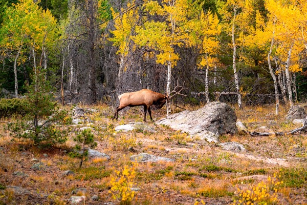
The photograph on this page: Bull elk in autumn aspens. More Than Just Parks.
In court on this ground
No court case we track is over White River National Forest.
Who holds the vote
PLAN’s record doesn’t tie a member of Congress to this fight yet. The scorecard grades the votes and bills that decide public lands; nothing joins a vote or a bill to this decision, so there’s no member to name here without guessing.
See how your members vote ↗Calling your two senators and your representative is the Call door on this page.
Forest ServiceWe track this on the agency’s own system of record, where most on-the-ground decisions live.
Know an open comment period we are missing, or spotted a wrong deadline? .
More fights that need you
Go deeper for free
See how your members of Congress vote on public lands
Every representative, graded on the votes that decide the fate of parks, forests, and refuges.
Open ↗The mapSee the places under active threat
A live map of the parks, monuments, and wild country in the crosshairs right now.
Open ↗A wrong fact, a dead link, a form that wouldn’t take your letter: one tap and it comes to the people who build PLAN, with this fight attached.