
The National Park Service list for North Carolina names 12 sites, and the spread is absurd. The most visited national park in America on one end of the state, two of the wildest beaches on the Atlantic coast on the other, and the field where humans first flew in between.
A word on the math. The NPS puts the official North Carolina number at 10 park units, and its state list names 12 sites; the difference is long-distance trails that pass through on their way somewhere else. We cover all 12, ranked honestly.
One thing to know up front. Hurricane Helene tore through western North Carolina in September 2024, and the Blue Ridge Parkway is still healing. Roughly 38 miles remain closed between Linville and Mount Mitchell as of June 2026, and the NPS expects every Helene-damaged section back open by the end of the year. We’ve flagged what that changes below, because most articles on this subject apparently haven’t checked.
North Carolina’s Park Sites at a Glance
| Site | Type | The Draw | Base Town | Time Needed |
|---|---|---|---|---|
| Great Smoky Mountains | National Park | The quiet half of America’s most visited park, plus elk | Bryson City / Cherokee | 2-4 days |
| Blue Ridge Parkway | Parkway | 252 North Carolina miles of the most visited site in the system | Asheville | 1-3 days |
| Cape Hatteras | National Seashore | 70 miles of barrier-island beach and the famous lighthouse | Buxton / Ocracoke | 2-3 days |
| Cape Lookout | National Seashore | Boat-only beaches and wild horses, zero development | Harkers Island / Beaufort | 1-2 days |
| Wright Brothers | National Memorial | The exact spot powered flight began | Kill Devil Hills | 2-3 hours |
| Fort Raleigh | National Historic Site | The Lost Colony mystery, on the actual ground | Manteo | 2-3 hours |
| Carl Sandburg Home | National Historic Site | The poet’s farm, complete with goats | Hendersonville / Flat Rock | Half day |
| Guilford Courthouse | National Military Park | The 1781 battle that bled Cornwallis toward Yorktown | Greensboro | 2-3 hours |
| Moores Creek | National Battlefield | The Revolution’s first Southern patriot victory | Wilmington | 2 hours |
| Appalachian Trail | Scenic Trail | Roan Highlands balds and Max Patch | Hot Springs | An hour to a week |
The Headliners
1. Great Smoky Mountains National Park

America’s most visited national park drew 11,527,939 visits in 2025, and here’s the secret. The overwhelming majority of them happen on the Tennessee side. Half the park is in North Carolina, and the North Carolina half is the better half for anyone allergic to traffic.
109 public lands destinations are under threat. Get the free weekly briefing that 25,000+ people use to stay informed and take action.
Enter at Oconaluftee near Cherokee, where the Mountain Farm Museum’s relocated log buildings sit in a river-bottom field that fills with elk most mornings and evenings. The herd was reintroduced in 2001 and has become the park’s best wildlife show. Half a mile up the road, Mingus Mill (our header photo) is the park’s most impressive gristmill, though its interior has been closed for rehabilitation work, so check the park’s alerts before promising anyone flour.

From there, climb to Kuwohi, the park’s 6,643-foot high point, renamed in 2024 to restore its Cherokee name after decades as Clingmans Dome. The observation tower sees a hundred miles on the rare clear day, and our Kuwohi guide covers the tricks for catching one. Base in Bryson City for the Deep Creek waterfalls and the Road to Nowhere, and know that Cataloochee Valley, the park’s other elk stronghold, reopened for day use in April 2025 after Helene but only partway. The entrance road is open 4.7 miles in, the campground has stayed closed, and the foot logs on most trails washed away, so check current conditions before building a day around it.
Access notes. Entry is free, but since 2023 any car parked longer than 15 minutes needs a parking tag. $5 a day, $15 a week, $40 a year, sold on Recreation.gov and at visitor centers, and an America the Beautiful pass does not replace one. Our full coverage lives on the Smokies hub, with the best hikes, things to do, and an honest answer on the best time to visit. October on the North Carolina side is the best fall color east of the Rockies, and yes, that’s a fight we’ll take.
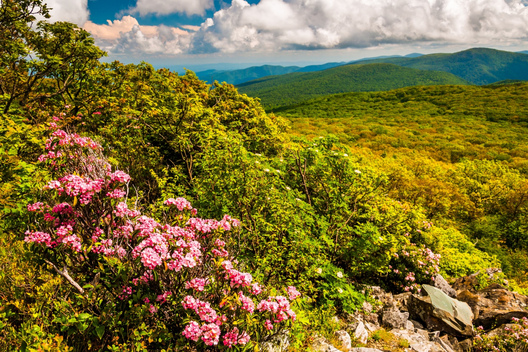
2. Blue Ridge Parkway

America’s favorite drive runs 469 miles from Shenandoah to the Smokies, and North Carolina holds 252 of them, including everything most people picture when they hear the name. The Linn Cove Viaduct wrapping Grandfather Mountain at milepost 304. Craggy Gardens’ purple rhododendron tunnels in June. Waterrock Knob’s sunset at 5,820 feet. The southern terminus dropping you at Oconaluftee, where entry #1 begins.
Now the honest 2026 status. Hurricane Helene hit the parkway harder than anything in its history, and while most of it is back, roughly 38 miles remain closed between US 221 near Linville (milepost 317.5) and Mount Mitchell State Park (milepost 355.3), with some segments closed even to walkers while crews stabilize slopes. We verified that against the park’s road status page in June 2026. The marquee stretch from Asheville up through Craggy Gardens is open, as is everything south to Cherokee. Plan around the gap via US 221 and NC 226, and check the NPS closure map the week you go, because sections reopen in stages. The good news comes with dates. The NPS says the landslide repairs between mileposts 318 and 323 should wrap by fall 2026 and the rest by late 2026, putting the whole parkway back open by the end of the year, which means an October leaf trip rides the detour but a 2027 one shouldn’t have to.
Access notes. Free, no gates, fuel up before you climb. The parkway is consistently the most visited site in the entire park system, but at 469 miles it swallows crowds whole. Sunrise at any overlook above 5,000 feet will be just you and the ravens. More nearby ideas in our guide to national parks near Asheville.
3. Cape Hatteras National Seashore

America’s first national seashore, established 1953, and still its best argument. Seventy-plus miles of barrier islands hang off the coast like a comma, with the Atlantic on one side, Pamlico Sound on the other, and a two-lane road threading villages that still feel like fishing towns because they are. The Graveyard of the Atlantic earned its name honestly; more than 600 ships rest off this coast (estimates run far higher), which is why the islands grew three historic lighthouses.
The black-and-white spiral of Cape Hatteras Lighthouse, the tallest brick lighthouse in the country, is mid-restoration and likely won’t reopen for climbing in 2026, but the grounds stay open and the Bodie Island Lighthouse runs seasonal climbs for $10. Surf fishing here is a religion, the Buxton break is the best surfing on the East Coast, and the free state ferry from Hatteras village to Ocracoke is the prettiest hour of public transit in the South. End at Ocracoke’s banker ponies and eat your weight in fig cake.
Access notes. Free to enter, open year-round. Driving on the beach requires an ORV permit ($50 for 10 days, $120 annual, on Recreation.gov) and seasonal bird and turtle closures move the open zones around, so check the beach access map. Hurricane season peaks August through October; shoulder-season May and early June are the sweet spot.
4. Cape Lookout National Seashore

Everything Cape Hatteras was a century ago. Fifty-six miles of barrier islands with no road, no bridge, no development, reachable only by boat. If you want an Atlantic beach with nothing on it but shells, ghost crabs, and the diamond-checkered 1859 lighthouse, this is the last, best version.
The two experiences. Shackleford Banks carries a herd of about 100 wild horses that have survived on the island for centuries, a 20-minute passenger ferry from Beaufort. The Core Banks are for the committed, with passenger ferries from Harkers Island to the lighthouse and vehicle ferries from Davis and Atlantic for anglers hauling campers to the cabin camps. At the far north end, Portsmouth Village is a genuine ghost town, abandoned mid-century and kept frozen, reached by ferry from Ocracoke, which lets you chain both seashores into one trip.
Access notes. The park is free; the ferries are not, and they’re the real cost of the day, so check Island Express Ferry Service prices when you plan. No services on the islands. Water, shade, and bug spray are on you, and the bugs are serious about their work in summer.
5. Wright Brothers National Memorial

On December 17, 1903, Orville Wright flew 120 feet in 12 seconds, and the world has not been the same size since. The genius of this site is its literalness. Granite markers sit on the exact spots where each of the four flights that morning ended, and walking from the first to the fourth (852 feet, 59 seconds) makes the entire history of aviation feel like an afternoon’s progress, which that day it was.
Climb Big Kill Devil Hill to the 1932 monument for the view over the Outer Banks the brothers chose for its wind and soft sand, then give the visitor center’s reproduction Flyer an hour. Two to three hours covers it properly, which makes it the perfect bad-beach-weather card to hold.
Access notes. $10 per person age 16 and up, kids free, cashless. In Kill Devil Hills, ten minutes from Fort Raleigh, so do both with the same tank of gas.
Worth a Detour
6. Fort Raleigh National Historic Site

America’s oldest cold case. In 1587, 115 English colonists settled Roanoke Island; by 1590 they were gone, leaving the word CROATOAN carved on a post and four centuries of theories. The site preserves the restored earthwork fort and the quiet woods where the colony stood, and the not-knowing is the whole point. Walk the Thomas Hariot Trail to the sound, and don’t skip the later history. During the Civil War this island held a Freedmen’s Colony where thousands of formerly enslaved people built a free community, a story the park now tells properly.
Access notes. Free. In summer, The Lost Colony outdoor drama has played the Waterside Theatre here since 1937 (separate tickets, runs on its own schedule). Five minutes from Manteo’s waterfront, which is the Outer Banks’ best dinner town.
7. Carl Sandburg Home National Historic Site
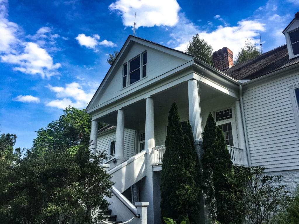
The poet of the working man spent his last 22 years on a 264-acre farm in Flat Rock called Connemara, writing a third of his life’s work on a typewriter balanced on an orange crate while his wife Lilian bred champion dairy goats. The park keeps both halves going. The house sits as the Sandburgs left it, down to the magazines, and the barn still raises descendants of those goats, which will accept your admiration with professional indifference.
Access notes. Grounds, trails, and goat barn are free; the guided house tour charges a small fee. Five miles of trails climb Glassy Mountain. Thirty minutes from Asheville, and an easy pair with the southern Blue Ridge Parkway.
8. Guilford Courthouse National Military Park
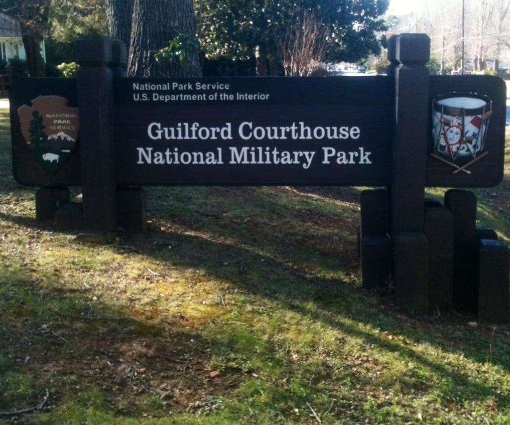
On March 15, 1781, Nathanael Greene lost the battle and won the war. Cornwallis took the field at Guilford Courthouse but lost a quarter of his army doing it, abandoned the Carolinas, and marched the survivors toward a Virginia port town called Yorktown. Greene’s summary of his Southern campaign, “we fight, get beat, rise, and fight again,” is the best one-line strategy memo in American history.
Access notes. Free. The 2.5-mile auto loop and monuments sit inside Greensboro’s city limits, so this is a two-hour stop, not a pilgrimage. The full story is in our guide to America’s best Revolutionary War sites.
9. Moores Creek National Battlefield
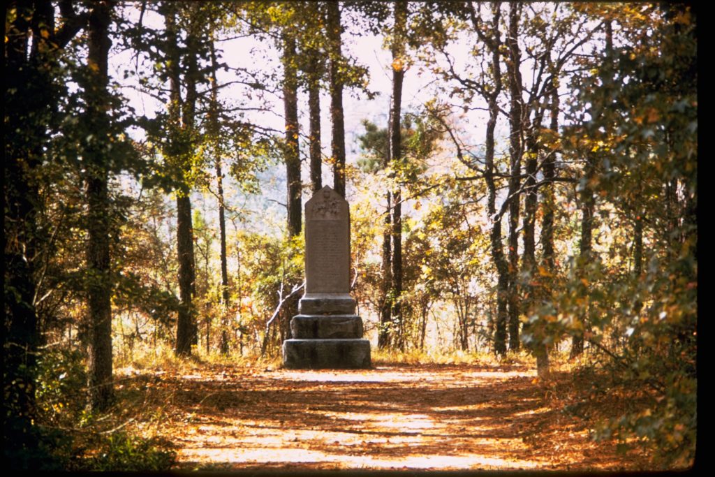
Three minutes. That’s roughly how long it took on February 27, 1776 for entrenched patriots to shatter a Loyalist charge across a partially dismantled bridge, broadswords and all. It was the Revolution’s first Southern patriot victory, it ended royal authority in North Carolina, and it pushed the colony to become the first to instruct its delegates to vote for independence. Pound for pound, more consequence per acre than almost any battlefield in the country.
Access notes. Free. Twenty miles northwest of Wilmington, one hour of walking covers the bridge site and monuments, and it pairs with a Wilmington beach weekend rather than justifying its own trip.
The Trails
10. Appalachian National Scenic Trail
Roughly 300 miles of the AT touch North Carolina, counting the long stretch that rides the Tennessee state line through the Smokies. The state’s signature moments are the Southern balds, treeless mountaintop meadows with 360-degree views. Max Patch is the famous one (day use only after years of being loved half to death), the Roan Highlands in June are the best rhododendron display in America, and the trail town of Hot Springs, where the AT runs down the main street to an actual hot spring, is the right place to end a section hike.
Access notes. Free, always open. Through the Smokies the AT requires a backcountry permit, and the Newfound Gap to Charlies Bunion out-and-back (8 miles round trip) is the best AT day hike in the state.
11. Overmountain Victory National Historic Trail

In the fall of 1780, frontier militia walked 330 miles over the mountains to find the British, and at Kings Mountain just over the South Carolina line, they destroyed them in an hour. The trail commemorates the march, and North Carolina holds the most walkable stretch, including the W. Kerr Scott Reservoir segments near Wilkesboro and the Yellow Mountain Gap crossing, the route’s high point. Mostly, though, this is a driving route with markers that rewards anyone already doing a High Country trip.
Access notes. Free. The September-October commemorative march reenactment moves along the route on the original timetable, which is the best time to catch the story. More in our Revolutionary War sites guide.
12. Trail of Tears National Historic Trail
In 1838 the United States forced some 16,000 Cherokee from their homeland at bayonet point and marched them to Oklahoma; thousands died on the way. The trail’s North Carolina anchor is the homeland itself, the mountains around present-day Cherokee, where the Eastern Band of Cherokee Indians descends from those who held on or returned. The Museum of the Cherokee People in Cherokee is the essential stop, tribally run and steps from the Oconaluftee entrance to the Smokies, which means there is no excuse for skipping it on a park trip.
Access notes. The trail is free and experienced through sites; the museum charges admission and earns it. This isn’t a feel-good stop, and it isn’t supposed to be.
Beyond the Park Service
Western North Carolina’s biggest public lands wear Forest Service green. Pisgah and Nantahala National Forests cover more than a million acres between them and hold half the famous places people assume are in a national park. Looking Glass Rock, Sliding Rock, and the waterfalls of the Davidson River country are Pisgah; the Nantahala Gorge’s whitewater and Joyce Kilmer Memorial Forest, one of the last great old-growth stands in the East with tulip poplars 20 feet around, are Nantahala. No entrance fees, far fewer rangers, and on an October weekend when the parkway crawls, the forest roads are where the locals went. Mount Mitchell State Park caps it all at 6,684 feet, the highest point east of the Mississippi, normally reached from the parkway but accessible via NC 128 off NC 80 while Helene repairs continue.
Planning a North Carolina Parks Trip
When to Go
The mountains peak twice, mid-June for rhododendron on the balds and mid-to-late October for color, when elevation lets you ride the peak for weeks by moving up and down. The coast is best in May, early June, and September, when the water’s warm and the crowds and hurricane risk haven’t both arrived. July and August belong to the beach anyway; just book Ocracoke a season ahead.
Two Logical Routes
The mountains (4 to 6 days). Asheville base. Parkway south past Mount Pisgah and Graveyard Fields to Waterrock Knob, into the Smokies at Oconaluftee, elk at dusk, Kuwohi at dawn, Deep Creek from Bryson City, and Carl Sandburg’s farm on the way out. Add the Roan Highlands if it’s June.
The coast (4 to 6 days). Start at Wright Brothers and Fort Raleigh, run the length of Hatteras with a lighthouse stop and a beach day, ferry to Ocracoke, ferry again to Portsmouth Village, then finish with the Shackleford horses from Beaufort. It’s the best national park road trip east of the Mississippi that nobody calls one.
Charlotte folks, your closest options are ranked in our guide to national parks near Charlotte.
Full List of North Carolina National Park Sites
- Great Smoky Mountains National Park
- Blue Ridge Parkway
- Cape Hatteras National Seashore
- Cape Lookout National Seashore
- Wright Brothers National Memorial
- Fort Raleigh National Historic Site
- Carl Sandburg Home National Historic Site
- Guilford Courthouse National Military Park
- Moores Creek National Battlefield
- Appalachian National Scenic Trail
- Overmountain Victory National Historic Trail
- Trail of Tears National Historic Trail
Helpful Related Articles
Things to Do in the Smokies 15 Things to Do in Great Smoky Mountains
Best Hikes in the Smokies 15 Best Hikes in Great Smoky Mountains
When to Visit the Smokies Best Time to Visit Great Smoky Mountains
Kuwohi (Clingmans Dome) Kuwohi Tips, Tricks & Secrets
Near Asheville 10 Amazing National Parks Near Asheville
Revolutionary War Sites America’s Best Revolutionary War Sites
Tennessee’s Parks 15 Amazing Tennessee National Parks
South Carolina’s Parks 8 South Carolina National Parks to Visit