
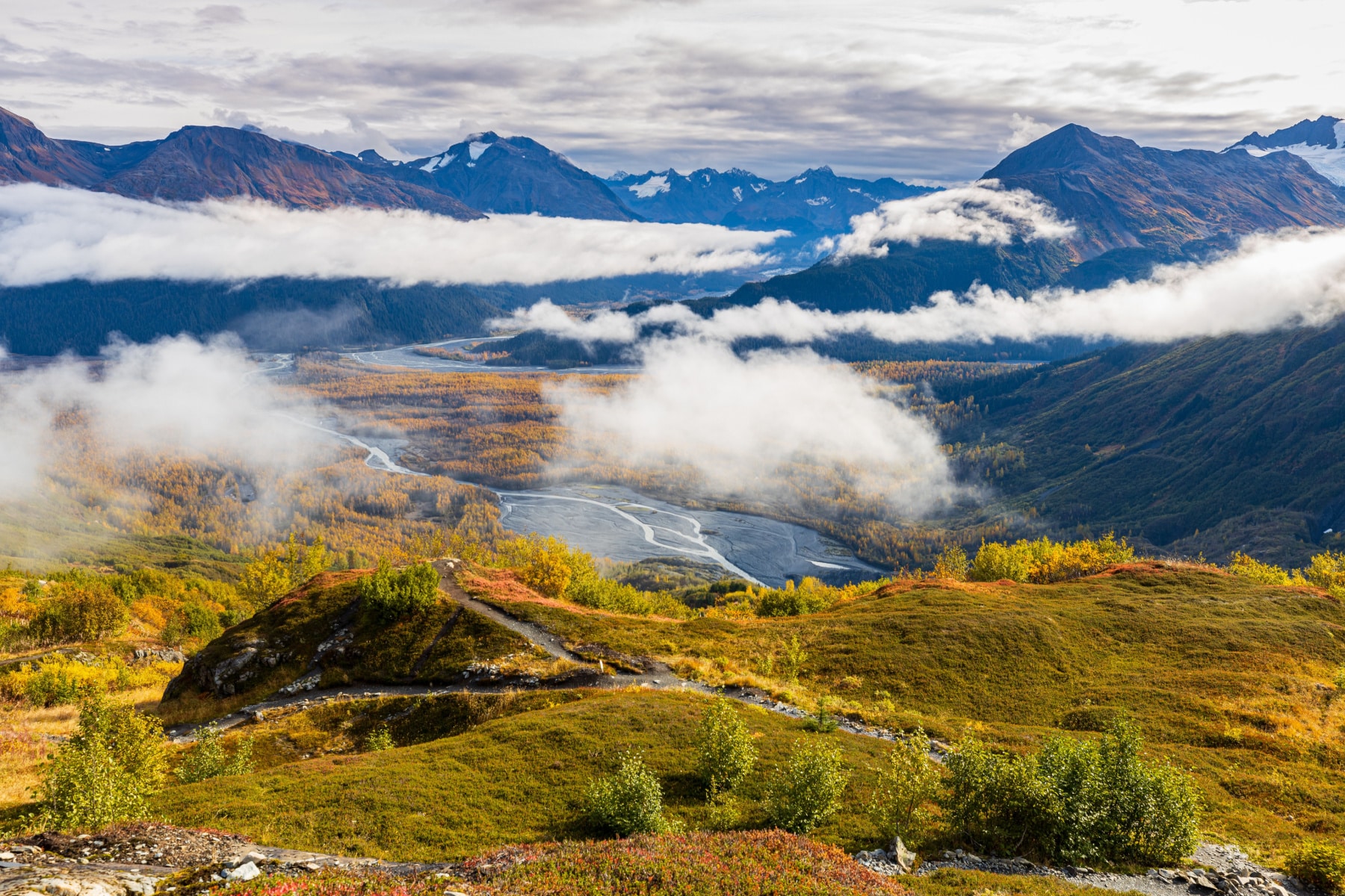
We filmed in Kenai Fjords National Park, and the Harding Icefield Trail is the best way we know to earn a view in Alaska. The trail climbs 8.2 miles round trip from the Exit Glacier valley floor to an overlook of a 700 square mile sheet of ice left over from the last ice age. You gain roughly 1,000 feet per mile. Your legs will have opinions. The view wins the argument. For broader trip planning, see our full Kenai Fjords National Park guide.
5 Quick Things to Know Before Visiting Kenai Fjords National Park
Read the bulletin board at the start of the Harding Icefield Trail. It posts the warnings that matter on a given day, including avalanche risk and recent bear activity. Sign the trail register too. It helps rangers know who is on the trail if weather turns.
Kenai Fjords National Park Map
1 trails mapped — click a pin to learn more
Kenai Fjords National Park at a Glance
2 alerts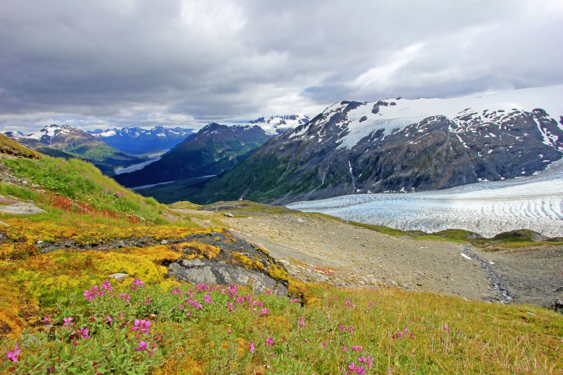
- Kenai Fjords National Park is free. No admission is charged for cars or individuals. The America the Beautiful Pass ($80) covers entrance fees at 2,000+ federal recreation sites for a year, which matters if Kenai Fjords is one stop on a bigger Alaska run.
- A few things that earn their weight on this trail. This guidebook, this waterproof map, reef-safe sunscreen, and bug spray for the lower meadows.
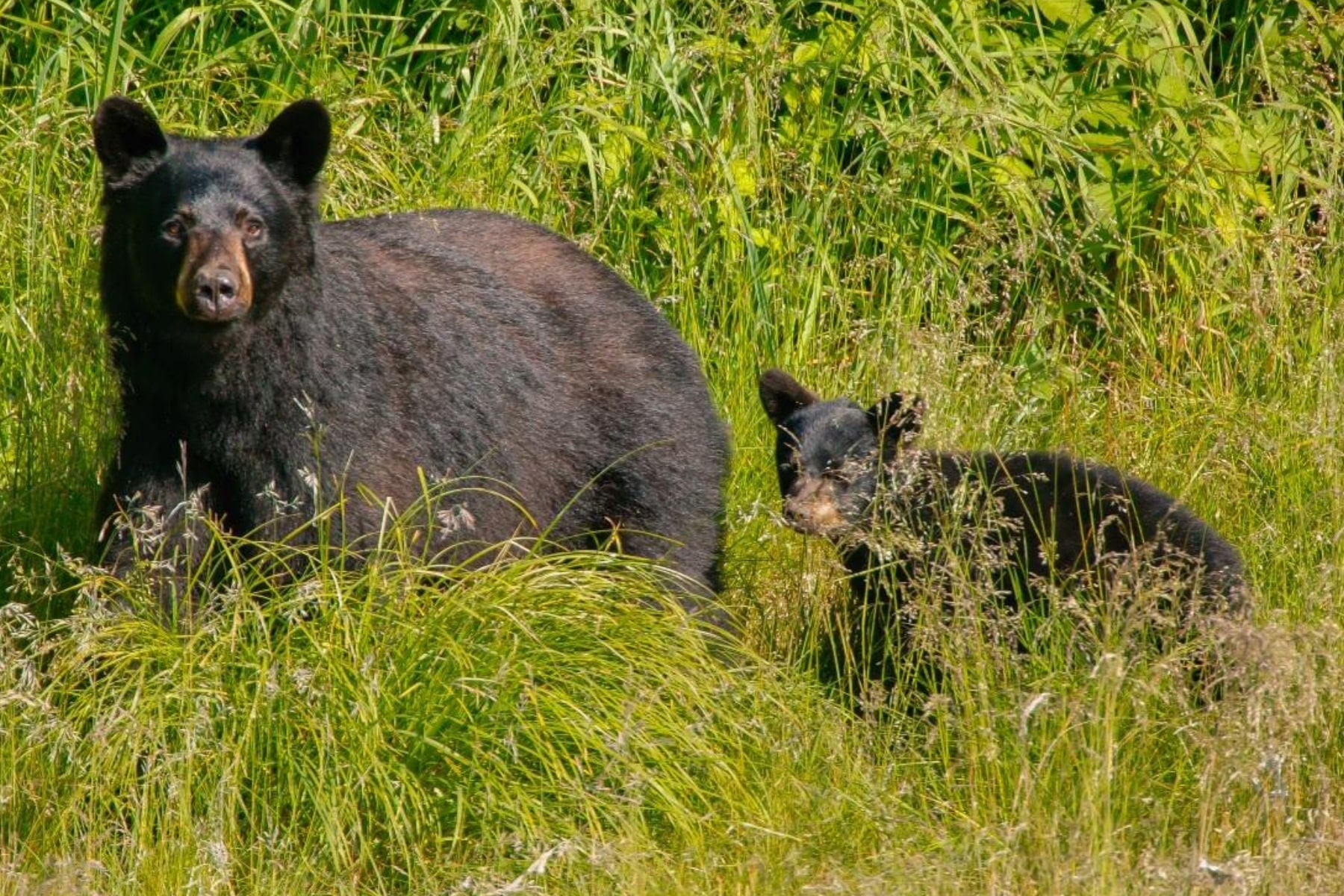
- You need bear spray on the Harding Icefield Trail. Several brushy sections give you no sight line on an incoming bear. Wear it on your hip, not in your pack.
- Glacier sunglasses prevent snowblindness. Snow sits on the upper trail into July, and the glare off the icefield is no joke.
- Resurrection Lodge on the Bay is a solid Seward base. Free shuttle and breakfast before a 6 to 8 hour hike is the right math.
Hiking the Harding Icefield Trail Step-by-Step Guide
The trail starts near the Exit Glacier Nature Center. If you want a warm-up, the Glacier View Loop adds an easy mile and puts Exit Glacier in front of you before the climbing starts. Worth it. You are about to spend hours looking down at this glacier, and seeing it from below first gives the whole hike scale.
Love Kenai Fjords? It's one of 109 threatened public lands destinations we're tracking. Get the free weekly briefing.
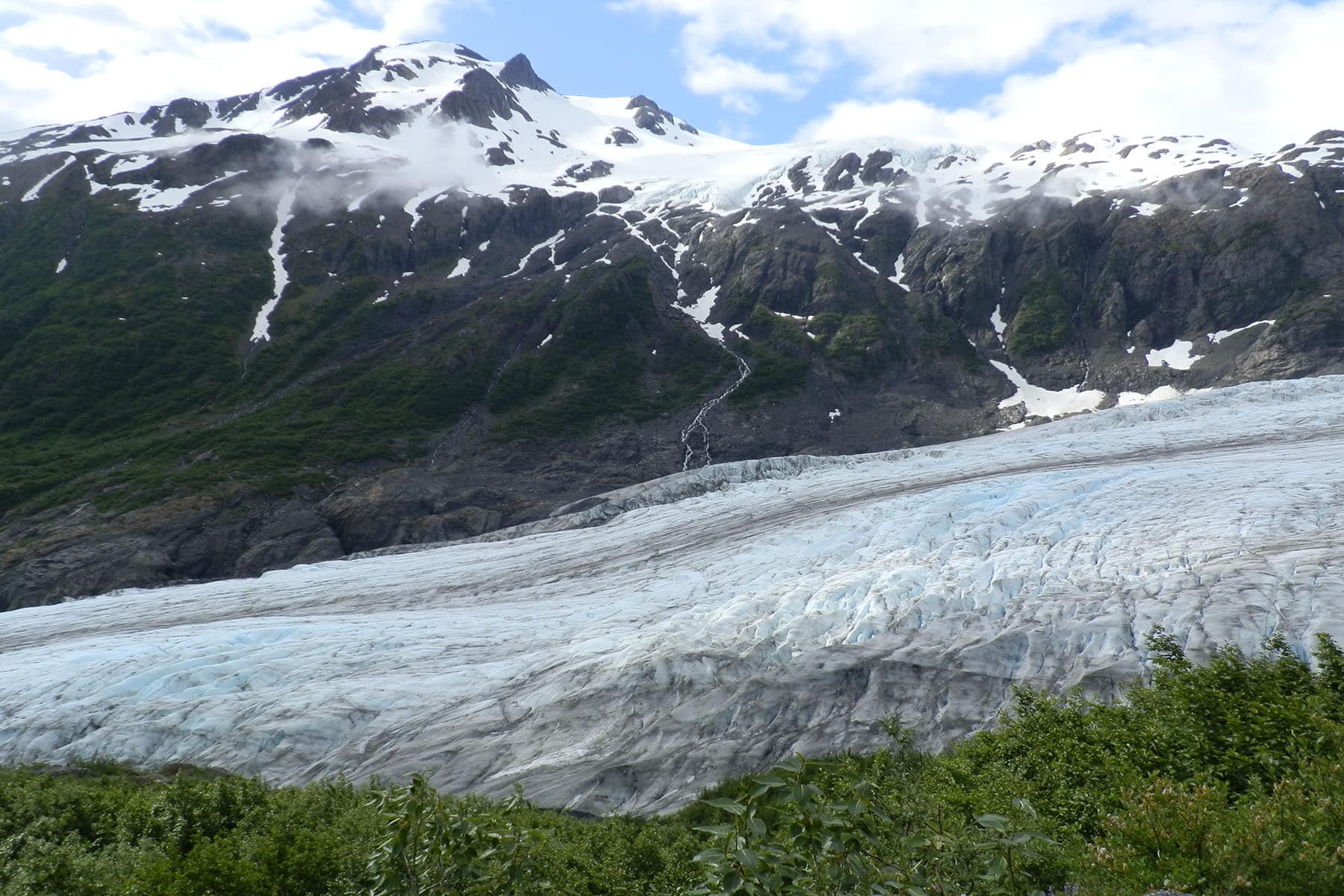
What is Exit Glacier?
Always Check The Trail Conditions Near Exit Glacier Before Taking The Scenic Paths
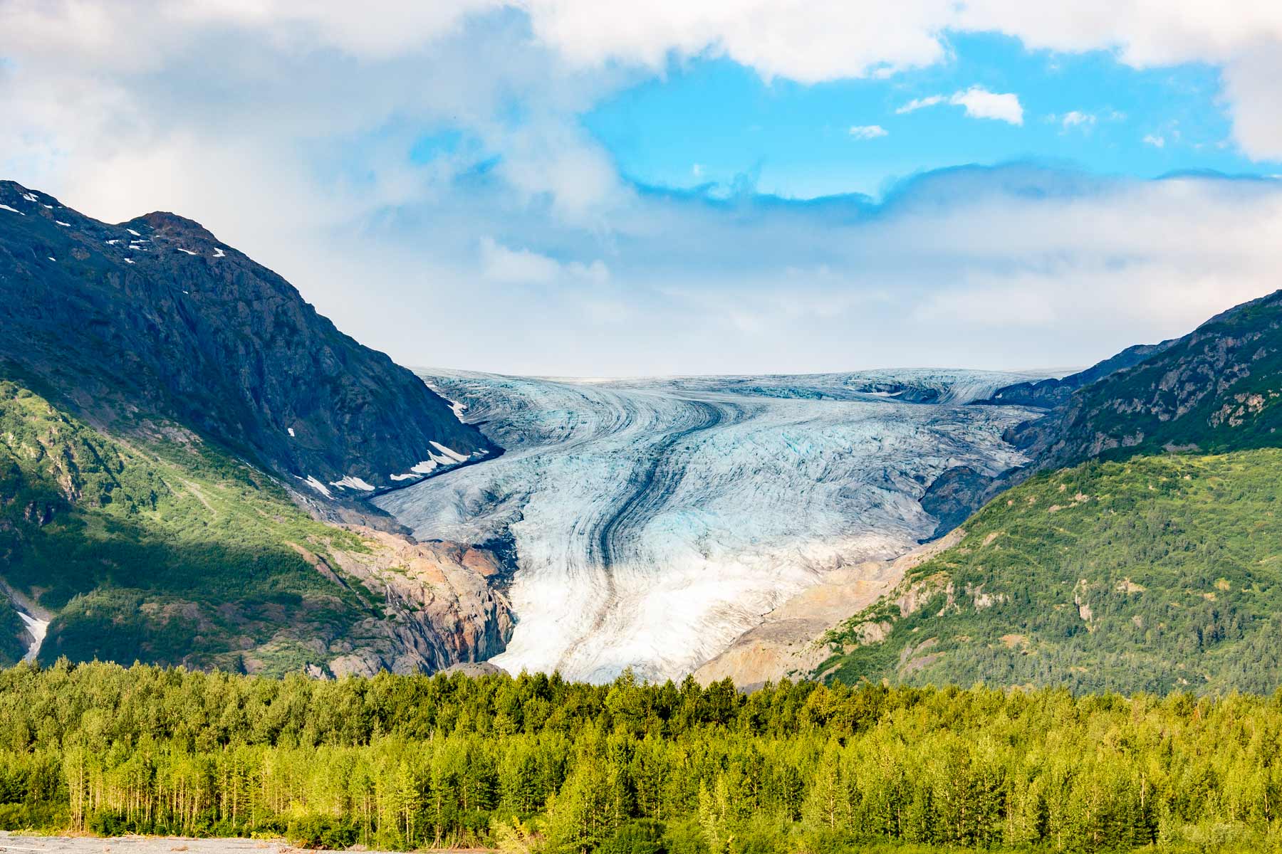
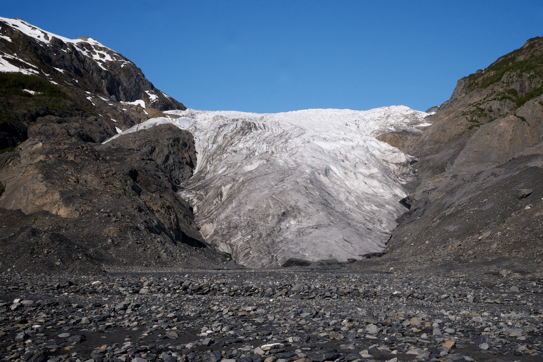
Exit Glacier is a “Valley Glacier” that “exits” the larger Harding Icefield in Kenai Fjords and ends in a valley.

The Ascent of Harding Icefield Trail
The Harding Icefield Trail runs 4.1 miles one way and gains roughly 1,000 feet of elevation per mile. Those numbers should intimidate you. Let them. The first switchbacks are a warm-up for what comes later, and folks who blow their energy in the first mile pay for it in the last two.
Wooden Bridge Milemarker: 922′ Elevation
This wooden bridge over a glacial stream is a perfect first rest point to catch your breath.
The next half mile to Marmot Meadows is prime bear country. The trail narrows, the brush gets thick, and your sight lines disappear. This is where you make noise. “Hey bear” every minute or so feels silly until the day it doesn’t.
Marmot Meadows
Elevation: 1,572 feet
Marmot Meadows arrives about 1.5 miles in, and you’ve earned the break. Locals call the spot “lunch rock.” Fuel up here with a full look at Exit Glacier below before the next ascent.
You still have 2.6 miles ahead of you. If the steepness is already winning, this view makes an honest turnaround point. No shame in it.
The name comes from the hoary marmot, which was once abundant here. Their numbers have dwindled as the brush grew in, but you might still hear one whistle at you from the rocks.
TRAVEL TIP: If you really want to see whistling marmots, plan a trip to the Skyline Trail in Mount Rainier National Park.
Bottom of the Cliffs
Elevation: 1,788 feet
The next 0.4 miles weave through open meadows with Exit Glacier holding steady on your left. The closed-in woods are gone. In mid-summer the wildflowers here run up the slopes in every direction, and the whole stretch feels like a reward you haven’t fully paid for yet.
You haven’t. Take a swig of water and stretch your calves. The switchback stretch above this point is the hardest part of the Harding Icefield Trail in Kenai Fjords National Park.
Top of the Cliffs
Elevation: 2,452 feet
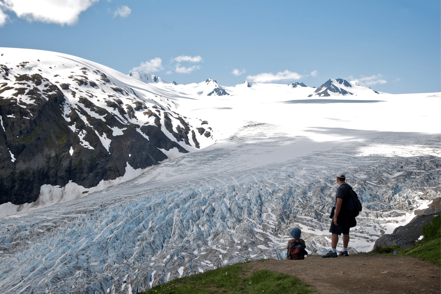
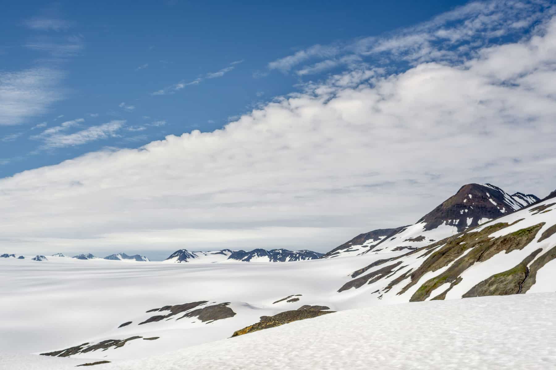
The Harding Icefield finally comes into view at the Top of the Cliffs, along with the nunataks, the lonely mountain peaks poking through the ice. If you only have the legs for part of this trail, make it this far. The round trip to here is 4.8 miles, and the payoff covers most of what the full trail delivers.
Snow covers portions of the trail, sometimes all of it, well into July. This is where you should stop during avalanche advisories unless you are equipped for mountaineering with an avalanche probe, shovel, and transceiver, and know how to use all three.
While the snow hangs on, orange flags mark the route.
DID YOU KNOW? The nunataks have 4,000 feet of compacted snow and ice all the way down.
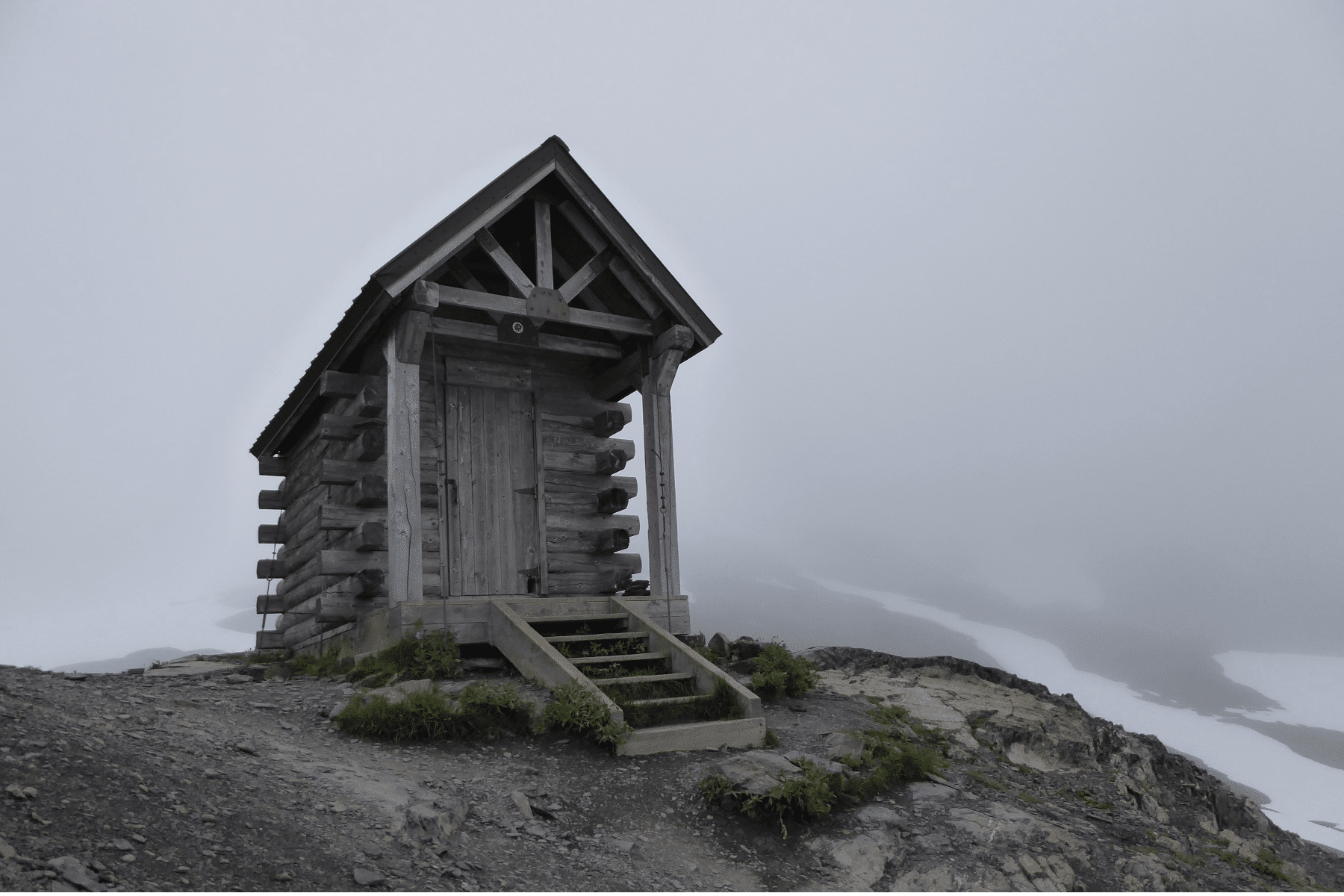
Emergency Shelter: 3,459 feet
Good news and bad news. The good news is the final 1.7 miles to the end of the trail aren’t nearly as steep. The bad news is the wind up here can knock the breath out of you, and any chill in the air will rattle your bones.
This upper stretch of the Harding Icefield Trail goes full “Winter Is Coming.” Dark rock, fields of snow, and nothing growing. It stops looking like Earth and starts looking like a planet that didn’t work out.
The weather in Kenai Fjords changes fast, and that unpredictability is why the emergency shelter sits here. You can’t rent it or camp inside it. It exists only as an escape from threatening conditions on the Harding Icefield Trail.
If you lose sight of the orange flags in the snow, look for the emergency shelter atop a hill near the trail end and walk toward it.
Fascinating Fireweed
The purple plant you’ll see in this section is fireweed, and it grows abundantly here because it can survive the extreme climate of Alaska.
Why is it called Fireweed?
Fireweed earned its name by being the first plant back after a burn. It colonizes disturbed ground fast and was among the first plants to return after the 1980 eruption of Mount St. Helens, according to the U.S. Fish & Wildlife Service.
The end of the trail is a rocky overlook above the ice. The Harding Icefield covers roughly 700 square miles and feeds nearly 40 glaciers, and from up here it simply runs to the horizon. Do not push past the end of the trail. The scree slope below the overlook is loose, and the icefield itself is crevasse territory reserved for roped mountaineers.
Plan for the descent to take longer than you expect. Slick rock, lingering snow, and tired legs are a slow combination, and most of the trail’s injuries happen on the way down.
The best time to hike the Harding Icefield Trail is July through September, when you’ll actually be hiking and not mountaineering. Snow can hold on the upper trail into early July.
The summer months also mean more things to do in Kenai Fjords National Park, like taking a boat tour of the fjords. You’ll see more wildlife in a few hours on the water than most folks see in a week on trails.
Visiting during winter means as little as six hours of daylight. Boat tours become limited, if not impossible, to find from late September to early March due to rough seas.
Getting to Kenai Fjords National Park
Getting to the nearest town of Seward means hopscotching some transportation options. No commercial flights serve Seward, which leaves Ted Stevens Anchorage International Airport as the best option. From there, the drive to Seward takes about 2.5 hours, and the Seward Highway along Turnagain Arm is a contender for the best drive in America.
Other options include:
- Alaska Railroad
- Park Connection Motorcoach
- Cruise from Vancouver to Seward
From Seward, the Exit Glacier area sits another 12 miles out Herman Leirer Road. You can also park in Seward and use a shuttle or taxi service to get into the park.
TRAVEL TIP: The road to Exit Glacier, Herman Leirer Road, is closed during the winter at mile 1.3, where the road intersects with Old Exit Glacier Road. You can still access the park and Harding Icefield Trail by snowmobile, snowshoes, cross-country skiing, or fat bike.
Check Road Conditions And Closures Through Alaska Department Of Transportation
The road typically closes with the first lasting snow in mid-November and reopens around early May. In summer, you’ll start from the Exit Glacier Nature Center, where rangers post current trail conditions.
Beyond avalanche risk and slick trail sections, the Harding Icefield Trail comes with a few Alaska-sized hazards worth knowing in advance.
Cow Parsnip, aka “Pushki”
Be on the lookout for this plant. The leaves have a defense mechanism to fight off attacks, but the chemical can also cause intense itches, blistering burns, and pain.
Especially when exposed to sunlight, these wounds can last up to two months, with pigmentation discoloration for up to two years.
Salmonberries
The Harding Icefield Trail passes through a thicket of Salmonberries. Park rules allow you to collect “small quantities,” but the hungry bears that feed on these sweet treats pose the real risk.
Follow the Orange Flags
Here’s an example of the orange flags in the snow. They not only keep you on the trail but also prevent people from walking on the sensitive vegetation underneath.
Hiking the Harding Icefield Trail is worth it, and it deserves priority over places that aren’t feeling the effects of climate change so dramatically. In the park’s 2004 plan, one of the stated goals was to promote Kenai Fjords as a place to “touch a glacier.”
The 2018 plan told a different story, with four different options to promote the park, knowing that Exit Glacier is retreating.
“The NPS could also rebrand, divert, or provide appropriate and safe experiences to address the visitor expectation of touching ice, formalizing the mountaineering route off of the Harding Icefield may be one solution. Additional accessible trails should be considered, given the potential increase and diversity of visitors.”
kenai fjords national park, Scenario Planning Discussions for the Future Frontcountry
Management Plan, 2018
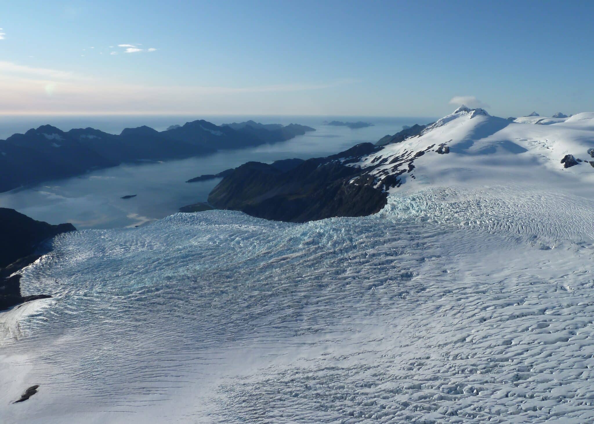
Exit Glacier has retreated more than a mile since the early 1800s, and the markers along the access road showing where the ice stood by year make the math impossible to ignore. Go see it while the “touch a glacier” promise still holds.
Ice means more than just frozen water here. A few terms save you the rabbit hole of research. (Fjord is pronounced fee-YORD, said fast, as close to one syllable as you can manage.)
- Fjord: A fjord is a long, narrow sea inlet that forms when a glacier cuts a U-shaped valley that later fills with seawater.
- Icefield: A large expanse of interconnected glaciers covering an area of at least 3 miles.
- Glacier: A persistent body of dense ice that is constantly moving under its own weight, formed from the compaction and recrystallization of snow.
- Nunatak: (“Noon-uh-tack”) Nunataks are isolated peaks of rock or land projecting above glacial ice fields or sheets.
Map of the Harding Icefield Trail
A handful of the most expert-level mountaineers will attempt the walk the Harding Icefield in Kenai Fjords each year. That is considered a backcountry hike and should be done through an expert tour guide service based in Seward.
It’s the same reason water and the sky look blue. The long wavelength on the color spectrum, like red, gets gobbled up by the glacier. Concurrently, that leaves the short wavelengths of blue bouncing off the ice crystals within.
The strenuous trail takes six to eight hours, but conditions along the way could slow you down. You’ll also get the benefit of a lot of daylight during summer. From April 22 through August 21, the skies never turn to night.

Helpful Related Links
Kenai Fjords National Park Guide: Our full guide to planning a trip to Kenai Fjords.
Alaska National Parks: All eight of Alaska’s national parks, ranked.
Alaska Landmarks: 15 landmarks worth building a trip around.
Denali National Park: The best things to do in Alaska’s flagship park.
What to Bring to Kenai Fjords
Gear we recommend for Kenai Fjords. Affiliate links support our work at no cost to you.
Affiliate disclosure: Some links on this page earn us a small commission at no extra cost to you. We only recommend gear we actually use.


