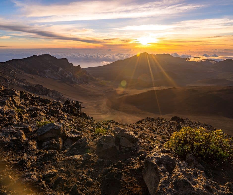
We filmed in Haleakala National Park, and the crater hike is one of the strangest, best day hikes in the park system. You start at nearly 10,000 feet, drop 2,500 feet into a landscape that looks borrowed from Mars, and climb back out on switchbacks cut into the crater wall. About 11 miles, six to eight hours, and not one boring step.
Several trails lead into the crater (which isn’t actually a crater, more on that later). This guide follows the classic long route, down Keonehe’ehe’e (Sliding Sands) and out Halemau’u.
Have You Hiked The Haleakala Crater? We’d love to see your feedback in the comments section at the bottom of this page.
Expand Table of Contents Haleakala Crater Hike
5 Important Things to Know Before Visiting Haleakala National Park
Remember all those times you were told never to hitchhike? Those rules don’t apply here. The park itself points hikers to a designated hitchhiking spot for the crater loop, because the hike starts and ends at two different trailheads six road miles apart. More on the logistics below.
Love Haleakala? It's one of 109 threatened public lands destinations we're tracking. Get the free weekly briefing.
- The entrance fee is $30 per vehicle, good for 3 days. Or grab the America the Beautiful Pass for $80 and cover a year of public lands.
- Maui requires mineral sunscreen only, a county law since October 2022. This one protects the reefs and your skin. At 10,000 feet you will burn faster than you think.
- Here is the best guidebook and map for the trails through Haleakala Crater. There is no mobile service in the crater. None.
- Every hotel on Maui means a long drive up the mountain. Wailea Beach Resort is a solid base if you want the beach on your rest days.
- This trail is rough on folks who suffer from altitude sickness. You start and end near 10,000 feet. The same way you shouldn’t dive and fly on the same day, don’t dive and hike Haleakala Crater on the same day.

The walk between the two trailheads is six miles on a winding, steep road if you don’t hitchhike or stage two cars.
Haleakala National Park Map
2 trails mapped — click a pin to learn more
Haleakala National Park at a Glance
4 alertsWith one car, park at the Halemau’u trailhead and follow the signs to the hitchhiking area to catch a ride up to the Keonehe’ehe’e (Sliding Sands) trailhead near the summit. Drivers stop for hikers here as a matter of routine. You hike back down to your own car, which beats ending an 11-mile day with a six-mile road walk.
To reiterate, no park shuttle runs between the trailheads, and rideshares and taxis are unreliable this far up the mountain.
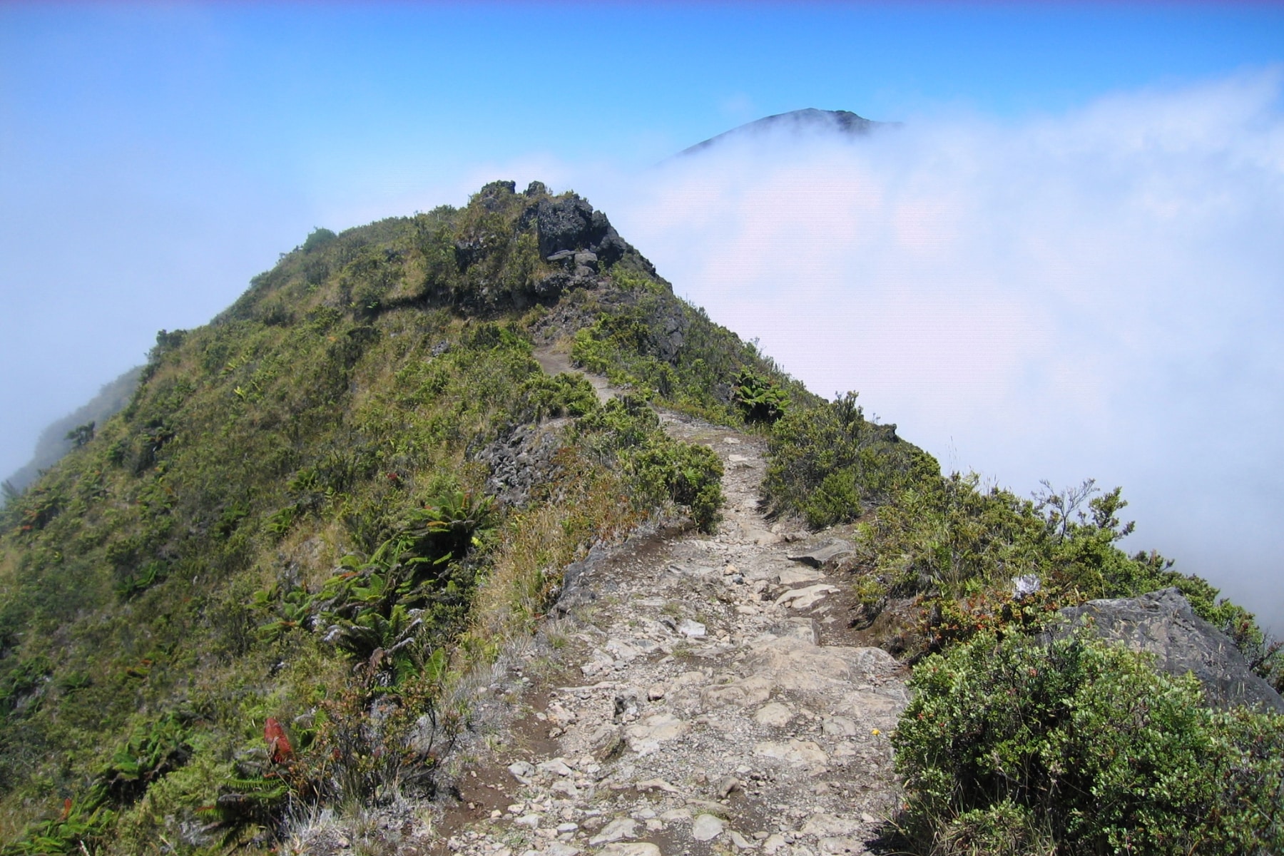
The Sliding Sands Trail
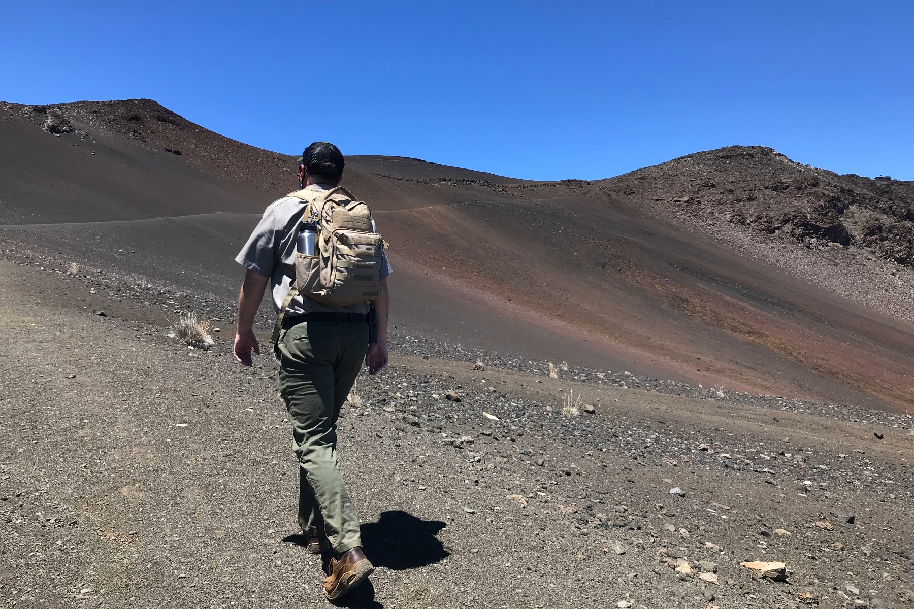
The crater offers routes as short as half a mile and as long as 11+ miles via connecting trails. The Keonehe’ehe’e (Sliding Sands) trail is the best starting point. Kiosks along the first stretch cover the history and geology of the path laid out below you, and the path really is laid out below you. You can see miles of it.
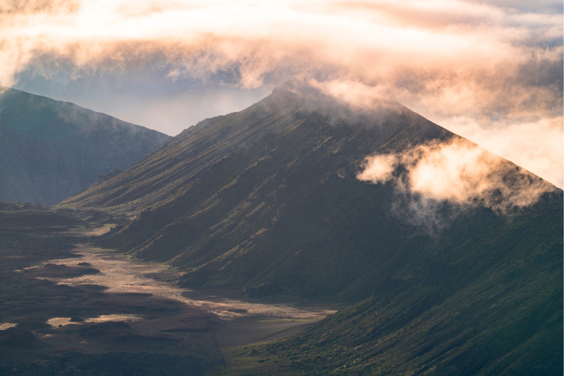
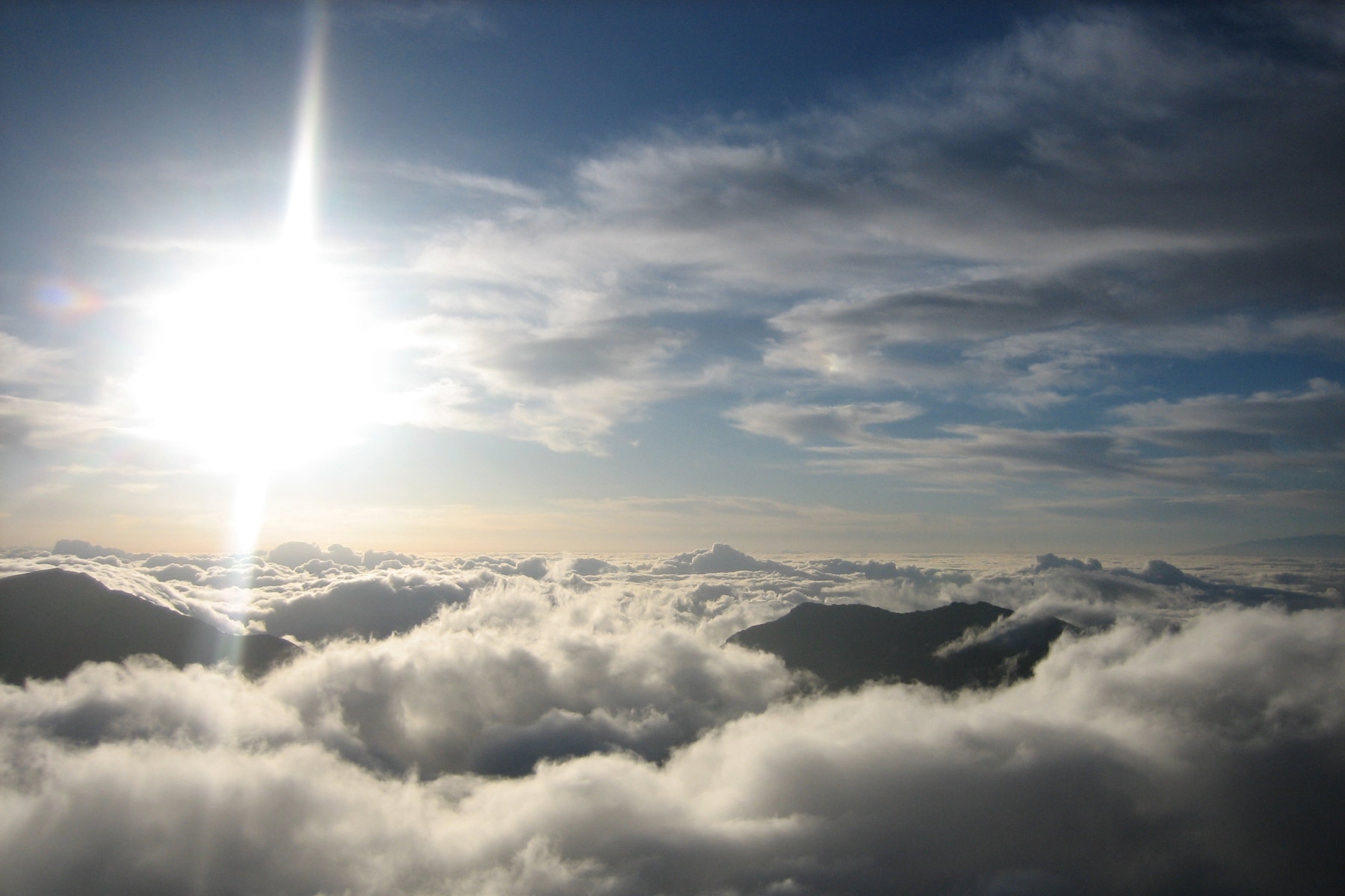
Expect clouds or fog to block the views at some point. That’s more likely than not. The weather changes constantly up here. The trailhead sits near 9,740 feet, and the trail drops 2,500 feet over almost four miles of switchbacks to the crater floor.
This is high-altitude hiking, and acute mountain sickness (AMS) is a real possibility. The only fix for the symptoms is descending. The trap on this trail is that you descend first, which means every foot you drop is a foot you must climb back out at altitude.
The first half mile reaches a scenic overlook, which makes a sensible turnaround for anyone feeling the altitude.
Between six and nine miles in, spur trails can shorten the route before you join the Halemau’u Trail for the climb out. Push 8.4 miles on the Sliding Sands Trail and you enter the Haleakala Wilderness.
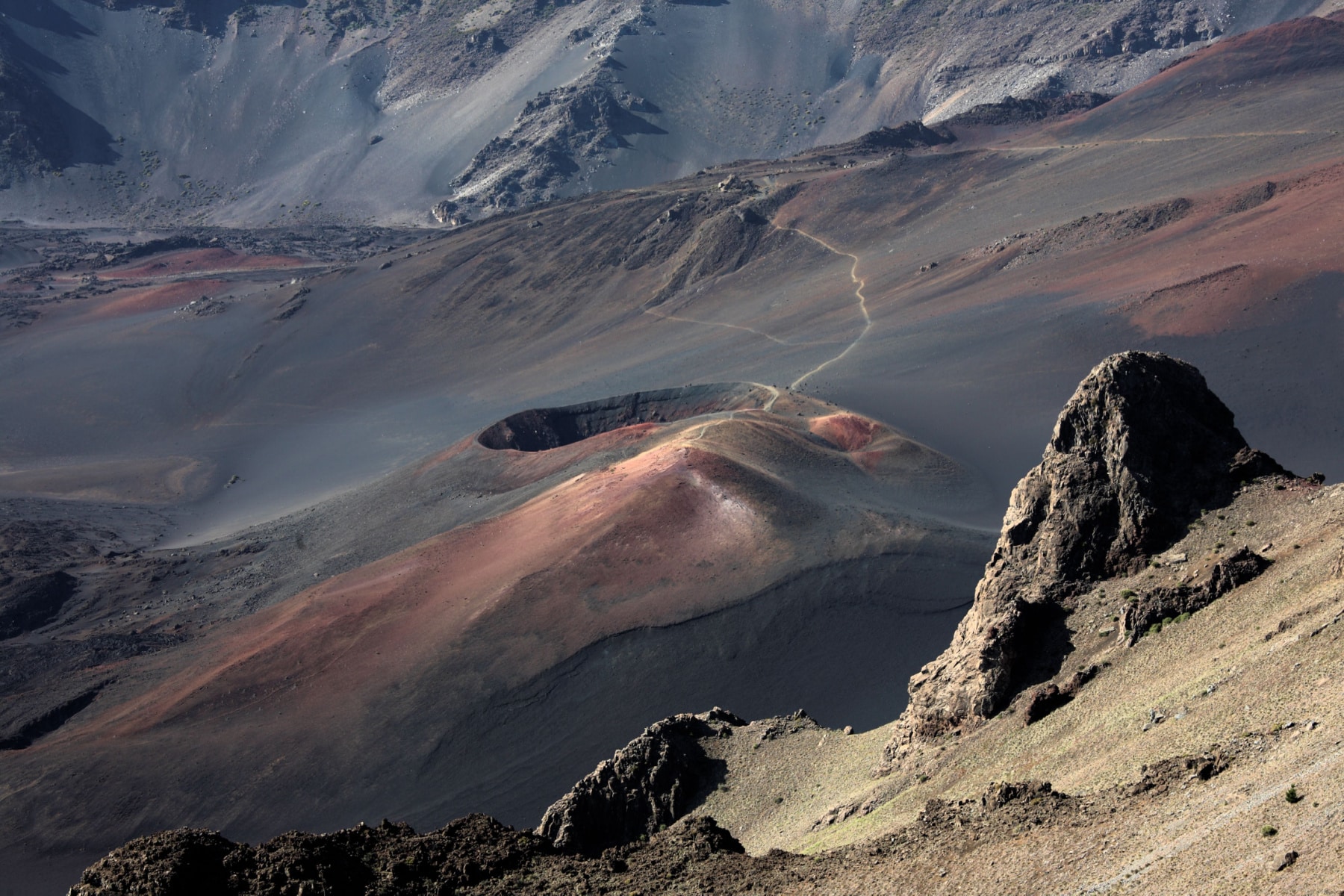
Day hikers should follow signs to the Halemau’u Trail. Before you take the path out, two features on the crater floor are worth the detour.
Pele’s Paint Pot
Pele’s Paint Pot circles a shallow depression about 200 feet wide. Vivid reds, oranges, yellows, and whites from oxidized volcanic minerals give the surface the look of a painter’s palette.
Kawilinau “Bottomless Pit”
A volcanic pit once thought to be bottomless. It’s 65 feet. The vintage photo shows people standing at the edge, but a fence surrounds the area now.
When you reach these features, you’re halfway through the loop.

The Halemau’u Trail
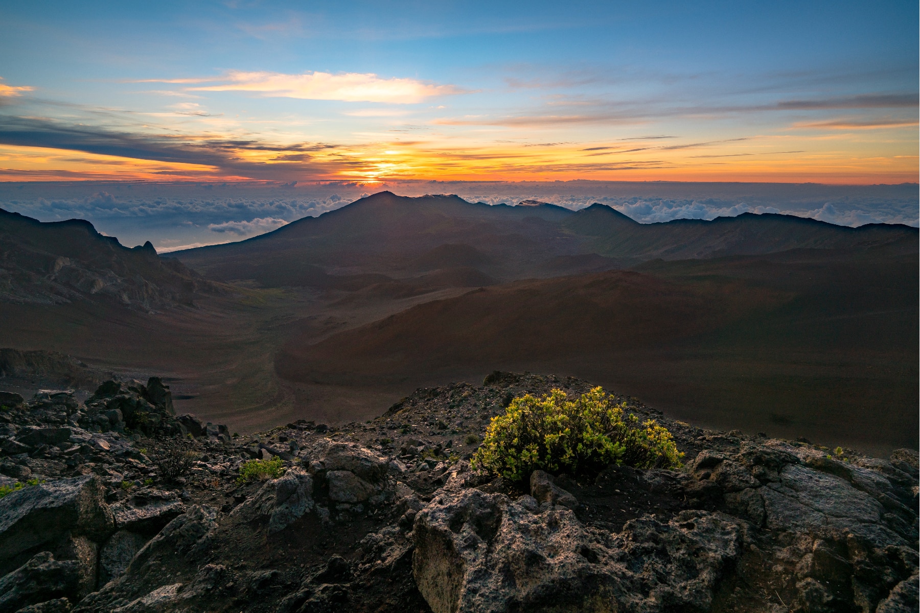
The crater floor is dark, vast, and quiet in a way that gets under your skin. Read up on the geology before you go. Knowing you’re walking across the eroded heart of a volcano that once stood maybe 15,000 feet tall turns a stark landscape into a fascinating one.
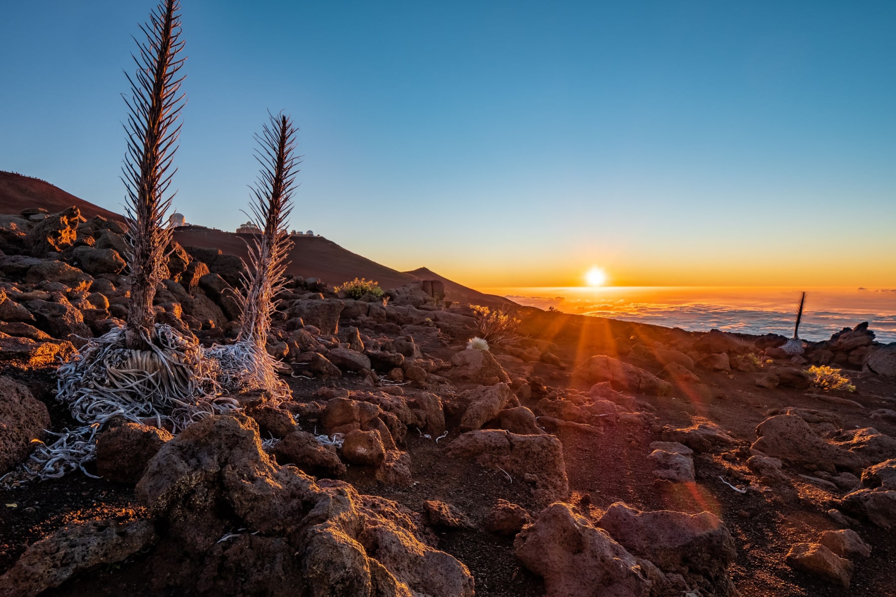
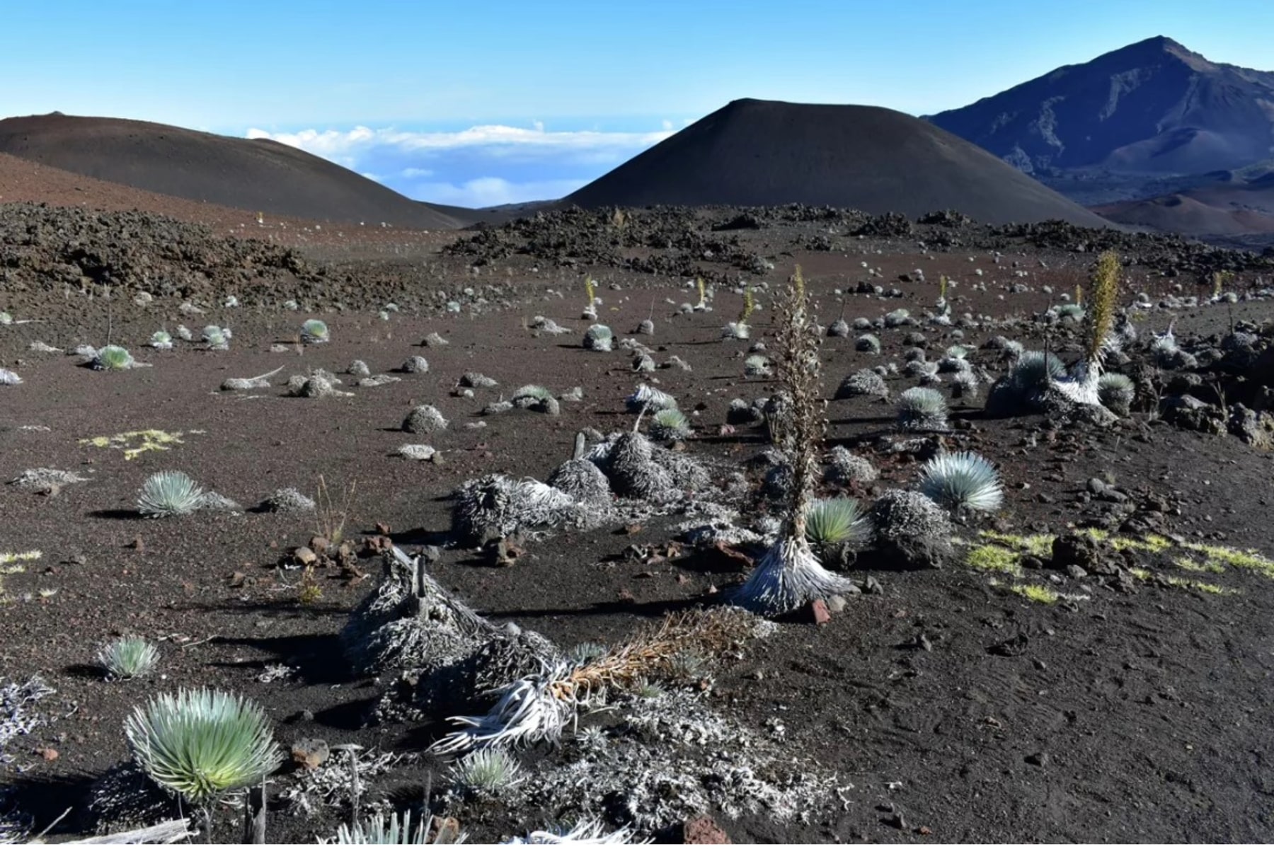
The best stretch comes on the way out, up the switchbacks of the Halemau’u Trail. Just over a mile from the bottomless pit, catch the Silversword Loop, where patches of green start to break up the cinder.
The silversword is a flowering plant found only in Hawaii, growing on volcanic slopes and craters. It forms a dense rosette of silvery sword-shaped leaves, lives up to 90 years, flowers exactly once with a stalk covered in hundreds of maroon blossoms, and then dies. Stay on the trail. Silversword seedlings grow right at its edges, and one boot ends nine decades of patience.
The Final Ascent
The switchbacks wait about two miles past the Silversword Loop. The climb gains roughly 1,000 feet up the crater wall itself, on a trail cut into ancient lava. Fog tends to hang on this side of the mountain, drifting through the gap in the rim.
You get more greenery in this section, though not the lush forests and waterfalls the Hawaii brochures promised. (Those live on the park’s Kipahulu coast, a separate district.) The climb is hardened by the miles already behind you and the thinning air.
In the final quarter mile, you cross Rainbow Bridge and get sweeping views back across the crater. Then the trailhead, and your car, exactly where you left it. This is why you parked at Halemau’u.
Getting to Haleakala National Park on Maui
Haleakala National Park is on the island of Maui, one of eight major islands among nearly 140 smaller islands. Honolulu is on the island of Oahu, 100 miles as the crow flies from Maui.
If you fly into Honolulu’s Daniel K. Inouye International Airport (HNL), you’ll need a separate flight to reach Maui. Maui’s Kahului Airport (OGG) offers some mainland and interisland flights. Hana Airport (HNM) only offers interisland flights.
Getting to Haleakala Crater Trailhead
Haleakala’s Summit District sits in remote eastern Maui, in the region known as Upcountry. The National Park Service puts it plainly, “There is no public transportation on Maui that will bring you into or near either district of Haleakala National Park.”
Unless you book a tour, you’ll drive yourself to the park, then keep driving to the trailhead.
The closest towns to the Haleakala Crater hike are:
- Kahului: (29 miles) – The closest major town, on the coast and home to Kahului Airport. About a 45-minute drive to the park entrance.
- Paia: (24 miles) – A small coastal town near the intersection of Hana Highway and the road up to Haleakala, about a 40-minute drive to the park.
- Hana (28 miles) – A remote town on the far eastern side of Haleakala at sea level. About 1.5 to 2 hours of driving to the Summit District.
From the park entrance, the summit area is still another 30-minute drive up the switchbacks.
Biking to Haleakala Crater
You can rent a bike or hire a bike shuttle service to take you up the mountain. Before you choose this option, respect what this road is. It climbs roughly 10,000 feet from sea level, and hypothermia is possible any month of the year up top. Yes, in Hawaii.
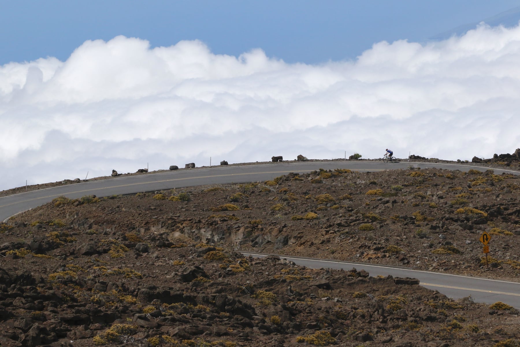
Biking to the Haleakala Crater hike is for expert-level cyclists only.
There are no bike paths on the winding road up the mountain, and even finding a shoulder is a struggle.
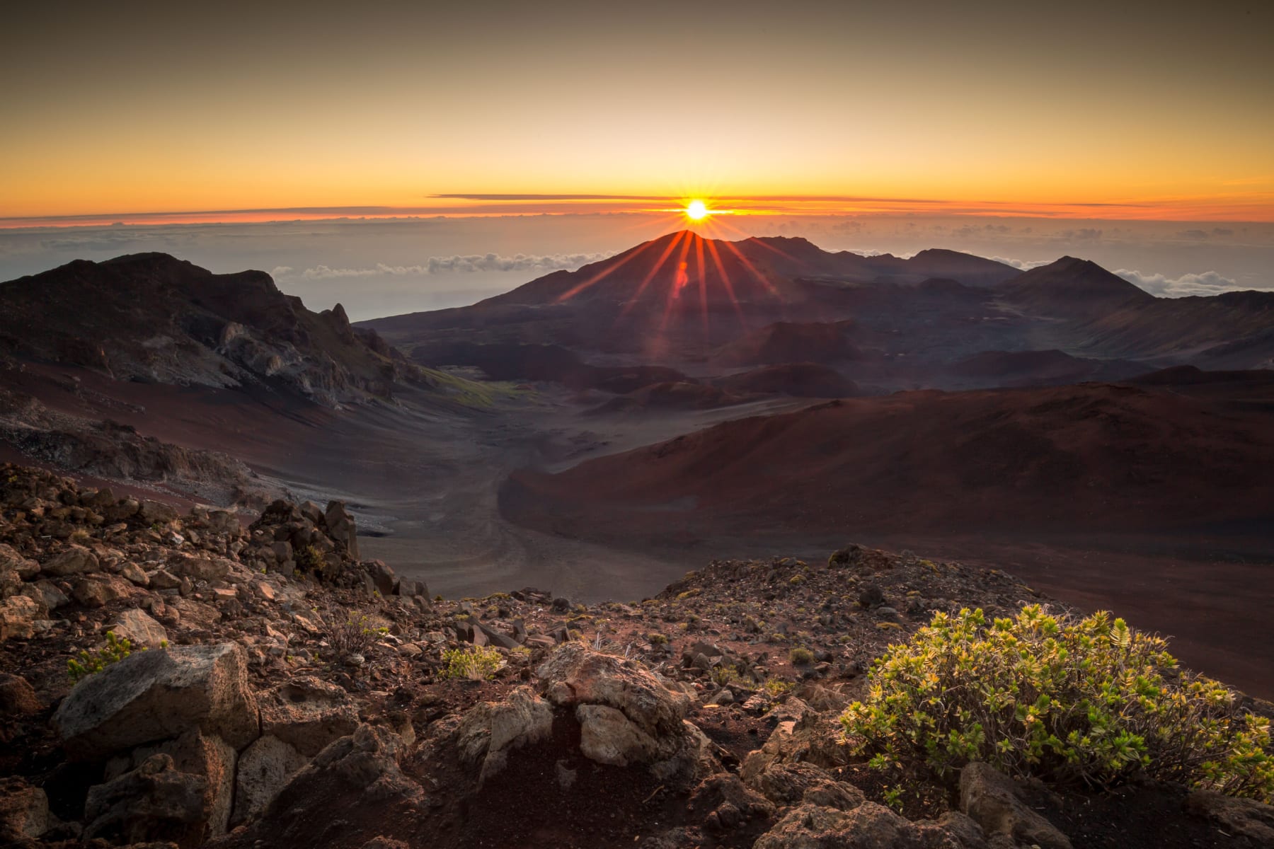
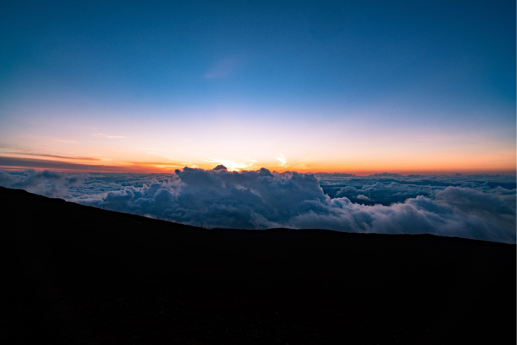
Sunrise Before Haleakala Crater Hike
If you’re going as far as hiking the crater, tack on a sunrise summit trip and see the view Mark Twain called “the sublimest spectacle I ever witnessed.” He saw a lot of spectacles. He kept this ranking.
Sunrise at the summit requires a reservation for any vehicle entering the summit parking lots between 3:00 am and 7:00 am. Tickets are released on a rolling 60-day window. If you want to see the sunrise on December 25, set your alarm for October 26.
How to Get a Sunrise Pass
A few tricks improve your odds of landing a sunrise reservation before your crater hike.
- Create a Recreation.gov account in advance.
- Tickets drop at 7:00 am Hawaii Standard Time. Hawaii skips Daylight Saving Time, so do the conversion math for your time zone. Here’s a little help.
- Book on the website, not the phone reservation line. The tickets sell out in minutes. Being on hold is wasted time.
- You are purchasing a ticket PER CAR, not per person.
- Have a card ready. The reservation costs $1.
- The reservation covers the 3:00 am to 7:00 am entry window, and the named reservation holder must be in the car with ID.
If you miss the 60-day drop, a second batch of tickets releases at 7:00 am HST two days before each date. Same process. One sunrise reservation per person every three days.
If you’d rather let someone else do the sunrise planning, book a tour. These are the only park-approved vendors for sunrise tours.
Sunset After Haleakala Crater Hike
Better play in our book. Time your hike to end near sunset and get the “sublime” view with zero reservation required. Stick around after dark and you’re stargazing from 10,000 feet with no light pollution, closer to the equator than any other US national park summit.
Hawaii and hypothermia in the same sentence might seem odd, but it’s a reality of this hike. The Summit District peaks at 10,023 feet above sea level, and the crater rim holds onto wind, fog, and cold that the beaches below never see.
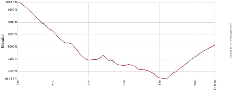
Here are the key elevation points on the way to the summit.
- The base of the Haleakala Highway: 3,403 feet
- Haleakala Park Entrance: 6,759 feet
- Top of Sliding Sands Trail: about 9,740 feet
- Lowest Spot in Crater: approximately 6,400 – 6,600 feet
The weather here is forecast by zones, and you can also pull a forecast just for the summit. Never rely on a single forecast. Conditions can run foggy to rainy to sunny and back during one lap of the crater.
That means more layers (and more weight) in your pack. Temperatures range between 30°F and 65°F every day of the year up top, and the wind and fog make it feel colder.
Plan for the temperature to change about three degrees for every 1,000-foot change in elevation. The summit runs about 30°F cooler than the coast.
MUST KNOW Details about Haleakala Crater Hike
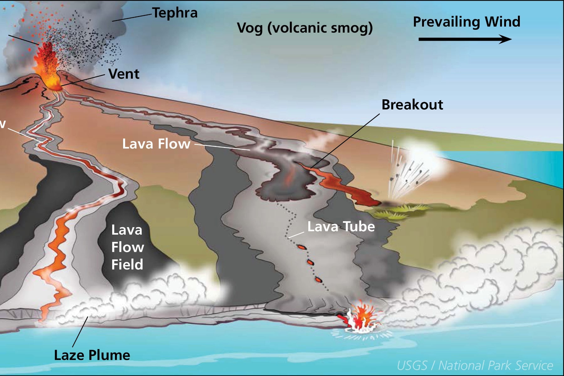
Eruption Risks on Haleakala Crater Hike
The United States Geological Survey states, “The on-land segment of this lengthy volcanic line of vents is the zone of greatest hazard for future lava flows and cindery ash.” The threat potential is ranked as moderate, though you’re more likely to experience an earthquake than an eruption on this hike.
Volcano Activity Tracking Tools for Haleakala Crater Hike
Haleakala hasn’t erupted in roughly 400 to 600 years, but the USGS does not consider it extinct. It’s the only active volcano on the island of Maui, with at least 10 eruptions in the past 1,000 years.
Most of the mountain hides underwater, about 97% of its mass. If the entire volcano stood above water, it would measure nearly 30,000 feet, taller than Mount Everest. Nearly 20,000 feet sit below the water line, including the Haleakala Ridge, the largest rift zone in the Hawaiian archipelago.
The odds of being in the crater when the volcano wakes up are slim. The USGS watches it constantly, and you can too with the links above.
What Do You Mean Haleakala Crater Isn’t a Crater?
Shield Volcano vs Stratovolcanoes
Everyone calls it a crater, a summit, a mountain. The geology says otherwise. Haleakala isn’t even the kind of volcano most folks picture.
Haleakala is a shield volcano. The cone-shaped killers like Mount Vesuvius, which buried Pompeii and Herculaneum in 79 AD, and Mount St. Helens are stratovolcanoes. Different machine entirely.
Shield volcanoes are gently sloping, broad domes built up over time by fluid basalt lava flows. The low-viscosity lava spreads out gradually rather than piling into a steep cone. That’s why this hike has steep walls at the beginning and end with a broad floor between. It also explains why Haleakala Crater isn’t really a crater.
What some call “the crater” is actually a massive valley carved by water and landslides. The original circular crater of the summit is long eroded away. This vast valley was once twice as deep, but subsequent eruptions of Haleakala partially filled the valley with flows and cinder cones.
Cinder cones form when thick lava fragments build up into a steep hill. Prominent cinder cones within the park include Pa Ka’oao (White Hill), Lua o Palahemo, and Pu’u O Kali. You’ll pass several on the hike, and 14 total stand in the park.
Haleakala may once have summited near 15,000 feet. The same erosion that carved the valley took the top of the shield with it.
Terminology of Hawaii and Haleakala National Park
This is sacred ground in Hawaiian culture, and it deserves to be treated that way. Even nailing aloha (greeting or parting) and mahalo (thanks) shows basic respect.
Most trails here carry both a Hawaiian name and an English name.
- Keoneheʻeheʻe (Sliding Sands Trail): The trail you take into the crater.
- Halemau’u Trail: The trail that carries you back out over the crater wall.
- Puʻu (cinder cones): The 14 cones in the crater, each with its own name.
Haleakala means “House of the Sun,” tied to the demi-god Maui’s battle with the sun for longer days. He snared the sun with ropes and only let go when it promised to slow its daily run across the sky.
You’ll pass a lot of rocks on this hike. They are not souvenirs. Beyond the Leave No Trace principles, there’s the Curse of Pele. Legend holds that anyone who takes rocks or sand is cursed. Going off the designated trails is likewise considered a desecration of sacred land.
Do Not Mail Rocks: The National Park Service fields thousands of returned rocks each year from folks convinced the rocks brought them bad luck. The park asks people to stop. The rocks come back contaminated by other climates, and this ecosystem is too fragile to just “throw it back.”
Protect the Ohi’a Trees on Haleakala Crater Hike
One well-known story in Hawaiian culture involves the goddess Pele and the Ohi’a flowering trees. Legend has it that Pele fell in love with a man named Ohi’a. Unfortunately, Ohi’a loved another woman named Lehua. Pele’s rage ended with Ohi’a transformed into a mangled tree.
When Lehua saw what became of her beloved, she asked her deified family to turn her into the bright red blossoms that adorn the tree. Forever after, Ohi’a and Lehua could be together. Rain reportedly falls when you separate these lovers by removing a flower from the tree, representing their tears at being apart.
Those trees are now threatened by Rapid Ohi’a Death, a fungal disease that kills them. Anyone coming to Haleakala from the Big Island should remove dirt and debris from their gear and clothing, then spray everything down with an alcohol spray to kill any hitchhiking fungus.
Checklist of Items for Haleakala Crater Hike
Checklist of Items for Haleakala Crater Hike
Clothing for wet, cold, hot, and muggy weather, with easy access to peel-off layers.
Snacks or prepackaged meals, as no food is available in the park.
Compass, as there is a confusing set of trails and no mobile service in the crater.
Stargazing flashlight to navigate in the dark without creating light pollution.
Water bottles to carry water, which is only available at the visitor centers.
Sturdy, well-worn hiking boots to navigate the sand and steep edges of the volcano.
The most popular Haleakala Crater hike from Keonehe‘ehe‘e through the crater bottom and up Halemau’u can take six to eight hours. Since the last two miles of the hike climbs steep switchbacks, don’t expect to make up any time here. Err on the side of caution due to the high altitude challenges.
No other road in the world gains this much elevation in such a short distance. The road is winding, narrow, and subject to quick changes in weather. Slow drivers can pull over at regular roadside pull-offs. The road is only as scary as your driver’s attention span and driving skills.
The National Park Service closes the summit region if the winds are too high, but it’s going to take a National Weather Service wind warning to make that happen. Be prepared for winds that could gust from 20 to 40 miles per hour at times. The average annual wind speed is 16 miles per hour.
Helpful Related Links
Stop at Hawaii’s other National Park: HAWAII Volcanoes National Park: Expert Guide
Is there winter in Hawaii?: Winter in Hawai’i Volcanoes
Need to know more about Haleakala?: 12 Fascinating Facts About Haleakala National Park
WATCH: Hawaii’s National Parks Are AMAZING
Planning a trip to Alaska after Hawaii?: Visiting 8 EPIC ALASKA National Parks (How to Actually Get There)
Another otherworldly park: 25 AMAZING Things to Do in Death Valley National Park
What to Bring to Haleakala
Gear we recommend for Haleakala. Affiliate links support our work at no cost to you.
Affiliate disclosure: Some links on this page earn us a small commission at no extra cost to you. We only recommend gear we actually use.
More Than Just Parks Film Watch our 8K film of Haleakala We spent weeks in Haleakala, one of our favorite public lands destinations, capturing it the way it deserves. Take a few minutes and see it for yourself.


