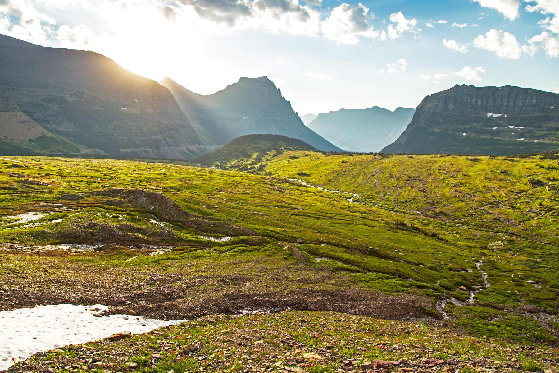
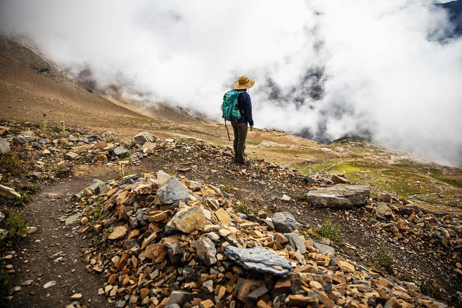
If You Only Do One Hike: Highline Trail. The Highline Trail is the single best maintained trail in any national park. You walk along the Continental Divide with the Garden Wall towering above you and an endless expanse of peaks falling away below. The first step off the shuttle at Logan Pass might make your stomach drop. The trail hugs a cliff edge for the first quarter mile. After that, it is pure alpine bliss for 11+ miles.
| Trail | Distance | Elevation | Difficulty | Time |
|---|---|---|---|---|
| Highline Trail | 11.8 mi one-way | 1,950 ft (with Granite Park) | Hard | 6-8 hrs |
| Grinnell Glacier Trail | 10.6 mi RT | 1,800 ft | Hard | 6-8 hrs |
| Avalanche Lake Trail | 5.9 mi RT | 730 ft | Moderate | 3-4 hrs |
| Hidden Lake Overlook | 5.3 mi RT | 1,335 ft | Moderate-Hard | 2.5-4 hrs |
| Iceberg Lake Trail | 9.6 mi RT | 1,275 ft | Moderate-Hard | 5-7 hrs |
| Ptarmigan Tunnel | 10.6 mi RT | 2,400 ft | Hard | 6-8 hrs |
| Dawson-Pitamakan Loop | 18.8 mi loop | 3,735 ft | Very Hard | Full day or overnight |
| St. Mary & Virginia Falls | 3.6 mi RT | 400 ft | Easy | 2 hrs |
| Trail of the Cedars | 0.7 mi loop | Minimal | Easy | 20 min |
| Running Eagle Falls | 0.6 mi RT | Minimal | Easy | 15 min |
| Swiftcurrent Lake Nature Trail | 2.5 mi loop | Minimal | Easy | 1 hr |
| Cracker Lake | 12.7 mi RT | 1,400 ft | Hard | 6-8 hrs |
| Scenic Point | 7.4 mi RT | 2,350 ft | Hard | 4-6 hrs |
| Lake McDonald Shore | Varies | Minimal | Easy | Varies |
| Apgar Lookout | 7.0 mi RT | 1,850 ft | Moderate-Hard | 3-4 hrs |
There’s something special about visiting Glacier National Park and its Rocky Mountain scenery. While you can view a lot of the park from your car, I say there’s nothing quite like actually hiking in it. With the park spanning 1 million acres, or 1,580 square miles, there are hikes for any age or level of fitness.
In this article, I’ll share what I believe are the best hikes in Glacier National Park as well as give you some helpful pointers along the way. For starters, I’ve labeled each hike as easy, moderate, or strenuous. The list starts on the easier side of things, for those with families, specific accessibility needs, or for those who just want a relaxing day.
Gradually, we’ll move along to the more challenging hikes. In addition, the time required listed for each hike is the average amount other hikers have reported back. I wouldn’t plan a tight schedule based on that estimate as it may take you a little longer to complete.
Love Glacier? It's one of 117 threatened public lands destinations we're tracking. Get the free briefing.
As a general and very important note about hiking in Glacier, bears do frequent the area. I’m not saying this to scare you, but just to make sure you’re prepared. I’d suggest carrying a can of bear spray.
Alright, let’s get to the list!

Glacier sat at the top of my list for years before I finally made it, and I researched the place obsessively before our first trip. The hikes below are the ones that earned their reputations, ranked from years of filming and hiking across the park.
I can tell you that Glacier National Park is way more beautiful in person than in photos, even some of the spectacular ones that are out there these days. Glacier National Park is one of the grandfathers of the national parks system and continues to stand the test of time as one of the best national parks in the US.
This mountainous park and its broad vistas make other park overlooks seem tame by comparison.
Related: Can You Do Glacier National Park in One Day?
2026 access update: Glacier dropped its vehicle reservation system for 2026. You no longer need a timed-entry vehicle ticket to drive Going-to-the-Sun Road, Many Glacier, Two Medicine, or the North Fork. Instead, the park runs a reservation-only ticketed shuttle to Logan Pass and caps parking at Logan Pass at three hours. Popular areas may be temporarily closed to inbound traffic when their lots fill.
Going-to-the-Sun Road shuttle reservations are booked on recreation.gov. The shuttle season starts July 1, 2026. Reservations open 60 days in advance (beginning May 2 at 8am), with next-day shuttle tickets released daily at 7pm starting June 30. If you would rather drive yourself, arrive early or after the afternoon rush, since Logan Pass parking is capped at three hours and fills fast.
Check the current reservation and permit rules for any park you plan to visit, since these systems change from year to year.
- The entrance fees to Glacier are $25 per vehicle from November 1 through April 30. Otherwise, it’s $35 per vehicle. If you have the interagency America the Beautiful pass, you won’t pay a per-visit fee. The once-a-year $80 pass covers federal recreation sites nationwide. International visitors ages 16 and up now pay an additional $100 per person non-resident surcharge at Glacier (effective January 1, 2026); a $250 non-resident annual pass is also available.
- Mobile service is spotty at best. Bring a Glacier National Park Guidebook and or a map of the Glacier to help during your trip.
- The Best Time to Visit Glacier National Park is during the summer months when the park is fully open. The best months are July, September, when the trails are mostly clear of snow, and the park is teeming with wildflowers and wildlife.
- Drive times in the park can be deceptively long, since mountain roads slow you down. Distances that are relatively short via crow flight can take hours to complete based on existing roads.
- Consider taking the Glacier National Park shuttle service, which operates seasonally on Going to the Sun Road, instead of taking a car to lighten your footprint on the park and eliminate the stress of driving.
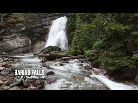
15. Baring Falls Hike
Baring Falls
- Distance: 0.7 miles
- Difficulty: Easy
- Elevation Gain: 108 ft.
- Time Required: 30 minutes
This trail is an easily accessible little gem, which is why it makes the list of best hikes in Glacier National Park. It’s typically not as crowded because most people don’t even know it’s there. It’s very close to the popular St. Mary and Virginia Falls, which often overshadow it. Personally, I like to bring a snack and sit and enjoy the waterfall for a little while before heading back down to my car.
Quick tip, the parking lot at Sunrift Gorge is pretty large, but it can fill up fast. I would recommend getting there early so you don’t have to fight for a space.

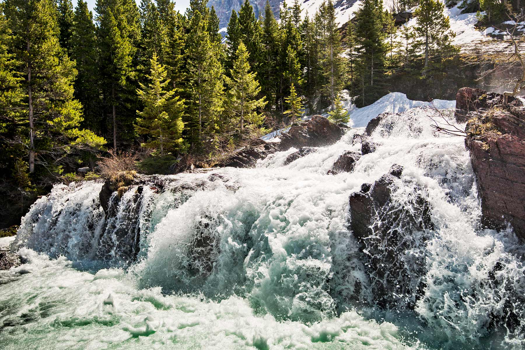
14. Redrock Falls
Redrock Falls
Distance: 3.6 miles
Difficulty: Easy
Elevation Gain: 100 ft.
Time Required: 1.5 hours
The trail for Redrock Falls begins at the Swiftcurrent Trailhead. It’s a relatively flat hike and pretty simple for those wanting some easy distance, which makes it one of the best family options in the park.
But be forewarned, it can be muddy due to the mist from the falls and snow runoff depending on the time of year. So if you have adventurous little ones, it may become messy. Perhaps a great photo op.
This area is also great for wildlife activity. There are several ponds along the way that frequently have moose in them. Bighorn sheep also make regular appearances and sometimes even bears.
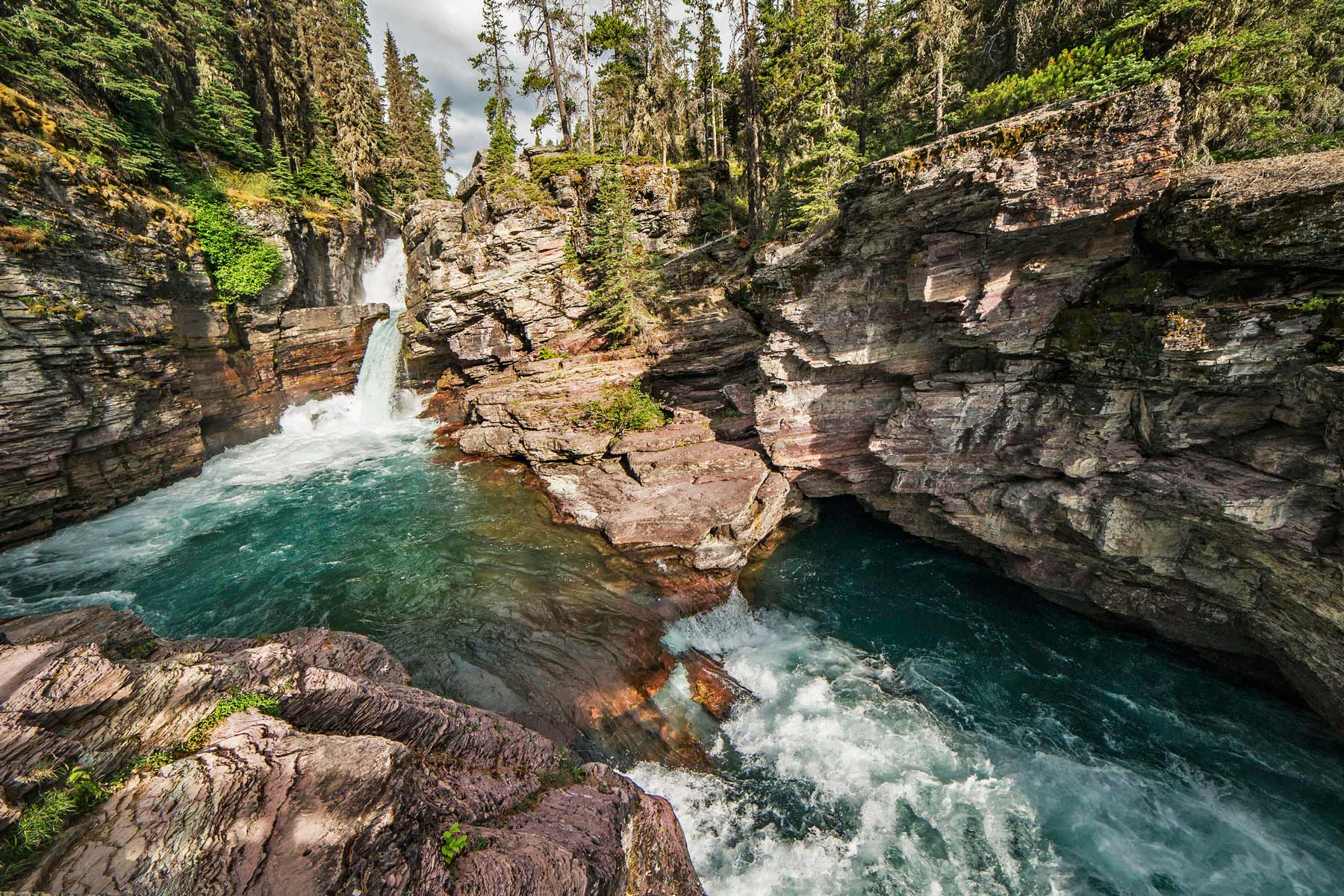
13. St. Mary and Virginia Falls
St. Mary and Virginia Falls
Distance: 3.6 miles
Difficulty: Easy
Elevation Gain: 285
Time Required: 1.5 hours
The St. Mary and Virginia Falls trail is one of the most popular trails in the park and for good reason. While most reviews online don’t talk about it, you can swim in the lake at St. Mary’s Fall. That makes this one of the few trails in the park where the payoff is a cold dip. Rangers watch to make sure everyone is being safe, but there are plenty of rocks to jump off of at varying heights into the cool water.
After you have your fill of fun swimming, head about another 0.8 miles ahead to see Virginia Falls. This is a great place to stop and have some lunch before heading back down.


12. Trail of the Cedars
Trail of the Cedars
Distance: 1.4 miles
Difficulty: Easy
Elevation Gain: none
Time Required: 30 minutes
Nature should be accessible to all, and sadly it’s often not. I’d like to commend the park for creating this handicap-accessible trail. Wheelchairs and even strollers can easily navigate the boardwalk path through the ancient cedars to a waterfall at the end. Trail of the Cedars is by far the best hike in Glacier National park for accessibility.
If you’re a experienced hiker, you may want to skip this one. I think it’s beautiful, but definitely nothing strenuous. It can also be pretty crowded due to the accessibility.

11. Cracker Lake
Cracker Lake
Distance: 12.8 miles round trip
Difficulty: Hard
Elevation Gain: 1,400 ft
Time Required: 6 hours
On your way to Cracker Lake, the trail is pretty consistently uphill, just as fair warning. The incline isn’t very steep though and you’ll be traversing through the scenic Cracker Flats area. Definitely bring your bug spray. They’re out in full force on this trail.
The lake itself is a vivid turquoise from the glacial water. And the hike back down is nearly all downhill, a rare luxury in this park. Remember how I mentioned bear spray up above? Well, this trail is known for bear sightings. Just make some noise as you hike and have that can of bear spray handy.
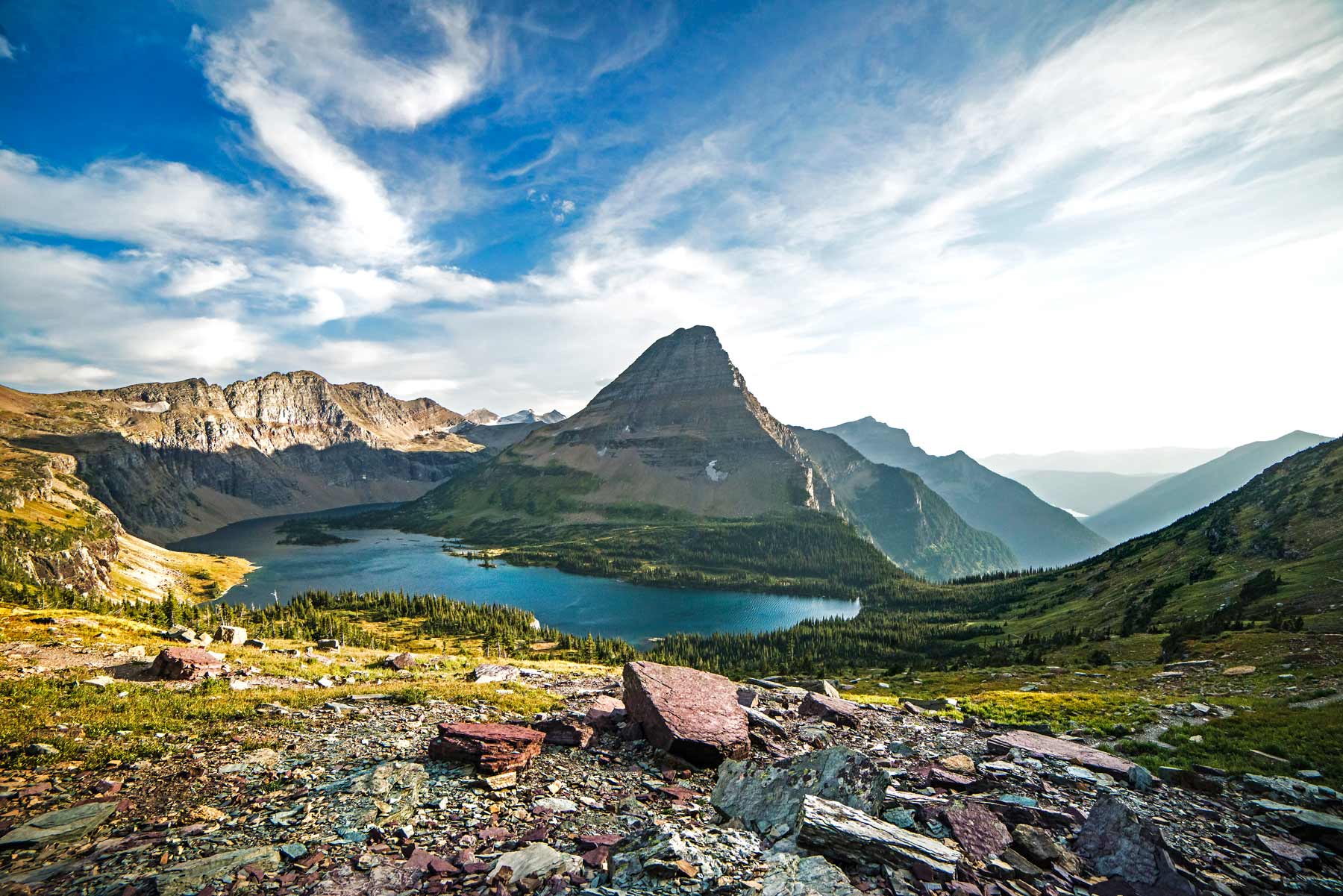
10. Hidden Lake
Hidden Lake Overlook
Distance: 2.8 miles
Difficulty: Moderate
Elevation Gain: 460 ft
Time Required: 1 hour
The view of Clements Mountain from this trail is beautiful. I feel like a broken record saying everything is beautiful, but once you’re in Glacier, you’ll see what I mean. This trail is perhaps one of the most photographed parts of the park. It’s often what you see photos of on maps, brochures, or postcards, which is why it earned its place on the list of the best hikes in Glacier National Park.
Depending on the time of year you’re visiting, part of the trail may be closed. The trail to the Hidden Lake overlook is always open, but reaching the lake itself depends on bear season. Around August, the park closes that portion of the trail due to all the huckleberries in the area that draw in bears. That part of the trail usually opens back up in October.
Parking is found in the Logan Pass Visitor Center and fills up quickly, so get there early.
9. Gunsight Lake
Gunsight Lake
Distance: 12.9 miles round trip
Difficulty: Hard
Elevation Gain: 1,724
Time Required: 5.5 hours
I consider this to be one of the most underrated and best hikes in Glacier National Park. After a few miles of descent from the Jackson Glacier Overlook, it flattens out in the valley below where you’ll be surrounded by views for the remaining 4 miles or so.
The lake itself has that beautiful turquoise glacial watercolor with a view of snowy peaks behind it. This trail passes through the St. Mary’s River as well as Reynolds creek, so the ground can be a bit soggy in places. Do not. I repeat, do not forget your bug spray for this hike. They thrive in the area’s moisture.

8. Bowman Lake
Bowman Lake
Distance: 26.2 miles
Difficulty: Hard
Elevation Gain: 3,090 ft
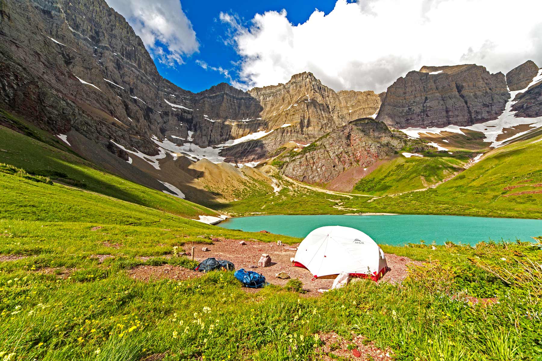
Time Required: 10.5 hours or commonly backpacked over a few days.
The journey to this trailhead is not for the faint of heart. The road is full of potholes and I wouldn’t recommend traversing it during bad weather or in a car that’s not four-wheel drive. Having said that though, the hike is well worth it.
The Bowman Lake trail stands out simply because it’s far less crowded. The hiking is more intense in this region, which deters the crowds. While you could complete this trail in a day, I found it more enjoyable to stretch it out and backpack along the way. If 26.2 miles isn’t your thing, but you’d still like to see the lake, you can hike out about 3 miles to take a peek and then turn back around.

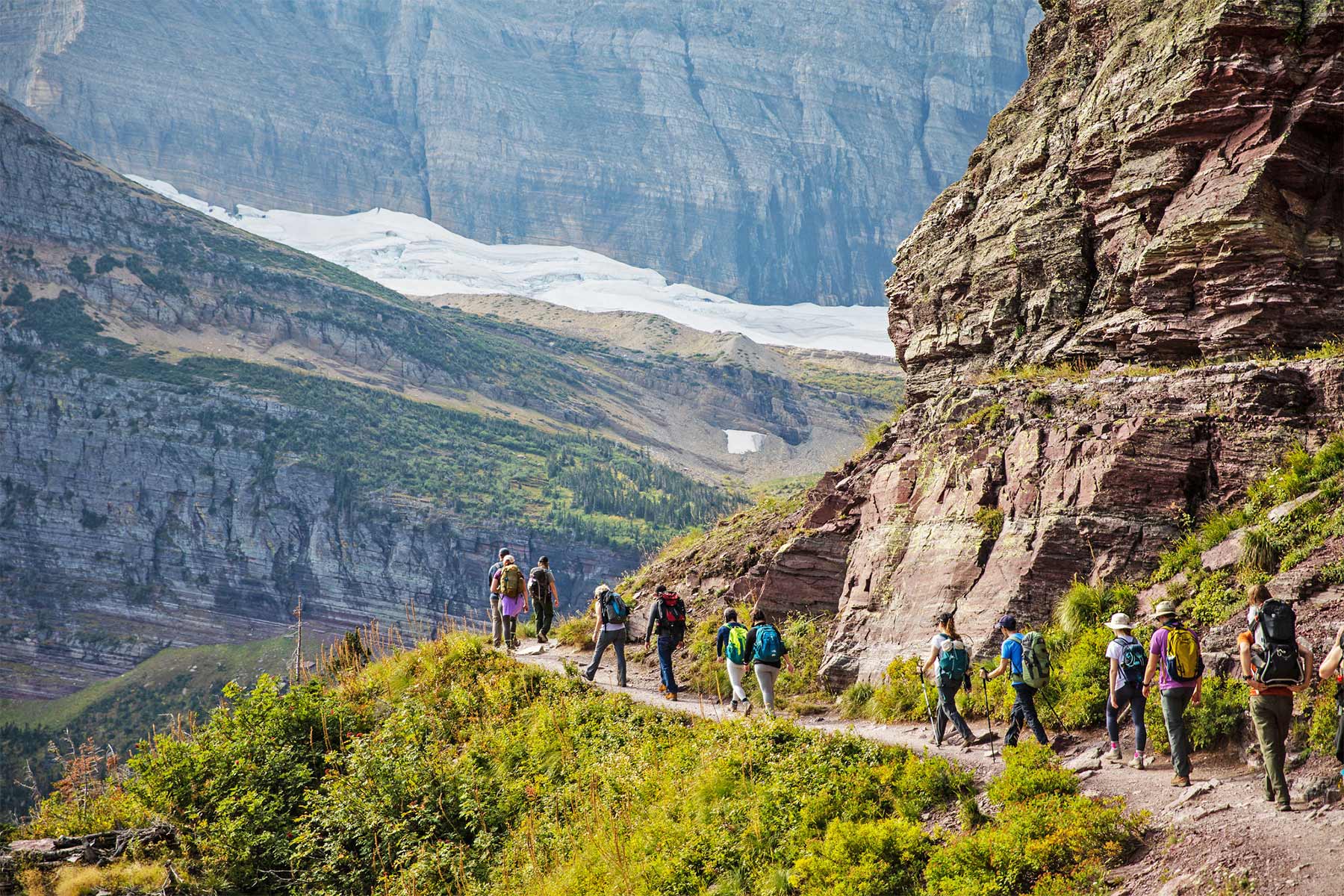
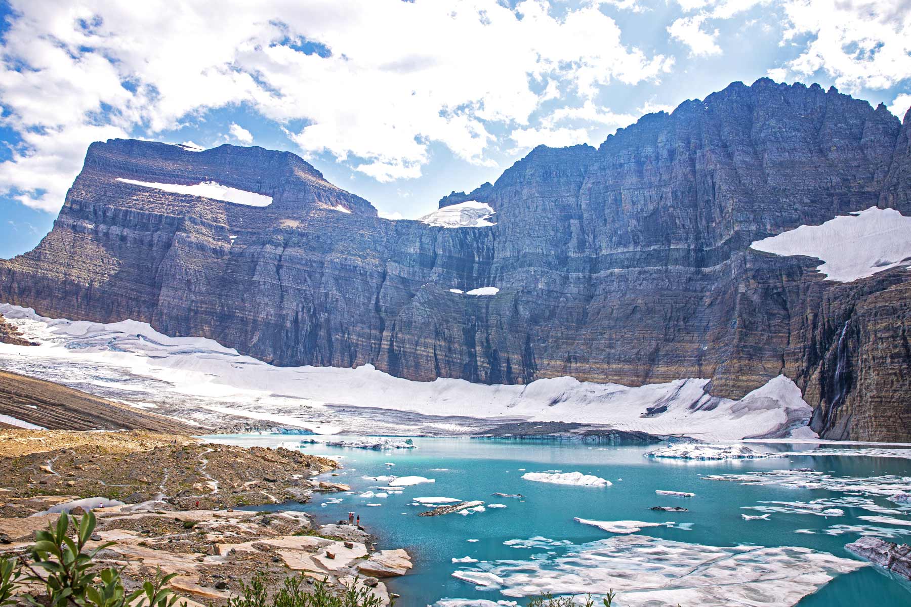
7. Grinnell Glacier
Grinnell Glacier
Distance: 11.2 or 7.6 miles*
Difficulty: Hard
Elevation Gain: 2,100 ft
Time Required: 4 – 5.5 hours
*taking the boat saves 3.5 miles round trip
You can start the hike one of two ways. Option 1, start at the official trailhead next to the Many Glacier Ranger Station. Option 2, you can take the boat on Swiftcurrent Lake to Lake Josephine followed by a second boat that drops you off on the far side of that lake.
All the details for the boat rentals you can find here. Taking the boat saves 3.5 miles round trip off the hike. Once on the far side of the lake the elevation begins up to Grinnell Lake where the best scenery begins to come into view. Waterfalls, wildflower meadows, turquoise waters, couple with switchbacks, and if you’re unlucky some unbelievably savage mosquitoes.
Finally you’ll reach the Grinnell Glacier viewpoint with sweeping views of what’s left of this once mighty and now greatly reduced ice flow. The view of the glacier, combined with the turquoise water and the landscape from up above, is the kind of payoff that lands a trail on every serious shortlist for the park.
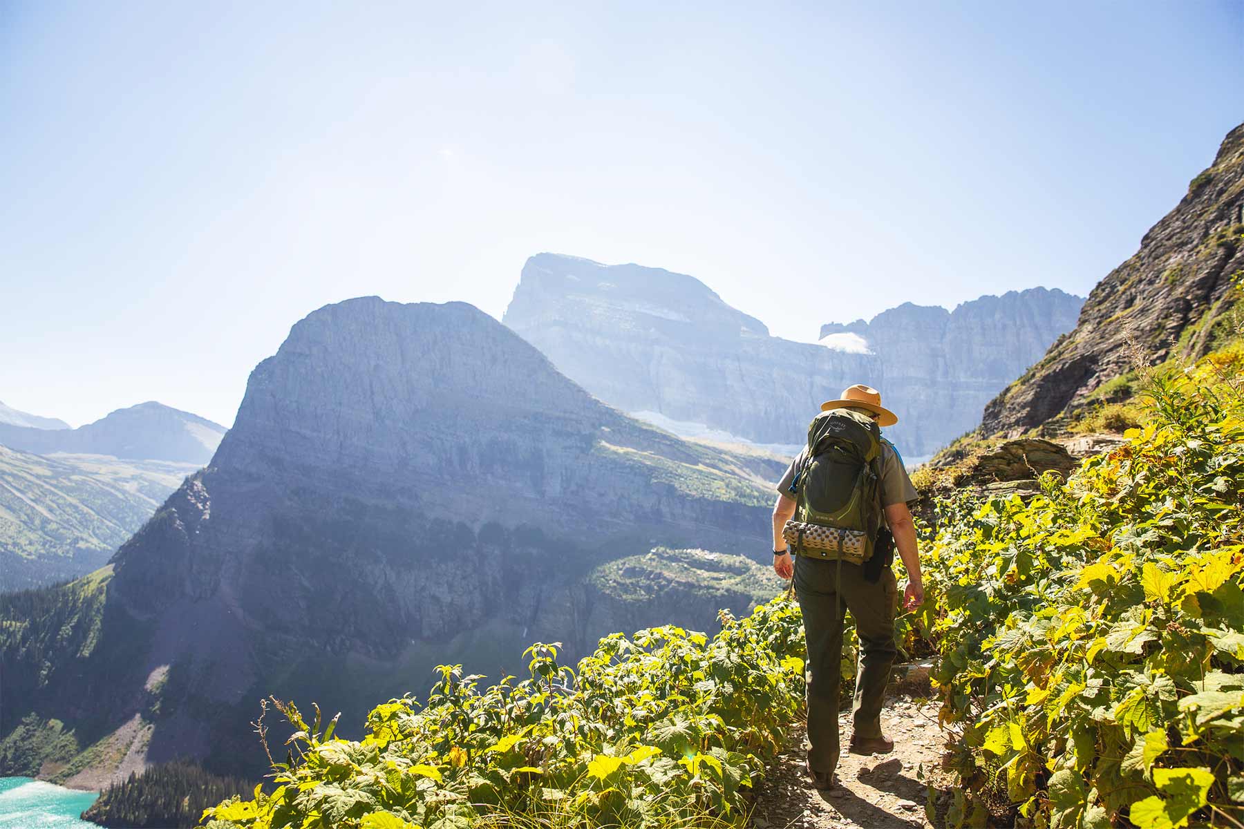
6. Highline Trail
Highline Trail
Distance: 11.8 miles (as a one way hike to the shuttle pickup)
Difficulty: Hard
Elevation Gain: 2,000 feet
Time Required: 7 hours
Typically this is a one-way hike. You start off at the Logan Pass Visitor Center and eventually make your way to The Loop where you’ll catch a free shuttle back to the Visitor Center. Having said that though, many people turn back around at a certain point and hike back to their car rather than taking the shuttle.
This hike is not for those with a fear of heights. It’s a pretty steep incline for the majority of the way with drop-offs along the way. There are some safety cables and chains throughout to hold onto in the spookier parts of the trail.
The higher elevation here delivers a view that earns the climb. This trail has grown in popularity recently and can be crowded. I recommend starting off at the visitor center no later than 7:30 for parking and also to maximize your daylight.
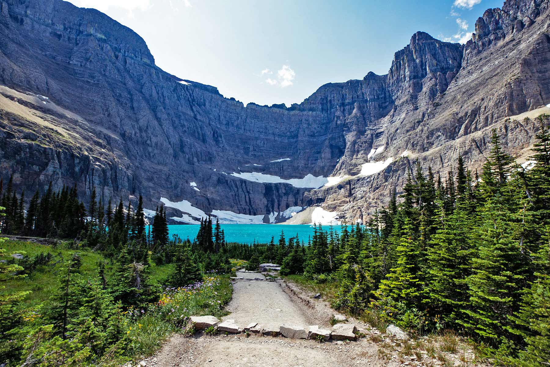
5. Iceberg Lake
Iceberg Lake
Distance: 9.3 miles
Difficulty: Hard
Elevation Gain: 1,200 ft
Time Required: 5 hours
The steep incline of this hike is made well worth it by the opportunity to jump in a glacial lake at the end. Be forewarned, the turquoise water is so cold that icebergs float in it year-round. The view of the glacier combined with the bright water, icebergs, and craggy rock background is a standout, one of the most scenic payoffs in the entire park, hands down.
This trail begins at the Iceberg Ptarmigan Trailhead and shares the first 2.7 miles with the Ptarmigan Tunnel Trail. This area is also very active bear country with regular grizzly sightings.
4. Pitamakan Pass and Dawson Pass
Pitamakan Pass and Dawson Pass Loop
- Distance: 17.2 miles loop
- Difficulty: Hard
- Elevation Gain: 3,641 ft
- Time Required: 9.5 hours
Depending on the time of year, this trail can be pretty snow-packed and require crampons and trekking poles. If the snow is too deep, Rangers will close access. I would recommend this as more of a mid-summer to early fall hike due to the conditions.
However, if the hike is available, it’s the best hike in Glacier National Park purely for the view of Lake McDonald at Old Man’s Campground. If you’d like to camp there, you’ll need to secure a permit. Once you head back out on the trail, the incline on Dawson Pass is pretty steep and the wind increases as you get higher. Definitely pack a windbreaker.
3. Ptarmigan Tunnel
Ptarmigan Tunnel
- Distance: 10.6 miles round trip
- Difficulty: Hard
- Elevation Gain: 2,300 feet
- Time Required: 6 hours
This tunnel was created in the 1930s as a way to create access from the Many Glacier Valley to the Belly River Valley. It’s worth the trip purely to see the impressive construction of the tunnel, which is 250 feet long.
Due to the weather, the tunnel is only accessible for a few months out of the year. So if you’d like to walk through it, it’s typically open from July through September.
2. Siyeh Pass Trail
Siyeh Pass Trail
- Distance: 4.6 miles
- Difficulty: Hard
- Elevation Gain: 2,240
- Time Required: 5 hours
There are two trailheads that ultimately lead to the Siyeh Pass Trail. The first one starts at Piegan Pass and the other from the Sunrift Gorge Trail. Really the main difference between the two is that the Piegan Pass route is a bit shorter with less climbing. Regardless of your choice, both routes are very steep and challenging to get to the pass.
Once you’ve reached the pass, you’ll head up to the saddle of Mount Siyeh. Once at the top, it’s one of best hikes in Glacier National Park for the view you’ll see from way up there.
While you can head back the way you came, you also have the option to descend on another path to the Sunrift Gorge. A free shuttle is located at the end to take you back to your car.
1. Swiftcurrent Pass
Swiftcurrent Pass
- Distance: 13.6 miles
- Difficulty: Hard
- Elevation Gain: 2,300 ft
- Time Required: 8 hours
This trail starts off at the appropriately named Swiftcurrent Motor Inn and takes you up into the Swiftcurrent valley. This is one of the best hikes in the park for side destinations along the way. Sure, they add some mileage, but why not make a backpacking trip out of it and take a few days.
One of the greatest side trails is the Swiftcurrent Fire Lookout which is the highest trail that’s maintained in the park. As for the actual trail, the last 6 or so miles are very steep and challenging to the top. Most people stop once they reach the pass instead of going the final stretch since the view isn’t all that different at the top. This hike is for experienced hikers who are in very good shape.

Closest Airport to Glacier: Kallispel, MT (MSO), 2 hours 40 minutes (140 miles)
I recommend flying into Glacier Park International Airport (FCA), renting a car, and making the roughly 30 minute drive up to the West Glacier Entrance. If there aren’t any affordable flights into Missoula you can try Spokane, Helena, & Bozeman.

If you plan on road tripping out and are still looking for some inspiration/ideas be sure to check out our Best National Park Road Trips article!
- Swiftcurrent Pass
- Siyeh Pass
- Ptarmigan Tunnel
- Pitamakan Pass
- Iceberg Lake
- Highline Trail
- Grinnell Glacier
- Bowman Lake
- Gunsight Lake
- Hidden Lake
- Cracker Lake
- Trail of Cedars
- St Mary & Virgina Falls
- Redrock Falls
- Baring Falls
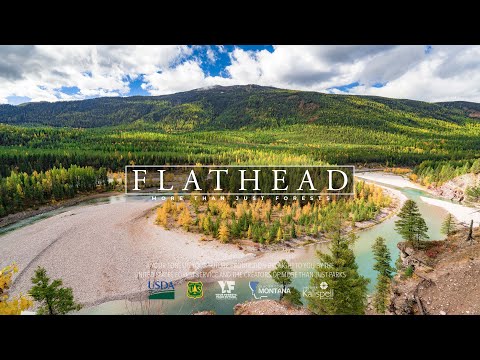
Check out the Flathead National Forest too!
Interested in seeing Glacier without the crowds? Located RIGHT NEXT to Glacier National Park is the equally scenic Flathead National Forest which sees a tiny fraction of the visitation.
Situated in the northwestern corner of Montana, the Flathead National Forest comprises 2.4 million acres of dramatic mountain beauty. In the wild heart of the Flathead lies over 1 million acres of wilderness.
Lynx, grizzly bears, timber wolves, and a vast and diverse array of other wildlife call the Flathead home. With over 1 million acres of wilderness, 2,600 miles of hiking trails, 250 species of wildlife and 22 species of fish, the Flathead National Forest truly has plenty to do.
We encourage you to visit this beautiful landscape and experience this unique part of America.


Permit Systems and Reservations
Check whether the national park you’re visiting has a permit or reservation system in place before you go. As parks grow more crowded, the agency leans harder on tools that manage the millions of people who visit each year. For 2026 Glacier replaced vehicle reservations with a ticketed Going-to-the-Sun Road shuttle and a three-hour parking limit at Logan Pass, so plan your summer access around the shuttle if you want to reach Logan Pass without circling for parking.
Want Less Crowds? Try a National Forest!
Try visiting a national forest while you’re on your trip to avoid the crowds. There are 155 national forests in America, many of which are equally as beautiful as the national parks they neighbor and only see a fraction of the visitors.
For example, try the Flathead National Forest next to Glacier National Park, the Bridger-Teton next to Grand Teton, and the Dixie which borders nearly all of the Utah National Parks.
Practice Safety, Seriously
National parks are beautiful but wild places, so it is essential to practice basic safety while visiting them. Every year people die while vacationing in national parks. This is easily avoided by:
- Sticking to trails
- Checking the weather before going out on a hike
- Maintaining a safe distance between wildlife which means at least 25 yards from most wildlife and 100 yards from predators
- Avoid ledges with steep drop offs
Things to Do at Glacier: Our list of things to do at Glacier National Park
Glacier Itinerary: Our 3-day Glacier National Park itinerary
Glacier Facts: Facts and a complete guide to Glacier National Park
Glacier National Park Hiking FAQ
What is the best hike in Glacier National Park?
The Highline Trail is our pick. It runs along the Continental Divide from Logan Pass with the Garden Wall towering above and an endless sea of peaks falling away below. If you only have the legs for one big day in Glacier, this is it. For a shorter trail with an equally jaw-dropping payoff, Grinnell Glacier and Iceberg Lake are both hard to beat.
Do you need a vehicle reservation for Glacier in 2026?
For 2026 the park dropped its general vehicle reservation system, but access to Logan Pass on the Going-to-the-Sun Road is managed through a ticketed shuttle, and there is a roughly 3-hour parking cap at Logan Pass. Plan to ride the free shuttle or arrive very early. Always check the park’s official alerts page before your trip, since the access tools here change year to year.
Do I need bear spray to hike in Glacier?
Yes. Glacier is grizzly and black bear country, and trails like Iceberg Lake, Grinnell Glacier, and Ptarmigan Tunnel see regular bear activity. Carry bear spray where you can reach it fast, make noise, and hike in a group when you can. It is the one piece of gear we never leave the trailhead without here.
When is the best time to hike in Glacier?
Mid-July through mid-September is the sweet spot. The high alpine trails along the Going-to-the-Sun corridor hold snow well into July, and the full length of the road usually does not open until late June or early July. By late September the high country starts to close down again.
Are there easy hikes in Glacier for families?
Yes. Redrock Falls from the Swiftcurrent Trailhead is flat and forgiving, St. Mary and Virginia Falls is short with a swimmable lake, and the Hidden Lake Overlook from Logan Pass is a manageable boardwalk-and-trail route with a huge payoff.
More Helpful Articles
Glacier Park Hub: Our complete guide to Glacier National Park
Grinnell Glacier Hike: Our deep dive on the Grinnell Glacier hike
Glacier in One Day: Can you do Glacier in one day?
Montana National Parks: The national park sites in Montana worth a visit
Grand Teton Hikes: Our guide to hiking Grand Teton National Park
Things to Do at Yellowstone: Our list of things to do at Yellowstone National Park
Yellowstone Facts: Facts about Yellowstone National Park
Wyoming National Parks: Our guide to the national parks of Wyoming
Things to Do at Wind Cave: Our guide to Wind Cave National Park
Affiliate disclosure: Some links on this page earn us a small commission at no extra cost to you. We only recommend gear we actually use.


