
Little White Salmon Watershed nears decision on Phase 2 thinning and logging
Little White Salmon Forest Resiliency and Fire Risk Mitigation Project
U.S. Forest Service· Little White Salmon Watershed, Gifford Pinchot National ForestU.S. Forest Service project page ↗
Forest ServiceWe track this on the agency’s own system of record, where most on-the-ground decisions live.
This is not a comment period
The comment round on this one is over
What is open now is a pre-decisional objection period. Only individuals and entities that already submitted timely, specific written comments during an earlier public comment opportunity on this project may file an objection (36 CFR 218.5(a)). If you commented, this is your round. If you did not, no filing you send here will be accepted, and the honest thing for us to say is that this door is closed to you rather than to hand you a form.
An organization’s comments count for the organization only. Being a member of a group that commented does not make you eligible; you had to comment in your own name (36 CFR 218.5(c)).
Do not file on our date. Get it from the notice. The objection clock runs from the day the legal notice was published in the forest’s newspaper of record, and that publication date is the exclusive means of calculating it. Objectors may not rely on a date from any other source (36 CFR 218.6(c)). The agency has to post that notice on the web within four days of publishing it (36 CFR 218.7(d)), so it is on the project page.
For what it is worth, the Forest Service comment portal listed October 26, 2026 for this project when we read it. That is the portal’s own field, not the legal notice, and we have not reconciled the two. We would rather show you where it came from than let it stand in for the law.
The groups on this fight
4 groups work Washington
By footprint, from the same match the STAND matchmaker runs; none is linked to this decision in our record yet. Give straight to them; nothing routes through us.
- Cascade Forest Conservancy
Works Washington: they work only in Washington.
- Conservation Northwest
Works Washington: submitted formal comments defending Hanford Reach National Monument during the 2017 federal monument review and publicly opposed any boundary adjustment or rescindment..
- Friends of the San Juans
Works Washington: they work only in Washington.
- Olympic Park Advocates
Works Washington: they work only in Washington.
Every group above is on STAND for Public Lands, with its court record, its filings and who backs it.
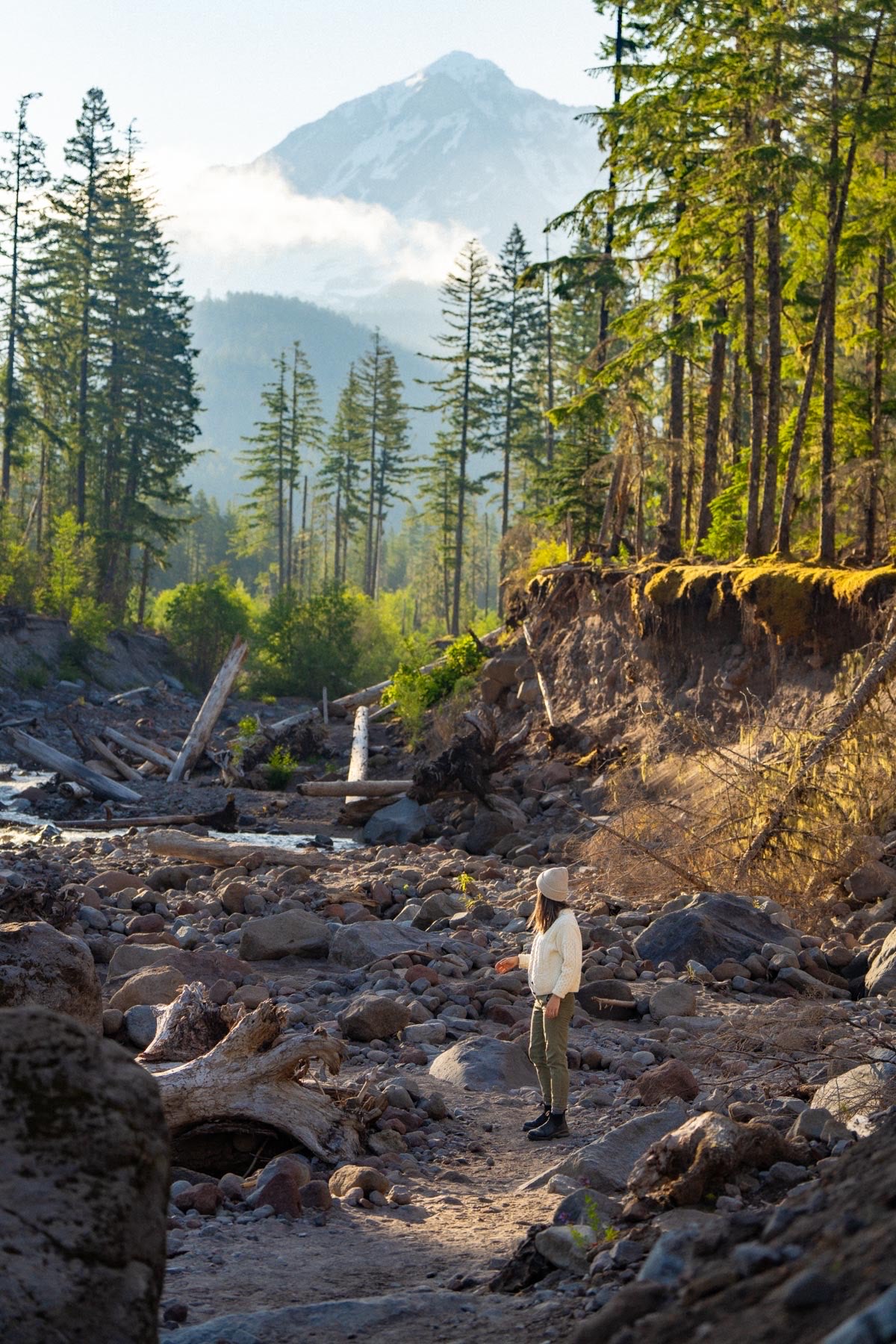
The Forest Service is close to approving commercial logging and fuels treatments across 1,411 more acres in the Little White Salmon Watershed.
What’s at risk
Only people or organizations that submitted written comments during the earlier public participation window are eligible to object. For those who qualify, 1,411 acres of the Little White Salmon Watershed face commercial timber harvest and fuels treatments that would alter forest cover and watershed conditions.
If this goes through
If approved, the Phase 2 decision would authorize logging and fuels treatments on an additional 1,411 acres, compounding the 9,897 acres already approved under Phase 1 of the same project.
Our plain-English read of the official notice ↗. Check it against the agency’s own words below.
The agency’s case, tested
What the agency argues, and whether its own record backs it
- 2
- Hold up
- 4
- No support given
- 2
- Never analyzed
The Forest Service wants to thin and treat fuels on 13,249 acres of the Little White Salmon watershed, decommission or close roads, and adopt two one-time forest plan amendments. It says dense, uniform stands left by past logging and fire exclusion are vulnerable to drought, insects and wildfire that threaten nearby communities and habitats.
“The purpose of this project is to increase forest resiliency to stressors and mitigate fire risk to highly valued resources by treating 13,249 acres of National Forest System lands on the Mt. Adams Ranger District of the Gifford Pinchot National Forest.”
Introduction
Each Ask below goes into your letter when you write it with PLAN on this page, matched to what you tell it about how this land reaches you.
Effects
No support given
The project creates no conflicts with the forest plan or other policies.
The agency says the soil estimate for the two stands comes from a calculation method that's less accurate for stands under 10 acres. It says their soils match neighboring stands and won't lose more productivity than other stands. Still, its own analysis estimates the two stands would exceed the forest plan's 20 percent limit on impacted soil, and the document offers no corrected figure or amendment.
AskShow how stands 303991B and 304528A will meet the 20 percent soil standard, or drop or redesign them, rather than stating there's no plan conflict.
The agency’s words, the record and the law +Hide the words
The agency says
“There would be no conflicts with plans, policies or other jurisdictions with the proposed action.”
Conflicts with Plans, Policies, or other Jurisdictions
Elsewhere in the same document
“However, based on how existing detrimental soil conditions are calculated, the analysis estimates that soil conditions in stands 303991B and 304528A would reach greater than the 20% Forest Plan Standard for impacted soil conditions post-treatment.”
Soils
The law
“Resource plans and permits, contracts, and other instruments for the use and occupancy of National Forest System lands shall be consistent with the land management plans.” National Forest Management Act, 16 U.S.C. 1604(i) ↗
Effects
No support given
Spotted owl habitat outside the 22 historic territories, and six surveyed territories, can be treated as unoccupied.
The agency ran a 2023 recording-unit survey with the Fish and Wildlife Service on the seven territories overlapping most affected habitat. One male was found. It assumed all 15 unsurveyed territories are occupied. It also found barred owls at every sample point, which it says makes recolonization highly unlikely. The Fish and Wildlife Service opinion, however, anticipates adverse effects and take in areas the agency called unoccupied.
AskExtend the owl effects analysis and breeding-season protections to areas where the Fish and Wildlife Service expects take, and repeat occupancy surveys before implementation.
The agency’s words, the record +Hide the words
The agency says
“Similarly, suitable habitat outside of the 22 spotted owl territories within the action area is considered unoccupied.”
Northern Spotted Owls
Elsewhere in the same document
“While the Biological Opinion concurred with the determinations for territories the USFS considered occupied by spotted owls, USFWS anticipated additional adverse effects to spotted owls in areas the USFS considered unoccupied (see page 73-74 for definitions of areas USFS considered occupied/unoccupied).”
Fish and Wildlife Service Consultation
Effects
No support given
Despite short-term losses, the project will increase spotted owl suitable habitat over the long term.
The agency cites fire modeling showing treated stands shift from high to low severity effects. It cites studies finding large wildfires are the primary cause of spotted owl habitat decline, and it expects thinning to help large trees persist. Table 12 still shows net losses of 1,230 acres of nesting habitat and 1,285 acres of foraging habitat. The document offers no long-term projection with and without the project, and the cited 10 to 20 year gain comes from mid-seral forests maturing.
AskModel suitable owl habitat over 20 years under both the proposed action and no action, including wildfire scenarios, and report acres gained or lost.
The agency’s words, the record +Hide the words
The agency says
“While the project will decrease the amount of spotted owl suitable habitat in the short term, it is expected to increase the amount of spotted owl suitable habitat in the long term, which is an objective that is consistent with the Spotted Owl Recovery Plan.”
Direct and Indirect Effects, Spotted Owl Suitable Habitat
Elsewhere in the same document
“Development of additional suitable habitat over the next 10 to 20 years is expected as mid-seral forests in the analysis area mature and transition from dispersal habitat to suitable habitat.”
Direct and Indirect Effects, Spotted Owl Suitable Habitat
Show 1 more claim +Show fewer
Process
No support given
Moving Survey and Manage surveys to after the decision keeps faith with the intent of those rules.
The agency's support is that surveys would still be required before any habitat-disturbing work, done to protocol, with any sites found managed as known sites. It adds that surveys closer to disturbance would better reflect current conditions. But the plan language it quotes ties surveys to searching habitat before decisions are made, and 1,727 acres, including high-priority stands, would be approved before being surveyed.
AskDefer the 1,727 unsurveyed acres to a later decision, or explain how survey findings could still drop or redesign stands and make those results public before logging.
The agency’s words, the record +Hide the words
The agency says
“This amendment would maintain consistency with the intent and objectives of the Survey and Manage provisions by protecting sensitive species while enabling timely decision-making and efficient, effective project delivery.”
Survey and Manage Survey Timing
Elsewhere in the same document
“Site-specific, pre-disturbance surveys that focus on the project unit are intended to meet the objective of “reducing the inadvertent loss of undiscovered sites by searching specified potential habitats prior to making decisions about habitat-disturbing activities” (USDA 2001, S&G page 21).”
Survey and Manage Survey Timing
“Of the 5,071 acres requiring Survey and Manage wildlife surveys, 3,344 acres (66%) have been completed, while 1,727 acres (34%) remain to be surveyed.”
Survey and Manage Survey Timing
What the document never analyzes
Not analyzed
Economic effects of the timber sales
The purpose and need cites jobs and local economic benefits and estimates 75 million board feet of volume, yet no section estimates jobs, income, sale revenue or project costs.
Searched all 102 pages for ‘revenue’, ‘employment’, ‘payroll’, ‘economic impact’. None appear.
AskEstimate jobs, income, sale revenue and costs to taxpayers, including road work and follow-up fuel treatments.
Not analyzed
Log hauling through nearby communities
The document places Willard and Mill A directly south of the project area and plans hauling on shared roads, but never analyzes truck volumes or safety in those communities.
Searched all 102 pages for ‘traffic’, ‘school bus’, ‘truck trips’. None appear.
AskDisclose expected log truck trips, haul routes through Willard and Mill A, and safety measures for residents.
Where its own record backs the agency
EffectsThinning would lower crown fire potential in treated stands compared with leaving them untreated.Why it holds +
Modeling of 180 stands shows most untreated stands support conditional crown fire through 2040, while thinned stands shift to surface fire and need far stronger winds to crown. Caveats: the modeled stands are a subset, flame lengths rebound 5 to 10 years after thinning, and follow-up fuel work needs separate review.
The agency says
“These stand-level results indicate reductions in crown fire potential in all treatment scenarios compared to the no treatment scenario.”
Fire and Fuels
Its own record backs it
“A 20-foot wind speed of around 20 mph would be needed to support active crown fire in the no treatment scenario.”
Fire and Fuels
“After thinning to 60% residual canopy cover, crowning index doubles to > 50 mph and continues to increase as residual canopy cover decreases.”
Fire and Fuels
EffectsCarbon removed by the project is tiny relative to the forest's total and would be regrown within months.Why it holds +
The section says removal would equal at most 0.2 percent of the forest's 217.55 +/- 7.1 Tg of stored carbon and that the forest would regrow it in less than half of a year. It reports stocks grew about 28.7 percent from 1990 to 2013, and past harvest cost about 0.5 percent of non-soil carbon. It doesn't state the tons removed.
The agency says
“Removal of carbon from the project area would equate to, at most, 0.2 percent of the total carbon stored in the Gifford Pinchot National Forest.”
Climate Adaptation and Carbon Stewardship
Its own record backs it
“An analysis of baseline carbon stocks and fluxes for the Gifford Pinchot National Forest (McKinley et al. 2020) indicates that baseline stocks increased by about 28.7 percent between 1990 and 2013.”
Climate Adaptation and Carbon Stewardship
Read from the agency’s own decision document ↗, all 102 pages. Every quote is checked word for word against it, a claim marked contradicted stands on a quote from the same document, and a second reading argued the agency’s side of every verdict before it was published. The verdicts are our reading; the quotes are the agency’s. A court can set aside agency action it finds “arbitrary, capricious, an abuse of discretion, or otherwise not in accordance with law” (5 U.S.C. 706(2)(A) ↗), which is why these gaps are worth putting in the record.
What to say
Make these points, in your own words
- I oppose this action as proposed, and I ask the agency to weigh the specific harms below.
- The agency proposes a Forest Plan amendment to allow Survey and Manage pre-disturbance wildlife surveys to occur after the NEPA decision, yet the document admits that 34 percent of required survey acres in mature stands remain unsurveyed, and that surveys will not be completed until 2026 or 2027 at the earliest. The 2001 Survey and Manage ROD exists precisely to prevent decisions from being made before surveys reveal what species are present. By shifting the survey deadline to post-decision, the agency is making a binding commitment to treat stands without knowing whether protected species occupy them. The EA acknowledges that unsurveyed areas include 'high priority treatment locations, including the northeast portion of the Little White Salmon watershed where restoration need is highest.' The agency should either defer the unsurveyed stands from the current decision until surveys are…
- The EA acknowledges that the U.S. Fish and Wildlife Service's Biological Opinion anticipated adverse effects and incidental take of spotted owls in territories the Forest Service itself classified as unoccupied, covering up to 3,187 acres of suitable habitat for 'harm' and 4,114 acres for 'harassment.' The agency's own analysis concluded 'likely to adversely affect' spotted owls, including a net loss of 1,230 acres of nesting, roosting, and foraging habitat and a net loss of 1,285 acres of suitable foraging habitat. Despite these findings, the project is being carried forward under an EA rather than an EIS. A net loss of over 2,500 acres of suitable spotted owl habitat, confirmed incidental take, and barred owl detections at every survey point in the active territory represent the kind of significant effect that triggers an EIS under NEPA. The agency should prepare an EIS that fully…
- The agency's fire behavior modeling shows that surface flame lengths in thinned stands will begin to increase again five to ten years after treatment as surface fuels accumulate, and may eventually exceed the no-treatment level in heavily thinned areas. The EA proposes follow-up treatments 'likely starting 10-15 years following the initial treatment,' but states explicitly that 'any repeat treatments would be analyzed through a separate NEPA review.' This means the treatments needed to sustain the fire risk reduction benefit the agency uses to justify the project are not actually authorized or analyzed here. The EA cannot claim lasting fire risk reduction as a benefit without analyzing the full treatment cycle. The agency should analyze the complete treatment rotation, including the interim period when fuels may exceed pre-treatment levels, or explain why the FONSI conclusion holds even…
- The EA proposes treating approximately 2,281 acres of mature forest over 80 years old for fire risk mitigation and an additional 1,759 acres for forest resiliency, yet the document concedes that 'no reliable, readily available methodology exists to map mature and old-growth forests at fine spatial scales' and that the project-specific mapping relied primarily on density of large live trees as a proxy. The agency says it dropped stands that 'could be considered old growth or approaching old growth,' but the mapping limitation means this screening cannot be verified. The EA does not quantify how many acres of the mature stands proposed for commercial harvest may contain unmapped old-growth inclusions, and acknowledges that old-growth inclusions identified in surveys will only be field-verified at implementation. This is an unreasoned gap: the agency cannot claim it has avoided old-growth…
Show all 12 points from the document
- The EA proposes treating approximately half of the 617 acres in Late Successional Reserve SW parcels in stands estimated to be over 80 years old, yet a footnote discloses that 'the responsible official has decided to not pursue consultation with the Region 6 LSR Workgroup at this time.' The Northwest Forest Plan explicitly requires that treatment in stands over 80 years old or removal of trees over 20 inches DBH in LSRs receive consultation with and approval from the R6 LSR Workgroup. The agency is not simply deferring this consultation but is leaving the treatment in the proposed action and analyzing it 'to preserve future management opportunities,' meaning the decision could authorize harvest in LSR old forest without the required workgroup review. The agency should either obtain the required LSR Workgroup consultation and approval before finalizing any decision on those stands, or…
- The EA acknowledges that thinning treatments reducing canopy cover to 40 percent will reduce flying squirrel abundance, and that 'it may take 10-20 years for stands thinned to 40% to recover sufficient canopy cover to support flying squirrels.' The document also notes that flying squirrels make up approximately 53 percent of spotted owl diet biomass in eastern Washington Cascades and 45 percent in western Washington Cascades. Despite recognizing this prey-base collapse as an 'adverse effect,' the EA does not quantify the magnitude of flying squirrel reduction across the 4,000-plus acres proposed for thinning to 40 percent canopy cover, nor does it analyze whether the combination of habitat loss and prey reduction could push the one confirmed active territory toward abandonment. The agency should analyze the cumulative prey reduction across all treatment acres and model spotted owl…
- The EA proposes to decommission National Forest System Road 6615, including removal of the Lost Creek bridge, eliminating the only vehicle access to a popular dispersed camping area on Lost Creek and cutting off the through-route between FR 66 and FR 6621. The document acknowledges 'anecdotal evidence suggests that in the summertime this site has a high use (i.e. every weekend), including day users and/or people camping,' but no visitor use data was collected. The EA also notes Disappearing Lake paddlers and motorcyclists using FR 1831 will lose access. NEPA requires a reasonably thorough analysis of recreation impacts, but the agency cannot quantify the number of users affected because the information was never gathered. The agency should conduct or cite a visitor use survey for these roads and sites before deciding to decommission them, or extend the comment period to allow the public…
- The EA relies on a preliminary timber volume estimate of 75 million board feet as the basis for project economics and local employment justification, but states that 'realized volume could be significantly different once timber cruise values are determined.' Project economics, local employment benefits, and the cost-benefit trade-off against resource impacts are all predicated on this unverified figure. If actual cruise volumes are substantially lower, the economic justification for authorizing significant habitat impacts weakens considerably. The agency also acknowledges that approximately 2,351 acres were dropped from the proposed action since scoping, affecting the acreage and volume base. The agency should either complete timber cruises before issuing a decision or explicitly analyze the range of economic outcomes, including scenarios where realized volume is materially less than…
- The EA states there is a variance being pursued with the Regional Ecosystem Office to remove spatial buffers for two Survey and Manage lichen species, Chaenotheca chrysocephala and Chaenotheca ferruginea, both Category B species, which would allow known occurrences to be impacted during project implementation. The EA discloses this variance process but makes clear that 'no change in the management of these species will occur within the project area unless the variance is approved.' The decision is therefore contingent on a regulatory outcome that has not yet occurred, and the EA does not analyze the alternative scenario in which the variance is denied and impacts to known occurrences must be avoided. This is an unresolved contingency that should be resolved before a final decision, not after. The agency should either complete the variance process before issuing a decision or fully…
- The EA proposes approximately 52 miles of temporary road in new locations, plus 15 temporary crossings on perennial streams and 19 crossings on intermittent streams, yet the hydrology analysis states 'temporary road construction associated with harvest activities may temporarily increase the risk of sediment delivery to streams' and that 'temporary stream crossings would be the most likely source of sediment input to streams.' The Hydrology section concludes there are 'no cumulative effects expected for peak flows or water temperature,' but this conclusion rests on the assumption that all temporary roads will be properly rehabilitated post-harvest. The EA does not analyze the consequence of incomplete or delayed road rehabilitation, which is a foreseeable risk given the scale of construction. This is directly relevant to the municipal watersheds for Willard and White Salmon communities…
- Say something only you can say. The law requires the agency to consider and respond to substantive comments, and specifics are what make a comment substantive.
In the agency’s own words
Increase forest resiliency to climate-related stressors and mitigate fire risk to highly valued resources in the Little White Salmon Watershed. Proposed actions will include commercial timber harvest, fuels treatments and other restoration projects.
Did the agency answer?
10 issues are on this record. The agency has not published its decision document yet, so each one stays pending until the agency answers.
Issues on the record, awaiting the decision
- PendingThe agency proposes a Forest Plan amendment to allow Survey and Manage pre-disturbance wildlife surveys to occur after the NEPA decision, yet the document admits that 34 percent of required survey acr
The agency proposes a Forest Plan amendment to allow Survey and Manage pre-disturbance wildlife surveys to occur after the NEPA decision, yet the document admits that 34 percent of required survey acres in mature stands remain unsurveyed, and that surveys will not be completed until 2026 or 2027 at the earliest. The 2001 Survey and Manage ROD exists precisely to prevent decisions from being made before surveys reveal what species are present. By shifting the survey deadline to post-decision, the agency is making a binding commitment to treat stands without knowing whether protected species occupy them. The EA acknowledges that unsurveyed areas include 'high priority treatment locations, including the northeast portion of the Little White Salmon watershed where restoration need is highest.' The agency should either defer the unsurveyed stands from the current decision until surveys are complete, or prepare an EIS that fully evaluates the risk of inadvertent species loss in those stands before any authorization is granted.
A hole PLAN found in the agency’s own analysis, quote verified against the document
- PendingThe EA acknowledges that the U.S.
The EA acknowledges that the U.S. Fish and Wildlife Service's Biological Opinion anticipated adverse effects and incidental take of spotted owls in territories the Forest Service itself classified as unoccupied, covering up to 3,187 acres of suitable habitat for 'harm' and 4,114 acres for 'harassment.' The agency's own analysis concluded 'likely to adversely affect' spotted owls, including a net loss of 1,230 acres of nesting, roosting, and foraging habitat and a net loss of 1,285 acres of suitable foraging habitat. Despite these findings, the project is being carried forward under an EA rather than an EIS. A net loss of over 2,500 acres of suitable spotted owl habitat, confirmed incidental take, and barred owl detections at every survey point in the active territory represent the kind of significant effect that triggers an EIS under NEPA. The agency should prepare an EIS that fully evaluates cumulative spotted owl habitat loss and the adequacy of mitigation measures.
A hole PLAN found in the agency’s own analysis, quote verified against the document
- PendingThe agency's fire behavior modeling shows that surface flame lengths in thinned stands will begin to increase again five to ten years after treatment as surface fuels accumulate, and may eventually ex
The agency's fire behavior modeling shows that surface flame lengths in thinned stands will begin to increase again five to ten years after treatment as surface fuels accumulate, and may eventually exceed the no-treatment level in heavily thinned areas. The EA proposes follow-up treatments 'likely starting 10-15 years following the initial treatment,' but states explicitly that 'any repeat treatments would be analyzed through a separate NEPA review.' This means the treatments needed to sustain the fire risk reduction benefit the agency uses to justify the project are not actually authorized or analyzed here. The EA cannot claim lasting fire risk reduction as a benefit without analyzing the full treatment cycle. The agency should analyze the complete treatment rotation, including the interim period when fuels may exceed pre-treatment levels, or explain why the FONSI conclusion holds even when treatments lapse.
A hole PLAN found in the agency’s own analysis, quote verified against the document
- PendingThe EA proposes treating approximately 2,281 acres of mature forest over 80 years old for fire risk mitigation and an additional 1,759 acres for forest resiliency, yet the document concedes that 'no r
The EA proposes treating approximately 2,281 acres of mature forest over 80 years old for fire risk mitigation and an additional 1,759 acres for forest resiliency, yet the document concedes that 'no reliable, readily available methodology exists to map mature and old-growth forests at fine spatial scales' and that the project-specific mapping relied primarily on density of large live trees as a proxy. The agency says it dropped stands that 'could be considered old growth or approaching old growth,' but the mapping limitation means this screening cannot be verified. The EA does not quantify how many acres of the mature stands proposed for commercial harvest may contain unmapped old-growth inclusions, and acknowledges that old-growth inclusions identified in surveys will only be field-verified at implementation. This is an unreasoned gap: the agency cannot claim it has avoided old-growth harvest when it admits its mapping cannot detect old growth at the stand scale. The agency should complete field verification of all old-growth inclusions in proposed mature harvest stands before making a decision, not after.
A hole PLAN found in the agency’s own analysis, quote verified against the document
- PendingThe EA proposes treating approximately half of the 617 acres in Late Successional Reserve SW parcels in stands estimated to be over 80 years old, yet a footnote discloses that 'the responsible officia
The EA proposes treating approximately half of the 617 acres in Late Successional Reserve SW parcels in stands estimated to be over 80 years old, yet a footnote discloses that 'the responsible official has decided to not pursue consultation with the Region 6 LSR Workgroup at this time.' The Northwest Forest Plan explicitly requires that treatment in stands over 80 years old or removal of trees over 20 inches DBH in LSRs receive consultation with and approval from the R6 LSR Workgroup. The agency is not simply deferring this consultation but is leaving the treatment in the proposed action and analyzing it 'to preserve future management opportunities,' meaning the decision could authorize harvest in LSR old forest without the required workgroup review. The agency should either obtain the required LSR Workgroup consultation and approval before finalizing any decision on those stands, or drop LSR stands over 80 years old from the current proposed action.
A hole PLAN found in the agency’s own analysis, quote verified against the document
- PendingThe EA acknowledges that thinning treatments reducing canopy cover to 40 percent will reduce flying squirrel abundance, and that 'it may take 10-20 years for stands thinned to 40% to recover sufficien
The EA acknowledges that thinning treatments reducing canopy cover to 40 percent will reduce flying squirrel abundance, and that 'it may take 10-20 years for stands thinned to 40% to recover sufficient canopy cover to support flying squirrels.' The document also notes that flying squirrels make up approximately 53 percent of spotted owl diet biomass in eastern Washington Cascades and 45 percent in western Washington Cascades. Despite recognizing this prey-base collapse as an 'adverse effect,' the EA does not quantify the magnitude of flying squirrel reduction across the 4,000-plus acres proposed for thinning to 40 percent canopy cover, nor does it analyze whether the combination of habitat loss and prey reduction could push the one confirmed active territory toward abandonment. The agency should analyze the cumulative prey reduction across all treatment acres and model spotted owl population response before concluding the project will not cause significant impacts.
A hole PLAN found in the agency’s own analysis, quote verified against the document
- PendingThe EA proposes to decommission National Forest System Road 6615, including removal of the Lost Creek bridge, eliminating the only vehicle access to a popular dispersed camping area on Lost Creek and
The EA proposes to decommission National Forest System Road 6615, including removal of the Lost Creek bridge, eliminating the only vehicle access to a popular dispersed camping area on Lost Creek and cutting off the through-route between FR 66 and FR 6621. The document acknowledges 'anecdotal evidence suggests that in the summertime this site has a high use (i.e. every weekend), including day users and/or people camping,' but no visitor use data was collected. The EA also notes Disappearing Lake paddlers and motorcyclists using FR 1831 will lose access. NEPA requires a reasonably thorough analysis of recreation impacts, but the agency cannot quantify the number of users affected because the information was never gathered. The agency should conduct or cite a visitor use survey for these roads and sites before deciding to decommission them, or extend the comment period to allow the public to provide use data the agency has not collected.
A hole PLAN found in the agency’s own analysis, quote verified against the document
- PendingThe EA relies on a preliminary timber volume estimate of 75 million board feet as the basis for project economics and local employment justification, but states that 'realized volume could be signific
The EA relies on a preliminary timber volume estimate of 75 million board feet as the basis for project economics and local employment justification, but states that 'realized volume could be significantly different once timber cruise values are determined.' Project economics, local employment benefits, and the cost-benefit trade-off against resource impacts are all predicated on this unverified figure. If actual cruise volumes are substantially lower, the economic justification for authorizing significant habitat impacts weakens considerably. The agency also acknowledges that approximately 2,351 acres were dropped from the proposed action since scoping, affecting the acreage and volume base. The agency should either complete timber cruises before issuing a decision or explicitly analyze the range of economic outcomes, including scenarios where realized volume is materially less than the preliminary estimate, so the public can comment on an accurate cost-benefit picture.
A hole PLAN found in the agency’s own analysis, quote verified against the document
- PendingThe EA states there is a variance being pursued with the Regional Ecosystem Office to remove spatial buffers for two Survey and Manage lichen species, Chaenotheca chrysocephala and Chaenotheca ferrugi
The EA states there is a variance being pursued with the Regional Ecosystem Office to remove spatial buffers for two Survey and Manage lichen species, Chaenotheca chrysocephala and Chaenotheca ferruginea, both Category B species, which would allow known occurrences to be impacted during project implementation. The EA discloses this variance process but makes clear that 'no change in the management of these species will occur within the project area unless the variance is approved.' The decision is therefore contingent on a regulatory outcome that has not yet occurred, and the EA does not analyze the alternative scenario in which the variance is denied and impacts to known occurrences must be avoided. This is an unresolved contingency that should be resolved before a final decision, not after. The agency should either complete the variance process before issuing a decision or fully analyze the project design and acreage implications if the variance is not approved.
A hole PLAN found in the agency’s own analysis, quote verified against the document
- PendingThe EA proposes approximately 52 miles of temporary road in new locations, plus 15 temporary crossings on perennial streams and 19 crossings on intermittent streams, yet the hydrology analysis states
The EA proposes approximately 52 miles of temporary road in new locations, plus 15 temporary crossings on perennial streams and 19 crossings on intermittent streams, yet the hydrology analysis states 'temporary road construction associated with harvest activities may temporarily increase the risk of sediment delivery to streams' and that 'temporary stream crossings would be the most likely source of sediment input to streams.' The Hydrology section concludes there are 'no cumulative effects expected for peak flows or water temperature,' but this conclusion rests on the assumption that all temporary roads will be properly rehabilitated post-harvest. The EA does not analyze the consequence of incomplete or delayed road rehabilitation, which is a foreseeable risk given the scale of construction. This is directly relevant to the municipal watersheds for Willard and White Salmon communities served by streams in the project area. The agency should analyze the sediment risk scenario in which temporary road rehabilitation is delayed or incomplete and explain how municipal water quality would be protected in that scenario.
A hole PLAN found in the agency’s own analysis, quote verified against the document
The reporting behind this
From More Than Just ParksAfter more than a decade chasing peak color across America, we built the foliage map we always wanted.
Another foreign mining company wants a piece of America’s public lands. This one comes with millions of gallons of groundwater pumping and radioactive radon.
The administration went looking for a sliver of Yosemite for a private developer and finally convinced the rest of public-lands world that if Yosemite is negotiable, nothing is safe.
More actions that need you
Go deeper, free
See how your members of Congress vote on public lands
Every representative, graded on the votes that decide the fate of parks, forests, and refuges.
Open ↗The mapSee the places under active threat
A live map of the parks, monuments, and wild country in the crosshairs right now.
Open ↗A wrong fact, a dead link, a form that wouldn’t take your letter: one tap and it comes to the people who build PLAN, with this fight attached.
Know an open comment period we are missing, or spotted a wrong deadline? .