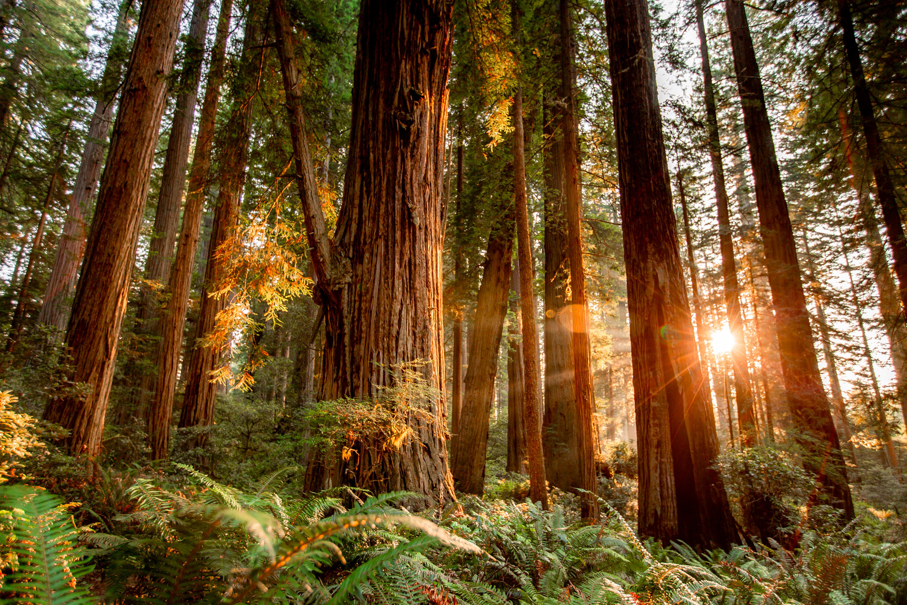
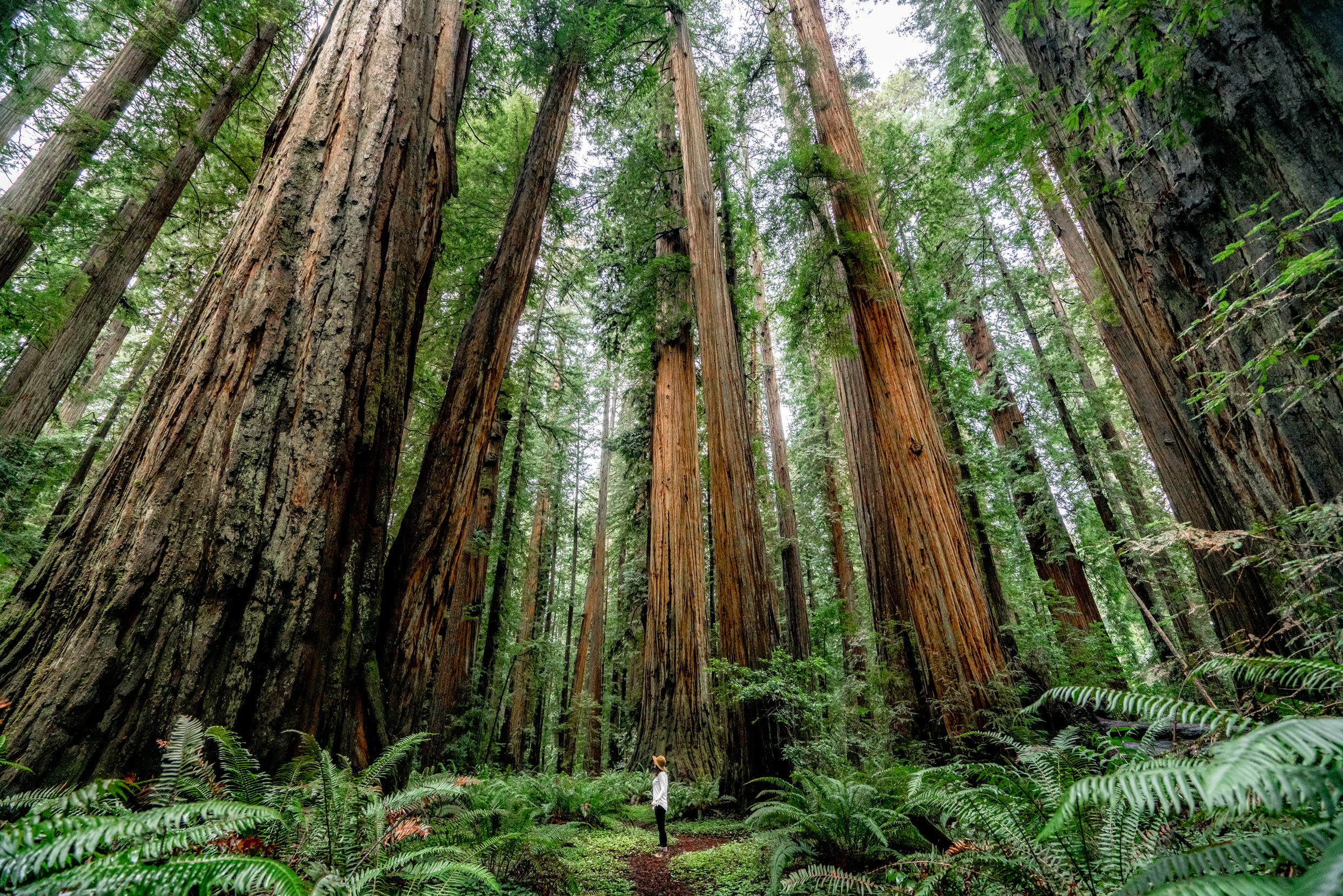
If you’re looking for maps of Redwood National Park to help you plan your next great adventure then you’ve come to the right place. Redwood is a truly special park, home to the tallest trees in the world and some of the best hiking trails in the national park system.
The park stretches along the northern California coast and is full of amazing campgrounds, day hikes, and scenic viewpoints. Thanks to it’s relatively low crowds, incredible scenery, and wildlife, Redwood recently ranked 5th on our 2021 list of the best national parks!
To really explore all that Redwood National Park has to offer you’ll need the right map (or maps) and about a lifetime, but let’s just stick to the maps here. Depending on the type of activities you’re looking to do, length of time you’ll be staying, and your physical abilities, you may want a few different maps to properly prepare for your visit.
We’ll cover them all below. And be sure to check out our comprehensive guide to Redwood National Park here!
What’s All This Talk About Redwood National Park Maps Anyway?
Maps are your guide to the national parks once on the ground, but quite often you’ll find visitors pulled off the road studying they’re newly acquired park map trying to figure out where they are and where they want to go next.
As some of you reading this may well know this can lead to frustration and a “testing of familial bonds”.
That’s why we recommend getting your map before you visit the park so that you can plot out the places that interest you ahead of time. This way you won’t find yourself on the side of the road with bickering passengers and your map upside down!
What Do We Know About A Good Redwood Park Map?
At More Than Just Parks we’ve been visiting and exploring America’s National Parks for a long time. To make our award-winning films on these parks we spend weeks on location in addition to weeks beforehand planning our trip.
Our experiences in countless parks, forests, and public lands have taught us a lot about how to plan these trips properly and one of the things we’re never without is a great map of the area.
While the National Park Service hands out wonderful maps with lots of interesting facts and history on the park to every visitor, these maps are not what one would call “comprehensive” by a long shot. They do a great job of highlighting the main points of interest as well as bathrooms, dining, and lodging options.
But for those looking to escape the crowds or find spots where they might have a better chance of seeing wildlife, or find that all-important campsite outside the already-full park you’re going to want a better map. Read on to review your options and pick the right map for you.
Things to Know Before You Visit Redwood
Entrance Fees
$30 per vehicle OR if you plan to visit more National Parks within the next 12 months we suggest you go ahead and purchase the America the Beautiful Pass (which can be purchased at any national park) and gets you into all National Parks, Forests, Monuments, and more including 2,000 sites for free after a one time $79 fee.
Redwood Map
The best map for the park: We like this map the best.
Best Guide Book
The best guide books for Redwood: This is our favorite hiking guide but this one is another great one that encompasses the surrounding area.
Cell Service
Cell Service is pretty reliable in the park. There are a few spots near Orick where service is more limited but overall visitors can expect to have good reception.
Getting to the Redwoods
Getting to Redwood National Park is half the fun! Out of state visitors can fly into Crescent City Airport (which is only 30mins from the closest part of the park), or San Francisco and drive up the coast (6 hours south of Redwood), or Redding (3 hours east of Redwood), or Medford, OR (2 hours northeast of Redwood).
Food & Restaurants
There are many restaurants and food options throughout the areas, cities, and towns around the park. The major towns for restaurants are Crescent City to the North, Klamath in the middle, and Trinidad to the South.
Mosquitoes
During the summer months (June – August) expect to find mosquitoes at varying levels in the Redwoods. I recommend this bug spray which has worked for me in the park and is environmentally friendly.
Best Time to Visit the Redwoods
The Best Time to Visit Redwood National Park is in Spring and Summer to take advantage of less crowds (Spring) and warmer temperatures (Summer).
Where to Stay in the Redwoods
Visiting Redwood National Park? If you haven’t decided where to stay (yet) check out our helpful guide on visiting Redwood National Park for tips. Don’t have time? Here’s our favorite hotel in the Redwoods.
Watch the Award-Winning Redwood Video
Maps of Redwood National Park
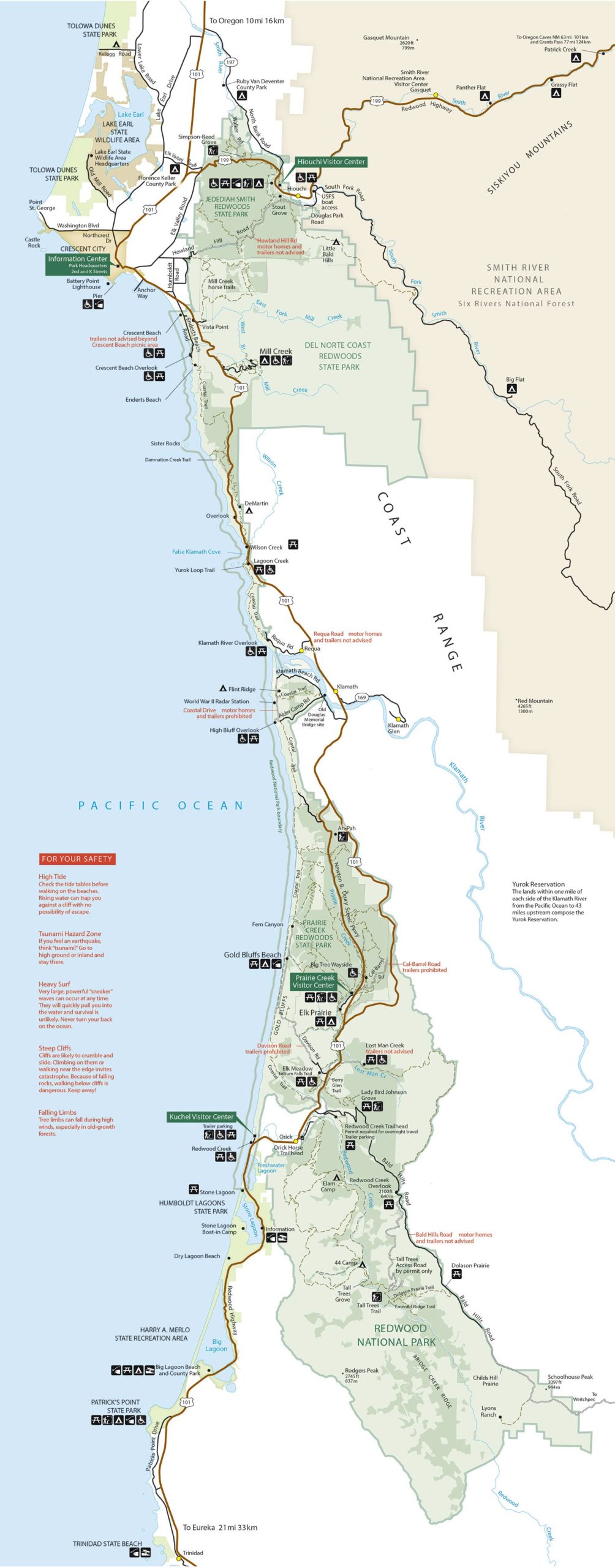
The National Park Service Redwood Map
Where to Buy It: Available at any park entrance station or visitor center for free
Use: Casual Visitor
These venerable tourist maps are handed out at every entrance station to the park and are filled with fascinating information about the park for visitors of all ages. The map itself contains everything you need to take a traditional tour of the park. These are things like overlooks, trailheads, visitors centers, restrooms, lodges, and general points of interest.
Download a High-Res Copy of the Official Redwood National Park Map from the National Park Service
For many visitors this is the only map you’ll need, but if you’re looking to experience more of the park and get away from the crowds and bustle of the roads a more detailed map is likely in order. For that we go to our next map of Redwood National Park.
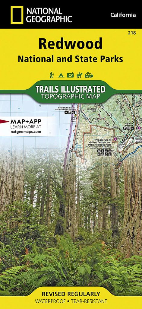
Detailed Map of Redwood National Park
The National Geographic Trails Illustrated Redwood National Park Map
Where to Buy It: On Amazon here
Use: For Day Hikes, Overnight Hikes, Backcountry Trips, and more
This map contains every mapped trail in addition to all roads in the area and a comprehensive list of points of interest like campgrounds, scenic overlooks, and interpretive sites.
The map base also includes contour lines and elevations for peaks and summits as well as mileage markers along the Klamath Wild and Scenic River for those looking to do some boating.
National Geographic makes the best maps of the national parks that are available to the public. They revise them every year and include everything you need to know to experience the park in its entirety. They’re waterproof and tear-resistant, you can write on them, bend them, fold them, and crumple them, but you can’t kill them.
Simply put, we highly recommend these maps regardless of the kind of activities you’ll be doing. If you have a favorite park that you like to visit often, one of these maps is a great idea to highlight your favorite spots and make notes of things you’ve seen in the park for future visits. If you’re still looking for maps of Redwood National Park this is the one we recommend.
Map of Redwood National Park
Redwood National Park is located in the northernmost corner of California, straddling the border with Oregon. The park stretched from the top of the state, along the coast, all the way down to the town of Orick.
The park shares a border with Six Rivers National Forest and a handful of California state parks. San Francisco provides the nearest major airport (6 hours away), while the much smaller Del Norte County Airport services the local area.
Getting To The Park – Directions & Location
There are a few ways to access Redwood National Park from different directions.
Closest Airport to Redwood National Park: CEC – Del Norte County Airport (in Crescent City)
The fastest way to get to Redwood National Park is by flying into Del Norte County Airport (the nearest airport to the Redwoods) and driving to the park. Flights into Del Norte are typically on the spendier side and rental car options are limited. The proximity can’t be beat as it’s a 20 minute drive from the airport to the nearest part of the park.
Driving from San Francisco: Getting to the park from San Francisco is incredibly scenic but long. I recommend renting a car from the airport and driving to Orick (roughly 300 miles from the airport). The drive takes about 6 hours without traffic.
Driving from Oregon: Alternatively you could fly into Medford, Oregon and make a two hour drive southwest to the park. This route is sometimes cheaper than direct to Crescent City.
Best Time to Visit Redwood National Park
The best time to visit Redwood National Park is during the Summer when temperatures warm.
During Summer, temperatures get up into the 80s with nights cool enough to sleep outside with low temperatures in the 60s. Summer is the perfect time of year to cool off in the Smith River with a swim. We recommend early summer (June) as the park sees more visitation in July and August.
The only downside to visiting in the summer, apart from dealing with crowds, is the mosquitoes. In various parts of the park, particularly Jedediah Smith Redwoods State Park, the mosquitoes can be pretty bad this time of year.
Why Listen to Us About Redwood Maps?
You should probably know that we didn’t just make this list up out of thin air. We’ve spent our entire adult lives exploring and filming America’s national parks and public lands. We’ve worked with the National Park Service, the Department of Interior, and the U.S. Forest Service for years creating films on important places and issues.
Our work has been featured in leading publications all over the world and even some people outside of our immediate family call us experts on the national parks.
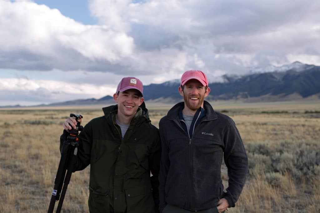
We’re Jim Pattiz and Will Pattiz, collectively known as the Pattiz Brothers. Our goal here at More Than Just Parks is to share the beauty of America’s national parks and public lands through stunning short films in an effort to get Americans and the world to see the true value in land conservation.
The Best Maps of Redwood National Park
Well that’s all folks. Did we help you find the right map of Redwood National Park for your trip? Let us know in the comments below!
Leave a Reply